Tag Archives: Pied Oyster Catcher

Walking south and into the suburb of Claremont on the 9th stage along the Derwent River

The intersection of Harbinger Lane and Ferry Road at Austins Ferry marks one corner of Weston Park. At 9.56am I turned left and walked across the Park parallel to Rusts Bay, crossed a single lane wooden bridge and rounded the Shoobridge sporting fields all the while enjoying the pleasures of dogs walking their owners along the edge of the Derwent River.

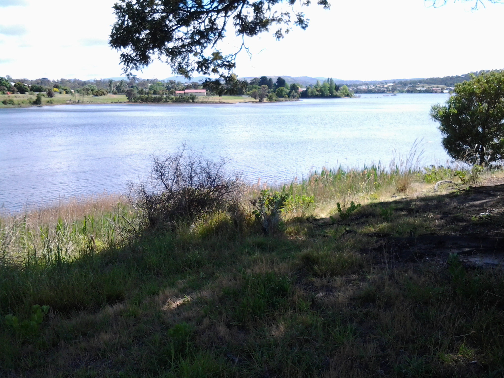
The photo below shows Shoobridge Park on the northern side of Beedhams Bay.

20141125_102813

I was amused and somewhat puzzled watching a Pied Oyster Catcher picking for worms on the sports oval, and not bothered by an interested German Shepherd. What happened to a little fear? What’s wrong with oysters?

I had an easy walk on mowed grasses to Beedhams Bay and was delighted when a White Faced Heron flew onto the path ahead of me. Slender. Petite. Soft grey.

At 10.10am I crossed the railway line following the tracks of others but there are no official paths. The Main Road was again to my right with the railway line to my left. Native Hens were feeding ahead and noisy plovers let them know I was coming.  Black swans floated on the Bay. I noticed bus stop 40, and realised 1 ¾ hours had passed since I started today’s trek from bus stop 47 in Granton South.

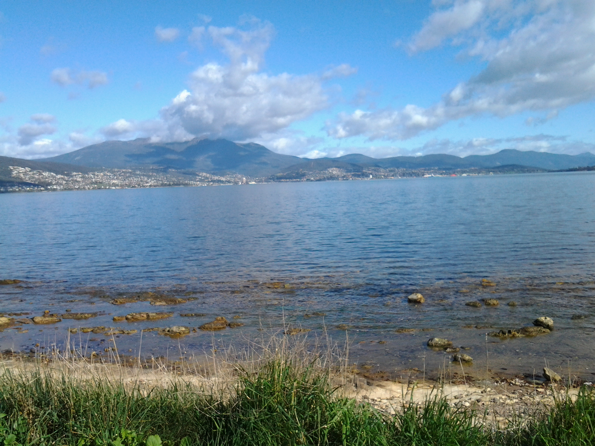
While at Beedhams Bay I was in full view of three mountains: Mount Direction on the eastern shore, and Mount Faulkner and Mount Wellington on the western shore.

I stopped for a morning tea break at 10.18 in a gazebo at the southern end of Beedhams Reserve.  Despite some protection from the elements, the food was blown off my spoon before I could transfer it to my mouth. My hair thwacked back and forwards at every angle across my head creating an interlocking mesh.

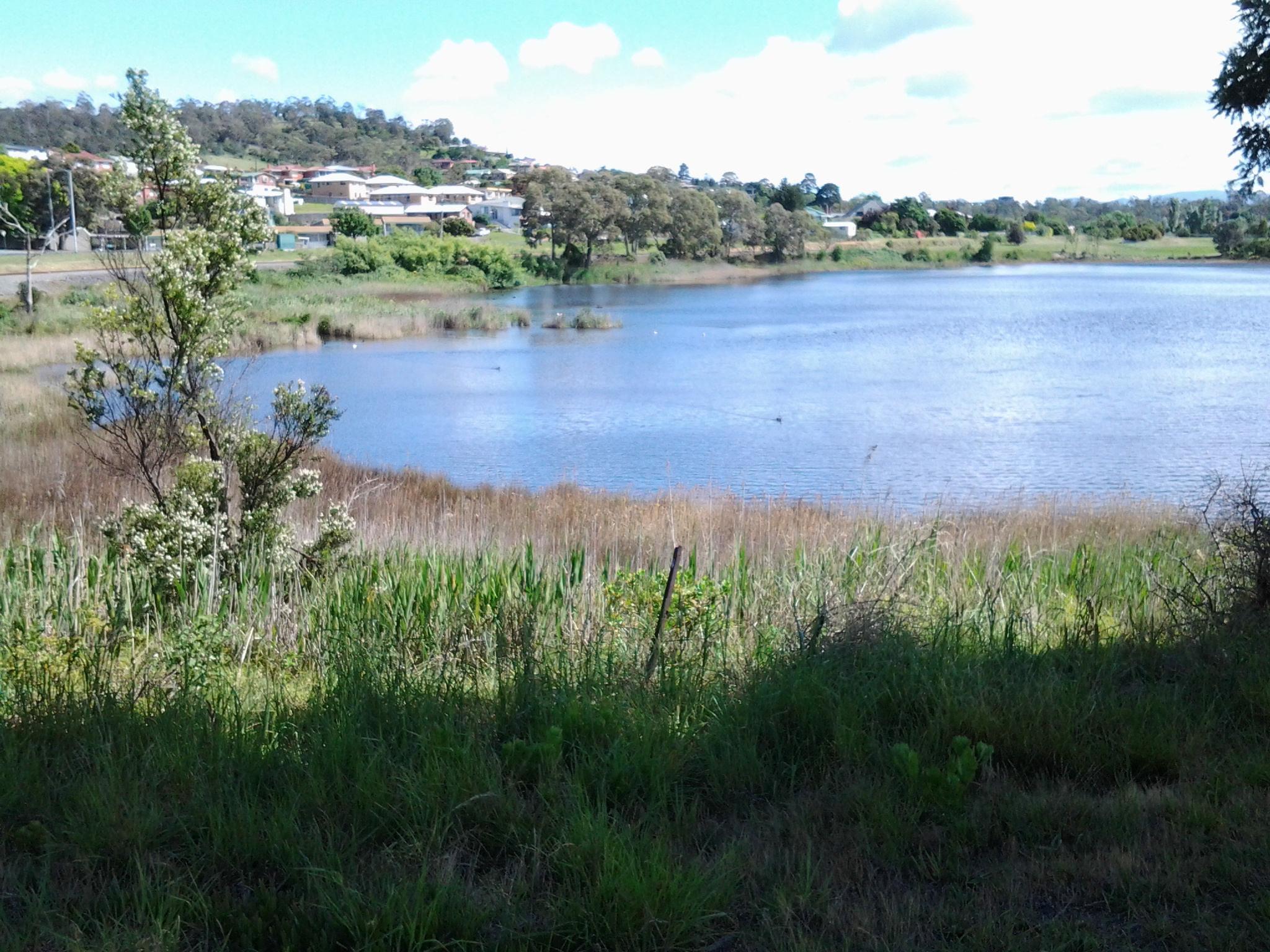
The photo below shows Beedhams Bay looking northwards across it.

20141125_102808

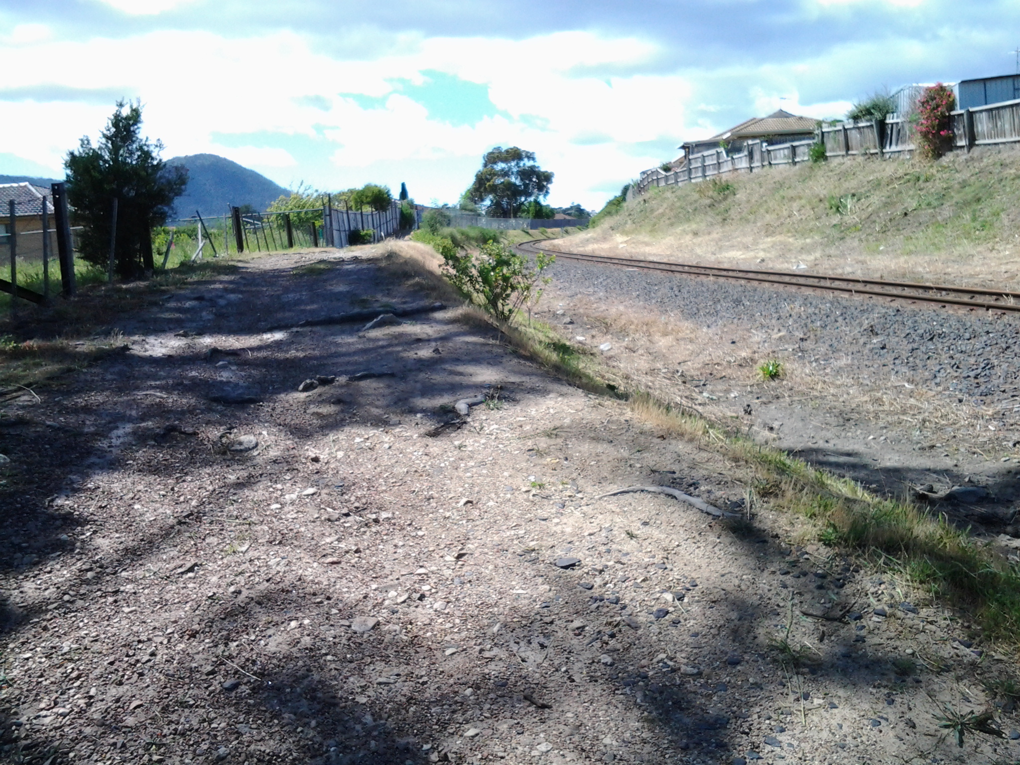
My maps indicated that the nearby building sunk low in the earth was a scout hall but I couldn’t see  signs of identification and the building looked locked up and unused. Foot tracks emerged from the area and crossed the railway line that cut through between packs of houses on either side. There was no evidence of being able to continue to walk close to the Derwent River so I walked up above but beside the railway line until I reached a road crossing at Bilton Street in Claremont.

20141125_102823

A local government bike and pedestrian path from Hobart reached its conclusion next to the railway line on the other side of the road. To my surprise Claremont Plaza, a multifaceted shopping village and other organisations, was located in the block diagonally opposite. This was a sensible location to make a toilet stop since there are no public toilets available during my 9th stage of the walk along the Derwent River.

By 10.46am I had returned to the rail/road crossing ready to continue the walk. I followed Bilton Street around the curve until its T junction with Cadbury Road and turned left. On the other side of the road, the lovely red brick unused old Claremont School stood boarded up.

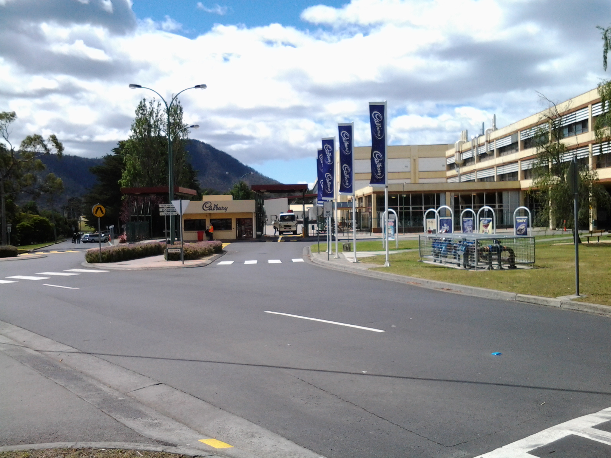
The road turned uphill and passed the Bilton Bay Reserve (10.49am) and the entrance to the Derwent Waters Residential Club – an estate signed as private property thereby denying my access to the River’s edge (10.56am).  I continued walking on Cadbury Road flanked by tall pine trees thrashing in the wind, past the Cadbury Sports Grounds (11.05am), past the Cadbury Visitors Car Park (11.08) and turned left onto Bournville Road.  I knew I would be returning to have a closer look at the Cadbury chocolate confectionery manufacturing factory so I proposed to walk to Dogshear Point first and then be rewarded sweetly later.

20141125_110910

Taking Bus 615 to Tranmere last Friday – Starting Stage 4 of walk along Derwent River

Having travelled across the Tasman Bridge, through the Eastlands bus mall near the shopping centre, and onwards, the bus takes the main route along Clarence Street. Along the way a sign marking the Clarence High School, established in 1959, looms large on the right. The 8.23am bus typically will carry a swarm of students who will jump off at this point and then the bus may quieten for the remainder of the trip.  But others will jump on after desperate running and laugh as they fall onto the bus with eyes sparkling from the exertion. Bus trips can be alive with life being expressed in all sorts of ways.

By 8.44am the bus pulled in at the Shoreline Shopping Centre mini bus mall.  Once moving again, the bus run goes the other way to a stream of traffic heading towards the city centre. Moving down the hill, and near bus stop 19, the bus passes the Howrah Primary School located across the intersection diagonally from the Shoreline shopping centre, and a Shell fuel service station which is located on the opposite corner. Further down, the bus passes The Sunshine Tennis Club and the Howrah Recreation Centre including the Guide Hall. Near bus stop 20, a Caltex fuel service station and a suite of small shops is located on the right with the Howrah Beach beyond.  It’s not long before, as a passenger, I am greeted by stupendous views of the Derwent Harbour, Hobart city on the western shore, and the all-powerful Mount Wellington peering over all.  Soon after the bus turns left into Tranmere Road, I noticed Tranmere Hall on the right, and then a little later near bus stop 23, I saw a sign designating the Tranmere Coastal Reserve and a nearby public walk way down to the Derwent River.

After passing Anulka Park at bus stop 25, I continued on and left the bus at stop 31 at 8.53am.

Yet again I was fortunate that the day was magical. As I crossed the road to stand next to the serene Derwent River, I listened to the lyrical lapping of soft tiny waves across the rocks.  Silver gulls were floating languidly. A lone Pied Oyster Catcher was watching and waiting. Fluffs of cumulus cloud like fairy floss hung suspended in front of the mountain.  Cabbage butterflies flew through the long grass. Orange flowering nasturtiums climbed through bushes edging the shore.

I soaked in the grandeur of the environment and prepared to start the walk – this fourth stage of my walk along the Derwent River.

20140926_085649

Stage 2 on 4/9/2014 William Gellibrand Email 7 of 14

With feet wet from long dewy grasses in the trek around Mary Ann Bay, I slopped along ready for new natural wonders. The track changed from dirt to dry sand and the large paw prints of a wandering dog were freshly impressed.  Soon after, it seemed the track had not been driven on for a long while and quickly it reduced to a single file.  Around 10.40 am, I had already walked up a hill, and had passed a mesh fence with the beach below to my left where I could see a small sandy bay complete with unconcerned Pied Oyster Catcher birds foraging.

From research and from information shared by a friend, I knew the original white settler, William Gellibrand, was buried somewhere along this part of coastal Derwent River. I wondered if I would be able to find the spot and whether the site would be marked.

A local group http://friendsofthearm.wordpress.com have been particularly instrumental in researching the history of the first white settlers (remember this South Arm peninsula was part of the country of the Moomairremener indigenous people). In addition, the South Arm Landcare Group has been doing its best to preserve the environmental landscape. Currently the latter group are ensuring the land around William Gellibrand’s burial site is protected.

William Gellibrand accompanied his son Joseph Tice Gellibrand (who had been appointed Attorney General for the colony) from England to Van Diemen’s Land in 1824. William was granted approximately 2000 acres of land at South Arm and assigned ten convicts.  This was later increased to 3000 acres by a grant from his son.  As other settlers arrived Gellibrand leased land to them and later they were able to purchase their lot. By 1885, many had purchased land on the peninsula: some names are  Alomes, Calvert, and Potters and people with these family names are still in the district today.

I am sorry not to have found a photo of William Gellibrand for insertion here.Below is a photograph of George and Agnes Alomes courtesy of the site at http://www. southcom. com. au/~pottermj/pagef. htm

  [IMAGE]

 William Gellibrand’s claims to fame in Hobart Town include his appearance in the registrar of Magistrates Hobart Town from 1826 until 1827 and he is also remembered for setting up banking in Hobart.  In addition, William was a merchant and exporter and served as a Justice of Peace.

Stage 2 on 4/9/2014 Travelling towards the South Arm peninsula Email 2 of 14

For people with lives normally immersed in the big cities of the world, travelling this route to Opossum Bay will be full of surprises.

Hobart is a capital city yet, after not many minutes of travelling, the bus passes through bush land from time to time, before coming out into clusters of developing real estate. Springing up around many corners, the landscape is meshed with strips of dark bitumen. These cul de sacs and neighbourhood streets are usually featured with white concrete lengths of soon-to-be driveways into soon-to-be built houses on blocks cleared of all vegetation. These new suburbs represent the interest in having and the will to live in your own home – even if it means a 20 minute or so travel time to the city. We know that by the standards of other capital cities around Australia and the world that such travel times are but a blink of time.  The easy accessibility to the centre of the city is a great reason to live in suburban Hobart.

As usual the bus travelled through the suburb of Rokeby. I was eager for another view of Ralph’s Bay remembering its sparkling crisp deep blue expanse when I travelled this way for Stage 1 of the walk. This time the colours were different however, despite the sun shining. Perhaps it was the high level wispy cirrus clouds that filtered the light and affected the colour of Ralph’s Bay on this journey. This time, when travelling the streets at the top of Rokeby, the spread of water was coloured a warmer tone of greys and pale greens. The Bay looked benign and neutral, and was all together welcoming. Further on in the journey, I passed the mud flats at the Lauderdale site of the Bay. The tide was in further than previously and covered most of the mud. I couldn’t help but think how time makes small differences in our world – it is only two weeks since I was travelling here on route for the first walk and, at that time, acres of mud flats were on show.

What else did I see during this bus trip?  Glossy dew on lawns. White blossom on fruit trees. Pink blossom. A well-painted graffiti wall, following a colourful display of clever mosaics in the suburb Clarendon Vale.  Road signs with the symbol of a horse with rider warning of the additional ‘traffic’ which the road might share. Paddocks with grazing horses. Horseboxes. White fences. As the bus started on the road across the isthmus to the South Arm peninsula one sign with a stylised image of a Pied Oyster Catcher bird indicated travellers should be aware that these birds may want to walk across the road from time to time.  Later, on the return to Hobart journey, I noted perhaps 50 Black Oyster Catcher birds resting as a large family, on the sandy edge of Ralph’s Bay near the sign.  They were not in the least put out by the rattling of the passing bus.