
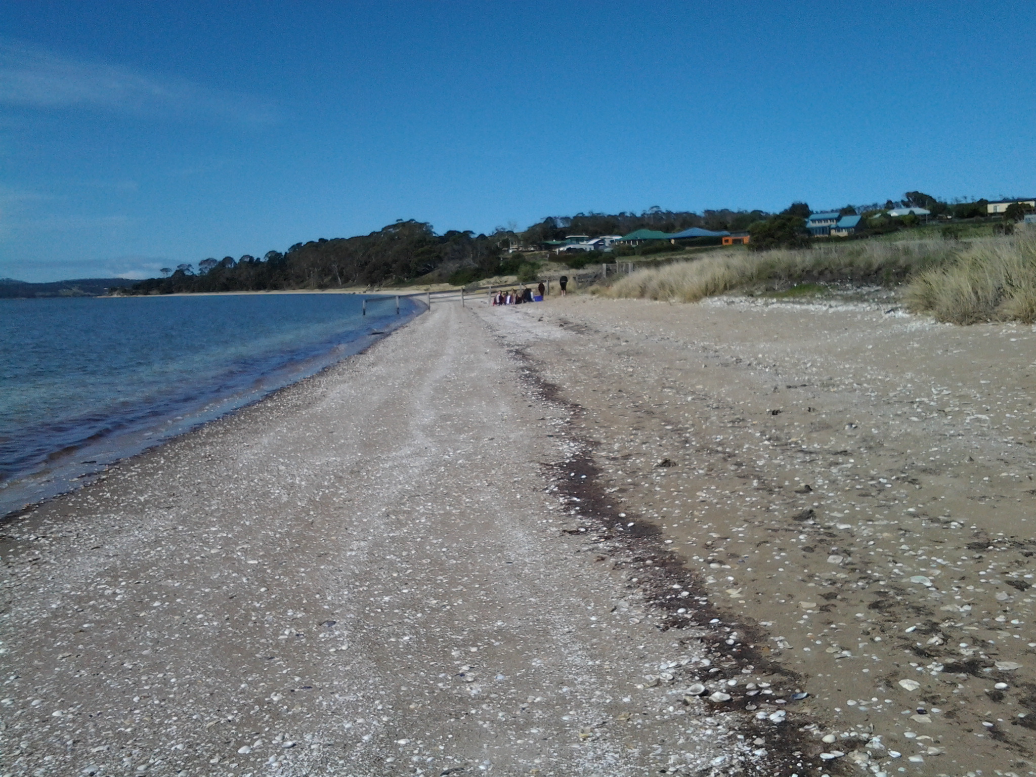
By 11.40 am (only 2½ hours since stepping off the bus) I had taken the trail around Gellibrand Point and south onto the northern end of the narrow sand-based Shelly Beach. Crunching underfoot, millions of sun-bleached shells shattered further. Large empty oyster shells everywhere. Their whites contrasted strongly with the golden dry-brown colours of the sandstone rocks.
The water hardly moved in or out. Quiet. Calm.
Different schools of 5 inch long fishlings darted from the clear shallows into slightly deeper water. The bank of sand beneath the Bay was very shallow and I suspect a swimmer might need to wade out quite a distance before being able to lie down and cover themselves comfortably with water. Out a little way in the bay, and like small mirrors, flashes of silver ovals lifted from the water’s surface when slightly larger fish came up for air. Or were they leaping with joy. Perhaps the fishlings that I disturbed when my feet vibrated the ground sending them scurrying for deeper and hopefully safer water, were a delicious meal for the larger fish.
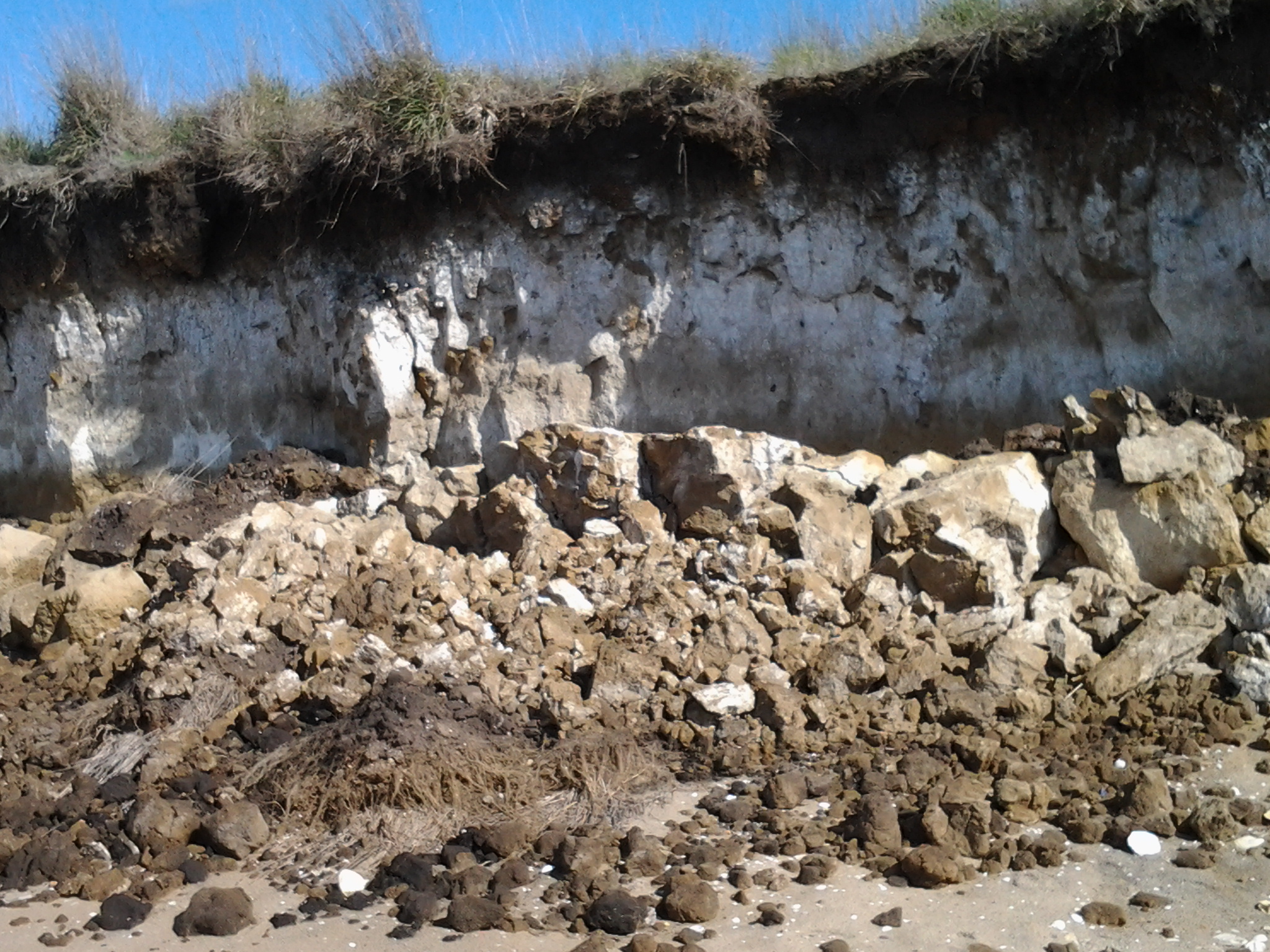
The succulent Pigface with its bright pink flowers grew at the bottom of the sandy cliffs. Were the layers of shells in the cliff strata, remnants of aboriginal middens or simply an older beach level? Was I seeing the shells of the Late Pleistocene?
Sand can be dangerous because, when packed, it doesn’t usually have any structural integrity. Everywhere, I saw crumbling cliffs as a testament to a perpetually ravaging process. Throughout my walk, on the western beaches and now on this eastern beach of the peninsula, all the sandy cliffs showed erosion and recent falls. It was clear to me that walking close to the edges on top could lead to a mini landslide if you were unlucky. I feel confident that walking at the bottom of the sandy cliffs poses no risk if you walk nearer to the water’s edge.
By midday, I had walked to a fence two thirds the way along this long beach. This fence across the sand to the water of Ralph’s Bay marked one track back towards Opossum Bay. Because a couple of new groups of older school children were now enjoying a drum playing class on the beach with their teachers near this fence, I decided to walk along the beach further. Never let it be said that I was a distraction to their lessons!
Five minutes’ walk past the fence, in the distance was a line of boulders across the sand from the grasses to the Bay.
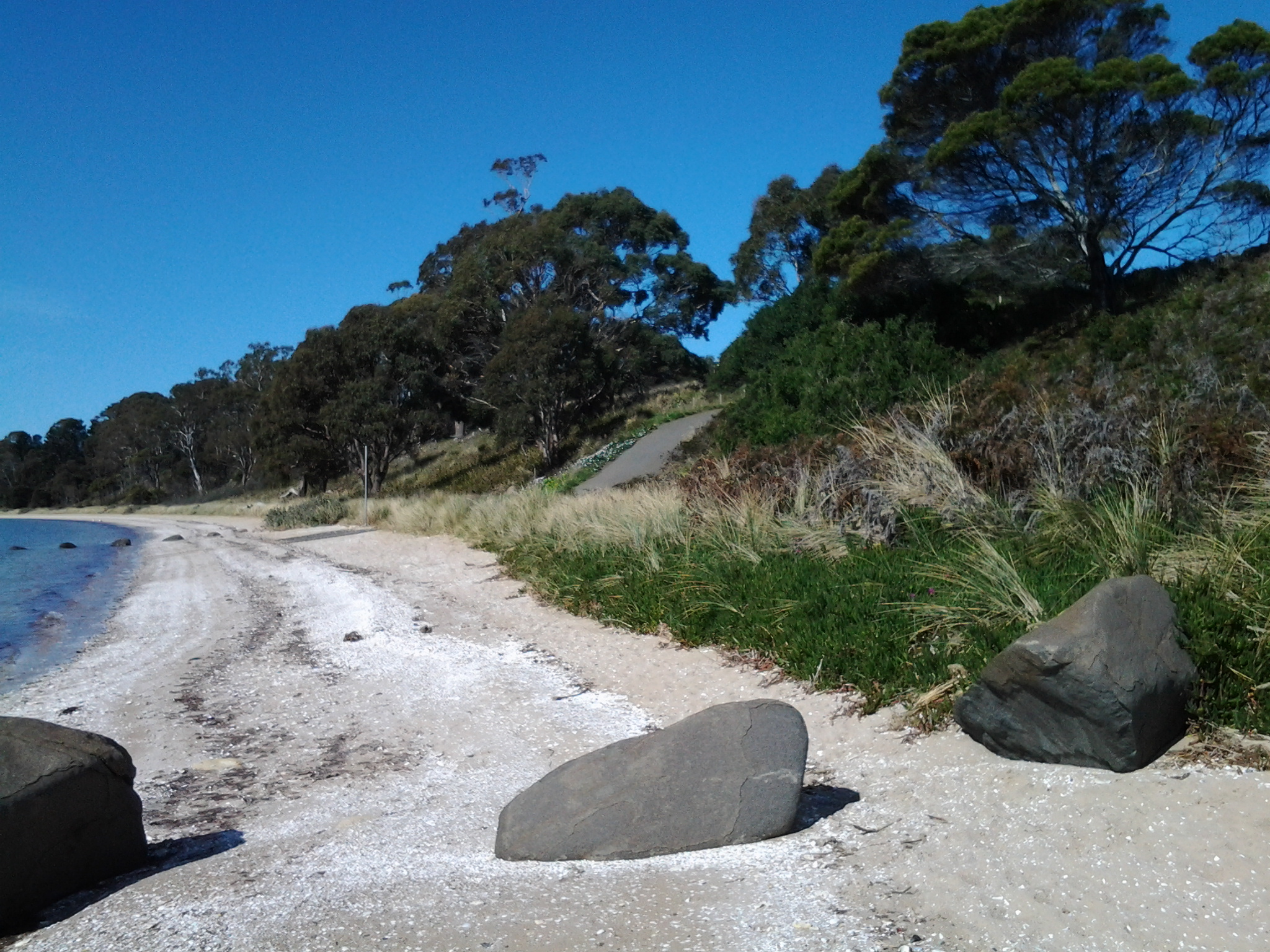
These rocks became my lunch time pit stop while rich brown hawks and protective plover birds whirled nearby.
Looking back where I had walked, the long Shelly Beach stretched into the almost unseeable distance.

My map informed me that Icehouse Bluff marked the southern end of Shelly Beach.
Around 12.20 pm I was packed and on my way to the Bluff following in the footsteps of a strolling couple and their dog. We met as they were returning and I asked what they knew about the history of the Icehouse or the Bluff’s name. Unfortunately, this remains a puzzle to us all.
The advantage of meeting these lovely locals was that I learnt the Bluff was private property and that no access would be possible – so I didn’t waste time looking for tracks up the slopes. We talked about the celebrity locals who have a house at Opossum Bay. I am led to believe that these include Brian Ritchie (MONA) who I thought I saw filling his car with petrol during my Stage 1 walk, Damon Thomas the Lord Mayor of Hobart, Gordon Brown well known heritage artefact collector and television personality, and John Cook who was the last lighthouse keeper for Tasmania’s last two manned light houses (Maatsuyker, Australia’s most southerly lighthouse and later at Cape Bruny). Quite frankly I imagine everyone who lives on this peaceful South Arm peninsula will have interesting stories to tell and will be celebrities in their own worlds.
