Tag Archives: Derwent River

The complex that makes up Wayatinah – posting 5 of 7

The Florentine River flows into the Derwent River.

Westwards from the Wayatinah Power Station, Andrew and I covered some kilometres of bush, clambering over fallen trees and through a mesh of understorey vegetation.  The marks of mankind were clear despite the absence of tracks; various weeds were flourishing.

20151029_091112.jpg

And through the bush in two different locations a well secured lidded white box sat alone with a surname and phone number written on top.  These were not bee hives and we could not determine their function.

20151029_093657.jpg

Once we had walked further westwards past the meeting of the Florentine River with the Derwent River, the Derwent presented with a low water level and stony river base.

20151029_094042.jpg

20151029_094127.jpg

However there were sections containing more water.

20151029_094048.jpg

Along the way we discovered the remains of an old shed and an ancient water level monitoring system, through which a bush fire had passed.

20151029_101015.jpg 20151029_101039.jpg

20151029_100953.jpg

20151029_101649.jpg

Bits of iron and steel were scattered through the cleared surrounds.

20151029_100936.jpg

20151029_100939.jpg

I loved the way the corrugated iron had been ‘stitched’ with wire to create the building. Very enterprising.

20151029_102240

20151029_102243

Amidst this debris a lone native orchid bloomed.

20151029_103015.jpg

Down next to the river bed, a water level height gauge was marked in imperial measurements, therefore indicating a date before the mid-1960s.

20151029_101155.jpg

20151029_101151.jpg

20151029_101548.jpg

20151029_100933.jpg

20151029_101745.jpg

We wondered what sort of electronic or satellite related devices and measurement tools were used these days.

I found this trackless walk to be very hard going (at the pace Andrew set) because negotiating the bush took thought and time.  I reflected on the challenges this section would pose if I had been carrying a full backpack.

Michelle’s aerial view gives an idea of the dense bush on the top side of the River where we walked.

PA280093Florentine & derwent intersection.JPG

The complex that makes up Wayatinah – posting 3 of 7

Wayatinah Power Station

On Thursday 29 October 2015, Andrew drove me off the Lyell Highway and down Long Spur Road to Wayatinah Power Station. An underground pipeline from Wayatinah Lagoon fills penstocks which fall down steep hills to the Power Station.  The water exiting the Station empties into Lake Catagunya, through which the Derwent River flows.

20151029_090827.jpg

Watch the video.

20151029_091538.jpg 20151029_091554.jpg


The complex that makes up Wayatinah – posting 1 of 7

As an introduction to the widely spread features of Wayatinah, the Derwent River runs in a south easterly direction past many acres of State Forest before flowing into the expansive Wayatinah Lagoon, a waterstore located five or so kilometres north of the Wayatinah Power Station. The Lagoon’s water is piped to the Station first underground and then overground in massive white pipes.

Excess water from the Lagoon seeps, dribbles or spills back into the Derwent River at the Wayatinah Dam, which isn’t far from the Wayatinah township. Then the low water level of the river trickles over a rocky base until it catches the flow of the  Florentine River before continuing on to become part of Lake Catagunya.  The western most reaches of the Lake have already formed before the river reaches the Wayatinah Power Station.

A change in plan due to the expected large volume of future information

In a blog post written a few weeks ago, I said I would not post a record for any walk on a section of the Derwent River unless it fell into the continuous sequence; that is the next post describing the walk should be from Gretna (the location of the end of the last stage of my walk- Stage 15) westwards.

From now on I will walk sections (yes blow the knee problem, I will continue)  that fit with friends dropping me off at starting points or collecting me from destinations, or that fit with the Tassie Link bus timetable.  In any given week I could be located at any point between Gretna and the source of the river as it leaves St Clair Lagoon. Therefore, in any week, my blog posts will be about where I have been walking and the experiences gained along the route.

The reason for my change of heart is that from the reconnaissance and short walking trips that I have taken in the past few weeks, I can see that there will be simply too much information to dump into the blog once I finish the walk.  Therefore, despite the chance of confusing blog followers, I will write up and post as I complete sections regardless of whether they fit into a seamless sequence.

Another advantage of this approach is that there will be less Derwent River related posts, and more actual walk related posts.

Where is the source of the Derwent River?

This question was on the minds of the new settlers to Van Diemens Land in the early 1800s.

In 1835 George Frankland, Surveyor General to the government of the time, organised a ‘search’ party to locate the source. After the expedition he wrote a report for despatch to the ‘mother country’, England.  The brief text has been published as The Narrative of an Expedition to the Head of the Derwent and to the Countries bordering the Huon in 1835.  The small book was reprinted by Nags Head Press for the publisher Sullivan’s Cove in 1983.

No description exists of how Frankland and his party travelled inland until they reached a property or area then known then as Marlborough (now known as Bronte) in the Lake country, located west of Lake Echo and directly east of Lake St Clair by over 30 kilometres. Marlborough was a probation station for North American prisoners in the 1830s/40s.

Map of probation stations including Marlborough

The map above can be seen in the story: ‘They left Jefferson County forever…’

The Marlborough district was discovered by Surveyor Sharland who also found Lake St Clair, in 1832, only three years before Frankland felt compelled to find the source of the Derwent.  It seems Sharland did not realise it was the Derwent River that flowed from the southern end of Lake St Clair. Further information can be read in G. H. Stancombe’s paper Notes on the History of The Central Plateau.

The Lyell Highway, according to the Highland Lakes Settlement Strategy has been known as the Marlborough Road where it runs westwards of Ouse and towards the area around Bronte.

Information, which is totally irrelevant to my writings about the Derwent but nevertheless interesting, concerns an earthquake near Marlborough that was recorded in The Courier, a Hobart newspaper on 25 April 1854. Thomas Bellinger reported ‘I beg to inform you of a very strange occurrence on the evening of the 24th of March last. A shock like that of an earthquake was felt in almost every part of the Marlborough District. Two shepherds were gathering sheep the other day and discovered the cause of it.  I went to the place yesterday: there has been some fearful volcanic eruption, rocks of enormous size have been driven about, the face of the earth appears to have been hoisted in the air and pitched surface downwards. I cannot describe to you the appearance, but if you will come up I am sure you will be highly gratified – the distance is about ten miles from this.’  I have no information about where Thomas Bellinger was writing from but I am curious to hunt out the location of this upheaval.

After that information detour, let’s go back to the expedition to find the source of the Derwent River.

Following a ‘difficult journey from the settled Districts’, all members of George Frankland’s party assembled at Marlborough on the 7 February 1835.  The record shows that George Frankland did not follow the edges of the Derwent, rather he crossed the Nive River (which empties into the Derwent River much further south), then travelled north-westwards. Initially densely forested hills stymied progress with horses, and then the boggy plains ahead slowed him down.  He continued generally in a westward direction and after almost five days, found Lake St Clair; ‘we suddenly found ourselves on the edge of a beautiful Lake in the heart of Scenery of the most picturesque Character’.  After further walking around parts of the lake, Frankland reports ‘It was a fine summers day and the Air was so serene that the surface of the Water was scarcely ruffled but the sandy beaches bore evidence of the Lake being at times as rough as the Sea. I will not here dilate on the extreme beauty of this scenery as it might be considered out of place in an official report, but … I feel it difficult to avoid expressing the impressions of delight which were inspired by first discovering of such a romantic Country…’

On the 14th February, Frankland despatched two of his party to return to the source of the Derwent and follow it downstream on the left bank while he set out to explore the country on the right bank.  Both parties walked across open plains where Lake King William now fills the area.  They reunited the next day.  One of the party, a Mister Calder was despatched to continue along the edge of the river until he met the entrance of the Nive, which he successfully achieved (although details are absent).  Meanwhile Frankland tried to continue following after Calder but was only able to proceed for 3 miles. ‘At that point we plainly perceived that the Country had … become such a thick forest that to take the horses any further was out of the question.’  The result was that Frankland split the party further with the horses taking an easier route to Marlborough.

On their first day trying to walk the edge of the Derwent, Frankland recorded ‘This day was consumed by a laborious march of two miles through a most obstinate scrub – and we bivouacked on the steep edge of the Derwent after wading for a considerable distance through the torrent, up to the middle, as the easiest mode of travelling.’  The forest is as dense in 2015 as it was then, so regular blog followers can appreciate why walking some sections of the rest of the way to Lake St Clair concerns me.

At this point Frankland was for giving up. ‘On the 18th February I determined on leaving the Derwent and accordingly struck away to the N.E. The forests continued depressingly thick – but by dint of labour we accomplished about four miles this day’.  Only four miles in a day for strong men!  What chance do I have of walking this part quickly or easily?

A couple of days later Frankland reached Marlborough and from there he set off to cross the Derwent River and explore the Huon River area further south.

Thank you Andrew for alerting me to this report and for the loan of the book.

The best laid plans of mice and men …

Other people have sore knees or knees that can’t walk downhill without discomfort or pain. Not me.  That is, until a week or two after my walk to Gretna.  For the first time in my life, I noticed my knees.

On a couple of occasions since that walk, a shooter of a pain in one of my knees left me staring wide eyed and grunting. During a visit to my GP, she listened to both knees and (they didn’t speak to her but …) she heard them grinding away.  Subtle noises, of course.  Noises not available to the common ear.  Now, after X-rays and ultrasounds, the verdict is clear. I have little to no cartilage left between my knee bones.  Yes, you guessed it. Walking is not advisable.

I whined … ‘but the source of the Derwent River is still a long way off.’  My GP looked at me purposefully, ‘it’s going to take you a long long time to finish that walk. You can add ice or heat treatments, compression knee bandages, and walk with two poles to help, but you shouldn’t walk too far, too often or on uneven ground.’  I pursed my lips. I knew cartilage does not regenerate and I realised that a lifetime of walking has gradually taken its toll on my knees. A number of expletive deletives passed through my mind.

Can I let such a ‘little’ thing get me down? What’s my plan for the future?

I have some day walks planned along the upper Derwent with friends who are ferrying me to and collecting me from various locations. I plan to walk those. If my knees fail me then I will crawl or slither back to cars or buses. No probs!  But I feel that scenario is unlikely.  I suspect I will get through a shortish day walk just fine. Nevertheless the remaining cartilage is a finite quantity and I have to think about how much I want to aggravate the situation.

Many of my blog posts have mentioned my sore feet and how by concentrating on taking one step at a time, I can continue for hours with that focus.  Each walk in the future will continue on this basis until my knees indicate it is unwise to go on.

What else can I do to achieve something like the original goal?

Thinking laterally – here’s the first idea which comes to mind and that therefore is not necessarily one to be converted into action: so far I have covered about 90 kms of the 215 km length of the Derwent River.  If, during the future planned walks I cover another 20 or 30 kms of the river (which I expect requires lots more actual walking kms to achieve those few), I am now considering the idea that whatever kilometre gap remains, I might swim that length, not in the cold Derwent but in a heated Olympic-sized swimming pool located next to the Derwent. One kilometre at a time. Maybe swimming two or three times a week.  One of my original motivations for the Derwent River walk was my need to create a personal physical challenge; the goal of swimming 100 or so kilometres would give me something major to pursue (one armstroke at a time – until the shoulders fail . Hmm perhaps I shouldn’t tempt fate by making such jokes.). Watch this space for the continuation of this idea – or a new one.

The Derwent River is 215 km long – the authoritative answer!

I am so excited.

Blog followers know I have been frustrated in my attempt to discover the official length of the Derwent River. Now I have found the answer in Australia’s most reliable source of information.  Today I found that the Australian Bureau of Statistics gives the length as 215 km.  I feel vindicated.  Previously, using an Opisometer on 1:25,000 Tasmanian maps, I had calculated the length of the River at 214 km – all the time knowing that some inaccuracy was possible with this device. You can read my earlier post here.  Now all I have to do is to persuade Google to change their information!  What chance do I have?

Fires above the Derwent River

On too many nights last week the sky was dense with a rosy fire haze across my suburb.  The smoke slipped through crevices in my house so that, through each evening, I felt like I inhaled a camp fire.  Back then I checked the Tas Fire Alert website and learned the closest fire was in Quarry Road less than half a kilometre away. Today I went off to see what the burn looked like.

I chose to walk through the bushland of Waverley Flora Park first and then descend down Quarry Road.

2015-11-09 09.37.10

From the top of one of the Park’s walking tracks, I looked through stands of gum trees towards the mouth of the Derwent River.

2015-11-09 09.22.36 2015-11-09 09.22.51

In the other direction Mount Wellington loomed large over the Hobart CBD and the Derwent Harbour.

2015-11-09 09.24.47

I followed in the footsteps of Charles Darwin, ‘father’ of the theory of evolution, who walked around Hobart in 1836. At some time during that visit he crossed to the eastern shore and wandered around the Bellerive suburb and beyond.

2015-11-09 09.22.59 2015-11-09 09.20.23 2015-11-09 09.20.15

I saw unfamiliar medium-sized birds collecting nesting material and insect food morsels (who flitted away far too fast for me to take a photograph): one was dressed in silvery greys with a long strand floating after its tail, and another with a rich olive green coat. None of my bird books help me to identify either of these birds – any locals with bird knowledge?

A profusion of native spring flowers carpeted parts of the Park, or stood as single colourful spikes amidst the dull dry green grasses.

2015-11-09 09.32.36 2015-11-09 09.25.26

It soon became clear that lots of burned vegetation and scorched earth passages were scattered next to the walking track and beyond.

2015-11-09 09.29.05 2015-11-09 09.28.19

Later when I walked down Quarry Road with not a burn mark in sight, I realised that for bureaucratic purposes the Tas Fire Alert site had to indicate the best road for fire trucks to follow.  It had been parts of the Waverley Flora Park that suffered fire damage.

As I continued downhill, I heard the siren sounds of a fire truck and watched it whip past the intersection below.  When I turned the corner, the truck was parked askew with hefty yellow clad guys preparing their gear.  The screams of other sirens were closing in. I watched wisps of smoke escaping from all manner of slits and slots and dirty brown smoke puffing from the front door of the house below.  I saw an approaching ambulance and guessed this wasn’t someone’s best day.

Derwent River: time-lapse photographic display

The Derwent Project’s website contains engaging images from cameras located at various points along the edge of the Derwent River.

There is a great deal of viewing to be done across this site including the page with the time-lapse videos.

Because of the imagery on this site, I find it possible to appreciate the environment and weather changes in a simpler way.  I feel sure that if you can’t walk or drive along the Derwent River, watching these videos should give some sense of the pleasure that is possible.

The sheen on Shene

No.  The historic Shene property is not reflected in the Derwent River. Nevertheless it shines bright in my memory for the number of stunningly well restored and conserved 19th century sandstone buildings.

OLYMPUS DIGITAL CAMERA

OLYMPUS DIGITAL CAMERA

OLYMPUS DIGITAL CAMERA

OLYMPUS DIGITAL CAMERA

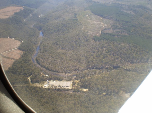
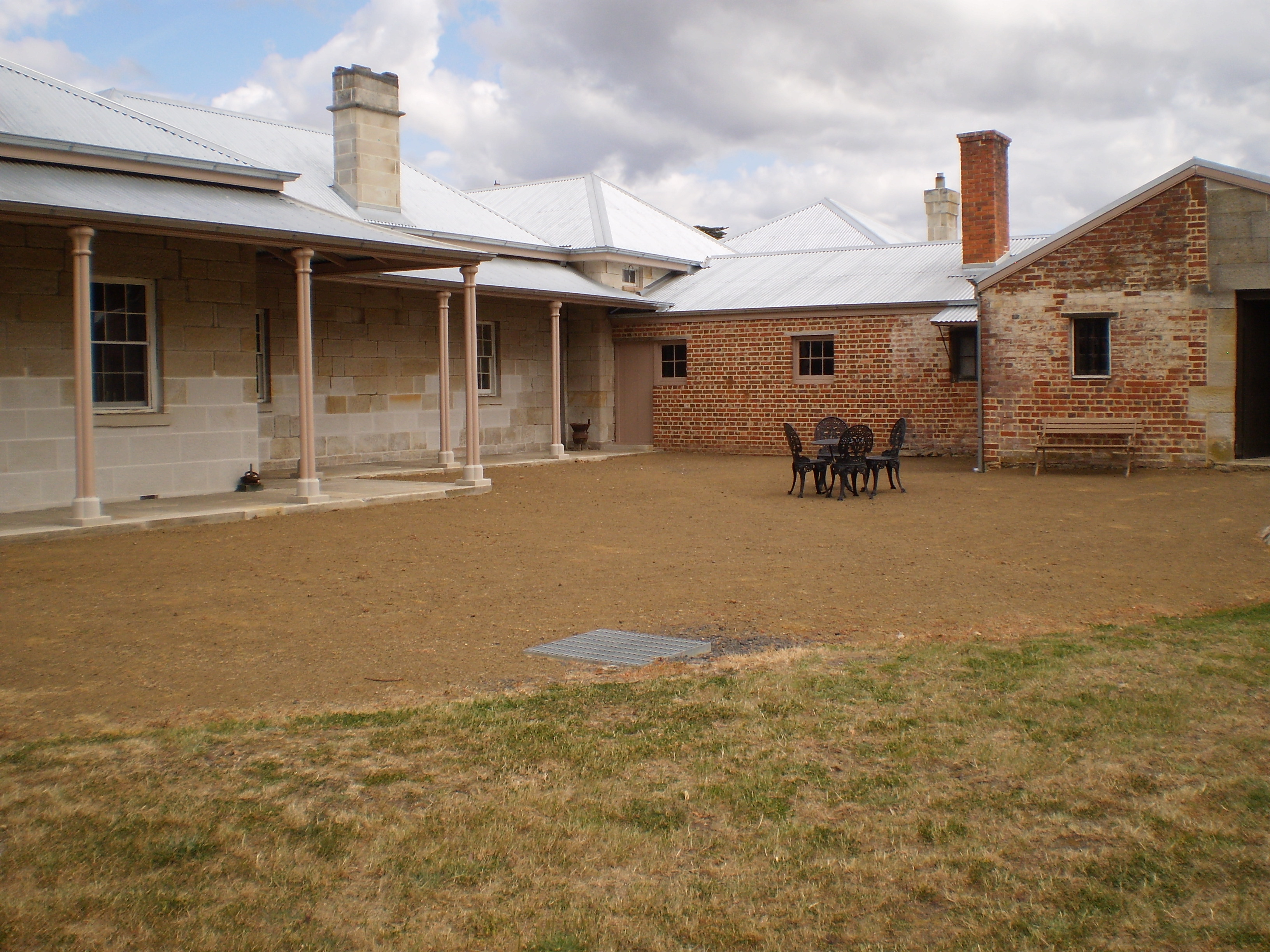
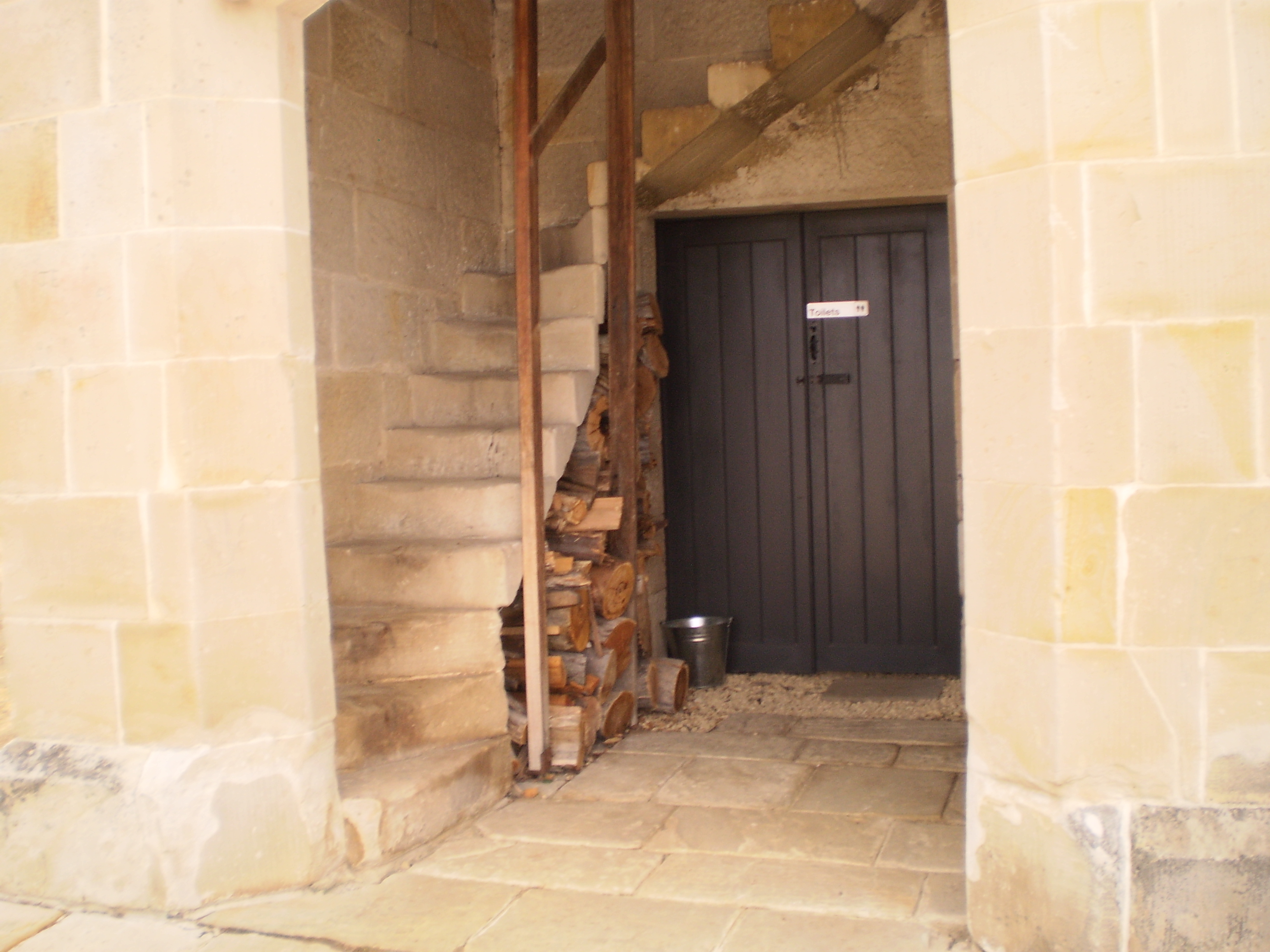
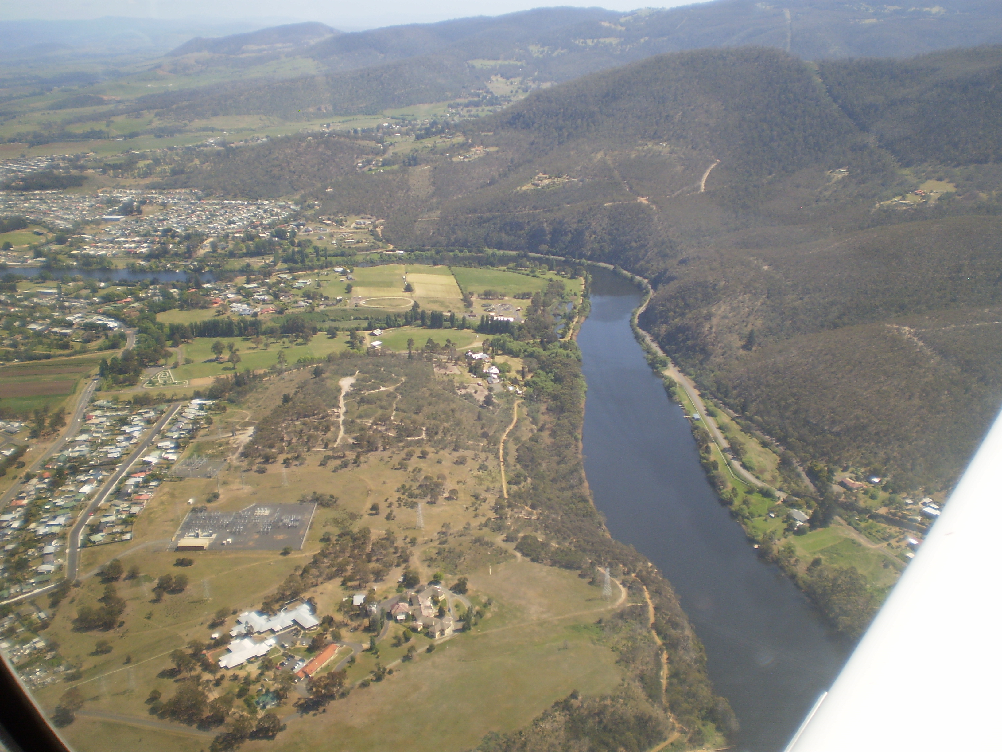
The Shene Estate, located just north of Pontville, covers many acres only a few kilometres inland from Bridgewater which sits on the Derwent River.  A few months ago a brilliant photographer, one of my blog followers, presented a set of images that stopped me in my tracks (pun not intended) – have a look.

When I visited last Friday, one of the owners, Anne Kernke enthralled me with the history of the property. Long term blog readers know that I get excited by many things and where possible I try and make a connection with the Derwent River, simply because I want to write a record.  I was on high alert the moment Anne mentioned the Derwent.  When she said that one of the key family members died near Pearson’s Point which is the location where I suggest the mouth of the river is located on the western shore, I knew I had reason to create a post.

Edward Paine/Payne emigrated to Van Diemens Land in 1820 and his eldest daughter married Gamaliel Butler who established the Shene estate. Unfortunately Edward drowned when travelling in a small boat with others because a boatman went “to the mast-head, which a small boat would not bear”. The boat capsized and it seems Edward could not swim. Anne Kernke has provided the following information: “an ill-fated boat trip to North West Bay, where Paine was looking for land to purchase.[1] The Hobart Town Gazette gave a very detailed account of the day’s tragic events:

It falls to our painful lot to record one of the most distressing and melancholy accidents which has ever occurred in this Settlement. On Saturday afternoon last, Mr. Edward Payne (who arrived recently in the ‘Deveron’), Mr Wickham Whitchurch, Mr James Kay, and Mr George Read, Superintendent of Government carpenters, left the port in a boat with three men to go to North-west Bay. On their way, they put into Tinder-box Bay, about 10 o’clock at night; but not finding the landing good, they determined to go on to the Government huts at North West Bay. When the boat had got about 300 yards, from the shore, the halyards being jammed in the mast-head, one of the boatmen went up to clear them, and in an instant the boat overset. With difficulty, and by the assistance of a Government boat which was in the bay, all were saved but Mr. Payne and Mr. Read. There was scarcely any wind or swell at the time; and this unhappy accident was caused solely by the man going to the mast-head, which a small boat would not bear. Mr. Whitchurch is an expert swimmer, and knowing that Mr. Kay could not swim, laid hold of him, and conveyed him within 50 yards of the shore, but from extreme weakness, was compelled to leave him for his own preservation. Mr Kay, although he never swam before, struggled through a thick bed of sea-kelp in deep water, and made the shore. Mr W. in the meantime floated on his back to recover his strength, until the Government boat came to their help.

Late on Sunday evening, accounts of the melancholy event reached Hobart Town; and upon its general circulation on Monday morning, it occasioned a sensation of feeling and regret proportioned to the estimation in which the unfortunate sufferers were held, and the loss inflicted by their sudden and premature fate. The body of Mr. Payne was found on Sunday, near the place where the boat overset. A Coroner’s Inquest on Tuesday gave a verdict of Drowned by Accident.’[2]

1]Journal of Peter Harrison, 1822, Royal Society of Tasmania, p.40 (typed copy)

[2] Hobart Town Gazette, 13 July 1822, p.2

On the following day, the distraught Mrs Paine was visited by the Reverend Robert Knopwood, who spent the evening trying to console her for her loss. Several days later, Knopwood conducted Paine’s burial service at the Hobart Town Cemetery (now St. David’s Park) on the 6th July 1822. The headstone was removed when the old cemetery was converted to the present day park.”  St David’s Park is in the Salamanca precinct which sits by the Derwent River at the edge of Hobart’s CBD.

Currently, to help support the expensive and meticulous restoration work across the Shene property, the owners provide guided tours by appointment, keep polo horses and will soon have competitions (the Hobart Polo Club now call Shene home and they use the 1851 stables as their clubhouse), they operate a distillery making a filtered and an unfiltered smooth tasting Gin, and much much more. More information can be read on the Shene website.

Revisiting sites

With a friend last Thursday and then with another yesterday I returned to Bushy Park,  where I introduced them to the hop kilns/Oasthouse precinct that is hidden at the end of 10 Acre Lane, next to the Derwent River.  They were amazed and delighted with the discovery.

20151031_151004

As it was when I first walked there, no-one else appeared on site. Thanks Alex and Andrew for the revisits. This site proves to be enthralling and special each visit.

Yesterday I realised the vegetation had grown dramatically and lushly in recent weeks so that ‘fences’ of flowering and green leafed Hawthorn blocked some previously easy views.  When Alex and I smelt delicate fragrant perfumes floating in the air, our noses were led to a throng of tiny roses clambering over themselves with a very strong but beautiful perfume. Standing beside this tangle was a flowering tree with perfumed drops of flowers somewhat similar to those on a wisteria, although coloured white.  We couldn’t identify this tree.  In another part of the precinct was a mass of trees with flowers in cone shaped clusters sitting up above their branches. Alex thought they might be chestnut trees.

20151031_150204 20151031_150217

The ducks ran out of the Junior Angling Pool hoping for a feed.

20151031_143852

Idyllic.

Revisiting the hop kilns was my reward after walking a little more of the edge of the Derwent River. But more about that in later posts.

20151031_140708

My sunhat has seen better days but it has a long way to go yet.

The euphoria continues

Yesterday a friend An drove me up along the Derwent River where we stopped off at a few dams, power stations and lakes. I was studying the terrain at ground level (our most recent Service Tasmania maps are aged and Google Earth photos are not current either), seeing where forestry and hydro tracks existed and determining where I will need to make my way through bush ‘with walls’. I can see a line of fiction here – turning an almost impassable density of bush into a character (an evil character – even though the bush is sublimely beautiful and bountiful) that has to be overcome.  My strategy will be as always, one slow step at a time and then the bush won’t even know I have come and gone (although my muscles will).

I walked some small sections yesterday, but I won’t write them up until I have walked in the areas westwards from Gretna to those sections.  I know now that it is difficult for some local readers to understand where I have been and therefore, if I change the blog posts from being a chronological record, it may be even more unclear.  Besides, by writing the stories in order and finishing with the last walk to the source it will be clear I have walked the Derwent.

Yesterday explorations and walks were as uplifting as the previous day’s flight; it was as equally wonderful, just different.  I feel gushy with delight when I am in the bush on a blue sky day, with no wind, and with a temp that rises sufficiently but not so that I boil.  Once I am sitting on rocks in the river bed with my lunch, listening to the birds, and sensing the spirit of the place, my life feels so right.  This is the place for me.

Then, despite the day’s experiences already being a treat, life added a new wonderful surprise.  Recently one of my blog followers, Justy, alerted me to the fact she and her partner were engaged in creating a new work of art for GASP beside the Derwent River at Glenorchy, a city in the Greater Hobart Area.  As part of their project, they had already walked along the Derwent River in Cumbria, England and now were planning to walk from the sea to the source of the Derwent early next year.  I hadn’t met them and only communicated a few times by email.  But yesterday, as An drove me towards Cluny Dam, I saw two women step from their car.  I waved and smiled as you do on a country road. As we drove on, I said to An “I bet they’re the two women who are engaged in the GASP project, out conducting a reconnaissance trip”. There was no reason to believe this except I felt I knew it to be the truth (the bush works its miracles). Nevertheless we continued on and had parked near the northern end of Cluny Lagoon when the two women drove past us. Again we waved. On a later road we found ourselves coming towards each other from opposite directions, so An waved them to a stop. The women looked at us queryingly. “Are either of you Justy or Margaret? we asked.” “Yes”, they responded. Instantly I called out, “I’m Helen”.  Their nod of acknowledgement followed. And then we all poured out of our cars, and hugged and had a lively chat standing on a dusty road in strong Spring sunlight. It was a brilliant unexpected meeting and capped off what had been a day of immense discovery and pleasure.

Best wishes for your project Justy and Margaret!

Dams on the Derwent River

The potential of the volume of water passing down the Derwent River for hydro-electricity generation was seen over a century ago.  While a few power stations were built in the early decades of the 20th century, with an influx of migrants from war ravaged Europe in the 1940s-50s, the numbers of dams and power stations increased quickly.  Overall, many dams and approximately 30 power stations have been built across central Tasmania.

On my way to Lake St Clair, I will reach and walk past each of the following 7 markers along the River:

  • Meadowbank
  • Cluny
  • Repulse
  • Catagunya
  • Wayatinah
  • Tarraleah
  • Butlers Gorge

One of the Hydro websites provides detailed information about these and others which feed into the Derwent River catchment.  In addition, the site includes the diagram below.

Derwent dams

Brilliant bird’s eye view

Thankyou blog follower Ju.  Recently Ju connected me with a woman with a husband who has a Private Pilot’s Licence.  Once I made contact, Michelle and Dave were delighted to fly me in their four seater plane, a Cirrus SR20 which Michelle referred to as the BMW of the skies.

Today we flew.  Not a cloud in the sky.  Clean blue sky. Hardly a breeze.  The landscape rich and varied.  The Derwent River sparkled from start to finish.

The experience was stunningly magnificent.  I love words but I find it difficult to express my excitement, my pleasure, and the sheer joy of the flight in the depth which I felt.  There below me was the river I have come to love and know a little more. There below me were the tracks, paths, roads and landscape over which I have walked – and I laughed occasionally remembering certain experiences during my walks. There below me were logging tracks, dam roads, and fading vehicular pathways.  And then we were flying over impenetrable sections which may not be walkable.

We left Hobart airport and flew to Storm Bay by rounding the Iron Pot, then we followed the river upstream to the source. Dave flew on until we reached the northern most point of Lake St Clair. The return journey was equally as beautiful and engaging. The light had changed presenting us with a ‘new’ landscape.

Of the hundreds of photos taken by Michelle, friend Chantale and myself, I include a tiny selection here.

OLYMPUS DIGITAL CAMERA

The photo above taken by Michelle caught me totally preoccupied by the view.

OLYMPUS DIGITAL CAMERA

MIchelle’s photo above shows the Derwent River snaking around the Claremont Golf course with Cadbury’s Chocolate Manufacturing buildings in white to the left.

OLYMPUS DIGITAL CAMERA

The photo above shows a straight section of the Derwent River before the township of New Norfolk on the upper left.

OLYMPUS DIGITAL CAMERA

The photo above shows the Derwent River circling part of Reid’s cherry orchards.

IMG_3864

Chantale’s photo of the Pumphouse Point accommodation projecting into Lake St Clair, also shows the dam across the Derwent Basin where the water enters St Clair Lagoon.  The source of the Derwent River starts to the right of the photo.

OLYMPUS DIGITAL CAMERA

Michelle’s photo above shows part of sprawling Hobart set against the Derwent Harbour.

Those photos taken while flying over the river westwards of Gretna will be incorporated into the stories of my walks from Gretna onwards, in future posts.  From now on, you can expect both ground-based and aerial photos to enrich the stories.
I feel like the luckiest person in the world for the opportunity to travel in a smooth flying small plane, to see the Derwent River winding through the landscape in glorious blueness, and to be reminded Tasmania is a superb place. A truly wonderful and memorable day. Thankyou to all concerned.

Dangerous rivers

The Derwent is ranked No.8 in the country’s top 10 most dangerous inland waterways, with 12 victims since 2001,’ said David Beniuk in his article “Don’t run the risk in rivers”, published in The Sunday Tasmanian yesterday.

He explained that ‘Tasmanians are being reminded of the dangers of their beautiful, but potentially deadly rivers in a national campaign.’

The Royal Life Saving Society says ‘We are a state that absolutely loves our waterways … But our inland waterways, in terms of drowning fatalities, are really where it’s happening in Tasmania. The perception is that the still waters of a river are calm and are safe. But it’s what we don’t see and don’t know, things like ice cold water, snags, things like tree branches as well as river currents, that often get people without notice.’

Beniuk reports that ‘The state registered the highest per capita rate in the country, with men over 55 at risk.’  He noted a number of things we can do which offer protection: ‘wearing a regularly serviced life jacket, avoiding alcohol, never swimming alone, knowing the area, telling people where and when you’re going and learning first aid.’ In addition, ‘checking weather conditions and the Maritime and Safety Tasmania website were also important.’

This article was timely; over the weekend a friend urged me to stay with my decision not to canoe/kayak down the Derwent River.  As I mentioned in a recent post, a strong fit male family friend canoed down a short section and had never been so frightened.  I got the message then.