Tag Archives: Derwent River

Sport and the Derwent River

A couple of weeks ago an international Test cricket match between Australia and the West Indies was staged at the Blundstone Arena in Bellerive. Australian cricket tragics (but probably not those from the West Indies) may enjoy these photos. When you stand in the open or sit in the grandstands, fabulous views of the Derwent appear before you and distract.  Cricket Tasmania’s website  shows a glorious aerial shot of the Arena with the Derwent River beyond and mysterious Mount Wellington looming behind the city.

Last Friday night, I was on the Hobart Domain at the Hobart tennis courts. First I watched retired Tasmanian tennis player Richard Fromberg (he reached about number 20 in the world when he was playing on the world circuit) play an up and coming Tasmanian player, Harry Bourchier, who hopes to break into the Australian Open Grand Slam in January.  Fromberg is circled below watching a later match.

Richard Fromberg.jpg

A fun doubles game followed with two 7 year olds (one of which was Cruz Hewitt, Lleyton Hewitt’s son) teaming up with their adult coaches to play a short game.  Those extraordinary 7 year olds stood firmly at the base line and served their balls over the net, despite the net being a great distance off and higher than they were tall. The night finished with ex World number 1 tennis player Lleyton Hewitt playing an exhibition match against Australian Sam Groth who currently has the fastest serve in the world.  In the photo below, Groth wears red at the left of the net and Hewitt wears blacks to the right.

2015-12-18 20.43.38 Sam Groth in red and Lleyton Hewitt in black.jpg

I was thrilled by the hard and fast hitting.  A good game!

Beforehand I wandered to one end of the main court and looked out through an overcast evening, to the Derwent River.

2015-12-18 18.13.43

On occasions when the sky is clear and blue, the Derwent River sparkles.  Getty Images has one shot I particularly like.  The blue tennis court in the foreground seems separated from the Derwent River by a giant cruise ship at anchor in port.

Possession of aboriginal lands by European settlers and the government of Van Diemen’s Land

John Wadsley’s Brighton, Central Highlands, Derwent Valley and Southern Midlands Councils Joint Land Use Planning Initiative – Stage 2 Heritage Management Plan of July 2010 reports: ‘After the initial period of European settlement from 1803, a large influx of free settlers and pastoralists in the 1820s saw a major expansion of European influence and land grants in the central and midlands areas of Tasmania. Settlement along the Derwent, Jordan, Clyde and Ouse rivers forced local Aboriginal bands from traditional hunting grounds and increased tension between settlers and tribal groups. Conflicts flared in a number of areas, with local farmers and vigilantes attacking Aborigines and retaliation by tribal groups attacking road gangs, stockmen and homesteads.

In 1828 Governor Arthur declared martial law against Aborigines after failed attempts to divide Aboriginal lands from the “settled districts” to reduce the number of attacks by tribal groups. By 1830 the number and frequency of attacks by and on had reached such a level that Arthur decided to launch a full scale military operation against the indigenous population in the southern Central Highlands, southern Midlands and south east areas. This became the so-called “Black Line” which was intended to round up Aborigines and move them from the settled districts. By 1831 some hundreds of Aborigines and settlers had been killed over land occupation and dispossession of traditional tribal lands. The Aboriginal population in the Midlands and Central Highlands was by now very small, probably less than 100. Many traditional hunting areas had been cleared of tribal groups allowing further expansion of pastoral activities. The so called “conciliation” process under George Robinson eventually saw the remaining Aboriginals moved off their traditional lands to Flinders Island by 1834, and then to Oyster Cove in 1847.’

Hamilton and Ouse in Tasmania

These two historic towns straddle the Lyell Highway and both are situated a distance from the Derwent River.  Private farms fill the distance. Direct access to the River can only be achieved by driving approximately 15 kms when leaving Hamilton, or when driving from Ouse, the River or Meadowbank Lake can be reached from two directions; one approximately 7 and the other approximately 10 kms away.

Hamilton is located approximately 4kms ‘as the crow flies’ to the east of Meadowbank Lake.  The Clyde River, which passes through Hamilton empties into Meadowbank Lake (and it once flowed directly into the Derwent River before the Meadowbank Dam was built in 1967).  Tasmania for Everyone claims ‘Hamilton had its origins at a time when early European settlement of Van Diemen’s Land (Tasmania) had progressed from Hobart up the Derwent Valley. The first settlers arrived here shortly after New Norfolk was settled in 1807. A ford across the “Fat Doe River” probably led to the first settlement of the area then known as Sorell Plains, with the village first named Macquarie’s Town, and later, Lower Clyde.By 1828 there were a few weatherboard and sod cottages on the banks of the Clyde, whilst by the 1830s a visitor noted there were some thirty sly grog shops as one entered the town. The name Hamilton had already been suggested for the settlement sometime in 1825 when, during a visit, Lt. Governor Arthur asked if Bothwell would not be suitable, being a Scot himself and dining with the mainly Scottish settlers. The “Fat Doe River” was renamed the Clyde and Hamilton and Bothwell chosen as names for the new settlements, both names recalling towns on the lower and upper Clyde in Scotland.
Occupying a strategic location in the development of roads and agriculture, Hamilton became the focal point of the transport of produce into and out of the district.  By 1832 there were sixty persons living in the settlement and surrounding landholders successfully petitioned for a police establishment as protection from marauding bushrangers and a spate of robberies.
By 1835 the district population had zoomed to 779, including 309 convicts and by 1837 the Police establishment had eleven petty constables and a flagellator (for whipping punishment).  With cheap convict labour it was during this period that many of the town’s buildings (which still stand today) and bridges were constructed.
By 1844 Hamilton was a bustling town, with two breweries, six or seven Inns, a blacksmith, stone quarries, mills, three agricultural implement makers and a large convict probation station; it held its own Races and Hunts, indeed development was so promising that the town was marked out as a major country town, in the style of an English town at the time, with squares, an esplanade, a Circus and Municipal Reserve.
A drive up onto the Hamilton Plains shows the roads laid out, and the decaying, dry stone walls are a reminder of the failed attempt by the mainly Irish settlers to farm the rich volcanic but dry soils of the plains. Nevertheless, Hamilton remained a bustling country town throughout the remainder of the 19th century, with the population peaking at 400 in 1881 and developments like the Langloh Coal mine to the northwest of the town in the late 1930s ensured its importance as a major rural centre.
Increasing mechanisation and improved road transport effectively put an end to Hamilton’s growth. Whilst sadly these factors led to Hamilton’s decay and ultimate demolition of some notable buildings, many fine examples remain in the streetscape having an ambience redolent of our colonial history.’ 

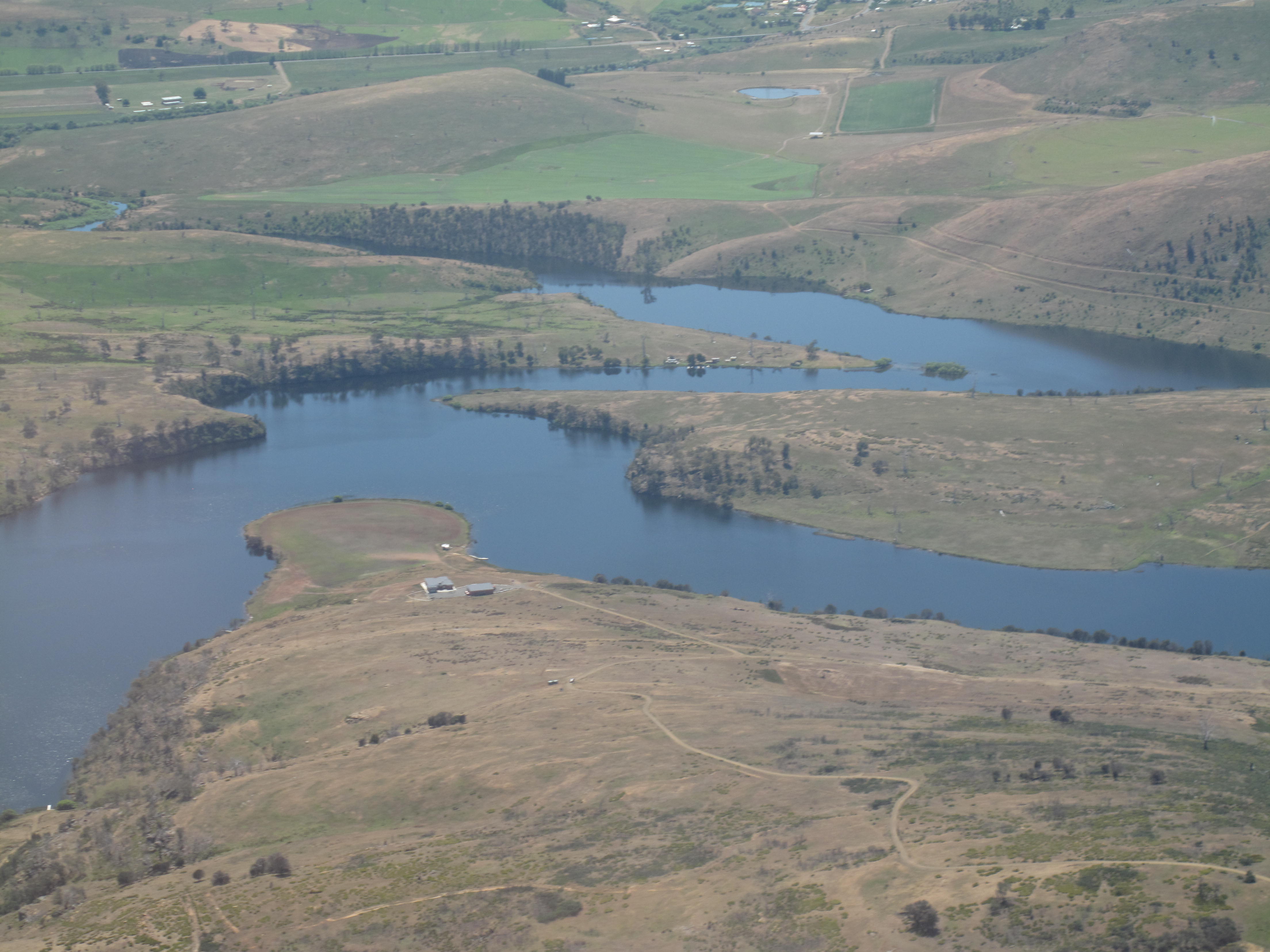
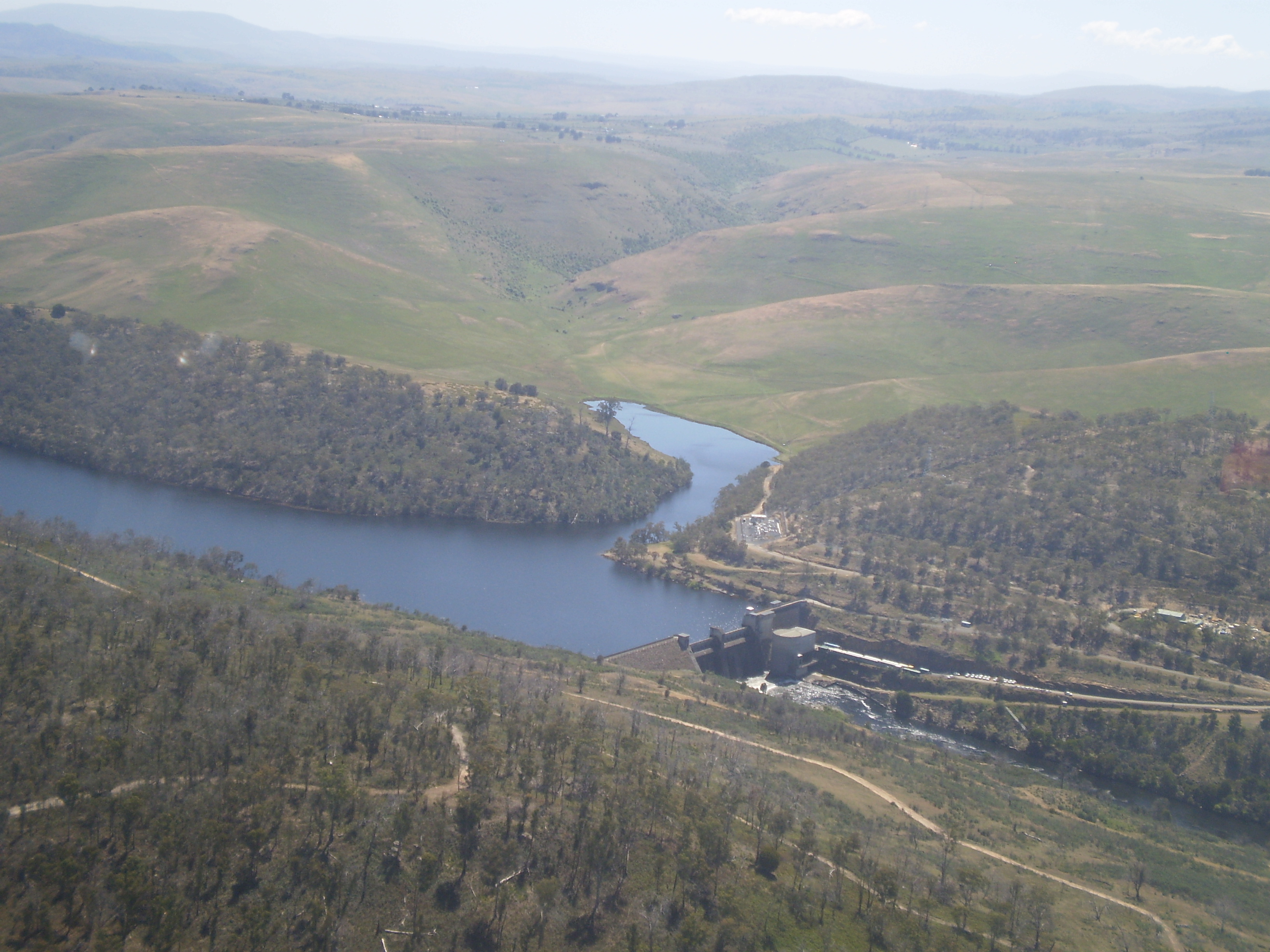
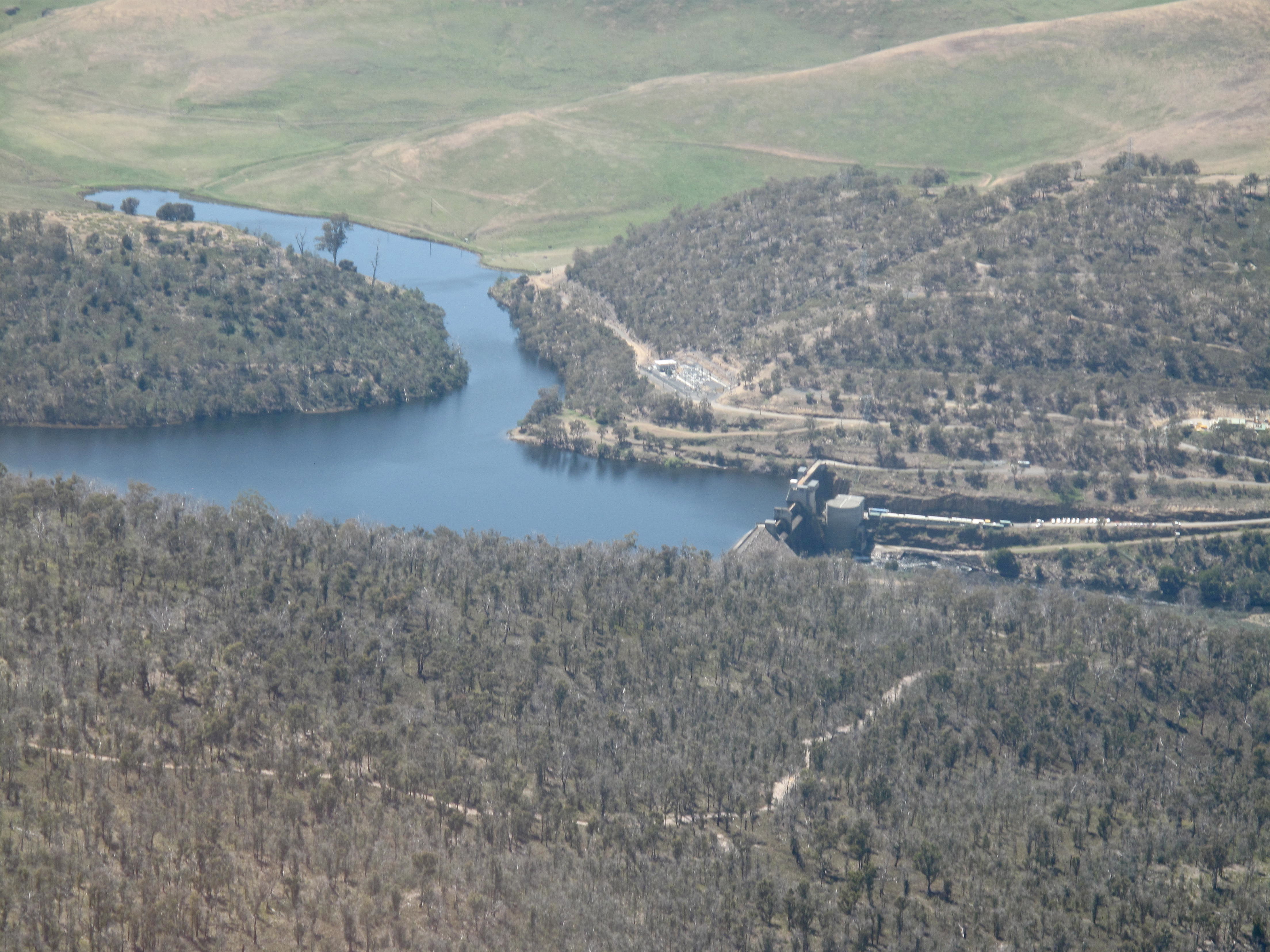
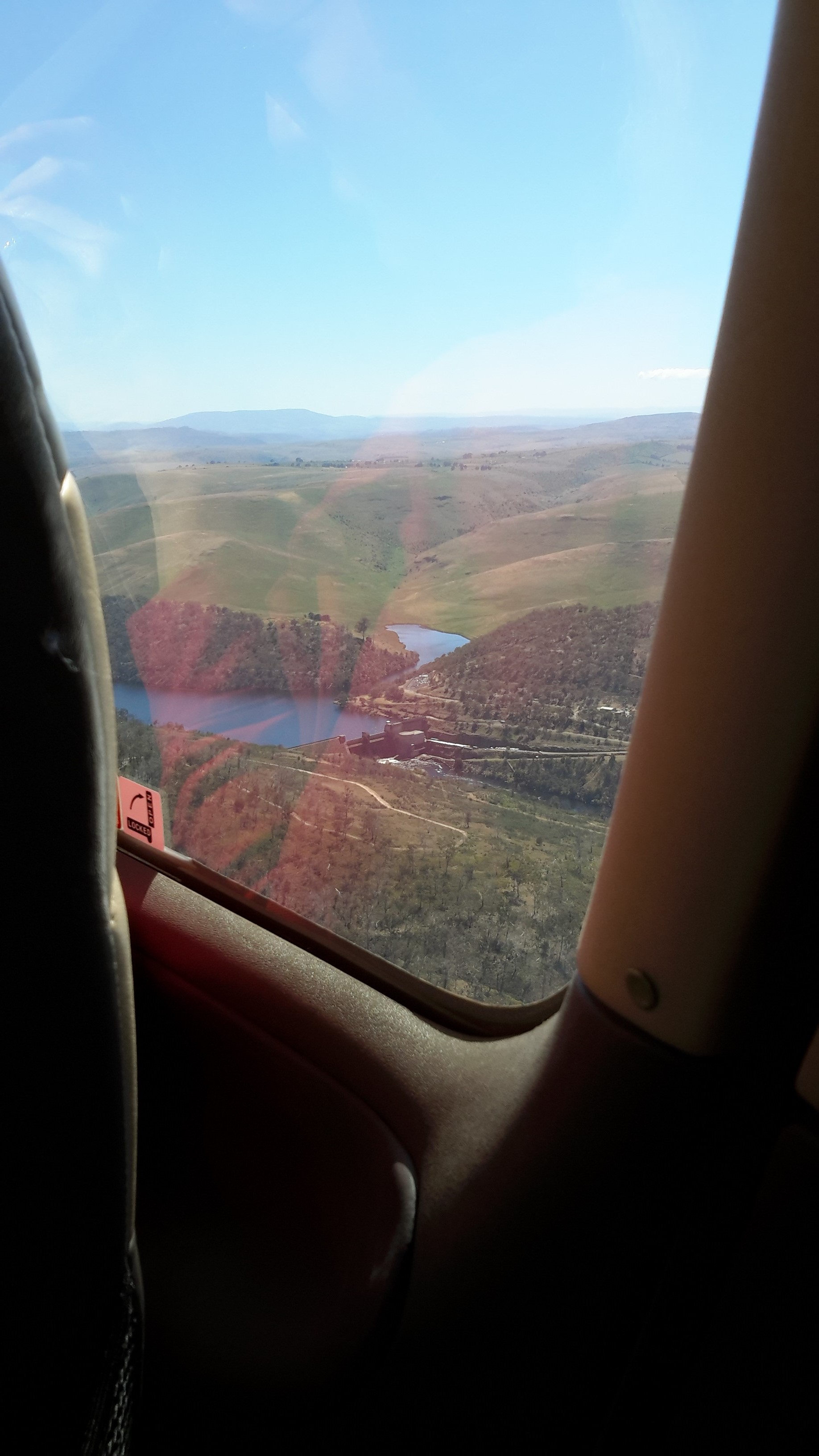
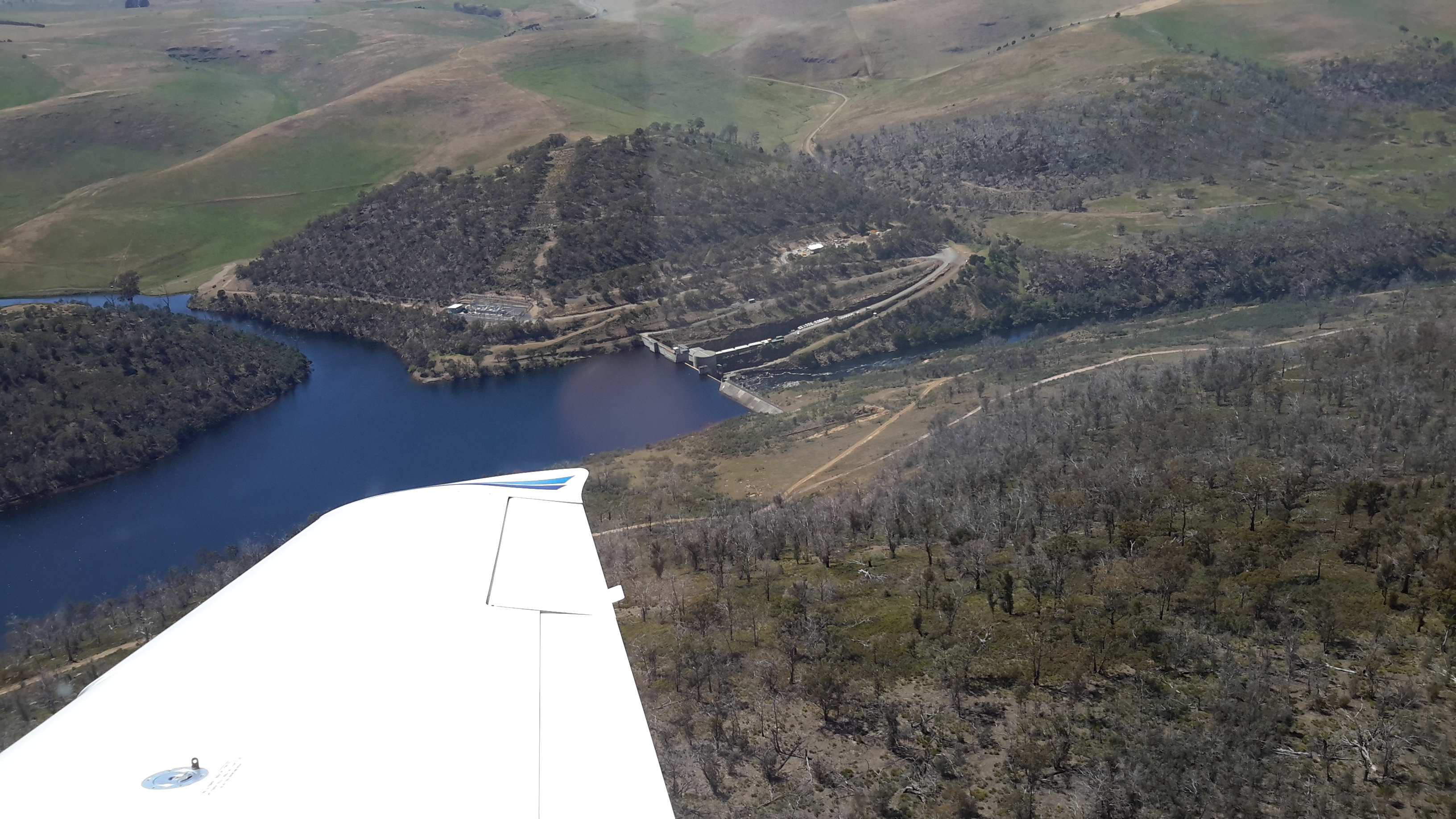
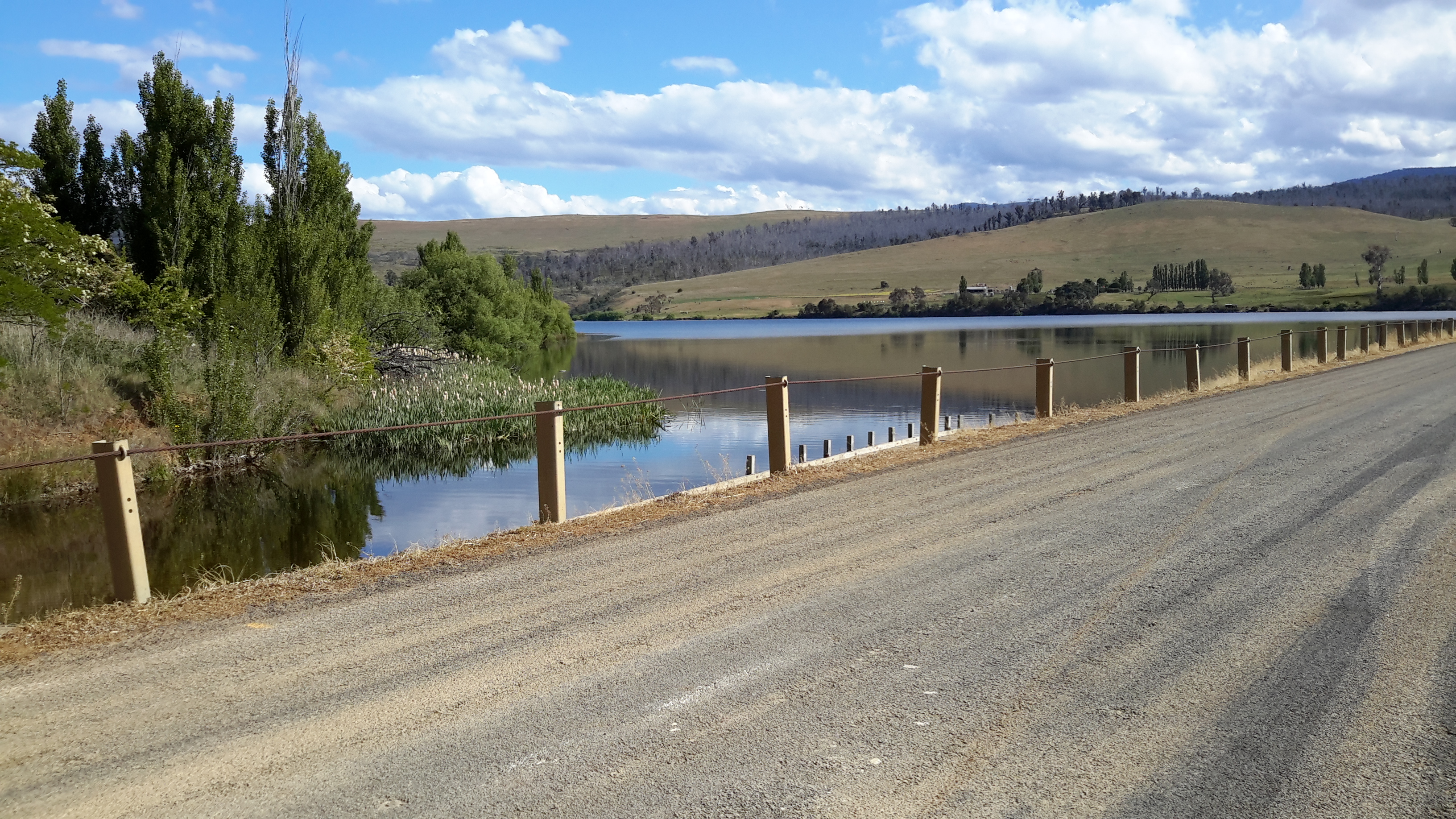
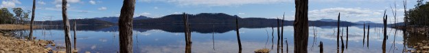
Hamilton is located on the far side of the hill in the photo below. The water is part of Meadowbank Lake.

20151028_114436.jpg

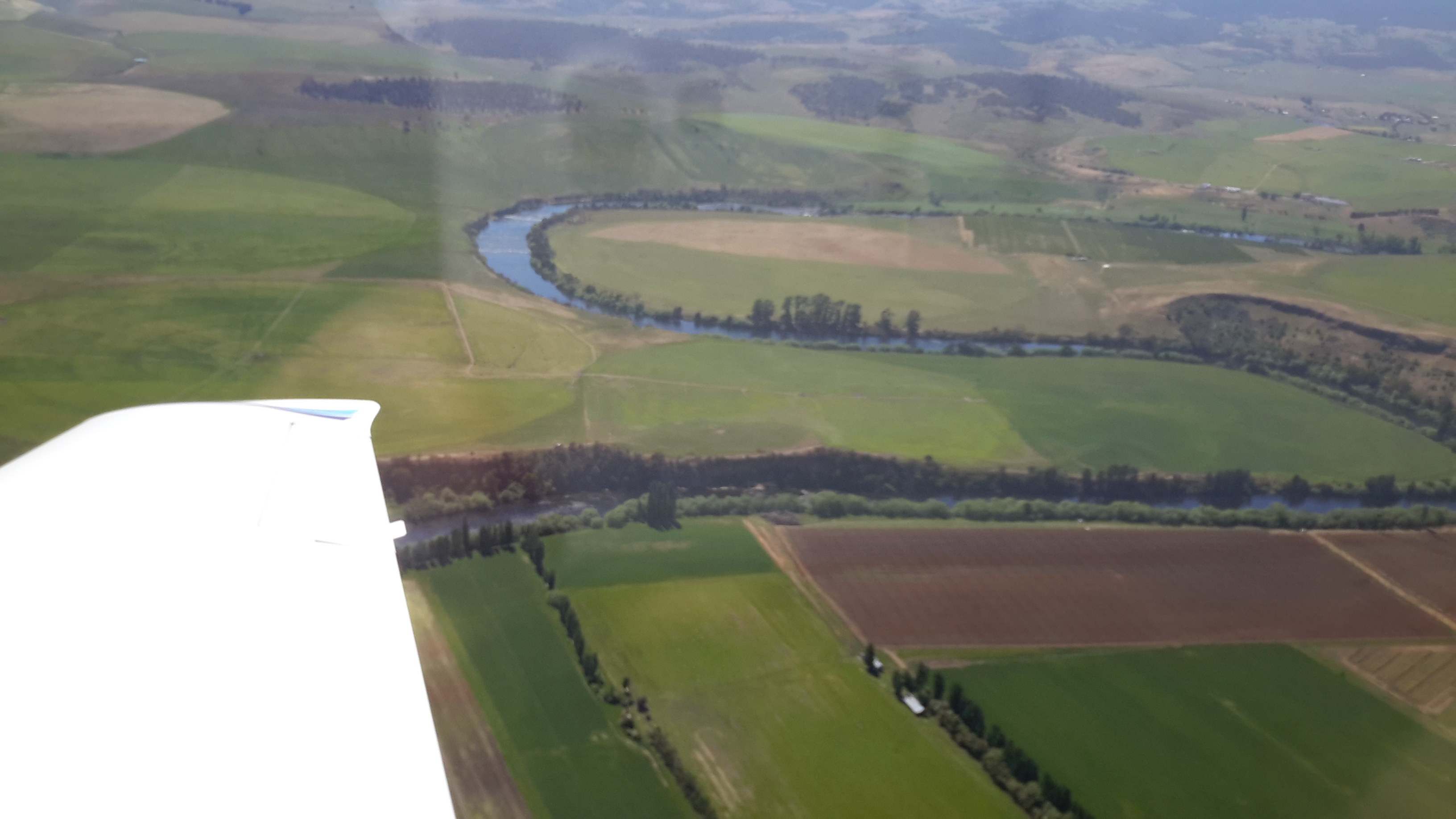
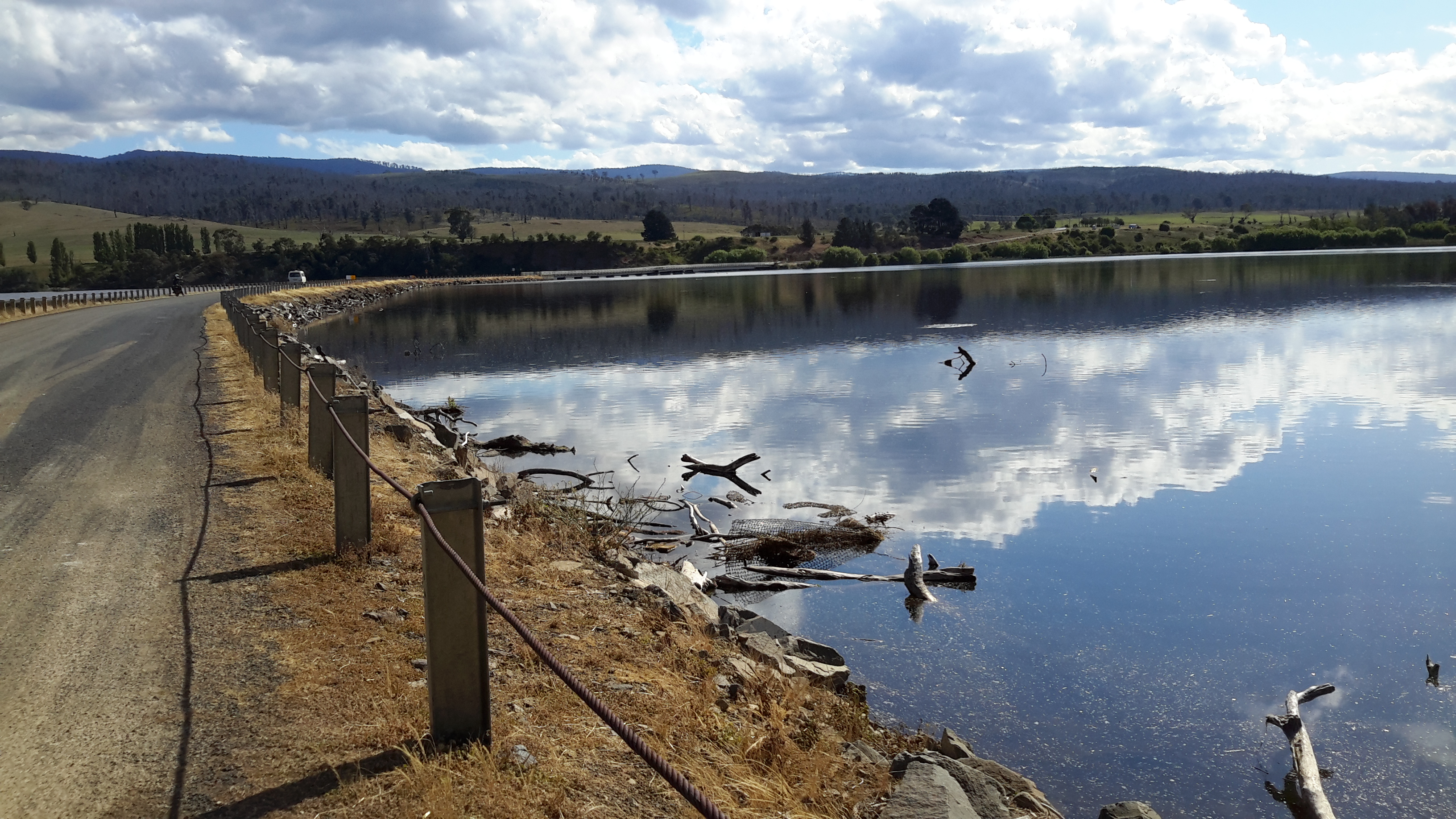
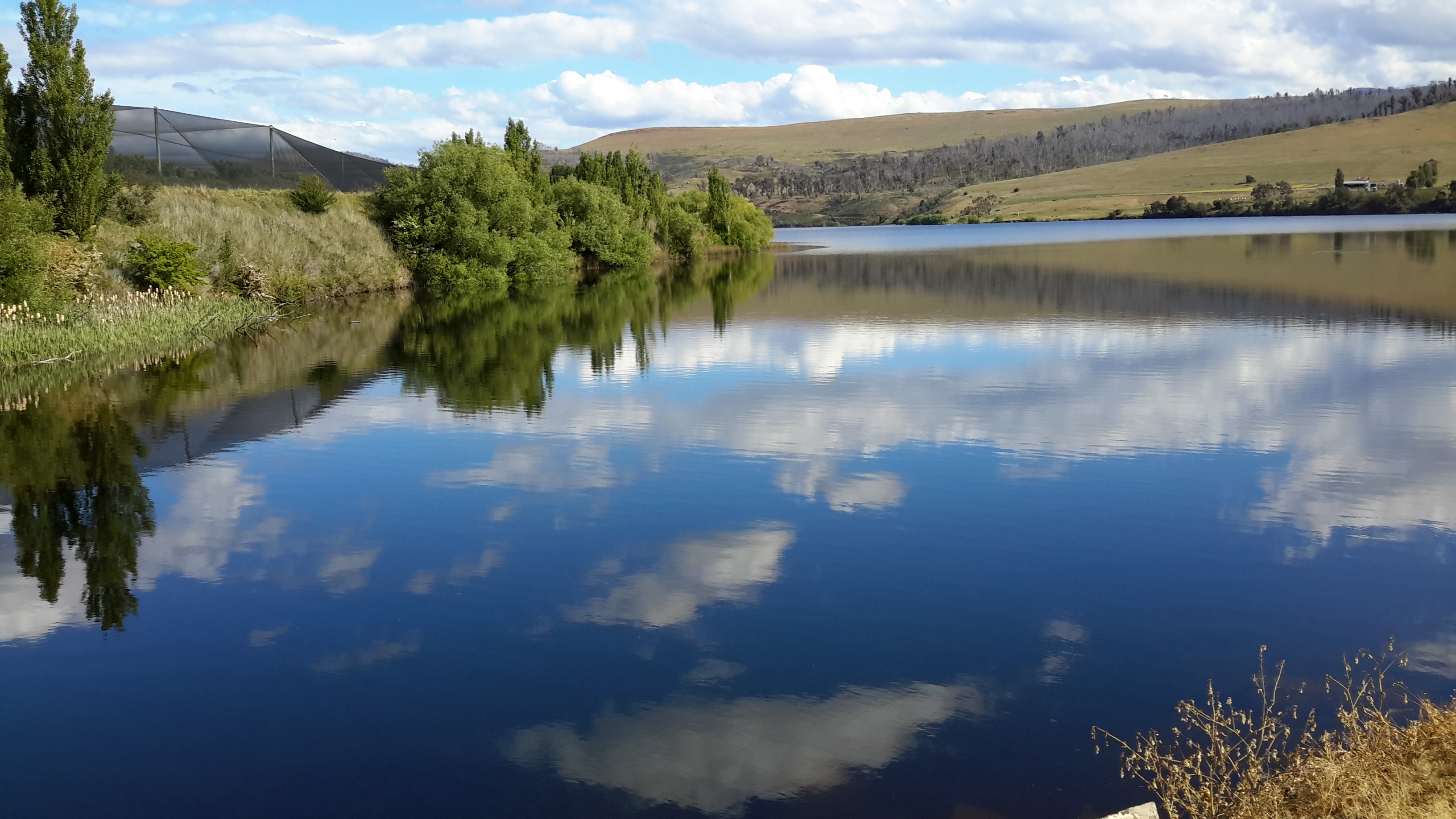
In Chantale’s photo below, the Clyde River is running into Meadowbank Lake. At the top centre of the photo you can see a few houses and these form part of the town of Hamilton.

IMG_3904

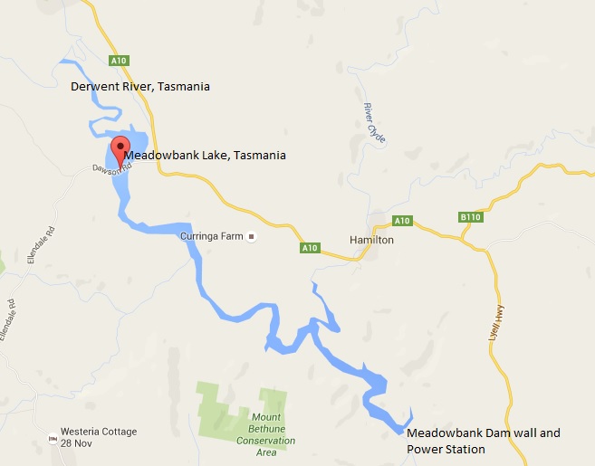
Ouse (pronounced ooze) is located approximately 3 kms ‘as the crow flies’ to the east of the Derwent River between Cluny Dam and the north western end of Meadowbank Lake. Tasmania for Everyone claims Ouse is ‘a small rural Central Highlands town on the Lyell Highway, situated on the junction with the Victoria Valley Road and on the banks of the Ouse River. Ouse is the settlement where convicts James Goodwin and Thomas Connolly broke out of the South West Wilderness four weeks after their escape from Sarah Island. Ouse Post Office opened on 1 October 1835.’

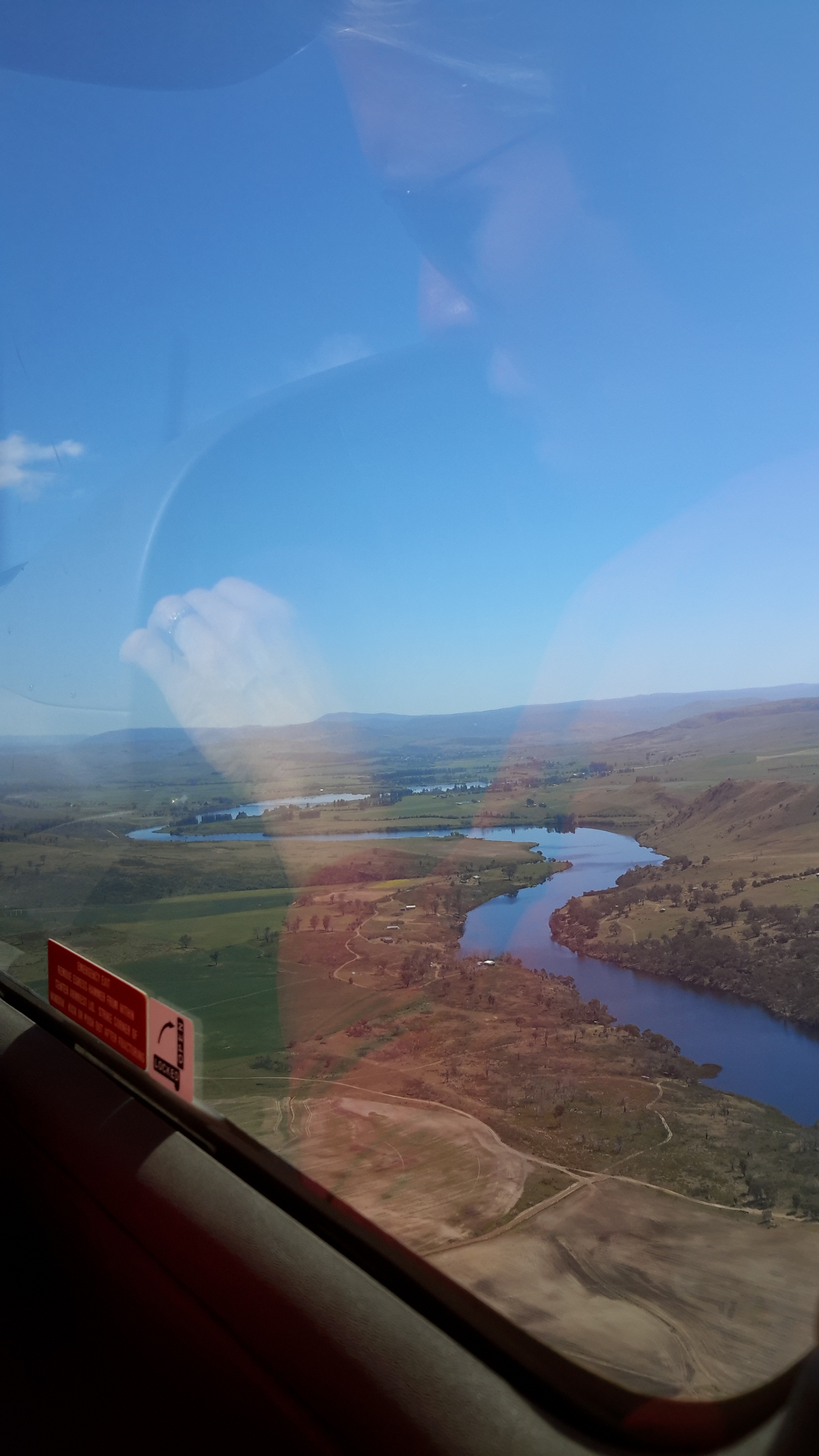
In Michelle’s photo below you will need to imagine that Ouse is located over the low hills in the distance away from the Derwent River.

PA280084Top of Meadowbank Lane and then Derwent again.JPG

John Wadsley’s Brighton, Central Highlands, Derwent Valley and Southern Midlands Councils Joint Land Use Planning Initiative – Stage 2 Heritage Management Plan of July 2010 provides additional historical information concerning the building of bridges to enable expansion and ease transport, the significance of convict labour in settling the Valley, and the growth of farming, the development of industries, and the establishment of hydro power generating facilities.

Catherine Nicholson’s Highland Lakes Settlement Strategy of December 2009 offers further information about the history of settlement in the Derwent Valley.

What I notice, in all the histories of the Derwent Valley that I have read, is that attention is seldom given to the Derwent River rather it is focused on the rivers which fed into the Derwent, and also on the central highland lakes.  The search for fertile soil in which to grow wheat and other crops, and for land offering suitable pastures for sheep and cattle, was of paramount importance.

The photo below shows me in Hamilton. Behind me, the Clyde River (which flows into Meadowbank Lake) is located at the bottom of the hill and edges a delightful park which suits picnicking. I am sort of smiling but I was hot and bothered after a delightful day’s walk elsewhere.

20151031_140708.jpg

The inspirers

Congratulations to all the bloggers who celebrate the wonders of our world.  I hope those listed below may inspire my blog followers to be excited by the opportunities to see beautiful landscapes whether close to home or thousands of miles away.

In particular, I am inspired by all those who present Tasmania with glorious photographs and introductions to the geographical nooks and crannies that walkers, cyclists, rowers, kayakers, skiers, sailors and drivers find.  It has been my privilege this year to discover new sites, whose owners love what they find and then share it with the world.  Amongst these, you can find informative and stunningly beautiful photos of Tasmania’s Derwent River.

Here are some of my favourite blogs.

  • Showcasing Tasmania is No Visible Means
  • Traverse our life highlights more Tasmanian beauties by new arrivals to this State
  • This Amazing Planet presents photographs Tasmania, mainland Australia and more broadly overseas
  • The blog, Tasmanian Beaches is being written by a person who plans to find every Tasmanian beach by walking, cycling, sailing or kayaking.
  • For mainland Australia vistas, I love those posted by Solo Hiker. From Home to Roam
  • Life:Kitt shows me colourful photos of cities on mainland Australia
  • The couple of guys who write Everyday Adventures transport me to places in Australia and around the world, give me a new perspective on the familiar and encourage me to seek out more of the unfamiliar.

In addition, the photographs and written content of many overseas bloggers uplift me.  Some examples:

A few bloggers and I have developed a wonderful mutual adoration society because we enjoy what each of us shows in our blogs.  In particular, I love the blogs of

Perhaps you have found blogsites that inspire you. If you think they may interest me or other bloggers then please add the details in a comment to this posting.

Getting perspective

I discovered the following graphic on the Australian Native T-Shirts website.

For readers who do not know Australia well, note Hobart is located at the southern end of the island state of Tasmania at the bottom of the country.  Slightly east of Hobart is where the Derwent River flows out into the sea.  The source of the Derwent River is located north west of Hobart roughly in the centre of Tasmania.

Map of Aust with Europe over it.jpg

A comparison map showing Australia and the United States of America is located at the site ‘On Walkabout’.

AustraliavUSA comparison map.jpg

Finally, I found a most amusing map with multiple overlays of Australia across the world.

Australia-over-the-world

Seeing such images certainly helps me to understand the scale of our nations.

Gretna to Lake Repulse Dam – an aerial perspective: 2 of 3

Meadowbank Lake, through which the Derwent River runs, is an expanse measuring approximately 15 kms in length. A few kms of Derwent River flow between the Lake’s western end and Cluny Dam.  Between Meadowbank Dam and Cluny Dam, Michelle saw:

PA280076 Meadowbank Dam.JPG

PA280079 Doctors Flt and Tickleberry Flat on other side.JPGPA280081.JPGPA280084Top of Meadowbank Lane and then Derwent again.JPG

OLYMPUS DIGITAL CAMERA

OLYMPUS DIGITAL CAMERA

 Between Meadowbank Dam and Cluny Dam and Power Station, Chantale saw:

IMG_3907.JPGIMG_3905.JPGIMG_3904.JPGIMG_3901.JPGIMG_3898Dunrobin bridge.JPGIMG_3897Top of Meadowbank Lake

Between Meadowbank Dam and Cluny Dam and Power Station, I saw:

20151028_114338.jpg20151028_114404.jpg

20151028_114522.jpg


Gretna to Lake Repulse Dam – an aerial perspective: 1of 3

I have felt bereft at the constraint of not being able to provide details of where I have walked nor present photographs of grand scenery of the Derwent River and its surrounds.  Then I remembered the flight I took from the mouth to the source and return.  I realised I could use a selection of the photos that my two companions and I took during the flight. This series of postings will show you aerial shots covering the area between Gretna and Lake Repulse Dam.  I hope readers will be as thrilled as I am to see the rich expanses of our land by the River and then to be excited by that blue ribbon that winds through that landscape.

Sitting astride the Lyell Highway, Gretna is the tiny town at one end (the closest end to Hobart) of this Gretna to Lake Repulse Dam distance. Approximately 52 kms of Derwent River stretches between these two points and to walk it requires covering considerably more kms.

Between Gretna and Meadowbank Dam and Power Station, Michelle saw:

OLYMPUS DIGITAL CAMERA

OLYMPUS DIGITAL CAMERA

OLYMPUS DIGITAL CAMERA

OLYMPUS DIGITAL CAMERA

OLYMPUS DIGITAL CAMERA

OLYMPUS DIGITAL CAMERA

OLYMPUS DIGITAL CAMERA

PA280073.JPG

Between Gretna and Meadowbank Dam and Power Station, Chantale saw:

IMG_3912.JPG

IMG_3911.JPGIMG_3909.JPG

Between Gretna and Meadowbank Dam and Power Station, I saw:

20151028_11415220151028_114203.jpg20151028_114222.jpg20151028_114228.jpg


Walking between Gretna and Lake Repulse Dam – 3 of 3

Tracks

Meandering at the edges of paddocks and sometimes across them, the deeply engrained cow and sheep trails were my usual pathways.  When I was not following these, I opted to walk on vehicular tracks. At all times, I deliberately set out to leave no trace of my passing.

Even when I climb fences, I make an extra effort to restore any reshaping to the original configuration. The last thing I want is for anyone to see that a fence has been climbed and believe this is a regular ‘pathway’.  When fences become distorted, they start the journey to break down and, with valuable livestock to be managed, no farmer wants to be worrying about maintaining fences when the deterioration is not time-related.

The Derwent River

The speed of the river flowing downstream always surprises me.  The power of that water, the changing colours of that deep mass, the scale of the River, and the variations in the unique landscapes on the edge impress me strongly. Time and again.

20151129_093815.jpg 20151129_114502.jpg

Where the Derwent passes through Cluny Lagoon and Meadowbank Lake, the wider expanses of water gleam.

Meadowbank Lake - Nov15 section larger photo.jpg

Section of larger photo on Meadowbank Lake.jpg


Walking between Gretna and Lake Repulse Dam – 1 of 3

I no longer believe that walking the Derwent River from the mouth to the source is possible as a normal public option. The reasons why others should not follow in my footsteps and expect to walk the length of the River include:

  1. Private landowners will not grant access permission to cross their land for a range of very sound reasons.
  2. There are no public pathways, roads or tracks near most of the River.
  3. Fences and gates make forward progress difficult or impossible.

Let me explain by focusing on the situation in one inland section.

The Derwent River winds around mostly cleared hills between Gretna and Lake Repulse Dam, and on two occasions its travel is impeded:  by the Meadowbank and Cluny Dams. The Derwent between these two locations measures approximately 52 kms.

As a result of privileged access and after a series of recent walks, I have covered the majority of these kilometres, sometimes walking on one side of the River and sometimes on the other.  I expect to finish this section by filling in the few small ‘gaps’ in the near future.  Once the 52 kms are completed then I will add the details into my blog under USEFUL ADDITIONAL INFORMATION. Weather (not snowing, raining, excessively windy or hot – I’m not fussy!) and the availability of chauffeurs will influence when and where I walk in the future.

Some of the many landowners along the way have granted me permission to walk on their land with the proviso that specific details which allow identification of them and their properties will not be provided.  I understand the reasons for their positions and will not share the information. Unfortunately, so many of my glorious panoramic photos of the Derwent River feature rapids or other indicators such as hills, dramatic cliffs and distant properties which show the side of the River on which I walked. As such, these would help locate the properties on which I walked.  Therefore, for the first time, I am disappointed to include only a couple of River shots in my blog posts.

20151128_155033

Many blog followers have enjoyed the details of what I see and experience in each walk.  Without providing identifying information, I will do my best to present some of the ‘flavour’ of the River between Gretna and Lake Repulse Dam in the next couple of blog posts.

Thanks to blog follower Jeanette, I was chauffeured to some starting points and collected from destinations in the section between Gretna and Lake Repulse Dam.  In addition, she walked with me on one occasion. At the time we tried out hand-me-down walking poles (my doctor says they will support my knees) but since they were no longer collapsible, we soon discarded them.  For blog followers wondering how my knees are holding up – very well, thank you.  Now that I wrap and support them, walking has become so much easier.

Tackling the Derwent in the Meadowbank Lake region

Meadowbank Lake, which backs up behind Meadowbank Dam and its Power Station, is approximately 15 kms long. Downstream, the Derwent River snakes its way through the landscape for about 23 kms until it passes Gretna and heads on towards the sea.  Upstream, after approximately 9 to 10 kms, the Derwent River finishes at Cluny Dam.  The Cluny Lagoon which extends to Lake Repulse Dam extends a further 4 kms.

To walk the Derwent between Lake Repulse Dam and Gretna is not straightforward because some private property owners cannot afford to let strangers on their property for insurance reasons, or their granted permission is a one off special case for me.  As a result, I have walked and will walk sometimes on the western and sometimes on the eastern side of the River and Lake, but I will not be providing a map and location details in my blog.  In this way I will protect the privacy of landowners, and respect the privilege their permission to access their property has given me.

I expect to tackle parts of the area on a total of 6 or 7 separate days. On each of these walks there will be a considerable amount of retracing of steps and walking away from the river/lake in order to reach roads where friends can collect me. For most of this area, public transport will either be absent or a great distance away.  Only the walk between Cluny and Lake Repulse Dams offers a reasonable amount of public access.

To date, I have walked a few sections, but I am not sure how to write up this Meadowbank area considering the confidentiality and privacy agreements I have made.  Once I have started moving west of Lake Repulse Dam and all the walks in the Meadowbank area are complete, then I will create one or more blogs that introduce at least some of the wonders of that environment.

Dunrobin Bridge over Meadowbank Lake


Meadowbank Lake map.jpg

Meadowbank Lake, a large spread of dammed water through which the Derwent River runs,  is located west of New Norfolk: an expanse of water which measures at least 15 kms in length.  Like many other dams and lakes on the Derwent, Meadowbank has been designed for electricity generation purposes.  The Meadowbank Power Station was commissioned in 1967. In a document The Power of Nature, Hydro Tasmania provides information about Meadowbank and the other electricity-generating lakes and stations across Tasmania.

The Dunrobin Bridge carries Dawson Road; a road which extends from the Lyell Highway, crosses Meadowbank Lake then continues on the western shore until it reaches Lake Repulse Dam.

The first Dunrobin Bridge over the Derwent River was built in the early 1850s. The National Library of Australia’s Trove repository of historic documents provides information from a 1910 copy of The Mercury newspaper: ‘Dunrobin Bridge was built over the Derwent, between the Ouse and Hamilton during the regime of Governor Denison. Governor Denison’s rule in Tasmania lasted from 1847 to 1855. It is a fine stone structure, and the cost is stated in the Legislative Council Journals of 1856 to have been £13,875. Its construction seems to have occupied six years, from 1850 to 1856. Dawson’s Road, which was named after the man who superintended its construction, went from Dunrobin Bridge…’ westwards.

In 1900, according to the blog Tasmanian Gothic , the bridge looked like:

Dunrobin Bridge

Dunrobin Bridge

The bridge was damaged during flooding in 1952 according to Linc Tasmania.

Dunrobin 1952

This site shows the remains of the bridge in 1963.

Dunrobin Bridgen1851

Once the Meadowbank Dam was built, the gorge behind gradually filled with water. The remnants of the old Dunrobin Bridge apparently remain beneath the current Meadowbank Lake.  I cannot find when the new Dunrobin Bridge was built.  Anybody know the date?

The photos of Chantale, Michelle and I show the current bridge across the northern section of Meadowbank Lake.

IMG_3898Dunrobin bridge.JPG PA280082Dunrobin Bridge over Meadowbank Lake.JPG

20151028_114634

At ground level, the Dunrobin Bridge curves across the Lake in a stunning simple arc.

20151029_161758.jpg 20151029_161743

As I walked in the vicinity, time and again I was almost overwhelmed by the beauty of the landscape.

20151029_161746.jpg

20151029_161842.jpg


Tarraleah Canal No 2

Derwent River water from storage in Lake King William travels overground via a number of canals towards Tarraleah Power Station.

The water pours down a carefully calibrated though seemingly slight gradient at an exceptionally fast rate. When I stopped at a canal crossing walkway, I could see the concreted sides offered no purchase if you fell in; there were no hand-holds to grasp. Clearly, if you found yourself in that water, you would never get out and soon find yourself tumbling through the penstocks before reaching the Power Station. At some point you would drown.

Listen to our estimation of the situation.

Watch this video to hear the rush.

20151029_133916.jpg

This canal cuts a significant swathe through the landscape roughly one to two hundred or so metres away from the Derwent River, as noted in Chantale, Michelle and my aerial photos.

IMG_3880.JPG

PA280107 Canal 1 and Butlers Gorge Rd.JPG

20151028_120052.jpg


Lake King William

Lake King William map

At the lower edge of my aerial photo below sits the Clark Dam with Lake King William backed up behind. The photo also shows clearly the road/track to be taken westwards to walk along the edge of the Lake.

20151028_120116.jpg

Behind the massive curved wall of Clark Dam sits millions of tonnes of water in a glorious expanse that extends over 15 kilometres northwestwards.

20151029_123306.jpg

20151029_123353.jpg

At the boat ramp, a sign provides information for visitors.

20151029_123855.jpg

The water level of the Lake is extremely low.

20151028_120129.jpg

20151028_120307

I loved the silver grey driftwood on the rocky shore and imagined the creation of rustic furniture.  That might become my next project.

20151029_125002.jpg

The views across the Lake were sensational.

20151029_125012

20151029_125026.jpg

20151029_125114.jpg

20151029_125134

I should have chosen a panoramic photo option.  Fortunately my chauffeur and companion walker Andrew did take such a stunning shot.

Andrews Lake King William panorama 1451 (1)

While there was no-one else around during our visit, this fireplace was an obvious sign of past visitors.

20151029_125152.jpg

I expect to walk the length of Lake King William solo before Christmas: 15 km ‘as the crow flies’, and possibly 30 kms to walk at ground level. Before I reach the Lyell Highway way up in a north westerly direction, the Derwent River will empty into Lake King William.

When I flew up the Derwent River, and when Lake King William came into view, it was clearly a massive stretch of water.  See Michelle’s photos below.

PA280106.JPG

PA280108Lake King William.JPG

PA280109lake King William.JPG


Clark Dam

Clark Dam map

Late in October 2015, on the northern side of the Derwent River, I walked at Clark Dam built on Butlers Gorge, and then along a little of Lake King William. We know that in 1835, George Frankland followed the Derwent River in a southwesterly direction from Lake St Clair across huge plains until the gorge country commenced. The Clark Dam has been built at that junction, and over the decades the plains behind have been swamped with what is now known as Lake King William. The location is a place of extreme weather conditions, from blizzardly snows to ferocious and bitterly cold winds and to scorching sunny days, but always stunning.

Clark Dam is a massive piece of engineering in a beautiful but remote area of central Tasmania.

20151029_122628.jpg

20151029_122354.jpg

20151029_122454.jpg

Chantale’s aerial photograph below puts the Dam and Lake King William into context.

IMG_3876Clark Dam

Michelle’s photos below provide similar information.

PA280110Clark Dam.JPGPA280111Clark Dam.JPG

In 1952 a special tribute plaque was installed on the Dam: ‘The Hydro Electric Commission, Clark Dam, A Tribute, To those who conceived this project, who laboured on its construction, who made its accomplishment possible, a united effort to harness the forces of nature for the benefit of mankind.’

20151029_122335.jpg

Another plaque nearby records: ‘The Hydro Electric Commission, Clark Dam, Named in honour of his Excellency, Sir Ernest Clark,  G.C.M.G., K.C.B., C.B.E., Governor of this State, 1933- 1945.’

20151029_122849.jpg

My chauffeur for the day Andrew, remembered years ago he walked across the Dam wall but that is now impossible.

20151029_122312.jpg

20151029_122459.jpg

This means it is impossible to change from one side of the Derwent River to the other at this point.  In the photo below despite the walkway beckoning a walker, it was impassably gated at the other end.

20151029_123303.jpg

The reminder that the Clark Dam is part of an electricity generating project is everywhere.

20151029_122528

The complex that makes up Wayatinah – posting 7 of 7

The Derwent River at Wayatinah

20151029_113841.jpg

20151029_113829.jpg

From my aerial experience, I know the river looks like this all the way north-westwards of the Wayatinah Lagoon to Clark Dam at Butlers Gorge; a distance of not much less than 30kms in very steep country with numerous creeks cutting the landscape and flowing into the Derwent River.  In the post introducing George Frankland’s walk, mention was made of the Nive River. The Nive flows into the northern end of Wayatinah Lagoon. Before the Wayatinah dam was built, the Nive flowed directly into the Derwent.  The river edge between Wayatinah and Butlers Gorge is where Frankland and his expedition found two to four miles per day was the going rate because of the density of the bush. And then they gave up and walked inland away from the Derwent River.

 20151028_115431

20151028_115442.jpg  
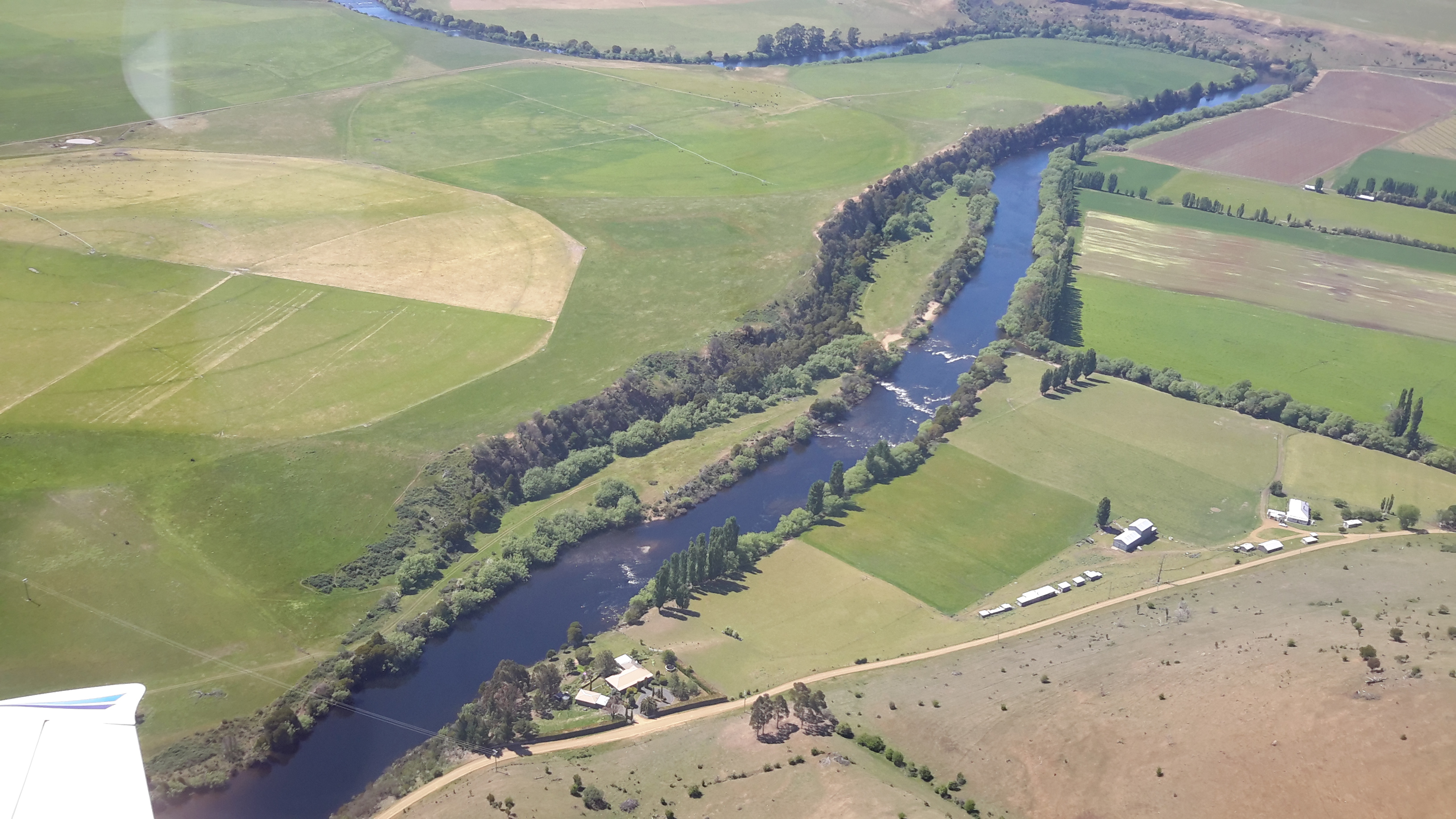
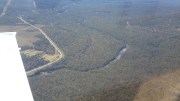
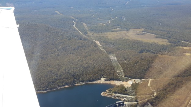
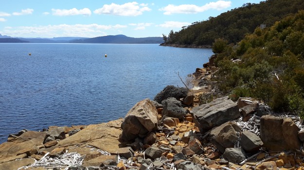
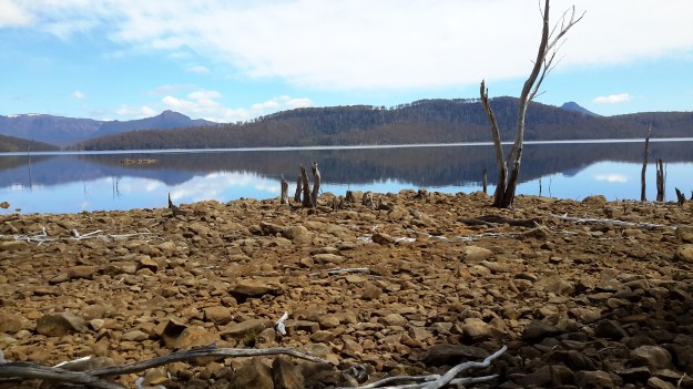
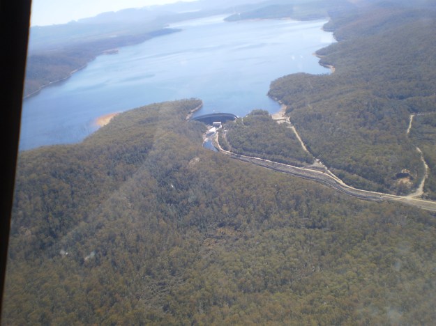
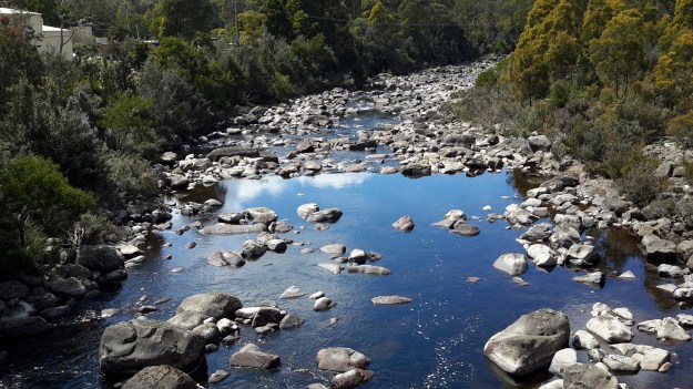
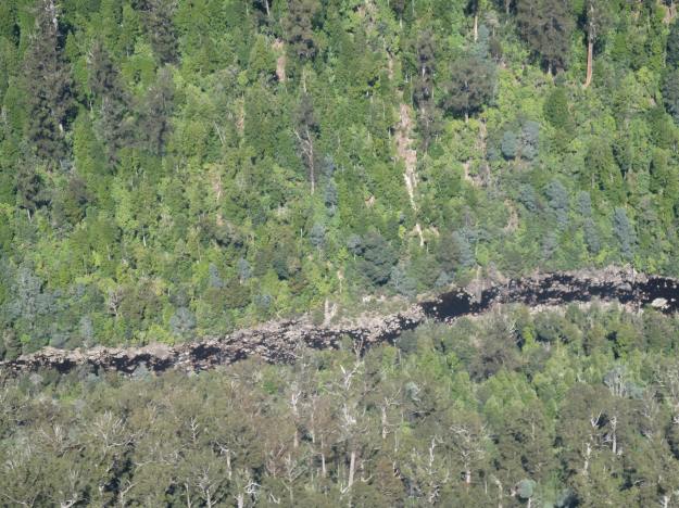
A couple of Chantale’s aerial photos show similar rocky beds along this remote and wild part of the Derwent River.

IMG_3828dryish river bed.JPG

IMG_3832.JPG