Tag Archives: boat ramp

Lake King William

Lake King William map

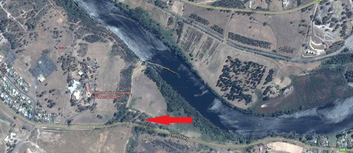
At the lower edge of my aerial photo below sits the Clark Dam with Lake King William backed up behind. The photo also shows clearly the road/track to be taken westwards to walk along the edge of the Lake.

20151028_120116.jpg

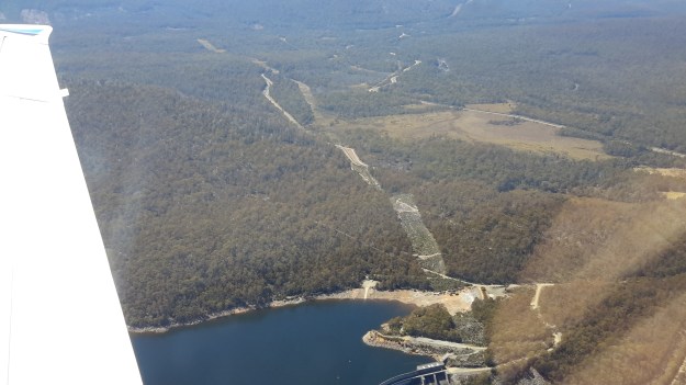
Behind the massive curved wall of Clark Dam sits millions of tonnes of water in a glorious expanse that extends over 15 kilometres northwestwards.

20151029_123306.jpg

20151029_123353.jpg

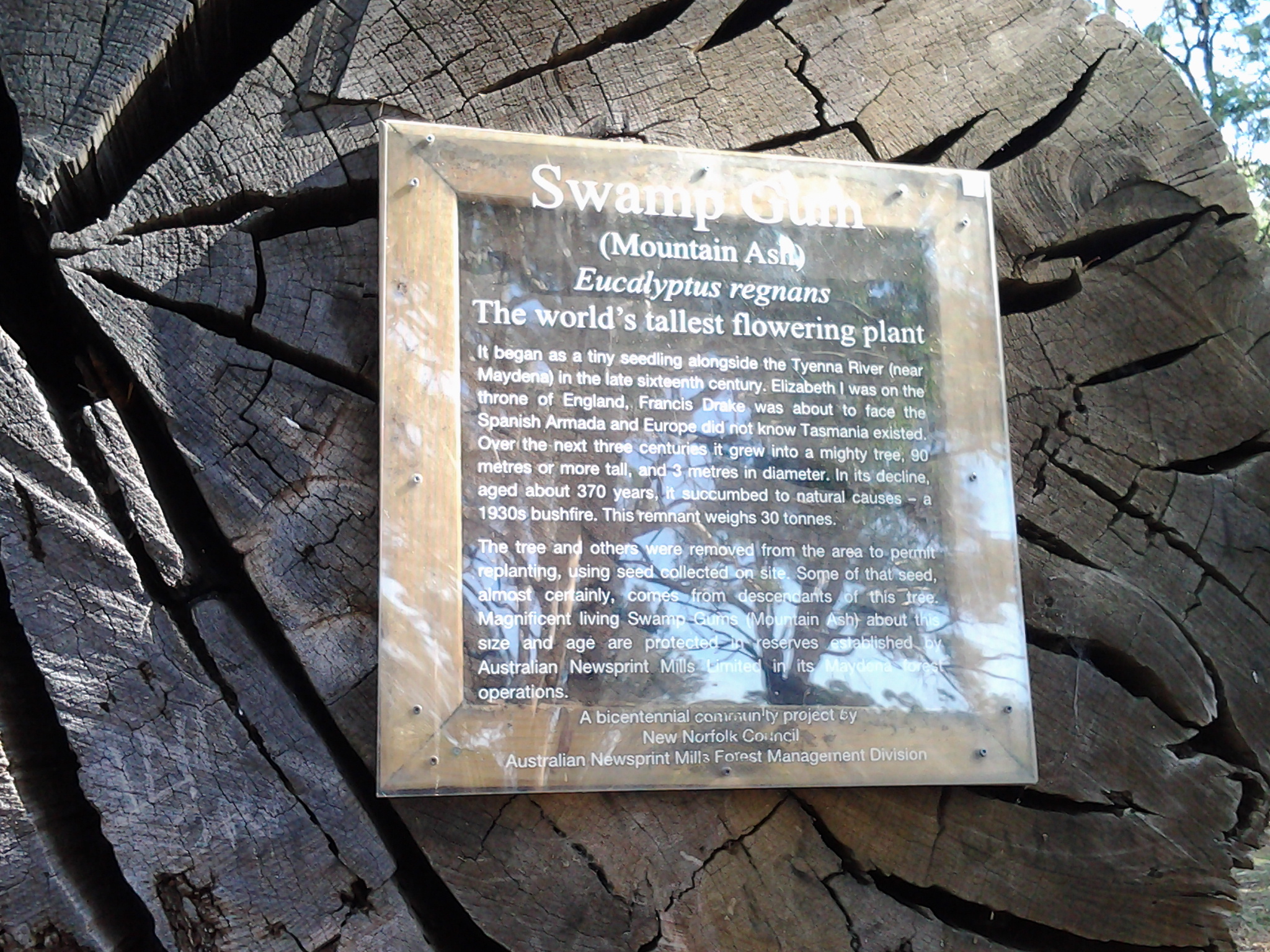
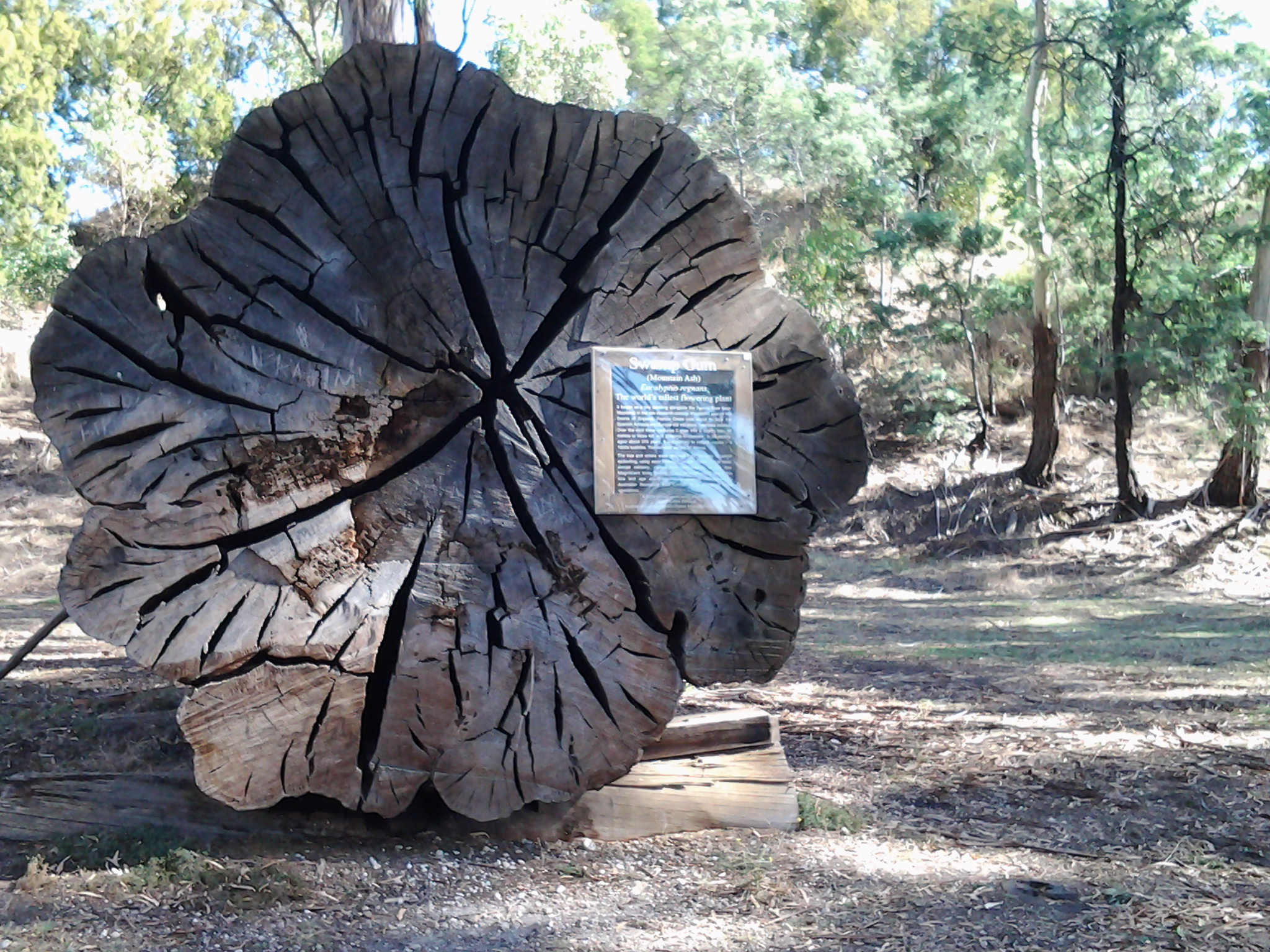
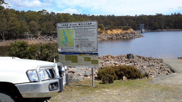
At the boat ramp, a sign provides information for visitors.

20151029_123855.jpg

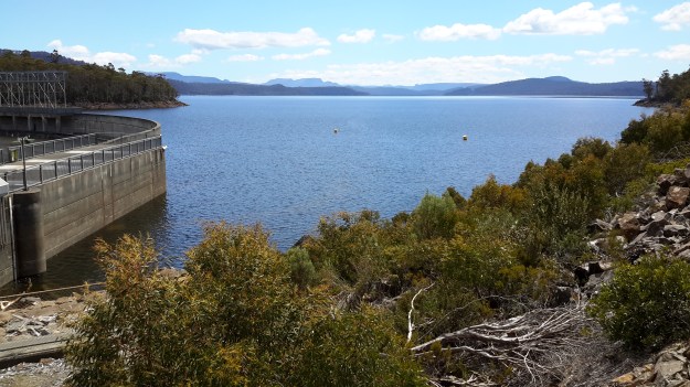
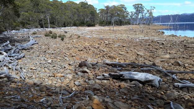
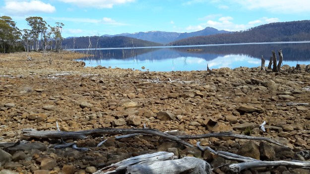
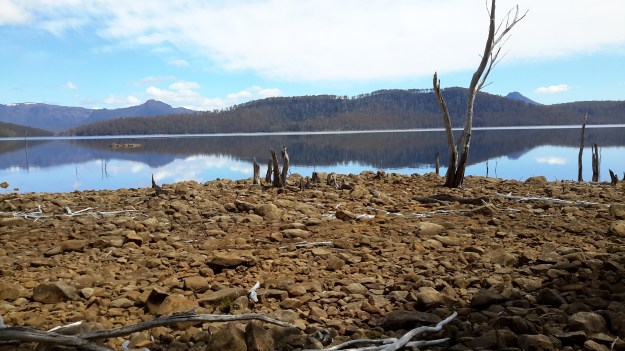
The water level of the Lake is extremely low.

20151028_120129.jpg

20151028_120307

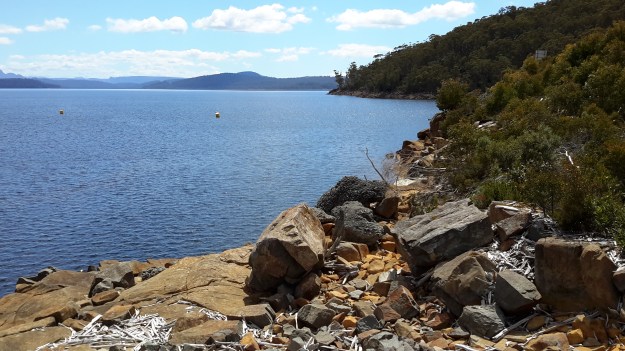
I loved the silver grey driftwood on the rocky shore and imagined the creation of rustic furniture.  That might become my next project.

20151029_125002.jpg

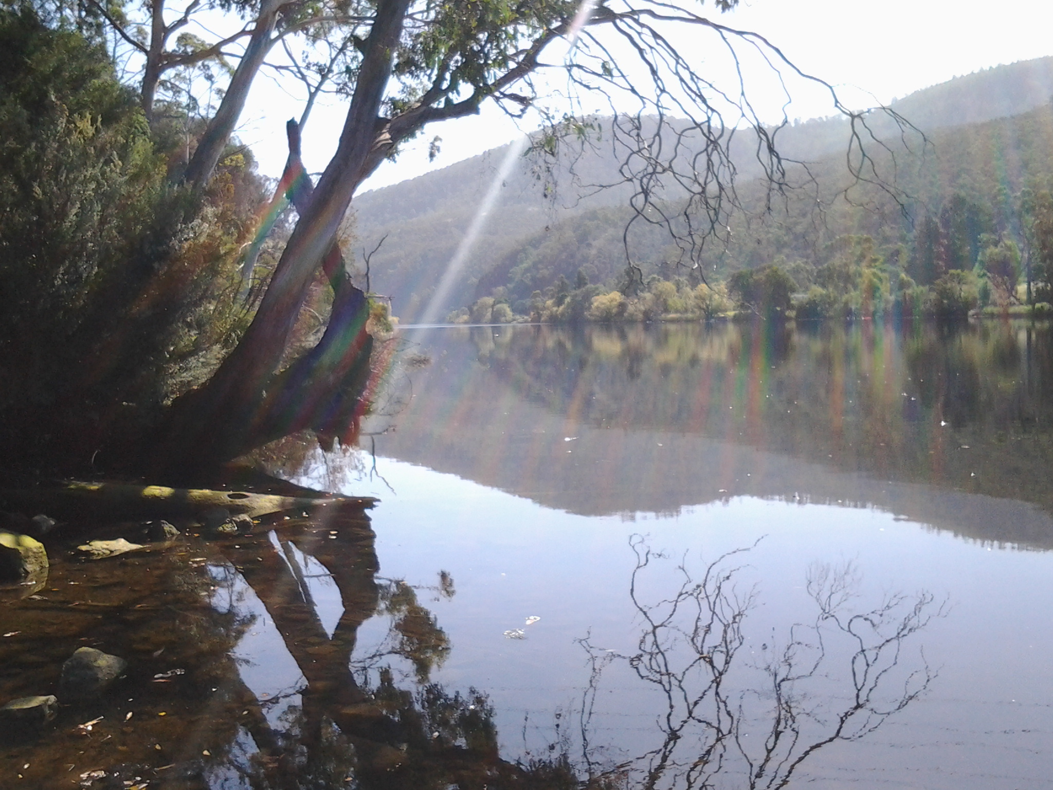
The views across the Lake were sensational.

20151029_125012

20151029_125026.jpg

20151029_125114.jpg

20151029_125134

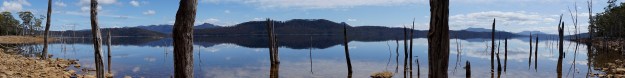
I should have chosen a panoramic photo option.  Fortunately my chauffeur and companion walker Andrew did take such a stunning shot.

Andrews Lake King William panorama 1451 (1)

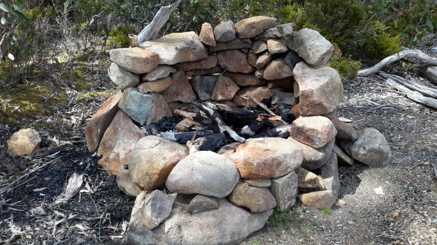
While there was no-one else around during our visit, this fireplace was an obvious sign of past visitors.

20151029_125152.jpg

I expect to walk the length of Lake King William solo before Christmas: 15 km ‘as the crow flies’, and possibly 30 kms to walk at ground level. Before I reach the Lyell Highway way up in a north westerly direction, the Derwent River will empty into Lake King William.

When I flew up the Derwent River, and when Lake King William came into view, it was clearly a massive stretch of water.  See Michelle’s photos below.

PA280106.JPG

PA280108Lake King William.JPG

PA280109lake King William.JPG


Tynwald Estate buildings came into view when I walked Stage 14 along the Derwent River

Twenty minutes later after leaving the boat ramp, I spotted what seemed to be the ruins of a 19th century building and more recent structures.

20150413_132254 20150413_132520

These are located at the end of Tynwald Street, a road which comes off the Lyell Highway. I suspect one of these buildings is the remains of an 1820 granary that formed part of the estate of Tynwald House (http://www.tynwaldtasmania.com/history/).  I continued downhill along the track until I was at river level again.  A little further along,when I looked up through the trees, I could see the stately and elaborate Tynwald House, built in the 1830s and now operating as an accommodation and restaurant facility.  Trip Advisor contains more information http://www.tripadvisor.com.au/Hotel_Review-g504312-d1045373-Reviews-Tynwald_Willow_Bend_Estate-New_Norfolk_Tasmania.html

20150413_132835 20150413_132938

Further along I could see the remains of Tynwald estate’s Oast House (a building designed for kilning  or drying hops as part of the beer brewing process), now a Museum.

20150413_132941 20150413_133109

The landscape was stunningly beautiful along this walk.

From the boat ramp on a track towards New Norfolk

A few minutes after 1pm I wrenched myself away from the gloriousness of the boat ramp, and started on an unsigned vehicle width track, having tried unsuccessfully tracking closer to the water. As I discovered later, the Derwent River was edged by cliffs and so walking uphill and across the top was the only way to proceed.

20150413_130324

As I walked and with some sadness about leaving a beautiful place, I looked back to the boat ramp and down the Derwent River.

20150413_130516

The track was perfectly suitable for someone in a motorised wheelchair (or so it seemed to me).

20150413_130954

This was a sunfilled, quiet, easy walk across the top of the cliff above the Derwent River moving westwards towards New Norfolk.

20150413_131452 20150413_131956

Arrival at the ramp for launching boats into the Derwent River on Stage 14

I reached this beautiful location at 12.50pm, took in the surroundings and watched other visitors casually meandering around the area.

20150413_125843 20150413_125937

20150413_130027 20150413_125924

20150413_125928 20150413_125905

A sign provided boat safety information.  On the second photo, an arrow points to the location of the boat ramp.

20150413_125729 Arrow to boat ramp

I felt I could stay here forever. I was warm in the sun, the sky was so blue and clear, no wind forced its way around the curves of the river and into this environment, the water was so clear I could watch a school of eating-size fish swimming around, and the perfect reflections on the river all contributed to my great sense of well being. For this alone, the Stage 14 of my walk along the Derwent River had been worthwhile.

The stump remains of a magnificent tree seen on Stage 14

The previous post introduced the rock line-up located beside the gravel road that leads to a boat ramp located east of New Norfolk. Resting impressively nearby, the massive stump pictured below was labelled as a Swamp Gum/Mountain Ash/Eucalyptus Regnans – the world’s tallest flowering tree.

20150413_125105

This Eucalyptus Regnans tree began life when Queen Elizabeth 1st was on the throne in England in the 16th century.

20150413_125041

The tree stump was collected from west of New Norfolk after growing to 90 metres tall and 3 metres wide, before being felled by a bush fire. Nevertheless, the remains of this grand old-growth forest gum tree reminds me of the wonderful original forest trees we have lost to pulp and paper making in Tasmania and how important it is to protect what we have left.

The placement of this 30 tonne tree stump by Australian Newsprint Mills in association with the New Norfolk Council was made as part of the Australian Bicentennial year of celebrations of European settlement in 1988.

The vegetation beside the gravel road was a lush, overgrown, infestation of blackberry bushes. The photo below shows the steam effluent of the Norske Skog newsprint production mill in the distance.

20150413_125243

Map of rocks and tree stump

After the rocks and tree stump diversion, I stepped back onto the gravel road where I could see the Derwent River and some building structures at the bottom of the incline.

20150413_125238