
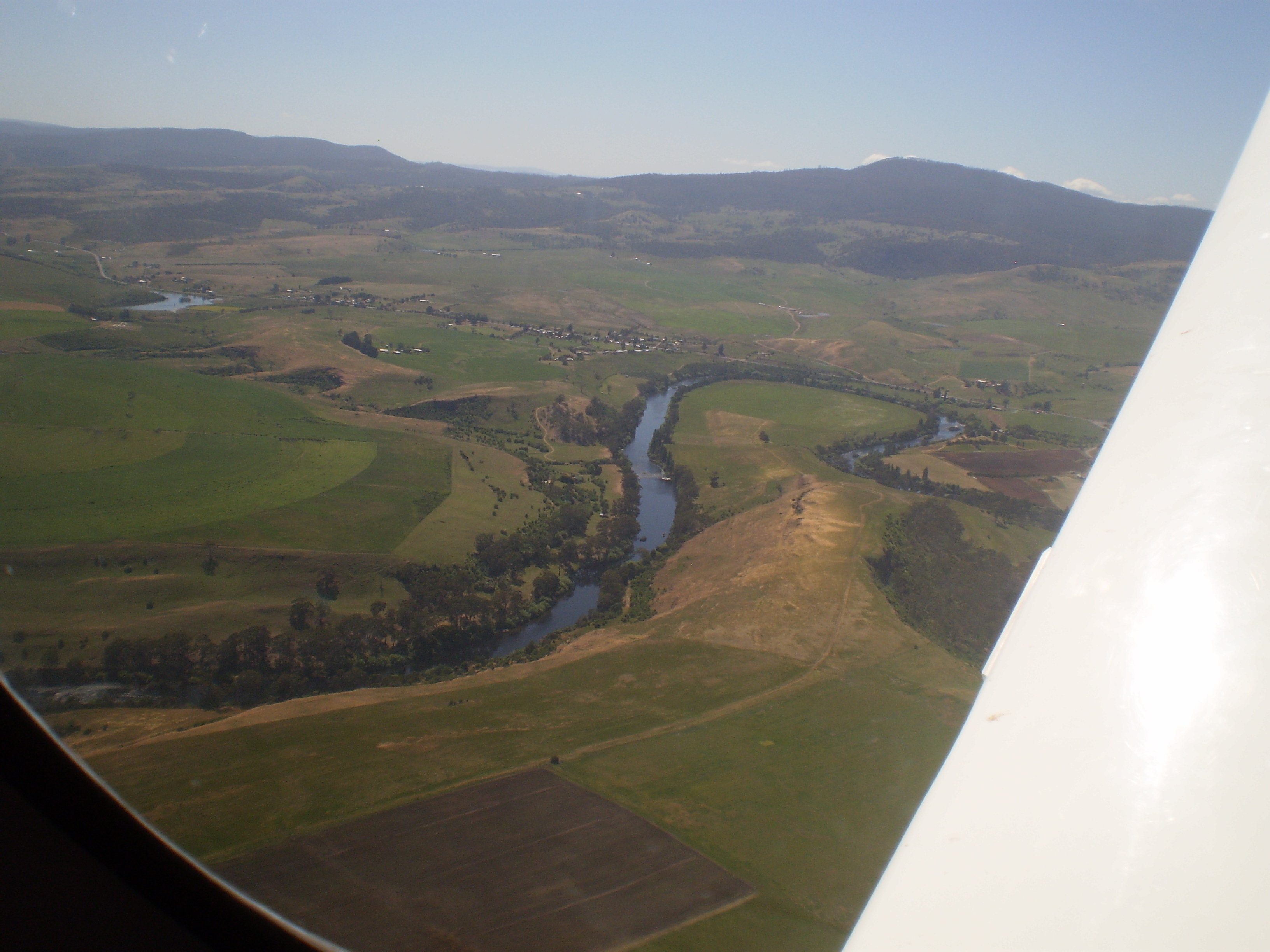
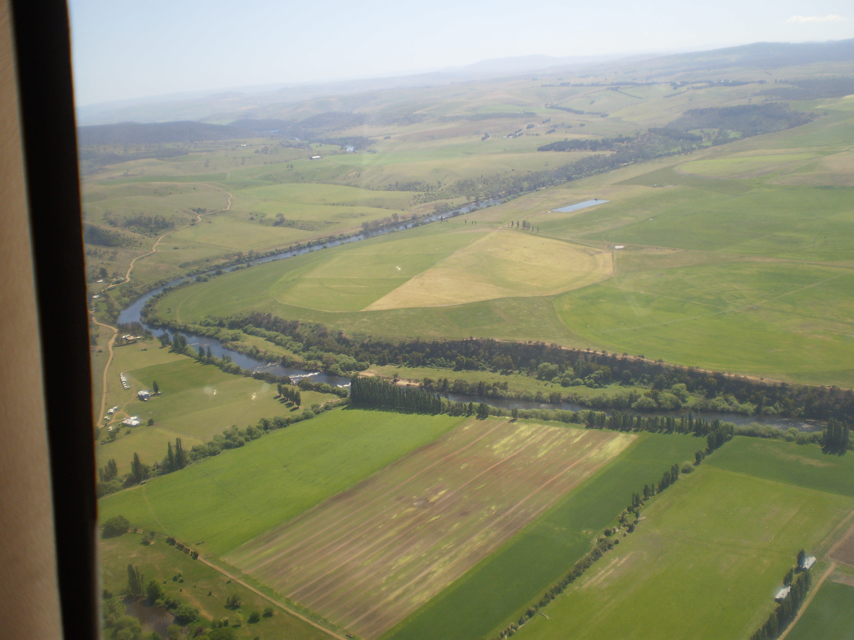
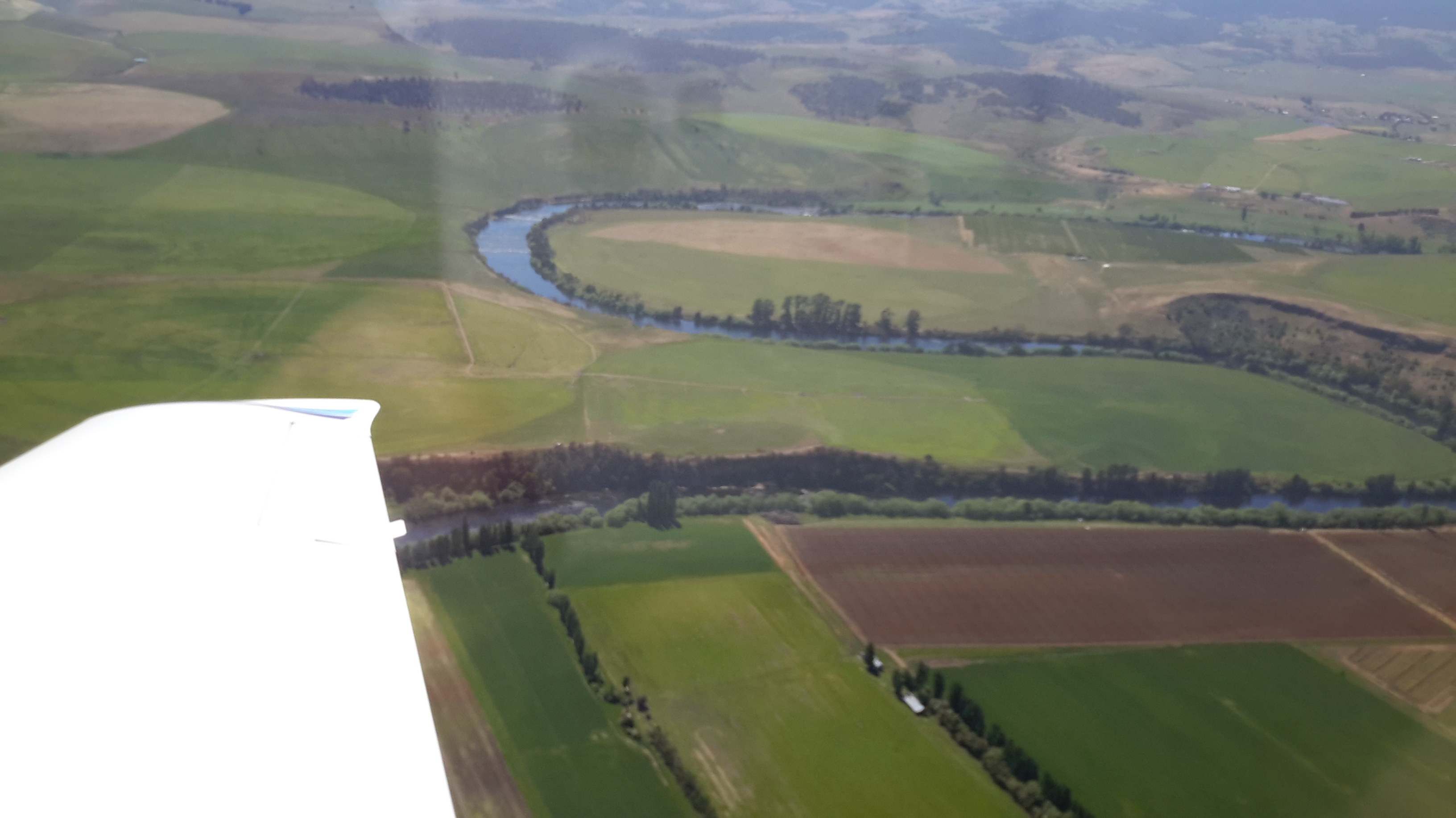
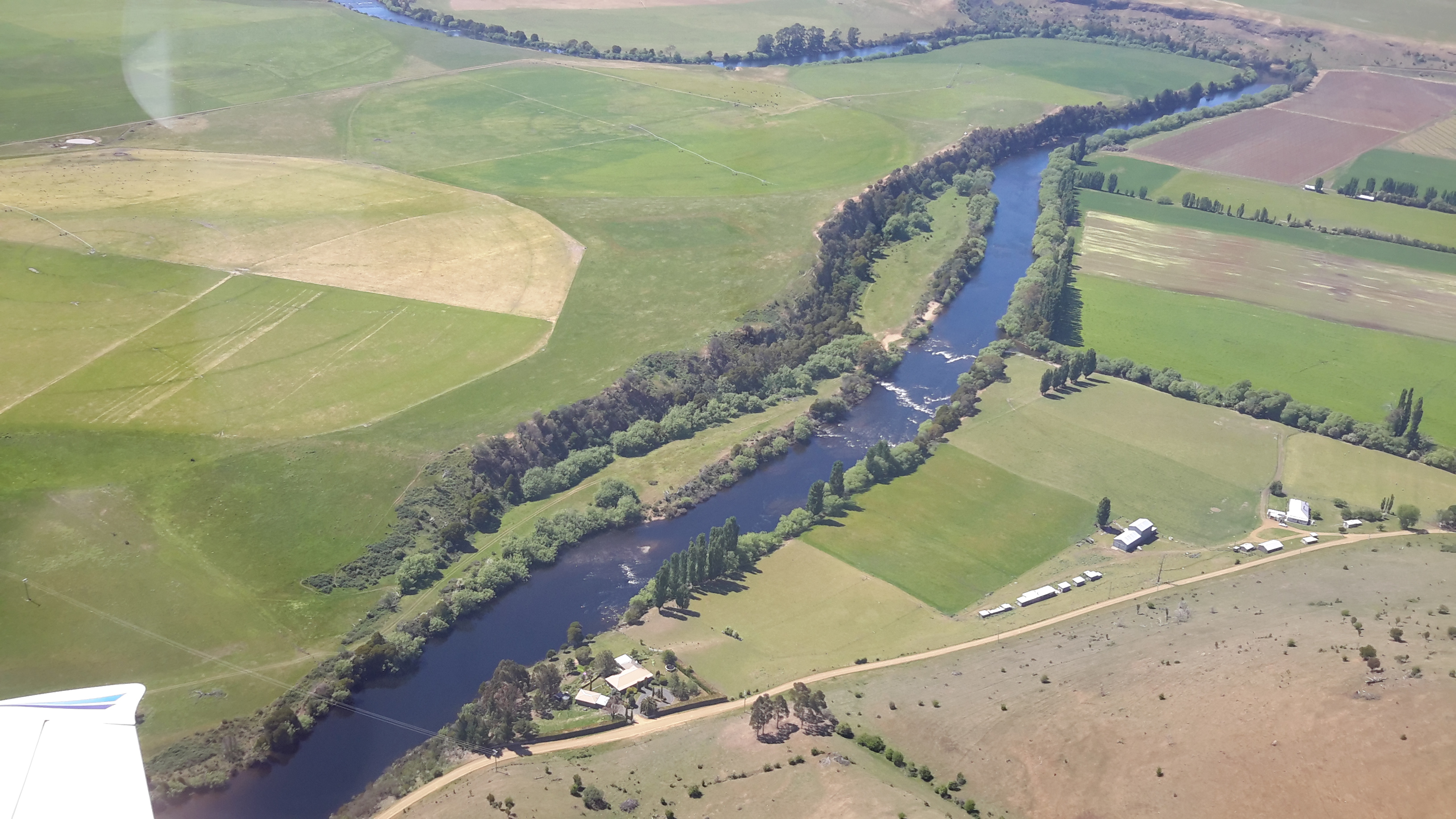
I have felt bereft at the constraint of not being able to provide details of where I have walked nor present photographs of grand scenery of the Derwent River and its surrounds. Then I remembered the flight I took from the mouth to the source and return. I realised I could use a selection of the photos that my two companions and I took during the flight. This series of postings will show you aerial shots covering the area between Gretna and Lake Repulse Dam. I hope readers will be as thrilled as I am to see the rich expanses of our land by the River and then to be excited by that blue ribbon that winds through that landscape.
Sitting astride the Lyell Highway, Gretna is the tiny town at one end (the closest end to Hobart) of this Gretna to Lake Repulse Dam distance. Approximately 52 kms of Derwent River stretches between these two points and to walk it requires covering considerably more kms.
Between Gretna and Meadowbank Dam and Power Station, Michelle saw:


OLYMPUS DIGITAL CAMERA


Between Gretna and Meadowbank Dam and Power Station, Chantale saw:


Between Gretna and Meadowbank Dam and Power Station, I saw:


I love these aerial shots. Thanks for sharing them.
LikeLike
I am glad you like them. Being up in a plane was an enormous privilege and the views were so expansive. Of course I can only show one frame at a time, but the photos do indicate a large piece of country.
LikeLiked by 1 person