Tag Archives: Central Highlands

Between Wayatinah and Catagunya Power Stations- posting 6 of 6


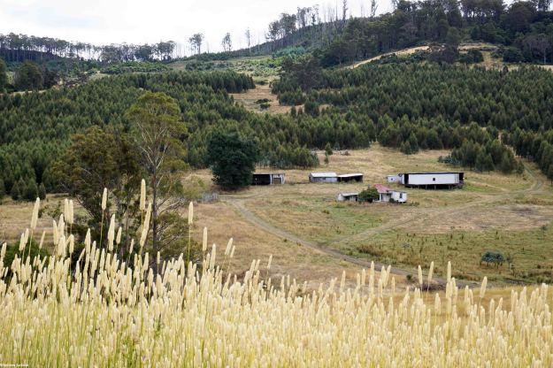
The goal was achieved. It was great to have it done. I am very grateful for Andrew’s generosity of spirit and for his notes and photographs. The walk between Wayatinah and Catagunya Power Stations could be ticked off the list. But a long walk back to the Lyell Highway had to be faced before returning home. Andrew turned north for the 7 km walk on Catagunya Road. He passed a mix of open unfenced paddocks and distant plantations. The Cooma farmstead and outbuildings were the only marker that people had lived in the area.

DSC01747e.jpg

For a brief moment he thought he would have company. Andrew had been walking for a while when, in the distance on a straight stretch of road, he could just make out a couple of figures coming slowly towards him.  Someone to say g’day to and have a natter  – but  – on closer inspection they transformed into ambling sheep. After that, Andrew’s company all the way back to the locked gate was a rather large herd of very healthy looking quadrupedal steaks – which, with a spritely step, he kept ahead of. After some 7 hours of pleasant walking, this walk along the Derwent River was over.   There had been time for plenty of stops during the day to take photographs and to enjoy the surroundings.

Hydro Tasmania, TasNetworks and forestry related employees can drive over the convoluted maze of tracks between the two dams, but there are numerous locked gates and no general public access.  Even during the walking, many locked gates with serious double and complicated locks were seen. I have said in earlier postings that landowners and managers in the Derwent Valley and Central Highlands can recite histories of bad experiences with people entering their lands and not treating it appropriately or stealing their wood or livestock. It is a shame that a few people wreck it for the rest, and remove the opportunities for those who care for the land and the property of others and wish to explore more of our wonderful Tasmanian natural environment.


Possession of aboriginal lands by European settlers and the government of Van Diemen’s Land

John Wadsley’s Brighton, Central Highlands, Derwent Valley and Southern Midlands Councils Joint Land Use Planning Initiative – Stage 2 Heritage Management Plan of July 2010 reports: ‘After the initial period of European settlement from 1803, a large influx of free settlers and pastoralists in the 1820s saw a major expansion of European influence and land grants in the central and midlands areas of Tasmania. Settlement along the Derwent, Jordan, Clyde and Ouse rivers forced local Aboriginal bands from traditional hunting grounds and increased tension between settlers and tribal groups. Conflicts flared in a number of areas, with local farmers and vigilantes attacking Aborigines and retaliation by tribal groups attacking road gangs, stockmen and homesteads.

In 1828 Governor Arthur declared martial law against Aborigines after failed attempts to divide Aboriginal lands from the “settled districts” to reduce the number of attacks by tribal groups. By 1830 the number and frequency of attacks by and on had reached such a level that Arthur decided to launch a full scale military operation against the indigenous population in the southern Central Highlands, southern Midlands and south east areas. This became the so-called “Black Line” which was intended to round up Aborigines and move them from the settled districts. By 1831 some hundreds of Aborigines and settlers had been killed over land occupation and dispossession of traditional tribal lands. The Aboriginal population in the Midlands and Central Highlands was by now very small, probably less than 100. Many traditional hunting areas had been cleared of tribal groups allowing further expansion of pastoral activities. The so called “conciliation” process under George Robinson eventually saw the remaining Aboriginals moved off their traditional lands to Flinders Island by 1834, and then to Oyster Cove in 1847.’