
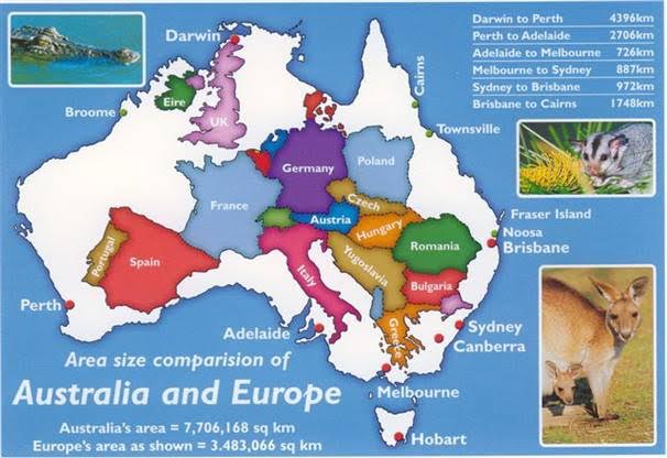
I discovered the following graphic on the Australian Native T-Shirts website.
For readers who do not know Australia well, note Hobart is located at the southern end of the island state of Tasmania at the bottom of the country. Slightly east of Hobart is where the Derwent River flows out into the sea. The source of the Derwent River is located north west of Hobart roughly in the centre of Tasmania.
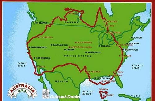
A comparison map showing Australia and the United States of America is located at the site ‘On Walkabout’.
Finally, I found a most amusing map with multiple overlays of Australia across the world.

Seeing such images certainly helps me to understand the scale of our nations.

These certainly put the size into perspective. I hadn’t seen the last one before.
LikeLike
I was surprised how large Africa was.
LikeLike