Tag Archives: Mount Wellington

Walking the Derwent from Rosny Point to Geilston Bay – Stage 5 October 10th

A maximum temperature of 20 degrees but with a 70% chance of rain was Friday’s weather forecast.  However, I was so desperate to get out and walk another stage that I decided to brave whatever today would throw at me. I am delighted to record that only sunshine between partly clouded skies and the occasional warm breeze greeted me for the 4 and ¼ hours I was away from home.

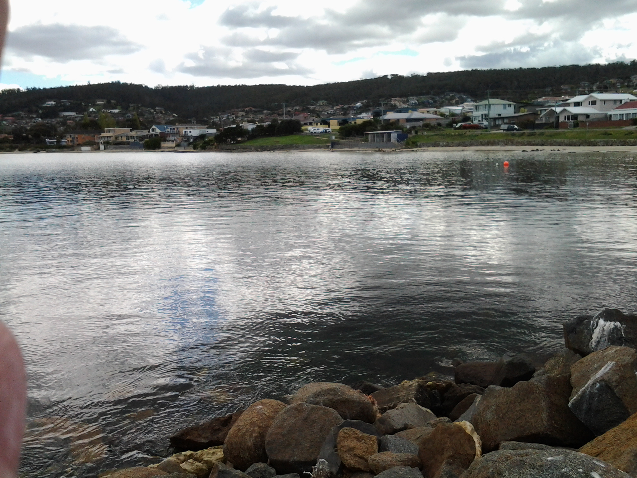
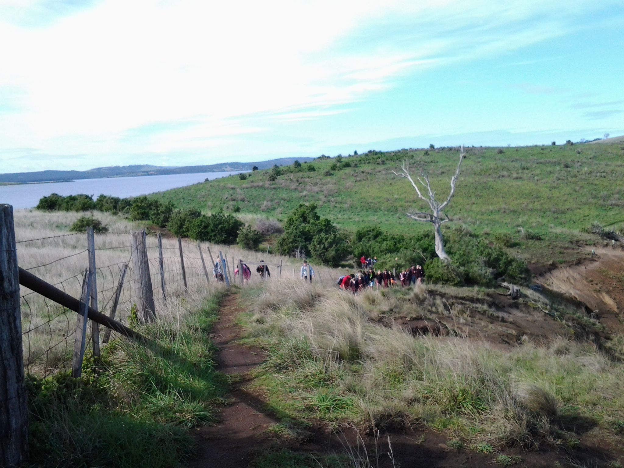
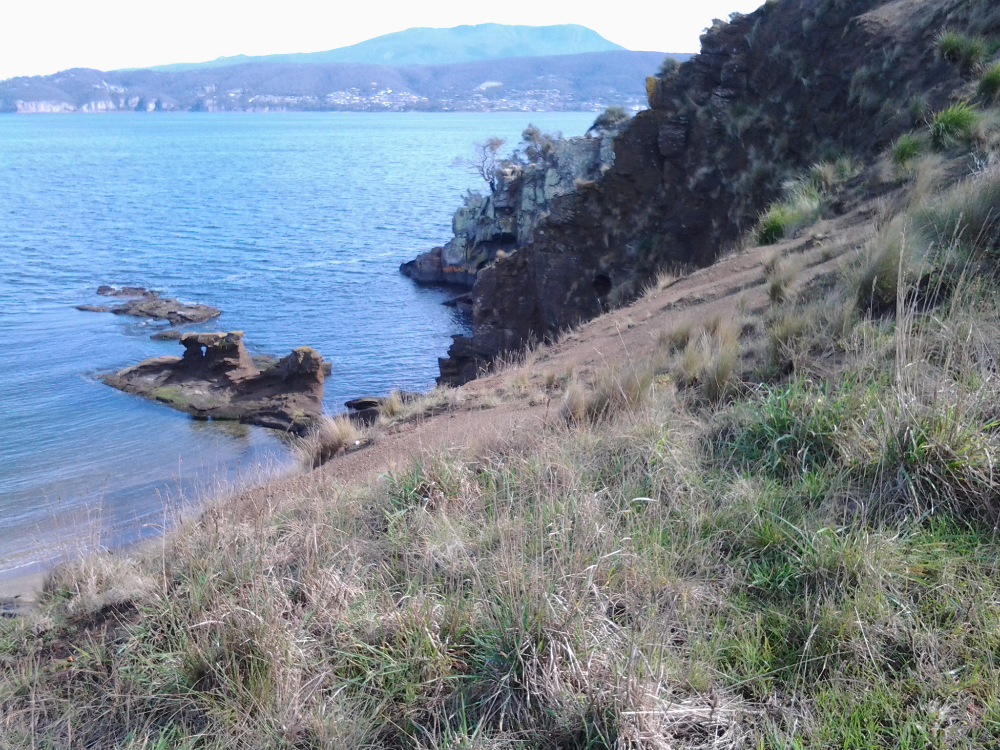
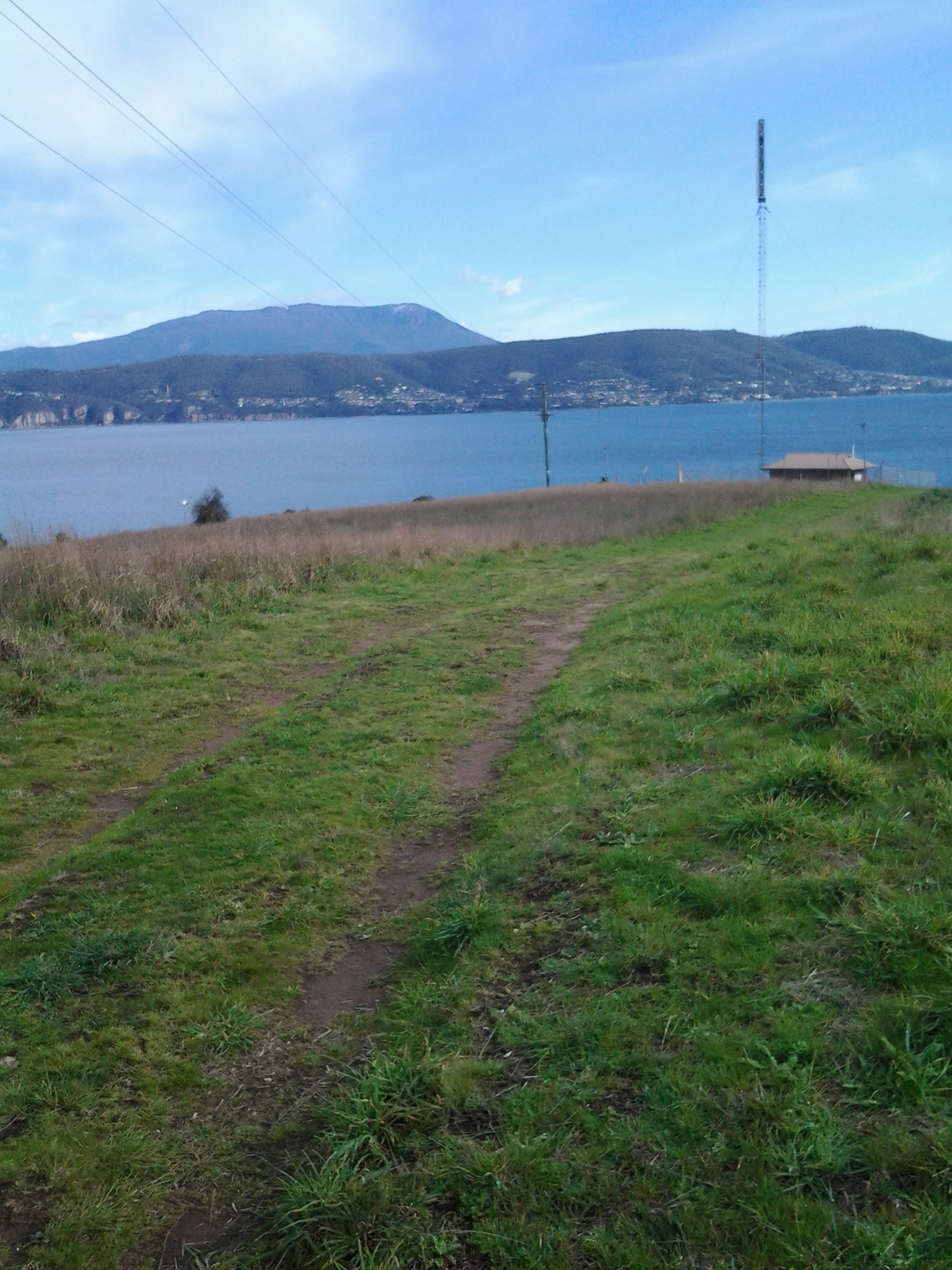
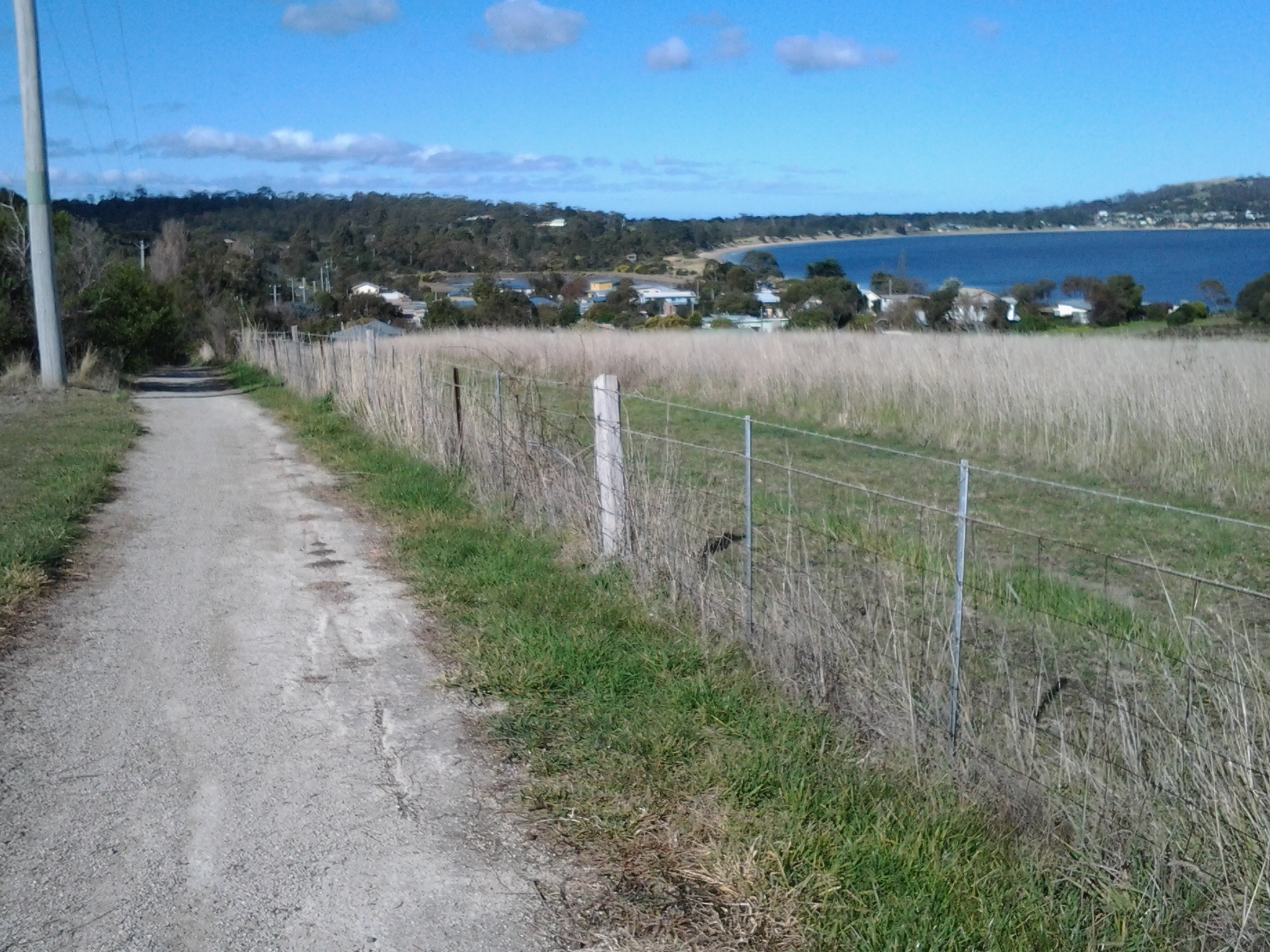
First up, I was the only passenger to catch the 9.15am Metro bus number 675 to Rosny Point from the Eastlands Shopping Centre at Rosny (Note: this bus started at Eastlands and not from Hobart. Refer to my next posting to understand the range of bussing options for today’s walk).  Soon after passing Rosny College, the tennis courts and Bowling Club on the left in Bastick Street, I got off at bus stop number 21. I walked down Seabird Lane; this road angled down off Bastick Street between bus stops 20 and 21 and went along closer to the water of Kangaroo Bay. Seabird Lane leads into a continuing Clarence Foreshore Trail that passes along close to the River through the five suburbs: Rosny, Montagu Bay, Rose Bay, Lindisfarne and Geilston Bay. Later postings will detail how the quality of this path changes from one where a person in a wheelchair could comfortably navigate the Trail to other sections where a mountain bike would be more useful. I will also provide information about the challenges of lack of directions on and off the Trail from time to time.

Walking Time

The walking time between the point of Rosny Point and the point where the Derwent River meets the entrance to Geilston Bay is approximately 2 hours and 20 minutes. However, if you decide to take this walk, then in order to get to the starting point by bus from Eastlands and leave the Geilston Bay area by bus, the total walking time will be around 3 and ½ hours.

Walking distance

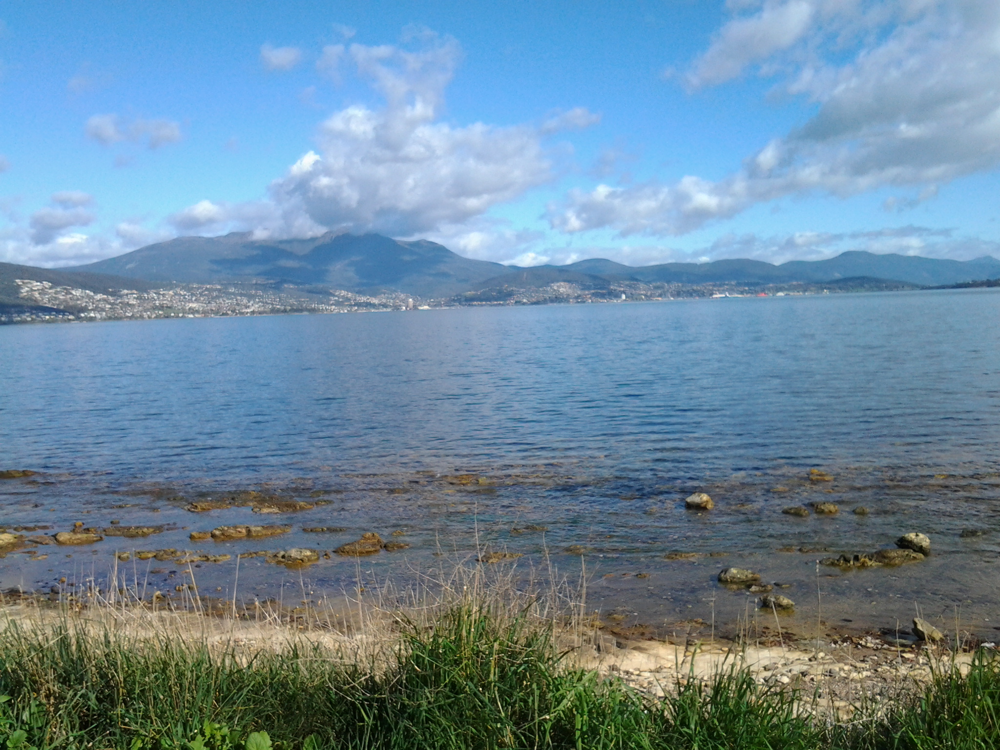
Today I walked approximately 12 kilometres, but this distance covered only 3.5 kms of the River length. Previously I had covered 19.5 kms of the length. Now I have achieved a total of 23 kms of the Derwent River.

Favourite photo

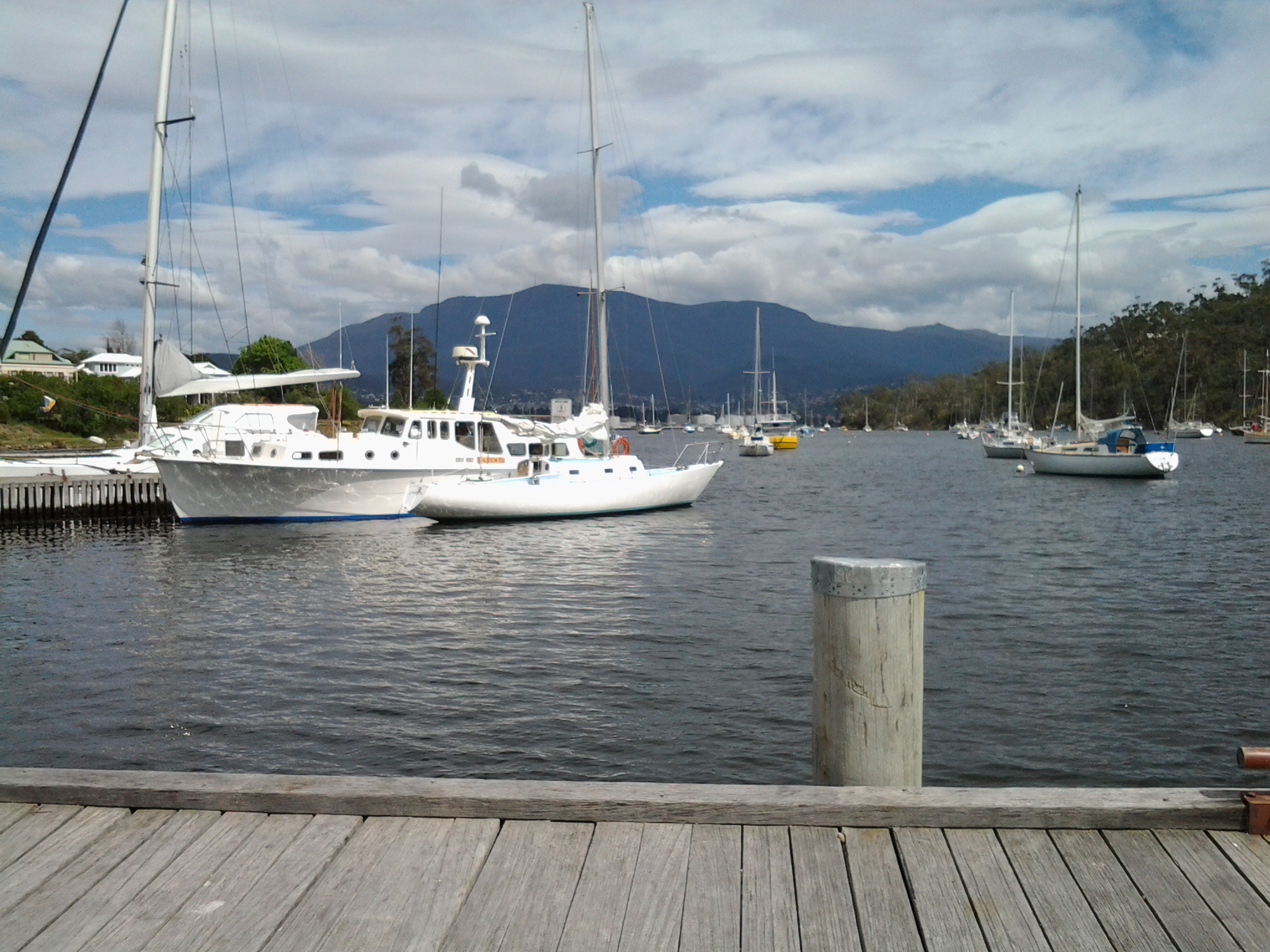
The photo below is my favourite from today’s walk. I clicked it while sitting eating my lunch on the wharf at Geilston Bay. The water reflections on the bow of the yachts on the left were sparkling, and the blue mountain provided a rich and colourful contrast in the background. Experiencing Geilston Bay for the first time was a treat. The starting point for Stage 6 of my walk along the Derwent River will begin here, so I look forward to seeing the place in the early morning light next time.

20141010_122959

The five suburbs to be walked through in Stage 5 of my walk along the Derwent River

From Rosny Point to Geilston Bay, I will walk as close to the edge of the Derwent River as possible.

In so doing I will pass through five suburbs: Rosny, Montagu Bay, Rose Bay, Lindisfarne and Geilston Bay. Most were settled early in the existence of Hobart Town. In 1793, Lieutenant Hayes sailed up the River naming it and many points of interest. It was only a decade later the first settlement was made and in 1804 the final site for Hobart was established on the western shore opposite Bellerive and Rosny. Possibly Geilston Bay was named in the 1810s, Rosny in the 1820s, Montagu Bay in the late 1820s. Lindisfarne was named a century after the first settlement in 1903.

Rosny

The starting point for the 5th Stage of my walk along the eastern shore of the Derwent River will be Rosny Point. The suburb of Rosny, within the City of Clarence, is located on a narrow peninsula which juts out from the eastern shore at Rosny Point and climbs the rising slopes of Rosny Hill to the public Rosny Point Lookout.

According to one of my favourite information sources Wikipedia, Rosny was named by Walter Angus Bethune, the holder of the original grant of land on Rosny Point, after his ancestor the Duc de Maximilien de Bethune Sully of Rosny-sur-Seine  (a town situated slightly north west of Paris in France).  Bethune, a Scottish merchant, first arrived in Van Diemen’s Land in 1820 and was a significant player in the early development of Hobart and sheep farming. His descendants have played important roles in Tasmanian history.

Jean-Baptiste-Camille_Corot_-_Château_de_Rosny

Chateau de Rosny was painted by French artist Jean-Baptiste Camille Corot in 1840

Montagu Bay

This suburb was named after ‘mad’ judge Algernon Montagu, who in the early 19th century lived in Hobart Town before purchasing a property ‘Rosny’ in the Montagu Bay area of the eastern shore of the Derwent River. This small suburb sits on the river edge next to Rosny Point/Rosny and contains the Clarence Aquatic Centre and Montagu Bay Primary School. The Tasman Highway travels over a northern corner section of this suburb, leading to the Tasman Bridge which links the eastern Shore to Hobart and beyond on the western shore.

Rose Bay

The suburb of Rose Bay sits on the river edge next to Montagu Bay.

Rose Bay High School has a permanent camera facing across the Tasman Bridge over the Derwent River towards the centre of Hobart and with the back drop of Mount Wellington. Normally the site operates 24 hours of the day and night. The site is located at http://ozforecast.com.au/cgi-bin/weatherstation.cgi?station=11233&animate=6. Currently the site is being rebuilt, however I recommend you follow the progress and when re-established, save the site as a Favourite. Then you can see what the weather is like over Hobart and how gorgeous it can be to look at regardless of the weather in daylight and with the city lights sparkling at night.

Lindisfarne

While the exact origins of naming our Lindisfarne suburb remain unclear, the main thought is that from 1892 the suburb was known as Beltana. Then it was renamed Lindisfarne in 1903 after Lindisfarne a tidal Island (Holy Island) in Northumberland, a region in the far north east of England. The easternmost part of the middle of the suburb, where the Beltana Bowls Club and the Beltana Hotel are located, is still locally known as Beltana.

It has been suggested this suburb took its name from Lindisferne House, a property built in the 1820s near the suburb of Rosny. From the Clarence City Council website at http://www.ccc.tas.gov.au/page.aspx?u=1601 “Lindisfarne is thought to have been named by Hezekiah Harrison, a free settler, who was granted land in the area in 1823. Harrison had lived just a few miles from Lindisfarne Island, on the Northumbrian coast. Known as the ‘Holy Island’, Lindisfarne was the base from which St Aidan worked to spread the Christian faith through the north of England in the eighth century AD. However, it is unclear whether the area was named by Harrison or the next owner, Thomas George Gregson, a prominent free settler who purchased much of the land between Risdon and Rosny. Gregson grew up in Lowlynn, very close to Lindisfarne Island in England.”

Geilston Bay

Apparently the inlet of Geilston Bay was named after Colonel Andrew Geils who was appointed Commander of the settlement of Hobart in 1812. Colonel Geils lived on a property in Geilston Bay which he called ‘Geilston Park’.

Walking Howrah and Bellerive Beaches on Stage 4 of my walk along the Derwent River

On arrival on Howrah Beach, I chose not to deviate to the Shoreline Shopping Centre, having no desire for shopping and because the fresh air and walking experience was such a joy. The long Howrah Beach was almost deserted, however occasionally happy dogs and mostly happy owners were enjoying themselves; I am never sure who is taking who for a walk.  I was fascinated by the man who declared he was deaf and then told me his dog was deaf, yet they both seemed to communicate well and understand each other.

20140926_105712

The photo above shows the stretch ahead of me as I started along Howrah Beach. The photo below shows the Beach when I had walked half its length.

20140926_105703

The sky gathered clouds, and the onshore breeze cooled the air as I walked. Before long I reached Second Bluff at the end of the Howrah Beach, and walked up and along the gravel pathway around this headland. At both the southern and northern ends of Second Bluff it is easily possible to walk off towards roads and, in the distance, to reach the main connecting route, Clarence Street, along which buses run regularly.

While walking around this Bluff, I passed some large Australian native Leptospermum trees in full flower; their snow-white petals presented a spectacular display.  Off and on I noticed bright bursts of fleshy native pigface acting as ground cover, with its purple-pink flowers made brilliant by the sunlight. I was afforded spectacular views back to Howrah, Tranmere, Droughty Hill, across the opening of Ralph’s Bay, and of Gellibrand Point and Fort Hill on the South Arm peninsula.

20140926_112427

20140926_112443

Once I reached the Bellerive Beach stairs, I descended and took my walk towards the northern end of the Beach over a kilometre away.

20140926_113238

From time to time tall white poles with red tops are positioned along the beach to indicate walkways to the Clarence Foreshore Trail behind the dunes and then the roads and suburban houses of Bellerive.

20140926_115126

Bellerive Beach is much frequented by fitness fanatics, walkers, joggers, kids, families, individuals, and dogs on leads with owners.  The clean sand, the tide moving the Derwent up and down the beach, and the startling prominence of Mount Wellington are always welcome.

20140926_115121

Near the far end of the Bellerive Beach, a massive structure looms above a row of tall pine trees. This is Blundstone Arena, once known as the Bellerive Cricket Ground. This sportsground, as a national venue for international and local cricket games in the summer, also hosts major AFL (Australian Rules Football) and state level games during the winter months. Between Blundstone Arena and the beach are public toilets along the edge of the Clarence Foreshore Trail.

20140926_121450

Further on and next to the Trail, an outdoor adult gym inspires beach visitors and picnickers to push and pull and otherwise move their bodies.  From here you can see a blue and white painted building standing prominently.

20140926_115457

This is Bellerive Beach’s Fish Bar where fresh fish and other seafood is battered or crumbed and cooked while patrons wait. Dining in or taking away are the two options; the weather and wind generally controls whether I take a fresh cooked meal and sit on the edge of the beach with friends. I live in Bellerive and so I know very well this Beach and all the delights which it offers.

On this walk as usual, I brought my own packed lunch so I passed the Fish Bar and sat towards the end of the beach, and munched and contemplated the leisurely activity of others. A simple pleasure amidst the flighty flashing of hungry squawking silver gulls, all expecting to be fed.

20140926_120252

Enjoying Little Howrah Beach on Stage 4 of my walk along the Derwent River

It was a relief to arrive at the calm peaceful Little Howrah Beach, after the constancy of the rock hopping stage around Howrah Point.  Looking back in the direction from where I had walked, the photo below shows my view across five kilometres of Derwent Harbour towards Mount Wellington and Hobart city beneath.

20140926_104157

I sat on a boulder and comfortably munched on some morning tea snacks.  The serenity of this Beach was remarkable.

20140926_104110

Across the road from the Beach I could see a tiny shopping centre: including a newsagent, pharmacy, hair salon and paint shop.  Public Toilets were located closer to the northern end of the Beach.

20140926_104118

Once walking again, the end of the 200 metre sandy beach was reached quickly and I picked a path through a short cluster of rocks before coming again onto the sand.  At this point I had choices; I could walk up to the Shoreline Shopping Centre for a drink or continue along the 1.2 kilometre Howrah Beach.

Taking Bus 615 to Tranmere last Friday – Starting Stage 4 of walk along Derwent River

Having travelled across the Tasman Bridge, through the Eastlands bus mall near the shopping centre, and onwards, the bus takes the main route along Clarence Street. Along the way a sign marking the Clarence High School, established in 1959, looms large on the right. The 8.23am bus typically will carry a swarm of students who will jump off at this point and then the bus may quieten for the remainder of the trip.  But others will jump on after desperate running and laugh as they fall onto the bus with eyes sparkling from the exertion. Bus trips can be alive with life being expressed in all sorts of ways.

By 8.44am the bus pulled in at the Shoreline Shopping Centre mini bus mall.  Once moving again, the bus run goes the other way to a stream of traffic heading towards the city centre. Moving down the hill, and near bus stop 19, the bus passes the Howrah Primary School located across the intersection diagonally from the Shoreline shopping centre, and a Shell fuel service station which is located on the opposite corner. Further down, the bus passes The Sunshine Tennis Club and the Howrah Recreation Centre including the Guide Hall. Near bus stop 20, a Caltex fuel service station and a suite of small shops is located on the right with the Howrah Beach beyond.  It’s not long before, as a passenger, I am greeted by stupendous views of the Derwent Harbour, Hobart city on the western shore, and the all-powerful Mount Wellington peering over all.  Soon after the bus turns left into Tranmere Road, I noticed Tranmere Hall on the right, and then a little later near bus stop 23, I saw a sign designating the Tranmere Coastal Reserve and a nearby public walk way down to the Derwent River.

After passing Anulka Park at bus stop 25, I continued on and left the bus at stop 31 at 8.53am.

Yet again I was fortunate that the day was magical. As I crossed the road to stand next to the serene Derwent River, I listened to the lyrical lapping of soft tiny waves across the rocks.  Silver gulls were floating languidly. A lone Pied Oyster Catcher was watching and waiting. Fluffs of cumulus cloud like fairy floss hung suspended in front of the mountain.  Cabbage butterflies flew through the long grass. Orange flowering nasturtiums climbed through bushes edging the shore.

I soaked in the grandeur of the environment and prepared to start the walk – this fourth stage of my walk along the Derwent River.

20140926_085649

Stage 3 Walking from Trywork Point back to the suburb of Tranmere 20 September 2014 Posting 3 of 6

I left Trywork Point at 10.30 am intending to walk back along the edge of the River in order to determine what could be achieved without walking on private land. I am delighted to say that the low rocky foreshore from Trywork Point is very walkable if you wear strong ankle supporting boots. Of course it is slower than walking the cattle tracks but quite spellbinding.

20140920_110119

I did come upon one section as shown in the photograph above of rocks that rose in the air, and I couldn’t descend (it would be perfectly easy to ascend if walking towards Trywork Point by the rocks, but long legs are required to descend – and mine are short) so I climbed back up to a cattle track and followed that until I reached a gully – no water running and grassed over – where I could easily step down onto a large pebble beach.

Smooth grey driftwood pieces in all sizes and shapes were washed up to where the pebbles met the land.

20140920_111446

The blanching shells of thousands of mussel shells and the occasional oyster shell fitted between the pebbles. Detritus, the flotsam and jetsam of human activity was interspersed across the beach. The remains of polystyrofoam containers, blue plastic containers, empty plastic drink bottles, beer bottles, and frayed ropes were typical. Attracted by its bright yellow colour, I picked up a perfect Spalding high-bounce ball which can be used when learning to play tennis.

Around a tiny rocky headland I walked from the large pebble beach to a beach of smaller pebbles. All the while treading slowly as the stones rocked and rolled, and as pieces of rusty metals thrust up unexpectedly from below. At the northern end of this pebble beach, and as I neared the first houses of suburban Tranmere, a falling down fence crossed from the land over the pebbles and continued into the water. Once near the fence, I could see that someone had built a gate that swings in the wind, so that locals can access the beach from the suburban side of the fence.  I passed through the gate and continued on a home grown track for the occasional pedestrian traffic.  There were no signs here or around about indicating entry to the beaches and rocks where I had been walking, was prohibited.

20140920_112751

The white structure is the make shift gate through which I had walked.  Note that in the foreground a variety of native pigface fleshy foreshore plant are growing.  Today, the flowers were like jewels as they gleamed in the sun.

20140920_112746

When I looked across the Derwent River, Mount Wellington in all its magnificence towered over Hobart city. The pebble beaches and later pathways offered superb vantage points.

After walking for ten minutes from the gate, on the public verge above the river in front of many houses, I came to a public pathway leading uphill to the road; a steep concrete path that would be impossibly slippery when wet.  The pathway is located between 24a and 26 Vaughan Court and could be the starting point for a legitimate walk to Trywork Point via the rocky foreshore.

Yearning to walk the next stage

For the past almost two weeks I have yearned to be out walking and discovering another length of the Derwent River. Unfortunately, when snow storms powdered the mountain (Mt Wellington) last week it was simply too cold and then some of the days when I was free to walk were overcast. I find that I continue to make my own rules about what should happen as and when I walk the Derwent River. The latest ‘rule’ is that I will not walk unless the sun is shining.  The reason is that I only want to take photographs to show you the land and the river in full sparkle. I only want to see it that way myself as I walk.

Again yesterday snow storms on the mountain brought the temperature low and the forecast is for rain to continue off and on until this Saturday, when not only will the day be dry but the sun will shine.   Come on Saturday!

Another thing I must consider is the availability of public transport because, as you know, my walks must be able to be reached and finished in touch with our local public transport system, the Hobart Metro buses. If you have a car to duplicate my walks then you are lucky. Not everyone has access to their own transport.  Weekend bus times are not nearly as frequent as during the weekdays.  For example, the Camelot Park bus that I need for travel on Stage 3 of the walk is around in that suburb every half an hour during the week but only once an hour at the weekends. Research and vigilance is always the key.


Stage 2 on 4/9/2014 Onwards to Gellibrand Point Email 10 of 14

My journey continued up a hill where I recognised two track options; one inside a fence line, and another outside the fence at the top of the cliffs on the side of the Derwent River. I took the track outside the fence (I watched the following children and they were evenly divided between the inner and outer tracks- obviously their teachers thought the outer track to be safe), and at the top of the hill there was an opening to step through the fence and return to a 4 wheel drive track.

20140904_105455

The air was clear. The day was warming up. The views in every direction were sensational. One of those experiences that makes me so happy to be alive.

20140904_105300

The photo above looks across part of the northern end of that part of the Mary Ann Bay, and via the Derwent River, looks towards Hobart city suburbs and Mount Wellington.

Not far away I walked past a pile of broken old convict bricks.

20140904_105102

Gellibrand Point at the northern most point of the South Arm peninsula was the destination for Stage 2 of the walk.

I found the shape of this headland was blunt and rectangular so that there was no hint of a ‘point’. So it was a little difficult to say I had reached the exact spot representing the end of the second stage of my walk along the Derwent River edge. Across the watery opening into the large Ralph’s Bay I could see the goal for Stage 3 of the walk: Trywork Point. This headland is situated south of the suburb of Tranmere, and north of the South Arm peninsula.

20140904_110320

In the photo above, you are looking at Trywork Point across the water.

The photo below was taken from my lunchtime vantage point looking across Ralph’s Bay towards the mound in the distance over the water on the left hand side; this is Trywork Point.

20140904_121302

The Tasman Bridge, which provides the main city crossing between the eastern and western shores of Hobart, shimmered in the distance. Mt Wellington with spots in crevices of hard white ice left over from two or three weeks ago of heavy snow, was majestic.

I wandered along the headland until, between the track and a smattering of Casuarina trees near the water line, I spotted some sandstone boulders that looked perfect as resting spots; the first I had seen. By 11.15 I had rested, eaten a snack for morning tea, and set off again up to and onto the track that extends back to Opossum Bay via the eastern side of the peninsula.

Stage 2 on 4/9/2014 The Tower Email 5 of 14

Having ascended from Mitchell’s Beach a little after 10 am, I turned left and followed the four wheel drive track with Mount Wellington looming in the distance. Swallows swooping ahead of me along the track. An old windblown pine tree stood on the left between me and the Derwent River with thousands of new pine cones in their early growth phase – like small golden brown candles. The Derwent River was almost flat calm.

Then I could hear children. Ah ha! Hmmm. The sounds of their happy voices coming closer. Behind me across the land. Drat! Solitude about to disappear. Maybe.

Walking across the undulating landscape allowed me to be in sight of the tribe of primary school children with their two accompanying teachers and then, alternately, to be on my own as the hill crests obscured my view backwards. It only took me 10 minutes to reach the tower on the open and exposed White Point Rock headland.  The tower, in its caged environment, is an Australian Department of Communications radio and television transmitter which ensures some suburbs across the river receive their needed communications connections.

20140904_100850

Apparently the land at White Point Rock dates to the Late Pleistocene – that is, roughly 126,000 ± 5,000 years ago, and University of Tasmania researchers (http://ecite.utas.edu.au/62080) have documented the shell remains of the ancient marine fauna contained in the land there, now 24 metres above the current river level.

The second stage of the walking tour

Tomorrow, Thursday 4 September, I plan to walk a second stage of my foot journey along the eastern shore of the Derwent river.  As with the first leg, I need to take Bus 640 that departs from the Hobart city bus mall at 8am and heads towards Opossum Bay.  I will jump on the bus once it reaches the eastern shore and, as before, I know I must be patient because it will weave through the suburbs of Rokeby and Clarendon Vale before passing Lauderdale, Sandford and South Arm (details of these great locations are in the earlier postings related to the first stage of the walk). My bus destination is the Opossum Bay Shop. From there I will walk north to Gellibrand Point via beaches, roads and open landscape.  I hope to be able to enjoy my pre-packed lunch sitting looking towards Mount Wellington before returning to the Driftwood Drive bus stop for my journey back towards Hobart. The morning low temperature is expected to be around 9 degrees when I arrive and rise to about 14 degrees around 1pm. The return bus leaves Opossum Bay at 2.02 so I hope it doesn’t rain before then.  Keeping my fingers crossed!

22 Aug 2014 South Arm beach and the walking continues – Posting 7 of 8

Around 11.30 am, I made myself comfortable on a rock on the South Arm beach, ate some pre-packed lunch and enjoyed the glorious qualities of the day and the location. The view across the broad Derwent towards Blackmans Bay, Kingston, and Mount Wellington with a scribble of snow on its summit was sensational. South Arm beach stretched as a thinning arc and seemed impossibly long and pure.

The photo below is the viewpoint directly in front of me as I ate my lunch.  Glorious Mount Wellington on the western side of the Derwent River.  Closer to the shore, a platform bobbed with the comings and goings of Pied Cormorants while they searched for their fish dinners.

 20140822_114606

Meanwhile my feet hurt to walk on. I felt crippled. But I had two hours before the bus returned so, as with any days spent travelling overseas, time was not to be wasted simply sitting around.

It wasn’t part of the plan for my first day walking the Derwent, however I decided to walk (shuffle if I must) the length of the South Arm beach, then take to the road and continue on towards Opossum Bay to find a bus stop.

It took me 45 minutes to plod along the long South Arm beach. Apart from a few locals the beach was deserted, except for the Silver Gulls who entertained me with their happy feet.   George Miller – forget those penguins! Here were normal ordinary seagulls performing a manoeuvre that left me astonished. As the short cold waves spread up the sandy beach, a seagull would stand knee deep waiting for the water to recede. When the water thinned, the gull would stamp both feet alternately on the wet sand at a super speed. Obviously this practice dislodged some wonderful edibles from the wet sand. With speed and agility, the gulls grabbed their lunch with a peck of their beaks. Then the speedy stomping began all over again.  Very funny.  Very clever.

From the end of the beach it was clear there was no track around the headland and later, as I walked towards Opossum Bay, I saw a private house ‘owning’ the space – refer to the photo below.

20140822_130337

I used the gravel bicycle and walking track next to the main road which extended from the beach end of South Arm beach to Opossum Bay Store, with a bus stop opposite. This is where I finished my walk. 

During my walk from South Arm to Opossum Bay I looked back at the long stretch of South Arm Beach. Fort Hill is above the township to the upper right.  The photo below gives some idea of the beauty of the place, and I hope it inspires others to take the walk.

 20140822_124948

This last leg took about 45 minutes. On route to the store, I passed two tourist information stands, both of which referred to this roadway being part of a convict trail, something which a team of local residents have researched (http://www.abc.net.au/news/2013-12-22/a-trail-between-south-arm-and-opossum-bay-tells-tales-of-tasman/5171434). The information which I found most interesting was that approximately 70,000 people came to Hobart on the prison and other ships between 1804 and 1853. I reflected that, of course, they all had to pass by Cape Direction, Cape Deliverance, Johns Point and the beaches on which I had been walking. It’s impossible to imagine how foreign this land of ours would have looked. And to think I started the day with trepidation!

Celebrity spotting: Brian Ritchie, once of Violent Femmes and now of MONA fame, filling up his car with fuel at the Opossum Bay store. Well I think it was him.

If you follow my walk and are in need, the public toilets are located 100 metres further along from the Opossum Bay Shop toward Opossum Bay beach.

Outside the Opossum Bay store are tables and benches, so I took the opportunity to finish my lunch. Sitting nibbling and watching people come and go occupied me until it was time to catch the bus.

22 Aug 2014 Heading for the start of the first walk at Cape Direction – Posting 5 of 8

The photo below shows Cape Direction. To the left of the headland trees is a concrete bunker.

20140822_095939

Heading toward Cape Direction, I walked along a vehicular track eastwards and down onto the firm sand of the beach at Pot Bay.  Large Gulls either Pacific or Dominican patrolled the beach, letting a mix of Pied Oystercatcher and Sooty Oystercatcher birds have a run around.  The protruding flat sandstone rocks on the beach featured empty oyster shells.

 20140822_095103

20140822_095416

 At the end of the beach I clambered up the rocky earthy banks amidst a rich layer of fleshy vegetation that looked good enough to eat. I knew that the pigface plant with bright pink flowers open to the sun was edible, but what about the rest.

The photo below shows a swathe of blooming pig face on the Pot Bay side of Cape Direction.

20140822_095628 

What did the original aboriginal people eat? I would be very interested to learn whether some of the other plants could be used as food.

I had been warned that most of the old gun placements on Fort Hill were out of bounds, and again a high mesh perimeter fence made that clear.  But I was able to wander towards the one remaining structure outside this fence – one without tunnels. I waded on through high grass and onto another vehicle track that lead uphill to the remains of a massive concrete gun placement structure.

The photo below shows the concrete structure. The Iron Pot lighthouse can be seen in the distance.

20140822_100305

As I wandered inside the structure, it made no sense to me, and with no information to hand I was left puzzling as to why it was surrounded on all sides by rock and earth so the soldiers would not have been able to see an enemy coming towards the Derwent leave alone fire on such a ship.  Perhaps I am the first non-defence services visitor (can that really be true?) and everyone else who has visited perfectly understands how the building was used. 

From this structure it was a short distance east to open and exposed Cape Direction – the starting point for my walk along the Derwent.  Opposite, almost linked to the mainland at low tide by a series of rocky reefs, was the Iron Pot in all its glory.

The photo below shows Mount Wellington above Hobart, past Cape Deliverance and taken from Cape Direction.

 Towards Cape Deliverance and Mt Wellington

A new idea – starting out

A year or so ago, I read the true story of an English man who walked the length of the Thames River in England. He did not start one day at one end and continue walking until he reached the other end. Instead the walker fitted many stages of the walk around his normal working life. Through his eyes, and via his words on the page, I discovered a new way of seeing and understanding the everyday world one step at a time.

Half a world away in Hobart Tasmania Australia, the mighty river Derwent wends its way from further north moving south over approximately 249 kilometres past Hobart towards the sea. Last weekend, I realised that if I could walk the edges of the Derwent, then a wonderful adventure might unfold.

As I reread the above, my writing seemed unimpassioned and lacking the excitement I feel about this idea.  How fabulous to walk along our wonderful river with all its changing temperaments and colours; on some days to walk beside its ruffled surface or its mirror sheen. To look across at parts of the city, the hills and the mountain.  To enjoy the bobbing and sails of the yachts. To be reminded that I live in this marvellous place.

And when I walk, I want to share my discoveries. I will write the story of the walk firstly on a blog followed by a later publication in a hard copy format – complete with photos.  In addition, I will align the walk with the various set down and pick up points of commuter buses of the public transport system. In this way, I will make the walks accessible for anyone without a car.

Alive with the idea, I alerted Ju and Jo. I knew they would contribute valuable information. Already the ideas are flowing.  Immediately, Ju expected to walk some stages with me – an obvious and appropriate response.  I expect other friends may wish to join some stages.

It is unlikely the stages will be walked sequentially. Rather we agreed that I should buy detailed maps on which to mark out the length and track of distinct stages. Then, depending on the weather of a day or my mood, I can select the stage that best meets the situation.  Stages will not last more than a day, but the length of any stage may vary. In winter a stage may last a few hours.  However, during the long days of summer, a stage may last many hours.

The walks will not always be on the rocky or sandy foreshores of the Derwent river. Sometimes these river edges may be place for our footfalls. At other times we may cross grassy slopes over hills or pass along the concrete pavements or bitumen roads of suburban streets. On occasion, permissions may be needed to pass through private land.  But such possibilities are ahead.

Each walk will be an incremental path through unknowns. Only once the length on both sides of the river has been covered on foot, can the patchwork of stages be brought together and moulded to tell a story.

Today I purchased five maps: New Norfolk (5026); Richmond (5226), Hobart (5225), Taroona (5224) and Blackmans Bay (5223). Collectively these cover a small part of the length of the Derwent river.  The initial aim will be to determine the walks from the sea ends of the river at a point in the Blackmans Bay suburb (on the western side) and near the township of Opossum Bay (on the eastern side) then continuing upriver and finishing at some point in the vicinity of New Norfolk.  Further west then north some of the river flows through untracked wilderness so that serious bushwalking plans will need to be developed for those distances.  The aim is to walk the most easily accessible bits first.

A wind ruffled Derwent River shows off the the pleasures of the water. being overlooked by snowcapped Mount Wellington

A wind ruffled Derwent River shows off the the pleasures of the water. being overlooked by snowcapped Mount Wellington