Tag Archives: Droughty Hill

What did I see on the walk along the Derwent River from Rosny to the Tasman Bridge last Friday?

Previous posts have explained the route I walked and the bus services that supported my walk from Rosny Point to Geilston Bay last Friday. This and a further couple of posts will provide colour and texture to those bones.

Once off the bus around 9.20am, I walked through a light open forest of wattle, gum, casuarina and other trees and could see snippets of calm Kangaroo Bay to my left. The photo below looks across the Bay to Bellerive Bluff which was the official finish point of Stage 4 of the walk. The suburb of Tranmere with Droughty Hill above, appears in the misty distance (the location of Stage 3 of my walk).

20141010_093831

The beautiful Bay seemed like murmuring silk. Almost no breeze. The whoosh of cars on distant roads seemed oddly out of time and place.

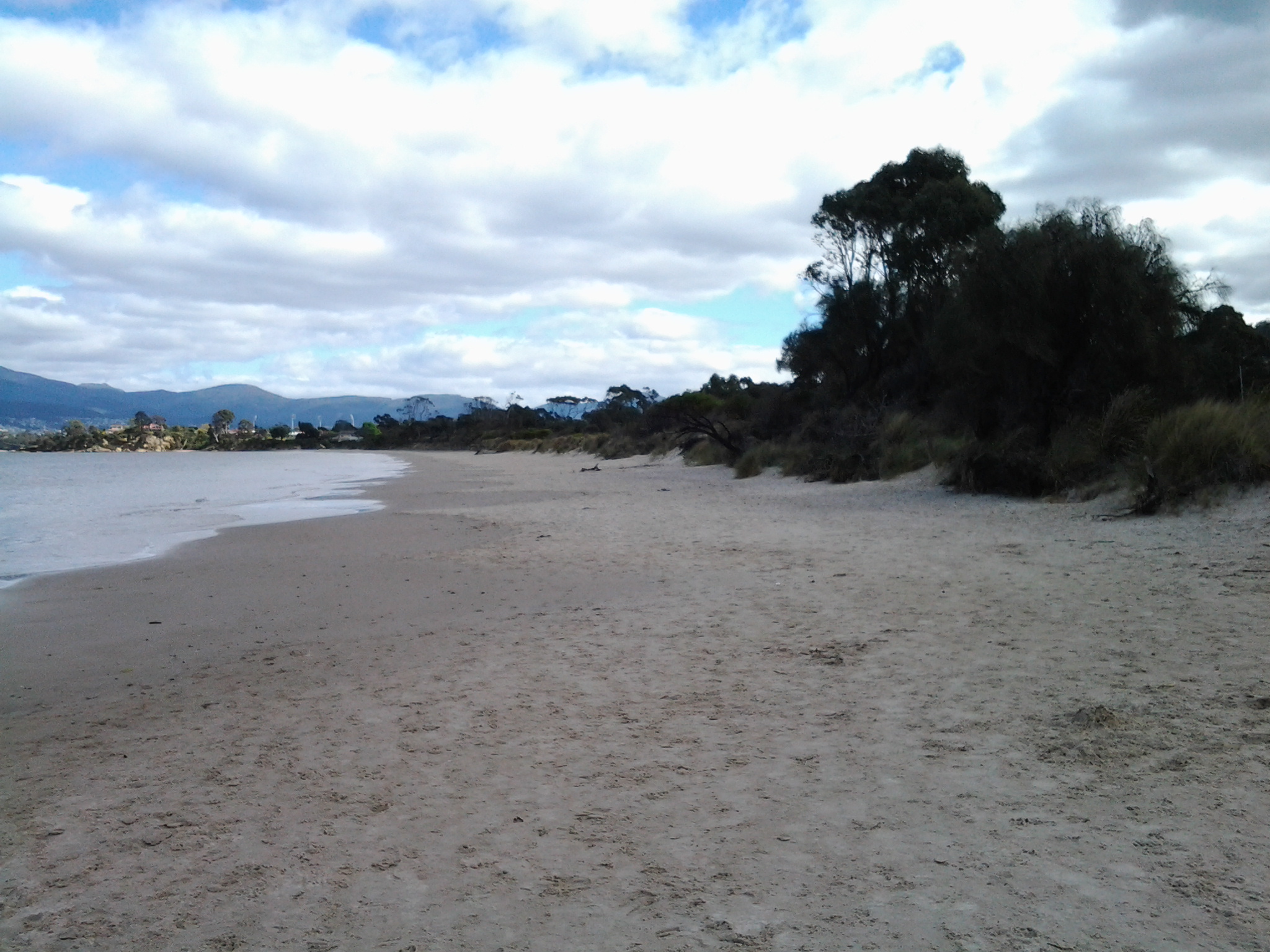
The Clarence Foreshore Trail passes the inaccessible Rosny Wastewater Treatment Plant on the left.  From the Trail, occasionally rough gravel tracks led down making it possible to reach the water’s edge and I could see Dominican Gulls on the rocks and the occasional Pied Cormorant. Around 15 minutes after leaving the bus I reached the Rosny Point curve where the land left Kangaroo Bay and moved around to edge the Derwent River.  A few minutes later, a Trail sign indicated the Tasman Bridge was 1.7 kilometres further on. I was thankful for the Trail because the narrow rocky shore was strewn with sharp broken oyster shells; later on I watched a family of Pied Oyster Catchers preening and resting – obviously they had eaten their fill.

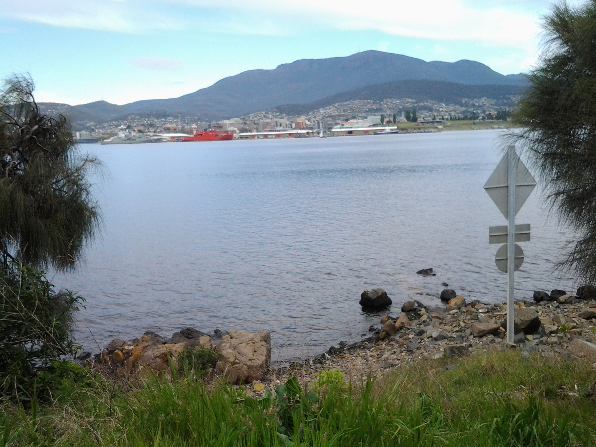
A few days ago I posted the story that the ‘navy had come to town’. The photo below looks across the River from a place between Rosny Point and Montagu Bay and shows the grey green HMAS Arunta to the left of the orange Aurora Australis Antarctic icebreaker. Oh, and by the way, I discovered the Commander of this naval ship was once responsible for the HMAS Derwent.

20141010_094333

Close to 10am, I reached the Derwent River corner of Montagu Bay.  Harsh sounds filled the air; very vocal wattle birds and the growling of power brakes used by large trucks on the Tasman Bridge. From here, I had the choice to walk 200 metres up to the Rosny Hill Lookout. However, I continued on towards the heart of Montagu Bay past a clutter of upturned dinghies partly hidden in the bushes by the shore. By 10.05am, I was out of the forest and soon passing Langdon’s Welding shop on the left with workers out repairing some boats. By the Trail, I noted a large nectarine tree filled with the start of new fruit and made a mental note to walk this way in December when the fruit should be ripe.

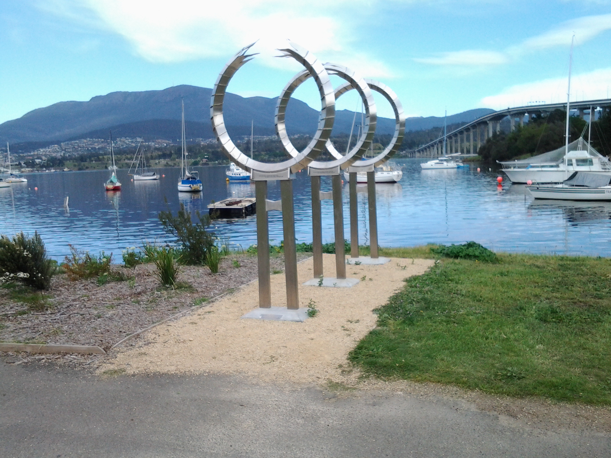
At Montagu Bay I was stopped by an elegant contemporary public sculpture (unknown artist) which I did not know existed.  Well worth a visit. This was the Memorial to those who lost their lives when the Tasman Bridge crashed in 1975. Have a look at the photo below.

20141010_100906

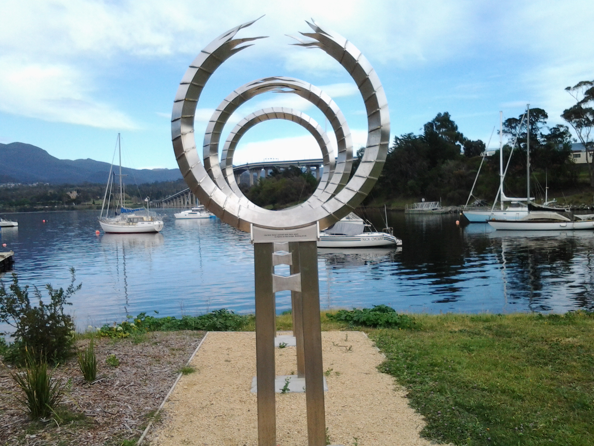
The idea is that you look through these circles to pin point the part of the bridge which collapsed.  An information board provided additional information on this tragedy.

20141010_100832

The view across the Derwent from Montagu Bay was magnificent.

20141010_100852

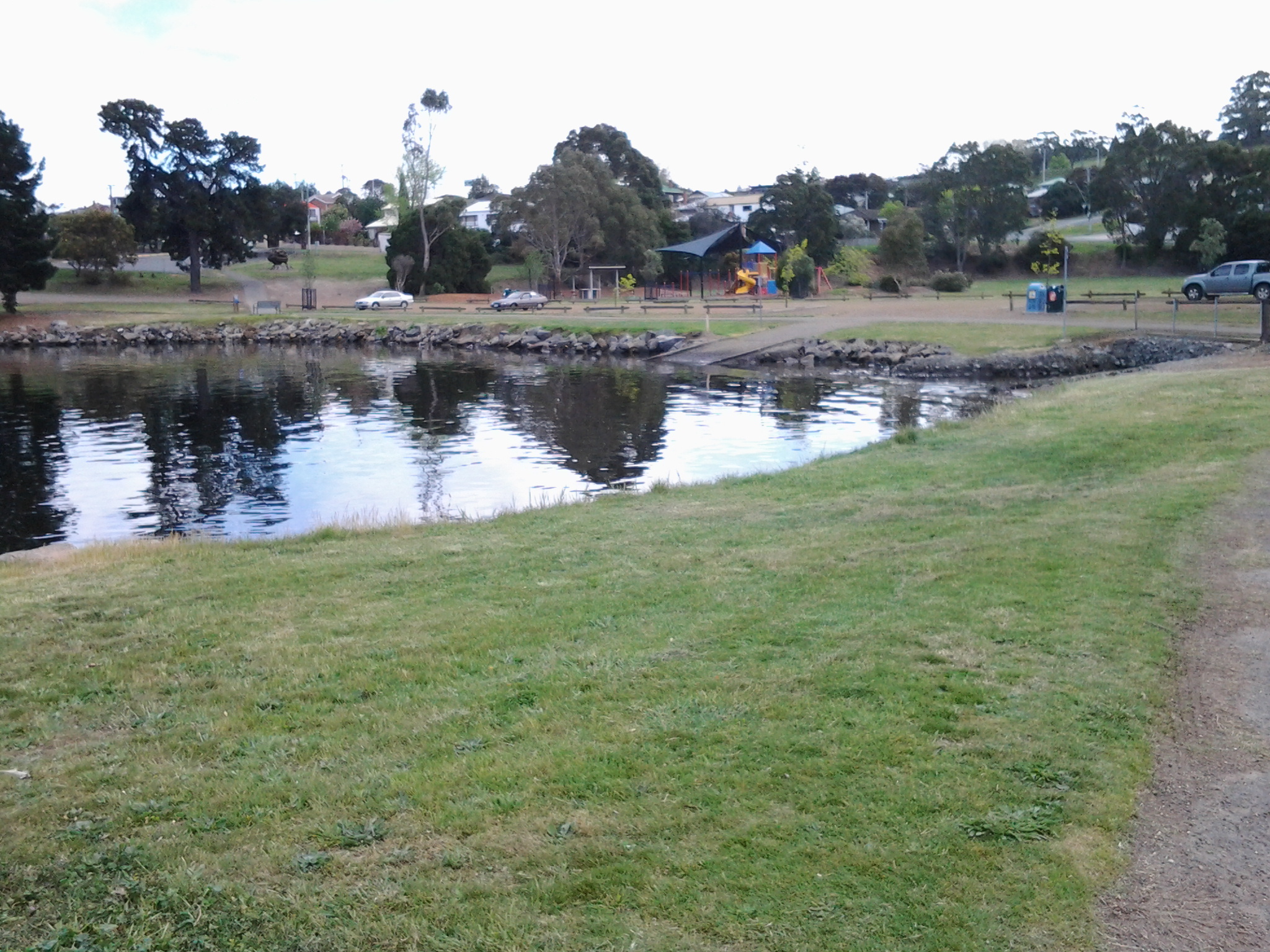
Public Toilets are located near the Montagu Bay Reserve parkland area. This area is one of many that are child friendly with kids play equipment for free use.

20141010_100923

300 metres along the Clarence Foreshore Trail after passing huge old pine trees, massive gums with fanciful ‘painted’ bark trunks, then the Montagu Bay Primary School on the right, I reached the Tasman Bridge which I walked beneath to continue towards Rose Bay. The time was 10.20am.

Walking Howrah and Bellerive Beaches on Stage 4 of my walk along the Derwent River

On arrival on Howrah Beach, I chose not to deviate to the Shoreline Shopping Centre, having no desire for shopping and because the fresh air and walking experience was such a joy. The long Howrah Beach was almost deserted, however occasionally happy dogs and mostly happy owners were enjoying themselves; I am never sure who is taking who for a walk.  I was fascinated by the man who declared he was deaf and then told me his dog was deaf, yet they both seemed to communicate well and understand each other.

20140926_105712

The photo above shows the stretch ahead of me as I started along Howrah Beach. The photo below shows the Beach when I had walked half its length.

20140926_105703

The sky gathered clouds, and the onshore breeze cooled the air as I walked. Before long I reached Second Bluff at the end of the Howrah Beach, and walked up and along the gravel pathway around this headland. At both the southern and northern ends of Second Bluff it is easily possible to walk off towards roads and, in the distance, to reach the main connecting route, Clarence Street, along which buses run regularly.

While walking around this Bluff, I passed some large Australian native Leptospermum trees in full flower; their snow-white petals presented a spectacular display.  Off and on I noticed bright bursts of fleshy native pigface acting as ground cover, with its purple-pink flowers made brilliant by the sunlight. I was afforded spectacular views back to Howrah, Tranmere, Droughty Hill, across the opening of Ralph’s Bay, and of Gellibrand Point and Fort Hill on the South Arm peninsula.

20140926_112427

20140926_112443

Once I reached the Bellerive Beach stairs, I descended and took my walk towards the northern end of the Beach over a kilometre away.

20140926_113238

From time to time tall white poles with red tops are positioned along the beach to indicate walkways to the Clarence Foreshore Trail behind the dunes and then the roads and suburban houses of Bellerive.

20140926_115126

Bellerive Beach is much frequented by fitness fanatics, walkers, joggers, kids, families, individuals, and dogs on leads with owners.  The clean sand, the tide moving the Derwent up and down the beach, and the startling prominence of Mount Wellington are always welcome.

20140926_115121

Near the far end of the Bellerive Beach, a massive structure looms above a row of tall pine trees. This is Blundstone Arena, once known as the Bellerive Cricket Ground. This sportsground, as a national venue for international and local cricket games in the summer, also hosts major AFL (Australian Rules Football) and state level games during the winter months. Between Blundstone Arena and the beach are public toilets along the edge of the Clarence Foreshore Trail.

20140926_121450

Further on and next to the Trail, an outdoor adult gym inspires beach visitors and picnickers to push and pull and otherwise move their bodies.  From here you can see a blue and white painted building standing prominently.

20140926_115457

This is Bellerive Beach’s Fish Bar where fresh fish and other seafood is battered or crumbed and cooked while patrons wait. Dining in or taking away are the two options; the weather and wind generally controls whether I take a fresh cooked meal and sit on the edge of the beach with friends. I live in Bellerive and so I know very well this Beach and all the delights which it offers.

On this walk as usual, I brought my own packed lunch so I passed the Fish Bar and sat towards the end of the beach, and munched and contemplated the leisurely activity of others. A simple pleasure amidst the flighty flashing of hungry squawking silver gulls, all expecting to be fed.

20140926_120252