Tag Archives: Walter Angus Bethune

Historic Houses


As I walked the length of the Derwent River, occasionally I passed 19th century heritage buildings: some were falling down and others existed in various states of restoration.  Occasionally I viewed these buildings from across the River, or from near my access routes to and from the River.

Below is a selection of houses that remain as evidence of the early white settlers in the Derwent Valley district.  During my recent foray into the writing, designing and compiling of books I was introduced to the Snipping Tool available as an accessory within Microsoft Word.   I will be using this Tool in such a way as you will think I am on one side of the river but I am on the other – all to protect the privacy and wishes of property owners and managers.
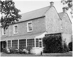
Cluny House

This 1820’s house was photographed and written up on a real estate site ‘The original brick section of Cluny was established with a larger sandstone section added in 1919 from sandstone sourced from an old farm building. Original timber floors, doors, window frames, open fire places and picture rails are featured throughout the home. A wide hallway leads to the four double bedrooms. The entire front boundary of this property is on the Derwent River with the advantage of a water licence and irrigation. The fertile river flats are suitable for any number of agricultural pursuits. The entire front boundary of this property is on the Derwent River with the advantage of a water licence and irrigation. The fertile river flats are suitable for any number of agricultural pursuits. There are numerous outbuildings including a five bay garage and machinery shed and an ancient stone cottage.

Cluny House.jpg

cropped-stone-bldg-cluny

Clarendon House

The property near Norton Mandeville was granted in 1819 to William Borrodaile and he built the house  and outbuildings from  1821 to include stables, hop kiln, barn and a walled yard.  The barn is pictured below

Barn Clarendon near Gretna.jpg

Images of the  house include:
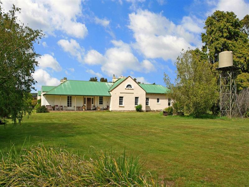
clarendon-3  clarendon-2  clarendon-near-grenta

Glenelg House

Tasmania’s Heritage Register provides the information that ‘Glenelg is a fine two storey Victorian Italianate Villa built in 1878 to a design of Henry Hunter. The house has a good hillside setting, and is seen prominently from the road. Glenelg at Gretna has been in the Downie family for six generations. Andrew Downie, a solicitor, was an immigrant from Stirling in Scotland in the early 1820s. He was granted the 1000 acre property Glenelg by Governor William Sorell in 1824. The original Glenelg grant still lies on the property, with sandstone corner posts at 3 of the corners and remains within the Downie family. In 1838 Andrew’s brother, William also emigrated to Van Diemen’s land and began working with his brother. Andrew had no children and returned to Scotland later in life, and William’s family continued to run Glenelg over the following years.’  Refer image 1
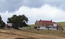
Glenelg House Gretna.jpg

Glenelg House Gretna 2.jpg

Dunrobin

The Dunrobin land was granted to Walter Angus Bethune in 1821, and the current external fence attests to the property’s establishment date.

20160121_141359.jpg

You can see photographs and read more details about this property here.

Dunrobin.jpg

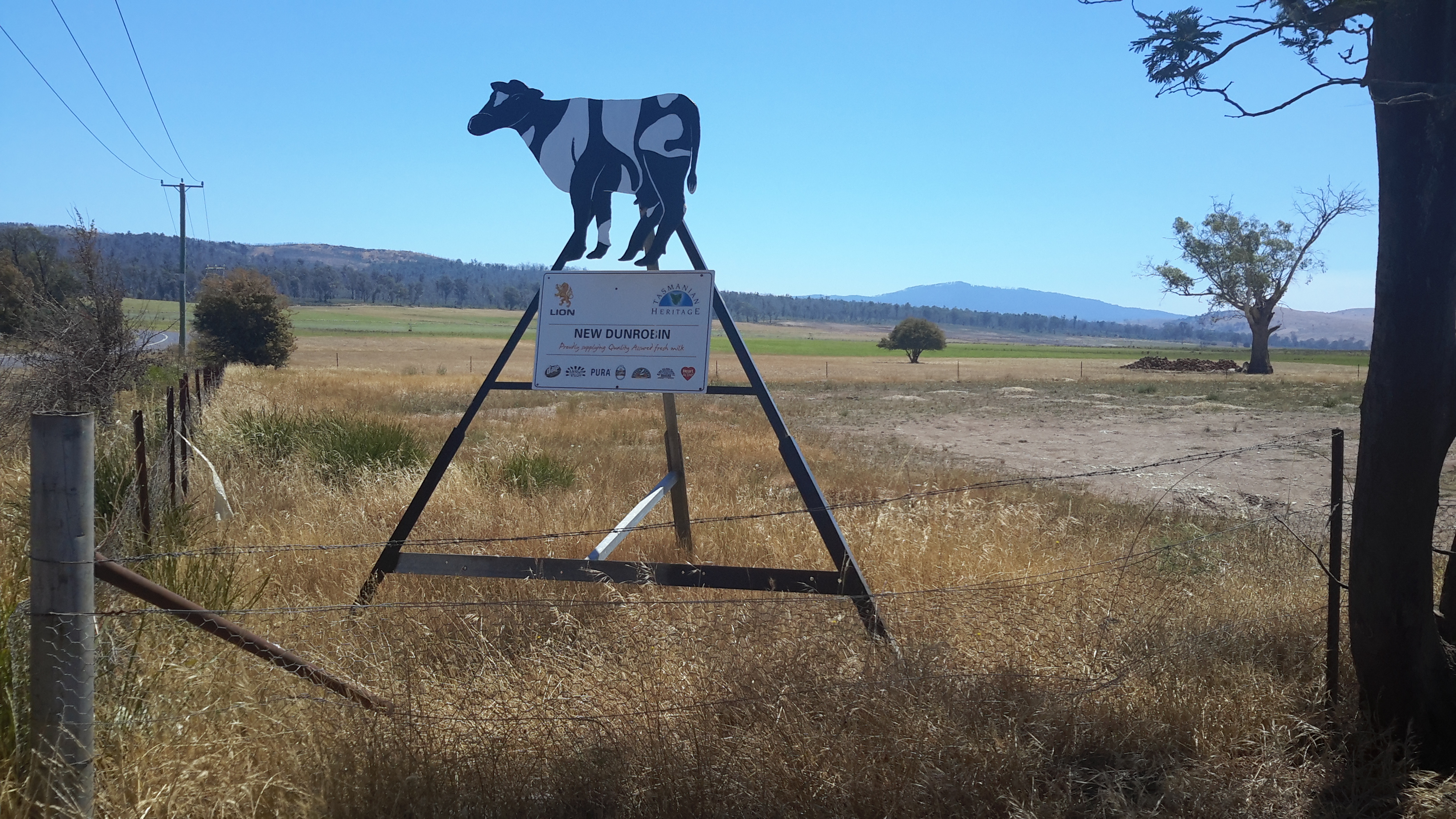
The New Dunrobin is a dairy estate.

20160121_142901.jpg

It was always a delight, amidst great tracts of agricultural land, to see isolated heritage buildings and to consider them as specimens of Tasmania’s social history.

The five suburbs to be walked through in Stage 5 of my walk along the Derwent River

From Rosny Point to Geilston Bay, I will walk as close to the edge of the Derwent River as possible.

In so doing I will pass through five suburbs: Rosny, Montagu Bay, Rose Bay, Lindisfarne and Geilston Bay. Most were settled early in the existence of Hobart Town. In 1793, Lieutenant Hayes sailed up the River naming it and many points of interest. It was only a decade later the first settlement was made and in 1804 the final site for Hobart was established on the western shore opposite Bellerive and Rosny. Possibly Geilston Bay was named in the 1810s, Rosny in the 1820s, Montagu Bay in the late 1820s. Lindisfarne was named a century after the first settlement in 1903.

Rosny

The starting point for the 5th Stage of my walk along the eastern shore of the Derwent River will be Rosny Point. The suburb of Rosny, within the City of Clarence, is located on a narrow peninsula which juts out from the eastern shore at Rosny Point and climbs the rising slopes of Rosny Hill to the public Rosny Point Lookout.

According to one of my favourite information sources Wikipedia, Rosny was named by Walter Angus Bethune, the holder of the original grant of land on Rosny Point, after his ancestor the Duc de Maximilien de Bethune Sully of Rosny-sur-Seine  (a town situated slightly north west of Paris in France).  Bethune, a Scottish merchant, first arrived in Van Diemen’s Land in 1820 and was a significant player in the early development of Hobart and sheep farming. His descendants have played important roles in Tasmanian history.

Jean-Baptiste-Camille_Corot_-_Château_de_Rosny

Chateau de Rosny was painted by French artist Jean-Baptiste Camille Corot in 1840

Montagu Bay

This suburb was named after ‘mad’ judge Algernon Montagu, who in the early 19th century lived in Hobart Town before purchasing a property ‘Rosny’ in the Montagu Bay area of the eastern shore of the Derwent River. This small suburb sits on the river edge next to Rosny Point/Rosny and contains the Clarence Aquatic Centre and Montagu Bay Primary School. The Tasman Highway travels over a northern corner section of this suburb, leading to the Tasman Bridge which links the eastern Shore to Hobart and beyond on the western shore.

Rose Bay

The suburb of Rose Bay sits on the river edge next to Montagu Bay.

Rose Bay High School has a permanent camera facing across the Tasman Bridge over the Derwent River towards the centre of Hobart and with the back drop of Mount Wellington. Normally the site operates 24 hours of the day and night. The site is located at http://ozforecast.com.au/cgi-bin/weatherstation.cgi?station=11233&animate=6. Currently the site is being rebuilt, however I recommend you follow the progress and when re-established, save the site as a Favourite. Then you can see what the weather is like over Hobart and how gorgeous it can be to look at regardless of the weather in daylight and with the city lights sparkling at night.

Lindisfarne

While the exact origins of naming our Lindisfarne suburb remain unclear, the main thought is that from 1892 the suburb was known as Beltana. Then it was renamed Lindisfarne in 1903 after Lindisfarne a tidal Island (Holy Island) in Northumberland, a region in the far north east of England. The easternmost part of the middle of the suburb, where the Beltana Bowls Club and the Beltana Hotel are located, is still locally known as Beltana.

It has been suggested this suburb took its name from Lindisferne House, a property built in the 1820s near the suburb of Rosny. From the Clarence City Council website at http://www.ccc.tas.gov.au/page.aspx?u=1601 “Lindisfarne is thought to have been named by Hezekiah Harrison, a free settler, who was granted land in the area in 1823. Harrison had lived just a few miles from Lindisfarne Island, on the Northumbrian coast. Known as the ‘Holy Island’, Lindisfarne was the base from which St Aidan worked to spread the Christian faith through the north of England in the eighth century AD. However, it is unclear whether the area was named by Harrison or the next owner, Thomas George Gregson, a prominent free settler who purchased much of the land between Risdon and Rosny. Gregson grew up in Lowlynn, very close to Lindisfarne Island in England.”

Geilston Bay

Apparently the inlet of Geilston Bay was named after Colonel Andrew Geils who was appointed Commander of the settlement of Hobart in 1812. Colonel Geils lived on a property in Geilston Bay which he called ‘Geilston Park’.