Category Archives: Hobart

The Perentie Lizard

The Perth Zoo in Western Australia looks after a Perentie Lizard (mentioned in the last posting) (http://perthzoo.wa.gov.au/animals-plants/australia/reptile-encounter/perentie/).

Perentie lizard at Perth Zoo

The Perentie is a Central Australian monitor (also known as a goanna) which is designated a ‘controlled animal’ under the Tasmanian Nature Conservation Act 2002. There is a low likelihood that this species could establish in Tasmania, with potential for minor impacts. The most significant impact is likely to be predation because Perenties have a broad diet and could potentially prey on a variety of native animals. These impacts are likely to be low because the Tasmanian climate is not suitable. This risk assessment categorises Perenties as a moderate threat to Tasmania and proposes that imports be restricted to those licence holders approved for keeping moderate threat species.

I have seen a few lizards during my walks along the Derwent River. Tasmania has fifteen different types of Skinks plus the Blue Tongue Lizard (some live in the rocks in my garden) and the Mountain Dragon. Delicate Skinks are a small, plain species, often found in suburban gardens in northern and eastern Tasmania.  Often I see a tiny Skink darting out of my way., but I do not know which type or types: more research is needed.  The photo below shows a Delicate Skink.

Delicate_Skink

The navy comes to town

From my home overlooking the Derwent River, on this grey overcast wintry Thursday around Hobart, I have just watched a small grey green naval ship charging up the Harbour accompanied by two tugs.  According to TasPORTS, the HMS Arunta was due to arrive at midday and it is now midday as it is edges along MAC4 wharf ready to moor. This perfect timing gives me great confidence in our Royal Australian Navy. Apparently HMS Arunta will depart on Monday at 10am.

HMAS Arunta (II)

When I checked the Royal Australian Navy website (http://www.navy.gov.au/), it referred to the historic ship, the HMAS Arunta (1) and provided information about the HMAS Arunta (II) (the ship which I have watched this morning). Apparently the HMAS Arunta (1) had a long history including action in World War II, was decommissioned in 1956 before sinking off the coast of NSW in 1969 having been sold for scrap.

The HMS Arunta (11) is a Frigate Helicopter (FHH) ship known as part of the Anzac class. Anzacs are long-range escorts with roles including air defence, anti-submarine warfare, surveillance, reconnaissance and interdiction.The ships are capable of countering simultaneous threats from the air, surface and sub-surface. Each Anzac frigate is fitted with an advanced package of air surveillance radars, omni-directional hull mounted sonar and electronic support systems which interface with a state-of-the-art combat data system.

The name “Arunta” comes from the Arrernte Aboriginal people (also spelt “Arunda” or “Aranda”) located in central Australia. Selection of the Arunta name and original motto ‘Conquer or Die’ recognises the ship’s proud history and the ongoing and special relationship with the ARRERNTE Aboriginal people. To maintain the warm and special bond between HMAS Arunta and the Arrernte people the Arrernte Council presented HMAS Arunta with a flag displaying a Perrente lizard. The lizard is an animal from the dreamtime for the Arrernte people. HMAS Arunta also sponsors a Perrente Lizard, the ships mascot, at Perth Zoo, Western Australia.

The five suburbs to be walked through in Stage 5 of my walk along the Derwent River

From Rosny Point to Geilston Bay, I will walk as close to the edge of the Derwent River as possible.

In so doing I will pass through five suburbs: Rosny, Montagu Bay, Rose Bay, Lindisfarne and Geilston Bay. Most were settled early in the existence of Hobart Town. In 1793, Lieutenant Hayes sailed up the River naming it and many points of interest. It was only a decade later the first settlement was made and in 1804 the final site for Hobart was established on the western shore opposite Bellerive and Rosny. Possibly Geilston Bay was named in the 1810s, Rosny in the 1820s, Montagu Bay in the late 1820s. Lindisfarne was named a century after the first settlement in 1903.

Rosny

The starting point for the 5th Stage of my walk along the eastern shore of the Derwent River will be Rosny Point. The suburb of Rosny, within the City of Clarence, is located on a narrow peninsula which juts out from the eastern shore at Rosny Point and climbs the rising slopes of Rosny Hill to the public Rosny Point Lookout.

According to one of my favourite information sources Wikipedia, Rosny was named by Walter Angus Bethune, the holder of the original grant of land on Rosny Point, after his ancestor the Duc de Maximilien de Bethune Sully of Rosny-sur-Seine  (a town situated slightly north west of Paris in France).  Bethune, a Scottish merchant, first arrived in Van Diemen’s Land in 1820 and was a significant player in the early development of Hobart and sheep farming. His descendants have played important roles in Tasmanian history.

Jean-Baptiste-Camille_Corot_-_Château_de_Rosny

Chateau de Rosny was painted by French artist Jean-Baptiste Camille Corot in 1840

Montagu Bay

This suburb was named after ‘mad’ judge Algernon Montagu, who in the early 19th century lived in Hobart Town before purchasing a property ‘Rosny’ in the Montagu Bay area of the eastern shore of the Derwent River. This small suburb sits on the river edge next to Rosny Point/Rosny and contains the Clarence Aquatic Centre and Montagu Bay Primary School. The Tasman Highway travels over a northern corner section of this suburb, leading to the Tasman Bridge which links the eastern Shore to Hobart and beyond on the western shore.

Rose Bay

The suburb of Rose Bay sits on the river edge next to Montagu Bay.

Rose Bay High School has a permanent camera facing across the Tasman Bridge over the Derwent River towards the centre of Hobart and with the back drop of Mount Wellington. Normally the site operates 24 hours of the day and night. The site is located at http://ozforecast.com.au/cgi-bin/weatherstation.cgi?station=11233&animate=6. Currently the site is being rebuilt, however I recommend you follow the progress and when re-established, save the site as a Favourite. Then you can see what the weather is like over Hobart and how gorgeous it can be to look at regardless of the weather in daylight and with the city lights sparkling at night.

Lindisfarne

While the exact origins of naming our Lindisfarne suburb remain unclear, the main thought is that from 1892 the suburb was known as Beltana. Then it was renamed Lindisfarne in 1903 after Lindisfarne a tidal Island (Holy Island) in Northumberland, a region in the far north east of England. The easternmost part of the middle of the suburb, where the Beltana Bowls Club and the Beltana Hotel are located, is still locally known as Beltana.

It has been suggested this suburb took its name from Lindisferne House, a property built in the 1820s near the suburb of Rosny. From the Clarence City Council website at http://www.ccc.tas.gov.au/page.aspx?u=1601 “Lindisfarne is thought to have been named by Hezekiah Harrison, a free settler, who was granted land in the area in 1823. Harrison had lived just a few miles from Lindisfarne Island, on the Northumbrian coast. Known as the ‘Holy Island’, Lindisfarne was the base from which St Aidan worked to spread the Christian faith through the north of England in the eighth century AD. However, it is unclear whether the area was named by Harrison or the next owner, Thomas George Gregson, a prominent free settler who purchased much of the land between Risdon and Rosny. Gregson grew up in Lowlynn, very close to Lindisfarne Island in England.”

Geilston Bay

Apparently the inlet of Geilston Bay was named after Colonel Andrew Geils who was appointed Commander of the settlement of Hobart in 1812. Colonel Geils lived on a property in Geilston Bay which he called ‘Geilston Park’.

Update on the name Bellerive

New research, since that undertaken for my last posting where I indicated the name change happened in the 1830s, gives much more precise information. I have just discovered that the present name of Bellerive was officially proclaimed in 1892.  This news makes me understand clearly why Glover and von Guerard referred to the site as Kangaroo Point.

Bellerive

Last Friday/Saturday the fourth stage of my walk along the Derwent River finished in Bellerive. Being curious to know a little history of this Hobart suburb’s existence, I discovered it was first settled in the 1820s after years of people ferrying across the Derwent River from Hobart Town. Its first name was Kangaroo Point.  No prizes for guessing why.  Apparently the area abounded with native kangaroos (and/or perhaps the prolific Bennetts Wallaby which is often referred to as a kangaroo).

The name changed from Kangaroo Point to Bellerive around 1830, using the French language as inspiration: bel = ‘beautiful’ + rive = ‘bank’.

However, its original name seems to have been retained in common usage, because two eminent artists of the 19th century produced art work located from Kangaroo Point. The renowned English artist John Glover painted Mount Wellington and Hobart Town from Kangaroo Point in 1834, and the Austrian artist Eugene von Guerard, who was active in Australia in the middle of the 19th century, created a colour lithograph Hobart Town, from Kangaroo Point, Tasmania in the late 1860s.

The Glover painting is at home in the Tasmanian Museum and Art Gallery in Hobart.  This picture interests me because some of the original indigenous land owners, the Moomairremener people, have been depicted on the banks of Kangaroo Point, and there is very little sign of the ‘civilisation’ of Hobart Town on the other side of the Derwent River.  By contrast, 30 odd years later von Guerard’s print shows considerable build-up of Hobart Town beneath a snow capped Mount Wellington.

John Glover- from Kangaroo Point towards Mt W and Hbt Town

The von Guerard lithograph is at home in the National Gallery of Victoria in Melbourne.

Von Guerard Hbt Town from Kangaroo Point

These days, Bellerive is a suburb of the Greater Hobart Area completely covered with streets and houses of every vintage. With its easy access to excellent sandy beaches, a vibrant village shopping centre, the regular presentation of fantastic free public festivals, and safe marina, Bellerive is a great place to live or visit.

Reconnaissance trip to and from New Norfolk

Last Sunday, friend Me took me on a discovery drive from Bellerive to New Norfolk along the eastern shore of the Derwent River.

We were curious to see how closely I would be able to walk along the edge of the River, and the extent to which I would need to deviate or stay on main roads.  It was an eye opener giving me advance warning of the walking challenges ahead.

The main handicap will be the limited opportunities to walk directly beside the River up on banks and not be required to jump along the often rocky shoreline or get lost in tall watery grasses. Even accessing the rocky or soft shores will be problematic. For example in one area, where maps indicate public roads branch off main roads, landowners with 5 acre blocks have fenced their properties and the roads down to their houses are blocked by gates. I believe that some of these roads are those mapped for public access and as such the landowners do not have the right to restrict access for the public to connect with the River beyond.  More research required.

Clearly public bus routes travel from Hobart through eastern shore suburbs on the way to Bridgewater, however bus stops are widely dispersed and the timetables indicate less frequent services, all of which will constrain me in the length and timing of my walks between these two suburban areas.

The future walking stage between the Bridgewater Bridge and New Norfolk has been concerning me.  I doubted whether bus stops existed along the way. We found there were no public bus stops on either side of the River, and the distance whether walking the road on the eastern or western shores amounts to a day walk rather than a morning or afternoon walk to cover that length. New Norfolk is 35 kilometres from Hobart. The distance from the Bridgewater Bridge to New Norfolk along the road on the western shore is the shortest at 17 kilometres compared to around 20 kms on the eastern side.

As a result of Sunday’s research, I plan to continue on the eastern shore of the Derwent River and walk to the Bridgewater Bridge, cross it, then walk back towards Hobart and ultimately finish at the mouth of the Derwent River in the Tinderbox area. Once those stages are complete, then I will return to the Bridgewater Bridge and proceed towards New Norfolk and beyond.

Thanks Me for all the laughs we had during our discoveries. It was a fun excursion.

Memories of the Bellerive Fort and Bellerive Bluff

A few days ago, I added a new post to this blog about the Bellerive Fort on the Kangaroo Bluff Historic Reserve. In response, friend Ma tells me she loves the Fort. “I played there as a child when I visited Mattie and Connie, Dad’s cousins in the Queen Anne house opposite the entrance to the Fort. My grand-kids have also made a few movies there with me.”

An earlier email from Ma told me: “Well I have wasted or not wasted four days searching family history re Kangaroo Bluff.  There are streets (including Buchanan Street) named after family members such as my Pa and Grandmas’ families and my fathers’ aunt. The cousins built at least 3 if not 4 mansions on that Bluff, including Bluff House and Wyvenhoe (29 Queen St) both of which I visited as a kid. They only passed out of the family in the late 60s or early 70s. And my grandfather, for some years, ran the pub where it is now plus another one that has been demolished, and the Rokeby Inn, a heritage building which was destroyed in the 1967 bushfires. I always thought I should buy a house in Buchanan St but felt that was a bit much even for me!!!”

Kangaroo Bluff Historic Reserve and Bellerive Fort

Near the end of my Stage 4 walk from Tranmere to Bellerive Bluff along the Derwent River, I saw a sign pointing to the Kangaroo Bluff Historic Reserve which I chose not to visit. However, my curiosity was aroused. So the next day, last Saturday, I made a special trip and walked to the Reserve to find out more.

20140927_091124

As I walked toward the entrance, I was puzzled. I could see a narrow road passing between two raised hills. On closer inspection when I discovered a massive deep and long ditch from the left to the right outside the stone edged wall of earth, clearly this site was the remains of a fortification.

20140927_091051

The site was a battery complex with underground tunnels and chambers for magazines, stores, the lamp room, a well and loading galleries. The public do not have access to the underground since these parts were bricked up in the 1920s: I would have been very interested to see the speaking tubes set into the walls used for communication purposes.

However there are many metres of well-preserved channels which can be walked in and around.

20140927_090522

20140927_090924

Signage provided useful information. I now understand that the idea of a protective Fort was first discussed in the 1830s as a means to protect the merchant ships travelling up the Derwent River, although I am unclear who might have attacked from the sea because Van Diemen’s Land (now named Tasmania) was very isolated from the rest of New Holland (now named Australia). However, it was not until difficulties were being felt between England and Russia in the 1870s that a renewed push for a Fort was made.

20140927_085957

By 1885 the defensive Fort was built – although I cannot imagine why anyone would think that Russia would believe it useful to send a war ship to the tiny colonial and penal colony in Hobart. It does not surprise me that the two canons were never used as war weapon.

20140927_090533


Kangaroo and Bellerive Bluffs on Stage 4 of my walk along the Derwent River

After lunch, I walked up to the road (Victoria Esplanade), turned left and proceeded to walk around a new headland, Kangaroo Bluff. The photo below looks south along Bellerive Beach to Second Bluff.

20140926_121521

Continuing the walk and a little way ahead at Gunning St, on the right hand side of the road, a sign indicated the Kangaroo Bluff Historic Site could be reached uphill in a couple of hundred metres. I didn’t take this route rather I continued on the Trail around the Bluff until I reached Bellerive Bluff, the official finishing point for my walk on Stage 4 along the Derwent River. Before reaching Bellerive Bluff, I watched the tomato red coloured Aurora Australis, the Australian Antarctic Division’s research and resupply flagship, manoeuvring around the Derwent Harbour.

Once I arrived at Bellerive Bluff, an information sign reminded me that Charles Darwin, the eminent English naturalist, visited when the Beagle sailed into Hobart in 1836. The sign is particularly informative because it includes a map showing exactly the path Darwin walked on the eastern shore, some of which I have walked during Stage 4. Apparently some of the geological research and findings he made here on the eastern shore of the Derwent River, laid the grounds for the development of the significant theory of continental drifts. This information reminded me that it does not matter in which little pocket of the world you live, some important global story will come from it.

The next, 5th leg of the walk will start opposite Bellerive Bluff at Rosny Point, on a day yet to be determined.  The dark treed headland in the photo below is Rosny Point at the foot of the low Rosny Hill (the ever present Mount Wellington is visible in the distance).

20140926_113324

From Bellerive Bluff further walking is required to access bus routes and return to the Hobart city centre (although I walked home nearby). The Clarence Foreshore Trail continues along the edge of Kangaroo Bay from Bellerive Bluff. This pleasant walk leads to the Bellerive Ferry dock, a Fish and Chip Bar, and the Waterfront Hotel all overlooking the calm Kangaroo Bay with its marina full of yachts.

20140926_130133

Continuing past the Hotel onto the Boardwalk (which stages wonderful open-air festivals throughout the year such as the Seafarers Festival, the Jazz Festival, and the Fruit Wine Festival) there are two choices: to continue along the edge of Kangaroo Bay and past the Bellerive Yacht Club, or to walk up to the street and access the shops and restaurants of Bellerive Village. On the road (Cambridge Road) after the Yacht Club, after the shops finish and not far from the intersection lights, the sign for bus stop number 8 is planted on the edge. From here a bus can be hailed (please do not expect a bus to stop if you do not hold out your arm and indicate, even though you may be standing at the bus stop).  A timetable of bus services is posted on the bus stand.

Once on the bus, you should feel satisfied (and so lucky) that you exercised your body, cleansed your mind, and experienced the beauty of a portion of the Derwent River and its immediate environment. At the end of every walk I treasure where I have been during the day, and I am always excited thinking about the unknowns of the next stage, and looking forward to it.

Walking Howrah and Bellerive Beaches on Stage 4 of my walk along the Derwent River

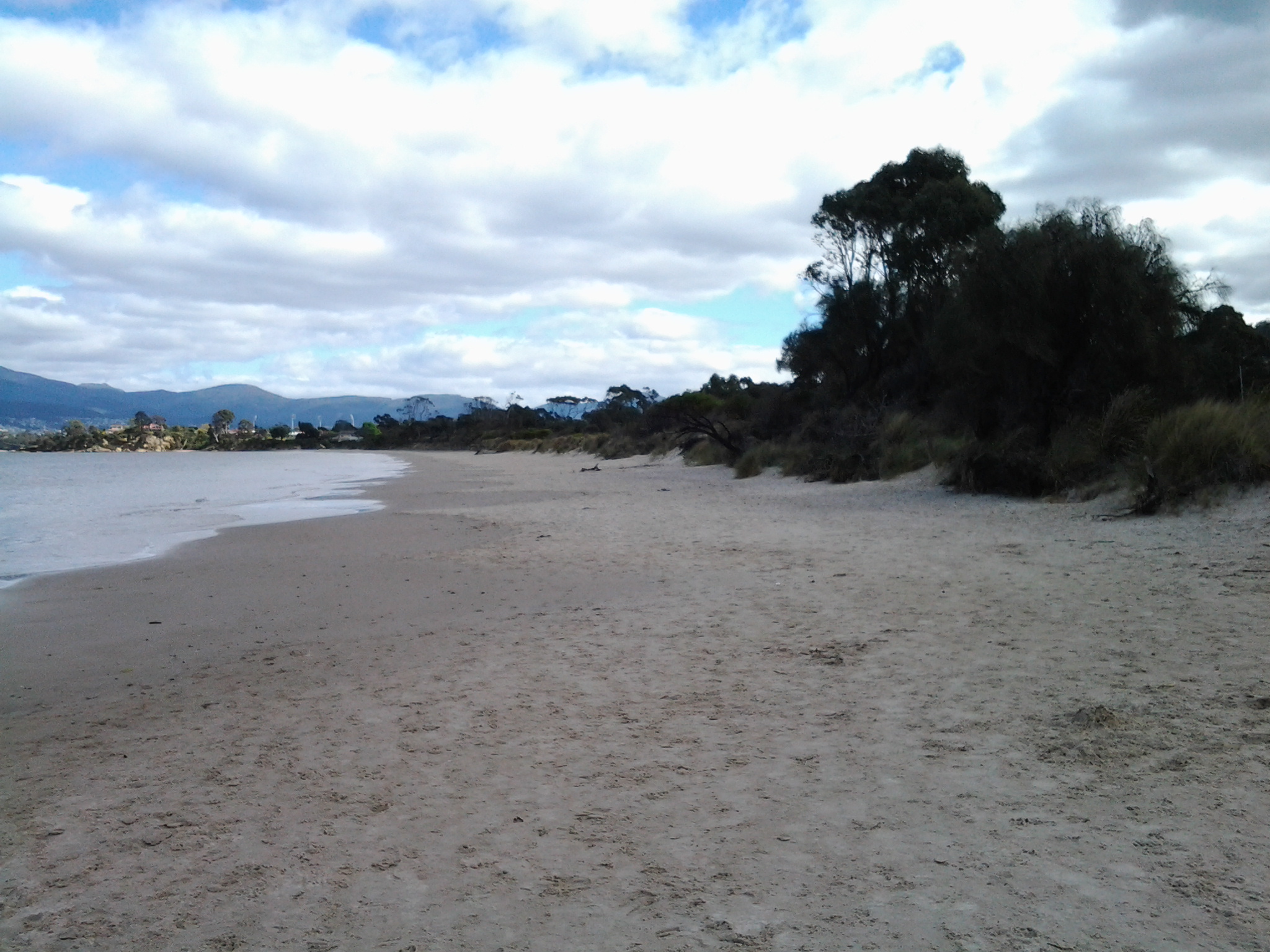
On arrival on Howrah Beach, I chose not to deviate to the Shoreline Shopping Centre, having no desire for shopping and because the fresh air and walking experience was such a joy. The long Howrah Beach was almost deserted, however occasionally happy dogs and mostly happy owners were enjoying themselves; I am never sure who is taking who for a walk.  I was fascinated by the man who declared he was deaf and then told me his dog was deaf, yet they both seemed to communicate well and understand each other.

20140926_105712

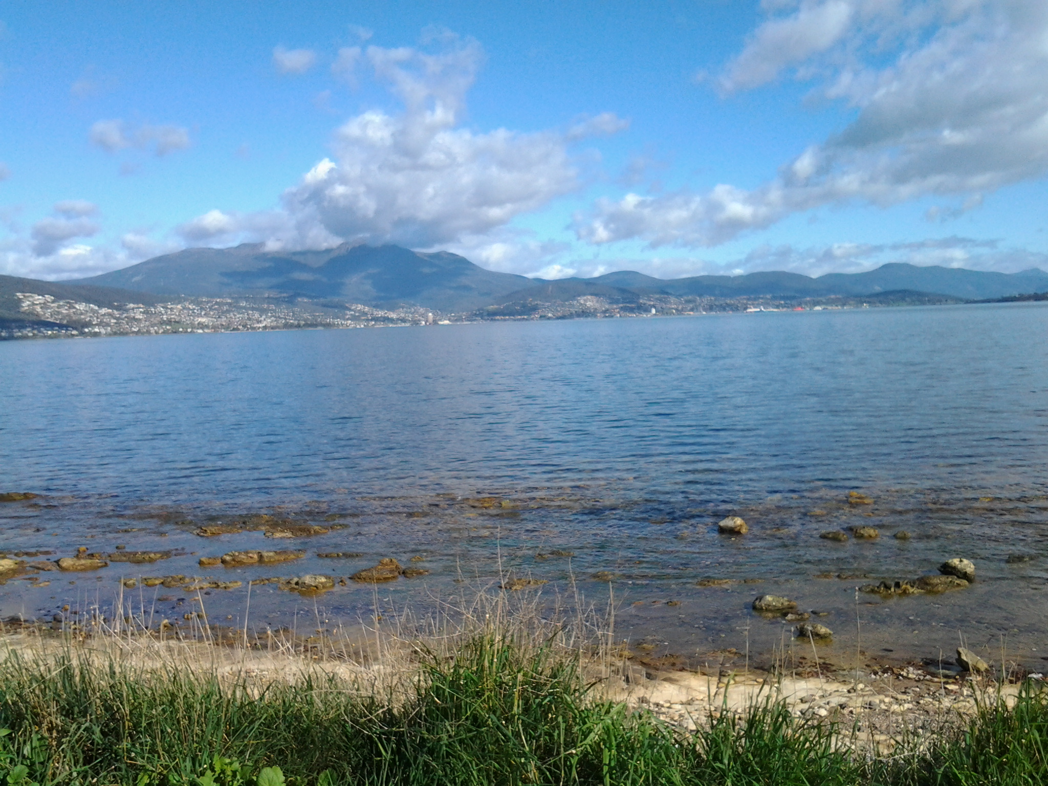
The photo above shows the stretch ahead of me as I started along Howrah Beach. The photo below shows the Beach when I had walked half its length.

20140926_105703

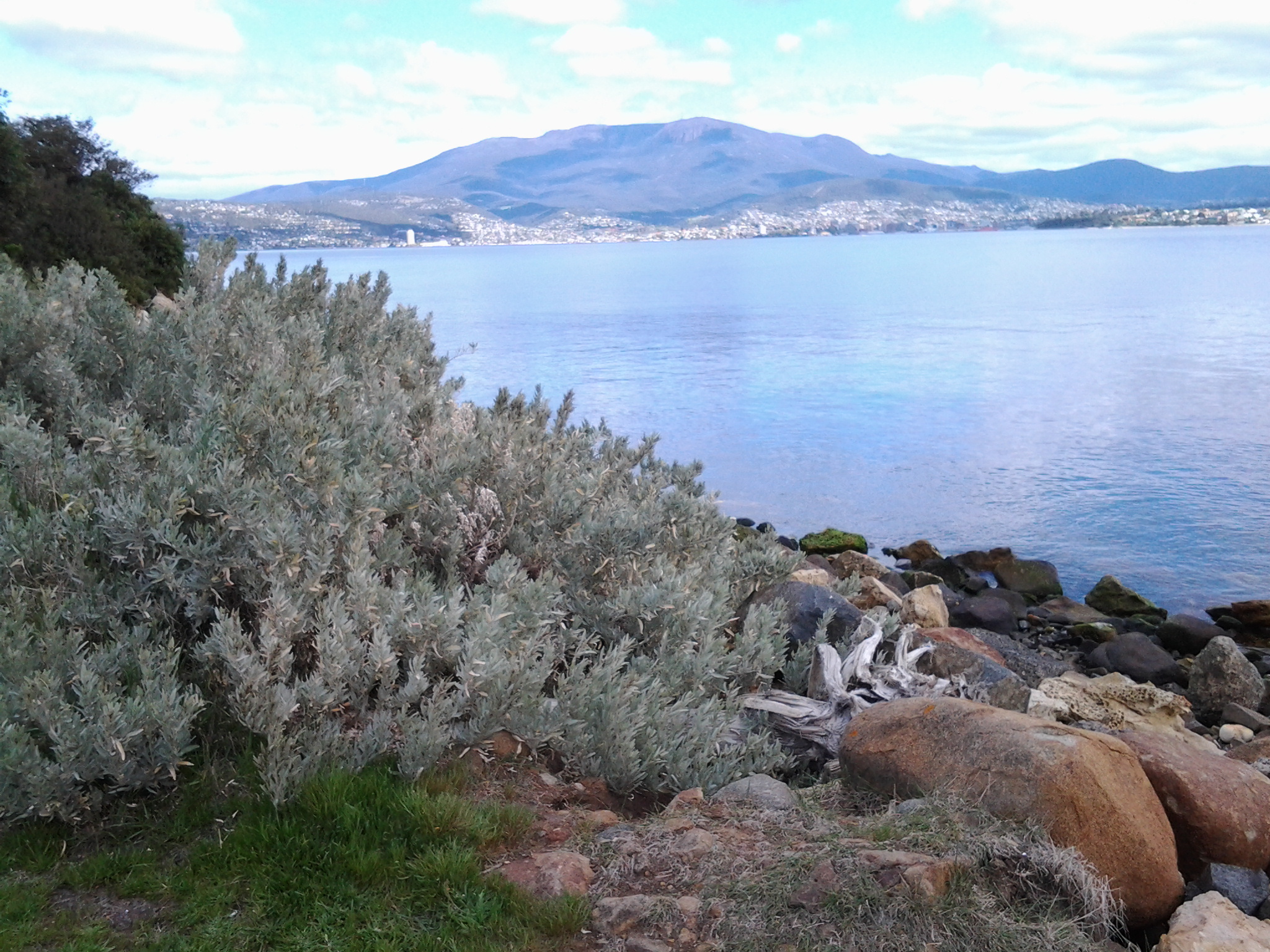
The sky gathered clouds, and the onshore breeze cooled the air as I walked. Before long I reached Second Bluff at the end of the Howrah Beach, and walked up and along the gravel pathway around this headland. At both the southern and northern ends of Second Bluff it is easily possible to walk off towards roads and, in the distance, to reach the main connecting route, Clarence Street, along which buses run regularly.

While walking around this Bluff, I passed some large Australian native Leptospermum trees in full flower; their snow-white petals presented a spectacular display.  Off and on I noticed bright bursts of fleshy native pigface acting as ground cover, with its purple-pink flowers made brilliant by the sunlight. I was afforded spectacular views back to Howrah, Tranmere, Droughty Hill, across the opening of Ralph’s Bay, and of Gellibrand Point and Fort Hill on the South Arm peninsula.

20140926_112427

20140926_112443

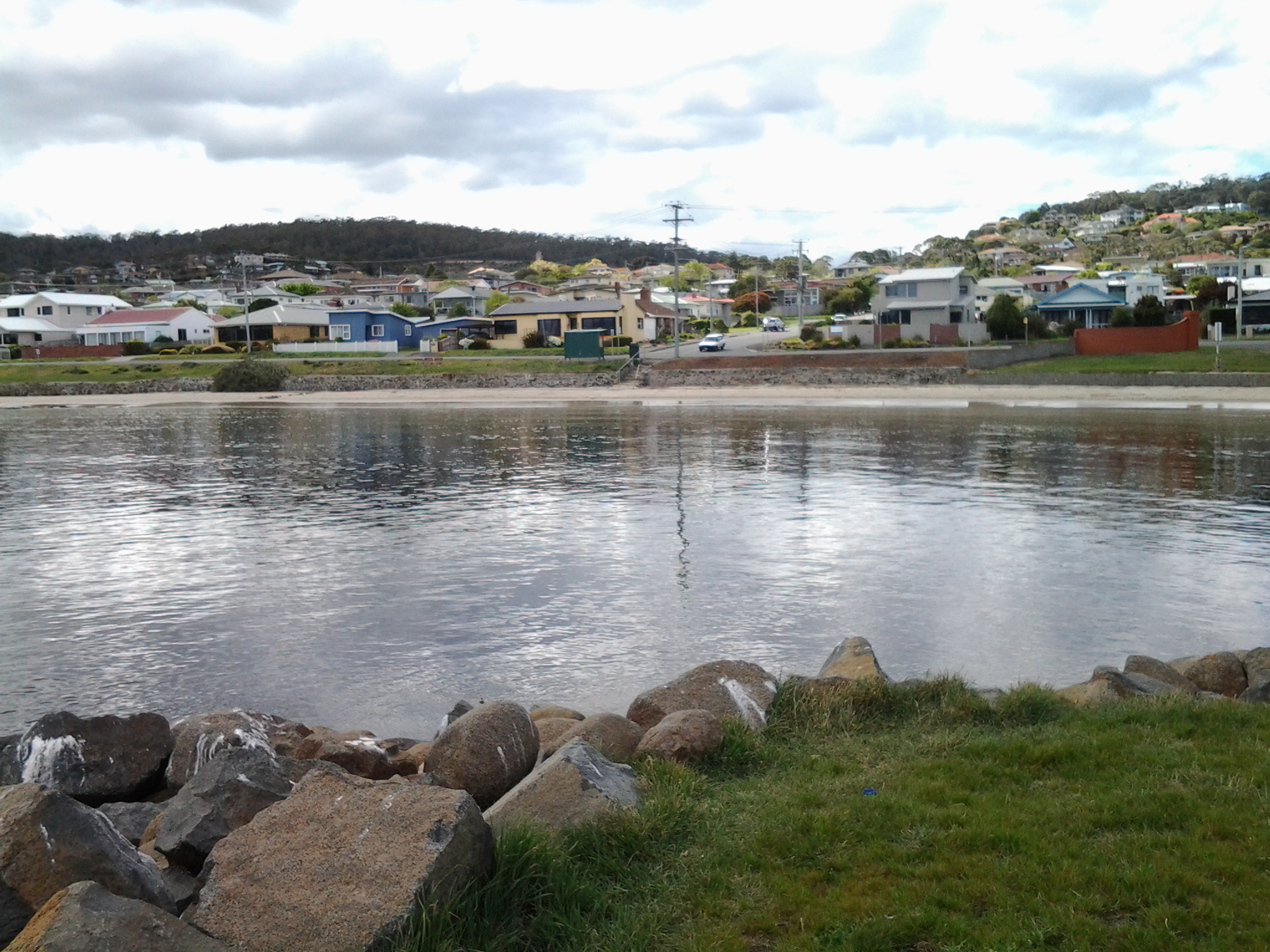
Once I reached the Bellerive Beach stairs, I descended and took my walk towards the northern end of the Beach over a kilometre away.

20140926_113238

From time to time tall white poles with red tops are positioned along the beach to indicate walkways to the Clarence Foreshore Trail behind the dunes and then the roads and suburban houses of Bellerive.

20140926_115126

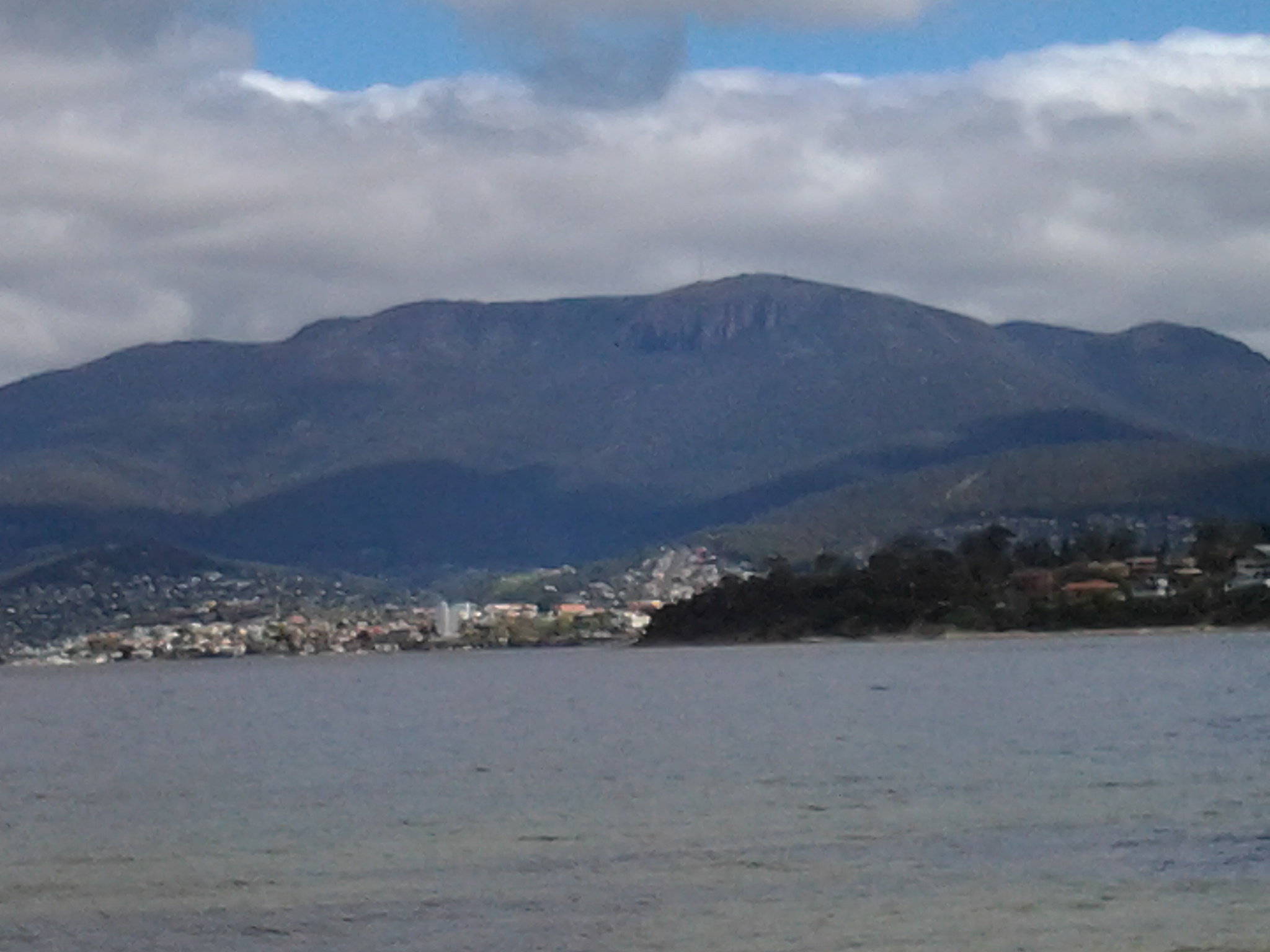
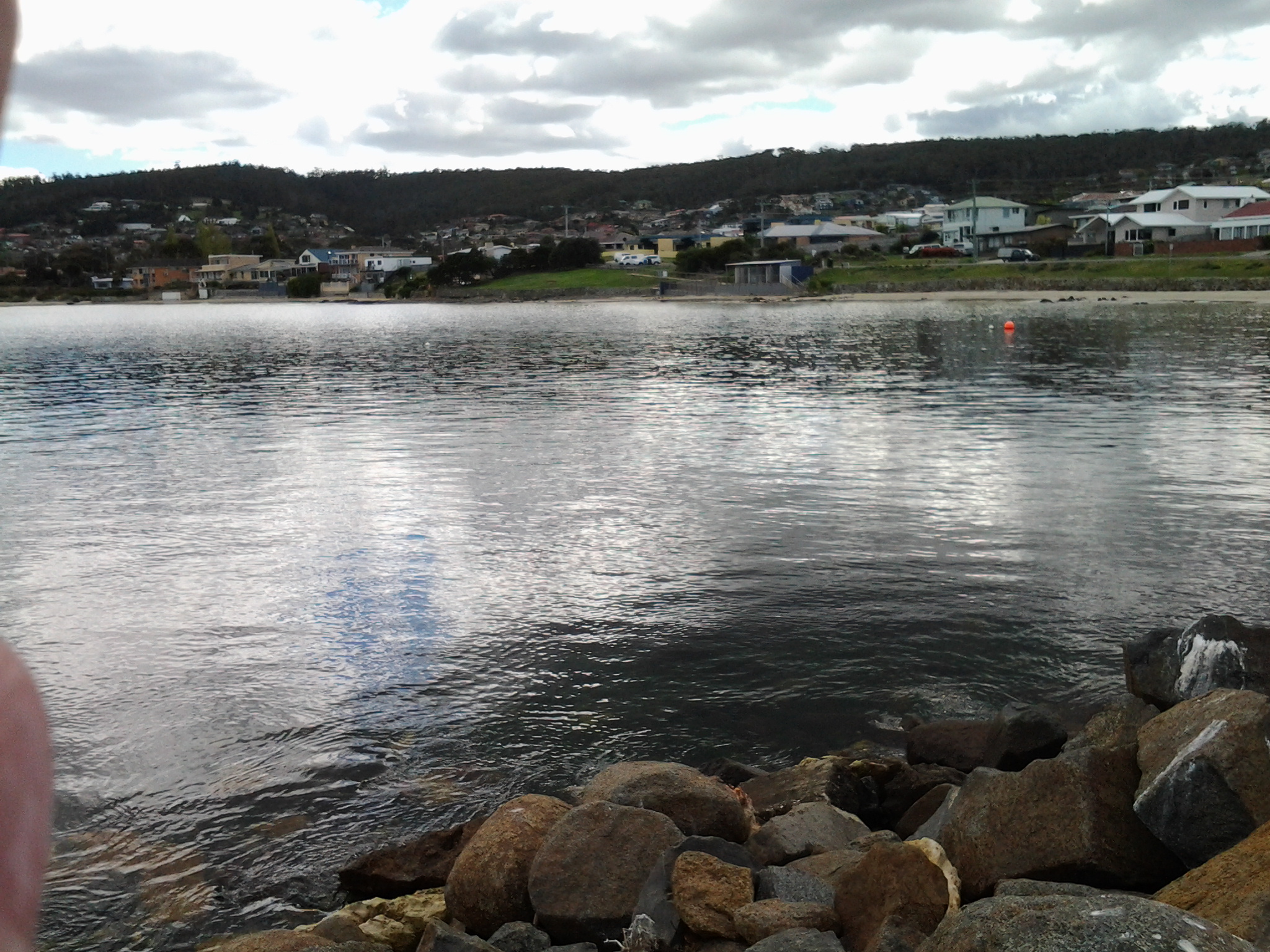
Bellerive Beach is much frequented by fitness fanatics, walkers, joggers, kids, families, individuals, and dogs on leads with owners.  The clean sand, the tide moving the Derwent up and down the beach, and the startling prominence of Mount Wellington are always welcome.

20140926_115121

Near the far end of the Bellerive Beach, a massive structure looms above a row of tall pine trees. This is Blundstone Arena, once known as the Bellerive Cricket Ground. This sportsground, as a national venue for international and local cricket games in the summer, also hosts major AFL (Australian Rules Football) and state level games during the winter months. Between Blundstone Arena and the beach are public toilets along the edge of the Clarence Foreshore Trail.

20140926_121450

Further on and next to the Trail, an outdoor adult gym inspires beach visitors and picnickers to push and pull and otherwise move their bodies.  From here you can see a blue and white painted building standing prominently.

20140926_115457

This is Bellerive Beach’s Fish Bar where fresh fish and other seafood is battered or crumbed and cooked while patrons wait. Dining in or taking away are the two options; the weather and wind generally controls whether I take a fresh cooked meal and sit on the edge of the beach with friends. I live in Bellerive and so I know very well this Beach and all the delights which it offers.

On this walk as usual, I brought my own packed lunch so I passed the Fish Bar and sat towards the end of the beach, and munched and contemplated the leisurely activity of others. A simple pleasure amidst the flighty flashing of hungry squawking silver gulls, all expecting to be fed.

20140926_120252

Shoreline Shopping and Hotel complex – as a stopover option on a walk along the Derwent River

Situated on Shoreline Drive in Howrah, this smallish shopping centre contains a variety of shops and facilities including a branch of the Commonwealth Bank, Woolworth’s supermarket, an optometrist, a pharmacy, children’s clothing store, a newsagent, a dry cleaner and eating cafes such as Subway and Banjos Bakery Cafe.

Amidst the car park and on the other side of the mini bus mall, the Shoreline Hotel offers a large bistro, bottle shop, a gaming section, 3 bars, a function area and accommodation.

For out of town visitors who want to copy the first four stages of my walk along the Derwent River, the Shoreline would offer a central position: the buses to South Arm and Opossum Bay and to Tranmere all pass through here.

Enjoying Little Howrah Beach on Stage 4 of my walk along the Derwent River

It was a relief to arrive at the calm peaceful Little Howrah Beach, after the constancy of the rock hopping stage around Howrah Point.  Looking back in the direction from where I had walked, the photo below shows my view across five kilometres of Derwent Harbour towards Mount Wellington and Hobart city beneath.

20140926_104157

I sat on a boulder and comfortably munched on some morning tea snacks.  The serenity of this Beach was remarkable.

20140926_104110

Across the road from the Beach I could see a tiny shopping centre: including a newsagent, pharmacy, hair salon and paint shop.  Public Toilets were located closer to the northern end of the Beach.

20140926_104118

Once walking again, the end of the 200 metre sandy beach was reached quickly and I picked a path through a short cluster of rocks before coming again onto the sand.  At this point I had choices; I could walk up to the Shoreline Shopping Centre for a drink or continue along the 1.2 kilometre Howrah Beach.

Walking around Howrah Point to Little Howrah Beach on Stage 4 of my walk along the Derwent River

This is not a walk I would recommend to others.

After leaving the main Clarence Foreshore Trail and for a while, I seemed to be walking on private property in someone’s garden; however there were clear markings that others had walked this way before. I realised people would not own all the land they mowed and that the Foreshore here would be public land.

Six minutes into this walk, the only way forward was to clamber down onto the rocks and, like a happy goat, wander up and down and up and down to continue.  Initially I rocked and rolled on large moving pebbles (ankle twisters) and from then on I was more observant about where each footstep was placed than looking at the scenery.

20140926_095638

Another five minutes later I was surprised to look up at a house with a flag pole on which flew the Tasmanian State flag. It is not often this flag is seen except on Government House and near our State Parliament building.

Continuing along, I enjoyed the colour of endless rocks with their bright lichens in every shade of yellow through to burnt orange. In places, the lichens almost ‘inflamed’ the rocks. Fabulous!

20140926_095625

Fences and gateways often barred entry to the homes perched above the rocks. A woman mowing her lawn waved to me.  Only idiots or friends would walk where I did.  To be fair, a lot of the rock walking was easy and a pleasant experience. However, since it took around 50 minutes for me to walk around Howrah Point to Little Howrah Beach, you can imagine that towards the end of the time and when I could see the main Howrah Beach in the distance, I did not want to retrace my steps. The difficulties were yet to come. If I had stayed on the main Clarence Foreshore Trail, perhaps I needed only to have walked for 15 minutes to reach the first beach for the day.

Within metres of reaching Little Howrah Beach, the Derwent River’s water reached the inaccessible bank. The few rocks above the water level were smooth and slippery with green water plants. Overhanging the bank were spiky branches from dead bushes.  Need I say more? This was not a safe place to walk. But I did continue and quite soon I sloshed up at the open ground adjacent to Little Howrah Beach.

Walking through Tranmere to the start of Howrah Point on Stage 4 of my walk along the Derwent River

As I walked back towards the city, the Clarence Foreshore Trail started as a concreted pathway for cyclists and pedestrians, then stopped and started as a formal walkway; sometimes I walked on the road and sometimes on the grassy verge.  Car traffic was almost non-existent. At bus stop 30 there were seats to enjoy the view, and a shelter offered protection from the weather. The air was perfumed with the smell of cypress trees expressing their oils as the early morning sun heated their branches. Magpie birds warbled musically from the trees. I spotted the occasional Pied Oyster Catcher, Cormorants holding their breath and diving deep for fish, and a single speed boat whizzing up the River in the distance. Very few people around.

When the track dipped down as a gravel pathway edging the Derwent River, the mowed lawns of the back yards of houses edged this walkway. Green. Peaceful. And without fences, I could appreciate the large picture windows installed in many houses, for the view of the Derwent Harbour and further beyond. Groves of Casuarina trees barely whispered in the slightest of breezes. Stands of almighty gum trees occasionally blocked the sun. Plump yellow beaked Dominican Gulls rested on sunny rocks above the moving water. Pairs of plovers hoping to protect their babies screamed overhead. A tourist sight-seeing aeroplane droned along the river. Walkers with their smiling happy Labradors, German Shepherds, Shitsus and all manner of other canines greeted me.

This was easy strolling but I was always edgy and watchful for any cyclists that might wish to share the pathway.

I saw evidence of Landcare – new trees have been planted, staked and surrounded with protective plastic. Occasionally I noticed public tracks from this Trail that went back up the hill to Tranmere Road, giving walkers the option of where they walked as they continued along the River. Occasionally I came across public seats where you could, if you wished, rest and enjoy the magnificent views. Swings and slides could be used by kids at the small Anulka Park.

Around 50 minutes after leaving the bus, I arrived at a sign which provided a list of plant species in Clarence, and which offered information about weeds and escaping exotics and the dangers these pose to our native vegetation. At this point, the Trail curved uphill and this is the way any future walker should go.  The alternative is comparatively difficult and dangerous.  However, I did not know this at the time and I decided to stay low and hug the Derwent River edge. I was about to walk around Howrah Point.

Taking Bus 615 to Tranmere last Friday – Starting Stage 4 of walk along Derwent River

Having travelled across the Tasman Bridge, through the Eastlands bus mall near the shopping centre, and onwards, the bus takes the main route along Clarence Street. Along the way a sign marking the Clarence High School, established in 1959, looms large on the right. The 8.23am bus typically will carry a swarm of students who will jump off at this point and then the bus may quieten for the remainder of the trip.  But others will jump on after desperate running and laugh as they fall onto the bus with eyes sparkling from the exertion. Bus trips can be alive with life being expressed in all sorts of ways.

By 8.44am the bus pulled in at the Shoreline Shopping Centre mini bus mall.  Once moving again, the bus run goes the other way to a stream of traffic heading towards the city centre. Moving down the hill, and near bus stop 19, the bus passes the Howrah Primary School located across the intersection diagonally from the Shoreline shopping centre, and a Shell fuel service station which is located on the opposite corner. Further down, the bus passes The Sunshine Tennis Club and the Howrah Recreation Centre including the Guide Hall. Near bus stop 20, a Caltex fuel service station and a suite of small shops is located on the right with the Howrah Beach beyond.  It’s not long before, as a passenger, I am greeted by stupendous views of the Derwent Harbour, Hobart city on the western shore, and the all-powerful Mount Wellington peering over all.  Soon after the bus turns left into Tranmere Road, I noticed Tranmere Hall on the right, and then a little later near bus stop 23, I saw a sign designating the Tranmere Coastal Reserve and a nearby public walk way down to the Derwent River.

After passing Anulka Park at bus stop 25, I continued on and left the bus at stop 31 at 8.53am.

Yet again I was fortunate that the day was magical. As I crossed the road to stand next to the serene Derwent River, I listened to the lyrical lapping of soft tiny waves across the rocks.  Silver gulls were floating languidly. A lone Pied Oyster Catcher was watching and waiting. Fluffs of cumulus cloud like fairy floss hung suspended in front of the mountain.  Cabbage butterflies flew through the long grass. Orange flowering nasturtiums climbed through bushes edging the shore.

I soaked in the grandeur of the environment and prepared to start the walk – this fourth stage of my walk along the Derwent River.

20140926_085649