Category Archives: Derwent River

The Shag Bay and Bedlam Walls area covers much loved and used aboriginal land of the Moomairremener people

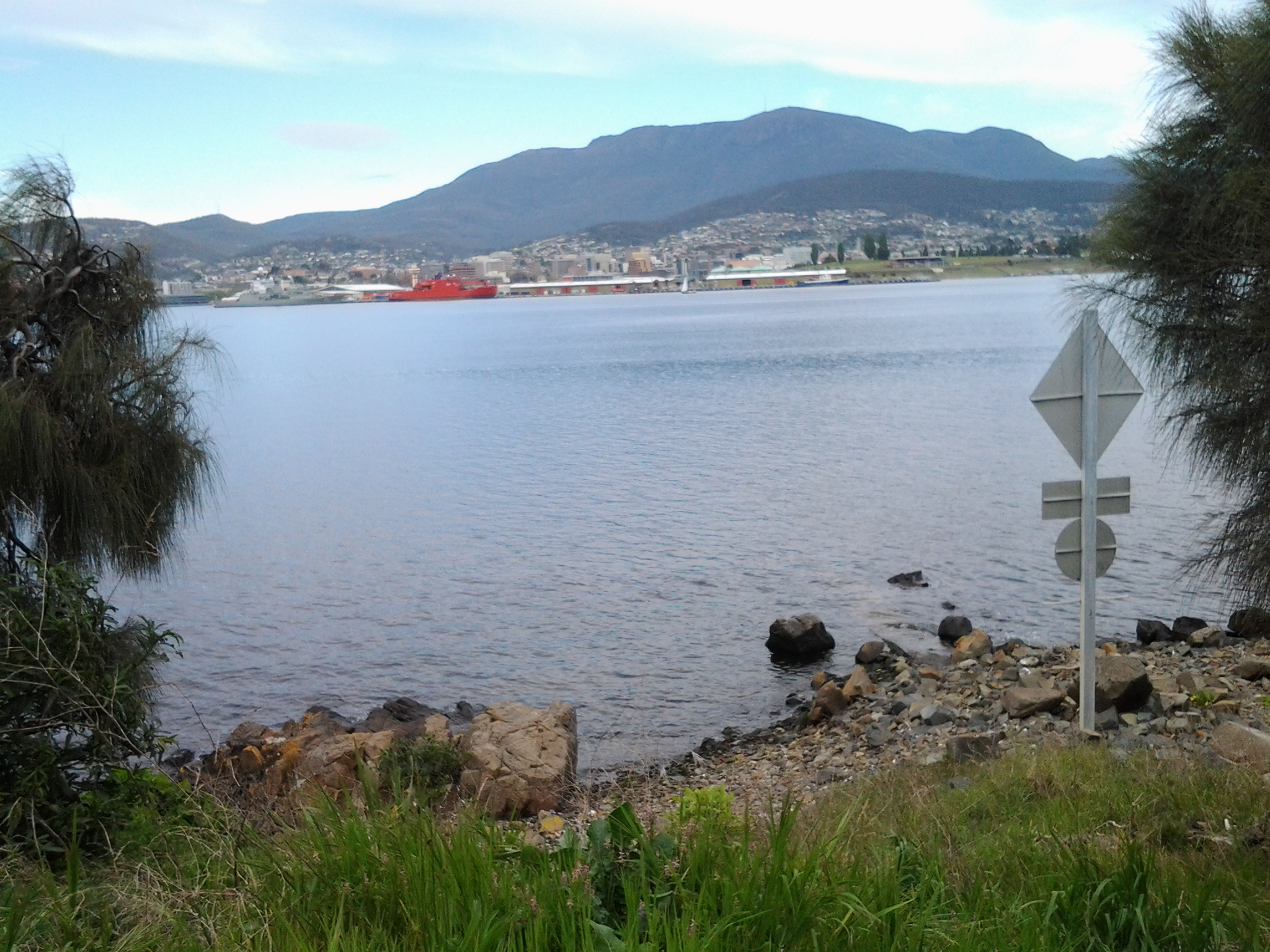
Various websites have indicated that the tract of land between Geilston Bay and Risdon Cove contains a great deal of evidence of land and river use by the original land owners.

Previously I acknowledged the traditional owners of the land along the Derwent River that I have been walking across. This land, before European settlement, belonged to the Moomairremener people however the early international settlers failed to understand that the local inhabitants had established government practices and legal systems, and worked with the land and sea to ensure an ongoing food supply. Unfortunately the characteristics which made the indigenous people civilised were different to those characteristics which made the settlers civilised. Because of their major cultural differences, both groups of people couldn’t grasp the positive values of each other. Each failed to learn from the other so that neither came to an understanding that the difference between them did not make one group better or worse.  As the new settlers encroached on aboriginal land and hunting grounds without understanding the value and significance of what they were doing and attacked aboriginal people, inevitably the Moomairremener people attacked in return.

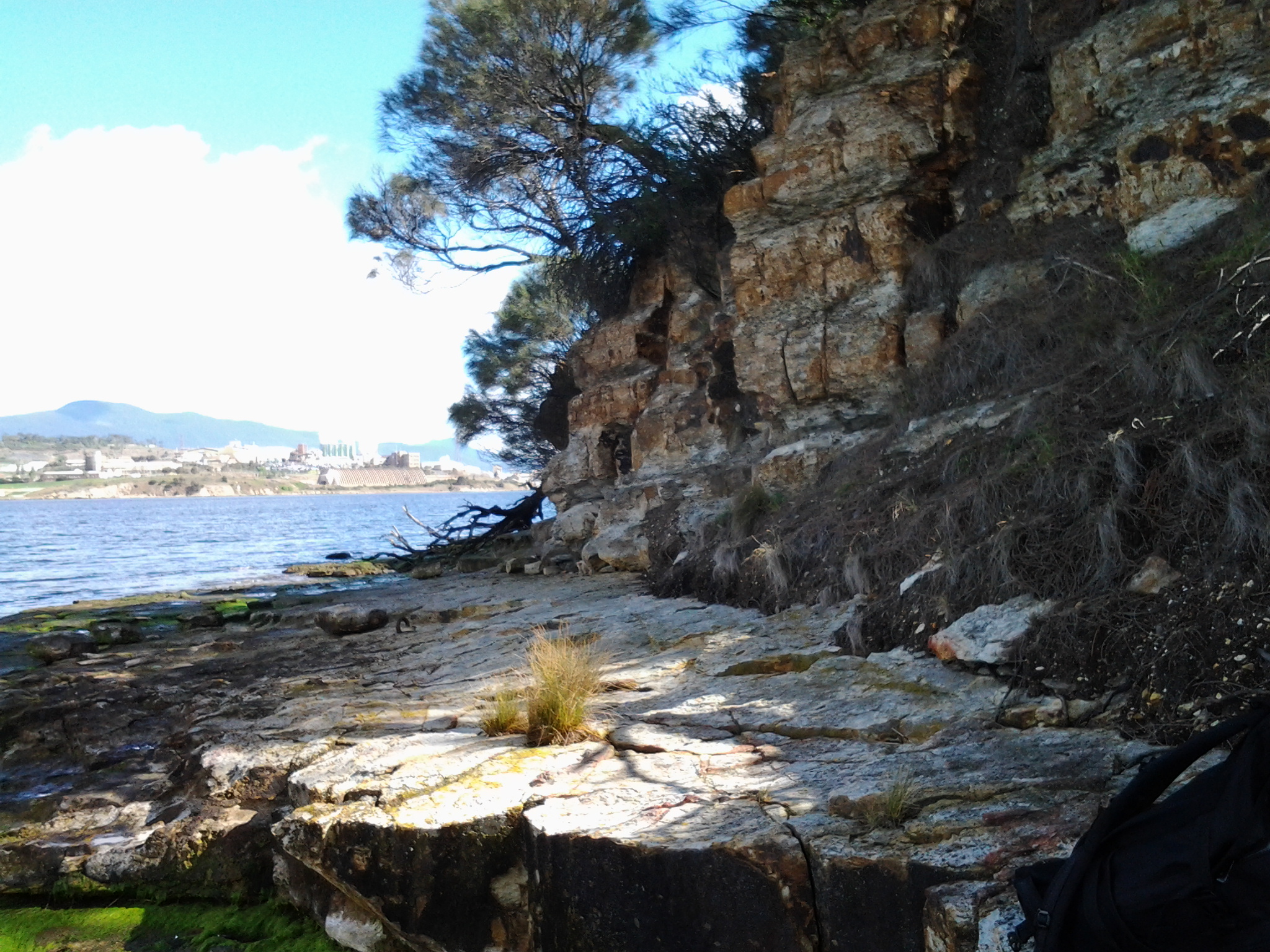
Bedlam Walls Point’s aboriginal cave, middens and quarry were the main features of aboriginal occupation that I expected to access during my walk. Regrettably I did not find the cave or the middens but I did see, at a distance, the quarry.  Another walk is needed to take more time to access these additional sites.

All the above are in easy walking distance of the site (Risdon Cove) at which, according to one story, an Aboriginal band hunting kangaroos was mistaken by whites for attackers and massacred (http://fieldnotestasmania.blogspot.com.au/2009/11/bedlam-walls-walk.html). According to http://www.australianhistorymysteries.info/pdfs/StudiesAHM-1.pdf “On 3 May 1804 there was a violent clash between a group of British settlers and a large party of Aboriginal people at Risdon Cove, near Hobart in Tasmania (then known as Van Diemen’s Land). Different writers and historians have given varying accounts of what happened then.”  In my view, neither option expressed on this website does any credit to the early settlers.

I cannot help thinking about the ongoing contemporary parallels where governments provoke fear by urging our populations to be vigilant against others who dress or look different. I cannot see this is a helpful way to learn to understand the benefits that different people can bring to all our lives.

Bird song on the track along the Derwent River

A glorious soundscape within a fresh and embracing landscape was my reward for Stage 6 walking along the Derwent River.

As I left the bus and began to walk along the marked gravel pathway nearby, a sulphur crested cockatoo screeched overhead. It was easy to enjoy the sunlit stand of poplar trees then Peppermint gum trees and other vegetation surrounding me.  Geilston Creek, with its paddling ducks, wound its way towards Geilston Bay on my right.

20141015_094500

The further I walked the more bird song I heard and the more native birds showed their colours. First I noticed a pair of pardalotes, then Jenny Wren and her mate the divine Blue Wren both collecting a meal of insects from the path ahead. To my left were sports ovals and tennis courts. 10 minutes after leaving the bus I reached a new walking bridge over the creek near the edge of Geilston Bay, garlanded by large flowering wattle trees at the entrance.

Once over the bridge I turned left onto a road, with a series of dinghy lockers visible on the other side of the creek, then a couple of minutes later the Bay was clear on my left and the last houses before the bush started were located up on the right. The track to Shag Bay started 15 minutes after I left the bus. Despite no breeze I felt the cold air hard on my face. But the air was deliciously clean, the environment pristine after the rain overnight, and the tranquillity of the vistas was sublime.

20141015_095242

The official sign in the photo above, which was located at the beginning of the track, includes a map showing the way to Shag Bay and on to Bedlam Walls. I trekked gently uphill parallel to Geilston Bay on an undulating gravel track and around me all manner of birds sang, whistled, chirped and squawked. An ornithologist would be able to identify those sounds, but mostly I needed to rely on seeing these feathered friends of the bush.  The sounds were inspiringly musical. It was a feast for the ears. I spotted a Black Faced Cuckoo Shrike.

20141015_100446

The photo above show where I had walked from: it looks down the track with Geilston Bay on the right.

Along the way, unofficial tracks led down to the water.  On this walk I had hoped to locate the known aboriginal cave but alas, I was unlucky.  I suspect one of those tracks would have led to it, and so I will return another day for further exploration. Previous research had indicated that our Parks and Wildlife Service government department no longer can afford the upkeep and safety practices that are associated with this cave, and that somewhere there are stairs to descend to the cave and a locked gate to prevent entry. Other bloggers have indicated this gate is easily climbed if you are prepared to take the responsibility to accept all risks. As yet I have no idea if Trespassers Prosecuted signs are in place for that location. A clear photo of the cave is available at: http://tastrails.com/shag-bay-heritage-walk/tastrails_shagbay_bedlamwalls/

At 10.05am I reached a split path and took the left hand route. The occasional gum tree was surrounded by open grassland containing frequent clumps of one of our native plants the Diplarrena Moraea, spiked with their white blooms. Tree roots slithered across the path creating a tripping hazard, so I walked slowly in order to absorb the views. At a second split in the path, again I took the left hand track.  This meandered downhill on slippery gravel under old Casuarina trees to the water’s edge. At 10.10am I stood on the rocky shore at Bedlam Walls Point.

20141015_101225

From the foreshore at Bedlam Walls Point, I looked across the Derwent River northwards to the industrial business ‘Nystar’ which edges part of the western shore of the river; a large zinc and lead smelting and alloying operation.

The photo below is also taken from Bedlam Walls Point and looks southwards. The headland on the left is the Lime Kiln Point marking the other entrance into Geilston Bay. Further afield the Tasman Bridge spans the Derwent River.

20141015_101301

Before I left the Point, I watched a few pieces of river traffic: cormorants diving for their fish dinners, the MONA catamaran, fishing boats, and the sailing yachts.

Generally tranquillity reigned. Then for a while, I walked the rocky edge back into Geilston Bay a little then retraced my steps again to walk around the Point and along the Derwent River edge hoping to find the cave.  Once it was obvious success with this search wasn’t likely, I clambered up the hill. By 10.25am, I was standing on top of a cliff on a little used unofficial track. I continued to walk along northwards and up the gentle hill with the intention of rejoining the official track. Before then, however, I came across an infrequently used 4 wheel drive ‘road’ and followed this instead. The main path was only 20 or so metres further inland. By continuing on the ‘road’ I walked closer to the River and found the experience very pleasant.  There were no other people, and no signs of native animals. Only beautiful bird song.

From Geilston Bay to Risdon on Stage 6 of my walk along the Derwent River yesterday

Yesterday’s walk was a sensationally wonderful experience. Over a few posts I will colour in the rich fabric of the day, much of it in clean fresh smelling bushland (such as that at Tommy’s Bight in the photo below).

20141015_133405

To start with, I caught Metro bus 694 destined for Risdon Vale and Glenorchy (scheduled from the Hobart city bus mall at 9.03) on the eastern shore and travelled to bus stop 14 on the East Derwent Highway at Geilston Bay. Thankfully the Clarence City Council has erected a sign marking the start of the walk.

20141015_093747

From the bus stop, I walked along the edge of Geilston Bay then northwards around Bedlam Walls Point to Shag Bay and onwards to the top of the Bedlam Walls, where I was rewarded with panoramas across the Derwent River. My northwards walk continued into and across the East Risdon State Reserve before descending into the suburb of Risdon. I turned south and walked on the edge of the Derwent River to Porters Bay where I took my lunch break before continuing south to Tommy’s Bight.

Eventually I retraced my steps back to Risdon and continued along the water’s edge to the junction of Saunderson’s Road with the East Derwent Highway. The return bus stop for a 694 bus, which arrived at 2.35pm (with not another one due for two hours), was on the Highway across from Risdon and adjacent to the land and water marking the Risdon Cove area.

I was away from home for approximately 6 and ¼ hours, and walked a total of around 12 kms winding over many tracks and retracing parts of my walk.

Previously I had walked 23 kms of the length of the Derwent River.  Yesterday I added 3 kms which brings the new tally to 26 kms.

Stage 6 of my walk along the Derwent River tomorrow – Tuesday

In preparing to walk from Geilston Bay north to Risdon Cove looking at natural and historical features along the way, I expect to make good use of initial research. Apparently I should see considerable evidence of past European and Aboriginal settlements and use of the land. Currently, there are no settlements along this edge of the Derwent River until the tiny suburb of Risdon is reached.

Birds between Geilston and Shag Bay

An obvious bird lover has blogged extensively on Tasmanian birds and, in particular, has walked part of the distance I will cover tomorrow.

More detailed information with glorious photos is available at http://tassiebirds.blogspot.com.au/2012/02/shag-bay-bluewings-more.html however, in summary; I should see a wide range of native birds if fortunate enough to be in the right place at the right time and with my eyes open.

Silvereyes, Black-headed Honeyeaters, Yellow-throated Honey eaters, Grey Currawongs, Blue-wing parrots, Yellow Wattlebirds, Brown Quails, Australasian Pipits, Dusky Woodswallows, Pied Cormorants, White-breasted Sea Eagles, Spotted Pardalotes, Dusky Robins, Black-face Cuckoo Shrikes, Grey Butcherbirds, Green Rosellas, New Holland Honeyeaters, Crescent Honeyeaters, and Brown Thornbills.  Phew!  What a collection!  I can identify some of these birds but not all. Therefore, I will be poring through my bird books later today to give me a better chance of seeing more and knowing what I am seeing.

Name of Shag Bay

Now is a good time to consider the name Shag Bay, the first Bay I will reach after Geilston Bay.  I cannot discover who gave the name, when, or why. In the absence of any information I have a theory. The common European bird Phalacrocorax aristotelis known familiarly as a Shag, is a species of cormorant. Cormorant birds are commonly seen fishing along our Derwent River. In fact, Tasmania has 4 species of cormorants with a vagrant fifth flying in from time to time. It seems very reasonable to imagine that the first Europeans, coming into what is now Shag Bay, repeatedly saw many cormorants fishing and so the name was easily applied.

Australia has developed a useful colloquialism: “like a shag on a rock”. This means abandoned and alone.  The Australian National Dictionary Centre explains “Any isolated person can be described as, or feel like, a shag on a rock – for example, a political leader with few supporters, or a person without friends at a party.”

Walking from Lindisfarne to Geilston Bay along the Derwent River last Friday

Gask

Talune St, Lindisfarne ended at the edge of the Derwent River, so I turned right to follow a pathway. At 11.45am the pathway continued along an extension of Paloona St before changing back into a shoreline Trail. Further on and next to the Clarence Foreshore Trail, an attractive weatherboard house named ‘Gask’, with an expansive enclosed verandah framing extensive Derwent River views, attracted my attention. Apparently this home was built in 1900 as a holiday residence for Dr William Crowther (but more research required confirming this because birth dates and the house dates do not make a suitable match). The property, originally named Villa Rose was renamed Gask, although I can find no explanation for this name. In 2010, the house was sold for over ¾ million dollars.

The Trail continued past the sweeping Koumala Bay where I watched the camouflaged catamaran speed past carrying its cargo of visitors from MONA to the city.

20141010_114355

In the photo below I have almost walked to Limekiln Point and the headland in the distance is Bedlam Walls Point. Limekiln Point is the southern location which corresponds with the northern Bedlam Walls Point across the other side of the gap where the Derwent River meets the waters of Geilston Bay.  At Limekiln Point I saw no remnants of any limekiln. Apparently Geilston Bay was initially named Lime Kiln Bay, so perhaps the lime works were centred around the curve of the Bay (more research required).

20141010_115251

Bedlam Walls Point will be the official starting point for Stage 6 of walk along the Derwent River.

My first view into Geilston Bay looked as follows:

20141010_120134

Closer to the Bay, my views included the following image which shows the walking track on the other side which I will follow in Stage 6 of my walk along the Derwent River:

20141010_120139

At midday, approximately 1km of my walk to the Geilston Bay Regional Park remained. The Trail became a gravel track, and while parts of the track earlier would have been suitable for someone using a wheel chair or crutches, much of the last 1000 metres of the track was better suited to mountain bikes, despite not being very hilly. Gardens cascaded down to the edge of the path and private uphill stony stairways ended in gates and fences. Jenny Wrens flitted through the undergrowth. Raucous sulphur crested cockatoos flew  screeching overhead. Colourful. Tranquil. Glistening light. Far from the maddening crowd (with apologies to Thomas Hardy). A perfect day.

I appreciated the skill in building a dry stone wall.

 20141010_120126

Sighting the first massive almond tree filled with growing fruit was a surprise, and then when I saw a few more I was amazed. Obviously, these were self-seeded and reseeding.  All growing between the Trail and Geilston Bay’s water edge.  I wonder when they will be ready to pick and eat.  Perhaps December or January?  Since they grow on public land, it will be a matter of first in first served.

Eventually the gravel pathway met with a formal Foreshore Trail and I continued around the Bay until I spotted a bench on the grey weathered wharf in front of the Geilston Bay Boat Club.  It was time to enjoy the view of Geilston Bay, Hobart city beyond and the ever present Mount Wellington.

20141010_120820

Friday’s walk was an easy simple experience and since it passed places, streets, and vistas I had never seen before, I loved it all.

From the Tasman Bridge to Lindisfarne along the Derwent River last Friday

Immediately after the Bridge, the Clarence Foreshore Trail ceased so I walked on the public road and then turned left onto a new road; Rose Bay’s Esplanade. From the cul de sac at the end of that road (which was parallel to the Derwent River), the Trail recommenced.  By 10.30am, I reached the spot where the Trail continued adjacent to a very long public road, the Esplanade.

The silvery blues of the Derwent River, Mount Wellington, and the Tasman Bridge provided a rich contrast to the green vegetation and the bright pink-flowered pigface plants that lined the Clarence Foreshore Trail as I continued walking through the Rose Bay area towards Lindisfarne Bay.  Throughout this Stage 5 of the walk I loved seeing the exotic flowers which had escaped from nearby gardens (and no, they didn’t run out of those gardens: the wind or birds moved their seeds) amidst the native plants because they created carpets and pops of sun-filled colour (I realise they are not good for the environment).

20141010_103138

During my walk from the Tasman Bridge, I was surprised to see a willow tree with its roots in the salt water of the Derwent River. Later in the walk I saw a couple of other large old willow trees on the banks of some Bays. Also surprising was the sight of a thick luscious stand of healthy silver beet proudly growing on the edge of the bank above the rocks.

Lindisfarne Bay

20141010_103210

The photo above shows my walk towards Lindisfarne Bay. From 10.50am, my walk left the Derwent River edge and began to take me into and around Lindisfarne Bay. A few minutes later I was passing the Lindisfarne Pump Station on the left of the Trail, and a massive enclosed kid’s playground with lots of holidaying loudly chattering families on the right of the Trail.  A set of adult outdoor gym equipment and public toilets were nearby.

20141010_105800

After 11am I passed the Lindisfarne Rowing Club, walked up to the continuation of the Esplanade road, and turned left for the Trail. I soon smiled at the duck crossing sign below.

20141010_110226

The Trail eventually turned left into Ford Parade where I noticed the Lindisfarne Scout Group Hall on the right with signs indicating the venue was available for hire. Around 11.09 I walked past the Lindisfarne Sailing Club, crossed the road and followed the Trail curving up and around a slight hill passing a wonderful old house named ‘Kentway’.  When this 1900 heritage home was listed for sale three years ago, its asking price was just under a million dollars. The sales spiel referred to the house’s Tasmanian Oak floors, and its ‘Blue Chip’ location. Lindisfarne was settled early in Tasmania’s history and has a wonderful array of houses of all vintages alongside the Derwent River.

Over the road, the Motor Yacht Club/ Returned Soldiers League displayed a sign offering meals available. I stopped by for a toilet break and was surprised how pleasant the place was with great views across Lindisfarne Bay.  I will get some friends together and enjoy their hospitality in the future.

Anzac Park

Continuing on the Trail, I reached a car park with Lindisfarne’s tennis courts on the other side. To the left was a dramatic gateway signed Anzac Park. It wasn’t clear that the Trail was through the gate, but I walked it, and found it was. By 11.25am, I reached a memorial to soldiers from the Lindisfarne area lost in wars since World War II.

20141010_112222

Further on an earlier war memorial remembering the locals who died in the first and second World Wars.

20141010_112509

Between the newer and older edifices, gardens containing memorial plaques for many were laid out carefully.

I left this area, Lindisfarne Point, around 11.30am all the while listening to the singing magpies, observing the tables and other seats that were plentiful for picnics, taking note of the Lindisfarne Cricket Ground on the right of the Trail and following the upper bitumen trail. Pathways continued down to the water of the small Beauty Bay with its kid’s playground however I trekked higher up in order to connect with the Trail and walk through the streets of Beltana Point. I turned left when I reached the small roundabout at Talune St.

Most attractive street

Up the road at the entrance to Koluri Court on the left, I spotted a very unusual sign. This street won “Most Attractive Street” in 1985 awarded as part of the Lindisfarne Garden Competition. Despite the fact that I was still walking along Talune St, I could see the lush foliage spilling from gardens.  In particular, the common plant was the Agapanthus, these days declared as a weed in Tasmania because it spreads into native bushland where it competes with native species. All parts of the plant are poisonous.

agapanthus

Photo from http://www.stockfreeimages.com/p1/agapanthus.html

What did I see on the walk along the Derwent River from Rosny to the Tasman Bridge last Friday?

Previous posts have explained the route I walked and the bus services that supported my walk from Rosny Point to Geilston Bay last Friday. This and a further couple of posts will provide colour and texture to those bones.

Once off the bus around 9.20am, I walked through a light open forest of wattle, gum, casuarina and other trees and could see snippets of calm Kangaroo Bay to my left. The photo below looks across the Bay to Bellerive Bluff which was the official finish point of Stage 4 of the walk. The suburb of Tranmere with Droughty Hill above, appears in the misty distance (the location of Stage 3 of my walk).

20141010_093831

The beautiful Bay seemed like murmuring silk. Almost no breeze. The whoosh of cars on distant roads seemed oddly out of time and place.

The Clarence Foreshore Trail passes the inaccessible Rosny Wastewater Treatment Plant on the left.  From the Trail, occasionally rough gravel tracks led down making it possible to reach the water’s edge and I could see Dominican Gulls on the rocks and the occasional Pied Cormorant. Around 15 minutes after leaving the bus I reached the Rosny Point curve where the land left Kangaroo Bay and moved around to edge the Derwent River.  A few minutes later, a Trail sign indicated the Tasman Bridge was 1.7 kilometres further on. I was thankful for the Trail because the narrow rocky shore was strewn with sharp broken oyster shells; later on I watched a family of Pied Oyster Catchers preening and resting – obviously they had eaten their fill.

A few days ago I posted the story that the ‘navy had come to town’. The photo below looks across the River from a place between Rosny Point and Montagu Bay and shows the grey green HMAS Arunta to the left of the orange Aurora Australis Antarctic icebreaker. Oh, and by the way, I discovered the Commander of this naval ship was once responsible for the HMAS Derwent.

20141010_094333

Close to 10am, I reached the Derwent River corner of Montagu Bay.  Harsh sounds filled the air; very vocal wattle birds and the growling of power brakes used by large trucks on the Tasman Bridge. From here, I had the choice to walk 200 metres up to the Rosny Hill Lookout. However, I continued on towards the heart of Montagu Bay past a clutter of upturned dinghies partly hidden in the bushes by the shore. By 10.05am, I was out of the forest and soon passing Langdon’s Welding shop on the left with workers out repairing some boats. By the Trail, I noted a large nectarine tree filled with the start of new fruit and made a mental note to walk this way in December when the fruit should be ripe.

At Montagu Bay I was stopped by an elegant contemporary public sculpture (unknown artist) which I did not know existed.  Well worth a visit. This was the Memorial to those who lost their lives when the Tasman Bridge crashed in 1975. Have a look at the photo below.

20141010_100906

The idea is that you look through these circles to pin point the part of the bridge which collapsed.  An information board provided additional information on this tragedy.

20141010_100832

The view across the Derwent from Montagu Bay was magnificent.

20141010_100852

Public Toilets are located near the Montagu Bay Reserve parkland area. This area is one of many that are child friendly with kids play equipment for free use.

20141010_100923

300 metres along the Clarence Foreshore Trail after passing huge old pine trees, massive gums with fanciful ‘painted’ bark trunks, then the Montagu Bay Primary School on the right, I reached the Tasman Bridge which I walked beneath to continue towards Rose Bay. The time was 10.20am.

The pleasures of people along the Derwent River

The people that I see and meet during my walks along the Derwent River always give me unexpected value.  My experience last Friday walking from Rosny Point to Geilston Bay was no exception.  People of all ages, sizes and racial backgrounds enjoyed being out and about.

There were joggers, runners, walkers, dogs leading their owners, a mother and father wrestling their son on the grass all laughing loudly and not a mobile phone or other communication device in sight, a man with a hand reel trying to catch fish from the rocks, cyclists who surprised me when they came up behind me and passed speedily and silently, the excited father and son who had seen a wallaby in the trees, a line of twelve senior men cycling without wearing lycra, five young mums in lycra with five new-baby laden prams in a row, kids skateboarding along the Trail, and families meandering to fill in the end of the school holidays. There was a man rowing a dinghy somewhere, a paddler in his kayak, and a boat motoring with trailing fish lines held by a family of three all wearing their life jackets.  Some I chatted with, for some it was a nod of ‘hello’, and for others we exchanged a wave and a friendly smile. I find that until around midday most people expect to and enjoy acknowledging others, then in the afternoon for some unexplained reason the experience changes and people are more reserved; perhaps the weight of the day has started to drag on them.

Two specialities of my walk last Friday were:

  • Along our public reserves and walkways, dog walkers can collect a black plastic bag so that when their Big Dog or Little Missie does a poop, the owner can collect the droppings from the path into the bag and add it to the garbage bins further along. The common sight is to see owners swinging a bag of excrement as they continue their walk. But on Friday I watched an innovative practice – and not one that is likely to catch on (hopefully not).  A man was walking along and he was emptying his plastic bag. Inside his bag was a mix of dirt and straw.  After the dog had pooped on the path, he poured a little of this mix over the droppings to cover.
  • A woman doing interval training by walking and running along the path stopped to talk to me about the dolphins she had seen. Her eyes sparkled. Apparently 6 dolphins were playing around the boats in Kangaroo Bay (located between Bellerive Bluff and Rosny Point). Where I had left the bus to start the walk, trees obliterated my view of the Bay at the point where the dolphins would have been. I was pleased the dolphins felt safe to be there and sorry to have missed seeing them.  This event reminded me that years ago, after I met an internet dating partner for the first time at Bellerive’s Waterfront Hotel, we walked along the edge of Kangaroo Bay and watched a small pod of dolphins swimming and enjoying themselves. It says something about me that I enjoyed that experience more than the date.

The photo below shows one of the many dogs that enjoyed their morning walk last Friday.

20141010_093850

Buses for walking the Derwent – Rosny to Geilston Bay and back to Rosny or Hobart

The website for Metro Tasmania is http://www.metrotas.com.au. When you get onto the bus you should ask for a DayRover bus fare so that you can get one ticket to be used on and off buses throughout the day.

Getting to Rosny Point

Only bus number 670 travels from Hobart city to Rosny Point but this only occurs late in the afternoon.  Therefore, from the city centre bus mall in Elizabeth St, Hobart take any bus travelling to the Eastlands Shopping Centre bus mall, Rosny Park. Please be aware not every bus that travels over the Tasman Bridge to the eastern shore of the Derwent River comes through the Eastlands Shopping Centre bus mall, but most of them do.  Consider buses numbered 605, 606, 608, 613, 614, 615, 620, 625, 638, 640, 642, 643, 644, 646, 648, 650, 652, 660, or 662. However, I recommend you always ask the driver for confirmation.

From the Eastlands Shopping Centre you have two choices to reach Rosny Point; bus number 670 (Rosny Park to Hobart City) or 675 (Rosny Park to Rosny Park Loop).

Once in the Rosny Point area, get off either at bus stop 20 or 21. Then take the road that travels down to the water from between these two bus stops. Continue walking along the road and eventually it clearly changes to the Clarence Foreshore Trail. This Trail is sometimes marked with a sign naming it. At other times the un-signposted bitumen or concrete pathway, with a broken white line marked down the length, indicates to walkers and cyclists to keep to the left hand side of the path. The Clarence Foreshore Trail continues along the Derwent River in various styles until Geilston Bay, and includes some road walking without the pathway. Along the way it is possible to stop the walk and access various buses.

Leaving from Montagu Bay if you wish

Both the 670 and 675 travel through the suburb of Montagu Bay so, having rounded the Rosny Point and arrived at Montagu Bay, it is possible to catch a bus either back to the Eastlands Shopping Centre, or to Hobart city.

Leaving from Rose Bay if you wish

Once you have left Montagu Bay and walked under the Tasman Bridge, you are in the area of Rose Bay.  To access a bus you would need to walk along the Clarence Foreshore Trail for some distance (perhaps 20 minutes) then walk up and away from the Derwent River until you reached the East Derwent Highway which runs somewhat parallel to the River. To bus back to Hobart, you should cross this Highway and wait at a bus stop on that higher side.

Leaving from Lindisfarne if you wish

Continuing onto Lindisfarne and its Bay, four buses regularly pass along the East Derwent Highway. In addition, two buses travel down the main street of Lindisfarne’s village (Lincoln St).

Departing from Geilston Bay

At Geilston Bay there are no buses at the wharf. Two choices: to walk up to Derwent Avenue through the suburban streets south of the Bay and find a bus stop along this road or, as I did, walk for 8 minutes to the East Derwent Highway along De Bomford Lane. Cross the road when you reach the Highway. Wait at bus stop 14 located left from De Bomford Lane on the Highway. If you do not cross the road you will end at the outer Greater Hobart Area suburb of Risdon Vale.

Walking the Derwent from Rosny Point to Geilston Bay – Stage 5 October 10th

A maximum temperature of 20 degrees but with a 70% chance of rain was Friday’s weather forecast.  However, I was so desperate to get out and walk another stage that I decided to brave whatever today would throw at me. I am delighted to record that only sunshine between partly clouded skies and the occasional warm breeze greeted me for the 4 and ¼ hours I was away from home.

First up, I was the only passenger to catch the 9.15am Metro bus number 675 to Rosny Point from the Eastlands Shopping Centre at Rosny (Note: this bus started at Eastlands and not from Hobart. Refer to my next posting to understand the range of bussing options for today’s walk).  Soon after passing Rosny College, the tennis courts and Bowling Club on the left in Bastick Street, I got off at bus stop number 21. I walked down Seabird Lane; this road angled down off Bastick Street between bus stops 20 and 21 and went along closer to the water of Kangaroo Bay. Seabird Lane leads into a continuing Clarence Foreshore Trail that passes along close to the River through the five suburbs: Rosny, Montagu Bay, Rose Bay, Lindisfarne and Geilston Bay. Later postings will detail how the quality of this path changes from one where a person in a wheelchair could comfortably navigate the Trail to other sections where a mountain bike would be more useful. I will also provide information about the challenges of lack of directions on and off the Trail from time to time.

Walking Time

The walking time between the point of Rosny Point and the point where the Derwent River meets the entrance to Geilston Bay is approximately 2 hours and 20 minutes. However, if you decide to take this walk, then in order to get to the starting point by bus from Eastlands and leave the Geilston Bay area by bus, the total walking time will be around 3 and ½ hours.

Walking distance

Today I walked approximately 12 kilometres, but this distance covered only 3.5 kms of the River length. Previously I had covered 19.5 kms of the length. Now I have achieved a total of 23 kms of the Derwent River.

Favourite photo

The photo below is my favourite from today’s walk. I clicked it while sitting eating my lunch on the wharf at Geilston Bay. The water reflections on the bow of the yachts on the left were sparkling, and the blue mountain provided a rich and colourful contrast in the background. Experiencing Geilston Bay for the first time was a treat. The starting point for Stage 6 of my walk along the Derwent River will begin here, so I look forward to seeing the place in the early morning light next time.

20141010_122959

The Perentie Lizard

The Perth Zoo in Western Australia looks after a Perentie Lizard (mentioned in the last posting) (http://perthzoo.wa.gov.au/animals-plants/australia/reptile-encounter/perentie/).

Perentie lizard at Perth Zoo

The Perentie is a Central Australian monitor (also known as a goanna) which is designated a ‘controlled animal’ under the Tasmanian Nature Conservation Act 2002. There is a low likelihood that this species could establish in Tasmania, with potential for minor impacts. The most significant impact is likely to be predation because Perenties have a broad diet and could potentially prey on a variety of native animals. These impacts are likely to be low because the Tasmanian climate is not suitable. This risk assessment categorises Perenties as a moderate threat to Tasmania and proposes that imports be restricted to those licence holders approved for keeping moderate threat species.

I have seen a few lizards during my walks along the Derwent River. Tasmania has fifteen different types of Skinks plus the Blue Tongue Lizard (some live in the rocks in my garden) and the Mountain Dragon. Delicate Skinks are a small, plain species, often found in suburban gardens in northern and eastern Tasmania.  Often I see a tiny Skink darting out of my way., but I do not know which type or types: more research is needed.  The photo below shows a Delicate Skink.

Delicate_Skink

The navy comes to town

From my home overlooking the Derwent River, on this grey overcast wintry Thursday around Hobart, I have just watched a small grey green naval ship charging up the Harbour accompanied by two tugs.  According to TasPORTS, the HMS Arunta was due to arrive at midday and it is now midday as it is edges along MAC4 wharf ready to moor. This perfect timing gives me great confidence in our Royal Australian Navy. Apparently HMS Arunta will depart on Monday at 10am.

HMAS Arunta (II)

When I checked the Royal Australian Navy website (http://www.navy.gov.au/), it referred to the historic ship, the HMAS Arunta (1) and provided information about the HMAS Arunta (II) (the ship which I have watched this morning). Apparently the HMAS Arunta (1) had a long history including action in World War II, was decommissioned in 1956 before sinking off the coast of NSW in 1969 having been sold for scrap.

The HMS Arunta (11) is a Frigate Helicopter (FHH) ship known as part of the Anzac class. Anzacs are long-range escorts with roles including air defence, anti-submarine warfare, surveillance, reconnaissance and interdiction.The ships are capable of countering simultaneous threats from the air, surface and sub-surface. Each Anzac frigate is fitted with an advanced package of air surveillance radars, omni-directional hull mounted sonar and electronic support systems which interface with a state-of-the-art combat data system.

The name “Arunta” comes from the Arrernte Aboriginal people (also spelt “Arunda” or “Aranda”) located in central Australia. Selection of the Arunta name and original motto ‘Conquer or Die’ recognises the ship’s proud history and the ongoing and special relationship with the ARRERNTE Aboriginal people. To maintain the warm and special bond between HMAS Arunta and the Arrernte people the Arrernte Council presented HMAS Arunta with a flag displaying a Perrente lizard. The lizard is an animal from the dreamtime for the Arrernte people. HMAS Arunta also sponsors a Perrente Lizard, the ships mascot, at Perth Zoo, Western Australia.

The five suburbs to be walked through in Stage 5 of my walk along the Derwent River

From Rosny Point to Geilston Bay, I will walk as close to the edge of the Derwent River as possible.

In so doing I will pass through five suburbs: Rosny, Montagu Bay, Rose Bay, Lindisfarne and Geilston Bay. Most were settled early in the existence of Hobart Town. In 1793, Lieutenant Hayes sailed up the River naming it and many points of interest. It was only a decade later the first settlement was made and in 1804 the final site for Hobart was established on the western shore opposite Bellerive and Rosny. Possibly Geilston Bay was named in the 1810s, Rosny in the 1820s, Montagu Bay in the late 1820s. Lindisfarne was named a century after the first settlement in 1903.

Rosny

The starting point for the 5th Stage of my walk along the eastern shore of the Derwent River will be Rosny Point. The suburb of Rosny, within the City of Clarence, is located on a narrow peninsula which juts out from the eastern shore at Rosny Point and climbs the rising slopes of Rosny Hill to the public Rosny Point Lookout.

According to one of my favourite information sources Wikipedia, Rosny was named by Walter Angus Bethune, the holder of the original grant of land on Rosny Point, after his ancestor the Duc de Maximilien de Bethune Sully of Rosny-sur-Seine  (a town situated slightly north west of Paris in France).  Bethune, a Scottish merchant, first arrived in Van Diemen’s Land in 1820 and was a significant player in the early development of Hobart and sheep farming. His descendants have played important roles in Tasmanian history.

Jean-Baptiste-Camille_Corot_-_Château_de_Rosny

Chateau de Rosny was painted by French artist Jean-Baptiste Camille Corot in 1840

Montagu Bay

This suburb was named after ‘mad’ judge Algernon Montagu, who in the early 19th century lived in Hobart Town before purchasing a property ‘Rosny’ in the Montagu Bay area of the eastern shore of the Derwent River. This small suburb sits on the river edge next to Rosny Point/Rosny and contains the Clarence Aquatic Centre and Montagu Bay Primary School. The Tasman Highway travels over a northern corner section of this suburb, leading to the Tasman Bridge which links the eastern Shore to Hobart and beyond on the western shore.

Rose Bay

The suburb of Rose Bay sits on the river edge next to Montagu Bay.

Rose Bay High School has a permanent camera facing across the Tasman Bridge over the Derwent River towards the centre of Hobart and with the back drop of Mount Wellington. Normally the site operates 24 hours of the day and night. The site is located at http://ozforecast.com.au/cgi-bin/weatherstation.cgi?station=11233&animate=6. Currently the site is being rebuilt, however I recommend you follow the progress and when re-established, save the site as a Favourite. Then you can see what the weather is like over Hobart and how gorgeous it can be to look at regardless of the weather in daylight and with the city lights sparkling at night.

Lindisfarne

While the exact origins of naming our Lindisfarne suburb remain unclear, the main thought is that from 1892 the suburb was known as Beltana. Then it was renamed Lindisfarne in 1903 after Lindisfarne a tidal Island (Holy Island) in Northumberland, a region in the far north east of England. The easternmost part of the middle of the suburb, where the Beltana Bowls Club and the Beltana Hotel are located, is still locally known as Beltana.

It has been suggested this suburb took its name from Lindisferne House, a property built in the 1820s near the suburb of Rosny. From the Clarence City Council website at http://www.ccc.tas.gov.au/page.aspx?u=1601 “Lindisfarne is thought to have been named by Hezekiah Harrison, a free settler, who was granted land in the area in 1823. Harrison had lived just a few miles from Lindisfarne Island, on the Northumbrian coast. Known as the ‘Holy Island’, Lindisfarne was the base from which St Aidan worked to spread the Christian faith through the north of England in the eighth century AD. However, it is unclear whether the area was named by Harrison or the next owner, Thomas George Gregson, a prominent free settler who purchased much of the land between Risdon and Rosny. Gregson grew up in Lowlynn, very close to Lindisfarne Island in England.”

Geilston Bay

Apparently the inlet of Geilston Bay was named after Colonel Andrew Geils who was appointed Commander of the settlement of Hobart in 1812. Colonel Geils lived on a property in Geilston Bay which he called ‘Geilston Park’.

Est-ce que je suis un flâneur?

Friend Ka suggested that ,in my walks along the Derwent River, I may have become what the French term, a flâneur.

I had never heard this wonderful word before, and with a little research discovered a great deal of information – and some very heavy stuff. After reading it all, I wonder – am I un flâneur, or not? The Oxford Dictionaries informed me a flâneur is “A man who saunters around observing society” and is derived from the French flâner meaning to ‘saunter, lounge’.

Wikipedia offered further information: “The flâneur was a literary type from 19th century  France, essential to any picture of the streets of Paris. The word carried a set of rich associations: the man of leisure, the idler, the urban explorer, the connoisseur of the street.  The flâneur was defined by Larousse in ambivalent terms, equal parts curiosity and laziness and he presented a taxonomy of flânerieflâneurs of the boulevards, of parks, of the arcades, of cafés, mindless flâneurs and intelligent flâneurs. The image below is by artist Paul Gavarni in 1842 and titled Le Flâneur.

Paul Gavarni Le Flaneur 1842

Wikipedia continued: In the 1860s Charles Baudelaire presented a memorable portrait of the flâneur as the artist-poet of the modern metropolis: The crowd is his element, as the air is that of birds and water of fishes. His passion and his profession are to become one flesh with the crowd. For the perfect flâneur, for the passionate spectator, it is an immense joy to set up house in the heart of the multitude, amid the ebb and flow of movement, in the midst of the fugitive and the infinite. To be away from home and yet to feel oneself everywhere at home; to see the world, to be at the centre of the world, and yet to remain hidden from the world – impartial natures which the tongue can but clumsily define. The spectator is a prince who everywhere rejoices in his incognito. The lover of life makes the whole world his family. Thus the lover of universal life enters into the crowd as though it were an immense reservoir of electrical energy. Or we might liken him to a mirror as vast as the crowd itself; or to a kaleidoscope gifted with consciousness, responding to each one of its movements and reproducing the multiplicity of life and the flickering grace of all the elements of life. Charles Baudelaire, “The Painter of Modern Life”, (New York: Da Capo Press, 1964). Orig. published in Le Figaro, in 1863.”

The website for The Arcades Project at http://www.thelemming.com/lemming/dissertation-web/home/flaneur.html explained that “Flâneur” is a word understood intuitively by the French to mean “stroller, idler, walker. He has been portrayed in the past as a well-dressed man, strolling leisurely through the Parisian arcades of the nineteenth century – a shopper with no intention to buy. Traditionally the traits that mark the flâneur are wealth, education, and idleness. He strolls to pass the time that his wealth affords him, treating the people who pass and the objects he sees as texts for his own pleasure. An anonymous face in the multitude, the flâneur is free to probe his surroundings for clues and hints that may go unnoticed by the others.  As a member of the crowd that populates the streets, the flâneur participates physically in the text that he observes while performing a transient and aloof autonomy with a ‘cool but curious eye’ that studies the constantly changing spectacle that parades before him (Rignall 112). As an observer, the flâneur exists as both ‘active and intellectual’ (Burton 1). The flâneur  has no specific relationship with any individual, yet he establishes a temporary, yet deeply empathetic and intimate relationship with all that he sees – writing a bit of himself into the margins of the text in which he is immersed. Walter Benjamin posits in his description of the flâneur that ‘He flows like thought through his physical surroundings, walking in a meditative trance, (Lopate 88), gazing into the passing scene as others have gazed into campfires, yet ‘remain[ing] alert and vigilant’ all the while (Missac 61). The flâneur is acutely aware, a potent intellectual force of keen observation – a detective without a lead. If he were cast as a character in the ‘drama of the world’, he would be its consciousness.”

The Paris Review at http://www.theparisreview.org/blog/2013/10/17/in-praise-of-the-flaneur/ remarked: “the idea of flânerie as a desirable lifestyle has fallen out of favour, due to some arcane combination of increasing productivity – hello, fruits of the Industrial Revolution! – and the modern horror at the thought of doing absolutely nothing. But, as we grow inexorably busier – due in large part to the influence of technology – might flânerie be due for a revival?”

Am I … can I be a flâneur? Whatever the answer to this question I am so grateful for Ka introducing me to this fabulous new word and all its ideas.

Update on the name Bellerive

New research, since that undertaken for my last posting where I indicated the name change happened in the 1830s, gives much more precise information. I have just discovered that the present name of Bellerive was officially proclaimed in 1892.  This news makes me understand clearly why Glover and von Guerard referred to the site as Kangaroo Point.