Tag Archives: Lyell Highway

ROCKY 6 discovered after leaving the Lyell Highway

On Stage 14 , I reached the turn off from the Lyell Highway around 12.45 pm and stopped to read my maps in order to be certain that I would find an alternative trail situated closer to the edge of the Derwent River than the highway.  From this boat ramp road (has a sign with boat ramp symbol on the highway), the trail looked definite and continuous so I peeled off from the Highway.

A few metres along the gravel road, a ‘parkland’ to the left of the road was covered with the gentle leaf droppings of the surrounding gum trees. In the dappled light, I noticed a row of large rocks standing to attention neatly, each with a name tag.

20150413_124926

20150413_124835 20150413_124840

20150413_124848 20150413_124908

20150413_124915 20150413_124919

A few metres from the rock row, a sign provided additional information. It seems the sign was placed here in 1988 as part of the Australian Bicentennial year of celebrations of European settlement. Who by and why is not clear.

20150413_124934

Were these rocks and the sign a help in understanding the local geology? Yes and no. Mostly the information on the sign referred to locations further west and north of New Norfolk, the town which is located a few kilometres west of this display. I did learn that, about the time when Tasmania was beginning to separate from mainland Australia 60 million years ago, the Derwent River began to form; a young river by the standards of some of the rivers of the world (the Rhine River began to form 240 million years ago, the Colorado River started forming about 75 million years ago, and the Nile about 70 million years ago).

Why was this location chosen to present this display?  Who, apart from the occasional walker like me, would find and examine this display? People travelling in vehicles would not be stopping to look. Rather they would be focussed on reaching the river edge ramp to launch their boats. Very strange.

Reaching the exit from the Lyell Highway leading to the Derwent River

On Stage 14, from Sorell Creek I continued walking on the Lyell Highway for a few kilometres until reaching a gravel road that exited on the right towards a boat ramp on the Derwent River.

During the walk, I enjoyed spectacularly beautiful glimpses of the Derwent River as it turned through the landscape.

20150413_122426 20150413_123009

20150413_123016 20150413_123125

I loved the enterprise of the roadside flower seller.

20150413_122639 20150413_122658

A few hundred metres before the turn off to the boat ramp I spotted a sign (see arrow on map to pinpoint the location).

Map of location 20150413_123932


Chatting with a traveller

On Stage 14 of my walk from Granton to New Norfolk by the Derwent  River, a car pulled off the road ahead of me at Sorell Creek. The female driver sat motionless. I plodded on and, as I walked past the car, she wound down her side window and asked for help.  A farmer from inland NSW, she and her daughter were staying temporarily in Maydena (http://www.discovertasmania.com.au/about/regions-of-tasmania/hobart-and-south/maydena), a small town on the way to Strathgordon in south western Tasmania – a town where our shy native platypus can be seen in the fast flowing Tyenna River, the waters of which eventually flow downstream to help keep the Derwent River level high.

While her husband worked that day, she decided to take a drive in the car and look around to see more of the country.

When we met, she wanted to find a route to the convict penitentiary at Port Arthur (http://www.portarthur.org.au) without needing to navigate busy Hobart city streets. Her only map was a small abbreviated tourist map of Tasmania that showed the main highways and a few towns. I dragged out some of my maps, and we chatted amiably while many options were considered.  Through these conversations I was clear that our road signage is designed for those who know where they are going, and not always for those who don’t know the terrain.

The thought of encouraging her to take the East Derwent Highway, come out near the Tasman Bridge and then need to cross three lanes of traffic immediately, filled me with dread.  When you are driving and unsure of where you are and how to get there, many signs and endless traffic can be disorienting.  I felt sure she would find herself in suburbia and never understand how to extract herself from there in order to be on her way to Port Arthur.

To take the Midlands Highway by crossing the Bridgewater Bridge, and travel towards Oatlands to find a cross country route, also seemed impractical.  Once off that highway, narrow winding roads lead eventually to Richmond but this would not help her easily to get onto a road leading to her destination, without much more direction asking of locals.

We settled on the option where she would continue along the Lyell Highway, drive along the Brooker Highway towards Hobart city, before taking the left hand exit to the Tasman Bridge near Hobart, and then driving across the Bridge.  I hope the blue airport symbol was posted liberally during that journey.  If she followed that symbol, then once at the final roundabout to the airport she knew to drive straight on.  We didn’t exchange contact details so I continue to wonder if she found Port Arthur without getting lost and without losing time.

At 12.15pm we parted company. I was glad to have had someone to talk with. Besides, she had been considering walking (http://www.bicentennialnationaltrail.com.au/) from the north to the south through Australia (a mere 5330kms from Cooktown in far northern Queensland to Healesville slightly east of Melbourne, Victoria).  I wish her all the best.

Sorell Creek sign post: Stage 14 of walk along the Derwent River

Around 11.35 am, directional signs at the Sorell Creek T junction with the Lyell Highway gave me useful information for me to gauge the distance I had walked from Granton and what was left to cover if I continued ‘straight’ to New Norfolk. As I crossed the actual creek flowing with a lot of water, I was made aware by a slightly mangled small blue sign, of a cemetery to my left; usually old cemeteries contain interesting stories but visiting it seemed like a deviation which would take me too far from the Derwent River so I continued on the Highway making a mental note to return another day to have a look at the Malbina cemetery.

20150413_113731

The main signs indicated New Norfolk was a mere 5 kilometres further north, if I stayed walking on the Highway – but I expected to be finding tracks off the highway taking me closer to river in the next half an hour.

20150413_113824

and the golden view when looking back south was also worth a photo.

20150413_113845

I wondered how many people commuted to New Norfolk daily by foot.  Probably zero numbers.

Time for a morning tea break on Stage 14 of my walk along the Derwent River

At 11.20 am, having been walking from Granton towards New Norfolk since a little before 8am,  the Sorell Creek area seemed a pleasant place to stop and take a break. The town is too small to have a shop so, as usual, I dug into my backpack for some prepared food to nibble.  I rested on a grassy bank near the road verge with my back to the Lyell Highway and surveyed the low paddocks with resting watchful cows, munching sheep and wandering geese.  Their backdrop were golden poplar trees with leaves dropping and blowing in the occasional breeze, and a strip of glassy dark blue Derwent River streamed behind. The crows were cawing. Traffic roaring. But the sun sparkled on everything I could see. The vista and experience seemed quite magically unreal.

20150413_113315

Raceway at Sorell Creek

Signs alerted me that I was approaching a raceway on my left as I walked toward the Mountain Dew Race Park on the edge of the tiny settlement of Sorell Creek (which is located closer to New Norfolk than Granton).  Photos on http://www.mountaindewiceraceway.com/ give an indication of the types of vehicles which race on this circuit.  It was all quiet as I walked past, and looking at their events calendar it seems no races are scheduled in the future.

A bus stop for the Derwent Valley Link bus service is located on this part of the Lyell Highway.

It was the rows of poplars changing from summer green to autumn gold that I will remember most. Absolutely stunning.

20150413_111323 20150413_111706

20150413_111901 20150413_111930

Seeing the paper mill at Boyer for the first time during the Stage 14 walk, was a thrill

After 15 minutes of walking, following my departure from the powerboat racing arena, the tarred road verges disappeared and weedy grass grew over lumpy and uneven ground to the edge of the Highway. I was forced to stand clear as cars and trucks approached, but there were moments when I could step out a rhythm walking on the Lyell Highway tarmac.  This situation continued for half an hour, however I was pleased that before and after this section I had a good metre or more width of road verge to walk along safely.

The features that could be seen from the Highway were varied: a feeding family of pelicans across the water; prominent Mt Terra on the other side of the Derwent River with Mt Dromedary behind; occasional tiny creeks lost in verdant grasses passing under the road; vehicle pull-offs at the edge of the road so boats could be entered into the water; corrugated iron cut-out full sized cows standing in a paddock; and a paddock full of horses their heads turned towards the sun.

20150413_100618 20150413_101444

20150413_104129 20150413_110252

20150413_110707 20150413_110741

At one part of the walk, in the distance and way south, the peak ‘Collins Cap’ pointed into the autumn sky.

20150413_105456

The distant paper making mills at Boyer showed their steaming stacks – an expanse of water, farming land or thickets of trees kept me separated. I knew these mills were very close to New Norfolk so that the larger the buildings seemed, the closer I was to reaching my destination.

20150413_100955 20150413_110604

By 10.50am I had a sense that I was returning to peopled land. Firstly I walked passed a long drive leading to a private house at the bottom of the hill; with long rows of old Radiata pines edging the highway.

A few moments later I passed the sheep grazing property named ‘Sunnyside’ on the western side of the road – a sign announced ‘Sunnyside’ was for sale.  You can make an expression of interest at http://www.domain.com.au/property/for-sale/rural/tas/sorell-creek/?adid=2010785567&sp=1 if interested. In the write up on that site, mention is made that the soils are based on limestone – makes the establishment of the lime kilns further south understandable.

At 10.54 am I reached a large cherry growing orchard on my right.

20150413_105358

Over the road to my left, on the property named ‘Scottsdale’ sat two old buildings which seemed late 19th century in architectural style. The sign on the gate declared this was the Derwent Dorper Stud (Rams), however this seems not to have a presence on the internet.

20150413_105407 20150413_105628

I noticed a Derwent Valley Link bus stop outside Scottsdale and the cherry orchard – for fruit pickers or shearers???  Certainly not for me. I had many kilometres yet to walk. New Norfolk was my destination, and so onwards I continued.

Powerboat racing on the Derwent River

I discovered the northern end of the Murphys Flat wetlands area came abruptly to a stop at the competition grounds for the Motor Yacht Club of Tasmania’s (MYCT) powerboat racing events (more information further below).

The area has a bland, functional entrance and I guess all the action and beauty happens on the Derwent River.

20150413_095502

The site is shared with another aspect of local community history.

20150413_095539

A metal arch over nothing and through which you don’t seem to be directed to walk, features the words HC MILLINGTON MEMORIAL AQUATIC with the letters MYCT over the top of the arch.  Millington’s Funeral Directors are well known in Hobart and it seems that the archway refers to Mr Harold Charles Millington who started out as a sometime professional cyclist and a wood craftsman before entering the funeral industry when, during the 1930s depression, people couldn’t afford new furniture but they died and were in need of burial coffins.  He died in 1969 so I am guessing the archway was built in the 1960s. I found Australian Powerboat Racing Association records for 2012 indicating the HC Millington perpetual trophy was no longer in use or destroyed. Was the dramatic archway and the trophy philanthropy, pure sponsorship or the result of lots of business arising from the area?  Why such an arch in an area where there are no houses and people would seldom visit?  Does anyone know the answer?

The area has been well cleared for vehicles and their boat trailers to be parked. This provided a dramatic contrast after the density of vegetation along Murphys Flat.

20150413_095628 20150413_095621

Even though the MYCT is based in Lindisfarne (I passed its club house during an  earlier walking stage), it runs powerboat racing competitions in conjunction with the Tasmanian Council of the Australian Power Boats Association, around Tasmania including at this Derwent River side facility between Granton and New Norfolk. Interested? Want to know more? Go to http://tasapba.com/about_us.html and at least one or two photos look like they were taken on the Derwent River.

As I researched information about the site, seeking the quirky and unexpected, I found that a Dianas on the Derwent race meeting is scheduled annually. No idea what that really means but I have taken a fancy to the title. In Roman mythology Diana was a virgin goddess of the hunt, the moon and childbirth with the power to talk with and control wild animals.  Perhaps the Dianas on the Derwent is a very young women’s racing event, where they hunt a winner’s trophy by racing at night, and their boats are their wild animals that require taming.  But childbirth?  Where does that fit?  Then I discovered a couple of You Tube videos and a related Facebook page. For example, https://www.youtube.com/watch?v=bs15dNuhMcw. In the video note the hands look male – so my theory about living goddesses driving speedboats seems to have flown. So what is this Diana thing about? Anyone know?

A 10 am I was back walking on the Lyell Highway having discovered that access to the road northwards along the Derwent River shoreline was impossible with barbed wires fences blocking the way.

20150413_100035

Green Island – do you know it?

How many islands are green with vegetation? How many blots of land are named Green Island? Probably many thousand.  Tasmania has a few ‘green’ geographical features spread around the state – followers may recall in an earlier walking stage I rounded Green Point on the eastern shore of the River. My walk along the Derwent River last week passed by a green Green Island.

While walking the length of Murphys Flat toward the northern end, across the water of the Derwent River I caught glimpses of a small length of low lying land in the flow of the Derwent River. Green Island was almost invisible from the western shore because the grasses in the Murphy’s Flat wetlands have grown tall.

This small piece of land provides a safe haven in which fish hang about the edges. New Norfolk Anglers Club members and others have enjoyed catching tagged salmon here.

Green Island is looked over by Mount Faulkner on the south western side of the river, and by Mt Terra and Mt Dromedary on the north eastern side.  On the map below, my arrow points to the slim Green Island near one bank of the Derwent River. The Lyell Highway is the yellow line curving through the lower part of the landscape. Murphys Flat is the fat area between the Highway and the River.

Green Island map

Only 10kms to go

20150413_092119

I blinked and double blinked. I almost missed the tiny green sign, probably no larger than my hand, on a pole opposite me as I walked from Granton to New Norfolk.

This tiny sign indicated that if I stayed on the Lyell Highway, I would only need to walk a further 10 kilometres to arrive in the town of New Norfolk. At that moment the end of the walk seemed so close, it was not yet 9.30am, and in a split second I thought the remainder of my walk for the day wouldn’t take long and I could reach my destination at lunchtime. But there was still a lot more walking to do, and later I would be walking off the main road following tracks – which would extend the journey. And later I would stop and chat with people – which would extend the time it took to reach New Norfolk.

Why are these wetlands called Murphy’s Flats? Who was Murphy?

20150413_090953

Thanks to http://www.parks.tas.gov.au/file.aspx?id=17347  I know that “Murphys Flat Conservation Area historically formed a portion of the property locally referred to as Marsh Farm, which was established through an ambitious land reclamation endeavour begun by Governor Arthur in 1824. The property was hailed as an agricultural “show place” throughout Tasmania and was one of the earliest land reclamations in Australia.”

The site http://www.derwentestuary.org.au/assets/NIE_-_wetlands.pdf provides the information that “In 1997 we nearly lost 40% of these wetlands when a farmer started draining the 66 hectare marsh known as Murphy’s Flat.”  This action was the catalyst for various tiers of government to step in and fund the process to purchase the land and retain it as a conservation area. The area known locally as Murphys Flat was acquired on 1 May 2001 by the Tasmanian Parks and Wildlife Service.

20150413_103930

The 2010 Management Statement at (http://www.parks.tas.gov.au/file.aspx?id=17347) is informative.
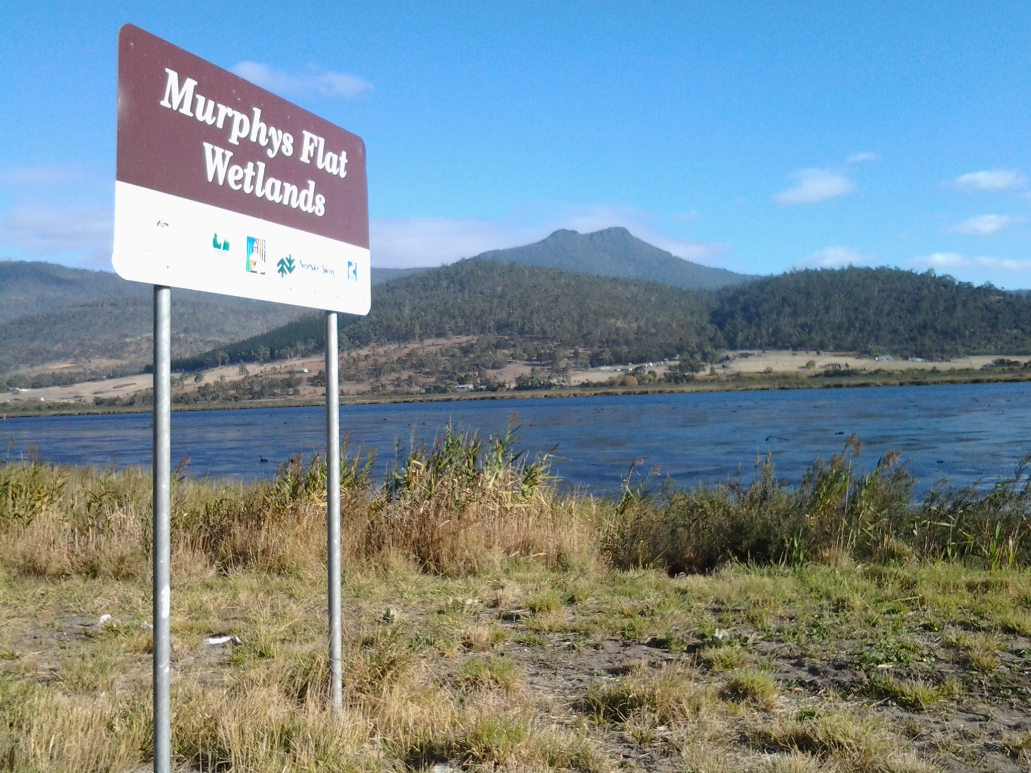
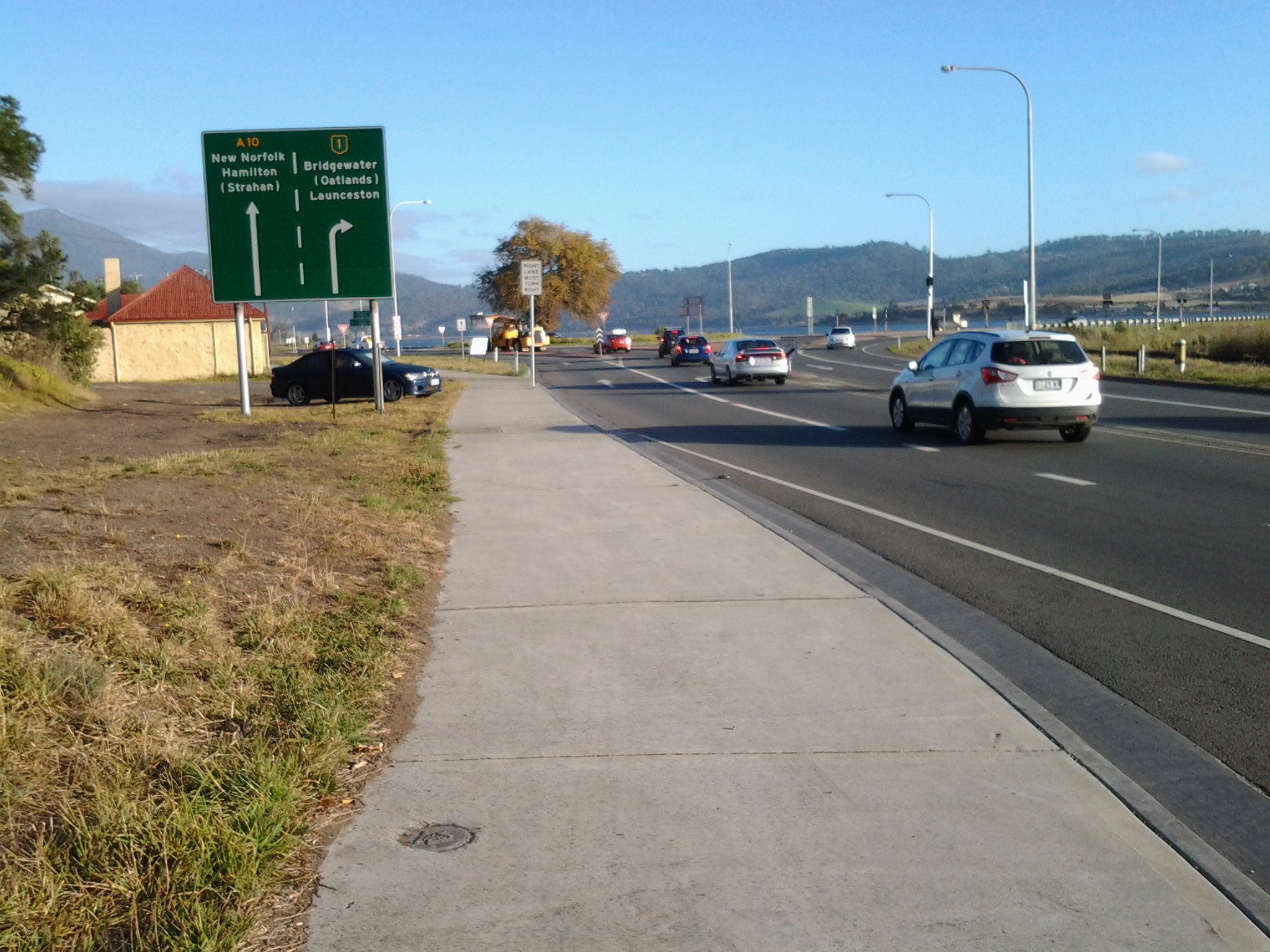
Murphys Flat Conservation Area is located within a wetland complex on the southern shore of the River Derwent beside the Lyell Highway between Granton and New Norfolk. The area has been recognised as being particularly species rich, with expansive areas of marshes, underwater grasses, tidal flats and reed beds that provide habitat and breeding areas for large populations of fish, platypus and waterfowl. Murphys Flat Conservation Area comprises 25 to 30 per cent of remaining wetlands in the River Derwent. It is listed within both the Directory of Wetlands of National Significance and the Tasmanian Geoconservation Database.

Birds are particularly abundant in the reserve due largely to the diverse habitat. The vicinity is well known for its large population of black swans and it is a likely hunting and foraging area for five significant bird species including the wedge-tailed eagle, white-bellied sea-eagle, swift parrot, masked owl and great crested grebe. The secretive, little-known Australasian bittern is also known to occur there.

Murphys Flat Conservation Area serves as a nursery for the sandy flathead and also provides important shelter for other juvenile native fish. Backwater areas of the reserve are of particular biological significance with unique botanical assemblages and an abundance of gastropod molluscs.

Until the early years of this century, “Murphys Flat was used as a dump site for domestic rubbish, garden waste and for overburden from road and earthworks. As a result, the area of wetland vegetation communities has decreased and its condition has been further compromised through the spread of weeds, largely from this source.” Now a weed control program has been instituted. “The vision for Murphys Flat Conservation Area is that it will contribute significantly to regional biodiversity and geodiversity in the upper River Derwent estuary, provide water quality services and research opportunities and be a vehicle for increasing public awareness of wetland values.”

In addition to the natural history and situation, Murphy’s Flat has a cultural history.

Firstly, the site is reported to have been on a travelling route for two Aboriginal tribes (http://www.parks.tas.gov.au/file.aspx?id=17347).

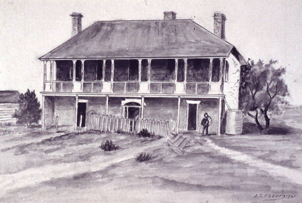
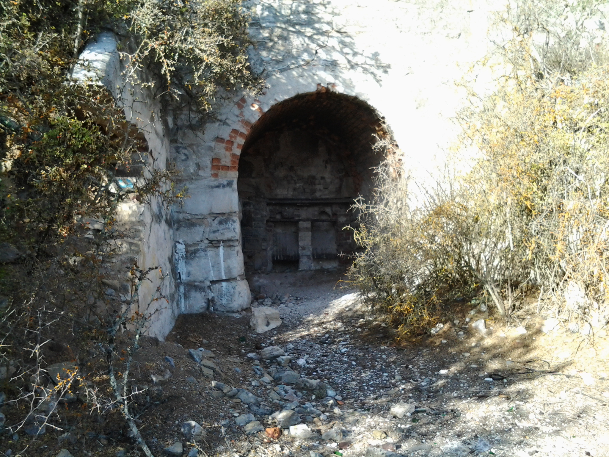
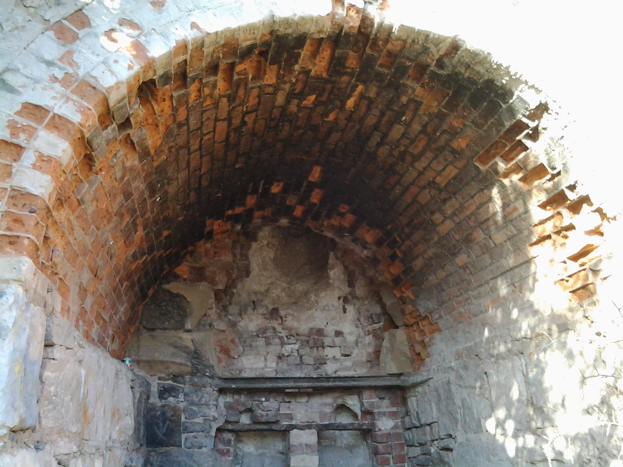
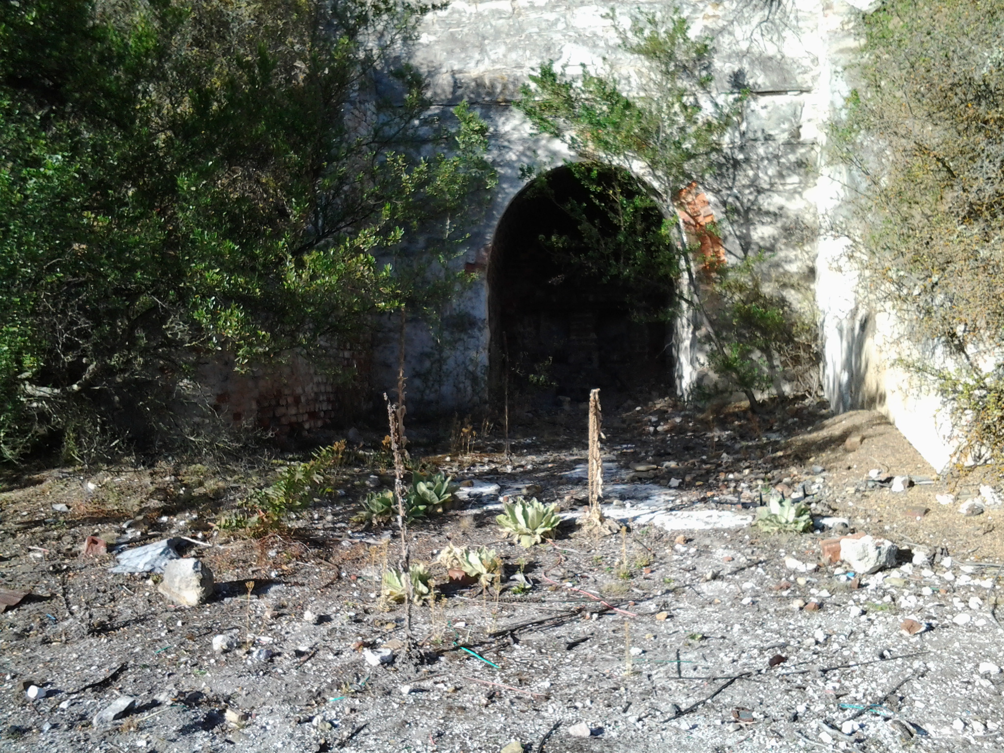
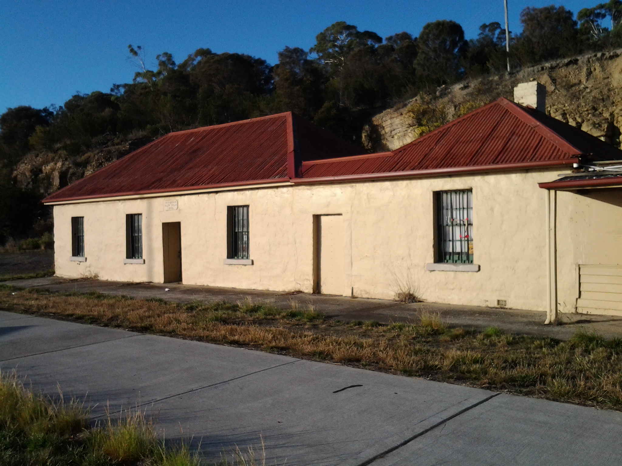
Then, according to Kelvin Markham at http://www.km.com.au/tasmania/ch14.htmFour miles beyond Granton stood a derelict grey stone house, known to all and sundry as The Haunted House. No one can tell why it received its name, though it is popularly (and wrongly) supposed to have been the country seat of early governors. The haunted house was originally the Golden Fleece Inn, licensed on 22 October 1824 to one Henry Fitzgerald. It did not long cater for travellers and in 1837 was on the market. This building was also called Addington Lodge Villa at one time.”

Add Lodge drawing -UTAS library

The image above is a drawing of ‘Addington Lodge Colonel Arthur’s Marsh Farm between Bridgewater and Sorell Creek Derwent Valley’ / ‘The Haunted House on the Granton New-Norfolk Road’ by artist A. T. Fleury c1931 – from the collection of Linc Tasmania

Photo of Addington Lodge

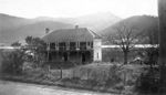
The photograph above is of ‘Addington Lodge, Granton, apparently a former residence of Governor Arthur’ – from the collection of Linc Tasmania

The National Library of Australia (http://trove.nla.gov.au/ndp/del/article/30094484?searchTerm=Anthony+Geiss) offers the information that “Addington Lodge was named after Mr. J.H. Addington, the Secretary to the British Treasury at the time. It was constructed by Governor Sorell to serve as a country house in 1820, a year after the construction of the Hobart to New Norfolk Road. The lodge was a double storey brick house with an architectural style typical of a late Georgian villa with symmetrical doors and windows and a wide fan-lit front door. The lodge was renamed the Golden Fleece Inn and opened to the public after a Mr Barker sold it to Mr. Henry Thomas Fitzgerald in 1824 having owned it for 4 years only. Addington Lodge at Murphys Flat became a popular half-way house for travellers between Hobart and New Norfolk and earned an unsavoury reputation.”

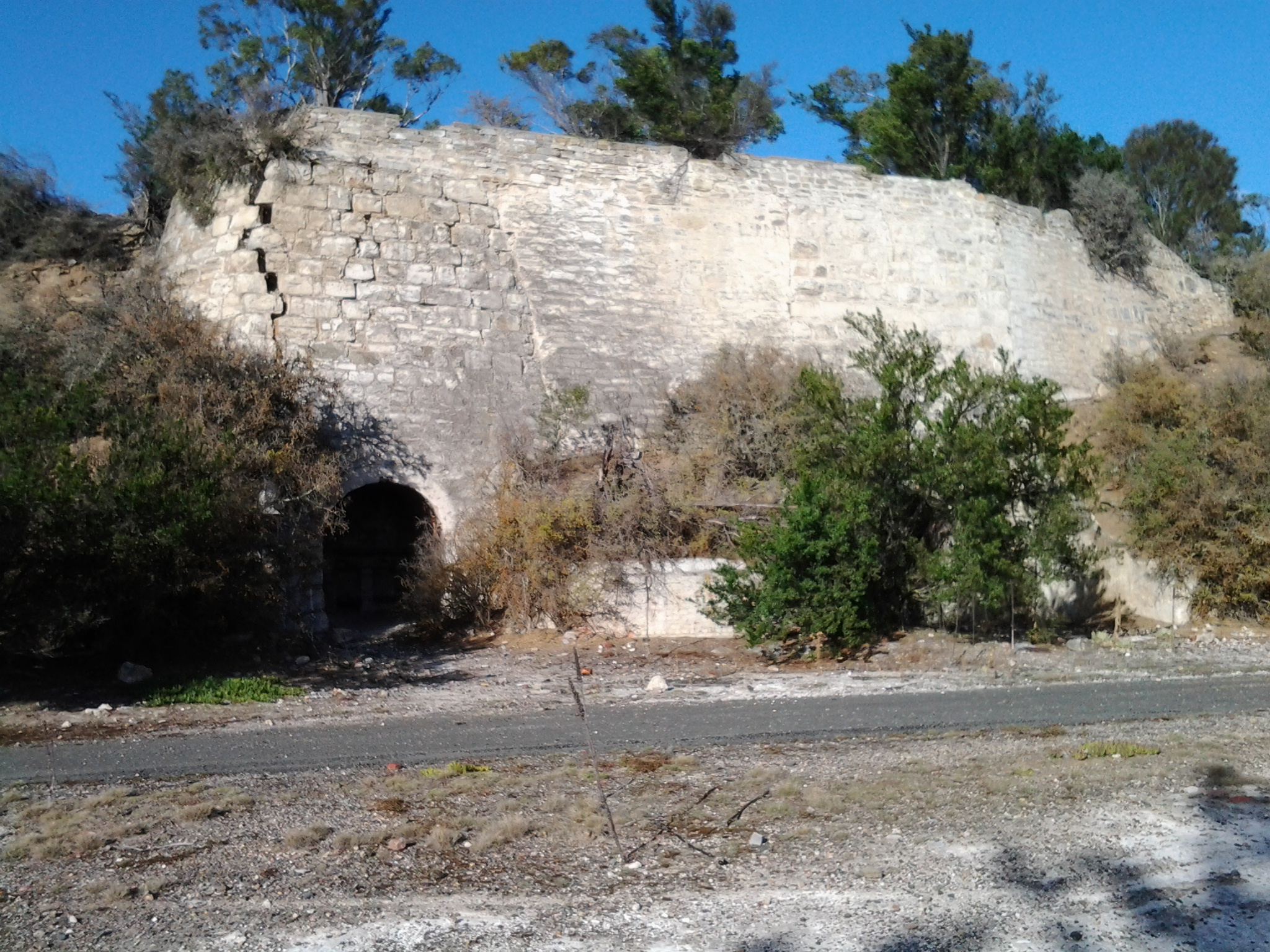
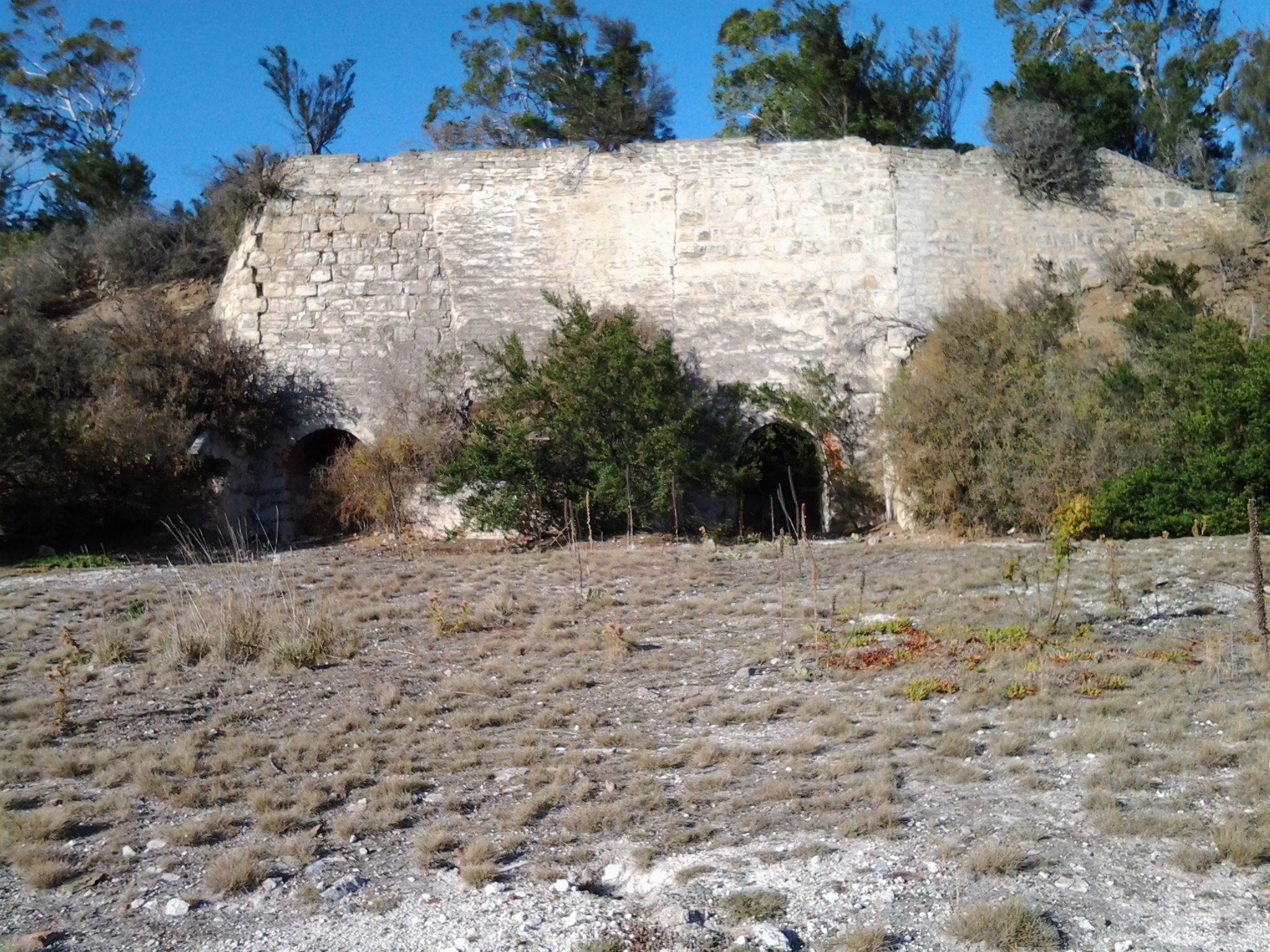
If remains of this house still exist they are now obscured from view by the lush vegetation  growing across the wetlands.  I saw no sign of it as I walked past Murphy’s Flat.

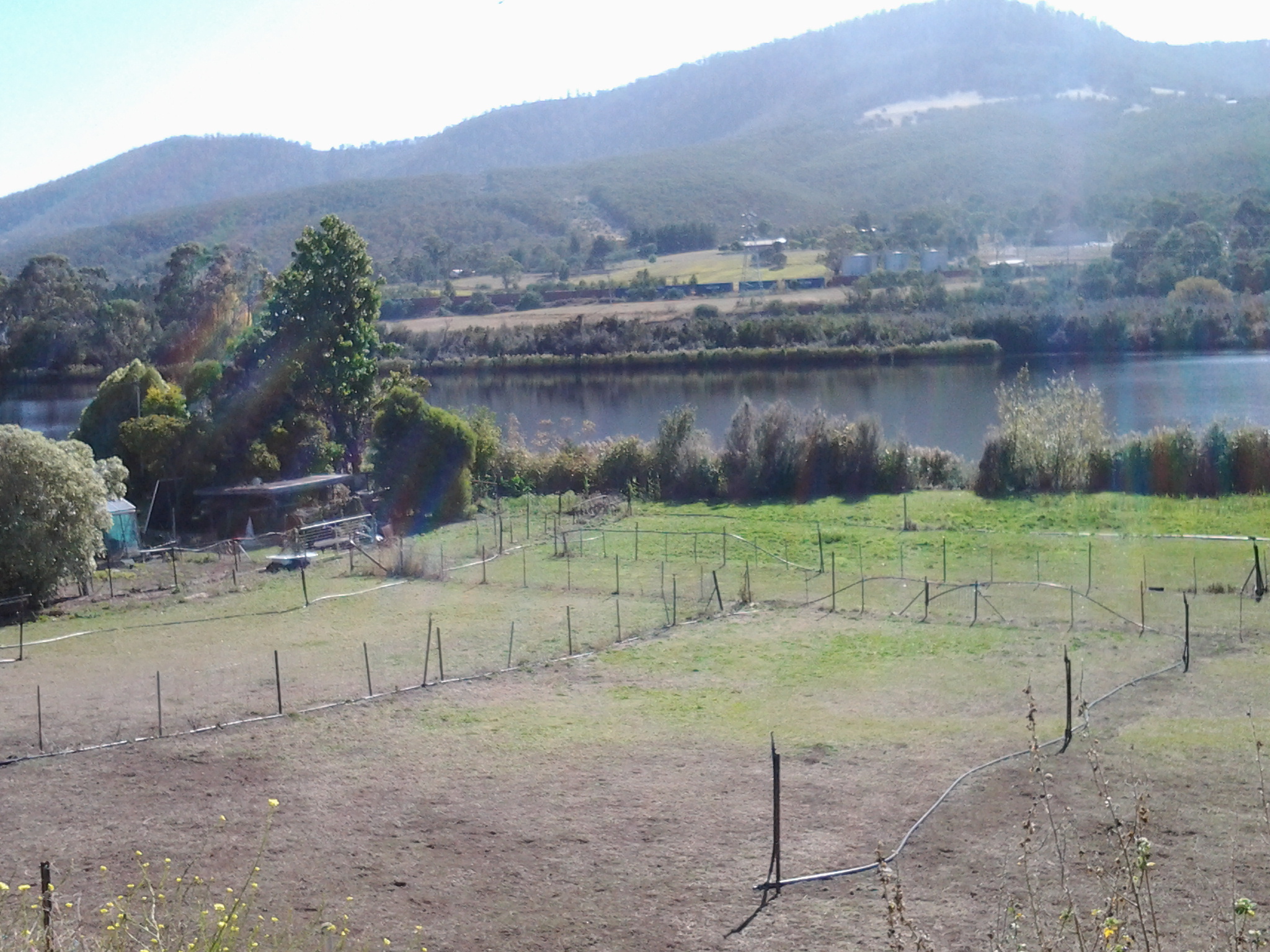
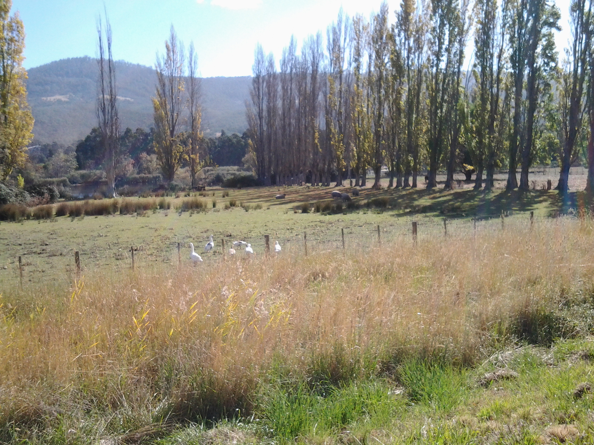
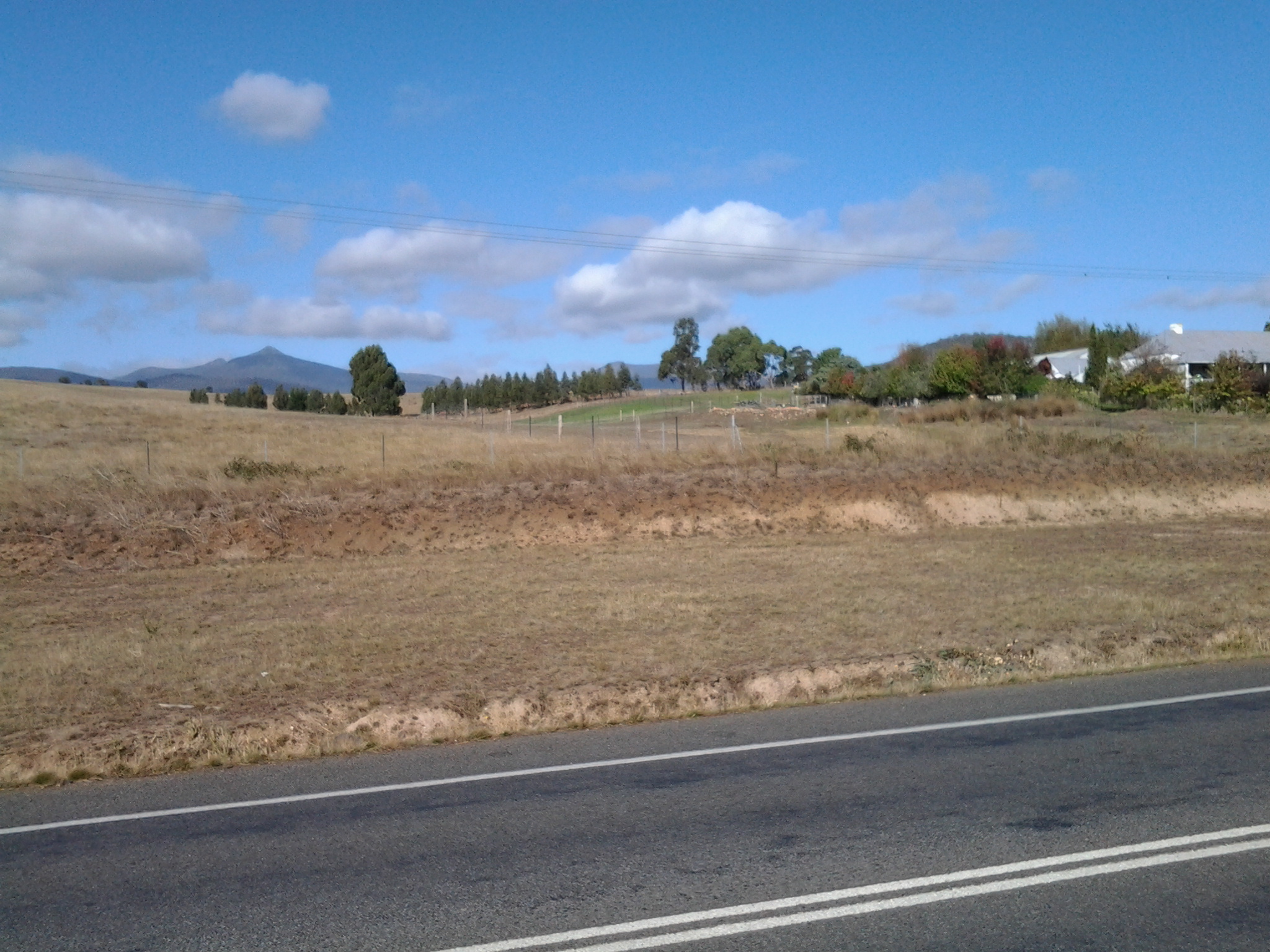
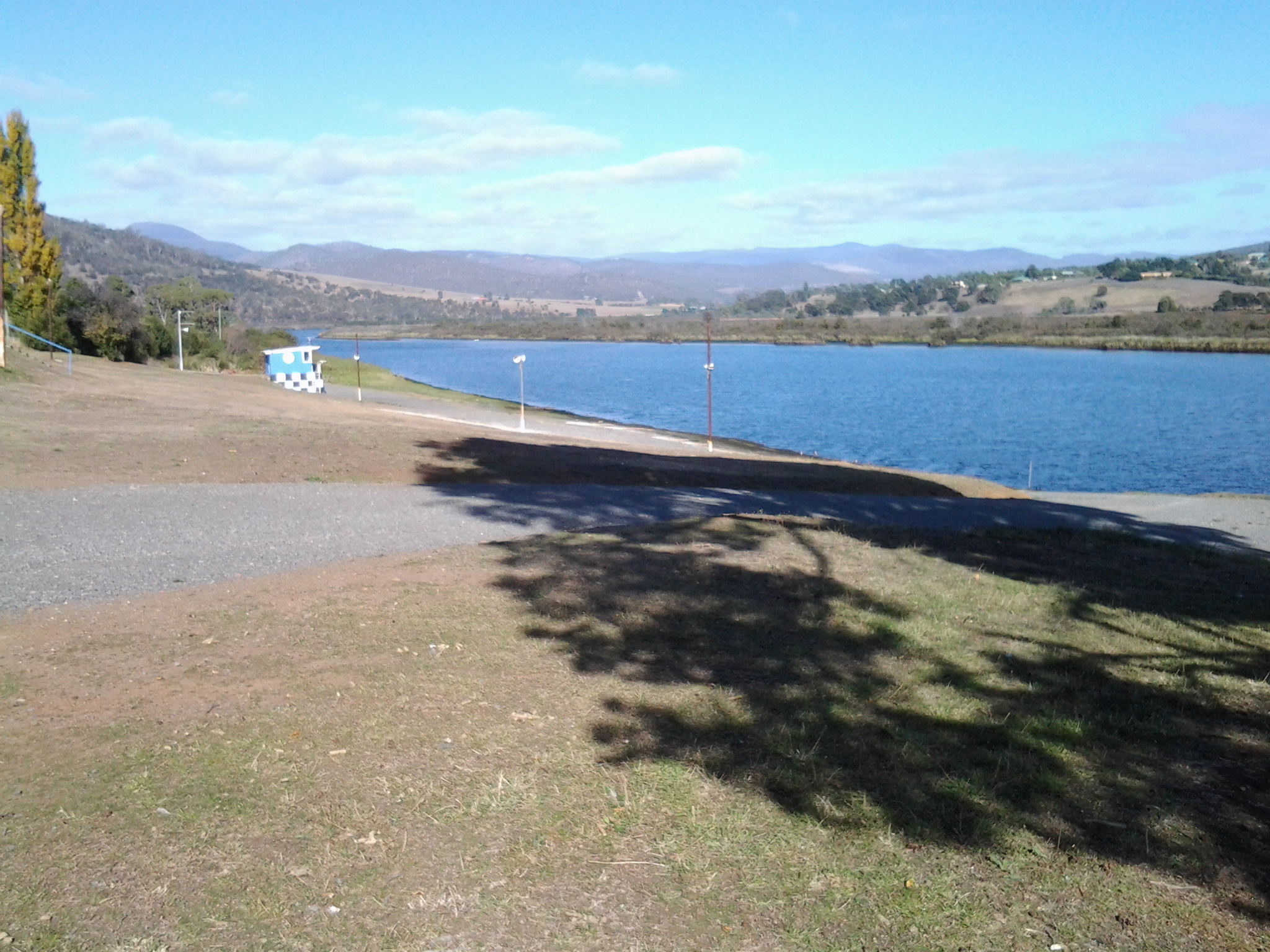
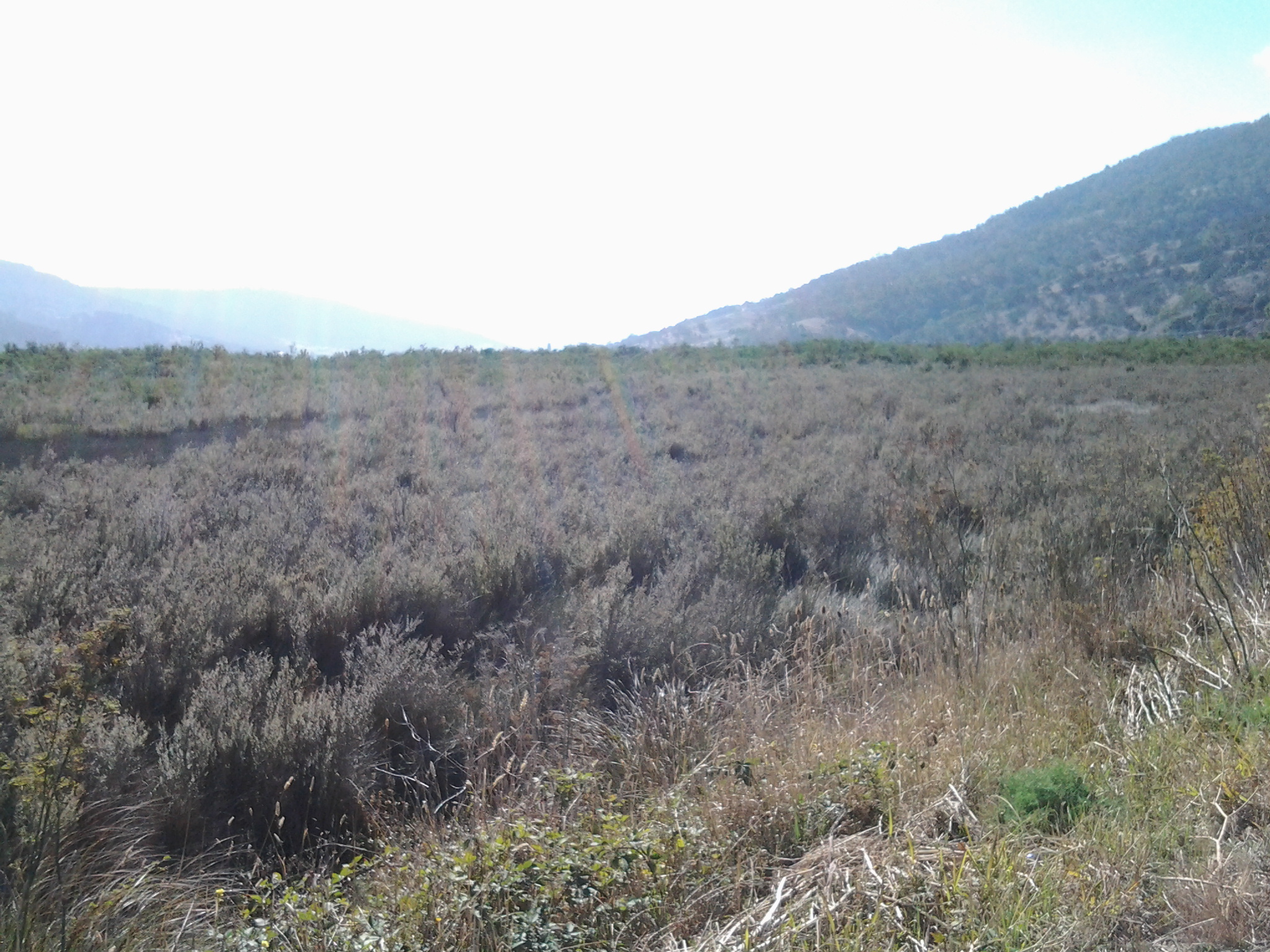
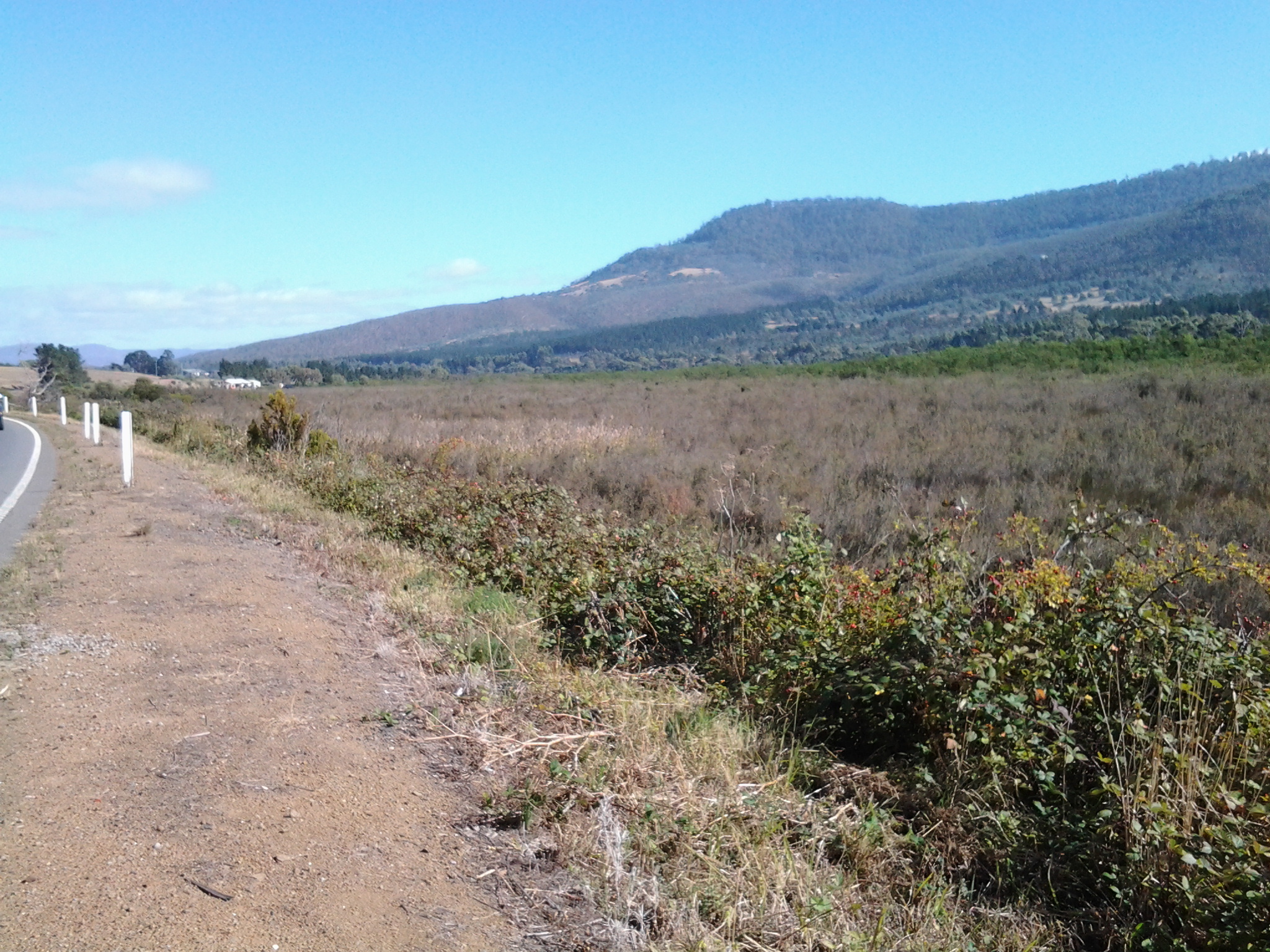
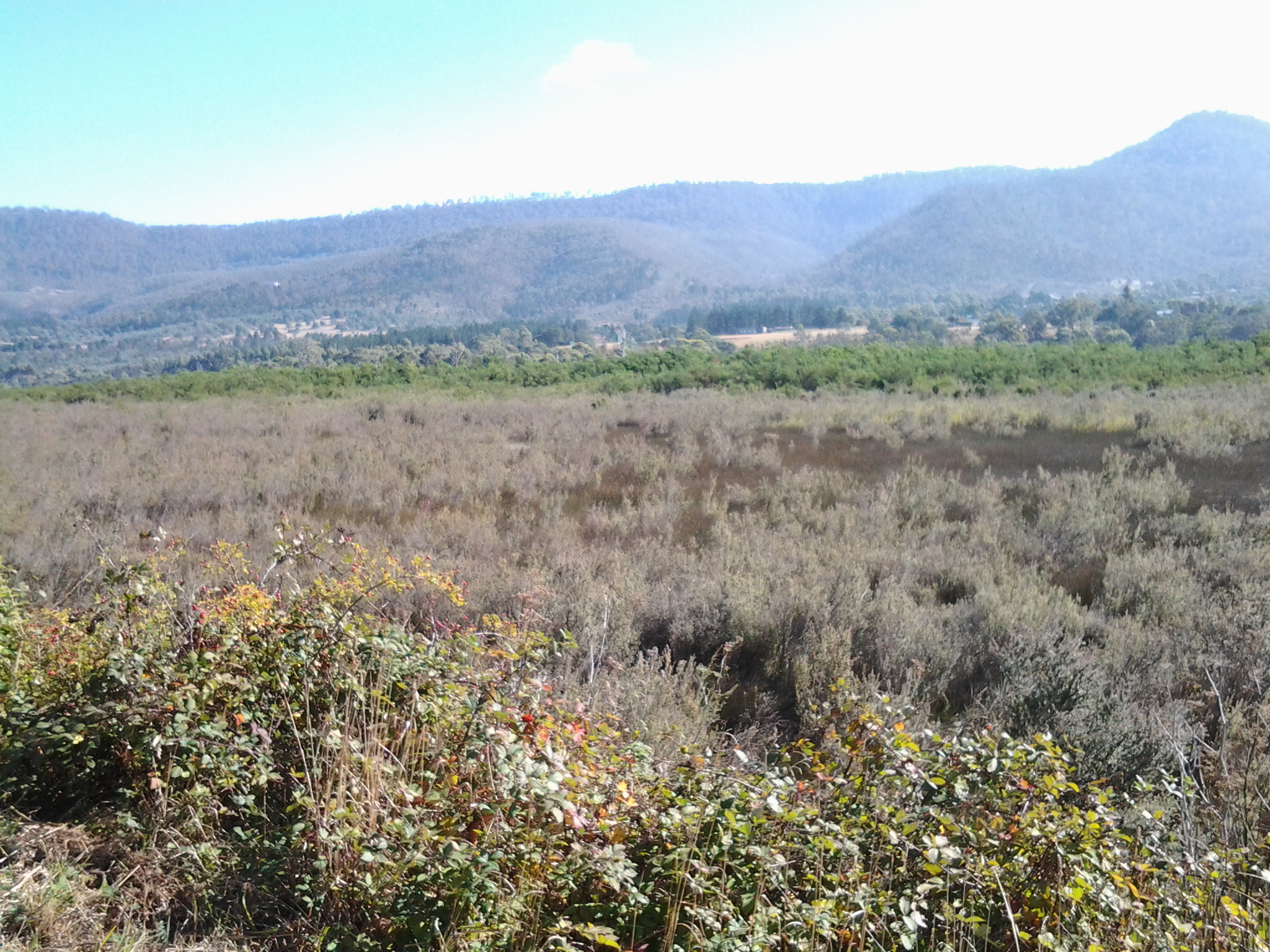
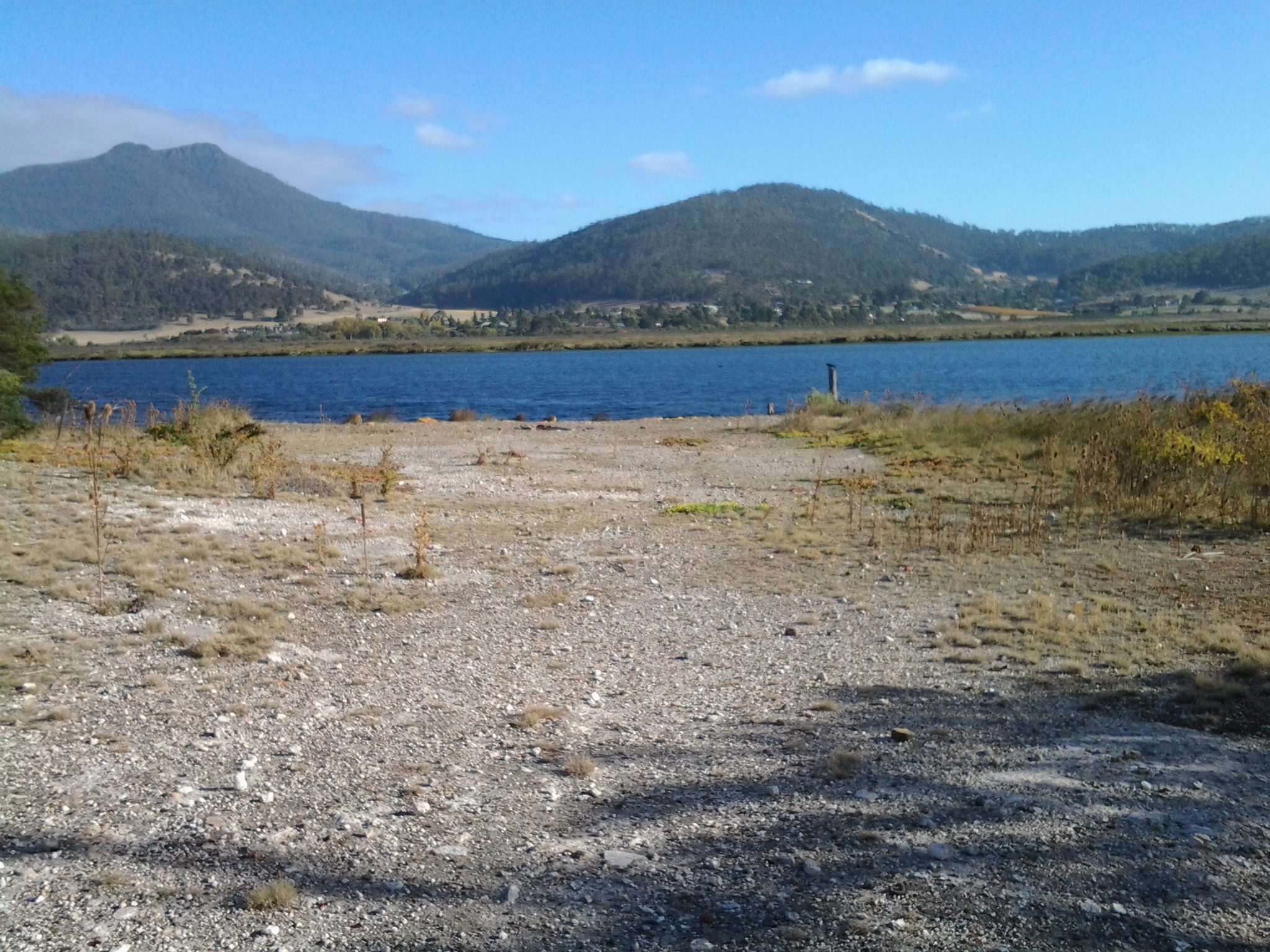
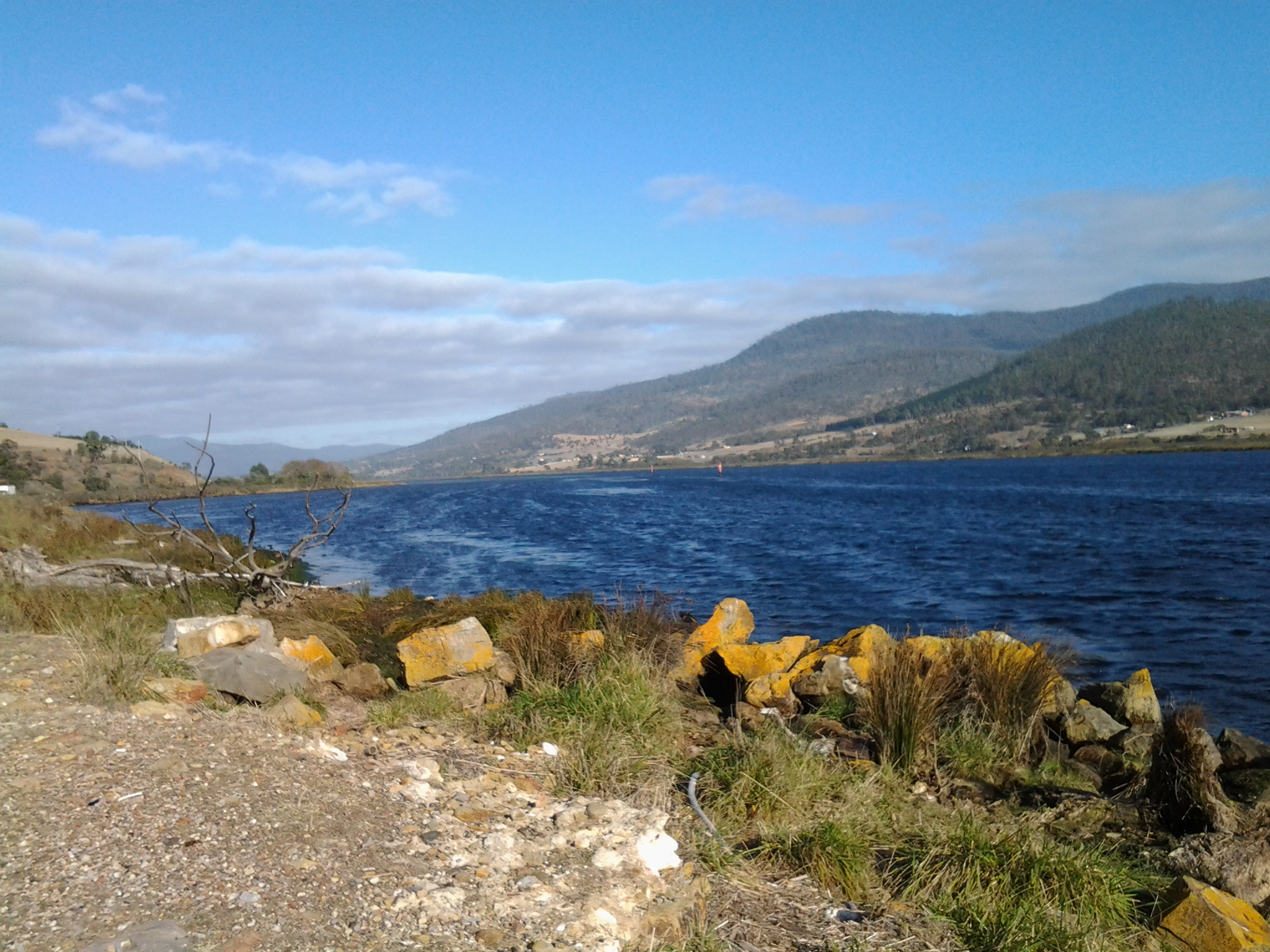
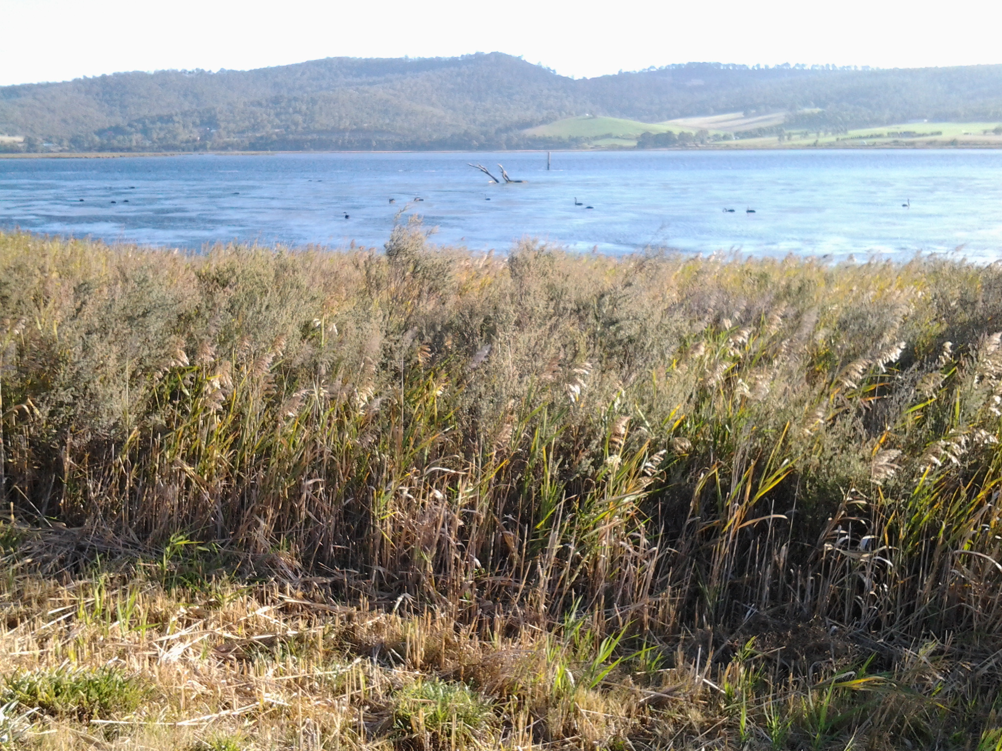
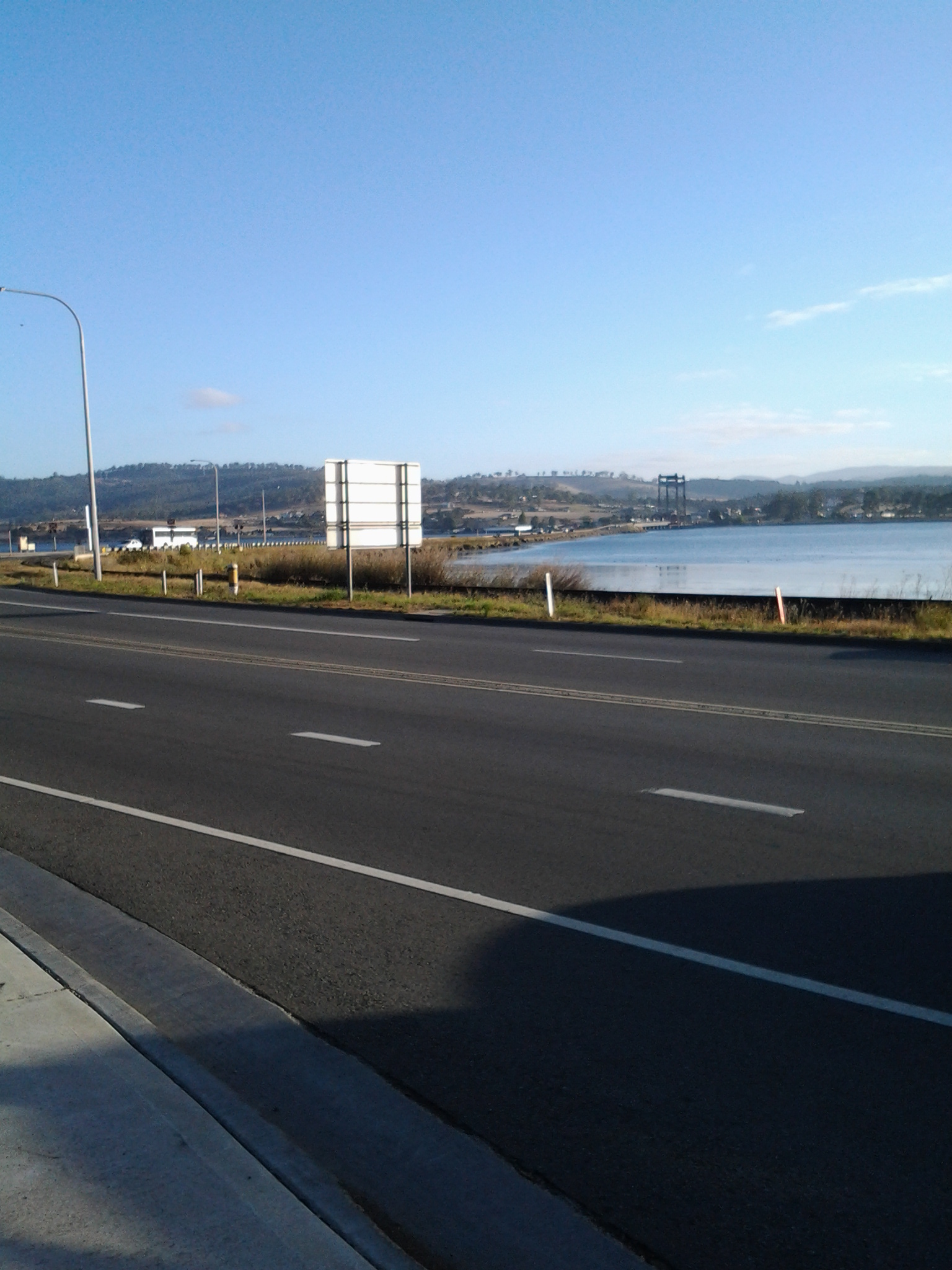
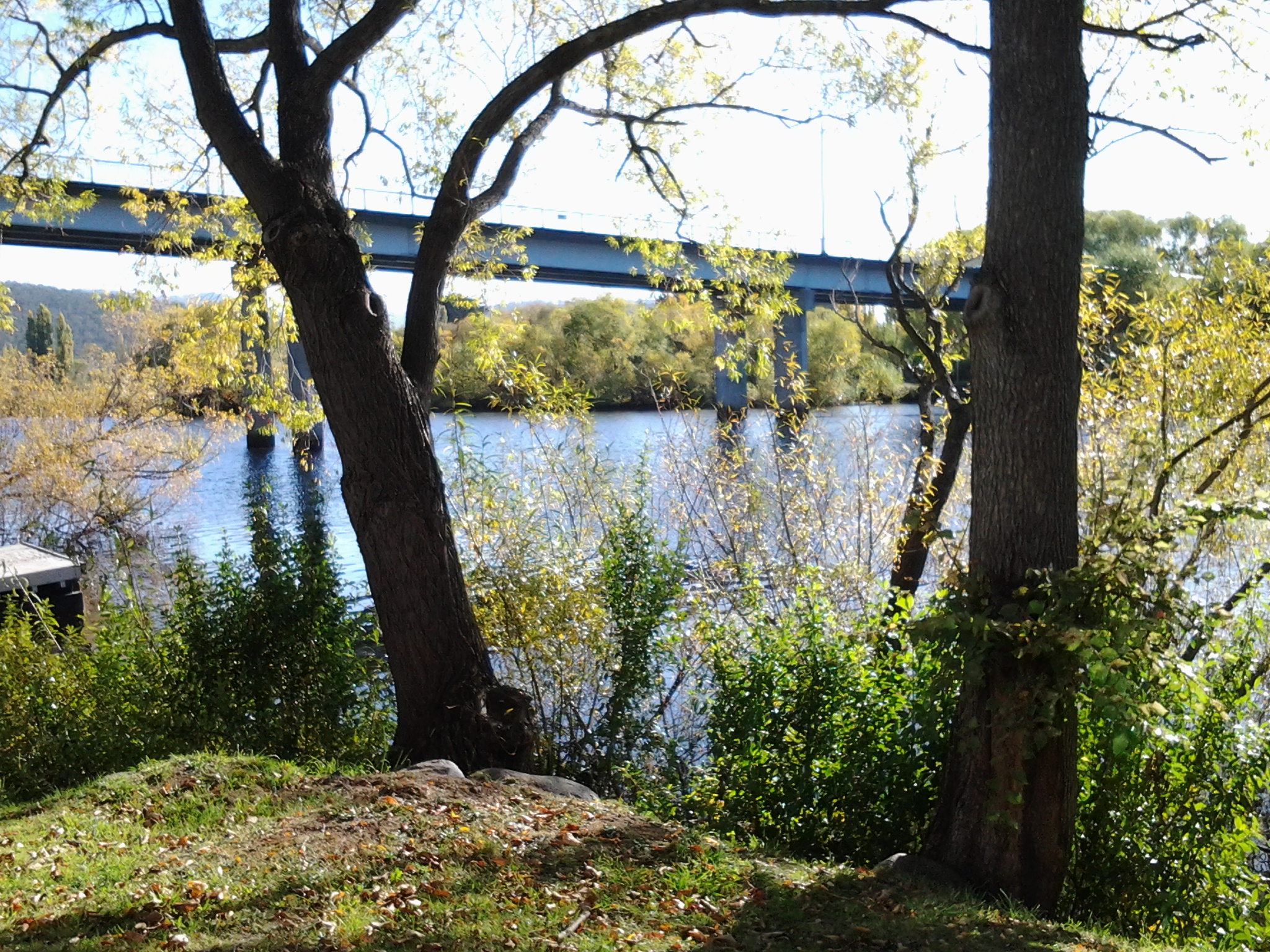
To give you some idea about the look of the wetlands from the Highway, the photo below shows the landscape when I looked back over the road just walked.

20150413_103926

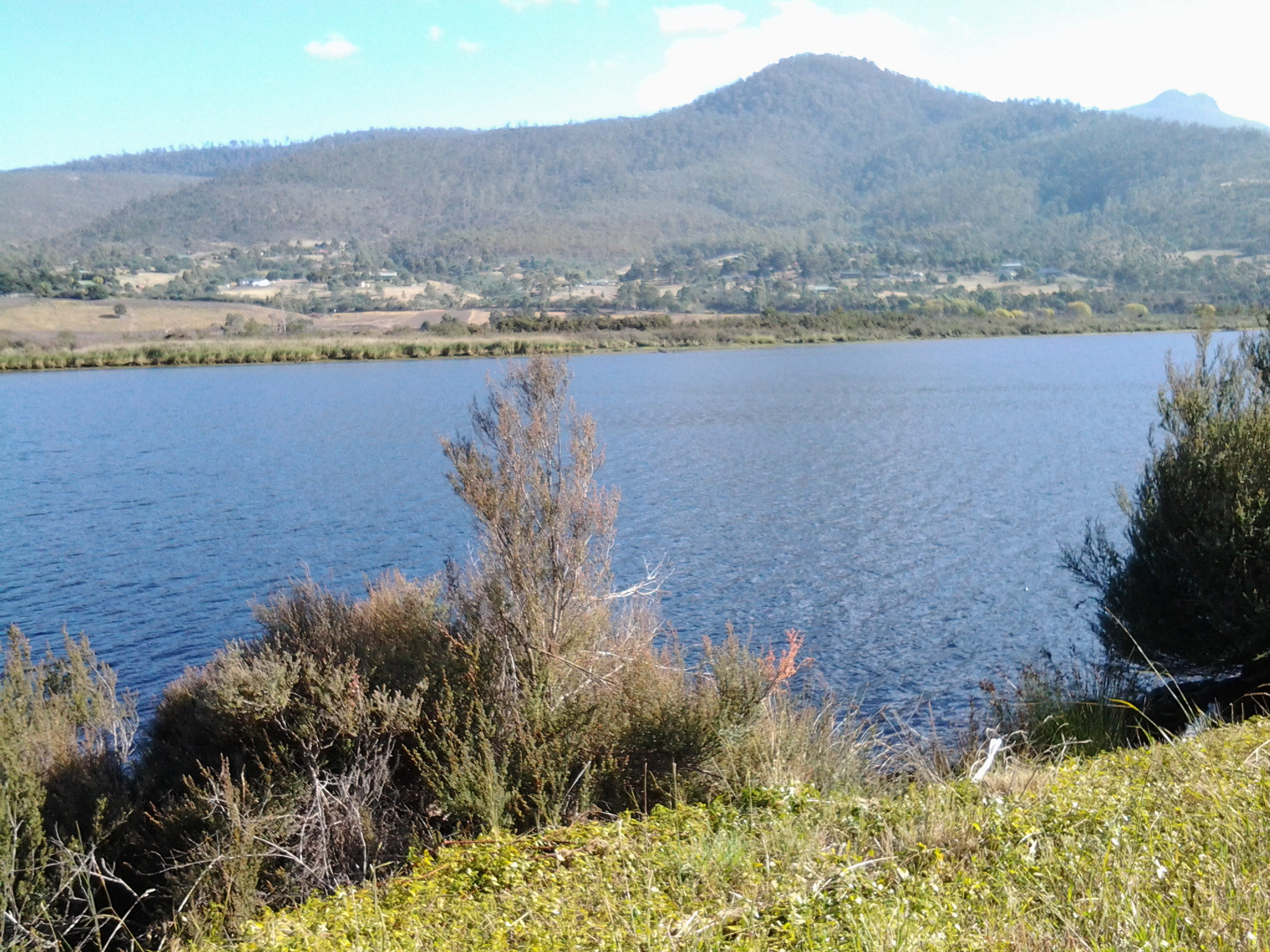
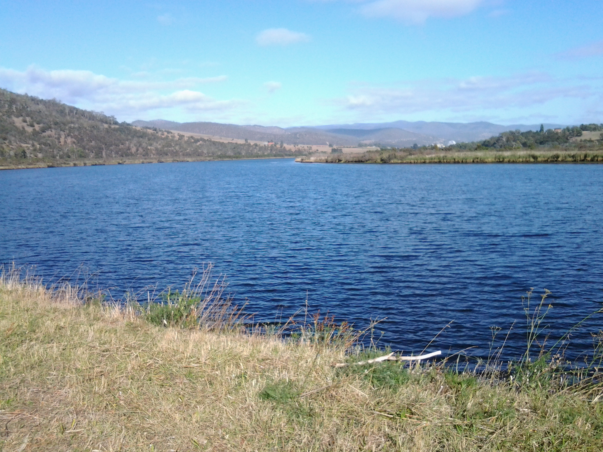
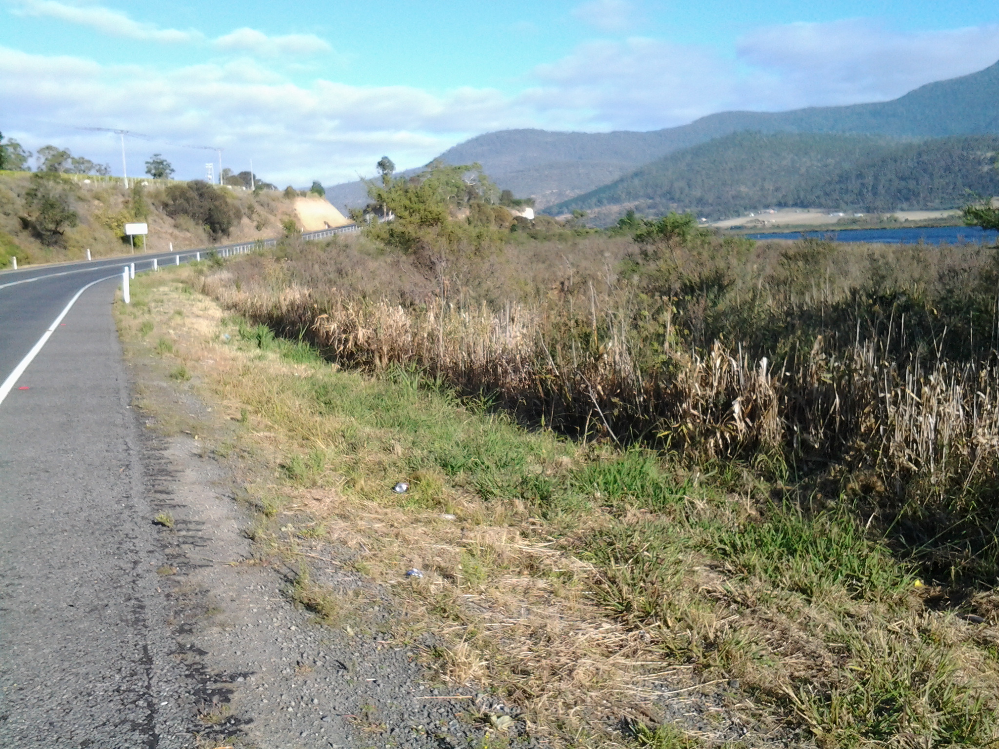
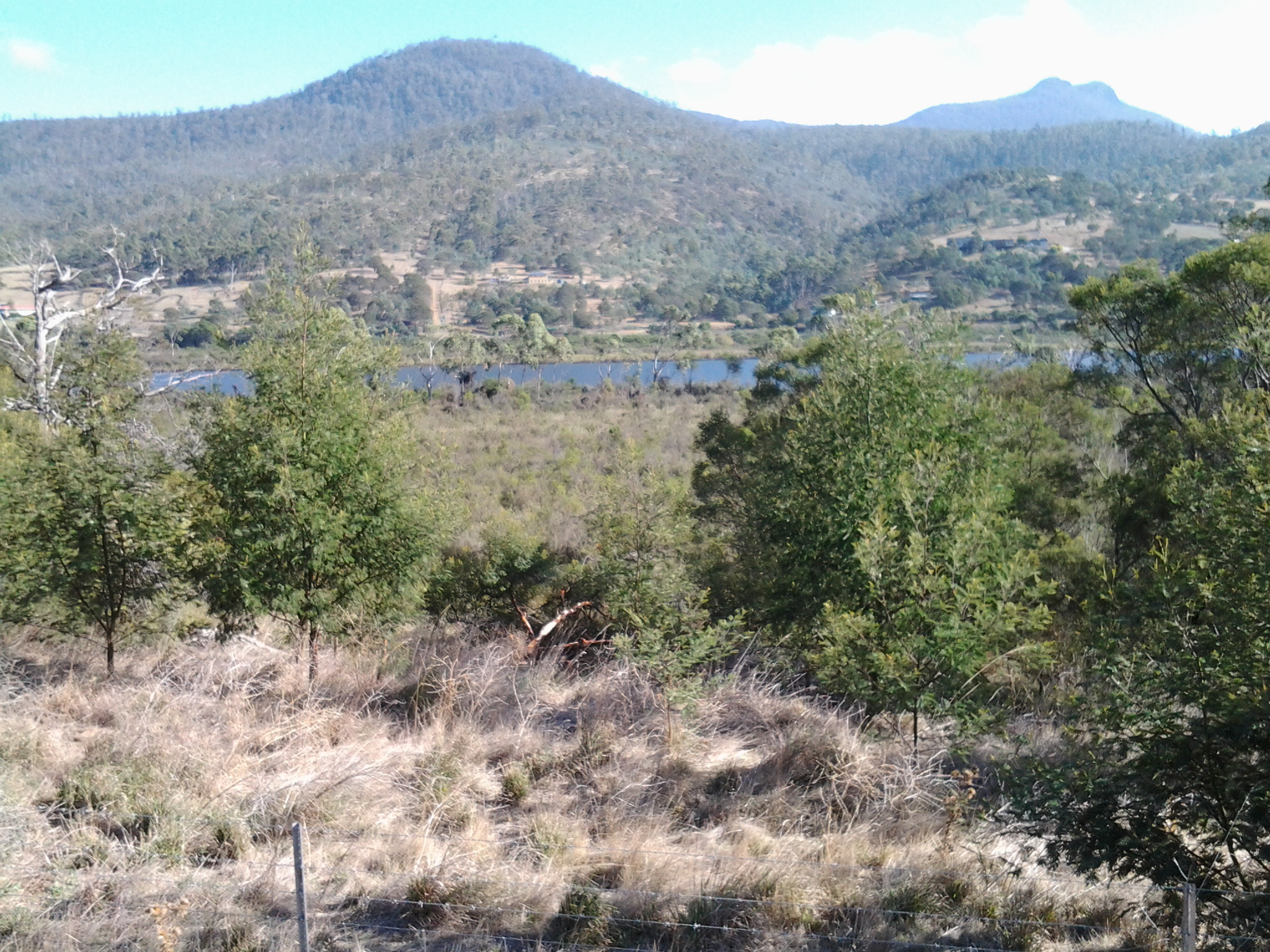
The wetlands looking toward the road yet to be walked.

20150413_103940

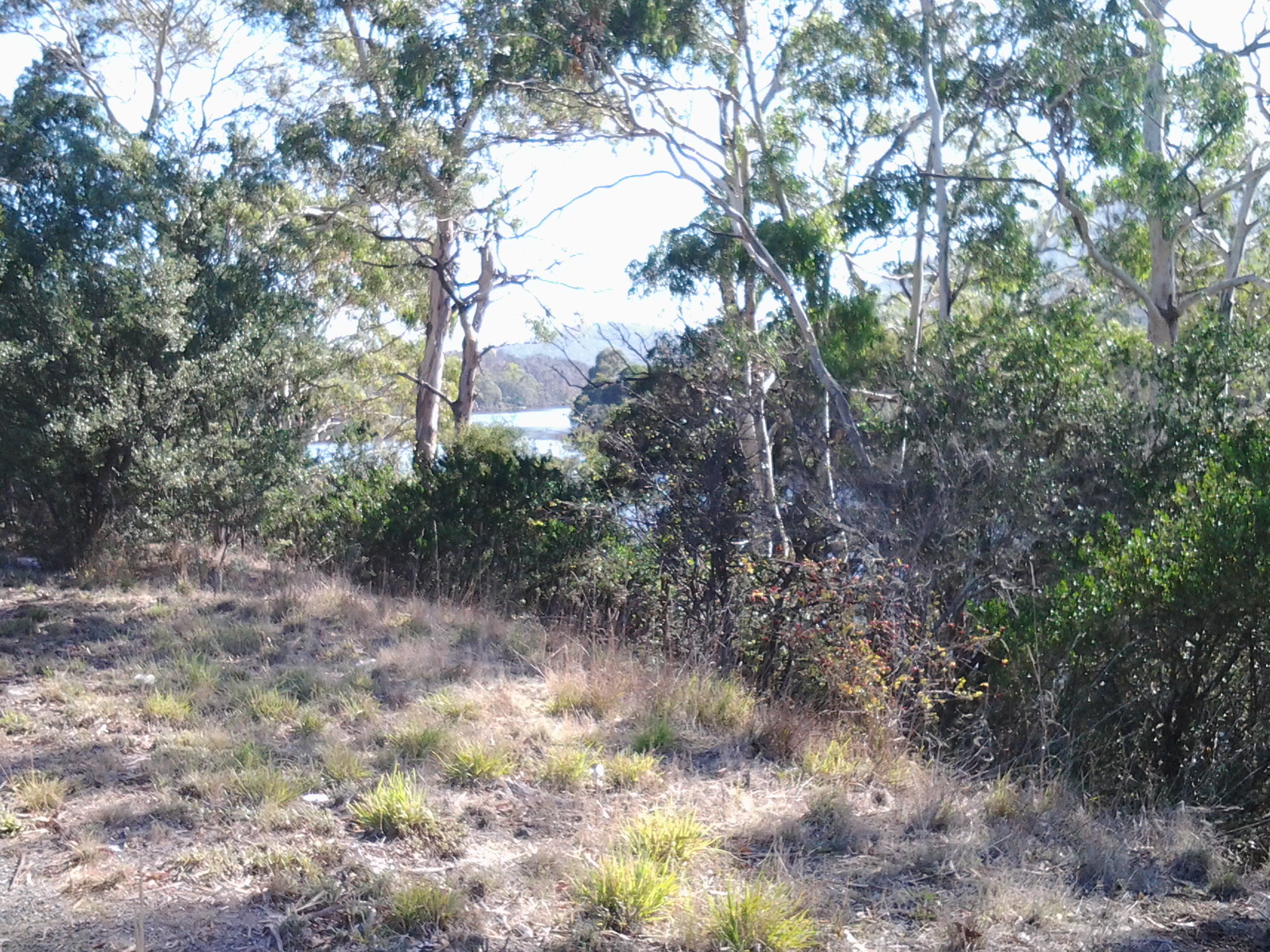
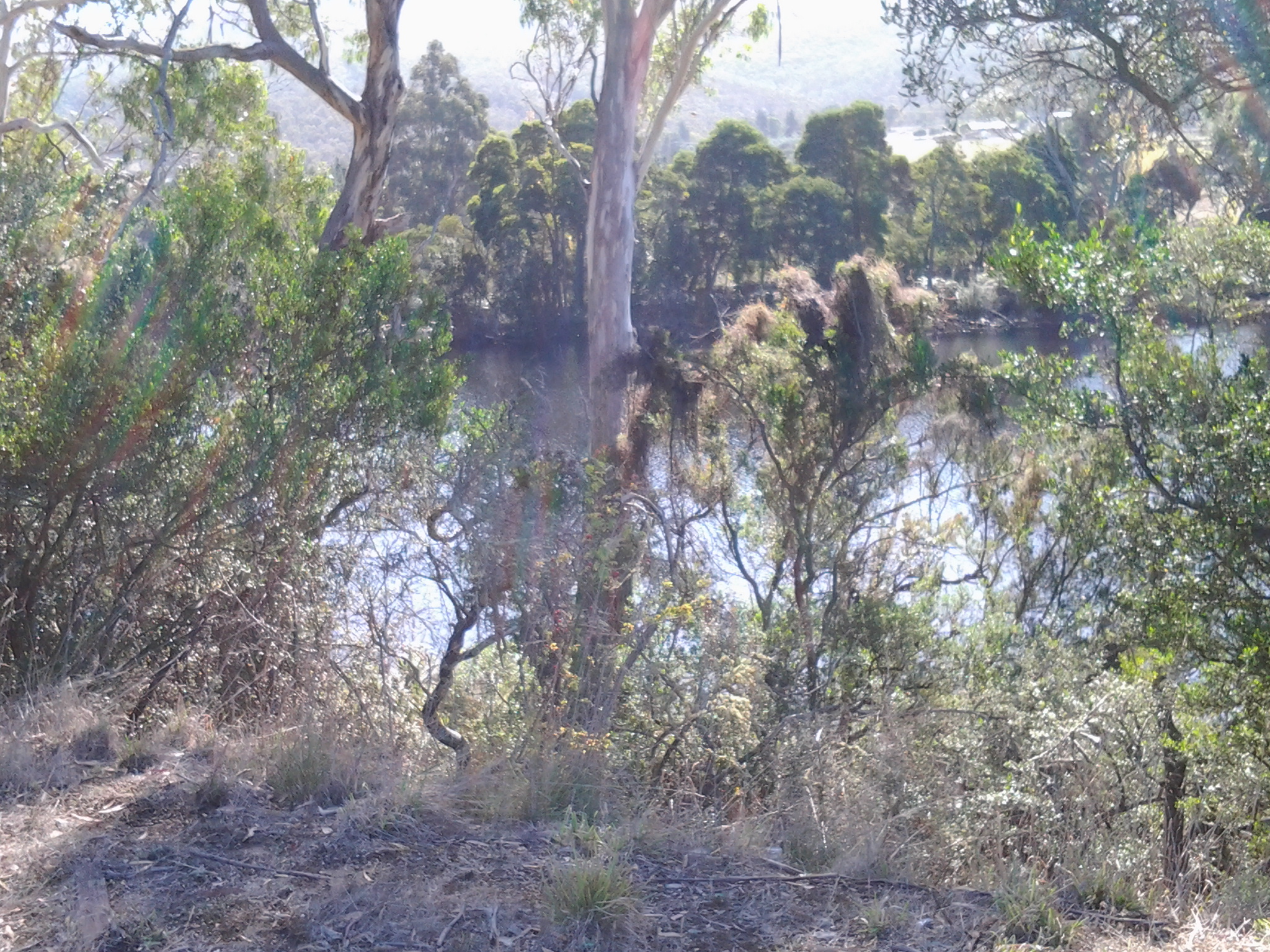
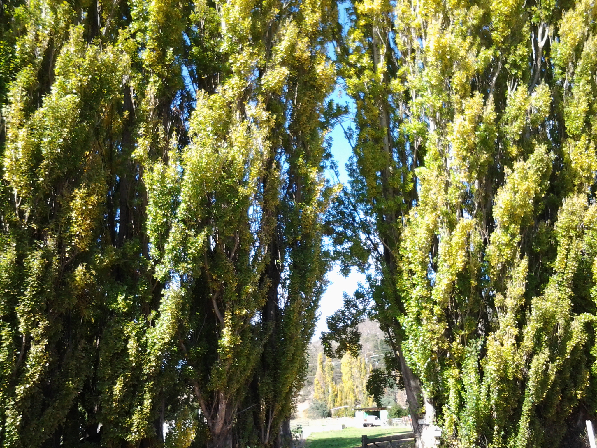
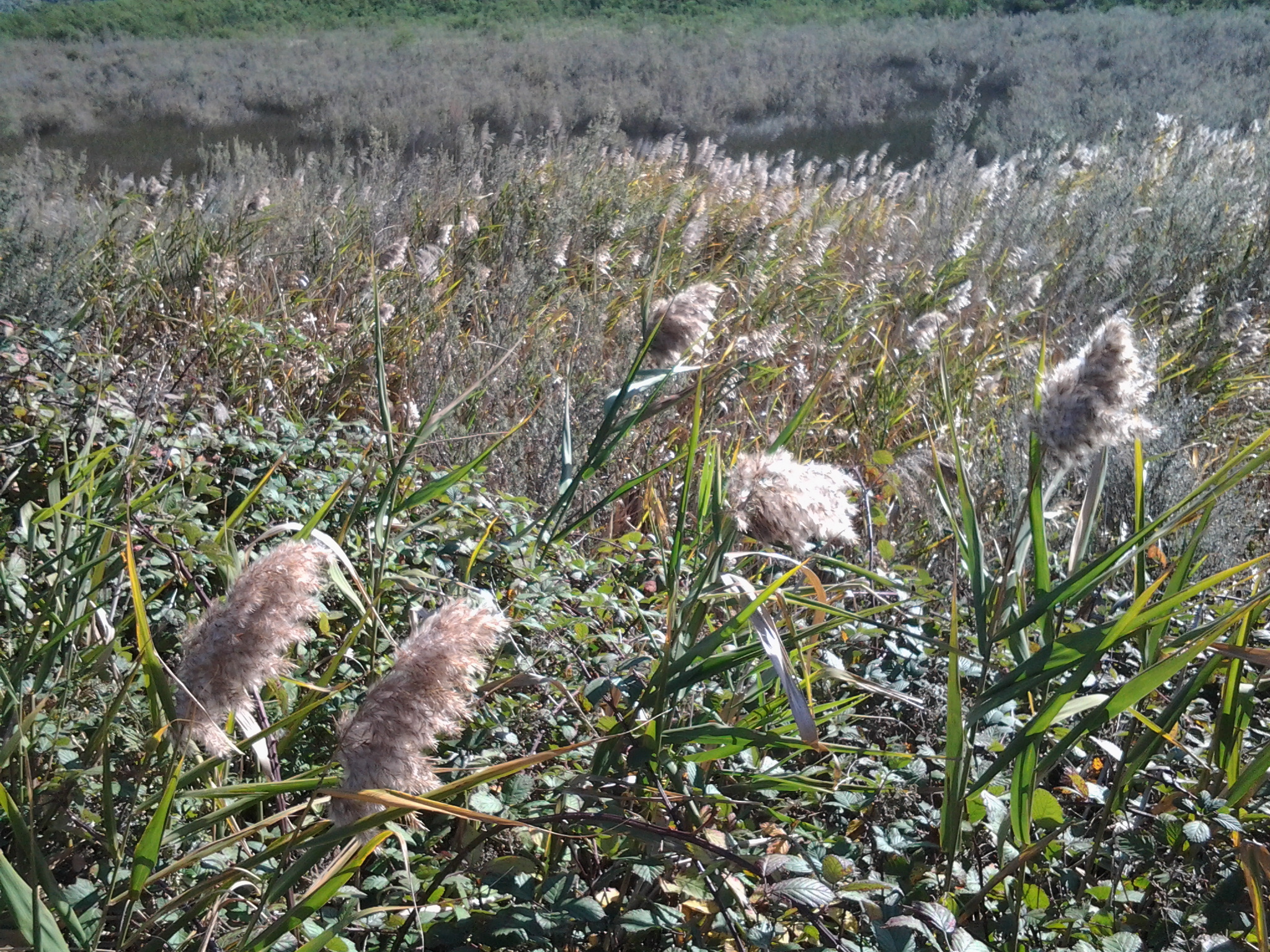
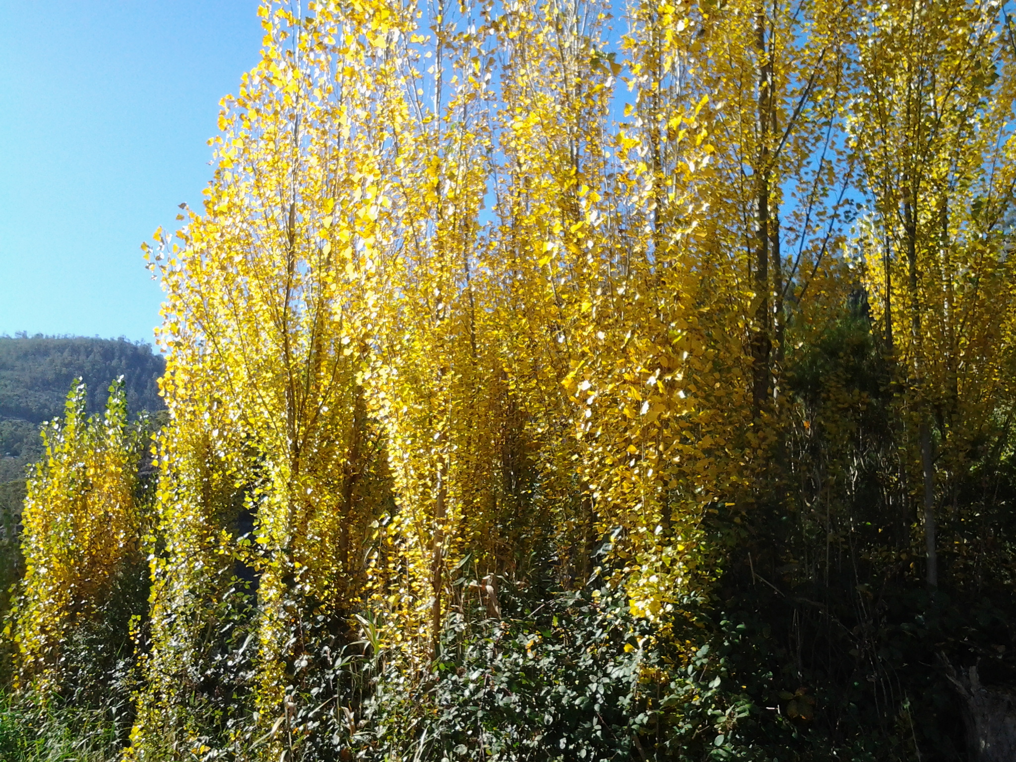
Along the kilometres (Murphys Flat Conservation Area is approximately 2.7 kilometres long and 550 metres wide at its maximum width) of Murphy’s Flat Wetlands, the vista consisted of subtle variations of the following:

20150413_091605  20150413_103937

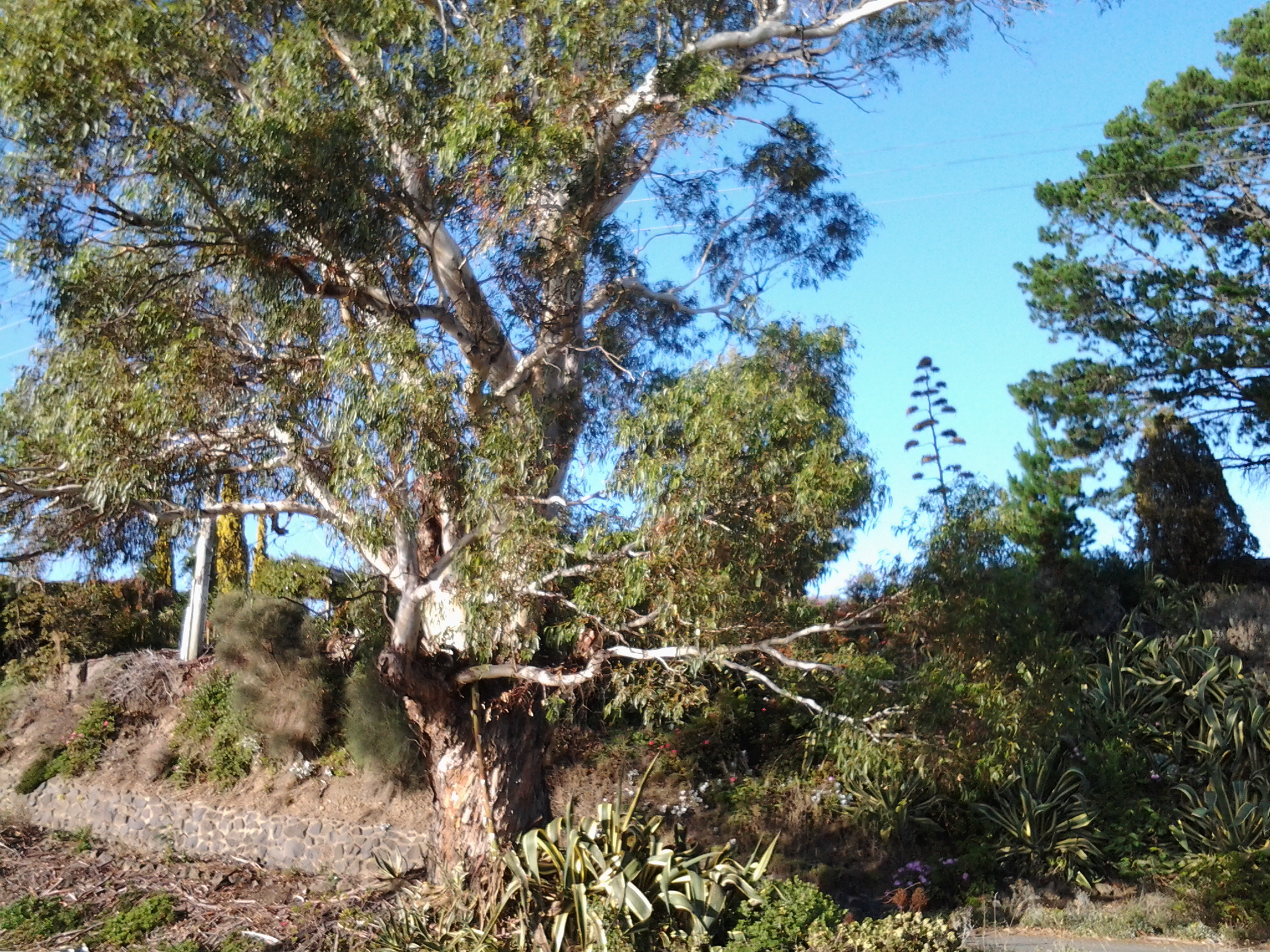
When I walked, most of the landscape between the Lyell Highway and the smoothly flowing Derwent River seemed impenetrable. I can only imagine this is a very safe place for water birds and fishlings to breed, and for native grasses and other plants to re-establish.

This posting started with a question which I have been unable to answer. I cannot discover who Murphy was. Regrettably.

Murphy’s law is a commonly heard saying which is typically stated as: Anything that can go wrong, will go wrong.  I wondered if the land now known as Murphy’s Flat had been purchased for the purpose of grazing animals and growing crops without due checking, and then found the wet soggy land to be useless in the days when preservation of native flora and fauna was not considered – I wondered if someone bought the land without really checking how it was and having spent all their money decided Anything that can go wrong, will go wrong. BUT according to the definitive book The History of Murphy’s Law written by Nick Spark, this adage was named after an American aerospace engineer Captain Edward Murphy who said as much around 1950. The naming of Murphy’s Flat at Granton seems to have preceded this ‘law’ so the area must have been named after a local – but who was it?  More research required.

Map of Murphys Flat 20150413_095018

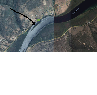
Google maps cannot locate Murphy’s Flat so I have attempted to indicate the location this posting has referred to.  Within the hand drawn oval above, the Murphys Flat Conservation Area sits contained between the Derwent River and the Lyell Highway.

Lime Kiln Point ahead

After walking 3 or so kilometres from the bus stop earlier in the day, from a distance I could see part of a white wall fronting the Derwent River.

20150413_084145

At 8.50am on Stage 14 of my walk, I left the Lyell Highway and walked down what seemed to be an earlier version of the highway until I reached the site of the Lime Kilns at Lime Kiln Point.

20150413_084758

At the site I first discovered the remains of one lime kiln built into the massive white wall.

20150413_085025

Later I discovered there were two lime kilns in that wall.

20150413_085326

Inside each were two burners.

20150413_085050 20150413_085109 20150413_085112 20150413_085134 20150413_085235 20150413_085219

If you looked at the video in the last posting, then you will be able to understand what my photos show you.

There are no site interpretations, signs, nor information panels and there are no site protection structures in place.  Perhaps these lime kilns are a minor piece of Tasmania’s history, nevertheless they are interesting. I would not have known what I was looking at except for the name of the Lime Kiln Point (a name which only appears on some maps. No road signs named this so if you come looking, it is located 200 metres north of the Derwent Estate Wines turn off) and I imagine there would be many others like me.

In front of the lime kilns, the broken remnants of a jetty poked up above the Derwent River through the cold air.

20150413_085029 20150413_085352

The view upstream was majestic.

20150413_085400

After taking time to look around Lime Kiln Point, I continued northward. When the old road petered out, I clambered up a loose gravelly rise and back onto the Lyell Highway.  It was only 9am.

Around Windy Point on Stage 14 of my walk along the Derwent River

Despite having driven and been driven along this patch of the Lyell Highway many times, its shape and character were not well known to me. I guess I have always looked out at the Derwent River and more or less disregarded the land.

The area jutting into the River, causing it to curve from a north west to western orientation, has been labelled Windy Point. I reached the start of this about 8.20 and it was another 15 minutes of walking before I reached its western end. There was some wind and when blowing my dribbling nose, the icy breeze flattened my handkerchief across my face. I sought visual distractions against the cold. A magnificent old gum tree amidst a range of exotic plants was a grand surprise.

20150413_081138

On one hill to my left were half a dozen dappled sheep with twins on their teats.  Sometimes their heads were black or brown but most fascinating was the dinner plate sized brown woollen shapes across their otherwise beige woollen bodies. I was too cold to take a photo of this sight.

In parts, the flowing river was a distance from the road.  Between the highway and the clear water, marshy water plants grew profusely, and access to the River was impossible.  The photo below looks across the Derwent River to Mt Dromedary in the distance and Mt Terra in the left  foreground.

20150413_095018

During my walk around Windy Point, at 8.30am I passed the road turn-off leading to Stefano Lubiana wines and noted there was a Derwent Valley Link bus stop on the highway – which, if you are a tourist without transport, would allow you easy access to the winery and the odd glass or two of some special liquid. I didn’t stop and visit – drinking at such an early hour didn’t seem like a good idea.

20150413_082819

Ten minutes later at 8.40am I was passing the road turn-off to the Derwent Estate Wines.

20150413_083657

I was surprised as I passed the estate to see what seems like late 19th century buildings nestled into the hill.  While the website explains: ‘the historic Mt Nassau property has been in the current owner’s family since 1913, I can find no information about these buildings which appear to be an earlier architectural style.  More research required.

20150413_084136

Opposite, in the River and its edging long grasses, white faced herons, coots, ducks and black swans were at home.

20150413_082210 20150413_082826

The day was offering truly magical sights aided by the intense blue of the sky and the water.

Arriving in Granton for Stage 14 of the walk along the Derwent River

Since walking along the Derwent River in the northern suburbs on the western shore earlier this year, I have revisited MONA at Berriedale on a number of occasions but I have not been further north. So it was a great delight when my X1 Metro bus, which departed from Hobart city at 7.17am, used the old main road after the Glenorchy bus mall to travel through Berriedale, Claremont and Austins Ferry before reaching Granton.  I was able to see the acres of majestic gold and red leafed vines of Moorilla Wines, to observe Cadbury’s chocolate factory puffing plumes of white steam into the crisp blue sky morning, to identify a range of native birds that were using Goulds Lagoon as a safe resting place, and to recognise various bays and other features that I had passed previously.  Everything seemed edged with the early sunlight which glowed strongly through rain washed, impeccably clean air.

I was off the bus at stop 49 on the last of the Brooker Highway at 7.50am.  Looking northwards, the sign made it clear the direction to take was straight ahead. An earlier post introduced the history of the old Granton watch house (search Historic Granton, Tasmania) – that’s the low yellow building on the left in the first photo below, and then the second photo shows the sun-struck front of the building.

20150413_074858 20150413_075049

I was aware New Norfolk, over last weekend, had been celebrating the glories of its autumn foliage as indicated by the sign below. The sign served to increase my anticipation of those colourful delights.

20150413_075028

The unmemorable architecture of the Granton Memorial Hall solidly facing the morning sun, seemed very out of place in this beautiful area.

20150413_075136

Equally solid and immediately serviceable was the public toilet block at the edge of the carpark used by many city bus commuters.

20150413_075231

In front of the carpark a sign reminded me of the importance of grape growing in Tasmania – not the least because the wine from our vineyards is very drinkable (as agreed by wine judges from around the world).

Vineyards ahead

My eyes swung across to the roundabout for vehicles travelling north on the Midlands Highway to Launceston via many rural towns. In the distance, the vertical towers of the Bridgewater Bridge marked the Derwent River crossing.  The calmness of the day, and the quality of the light was sublime.

20150413_075150

I hadn’t walked far along the Lyell Highway when I saw the sign below which indicated that 16 kilometres further along the highway I would reach New Norfolk.  But could I trust the sign? Two or so kilometres further back, when I was still bussing on the Brooker Highway, I had seen a sign indicating the distance was 16 kilometres.

Leaving Granton

Not far away another roadside sign alerted motorists (and the occasional pedestrian): Welcome to The Rivers Run Touring Route.

The Rivers Run

Walking on the right hand side of the road facing oncoming traffic and with the Derwent River on my right, I continued into the icy breeze heading towards New Norfolk.  It wasn’t much after 8am when I left the (comparatively) built up area of Granton on the first leg of Stage 14.

Between the bridges: Stage 14 of my walk along the Derwent River

The achievement yesterday was to walk from the Bridgewater Bridge to the New Norfolk bridge on the western shore of the Derwent River.

I set off from home before the sun was up and I found Hobart was quiet when I arrived at the city bus mall.

20150413_070843

Then I bussed to Granton and alighted from the bus at the intersection with the Bridgewater Bridge causeway.

20150413_074852

From Granton I walked north-west then west towards the inland town of New Norfolk walking mostly along the Lyell Highway and then on a walking track for the last 5 or so kilometres. The morning was freezing and the afternoon warm.  But the sun was out; its hard autumn light made the world seem alive and sparkling. The Derwent River was splendid, often still and reflecting the trees and hills on its surface, under a bright blue sky with the sun shining gloriously.

20150413_140121

I finished my walk at the bridge crossing the Derwent River in New Norfolk.

20150413_145514

During the walk, I covered about 15½km of the length of the Derwent River.  By my reckoning, the total distance of the Derwent River on the western shore from the mouth of the River to New Norfolk is 54¼ km.

My walking distance was approximately 20¼kms.  I have now walked approximately 191¼ kms not counting getting to and from buses, as part of this project to walk along the Derwent River.

The highlights of the walk to New Norfolk were finding the remnants of two clearly visible heritage lime kilns, seeing a family of 6 pelicans, finding the track along the river leading to New Norfolk, and being mesmerised by the spectacular autumn foliage along the walk and especially in New Norfolk.

20150413_140030

I started walking from Granton around 8am and, despite wearing a thick woollen beanie plus a thermal top under my windproof jacket, I was frozen for the first two and a half hours.  It was 8 degrees Celsius at Bellerive when I left home, 6 degrees at Glenorchy and I suspect much less with a wind chill factor along the first part of the walk.  On this basis, I will not be walking further inland until sometime in Spring, and the timing of starting again towards Lake St Clair will depend on the air temperature.

Over the coming week I plan to enjoy writing up the journey and the discoveries of Stage 14’s walk in a series of different postings.