
How many islands are green with vegetation? How many blots of land are named Green Island? Probably many thousand. Tasmania has a few ‘green’ geographical features spread around the state – followers may recall in an earlier walking stage I rounded Green Point on the eastern shore of the River. My walk along the Derwent River last week passed by a green Green Island.
While walking the length of Murphys Flat toward the northern end, across the water of the Derwent River I caught glimpses of a small length of low lying land in the flow of the Derwent River. Green Island was almost invisible from the western shore because the grasses in the Murphy’s Flat wetlands have grown tall.
This small piece of land provides a safe haven in which fish hang about the edges. New Norfolk Anglers Club members and others have enjoyed catching tagged salmon here.
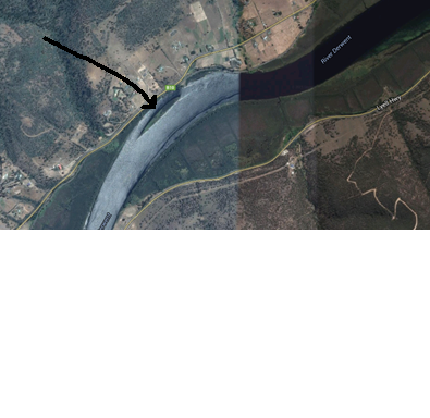
Green Island is looked over by Mount Faulkner on the south western side of the river, and by Mt Terra and Mt Dromedary on the north eastern side. On the map below, my arrow points to the slim Green Island near one bank of the Derwent River. The Lyell Highway is the yellow line curving through the lower part of the landscape. Murphys Flat is the fat area between the Highway and the River.

There is a Green Island not far from my house, in the Hudson River near Troy, NY. So, there is at least one more!
LikeLike
Guess people around the world have had the same ‘imagination’.
LikeLike