Tag Archives: walking

Wanderlust: a history of walking

Blog follower Ch alerted me to the book Wanderlust: A History of Walking by Rebecca Solnit. (Chicago: University of Chicago Press, 2000, viii, 326pp.).

Wanderlust book cover

Joseph Anthony Amato’s review of the book (Journal of Social History 35.1 (2001) 209-210) claims “This work is not quite a history of walking nor is it a study of Wanderlust. Rather, title notwithstanding, it is essentially a perceptive cultural commentary about what writers, thinkers, protesters, and Solnit herself have made of their walking in the last two centuries.”

In conducting internet searches I found the following quotations from the book (a copy of which I must locate and read):

  • For [Jane Austen and the readers of Pride and Prejudice], as for Mr. Darcy, [Elizabeth Bennett’s] solitary walks express the independence that literally takes the heroine out of the social sphere of the houses and their inhabitants, into a larger, lonelier world where she is free to think: walking articulates both physical and mental freedom.”
  • “A path is a prior interpretation of the best way to traverse a landscape.”
  • “Roads are a record of those who have gone before.”
  • “Many people nowadays live in a series of interiors…disconnected from each other. On foot everything stays connected, for while walking one occupies the spaces between those interiors in the same way one occupies those interiors. One lives in the whole world rather than in interiors built up against it.”
  • “Thinking is generally thought of as doing nothing in a production-oriented society, and doing nothing is hard to do. It’s best done by disguising it as doing something, and the something closest to doing nothing is walking.”

Walking next to the Derwent River. The proof.

By accident, I videoed my feet as I walked across the ground near the Derwent Entertainment Centre in the southern extremities of the Glenorchy Arts and Sculpture Park (GASP).  The video lasts 53 seconds, which when you watch seems a long time, and reminds me of the unchanging nature and relentlessness of some of the films of Andy Warhol decades ago.

http://youtu.be/q5sNFzfmFuI

Yesterday I completed Stage 10 of my sequential walk along the Derwent River

The goal for Stage 10 was to start at my last stopping point, MONA in the middle of Berriedale on the western shore of the Derwent River, and continue to Lutana the last suburb of the City of Glenorchy before the City of Hobart starts. But I went further.  Much further.  Almost much further than my feet could take me.  I walked to Hobart.

Over future posts I will write up the stories of the walk, what I saw and what I experienced, but for now it’s enough to say that I am continuing with this massive project to walk both sides of the Derwent between the mouth and Bridgewater, and then onwards to Lake St Clair. Once I get walking it is always so addictive.  Even when my feet feel crippled, I say to myself … ‘go just a little bit further. What else will I be able to see with fresh eyes?’

The day was gloomy with a cloudy sky, and Mount Wellington had veils of clouds covering at least part of its prominence most of the day. But it didn’t rain and so was perfect for walking.  However, the weather ensured the photographs were without sunshine.

Yesterday I covered 12 kilometres of the length of the Derwent River on the western shore (making 22 kms in total on the western shore), and walked approximately 19 kilometres (making a total of 130 kms to date) to achieve that distance. This distance also takes in the streets and paths on which I walked that led to dead ends so that I needed to retrace my footsteps.

Of the many highlights of the walk, I saw the building that once started life as Rosetta Cottage, and powerful Clydesdale horses with their large hairy feet.

20150109_162649

I surprised a friend still in pyjamas when I went visiting for the first time in my walks. The hot cups of tea were most welcome.

I am always excited when I walk the striped edged boardwalks of GASP (Glenorchy Arts and Sculpture Park) or pass the boatsheds of Cornelian Bay and it was no different yesterday.  See the photos below for a taste of the colour.

20150109_084404  20150109_145335

I very much enjoyed looking at the eastern shore where I had walked during past stages and seeing the landscape from a different perspective.  I felt it made the Greater Hobart Area seem undeveloped in a way which is quite amazing for a capital city. For example, Bedlam Walls on the eastern shore from the western shore of the Derwent River, in the photo below.

20150109_123940

From comments I have received, I know my walks are inspiring others to think about what they might do. Even if you choose not to walk, perhaps you can set yourself other challenges.

My next walk will start at Hunter St at Sullivans Cove on the wharf in Hobart and probably extend to Kingston.  But before then I need to record the details of yesterday’s walk.

Hagar the Horrible cartoon by Dik Browne – Walking

Some days this cartoon seems so relevant to my walking.

Hagar cartoon

Inspiring tourism

Stephanie Williams’ article ‘The heartfelt journey to a better world’ was published in The Sunday Tasmanian newspaper on 12/12/14. I cannot locate a free copy online for you to access, however because her ideas resonated with me, I feel compelled to share them.

Dr Susanne Becken, Professor of Sustainable Tourism at Griffith University, Australia has coined the expression ‘inspired tourism’.  I like these words because they conjure up the idea of a richer and more meaningful travel experience.  One that can lift people’s spirit and extend the limits they might have set for themselves.  The concept of ‘inspired tourism’ opens the way for both traveller and local residents to have value and vitality added into their lives.

When Williams’s article talked about community conscious travellers, it is clear increasing numbers of people are changing the way they holiday.  While more Aussie travellers want authentic experiences, there is increasing acceptance that along with ‘an insatiable appetite for discovering the world comes a responsibility to respect and protect the places we travel to.’

My take on these ideas includes the notion that travelling locally and becoming a tourist in your own town or city, by using public transport, should become a mainstream travel option. To do so is easy on resources, has minimal impact on the environment and most importantly allows the traveller to see more and understand more of their local situation. Until I started walking along the Derwent River, I had no idea about so many of the communities, the landscape and the history of places through which I have passed. And yet I have lived in Hobart for many years. My walk along the Derwent River has been, and promises to continue to be, inspiring.

Stage 6 of my walk along the Derwent River tomorrow – Tuesday

In preparing to walk from Geilston Bay north to Risdon Cove looking at natural and historical features along the way, I expect to make good use of initial research. Apparently I should see considerable evidence of past European and Aboriginal settlements and use of the land. Currently, there are no settlements along this edge of the Derwent River until the tiny suburb of Risdon is reached.

Birds between Geilston and Shag Bay

An obvious bird lover has blogged extensively on Tasmanian birds and, in particular, has walked part of the distance I will cover tomorrow.

More detailed information with glorious photos is available at http://tassiebirds.blogspot.com.au/2012/02/shag-bay-bluewings-more.html however, in summary; I should see a wide range of native birds if fortunate enough to be in the right place at the right time and with my eyes open.

Silvereyes, Black-headed Honeyeaters, Yellow-throated Honey eaters, Grey Currawongs, Blue-wing parrots, Yellow Wattlebirds, Brown Quails, Australasian Pipits, Dusky Woodswallows, Pied Cormorants, White-breasted Sea Eagles, Spotted Pardalotes, Dusky Robins, Black-face Cuckoo Shrikes, Grey Butcherbirds, Green Rosellas, New Holland Honeyeaters, Crescent Honeyeaters, and Brown Thornbills.  Phew!  What a collection!  I can identify some of these birds but not all. Therefore, I will be poring through my bird books later today to give me a better chance of seeing more and knowing what I am seeing.

Name of Shag Bay

Now is a good time to consider the name Shag Bay, the first Bay I will reach after Geilston Bay.  I cannot discover who gave the name, when, or why. In the absence of any information I have a theory. The common European bird Phalacrocorax aristotelis known familiarly as a Shag, is a species of cormorant. Cormorant birds are commonly seen fishing along our Derwent River. In fact, Tasmania has 4 species of cormorants with a vagrant fifth flying in from time to time. It seems very reasonable to imagine that the first Europeans, coming into what is now Shag Bay, repeatedly saw many cormorants fishing and so the name was easily applied.

Australia has developed a useful colloquialism: “like a shag on a rock”. This means abandoned and alone.  The Australian National Dictionary Centre explains “Any isolated person can be described as, or feel like, a shag on a rock – for example, a political leader with few supporters, or a person without friends at a party.”

Walking from Lindisfarne to Geilston Bay along the Derwent River last Friday

Gask

Talune St, Lindisfarne ended at the edge of the Derwent River, so I turned right to follow a pathway. At 11.45am the pathway continued along an extension of Paloona St before changing back into a shoreline Trail. Further on and next to the Clarence Foreshore Trail, an attractive weatherboard house named ‘Gask’, with an expansive enclosed verandah framing extensive Derwent River views, attracted my attention. Apparently this home was built in 1900 as a holiday residence for Dr William Crowther (but more research required confirming this because birth dates and the house dates do not make a suitable match). The property, originally named Villa Rose was renamed Gask, although I can find no explanation for this name. In 2010, the house was sold for over ¾ million dollars.

The Trail continued past the sweeping Koumala Bay where I watched the camouflaged catamaran speed past carrying its cargo of visitors from MONA to the city.

20141010_114355

In the photo below I have almost walked to Limekiln Point and the headland in the distance is Bedlam Walls Point. Limekiln Point is the southern location which corresponds with the northern Bedlam Walls Point across the other side of the gap where the Derwent River meets the waters of Geilston Bay.  At Limekiln Point I saw no remnants of any limekiln. Apparently Geilston Bay was initially named Lime Kiln Bay, so perhaps the lime works were centred around the curve of the Bay (more research required).

20141010_115251

Bedlam Walls Point will be the official starting point for Stage 6 of walk along the Derwent River.

My first view into Geilston Bay looked as follows:

20141010_120134

Closer to the Bay, my views included the following image which shows the walking track on the other side which I will follow in Stage 6 of my walk along the Derwent River:

20141010_120139

At midday, approximately 1km of my walk to the Geilston Bay Regional Park remained. The Trail became a gravel track, and while parts of the track earlier would have been suitable for someone using a wheel chair or crutches, much of the last 1000 metres of the track was better suited to mountain bikes, despite not being very hilly. Gardens cascaded down to the edge of the path and private uphill stony stairways ended in gates and fences. Jenny Wrens flitted through the undergrowth. Raucous sulphur crested cockatoos flew  screeching overhead. Colourful. Tranquil. Glistening light. Far from the maddening crowd (with apologies to Thomas Hardy). A perfect day.

I appreciated the skill in building a dry stone wall.

 20141010_120126

Sighting the first massive almond tree filled with growing fruit was a surprise, and then when I saw a few more I was amazed. Obviously, these were self-seeded and reseeding.  All growing between the Trail and Geilston Bay’s water edge.  I wonder when they will be ready to pick and eat.  Perhaps December or January?  Since they grow on public land, it will be a matter of first in first served.

Eventually the gravel pathway met with a formal Foreshore Trail and I continued around the Bay until I spotted a bench on the grey weathered wharf in front of the Geilston Bay Boat Club.  It was time to enjoy the view of Geilston Bay, Hobart city beyond and the ever present Mount Wellington.

20141010_120820

Friday’s walk was an easy simple experience and since it passed places, streets, and vistas I had never seen before, I loved it all.

Stage 3 One starting point for a Derwent River walk to Trywork Point 20 September 2014 Posting 4 of 6

If you choose to walk to Trywork Point, I recommend one starting point could be the pathway down from Vaughan Court (which runs off Oceana Drive to the right), and turn left at the bottom onto a grassy walking track. If my experience is a guide, you are likely to meet happy dogs and their owners enjoying a stroll along this route.

If you choose this route, I think you should allow at least 2 hours for a one way journey that has nil or minimal walking on the cattle tracks on private land.

This walk is not for everyone.

It requires specific equipment (supported walking boots) and a reasonable level of fitness, a tallish size and common sense. There are a number of dangers to be considered; the chance of rolling or spraining an ankle on the rolling rocks, the chance of injury on the slippery slopes where the needles from the Casuarina trees form a moving mat on the ground, and the surprising number of pieces of rusty fencing wire that pop up unexpectedly. In addition, if the herd of cattle was in the vicinity where you might be trying to edge along a cattle track, there might be some associated dangers. But above all, you are skirting around private land and that needs serious consideration.  If you are not very tall, you may find some of the rock climbing to be unsafe and perhaps impossible.

This walk is for the few.


The second stage of the walking tour

Tomorrow, Thursday 4 September, I plan to walk a second stage of my foot journey along the eastern shore of the Derwent river.  As with the first leg, I need to take Bus 640 that departs from the Hobart city bus mall at 8am and heads towards Opossum Bay.  I will jump on the bus once it reaches the eastern shore and, as before, I know I must be patient because it will weave through the suburbs of Rokeby and Clarendon Vale before passing Lauderdale, Sandford and South Arm (details of these great locations are in the earlier postings related to the first stage of the walk). My bus destination is the Opossum Bay Shop. From there I will walk north to Gellibrand Point via beaches, roads and open landscape.  I hope to be able to enjoy my pre-packed lunch sitting looking towards Mount Wellington before returning to the Driftwood Drive bus stop for my journey back towards Hobart. The morning low temperature is expected to be around 9 degrees when I arrive and rise to about 14 degrees around 1pm. The return bus leaves Opossum Bay at 2.02 so I hope it doesn’t rain before then.  Keeping my fingers crossed!

22 Aug 2014 Setting out to travel to South Arm – Posting 1 of 8

The first stage of my walk along the Derwent River took me away from home for 7.5 hours. This included walking to the tip of the eastern side of the mouth of the Derwent River in the South Arm area, then gradually plodding northward on the eastern side of the river.  I am exhausted but exhilarated. When I stand on my feet or move around, my body screams ‘sit down, stay still, and never move again!’

My walk started at Bellerive when I jumped on the Metro bus No 640 that departed from Hobart at 8am. The sky was blue and cloudless but I was rugged up and beanied to avoid the early morning chill. I was nervous, and queasily excited. This felt so much like travelling into the unknown when overseas; an unknown destination (years ago Ru took me to a weekend market at South Arm, and prior to that I had driven down and back to Opossum Bay – but I have never spent time in or explored the area), unknown bus stops and reliability of timetables, new maps, unknown people and circumstances, and no idea how long it would take me to cover the stage I had planned.  The return bus was leaving Opossum Bay at 2.02pm and the next one wasn’t leaving until 5.55pm. I wanted to time my walk to catch the earlier rather than the later bus because I knew my feet wouldn’t last long. I calmed myself with the realisation, that unlike the situation with most of my travels, I had a mobile phone and sufficient funds for a taxi if need be.

Nothing I imagined turned out to be.

I had thought there would be no one on the bus because everyone would be heading towards Hobart.  Of course, this was a dopey idea. But I was the only passenger from Lauderdale onwards as the bus sped along the uneven bitumen rattling strongly (these buses are not designed for nonurban areas).

What did I see during the bus trip? Peak hour traffic streaming towards the city. The Bridgewater Jerry steaming down the Derwent to the sea. The early morning sun in the driver’s eyes. Hard winter sun on the new growth on gum trees.  Yellow floral masses on wattle trees.  Dew still sparkling on wet grass. Rare smoke trails from occasional chimneys.  Sheep, horses, llamas, billy goats, olive trees and small house orchards. It was a simply gorgeous day to behold.

The bus route deviated through the back streets of Rokeby, a tiny suburb still 30 kilometres from Opossum Bay. From the upper streets the blue flat glittering expanse of Ralph’s Bay (which is fed by the Derwent River) was stunning.

Planning the first walk

Thanks to Je I was reminded that the grid on a map represents a distance and so, before I started fancifully imagining huge distances could be covered in a single leap, I have slowed down and thought through what is possible. And also what is desirable considering public transport times.

I have made the decision to start on my side of the river, the eastern shore of the Derwent. While stages along the river might be taken in any order, making a start on this epic journey at a key point seemed like the proper thing to do. I will start at the mouth of the river.  I am sure my decision as to where the mouth of the Derwent river starts will be controversial. But this is my walk. My Derwent River walk. Having consulted the maps, I can start where I think it is appropriate.

Previously I have remarked that all walks must be able to connect with public bus services – I don’t own a car, and I realise other future walkers of the Derwent might want to travel without worrying about car ferrying to get them to start and finish points. I accept the bus timetables may limit my possibilities and that I may need to walk additional kilometres simply to reach starting points, or after a finishing point along the Derwent. However, I know I will see and experience additional wonders that someone travelling in a car might miss.

Tomorrow morning the 8.09 Opossum Bay Metro bus from the Eastlands bus stop will convey me to South Arm where I plan to follow the Fort Direction road and continue on to Cape Direction.The Cape will be the starting point of my walk along the eastern side of the Derwent River. Tomorrow’s walk is a study in getting a feel for the time it takes to cover territory in a plodding easy way. It will also give me an indication of the reliability of the State Government maps. I expect to cover about 6-7 kilometres including historical sites, but only a portion of that will be along the Derwent.  This area is serviced by an infrequent bus run and I am aware that I need to be back at a bus stop for the next bus departing Opossum Bay at 2.02 pm.

Today is bright and sunny with that gorgeous cloud free Spring look. I am sorry that I hadn’t planned to start walking today. But my excitement is now building for the start of this epic adventure tomorrow!

A new idea – starting out

A year or so ago, I read the true story of an English man who walked the length of the Thames River in England. He did not start one day at one end and continue walking until he reached the other end. Instead the walker fitted many stages of the walk around his normal working life. Through his eyes, and via his words on the page, I discovered a new way of seeing and understanding the everyday world one step at a time.

Half a world away in Hobart Tasmania Australia, the mighty river Derwent wends its way from further north moving south over approximately 249 kilometres past Hobart towards the sea. Last weekend, I realised that if I could walk the edges of the Derwent, then a wonderful adventure might unfold.

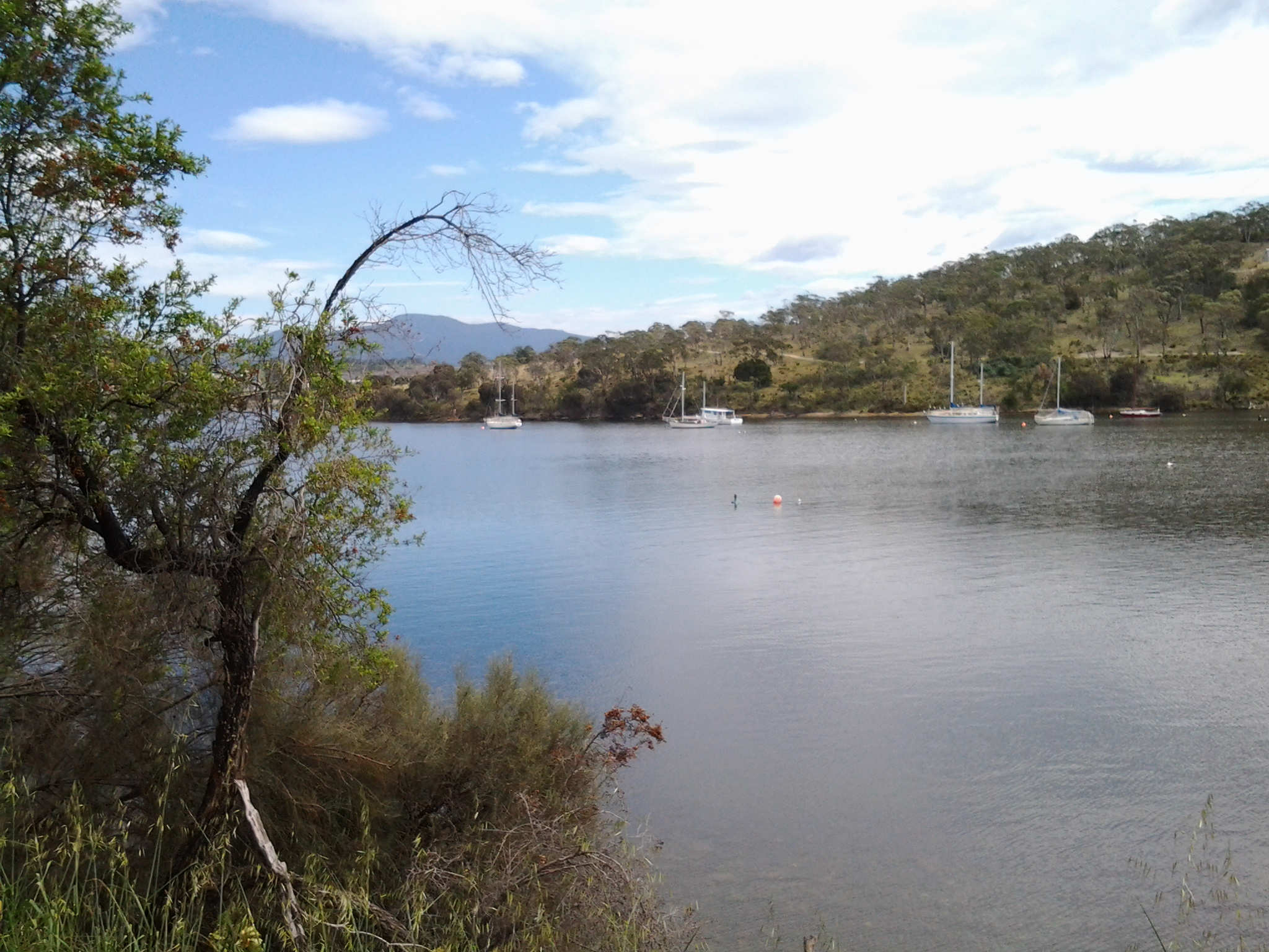
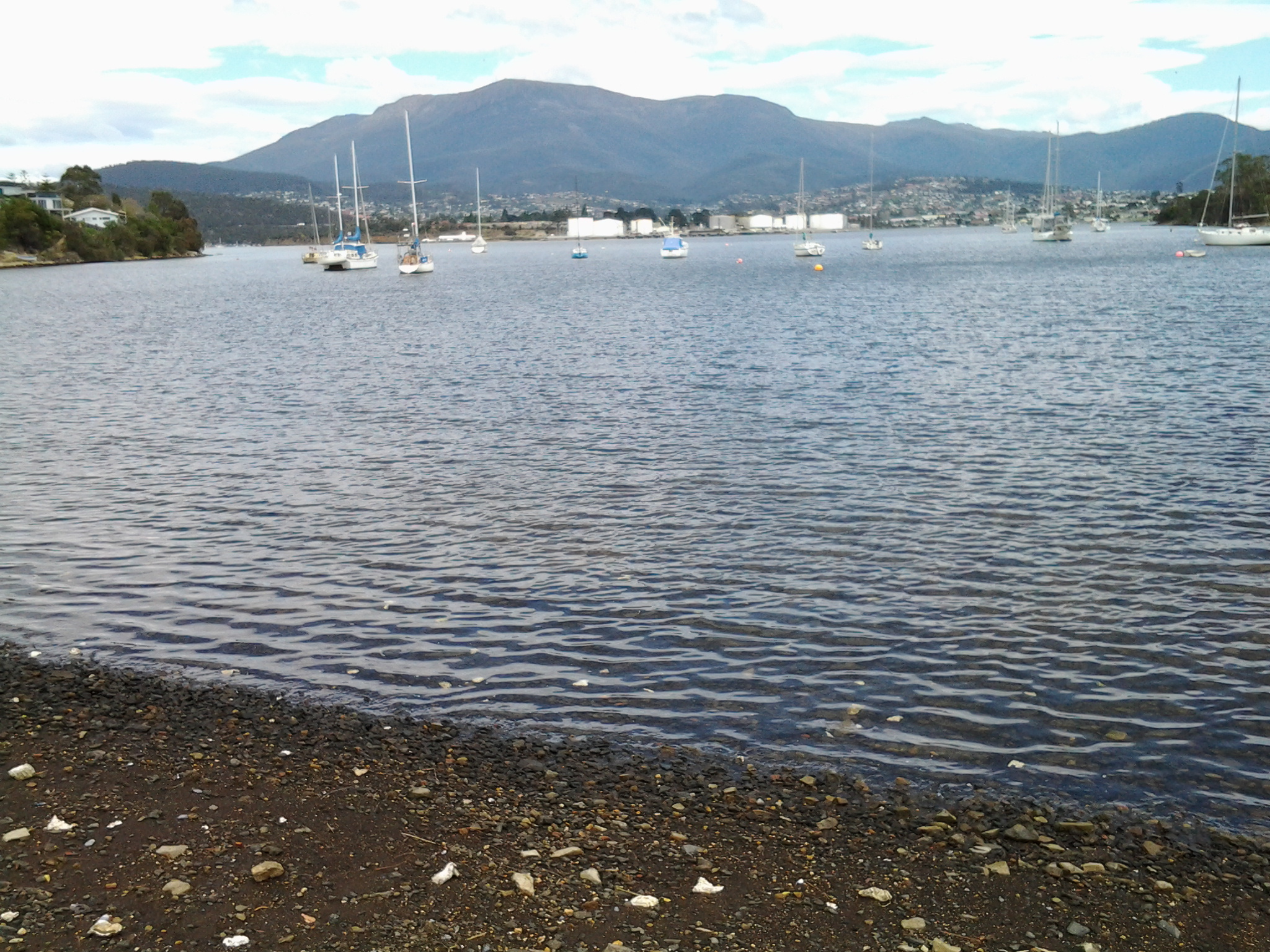
As I reread the above, my writing seemed unimpassioned and lacking the excitement I feel about this idea.  How fabulous to walk along our wonderful river with all its changing temperaments and colours; on some days to walk beside its ruffled surface or its mirror sheen. To look across at parts of the city, the hills and the mountain.  To enjoy the bobbing and sails of the yachts. To be reminded that I live in this marvellous place.

And when I walk, I want to share my discoveries. I will write the story of the walk firstly on a blog followed by a later publication in a hard copy format – complete with photos.  In addition, I will align the walk with the various set down and pick up points of commuter buses of the public transport system. In this way, I will make the walks accessible for anyone without a car.

Alive with the idea, I alerted Ju and Jo. I knew they would contribute valuable information. Already the ideas are flowing.  Immediately, Ju expected to walk some stages with me – an obvious and appropriate response.  I expect other friends may wish to join some stages.

It is unlikely the stages will be walked sequentially. Rather we agreed that I should buy detailed maps on which to mark out the length and track of distinct stages. Then, depending on the weather of a day or my mood, I can select the stage that best meets the situation.  Stages will not last more than a day, but the length of any stage may vary. In winter a stage may last a few hours.  However, during the long days of summer, a stage may last many hours.

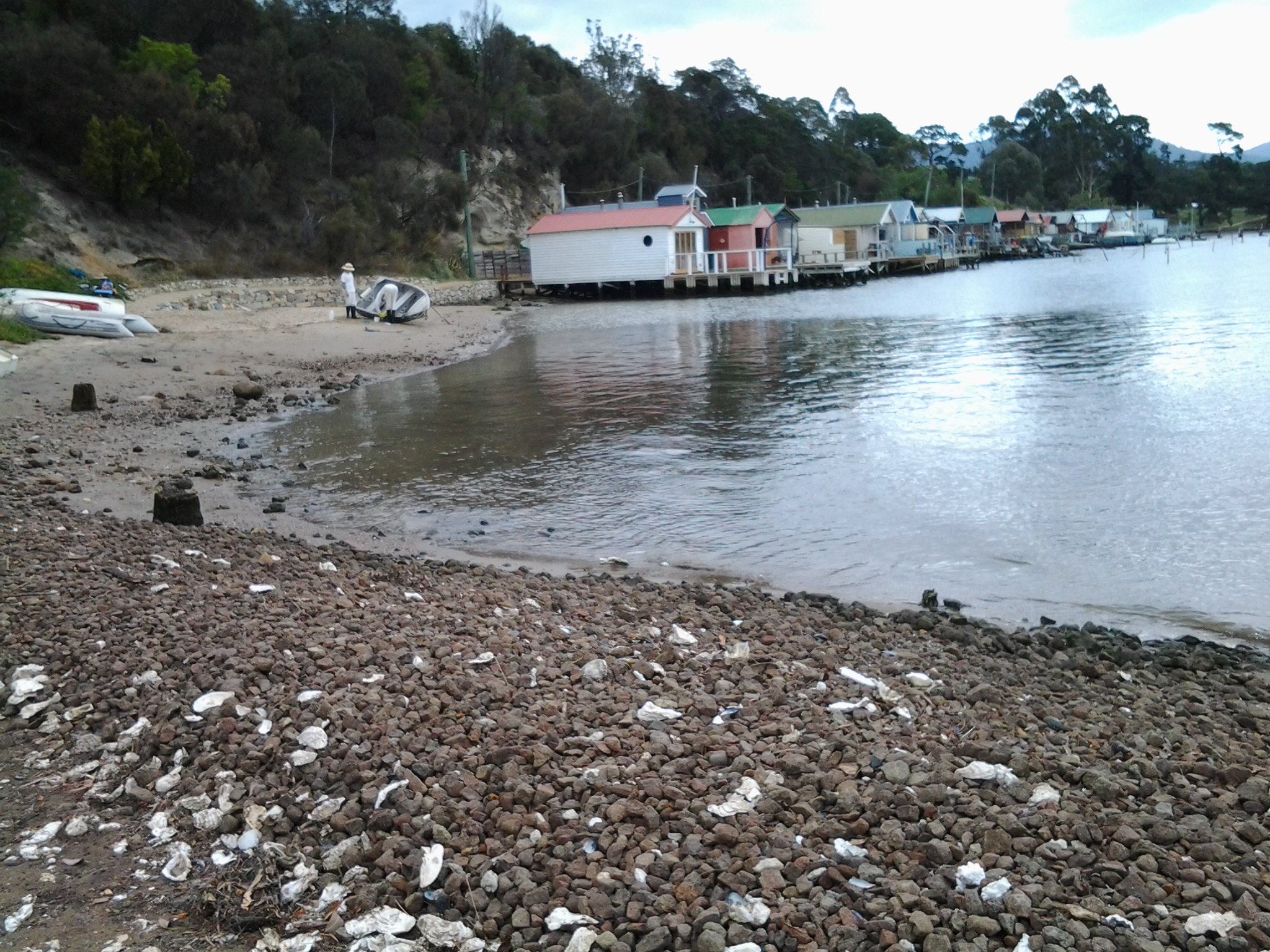
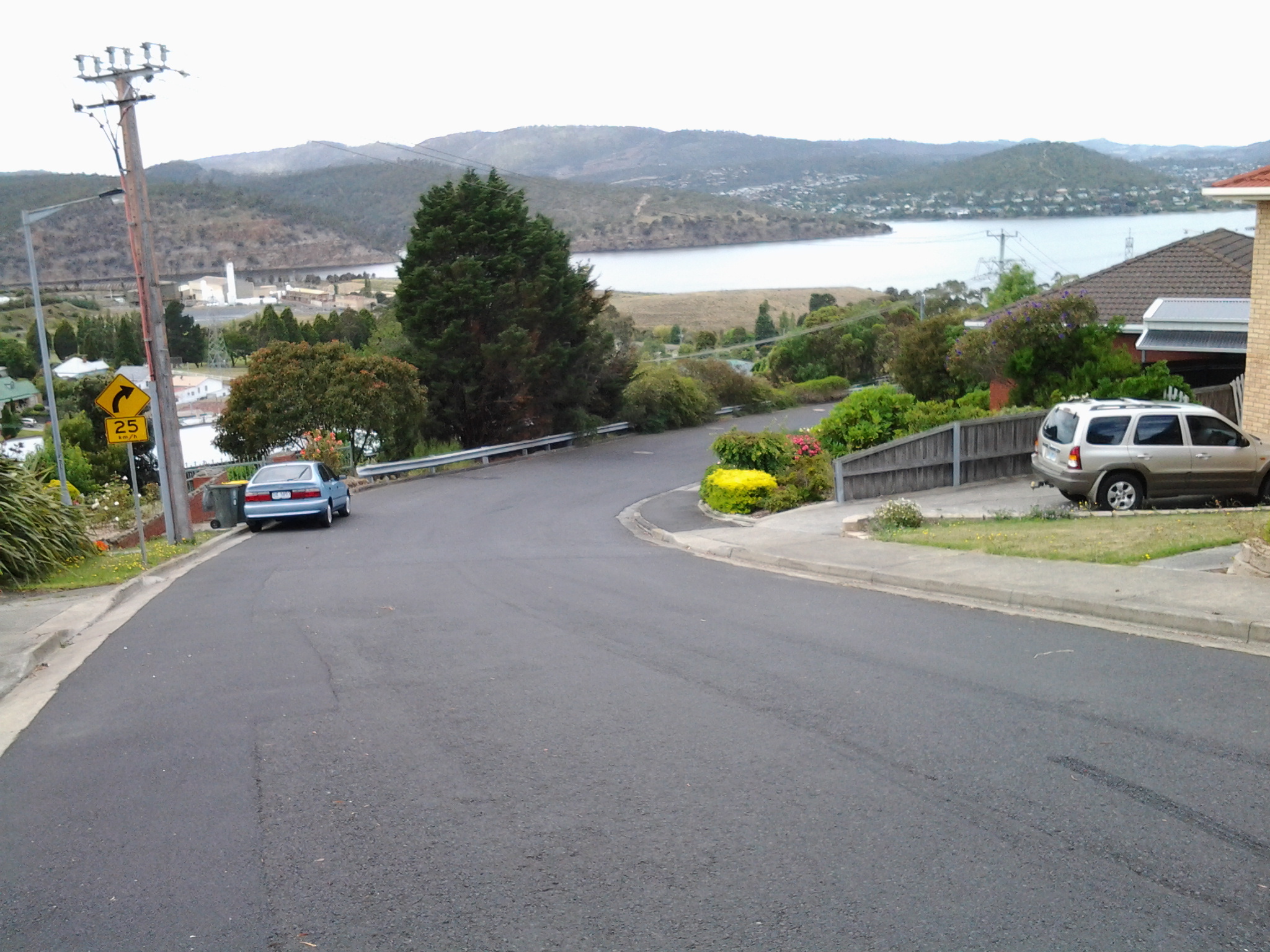
The walks will not always be on the rocky or sandy foreshores of the Derwent river. Sometimes these river edges may be place for our footfalls. At other times we may cross grassy slopes over hills or pass along the concrete pavements or bitumen roads of suburban streets. On occasion, permissions may be needed to pass through private land.  But such possibilities are ahead.

Each walk will be an incremental path through unknowns. Only once the length on both sides of the river has been covered on foot, can the patchwork of stages be brought together and moulded to tell a story.

Today I purchased five maps: New Norfolk (5026); Richmond (5226), Hobart (5225), Taroona (5224) and Blackmans Bay (5223). Collectively these cover a small part of the length of the Derwent river.  The initial aim will be to determine the walks from the sea ends of the river at a point in the Blackmans Bay suburb (on the western side) and near the township of Opossum Bay (on the eastern side) then continuing upriver and finishing at some point in the vicinity of New Norfolk.  Further west then north some of the river flows through untracked wilderness so that serious bushwalking plans will need to be developed for those distances.  The aim is to walk the most easily accessible bits first.

A wind ruffled Derwent River shows off the the pleasures of the water. being overlooked by snowcapped Mount Wellington

A wind ruffled Derwent River shows off the the pleasures of the water. being overlooked by snowcapped Mount Wellington