Category Archives: Tasmania

On through Kingston still heading southwards past Boronia Beach

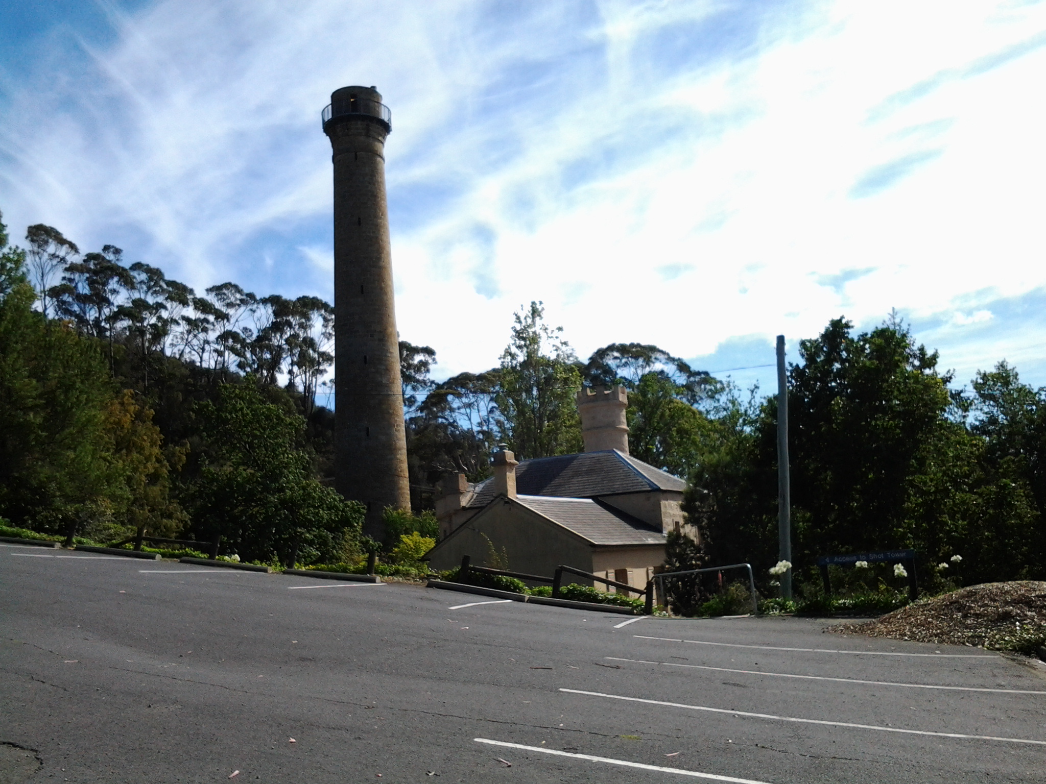
I finished my lunch on the south side of Browns River, crossed the pedestrian bridge over Browns River at 12.17 pm then proceeded along Osborne Esplanade (parallel and next to the Derwent River) towards the Kingston shops.  Over Christmas I holidayed in Kingston and my 3 posts titled I am on holiday watching over the Derwent River, Getting out into the air at Kingston Tasmania and Kingston Beach, Tasmania offer more information about this leg of my walk along the Derwent River.

I had the pleasure of meeting with Em for cups of tea and a long happy chat and saying hello to people I knew as they walked past the outdoor café Beachfront 32.  Immensely pleasant.

At 1.52 pm I restarted my walk southwards amidst foreshore joggers, walkers and seagulls – the sun was shining again and my world was warm.

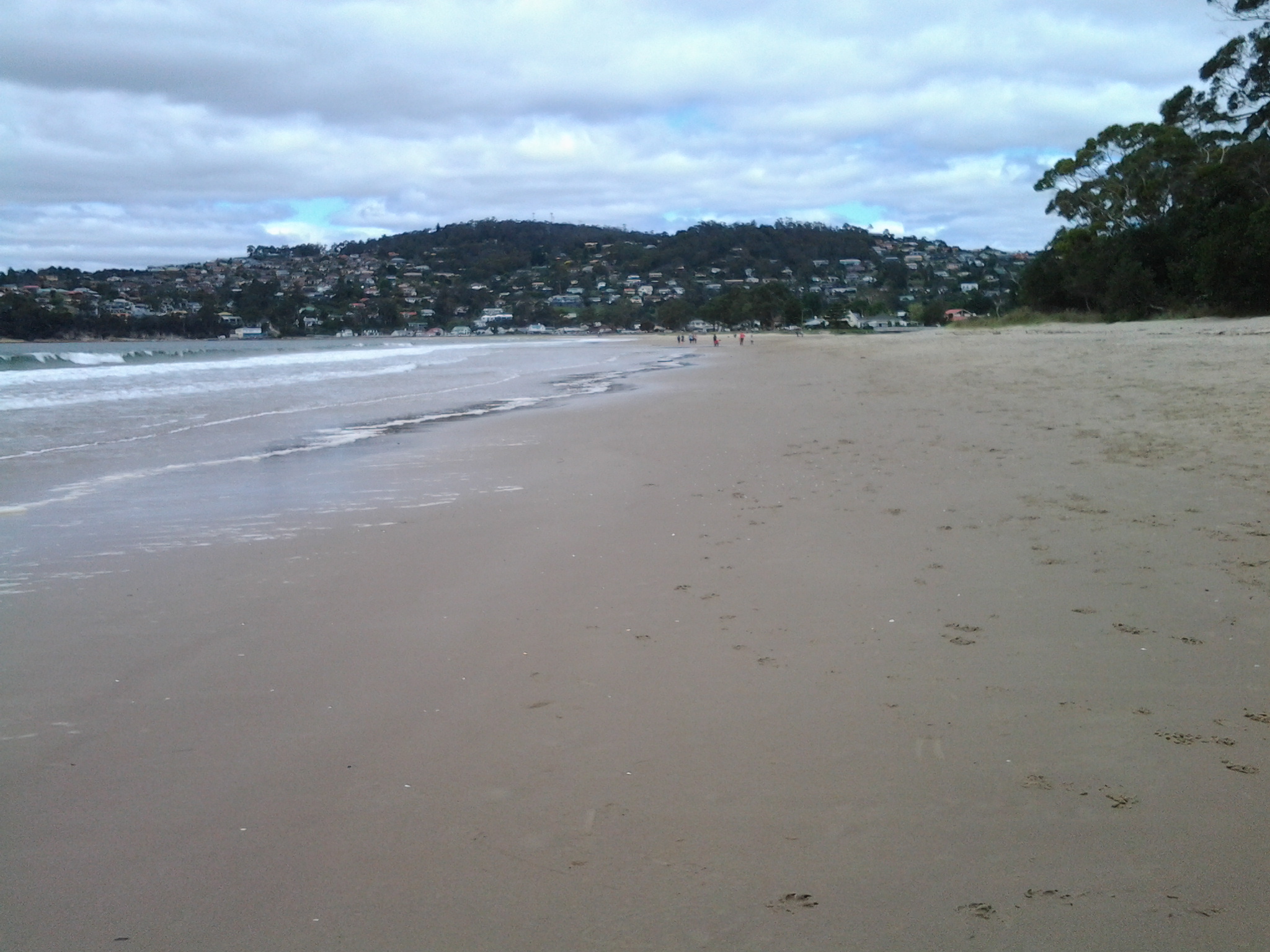
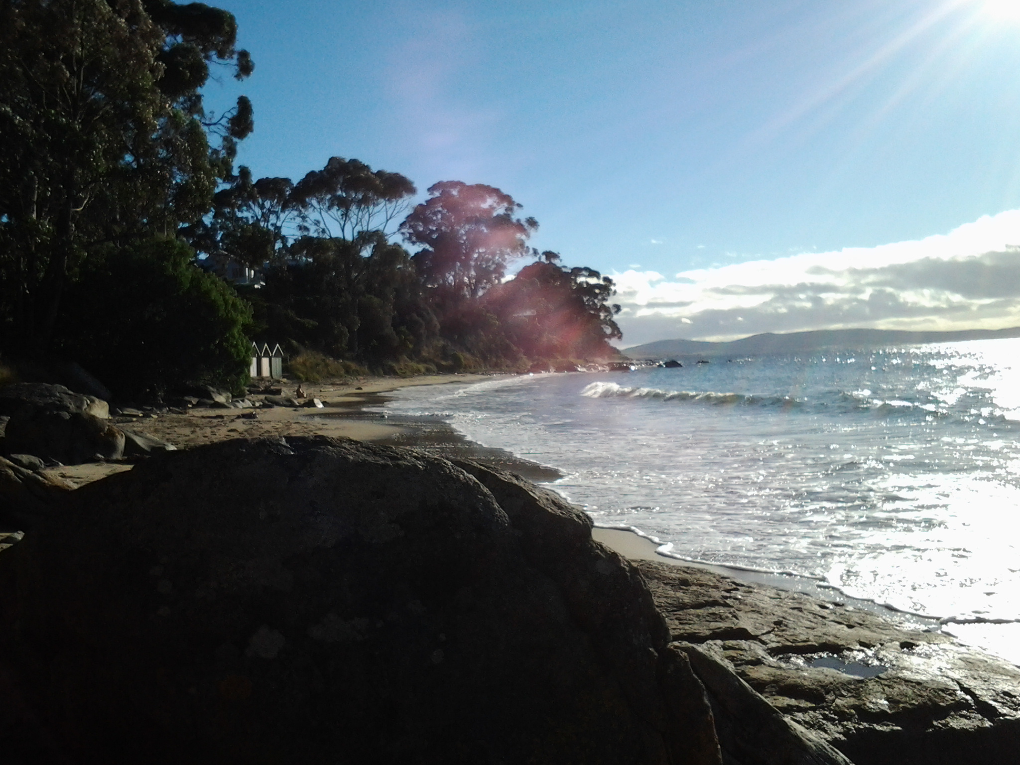
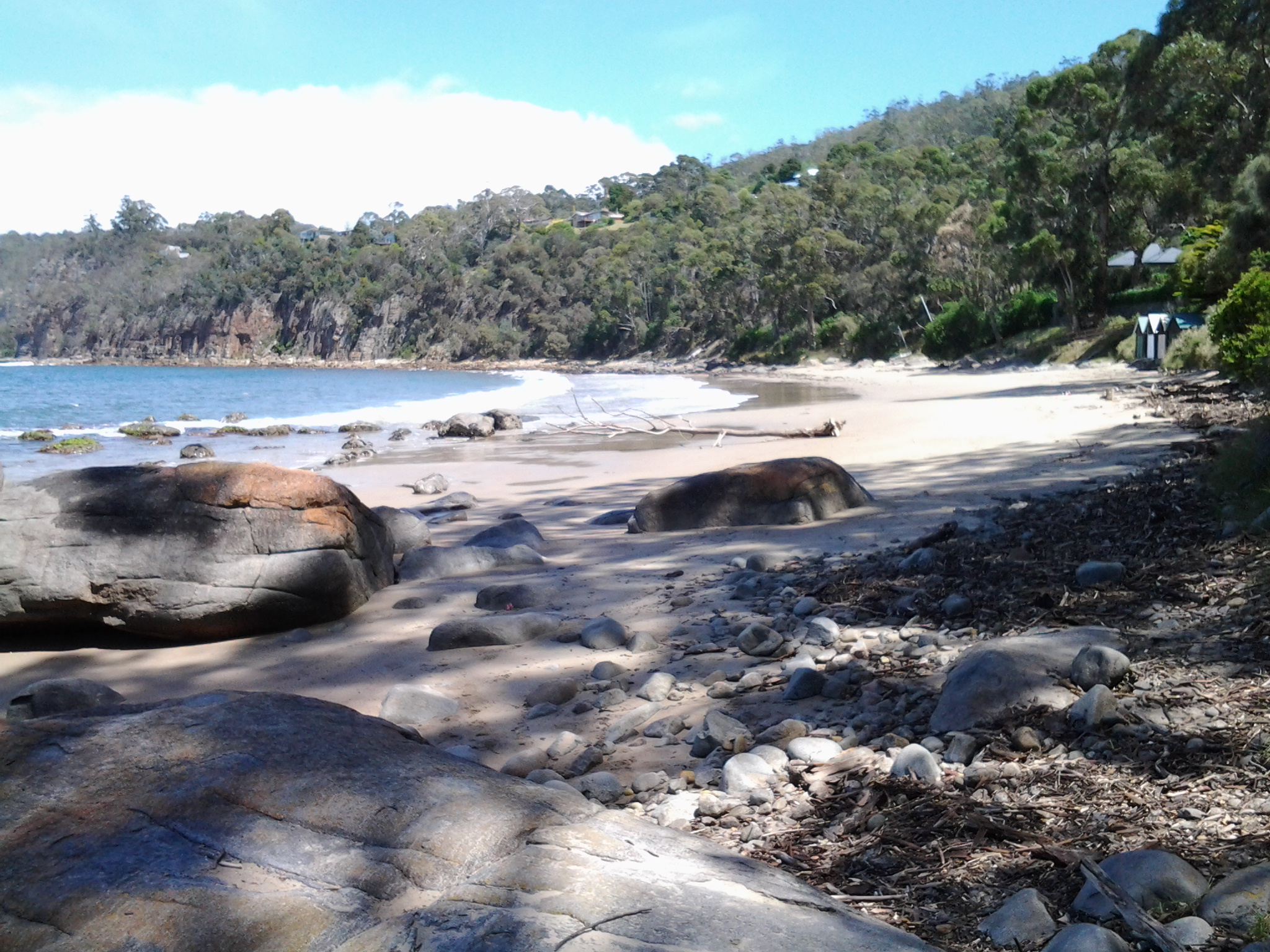
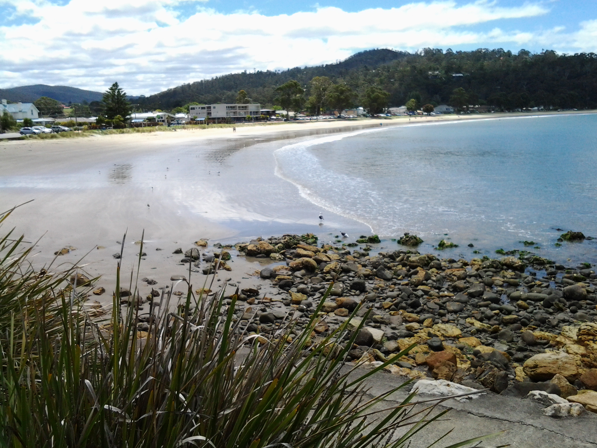
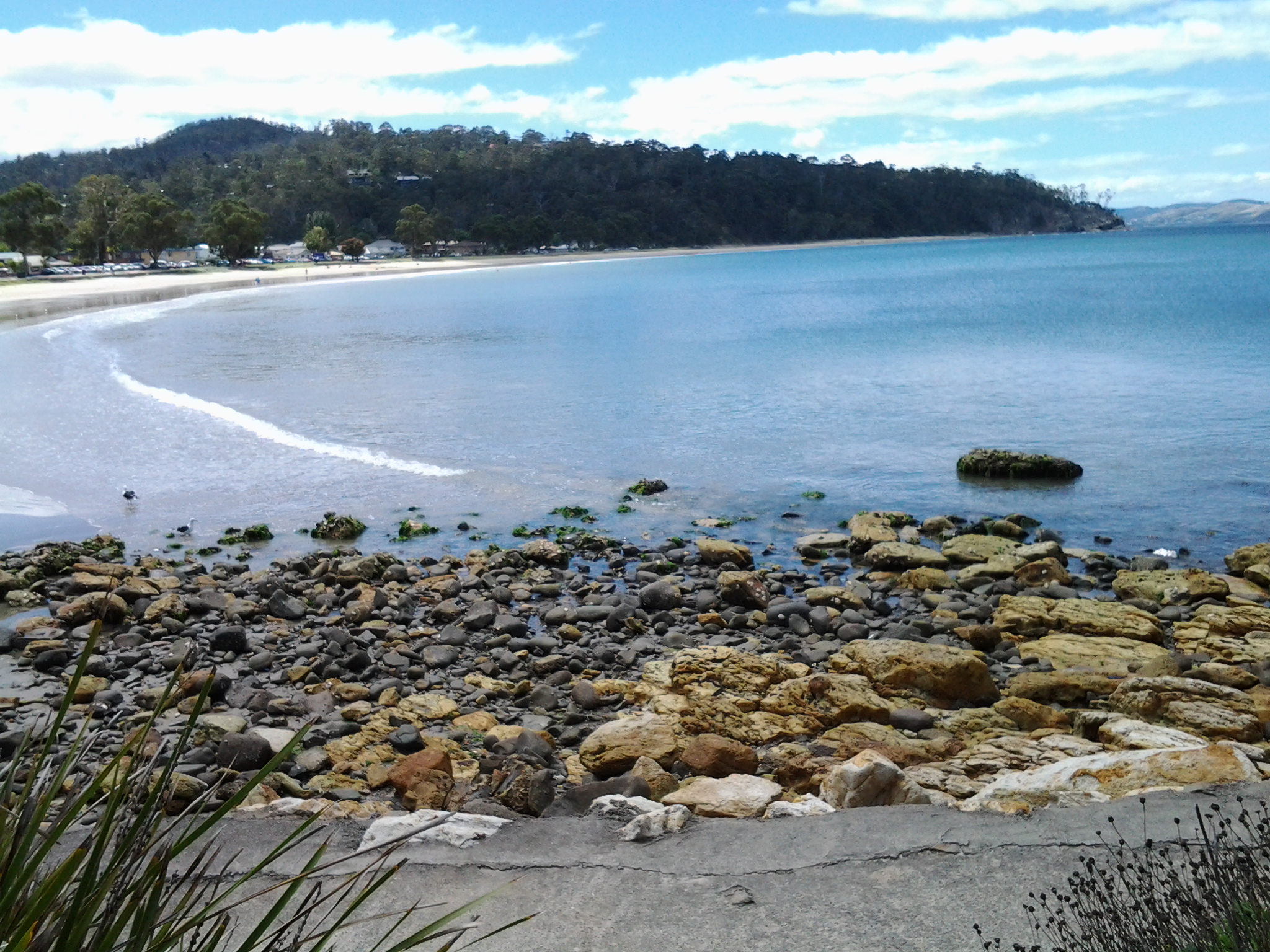
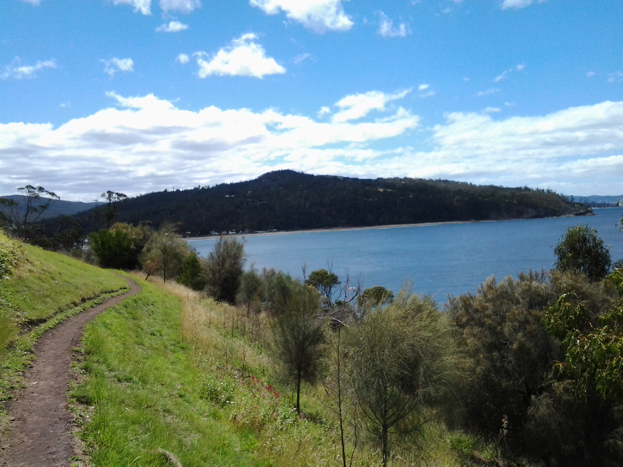
By 1.59 pm I reached the Kingston Beach Sailing Club and could look back northwards across the sweep of water and the arc of Kingston’s white sandy beach.

20150202_135849 20150202_135818 20150202_135809 20150202_135813

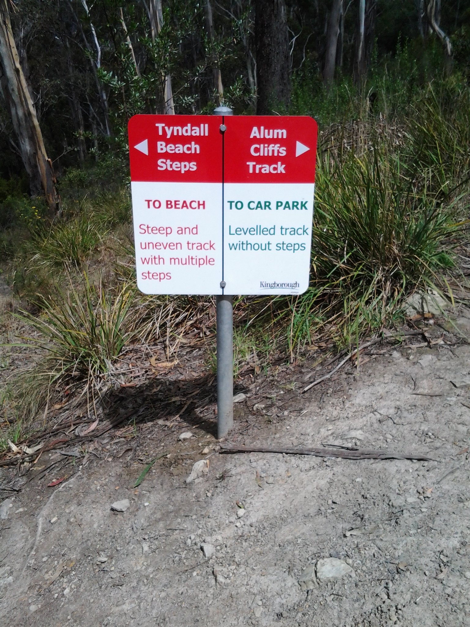
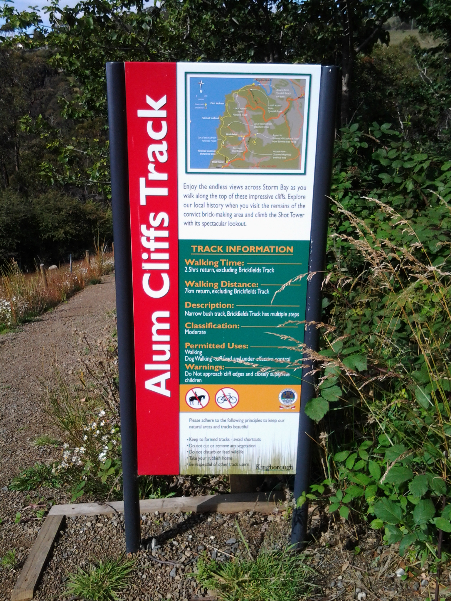
The last photo looks north to the headland at the end of Tyndall Beach which was spread at the bottom of the southern end of the Alum Cliffs.

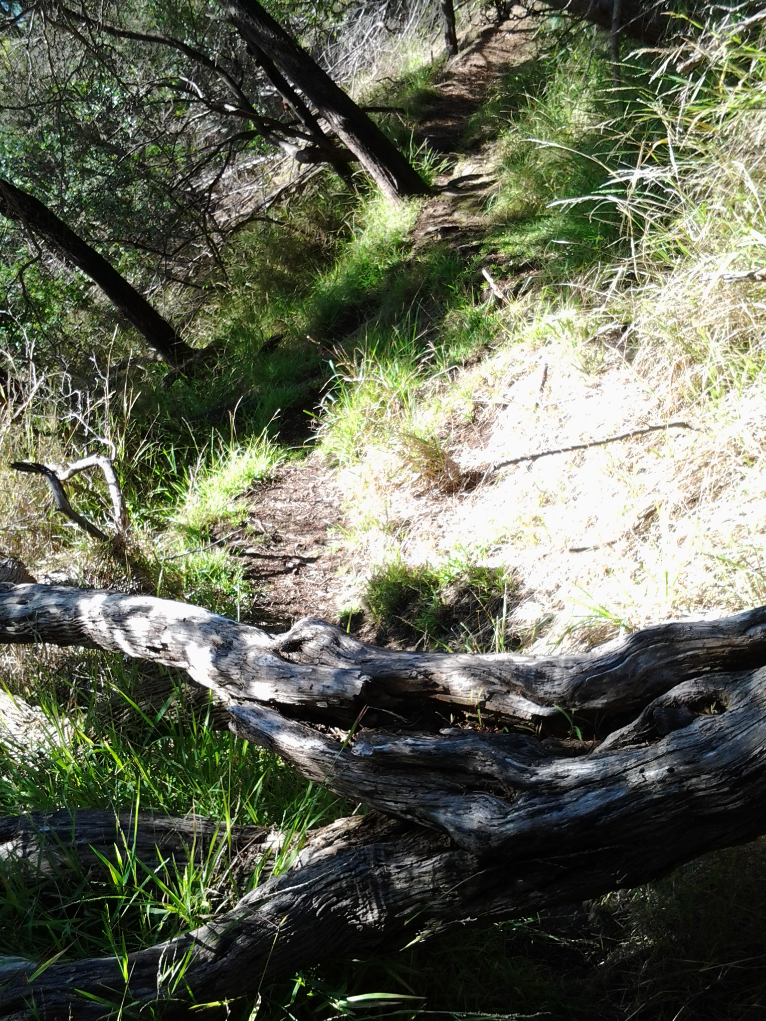
A minute later I reached the Boronia Beach Walking Track and turned left.

20150202_135909

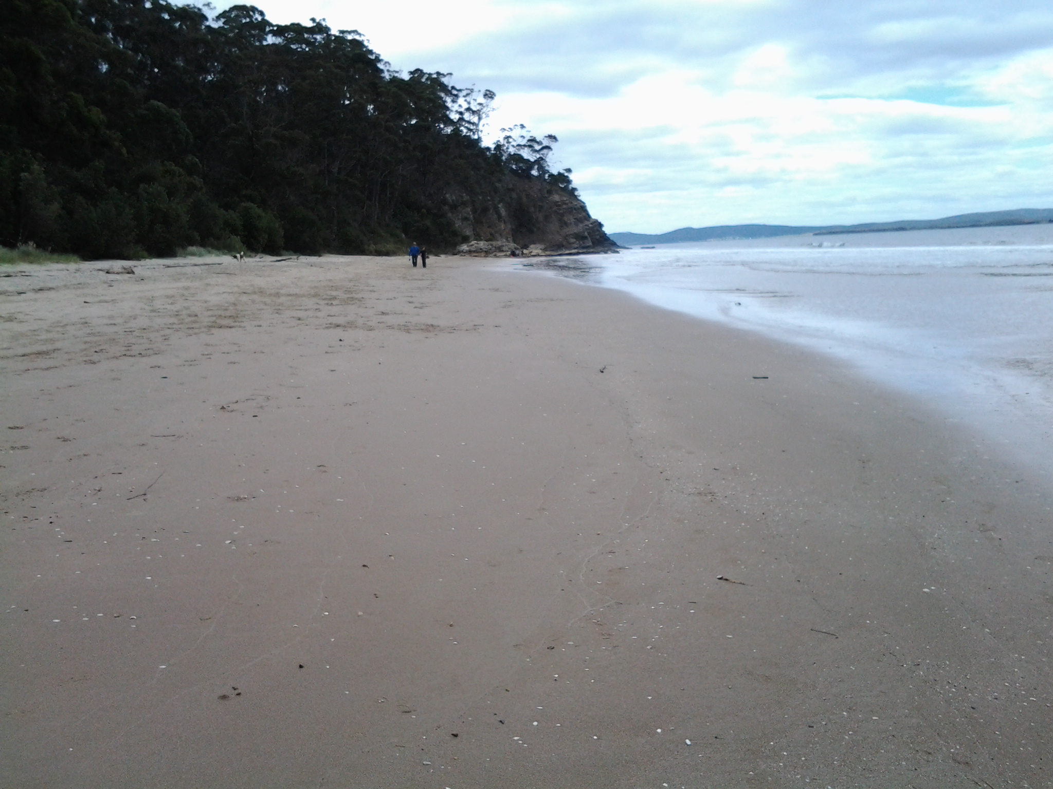
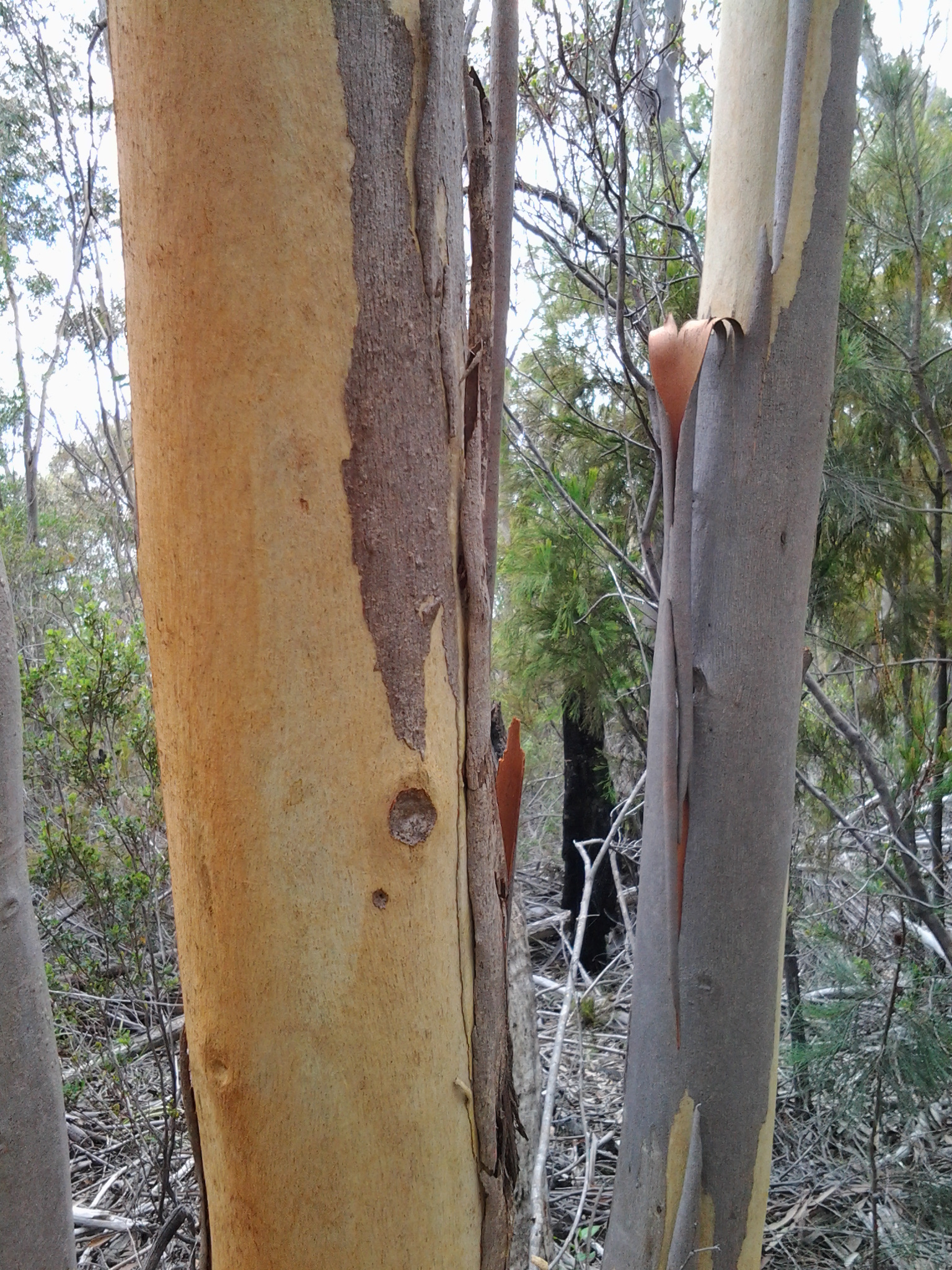
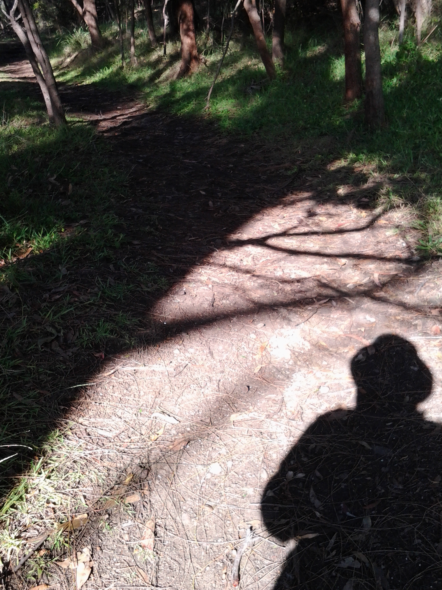
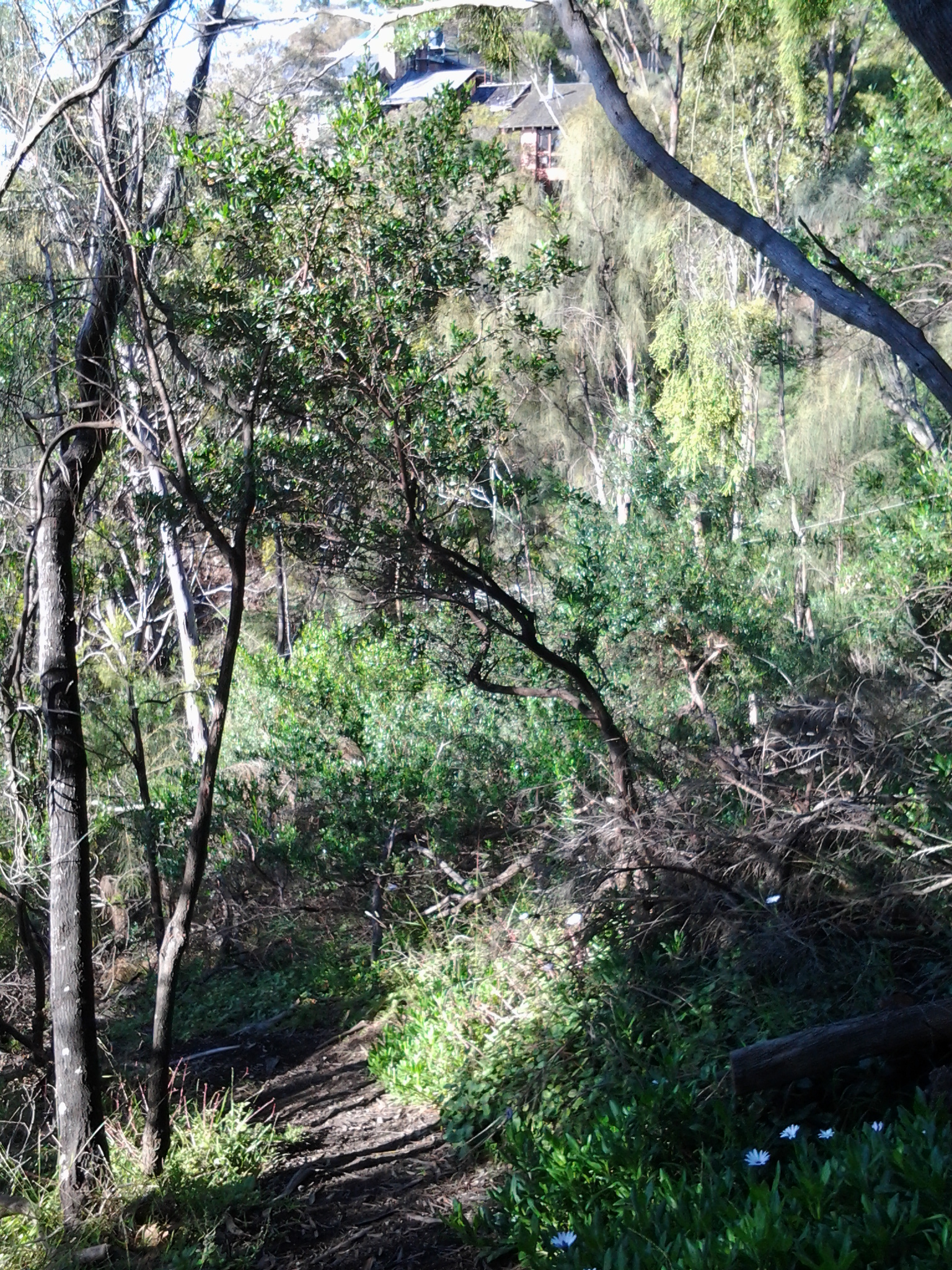
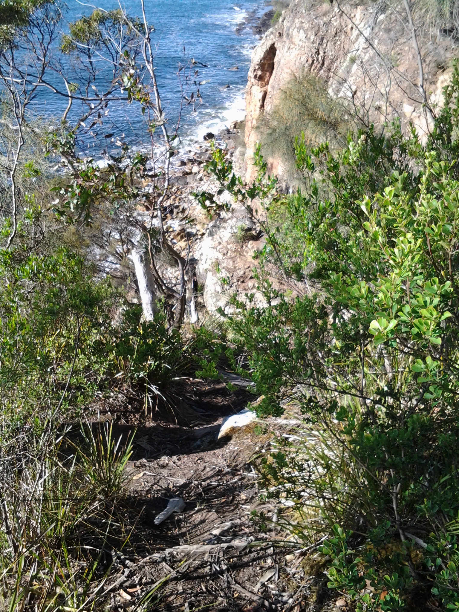
A gentle shady path meandered along above the water and I could hear happy voices on the rocks below.   The views through the trees were spectacular.

20150202_140623

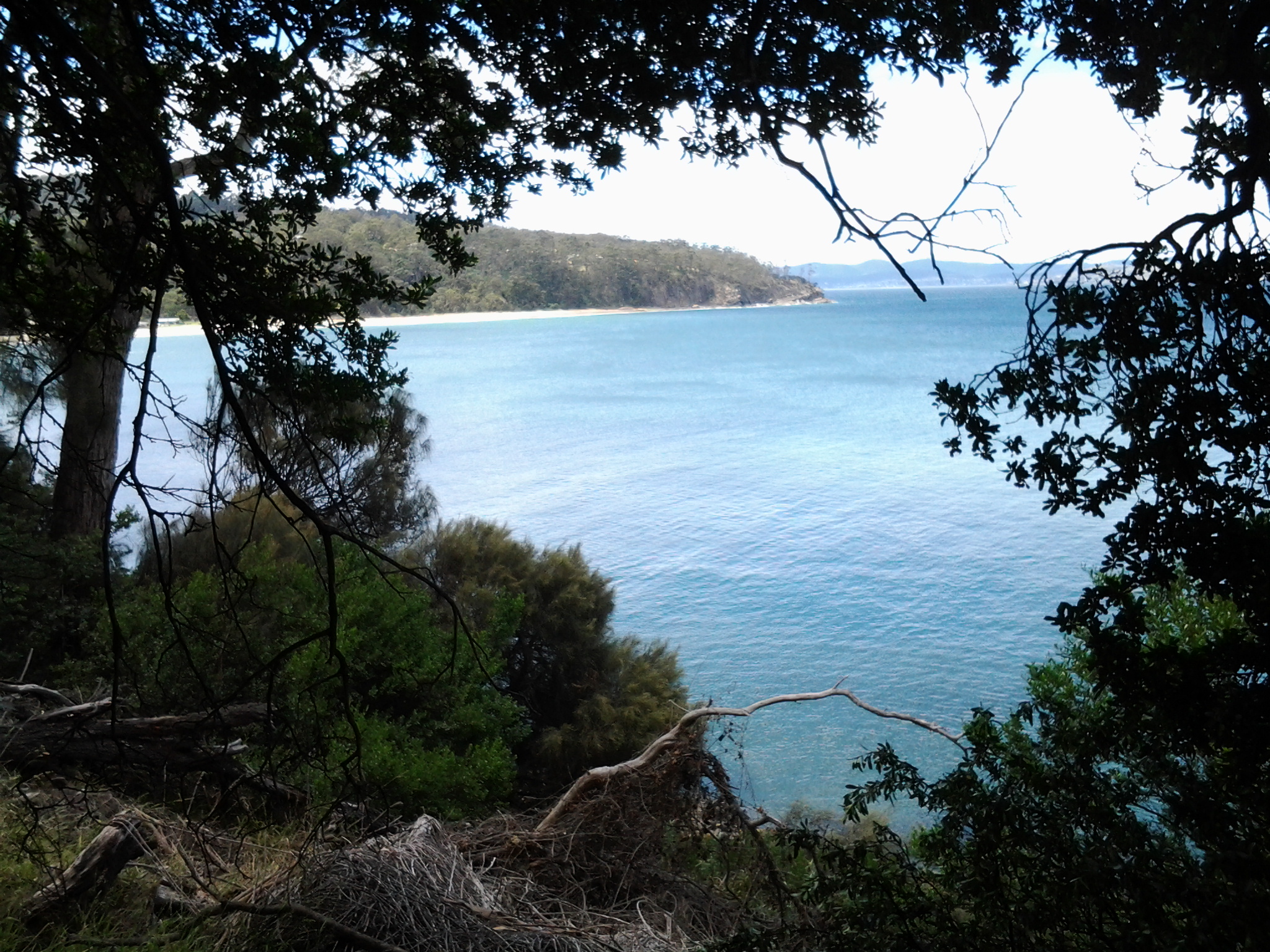
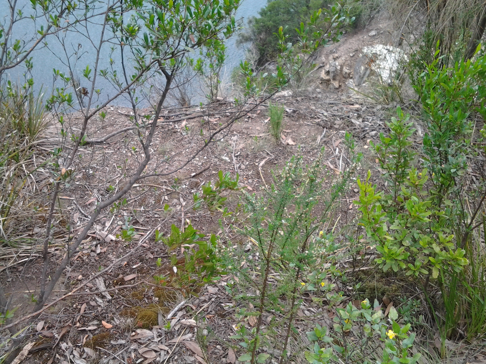
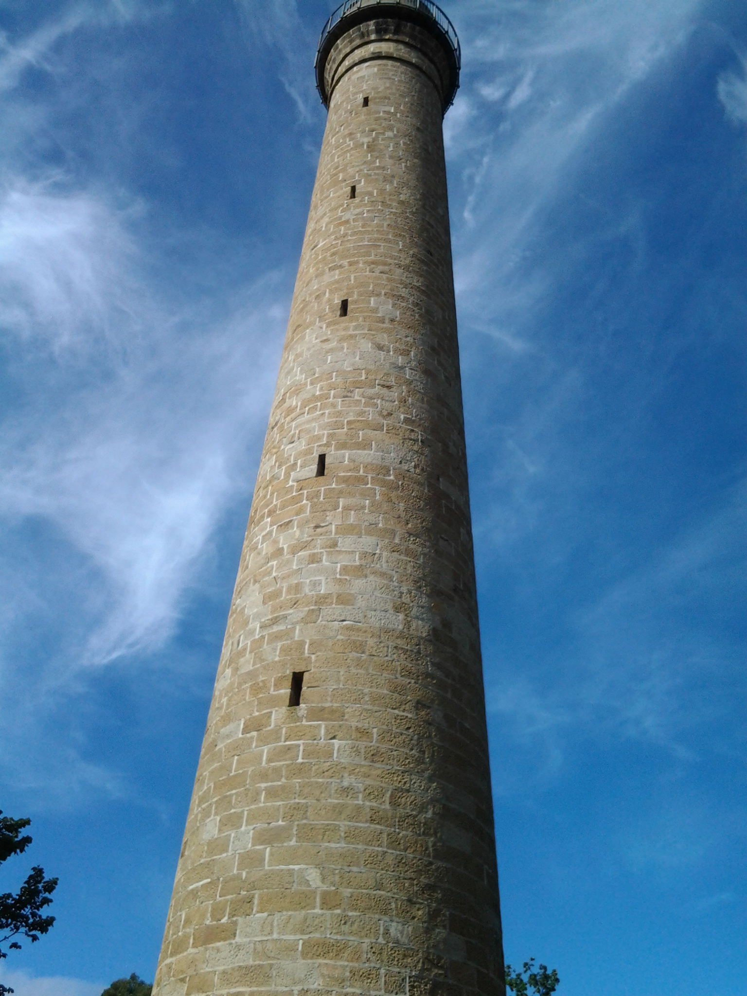
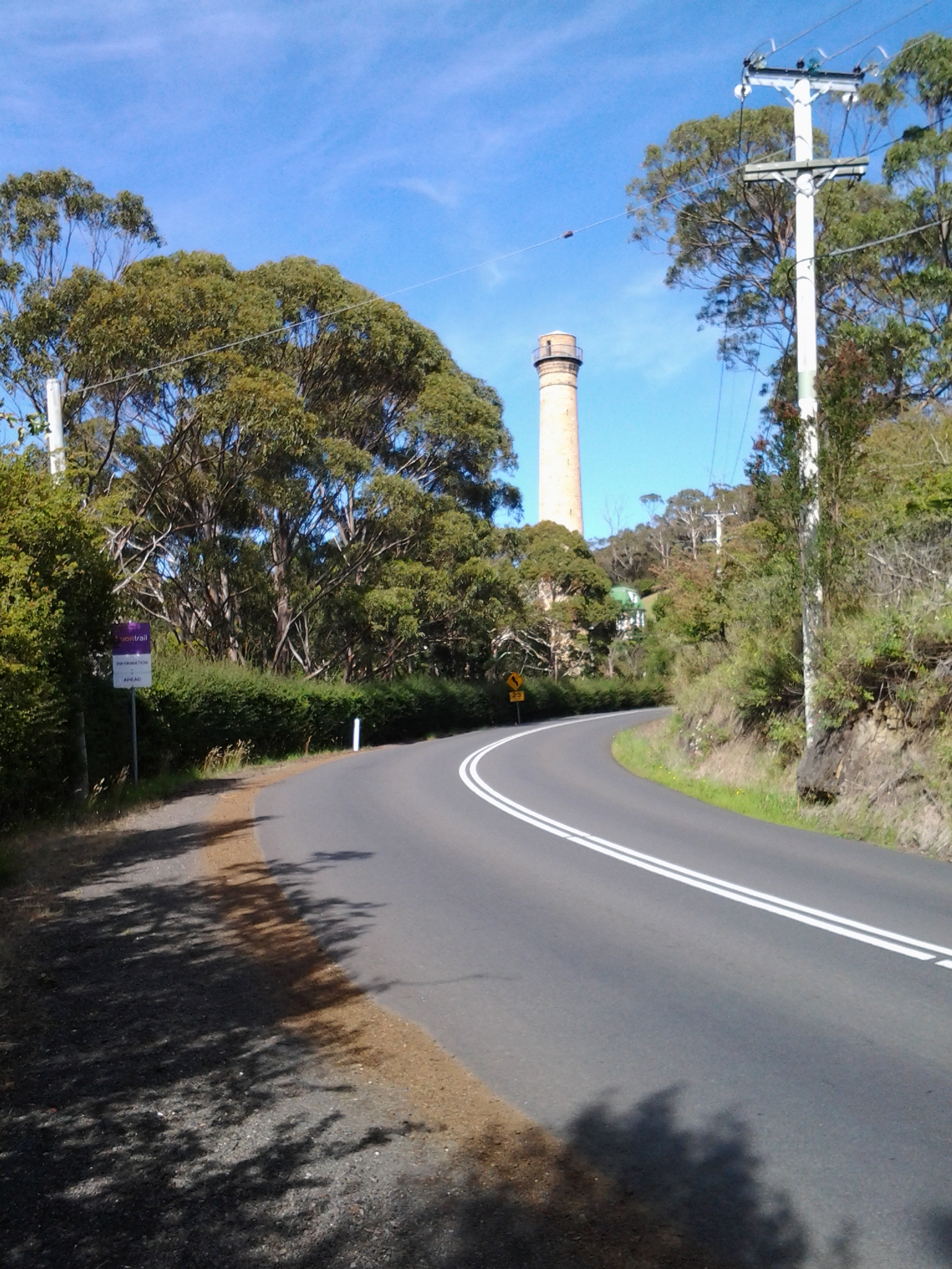
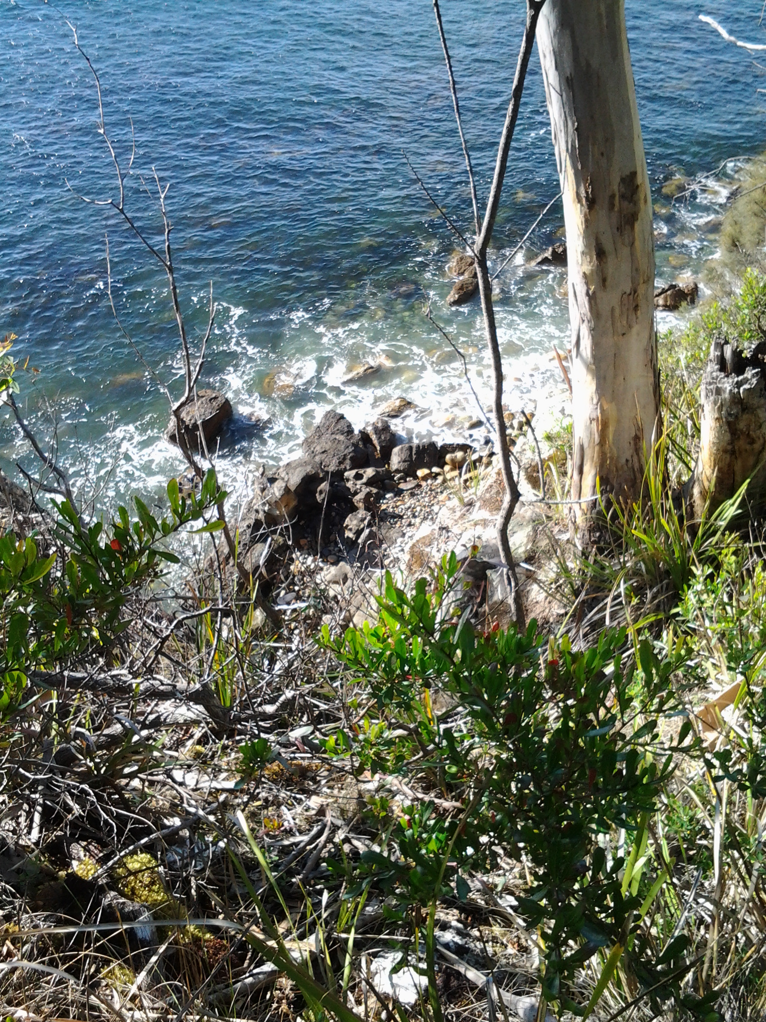
Up above me on my right were large houses with massive picture windows surrounded by high mesh fences. Then the landscape opened out and I could still look northwards to the Alum Cliffs where I had walked during the morning.

20150202_141612

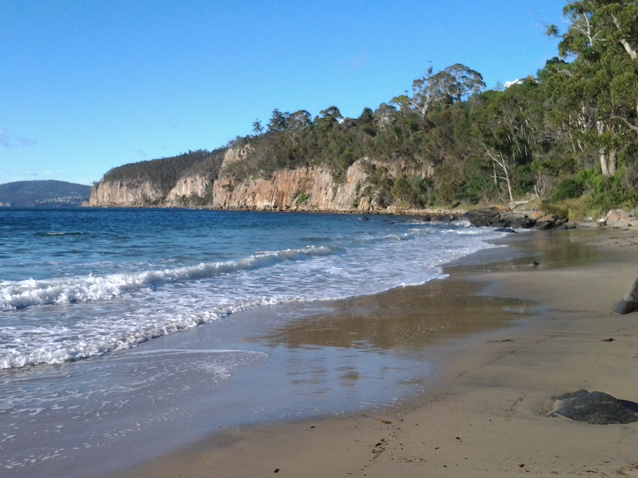
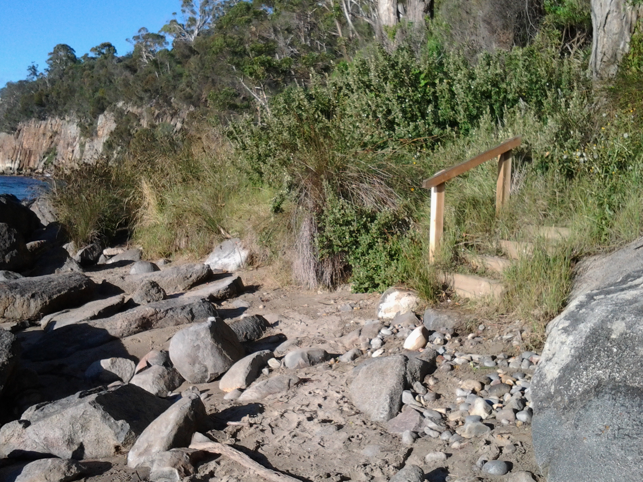
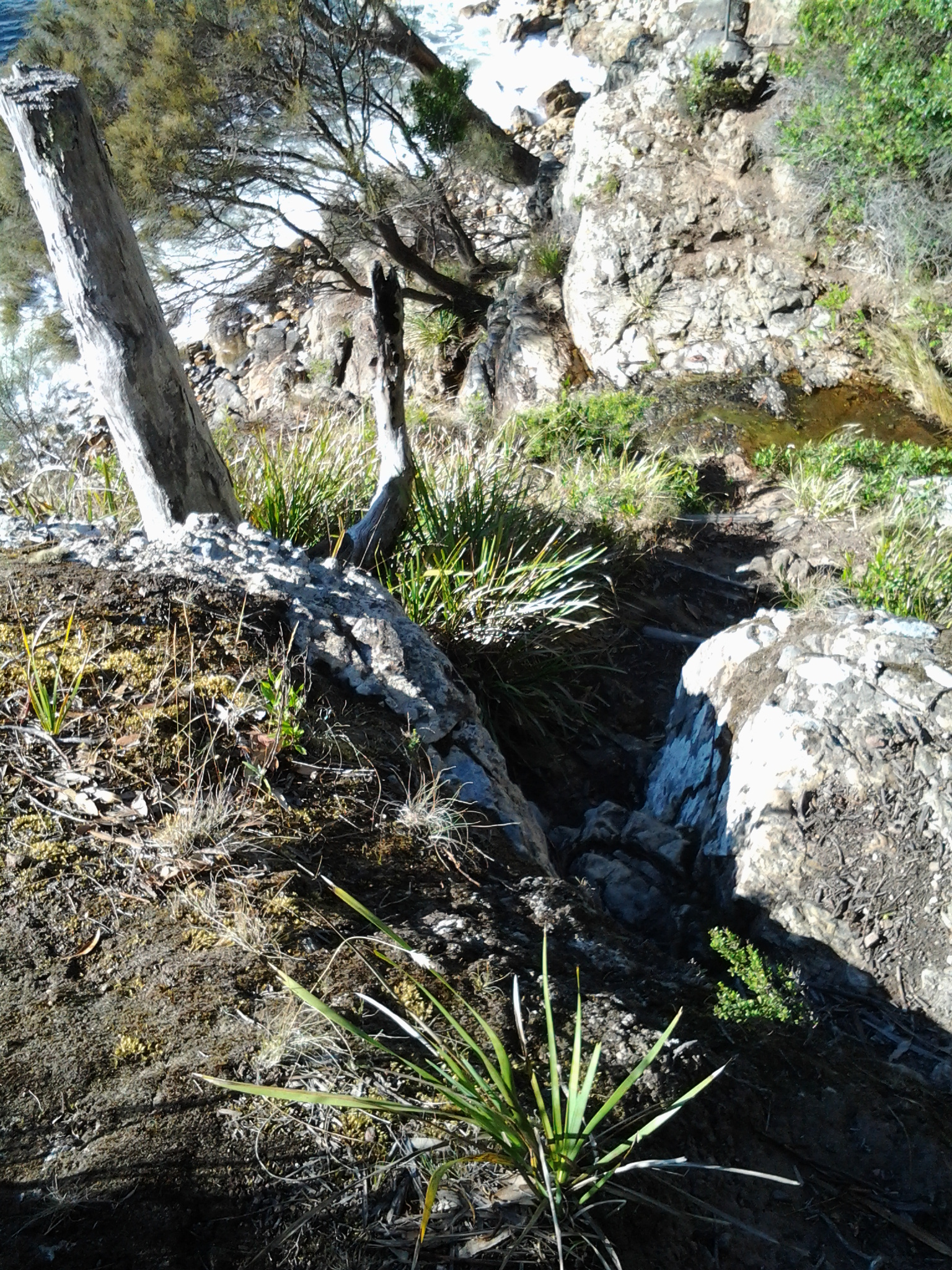
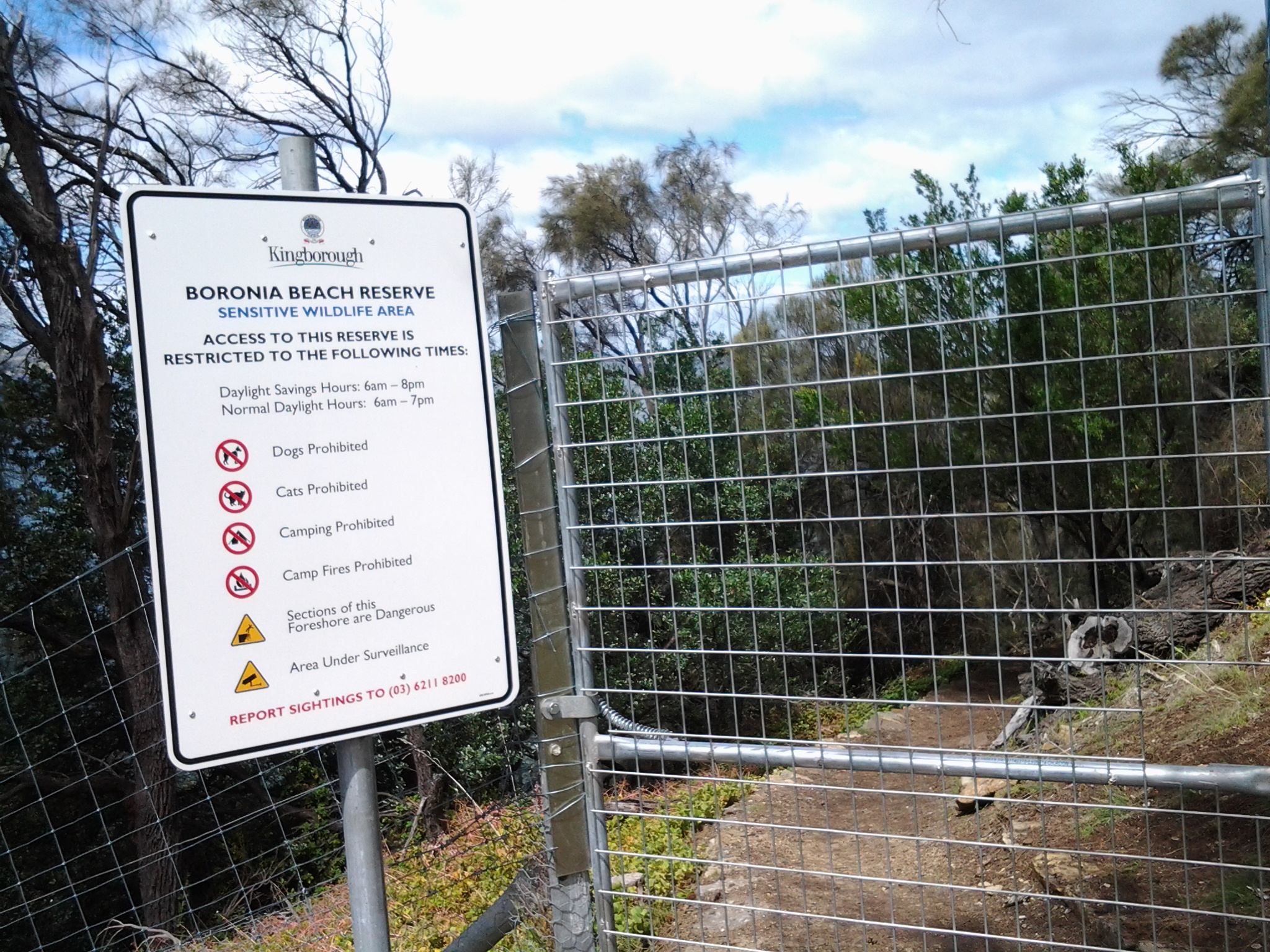
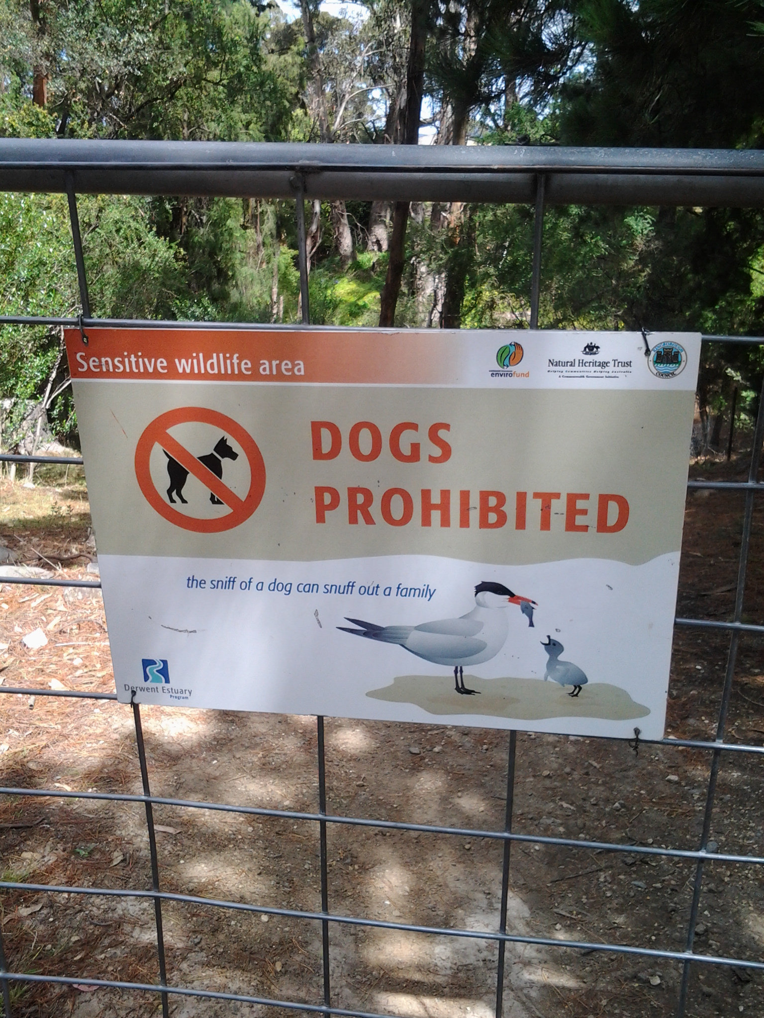
At 2.18 pm I reached a gate marking the entrance to the track down to Boronia Beach, a beach that I had previously not known existed.

20150202_141714 20150202_141816 20150202_141954 20150202_142008

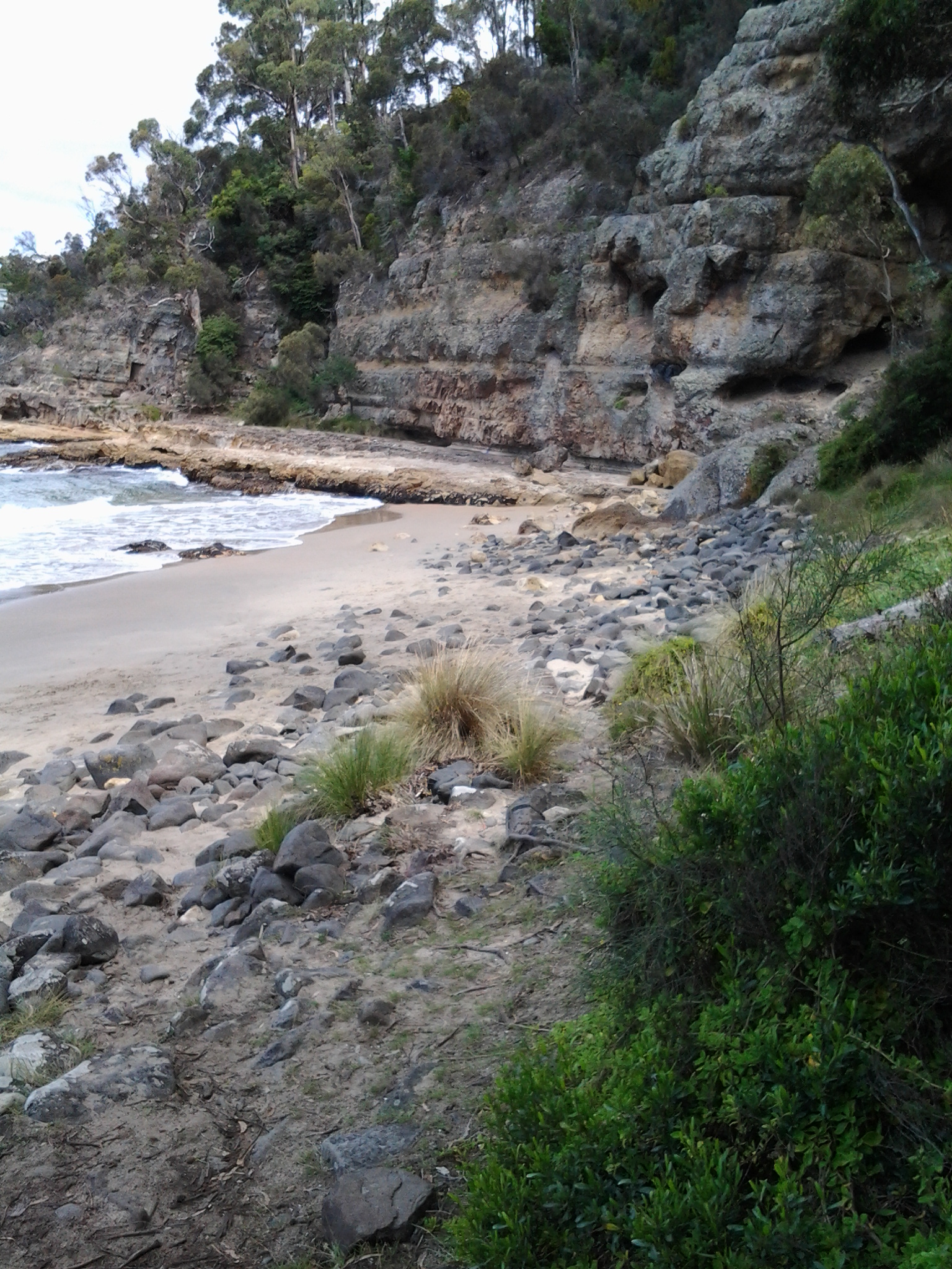
By 2.24 pm I was walking on the beach.

20150202_142513 20150202_142154

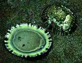
I remembered the chitons which had featured on a public art work at Taroona Beach and wondered whether they could be found on this beach (refer back to my posting Public art works along the Derwent River –Taroona’s Chiton for more information). I checked the rocks but found none.  I  concluded the chitons must collect together only on the Taroona Beach rocks.

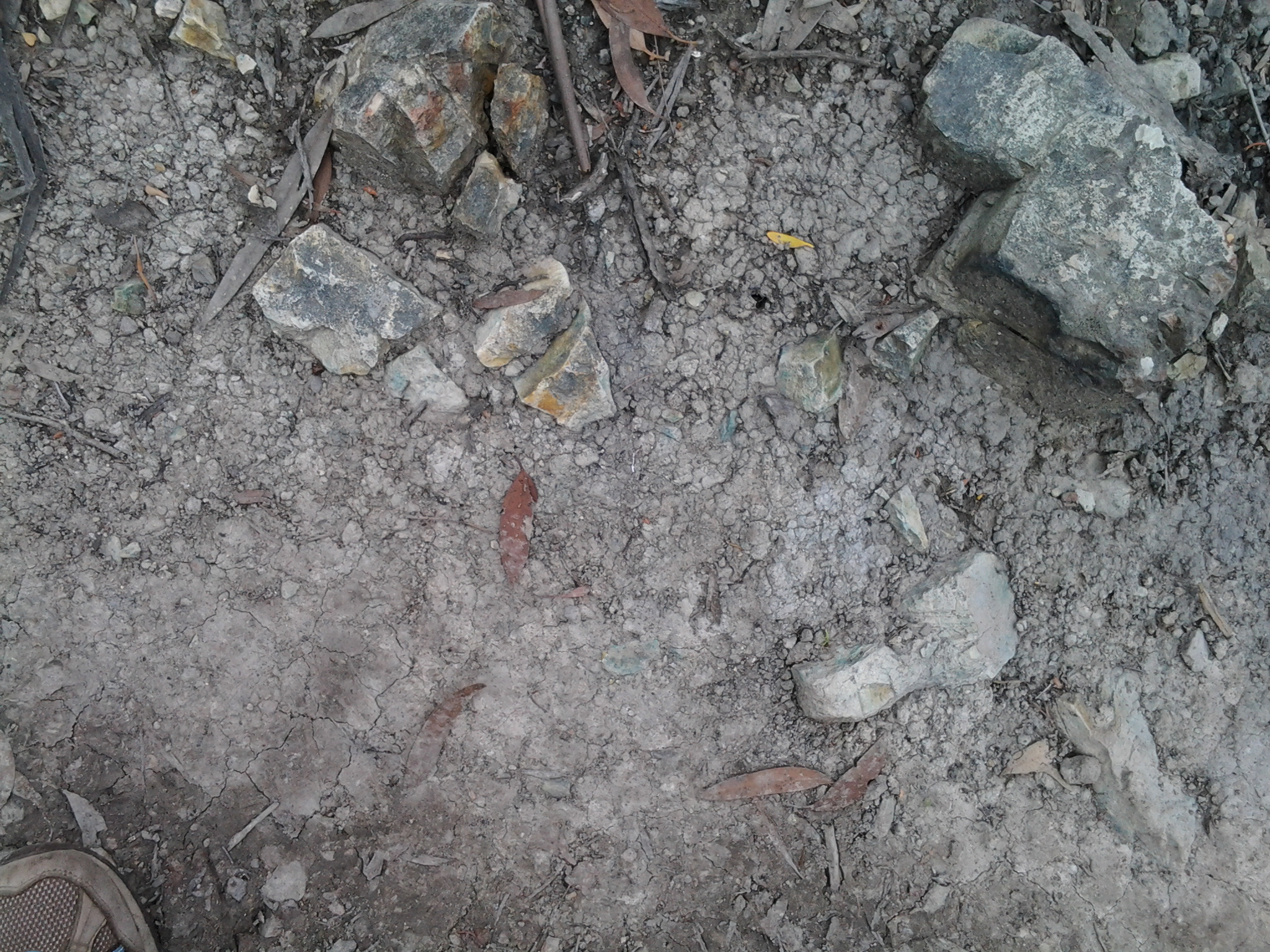
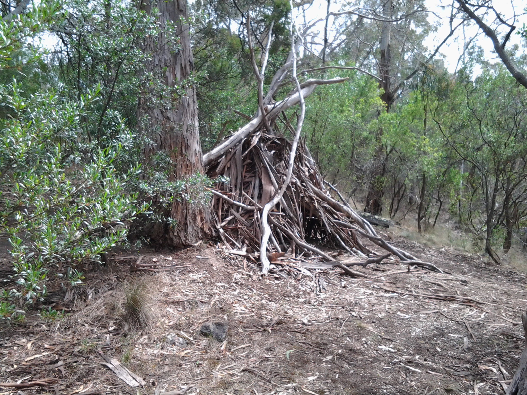
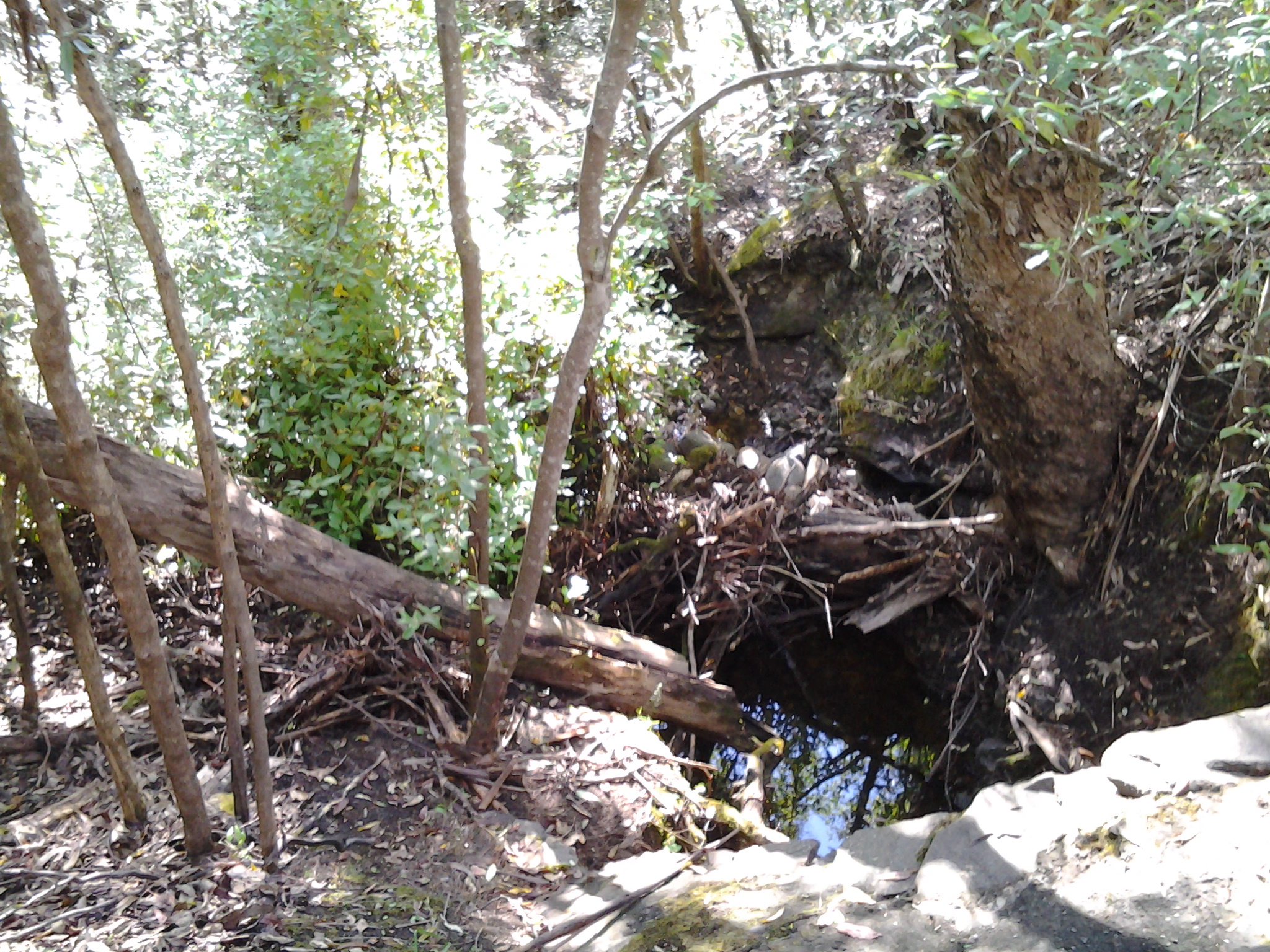
The rock formations at the southern end of the beach were a surprise.  The soft sandstone has been weathered and small caves were formed into the cliff.

20150202_142346 20150202_142436

Seeing these caves cast my mind back to Kalambaka in north western Greece. Last year I visited this town and marvelled at the stunning beauties of the Meteora (refer http://en.wikipedia.org/wiki/Meteora for more information) Below is one of my photos showing the caves in some of the cliffs which hermits used to climb up and live in (and which Roger Moore as James Bond climbed over dramatically in the movie “For Your Eyes Only”).

20140607_190315 20140608_094209

Boronia Beach’s caves are smaller and different in many ways from those of the Meteora.  However they surprised me in this tucked away gem of a beach.

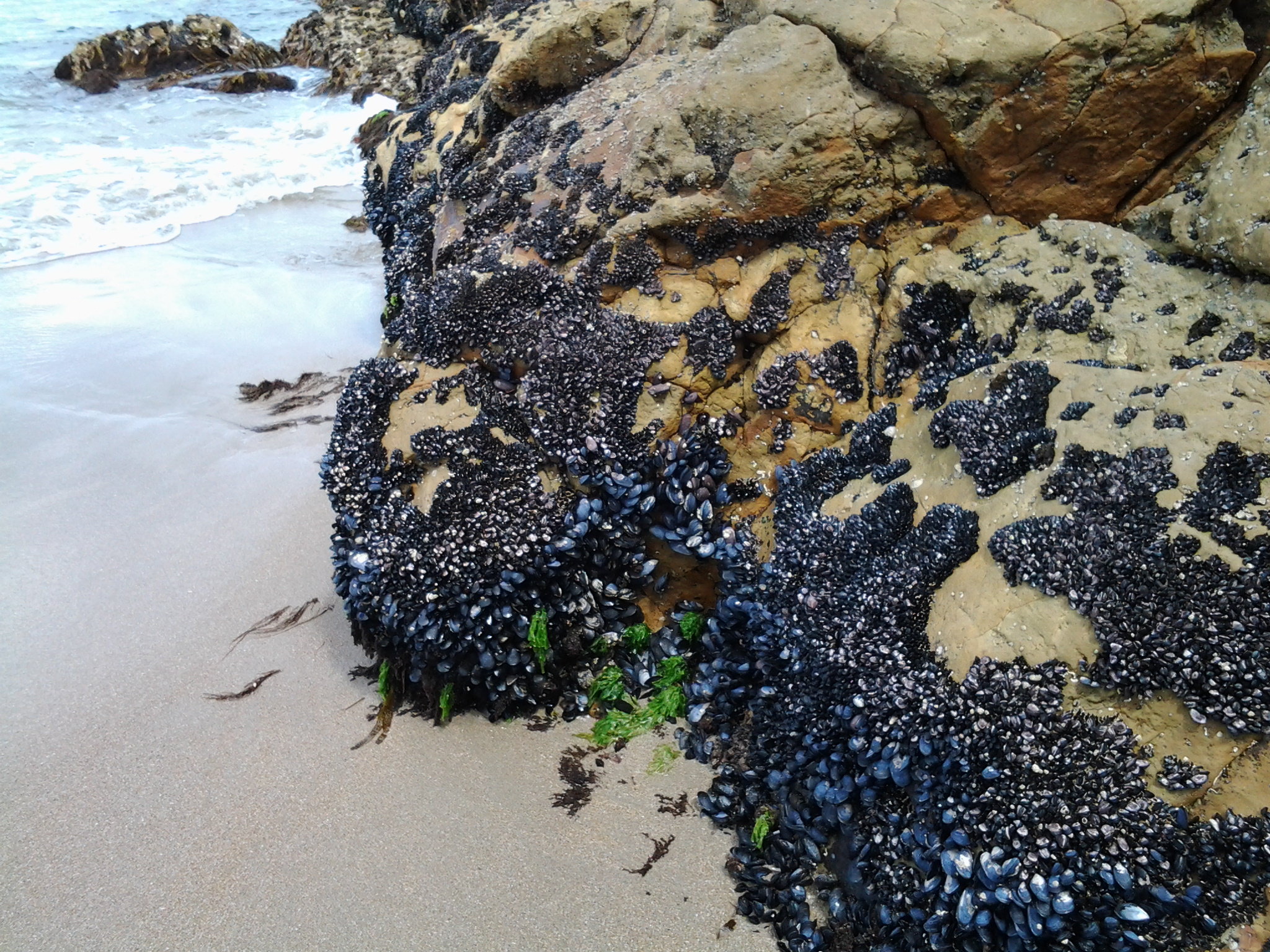
For those who loved the photo of mussels growing on Boronia Beach rocks which I provided in an earlier posting about the Stage 12 walk, here is another.

20150202_142536

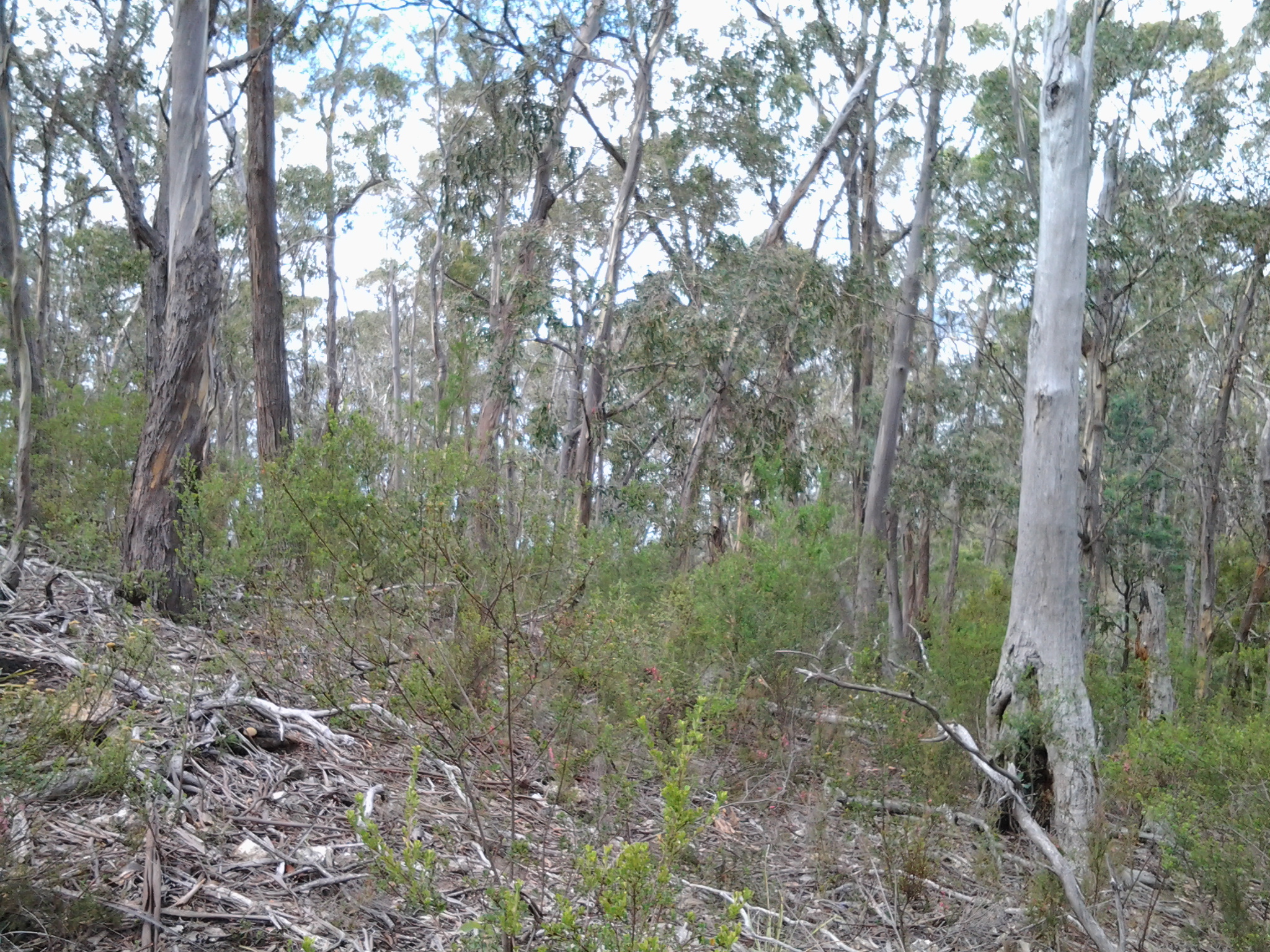
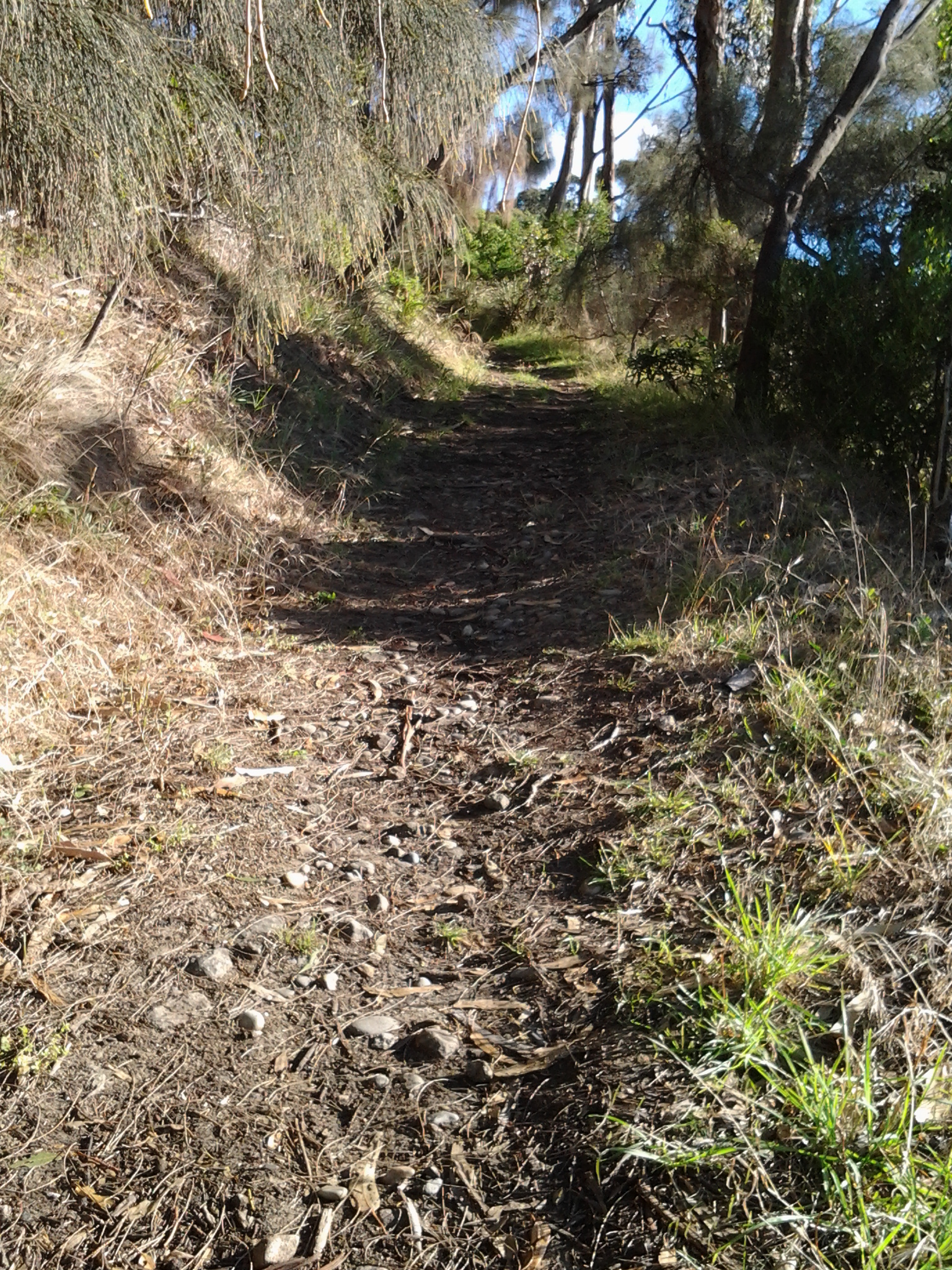
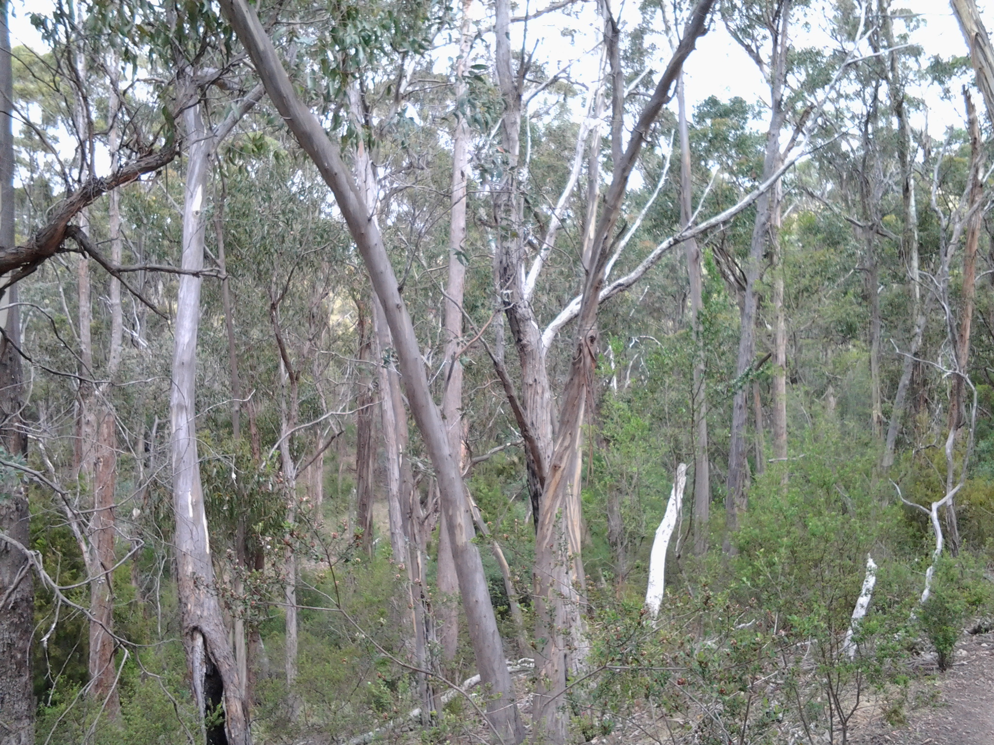
Five or so minutes later I began the trek uphill out of Boronia Beach under old pine trees.

20150202_143006 20150202_143214

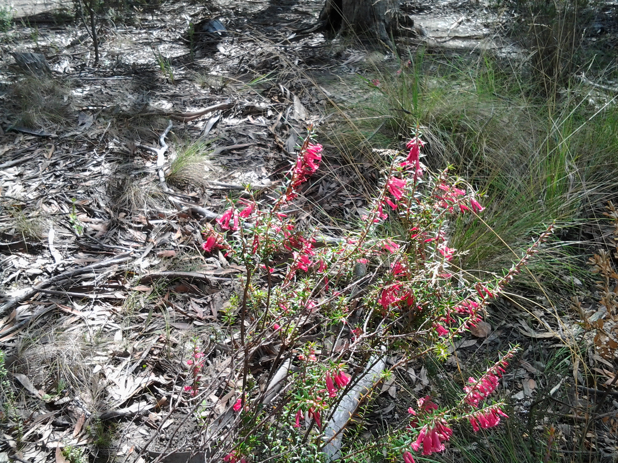
I was horrified to see thousands of escaped ‘forget me not’ plants, some flowering as they carpeted lots of the area near the beach and up the hill. I pulled out a few dozen and their roots came out easily but a concerted effort of a few days’ work to remove these before they spread any further is essential if the wild bush is to stay as pure as it can.

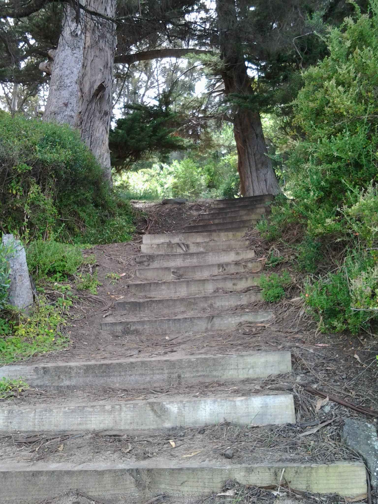
A gate half way up the hill let me out onto a continuing walking track at 2.36pm.  Not long after I decided to sit on the steep steps and smell, look and listen to the environment. Very peaceful.

By 2.45pm  I was walking again and a couple of minutes later I reached a gate to exit the entire walking track area.

20150202_144535

The entry was signed but, while the exit was easy, it was entirely unclear whether to turn left or right.  At the end of the dirt road in both directions I could see gates closed over the road.  Murphy’s Law has it that I will often make the wrong choice and it was no different at that point. I chose to walk down to the gate at the bottom of the road but found it entered into private property. Back up the road, lined one side with large girthed pine trees, I walked to the other gate and found no obstacle to walk around it. At 2.54 pm, I was continuing along the road watching a family of magpies fossicking in an open paddock, and later marvelling at an old crab apple and a pear tree both of which were laden with fruit.

At 3 pm I arrived at the junction with Kingston and Blackmans Bay’s main linking road, Roslyn Avenue.  The address for the dirt road on which I had been walking is Roslyn Ave 82-88, and it is directly across from Jindabyne St over the roundabout on Roslyn Ave.  One corner of the intersection is occupied by the Catholic Church of Christ the Priest and the Aloysius Primary School.

Down from the Alum Cliffs onto Tyndall Beach on the edge of the Derwent River

Discovering the Alum Cliffs had been a goal and now this part of the Stage 12 walk (on the cliffs) along the edge of the Derwent River was coming to an end. At 11.42 am I was walking above Tyndall Beach and a minute later reached the sign indicating a steep pathway leading down to the beach.

20150202_114250 20150202_114603

By 11.49am I was walking on the softly squishing expressive white sand. The day was now overcast, but it was refreshing to be at sea/river level again and feel the onshore breeze.  I noticed a track continued at the cliff bottom along a grassy area but chose not to take that route when I saw a sign indicating snakes might be around.

20150202_114838

I have never seen this sign before in Australia.

20150202_114944 20150202_115006 20150202_115435 20150202_115423

I walked along the sand until I reached Browns River, then turned inland along the river until I arrived at the Christopher Johnson Memorial Park with its public toilet, picnic tables and kids play area near the cross bridge.

At midday I stopped for a lunch break on this reserve and watched contented dogs and owners roaming.  A very brave Mr Blue Wren grabbed at insects in the grass around my feet and talked away to me (or someone – never saw Mrs Wren) incessantly. Parts of his wings were iridescent blue in the light of the greying day. I was afraid to move and frighten him away.  Wonderful.

The ebb and flow of the Derwent River against the Alum Cliffs

I made a 25 second video of the seemingly gentle movement on the surface of the Derwent River as it moved backwards and forwards to and from the Alum Cliffs, as seen through dry forest. It was rather hypnotic and I can now see the video would have been more powerful if longer.

To see South of Hinsby Beach with waves on the Derwent River Tasmania go to : https://www.youtube.com/watch?v=MdnLETfiRWA

Onto the ‘proper’ Alum Cliffs track near Taroona Tasmania

After walking across the Shot Tower carpark I had one last look back to where I had been. The sky was amazing.

20150202_100551

In the trees then and often further again along the track, Kookaburra birds laughed at me many times. Ha Ha Ha Ha!  Ha Ha Ha! Ha Ha Ha Ha Ha.  Their feathers camouflaged perfectly with the shadows from leaves and the colours of tree trunks and branches.  They were impossible to photograph. Ha Ha Ha Ha!  Ha Ha Ha!

A sign seen at 10.08am indicated the start of the Alum Cliffs track.

20150202_100632

Then I began the careful descent on a steep 100 metres or so length of a four wheel drive wide smooth gravel track. Partly eroded. Basic stairs were irregularly constructed on one side of this incline.  Bush either side.  A small wallaby surprised me bouncing through the undergrowth.

At 10.15 am I reached the creek crossing below. Peaceful.  Looking up, an even longer climb on the other side was rather dispiriting. On the trek uphill I stopped and sat for a while to take in the view of dense gum tree foliage. There were smooth gum trunks as far as the eye could see.  No wind. Trickling creek below. Peaceful.   As I walked higher, the Shot Tower came into view bit by bit over the trees.

20150202_102950

It was 10.33am when I reached a picnic table and lookout at the top of the Alum Cliffs.

Passing white crowned toadstools with sharp white gills when open, I walked along a shady path which was quiet except for the occasional birdsong, rustling water in the creek below, or the soft voices of other walkers. I learnt from one of the walkers that the Alum Cliffs track used to follow the edge and in order to cross creek gullies, ropes were installed up and down the cliff to steady yourself during the climbs.  Part of those walks included rock hopping along the shoreline as well.

At 10.45am I reached the turn-off to Taronga Road – I did not want to exit the Cliff walk so I continued on. At 10.53am I reached the junction with the Brickfields Track – another time I will return to this area and walk that track to look at the remains of any social history along the way.

A few minutes afterwards, I felt I was identifying exposed alum rock.  I decided it was the rock which had partly oxidised into a greenish colour in places. Whether or not it is the real deal I cannot say.

20150202_105708

Despite tree roots and rocks intruding on this track, the well-trodden dirt with a slight leaf covering made for very easy walking.  Off to the side of the track walking would not have been quick and easy.

20150202_104740 20150202_113018

I loved the colours on gum tree trunks as bark peeled away naturally.

20150202_105347

I loved seeing the signs of insects which once burrowed their way under the tree bark.

20150202_112428

At 11.07am I reached a seat with a viewing platform from where I watched an oil tanker motoring up the Derwent, having passed Gellibrand Point on the eastern shore.

20150202_110637

It was a long way down to the River over the Cliffs.

20150202_110656

Then I walked some way with another walker until I needed to stop and start with notetaking and the clicking of photographs.  I continued down across another creek and stopped when I noticed the clay at the bottom.  My earlier research/posting had indicated a connection between the alum rock and clay.

20150202_113327 20150202_113303

The track passed through a tiny wet forest area with green pronged tree ferns.  Back up onto a drier track I reached a picnic table at 11.26am. Nearby, a teepee of tree branches and leaves had been built casually.  Would it be better than no shelter in a rainy storm?  Not too sure how long the ‘tent’ would survive much wind.

20150202_112545

Walking past native flowers; pink heath, lots of yellow tiny daisy like flowers, and a delicate 5 petal lavender blue coloured solitary flower.

20150202_103455

I passed smaller tracks off to the left which ended by hovering over the edge of the Cliff, and some to the right which I imagine found their way back into suburbia or onto the Channel Highway.

A glossy scarlet red spider, black legs with a blue iridescent tail crossed my path.  I have never seen one before and knew nothing until I researched once back home; this was Nicodamidae –Red and Black Spider.  Apparently, ‘toxicity unknown, treat with caution’.  Trust me – I didn’t touch it.  The size was that of a woman’s finger nail.

Not long after chatting with a man and his dog, at 11.40am through the trees I could see bits and pieces of Kingston Beach.  My trek across the Alum Cliffs was almost over.

The Shot Tower, Taroona, Tasmania

Was someone shot here?  Was gunshot made here? What is the story of Taroona’s Shot Tower?

The website http://taroona.tas.au/shot-tower provides the full and correct name of what I visited on Stage 12 of my walk: Joseph Moir’s Shot Tower.

20150202_095850

Another website http://www.parks.tas.gov.au/index.aspx?base=2820, explains “Joseph Moir’s factory, which operated for 35 years from 1870, manufactured lead shot for contemporary muzzle loading sports guns.”  This second website offers background information about Moir: a Scot, he arrived in Van Diemens Land as a free settler in 1829. Details and photographs of some buildings, the choice of the site, the manufacturing process and Moir’s burial are all covered on this website for those who are interested to know more.

The man seems to have been both industrious and enterprising. Wikipedia claims he “issued tokens in his own name during a currency shortage in the colony”.  The Museum of Victoria (http://museumvictoria.com.au/collections/themes/2164/joseph-moir-ironmonger-1809-1874) confirms this story and offers more detail.

In relation to shot towers generally, the first one in history was created in 1783 in England, not many years before Moir was born and emigrated half way around the world. The early process involved molten metal being dropped from a great height in order to turn it into spherical shapes, and letting it land in a pool of water which cooled the metal.  Late in the 19th century, a wind method (short fall and blast of cool air) replaced the long drop and water method.

20150202_095810

Wandella Avenue to the Shot Tower, Tasmania

My previous posting explained that the first part of my Stage 12 walk along the Derwent River took me to Wandella Ave but then I retraced some steps and took an Alum Cliff-side disused track, which ultimately resulted in my returning to Wandella Avenue.

So – when you walk from Hinsby Beach and the track arrives at Wandella Ave, turn left, walk for a short while and then turn right into Baringa Rd (the signpost for this is missing). Continue walking around and uphill until you reach the junction with the Channel Highway. I reached there at 9.44am

Nearby was bus stop 32.

I enjoyed soaking in the view across the Derwent River where I could see Gellibrand Point and Opossum Bay.

20150202_094257

Further down the River, South Arm and Fort Direction Hill were visible at the mouth of the Derwent on the eastern shore.

20150202_094443

I turned left onto the Channel Highway (which has no footpath) and was able, for some metres, to walk inside a guard rail and then later on a narrow gravel verge with traffic streaming by.  At 9.50 am I was passing the sign indicating this was the Huon Trail Touring Route.

In the bush which I had clambered through earlier and now as I walked along the road, I was concerned to see an exotic which has escaped and been self-seeding rapidly everywhere.  I don’t know the name of the plant but from experience in my own garden, I know it grows fast and furiously into a medium sized plant with a purple pea flower. I did pull out some of the smaller plants and with the moist soil the roots came out as well.  But there were thousands of plants and continuing my walk was the greater priority, so I stopped pulling.

Further up the road, I could see the top of the Shot Tower above the trees.

20150202_095550

Before long I was standing outside the Shot Tower complex. The time was 10.05am.

20150202_095803 20150202_095850 20150202_095810 20150202_095929

The person manning the souvenir shop and entrance to the Tower gave me a booklet with all the tracks and walks in the Kingborough area, and he pointed out a nearby gum tree just over a rise. ‘That’s where the Alum Cliffs track starts’, he told me. He felt sure the Kingborough Council were ready to build the final part of the Alum Cliffs track from the Shot Tower to Hinsby Beach so I guess we wait and see what progress is made in the months to come.  However, it does seem the track won’t be marked out close to the Cliff edges on that northern part.

On my list of things to do in the future will be to return to the Shot Tower to take the walk up the many stairs and look out over where I have walked. The cost is only $8 including the opportunity to watch an interpretative DVD. The Shot Tower site includes a shop, museum, carpark and public toilets.  Plus the fabulous view!

Starting out from Hinsby Beach and walking south to Wandella Avenue – Stage 12

I left home in Bellerive on the eastern shore of the Derwent River before 7am while the morning was cool and the light was soft grey. By the time my bus into Hobart city was travelling over the Tasman Bridge, the sun had hit the top of Mount Wellington, the sky was blue, and the day promised to be sensational.   The dramatic circus tent on the Queens Domain was being dismantled. People on the bus seemed to be dozing. Yet outside the bus, I wondered at the stunning crispness of shadows and sunlight causing windows to sparkle.  The look of the day made me feel like I was sparkling.  But my eyes were wide open.  Waiting at the bus stop at Franklin Square for a bus headed towards Kingston but passing through Taroona,  all I could think was ‘glorious, glorious, glorious’.

With few people on board, the trip to bus stop 30 in Taroona (the one where I finished in Stage 11) only took 22 minutes and then I was out in the fresh air on the Channel Highway at 7.52am. Gulls calling. Gardens were flush with sunflowers, roses, agapanthus, wandering pumpkin plants, lavenders of all types, and flowering gum trees.  All overlaid by the sounds of bush birds flitting here and there.

By 7.58am I had walked down Hinsby Street and reached the top of the walkway leading to the Hinsby Beach.  I could hear the shushing of the soft waves along the beach and glimpse a tiny bit of water at the end of the shady path.

20150202_075819

I could see the Alum Cliffs through the trees.

20150202_075858

A swimmer was leaving the water as I clicked a photograph. When I registered his angry body language, I realised I had been feeling the place without really seeing.  Of course my finger on the tablet’s camera clicked mechanically without seeing or feeling – but featuring photographs with him was not to his liking. I immediately claimed to be photographing the Alum Cliffs at the end of the beach and promised not to blog his picture.

20150202_080143

I guess the swimmer was not used to sharing the beach with anybody else that early and could only repeat rather manically, ‘you must come in’, ‘you must come in’ as he gesticulated towards the water.  I was thickly dressed from neck to toe and already wearing my sun hat.  ‘Going in’ was not in my plan.  I continued along the beach. A little later on a path, I took the following photo – I hope you can understand that getting undressed would never have been an option.

20150202_080640

At 8.05am, at the end of Hinsby Beach, I looked back for one last sea-level view of Hinsby Beach.

20150202_080405

I reached a stairway with rails and walked uphill until I seemed not to be on a clear track.

20150202_080359

When you read further below you will realise the photo above does not show the start of the track which I should have taken.

Very soon I arrived at a gully with a small trickle of water passing downhill. I chose not to cross by balancing as a gymnast on the dead tree trunks that criss-crossed it. Instead I simply walked easily down, stepped across a few rocks and walked up the other side.  Before long it was clear I was fenced in and that a proper dirt track passed on the other side of the fence. The fence was elastic so I swayed over it rather dramatically without falling off and down the cliff on the other side of the track. When I righted myself and looked back along the track which I hadn’t known existed, three women and a dog stood very still, their mouths agape. ‘Are you alright?’ they chorused. ‘Yes’, I assured them as I smiled.  Some moments I wonder if I am losing my once good judgement.  ‘But where have you come from?’ I asked with a puzzled wrinkling of my forehead. ‘Where did you find this track?’  Apparently, if I had bypassed the stairs and track I had chosen and walked around over the rocks of Hinsby Beach a little further, the real track started there.  Time for the installation of a few signs!

This ‘new’ track was fine.

20150202_080456

Although there were occasional diversions across the track.

20150202_084019

The view back towards Hinsby Beach was clear.

20150202_082252

The time was 8.22am as I offloaded my jacket, smeared sunscreen across exposed parts of my body and continued walking along the track until it extended up into a suburban street.  At 8.25am I turned left into Wandella Ave, wandered along past houses for a while, could not see any further tracks back to the Alum Cliffs, talked to a local who did not think there was one and recommended that I should walk up to the Channel Highway and continue southwards on that road.

Not to be defeated, I retraced my steps down the original pathway until I discerned an old disused track that seemed to continue along the Cliffs.  I walked it but casual inexperienced walkers and those walking alone absolutely should not. Incredibly unsafe in just about every way.  I didn’t fall nor receive injuries but there were so many ways and places I could have damaged or killed myself on that route.  I won’t relay all the details of that walk except to say that the views across the Derwent River though the trees were grand. Blue Wrens darted around me through the bush. Waves pounded against the Cliffs, and I could hear the roar of waves crashing on distant beaches.  Because photographs flatten the vistas, the ones I have taken do not present the feeling of isolation, steepness nor roughness of this non-track.  But it was incredibly beautiful and I am glad to have seen that landscape.

20150202_085324

I started this diversion at 8.37am. After following a collapsing path (although parts were good), I managed a deep descent into and an ascent out of an unnamed gully by 9.12am, rounded an extensive private house, talked with the house owner about the future of tracks along the Alum Cliffs and the non-availability of any tracks passing his house (which stood on the very edge of the Cliff) around 9.25am, and walked down and around the very long winding private driveway over a trickling creek, I reached suburbia again at 9.35am – the same point on Wandella Ave I had been earlier in the morning. I had completed a loop. Certainly I had been close to the Derwent River more than most but I had not advanced along the River.

The first photo below shows the house I climbed up to on top of the cliff after descending into a gully, the waters of which plunged over a rocky edge to the River.

20150202_084704 20150202_085446 20150202_092605

I recommend that all evidence of the existence of the disused track should be eliminated.

The new Facebook and Twitter pages

For those who like accessing Facebook and Twitter, I have opened two new ‘walking the derwent’ accounts.

For Facebook go to https://www.facebook.com/profile.php?id=100009102812005 and become a follower if you wish.  Or share the address around and let your friends, relatives and colleagues access it – if this is their sort of thing.  For Twitter go to https://twitter.com/walkingderwent and also feel comfortable to share if you wish.

If you are happy simply following my blog, then you need not do anything. I am glad you are enjoying my walk, and I love reading your emails and comments.

From Hinsby Beach to Blackmans Bay accomplished on Stage 12 yesterday

The goal of my walk along the Derwent River for Stage 12 was to start at my last stopping point, Bus Stop 30 on the Channel Highway at Taroona on the western shore of the Derwent River, and continue to Blackmans Bay in the local government area of Kingborough.  I did not get as far as expected, but I was satisfied when I finished 2/3 of the way along the Blackman’s Bay Beach.

Over future posts, I will write up the stories of the walk, what I saw and what I experienced, but for now it’s enough to say that I am continuing with this massive project to walk both sides of the Derwent between the mouth and Bridgewater, and then onwards to Lake St Clair.

Yesterday I covered 5 ¾ kilometres of the length of the Derwent River on the western shore (making 35 3/4 kms in total on the western shore), and walked approximately 11 kilometres (making a total of 154 kms to date) to achieve that distance; there were a lot of steep ascents and descents.

20150202_085332

This distance also takes in the streets and paths on which I walked that led to dead ends so that I needed to retrace my footsteps.

The highlights of the walk include finding a way through some of the early part of the almost untracked Alum Cliffs, the delightful walk along the tracked part of the Alum Cliffs, meeting some friendly people along the way, the unusual snake sign at Tyndall Beach, stopping for a long cup of tea in Kingston with a friend, my discovery of another tucked away beach – Boronia Beach, and the Blackmans Bay Blowhole.

There are many memorable images but my favourite for today is one of my photos of mussels growing on the rocks at Boronia Beach.  I have already made it my desktop background image. When enlarged, the blues glow.

20150202_142540

Fundamentally the Stage 12 walk was about forest and water.

20150202_113014 20150202_104740  20150202_115156 20150202_152557

The day started with my being roughly opposite Gellibrand Point at the northern tip of South Arm and finishing opposite the long South Arm Beach.

I intend my next walk will start from where I left off at Blackmans Bay and then continue into the Tinderbox area to Fossil Cove.  But before then I need to record the details of yesterday’s walk.  So Stage 13 will be a while away.

Hobart Regatta – it is on this weekend!

Only a couple of Stages ago I walked through the Hobart Regatta Ground as part of my trek along the Derwent River. At the time, other than a few fishermen the area was people-less and very dull.

20150109_160021

By contrast, next weekend the area will be crowded with people involved in all sorts of Regatta related activities. The place will be buzzing. You only have to read the blurb offered by the Royal Hobart Regatta organisers on http://www.royalhobartregatta.com/ to realise there will be something that should interest everyone. Serious boat races and silly community fun races will be the mainstays of the Regatta. Concerts, movies, music, wood-chopping contests, pageants and trans-Derwent swims will support the event. Members of the Royal Australian Navy will arrive on the Flagship HMAS Sydney, complete with helicopters simulating live rescues etc. Finally, a fireworks display will light up the Derwent Harbour on Monday night.

The Regatta experience runs in tandem with the Australian Wooden Boat Festival over the weekend. Hobart’s waterfront will come alive with festivities. Thousands of people will throng the area over the four days.

Wooden boats will be afloat on the Derwent River this coming weekend

The Australian Boat Festival will run from Friday 6th to Monday 9th February centred around Hobart’s city waterfront and the Derwent River.

Every two years we remember that the first indigenous inhabitants made wooden canoes and the first European settlers arrived here in tall sailing ships constructed from wood, and we look at our historical (this time 20 of the boats will be over a century old) and current wooden boats. Around 550 vessels will be part of this Festival in 2015.

Apparently this has now become the southern hemisphere’s largest wooden boat festival.  These days in southern Tasmania we have a new history of a boat building industry that produces custom made craft, and restoration of older boats.

The spectacular Parade of Sails starts the program on Friday at 1pm and so I, like many others, will gather somewhere along the Derwent River to witness the event.

The program is detailed and complex; you can read more and view fabulous photographs taken at previous events at http://www.australianwoodenboatfestival.com.au.

Involved in the last Wooden Boat Festival was a replica of an ancient Viking ship.  I wait with interest to see what surprises will turn up this weekend.

Impressive swim down the Derwent River on Saturday

The air temperature didn’t rise above 20 degrees C and while I do not know the Derwent River’s water temperature, I imagine the swim was invigorating to say the least.

On Saturday, a Massachusetts (USA) marathon swimmer survived an overarm feat that nobody apparently has completed for 40 years. He swam from New Norfolk, 19kms by road west of Bridgewater Bridge (the Bridge I reached when walking a few Stages ago), southwards until he reached the Tasman Bridge which is the last bridge across the Derwent River before the mouth of the River. Dan Curtis began ‘The Big Swim’ at 6am and just on 10pm he reached his destination.  Photos of the man (http://dailynews.openwaterswimming.com/2015/01/dan-curtis-to-take-on-big-swim-after-39.html) indicate he is no spring chicken so I am very impressed.  This is another wonderful example of having a goal, giving it a go, then finding out whether success is possible.

Geological and Social History of our Alum Cliffs

Patricia Roberts-Thompson (http://taroona.tas.au/assets/document/1354363720-a_walk_along_alum_cliffs.pdf) indicates that the first recorded reference to the Alum Cliffs was in 1847.  She explains that these rocks, Permian mudstone (250 million years old, contain iron pyrites and, as the rock weathers, the pyrite oxidises and produces sulphuric acid which reacts with the limey clay to produce alum. Roberts-Thompson could find no evidence that the alum has been extracted from our cliffs for commercial purposes.

Simon Stephen’s research (http://taroona.tas.au/assets/document/1352547986-geology_reduced.pdf) is in sync with that of Patricia Roberts-Thompson  when he says the mudstone on the Alum Cliffs contains much sulphur so that when struck a strong smell is emitted. “Much of the sulphur manifests itself as a white encrustation on thee sheltered areas of the cliffs. It has a distinct bitter taste…”  (Trust me – I won’t be taking a bite or licking it). Stephen’s article is exceptionally interesting not the least because it pin points a geological fault line which is near Crayfish Point (where I have already walked) and which extends out through the end of Hinsby Beach and then under the water along the Alum Cliffs.  I don’t know if any seismological activity has occurred in my life time there nor whether any is expected. I’d rather nothing happened during my forthcoming Stage 12 walk along the Alum Cliffs.

The Kingborough Council distributes a brochure with the following information: “The route followed by today’s Alum Cliffs Track has long been a coastal path used by local people. In 1988 it was formally developed as part of Australia’s Bicentennial celebrations. In more recent years, Council has upgraded the southern section of the track, which climbs from Tyndall Beach through coastal blue gum forest with tall silver banksias. The track then winds up through silver peppermint bushland, dips into a glorious fern filled gully, before rising again onto headlands for commanding views over Storm Bay and the Derwent Estuary. A new start to the track without steps has now been constructed above Tyndall Beach to make the track accessible to more users. The Alum Cliffs are so named because alum – a compound used in dyeing, tanning and medicinal products – is found in the cliffs.”

It is a shame that all instructions to reach and walk the Alum Cliffs use Kingston Beach in the south as the base to walk north and then return. Websites provide information about multiple entrances along the route at Tyndall Rd, Harpers Rd, Taronga Rd.  Apparently a Metro bus stop is located 100m south of the intersection of Taronga Rd and Channel Highway. I wonder how many people have walked the Alum Cliffs Track from the northern end and, if not, like me would like to read advice about how to tackle the cliffs departing from Hinsby Beach.

20150119_131327

It may be that, on Stage 12, I will start out at the end of the Hinsby Beach and then be forced to retrace my steps, return to the Channel Highway and walk up the winding fairly narrow Highway with no pedestrian walkway until I reach the Brickfields Track. From http://www.greaterhobarttrails.com.au/track/brickfields-track I understand that “the Brickfields Track links between Taronga Rd (adjacent to the Channel Highway) in Bonnet Hill and links to the Alum Cliffs Track. The route of the Brickfields Track takes you through the historic remains of the brick-making area; part of the nearby and short lived 1840’s convict probation station. The track is a mix of narrow bush track and timber boardwalk with some steps along the route.”

Alum – what is it?

On my next walk along the Derwent River – Stage 12, I will start by walking 3-4 kilometres along the top of the Alum Cliffs from Hinsby Beach to Kingston. I have seen the cliffs from Hinsby Beach on Stage 11, and they look like ‘normal’ cliffs.

But what is Alum? 

According to http://chemistry.about.com/od/moleculescompounds/f/What-Is-Alum.htm, “Alum is any of the compounds with the empirical formula AB(SO4)2·12H2O” and if I tell you Alum is a specific compound of hydrated potassium aluminium sulfate with the formula KAl(SO 4)₂·12H 2O, your brow may wrinkle.  Are you still in the dark?  Worse – it seems there are a number of alum varieties including:

  • Potassium alum is also known as potash alum or tawas. It is aluminium potassium sulfate. This is the type of alum that you find in the grocery store for pickling and in baking powder. It is also used in leather tanning, as a flocculant in water purification, as an ingredient in aftershave and as a treatment to fireproof textiles.
  • Soda alum, with the formula NaAl(SO4)212H2O, is used in baking powder and as an acidulent in food.
  • Ammonium alum has the formula NH4Al(SO4)212H2O and is used for many of the same purposes as potassium alum and soda alum. Ammonium alum finds applications in tanning, dyeing textiles (acts as a mordant and helps to lock in colours), making textiles flame retardant, in the manufacture of porcelain cements and vegetable glues, in water purification and in some deodorants.
  • Chrome alum or chromium alum has the formula KCr(SO4)212H2O. This deep violet compound is used in tanning and can be added to other alum to grow lavender or purple crystals.
  • Selenate alums occur when selenium takes the place of sulphur, so that instead of a sulfate you get a selenate, (SeO42-). The selenium-containing alums are strong oxidizing agents, so they can be used as antiseptics, among other uses.

Other uses of Alum

Alum has several household and industrial uses.

  • purification of drinking water as a chemical flocculant
  • in styptic pencil to stop bleeding from minor cuts
  • adjuvant in vaccines (chemical that enhances immune response)
  • deodorant “rock”
  • pickling agent to help keep pickles crisp
  • flame retardant
  • the acidic component of some types of baking powder
  • an ingredient in some homemade and commercial modelling clay
  • an ingredient in some depilatory (hair removal) waxes
  • skin whitener
  • ingredient in some brands of toothpaste

Considering this list, and in this day and age of developers raping resources, I am surprised our Alum Cliffs are still standing.

The more I learn the more I am overwhelmed by options.  I wonder what the story is of our Alum Cliffs between Hinsby Beach and Kingston. More research is required.

Public art works along the Derwent River – Taroona’s Chiton

From a background in the visual arts industry I have a passing interest in the different kinds of public art that adorns reserves, parks and other edges of the Derwent River.

There have not been many sites with public art works and less with any of merit or real interest visually (in my unhumble opinions). Some of these might be claimed to be community craft works suggesting a second tier of relevance and importance.  During the Stages of my walk along the Derwent River I have not been seeking such art works but when they have appeared before me, I have taken some note.  This is my way of saying that I might be missing some works of art and that the ‘expose’ which I expect to write up over coming weeks may be incomplete.

The latest siting was at Taroona Park and it struck me as most unusual. At the motor vehicle carpark/entrance was a large concrete sign with sculptured limpet-like shell structures (man-made) stuck on. While these constructions showed some similarity with limpets, they were not quite limpets. So with recent Googling, I have attempted to turn up more information. The Variegated Limpet Cellana tramoserica which is common in Tasmanian waters looks like:

c_tramoserica2

Photo courtesy of: http://www.mesa.edu.au/friends/seashores/c_tramoserica.html

This does not look like the limpets on Taroona Park’s entrance structure seen below.

20150119_130442

These attachments were surprisingly large; perhaps 30cm or more in length. The strong grey uniform like colour smacked of an armoured uniform and made me wonder about aliens and science fiction possibilities. I had trouble making connections with reality.  The website at http://www.molluscsoftasmania.net/Locality%20pages/Taroona%20Beach.html lists all the molluscs at Taroona Beach, however the Propilidium tasmanicum (Tasmanian limpet) and all the other shells seem to have no physical similarity with the constructions that I saw.  Strange. Very strange.  Artist’s licence at work maybe?

But Google lifts up amazing results. Through further researching I located the answer at http://taroona.tas.au/environment. “It is said that the word Taroona is the local Aboriginal word for the chiton, a marine mollusc found on rocks in the inter-tidal and shallow sub-tidal regions of our beaches.”  So my idea that the sculptured relief referred to limpets was way off the mark.  At the website listed immediately above, the image provided of the chiton is comparable to those on the Park’s entrance block, even though the colour wasn’t accurate.  Regardless, it certainly commands attention.