Category Archives: Mount Wellington

Crossing the Bridgewater Bridge during the 8th stage of my walk along the Derwent River

This stage of my walk along the Derwent from the mouth of the River on the eastern shore was the most exciting one so far, because I was reaching a significant milestone.  By my reckoning, it marked the end of the easiest part of the walk to the source of the Derwent River at Lake St Clair. Accordingly, and to continue a walk with relative ease for a while, I planned to cross the Bridgewater Bridge and walk south to the mouth of the River on the western shore, then to start tackling the challenging kilometres further north next year.

I was a little surprised how special the day seemed, and so it was an easy decision to cross the Bridge rather than waiting to do so on Stage 9.

20141111_131436

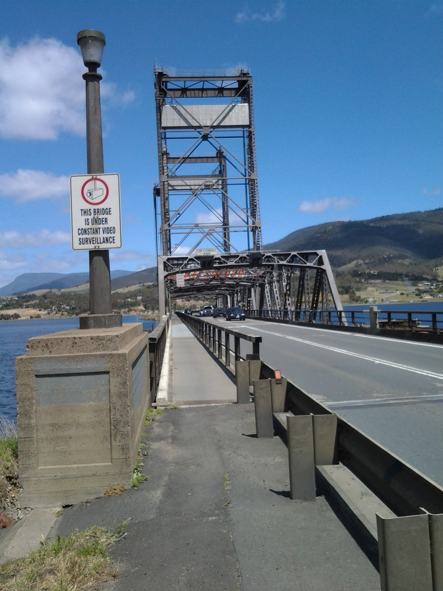
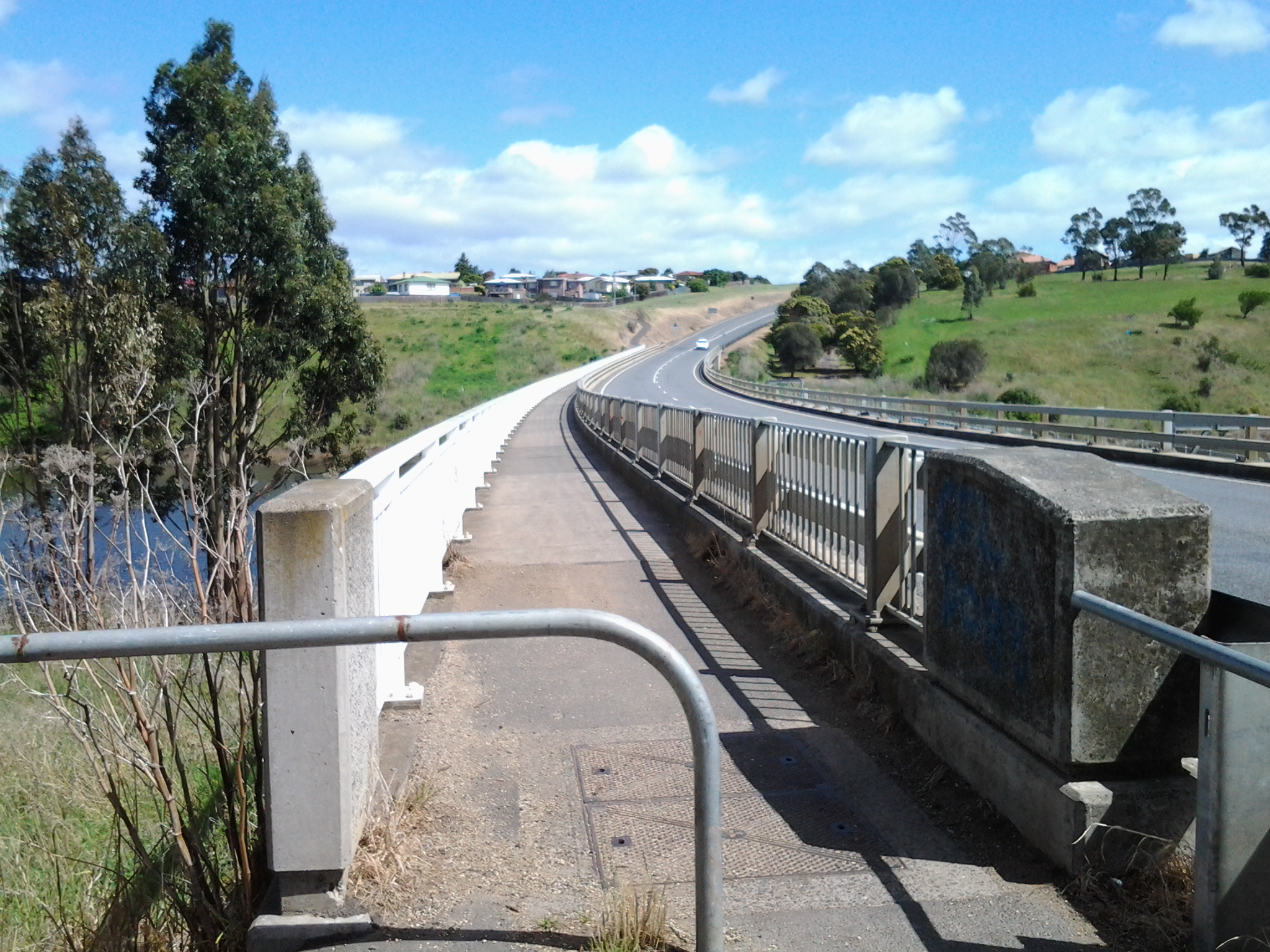
I stepped onto the path on the left of the Bridge at 1.14pm and was off the Bridge and onto the Bridgewater Causeway by 1.20pm. The terrifyingly large fast trucks threatened to suck me off the bridge with their speeding surges next to my shoulder (there was a metal fence separating us but the bridge noise and vehicle speed all combined to make the energy around me vibrate fiercely). I removed my sunhat and held on firmly.

20141111_132207  20141111_132150

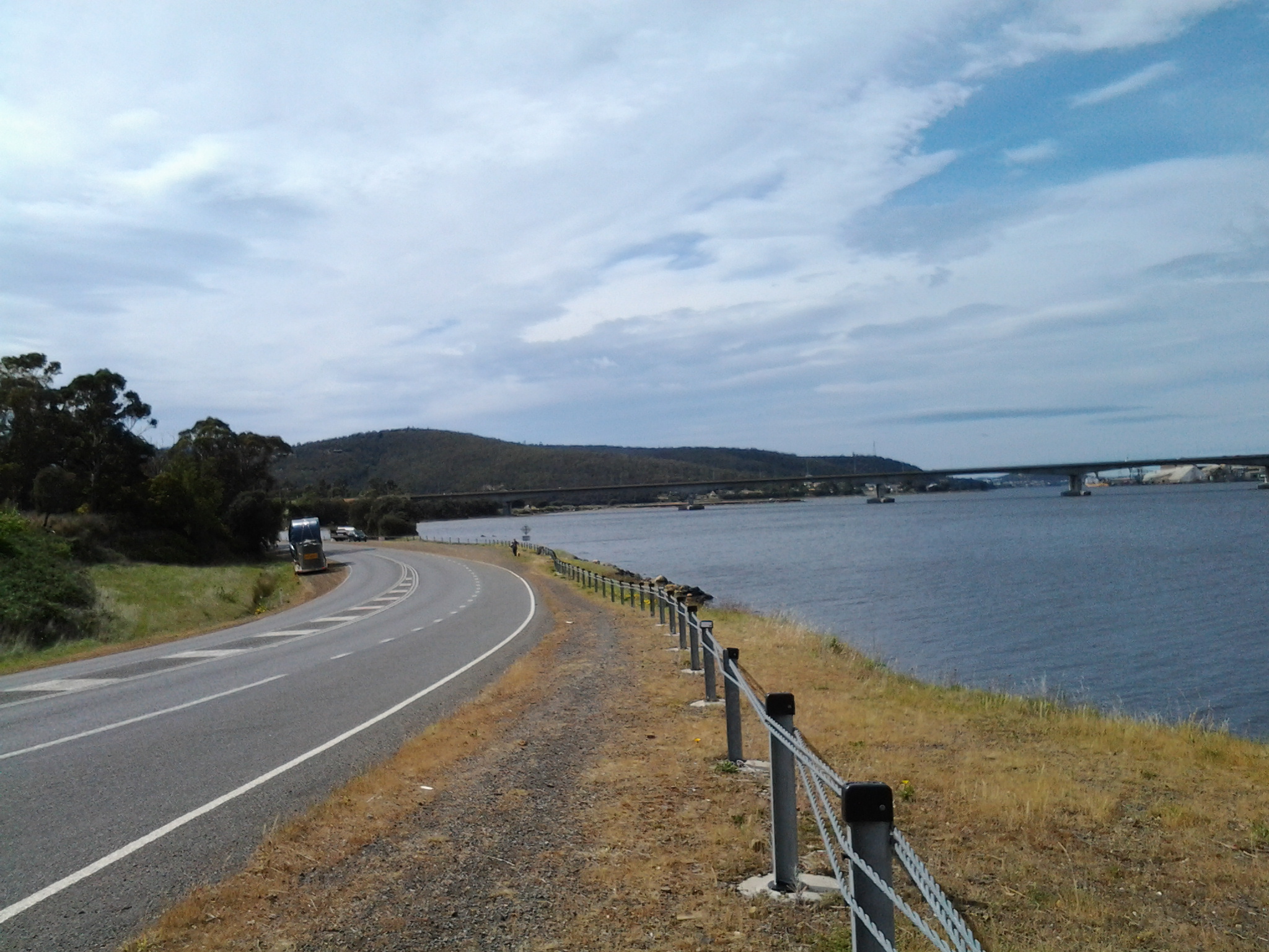
Except for a small layby, there was no formal walking track beside the Highway on the Causeway, and trying to walk on extremely unsafe and uneven ground beside railings (or none) required extra vigilance.

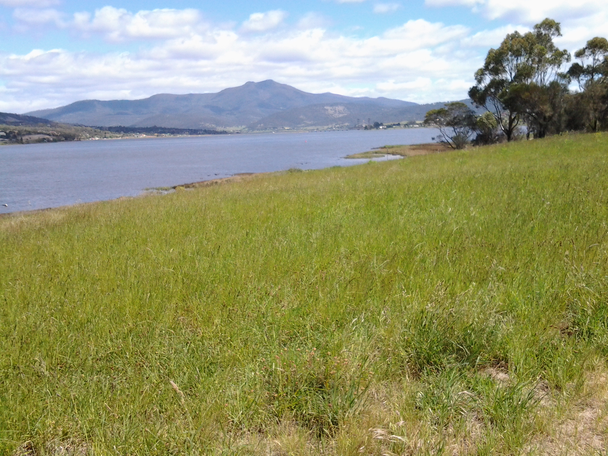
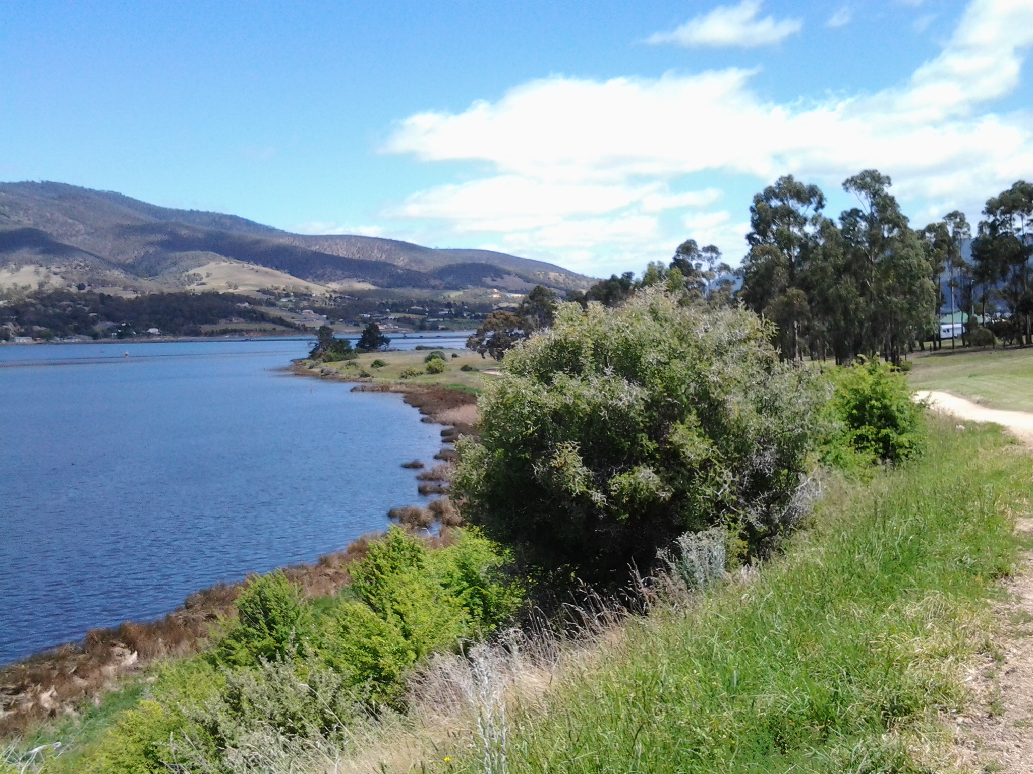
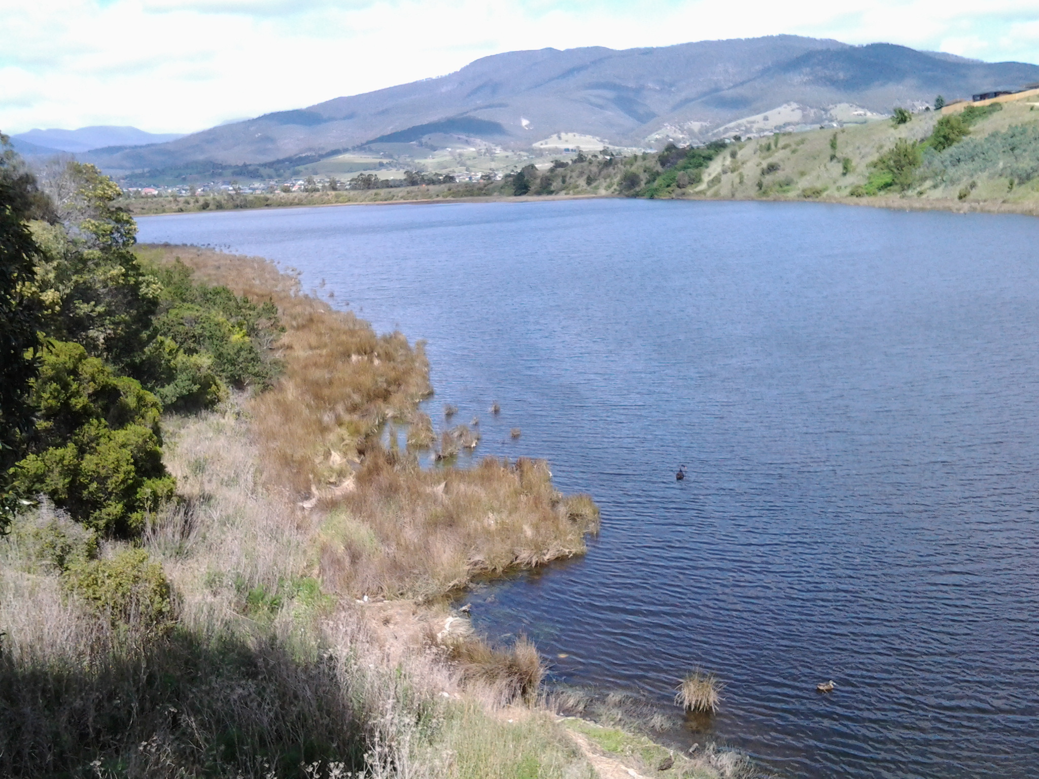
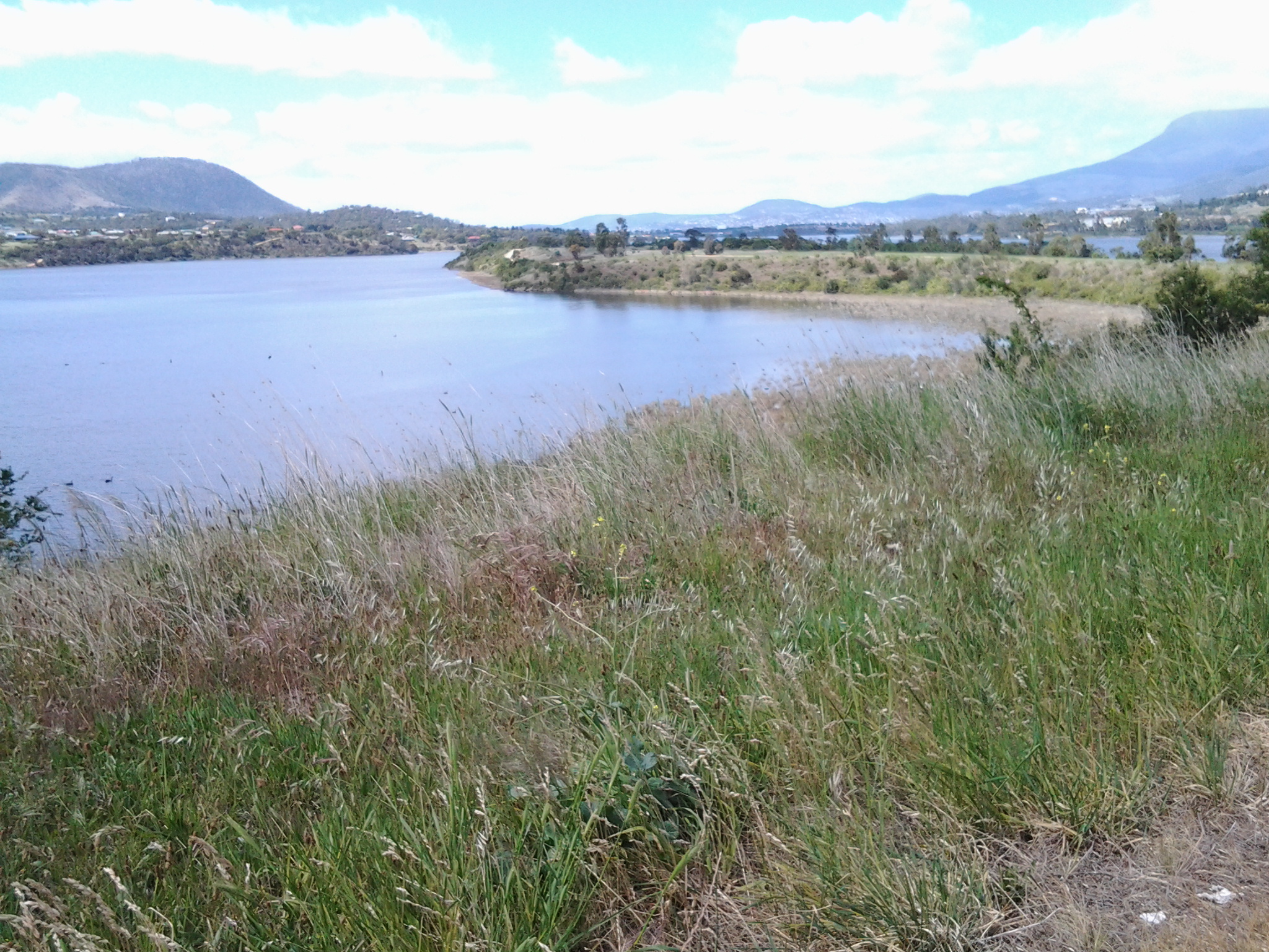
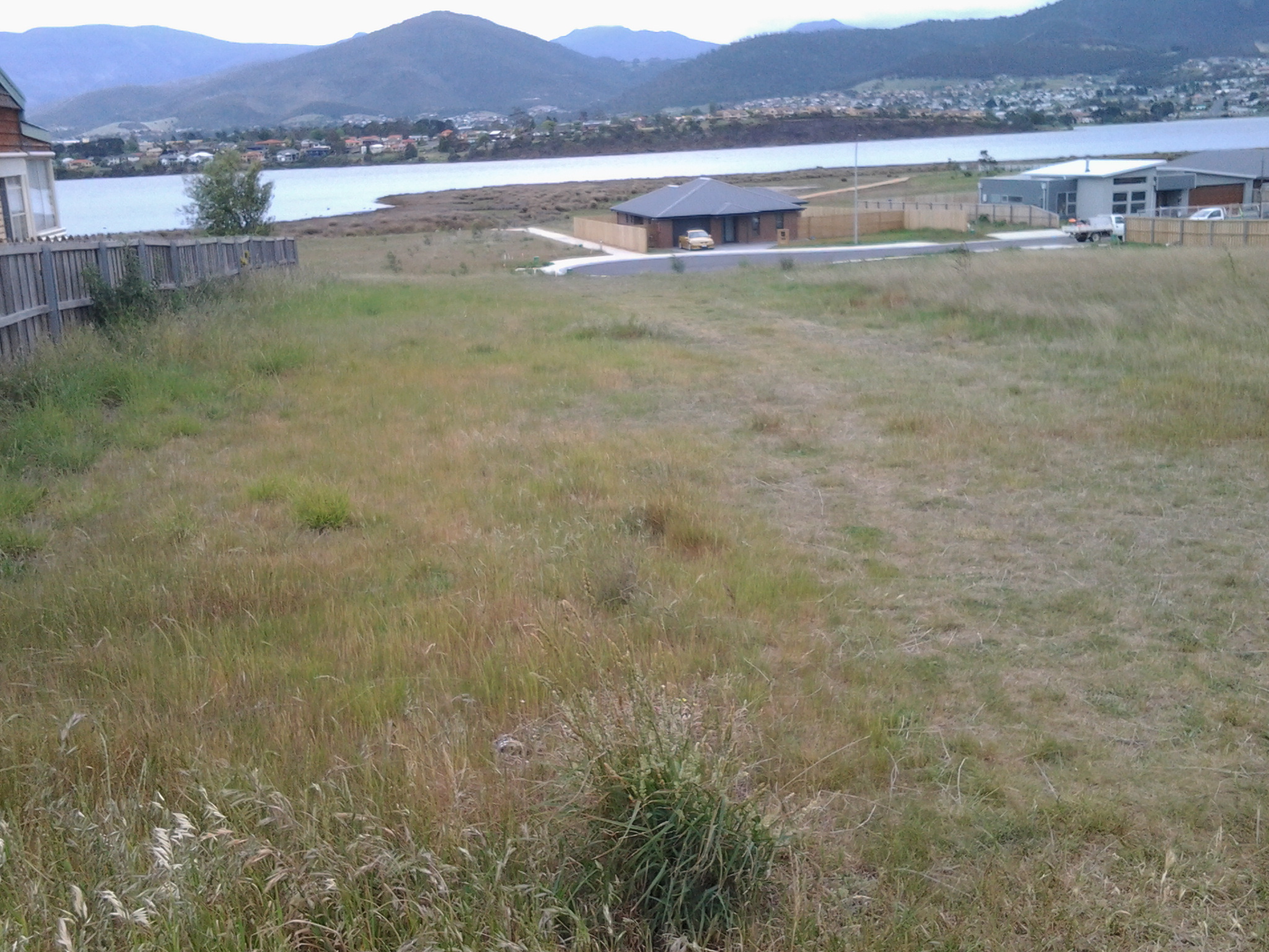
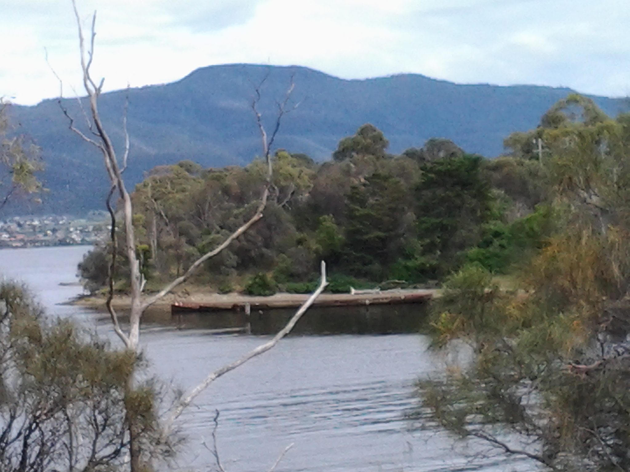
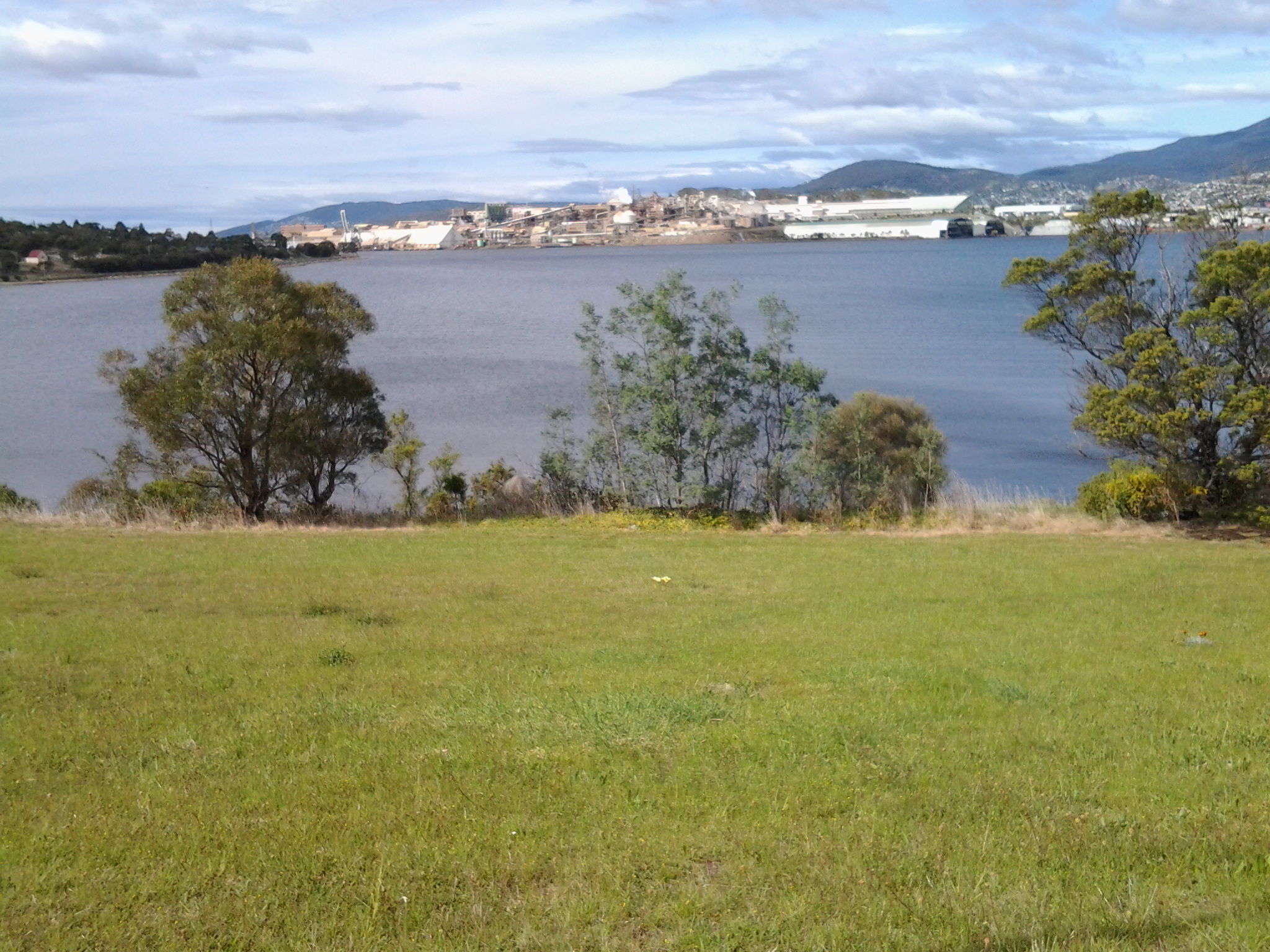
Looking ahead of the western shore, from the Bridgewater Causeway.

20141111_132218  20141111_132743

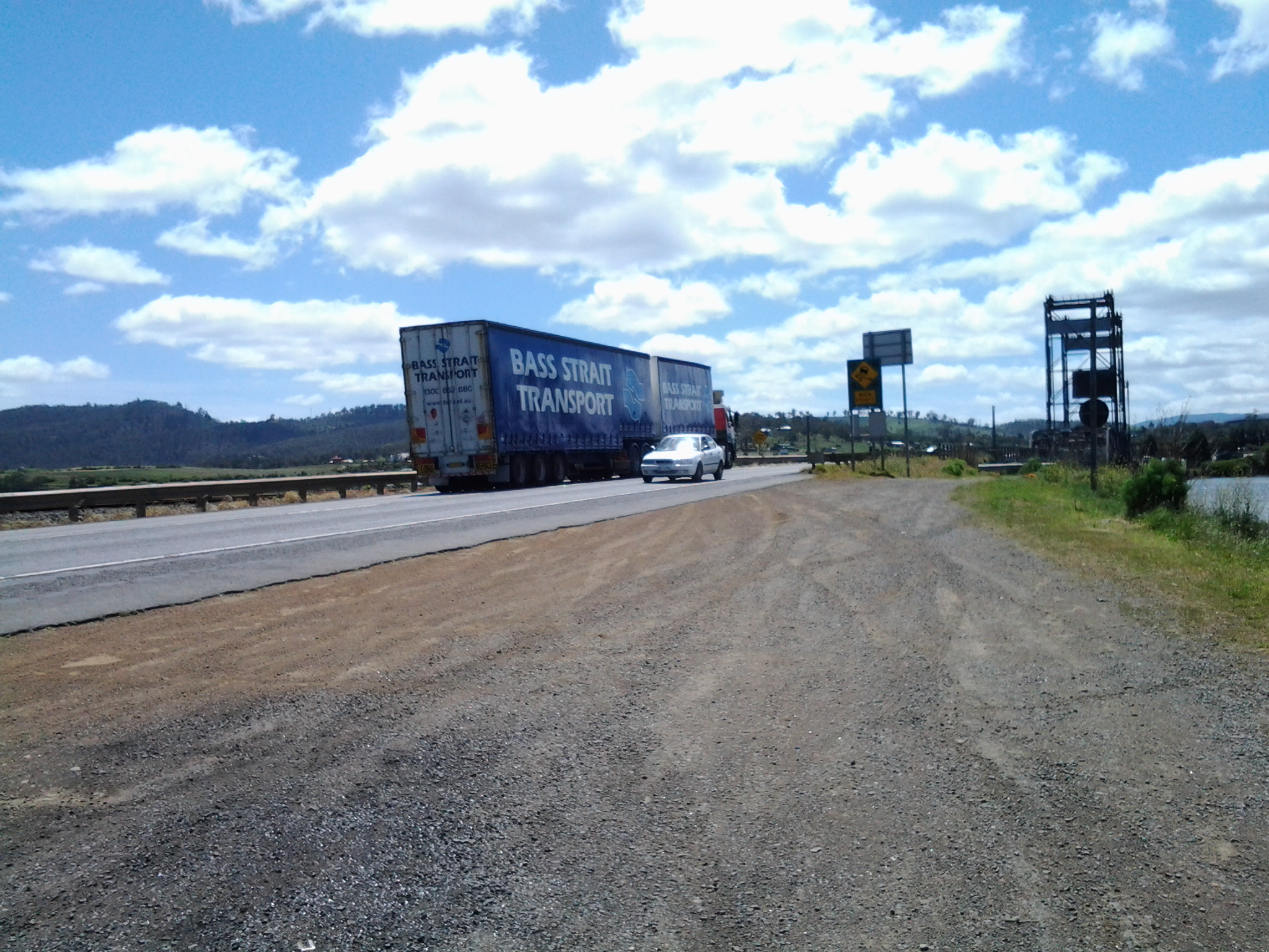
The persistently noisy and fast traffic (on what must be one of Tasmania’s busiest roads – the Midlands Highway) and the wind pushing across the Causeway from one side of the Derwent River to the other were constants, and I was determined they would not distract me from getting to the western shore. I was not the only one walking across the causeway; two others were following me across.  So, on the sample of three people, I would say 100% of people experience danger walking across the Bridgewater Causeway.  I didn’t take photos of the really dreadful bits – too busy concentrating on where my feet might go.

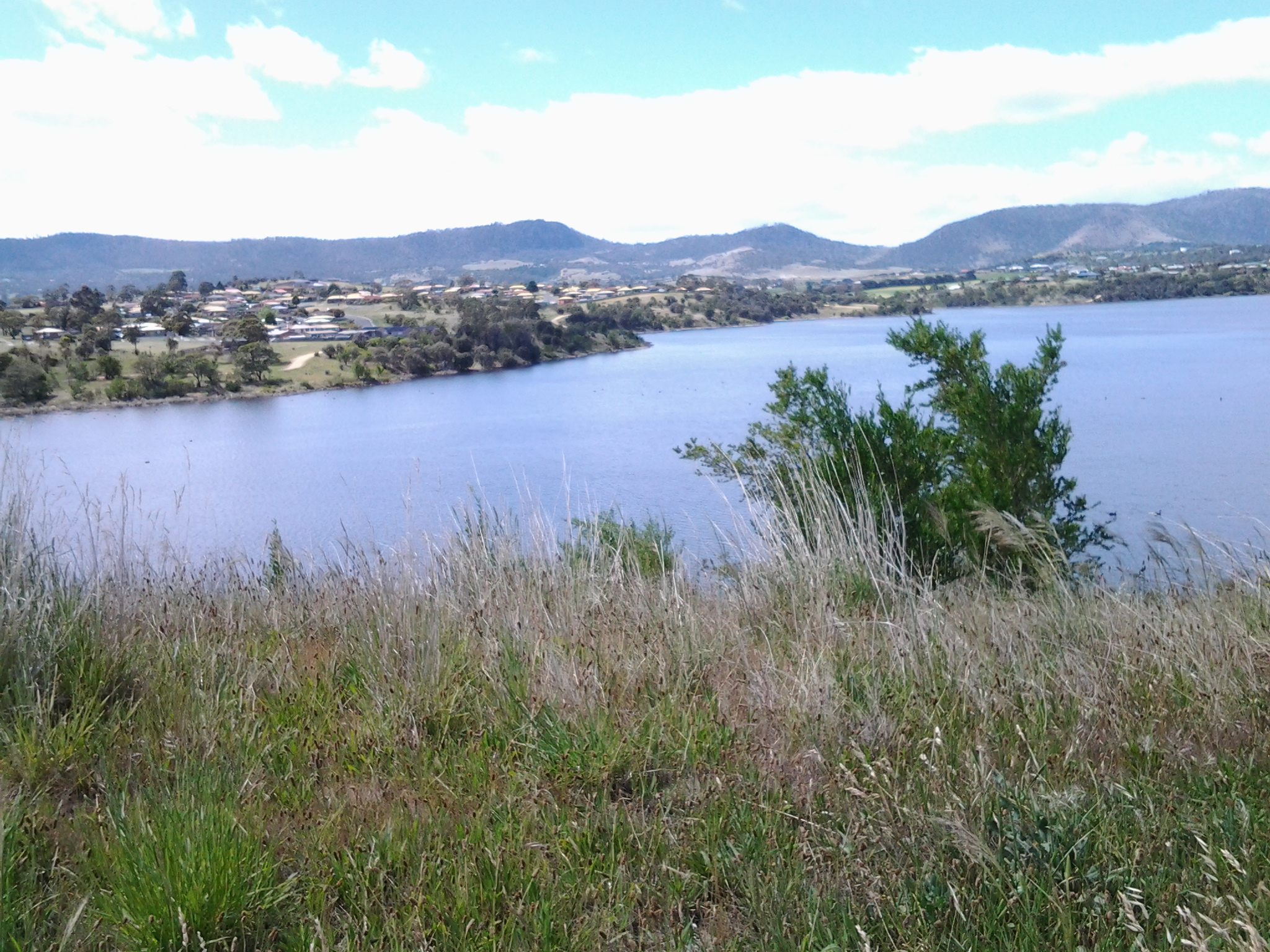
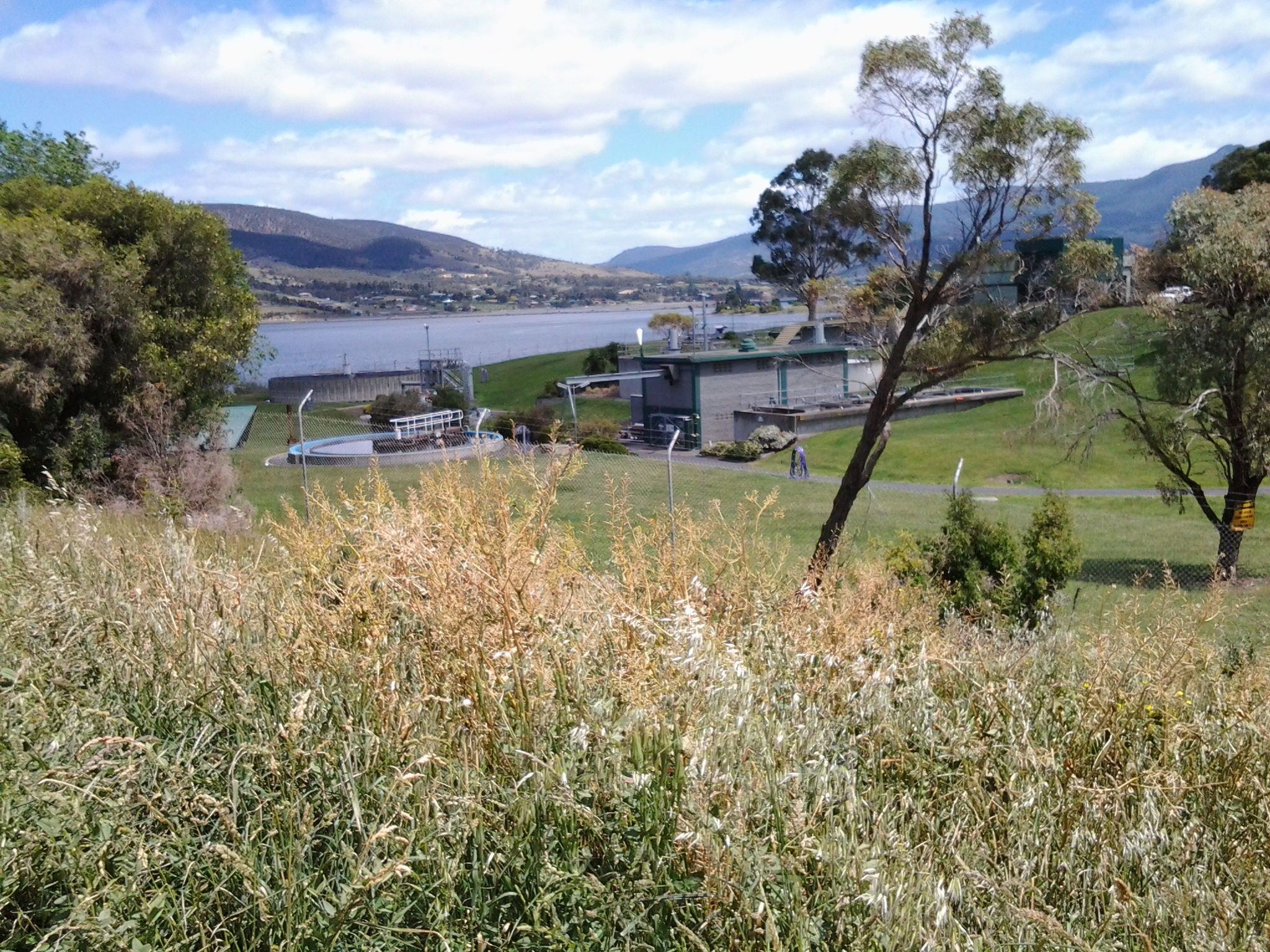
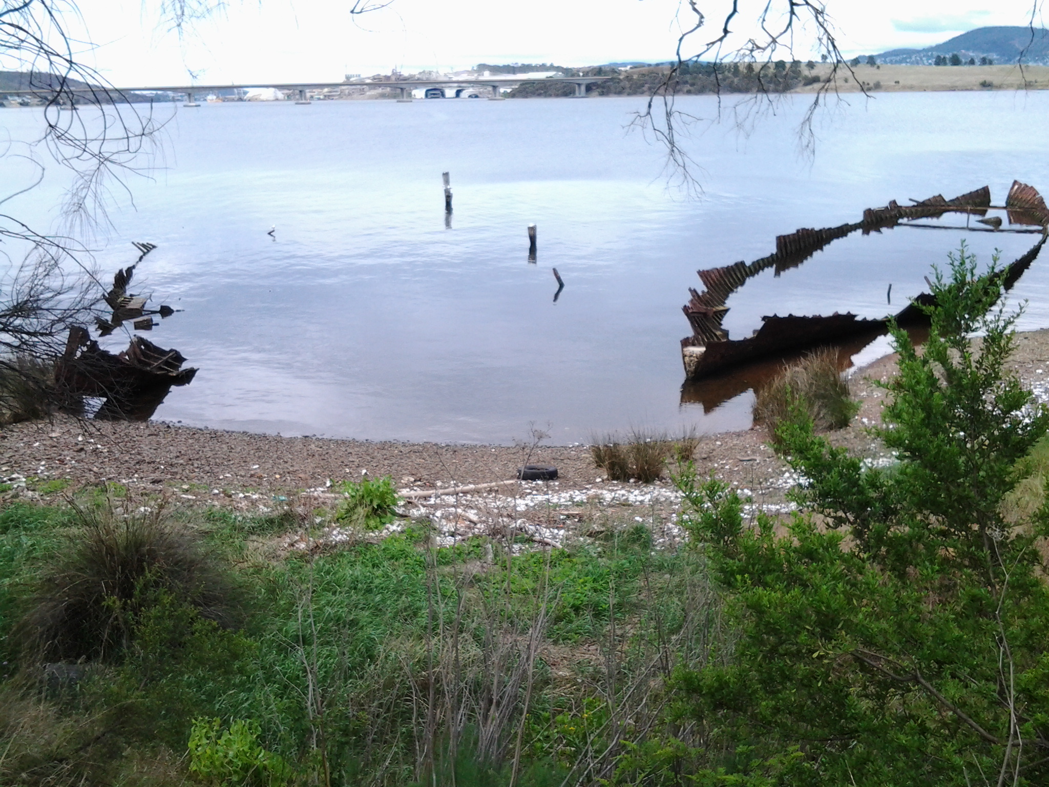
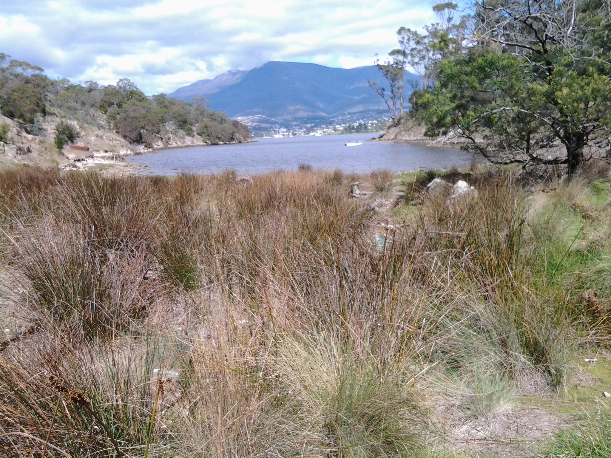
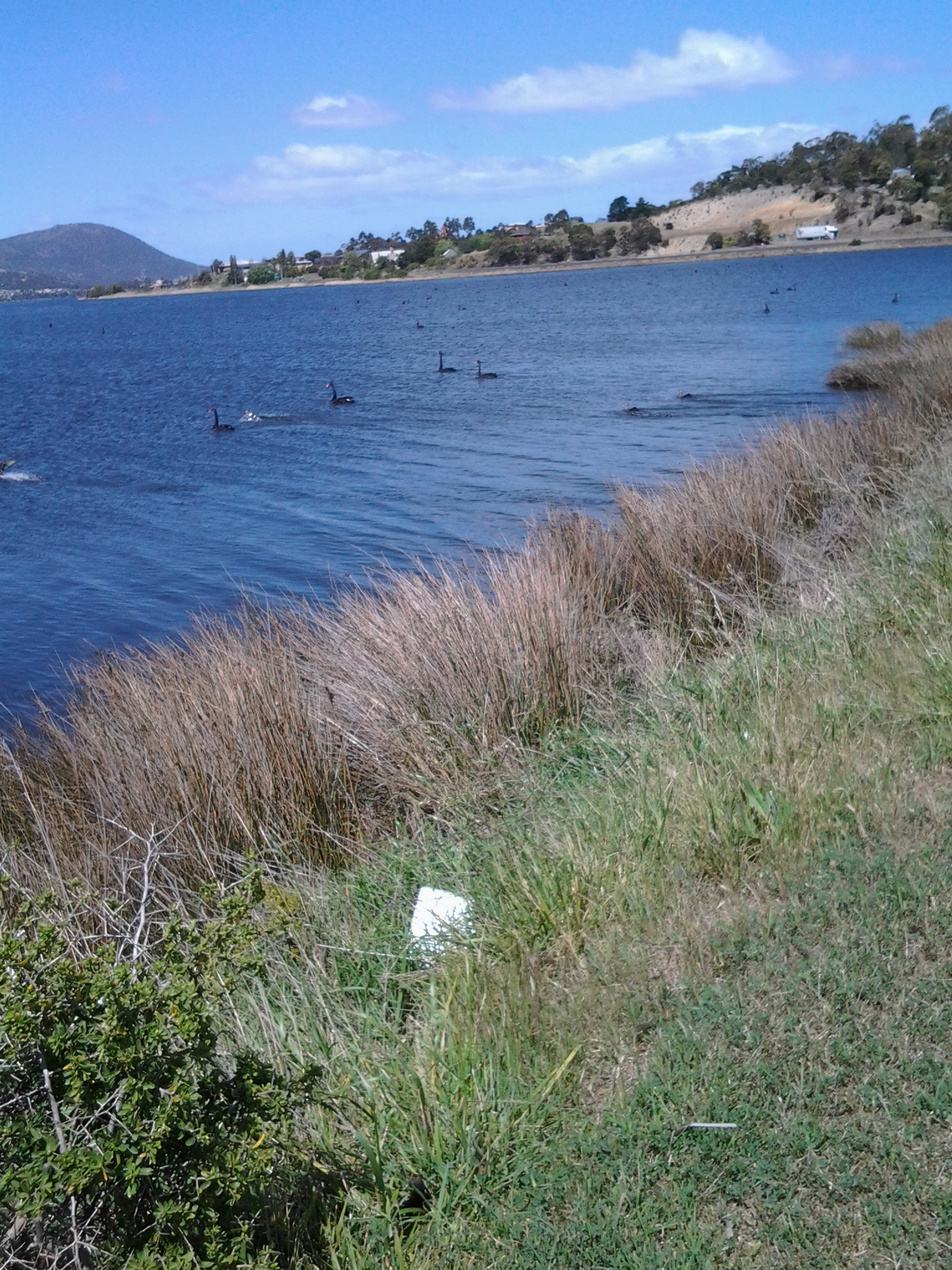
I did enjoy watching the dozens and dozens of Black Swans, and looking back at part of the suburb of Bridgewater on the eastern shore.

20141111_132202

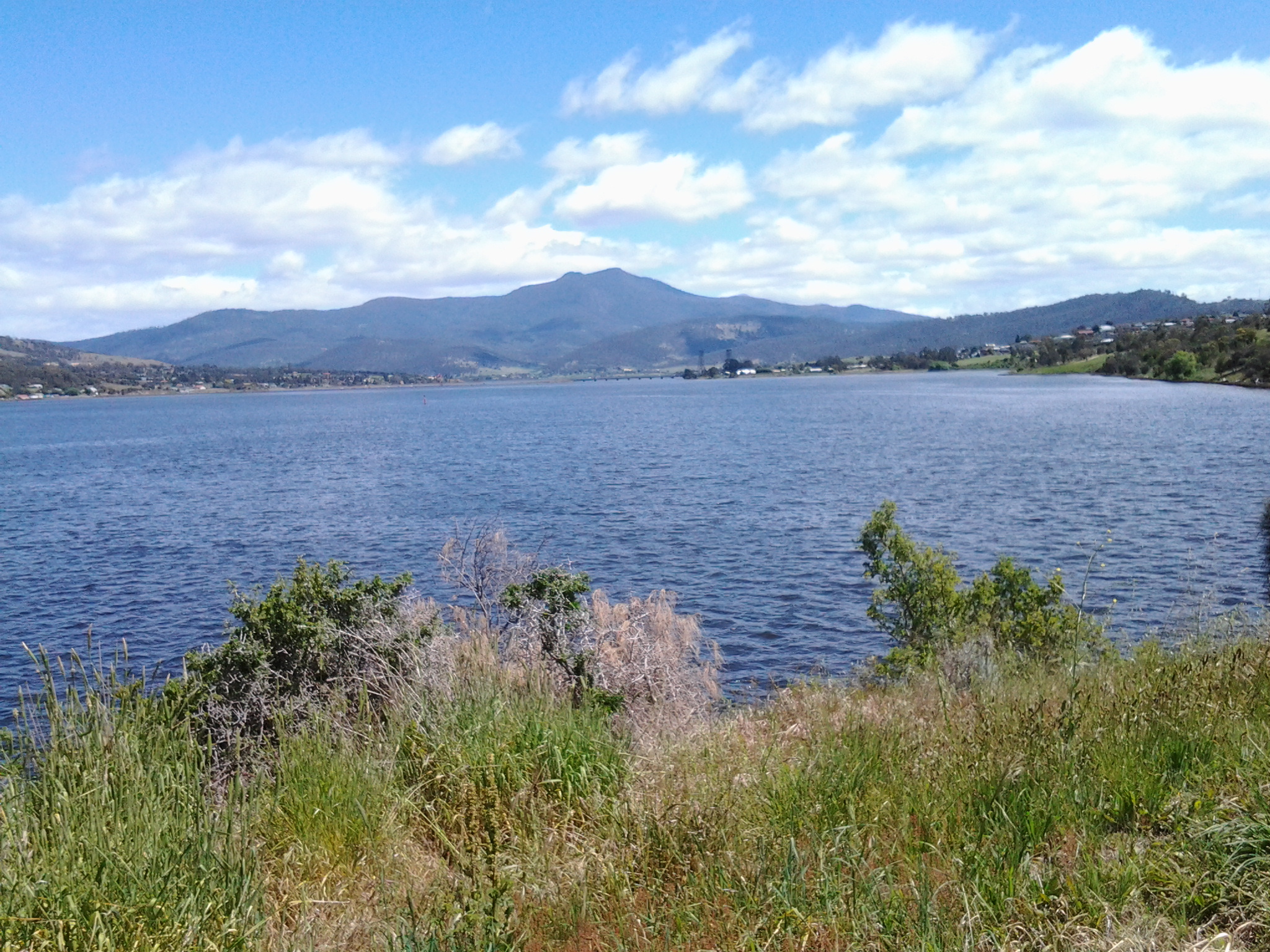
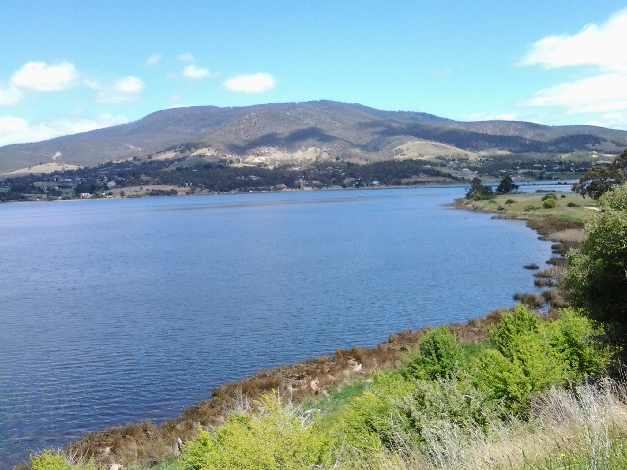
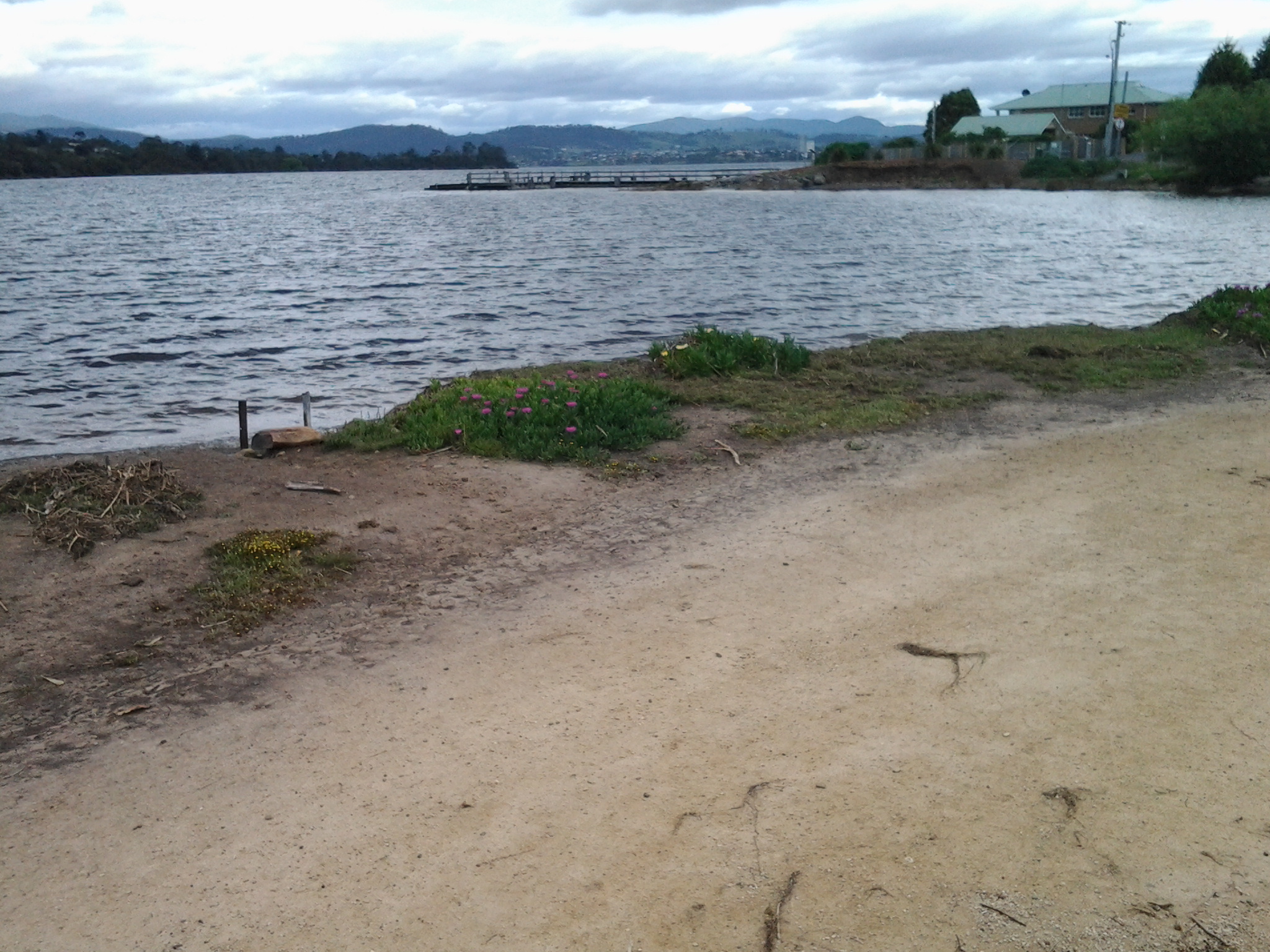
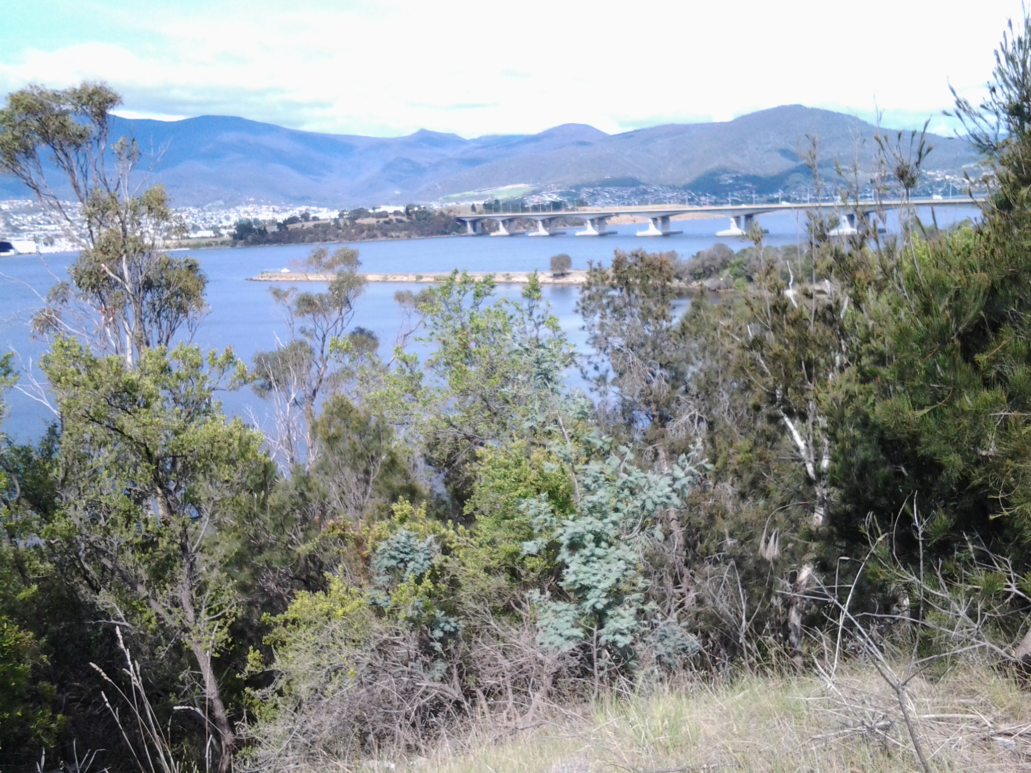
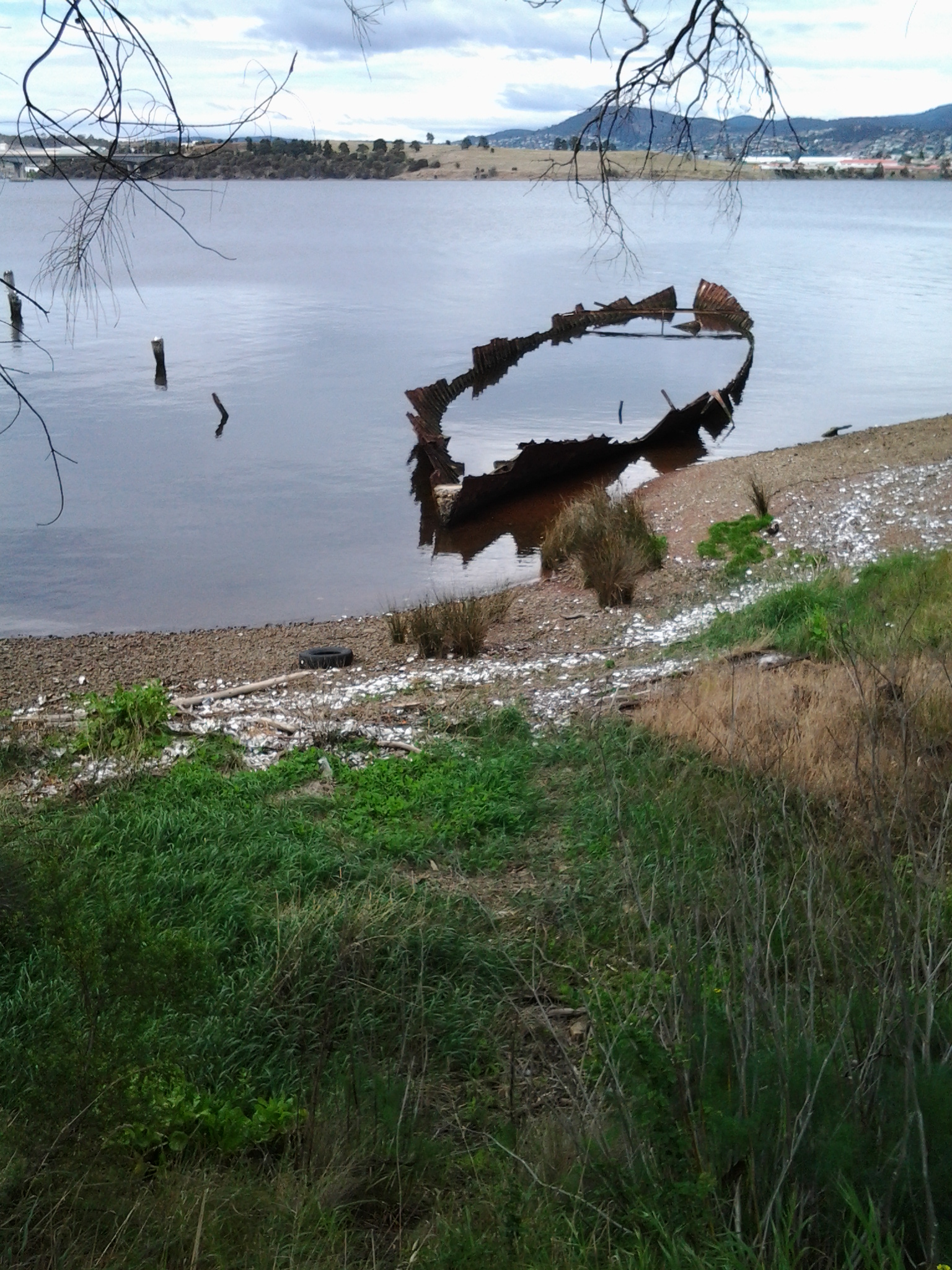
And towards the western shore:

20141111_132810

20141111_132913

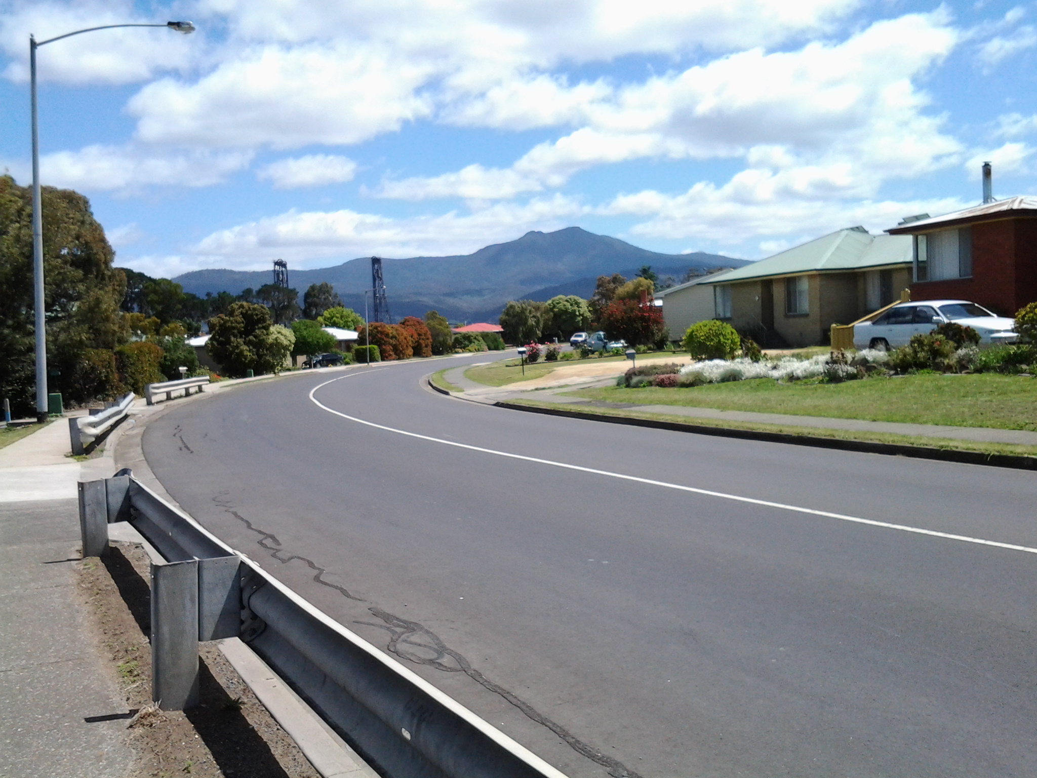
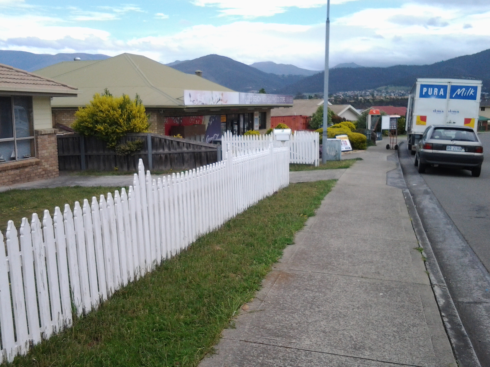
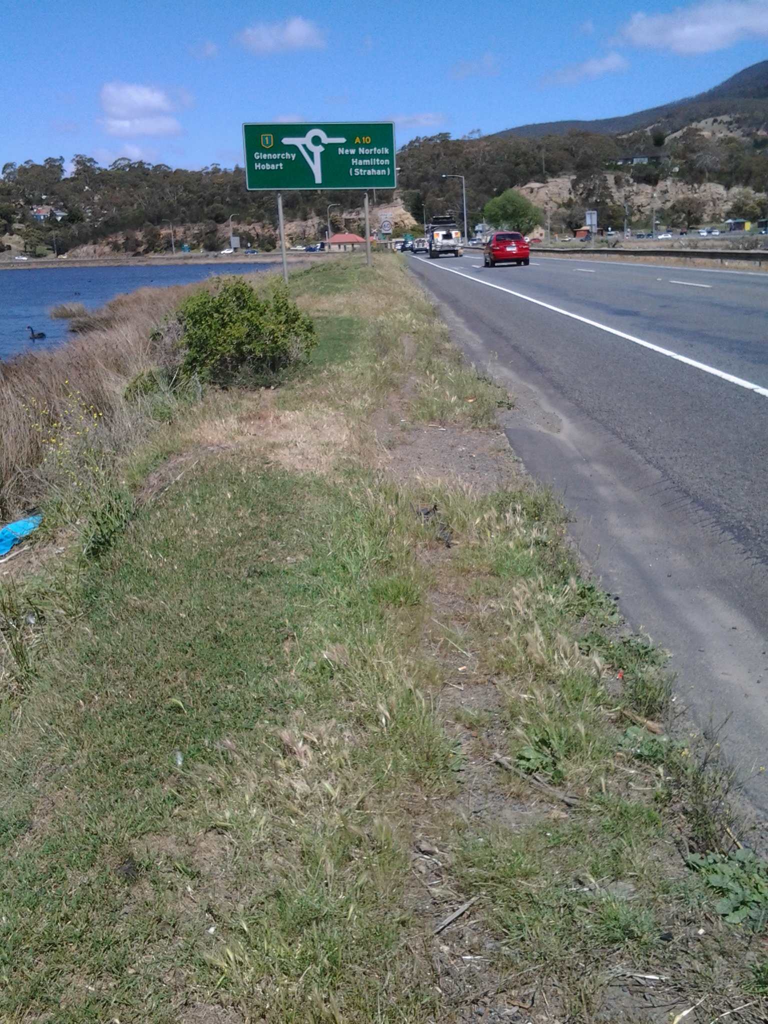
I reached Granton on the western shore at 1.35pm and negotiated myself along the road and across old train lines (this would all be easy if there was no or minimal traffic) all the time beginning to move southwards. Three minutes later I reached the sign indicating a left turn off the Brooker Highway towards Granton South and Austins Ferry.

20141111_134311

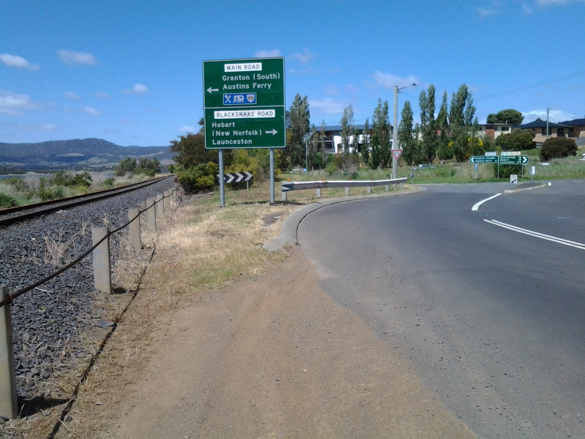
As I stepped in this direction I recognised a sign marking the start of the City of Glenorchy.

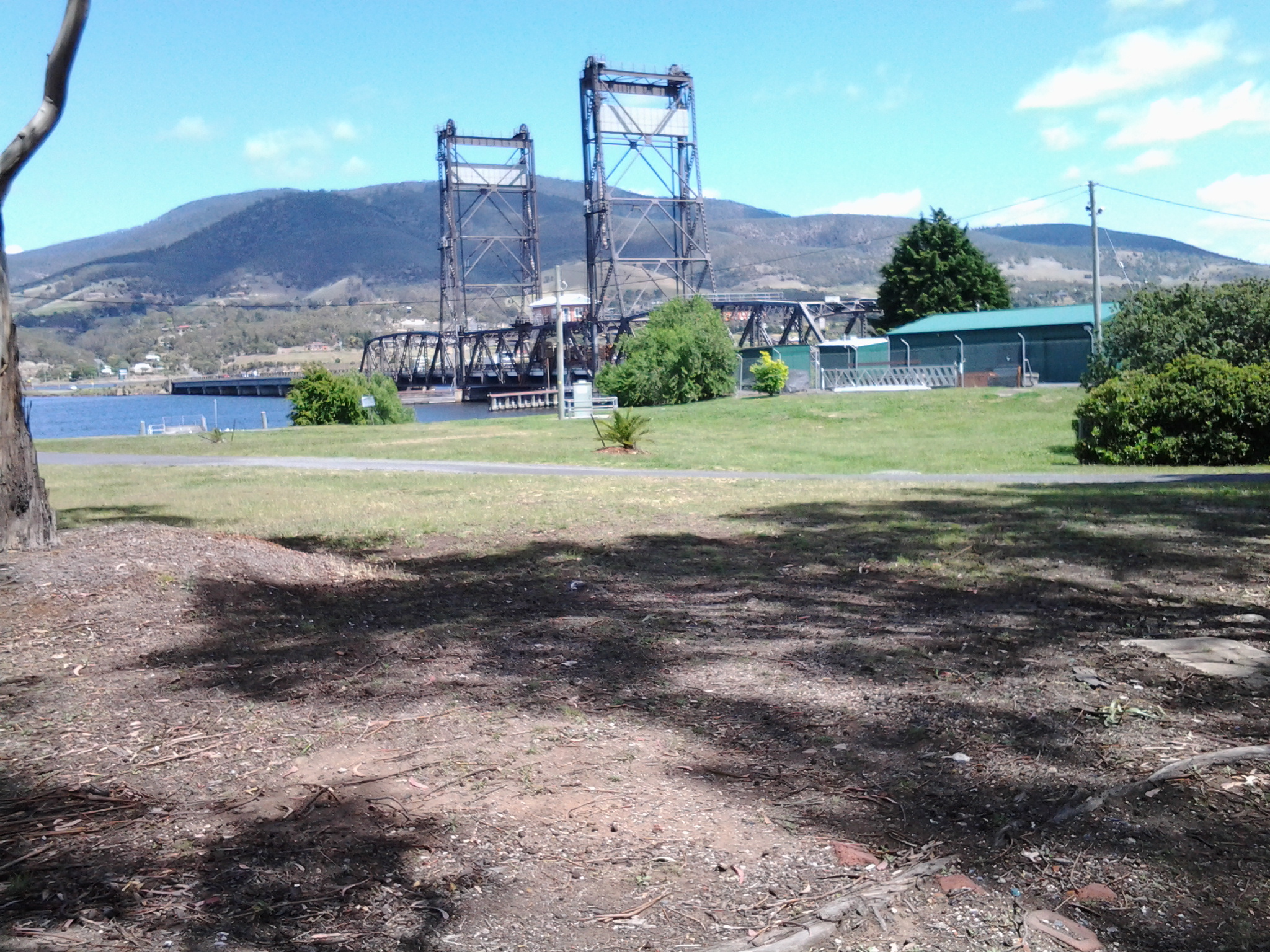
Occasionally I looked back towards the Bridgwater Bridge, across the railway line that was one a lively link between northern and southern Tasmania.

20141111_133556  20141111_134208

I followed a rough non-path on the edge of the road until a new sign at 1.45pm indicated I needed to take another left turn towards Granton South and Austins Ferry.

20141111_134416

As I walked around the corner, on the right in the distance I could see a hotel; the York Hotel.

20141111_134856

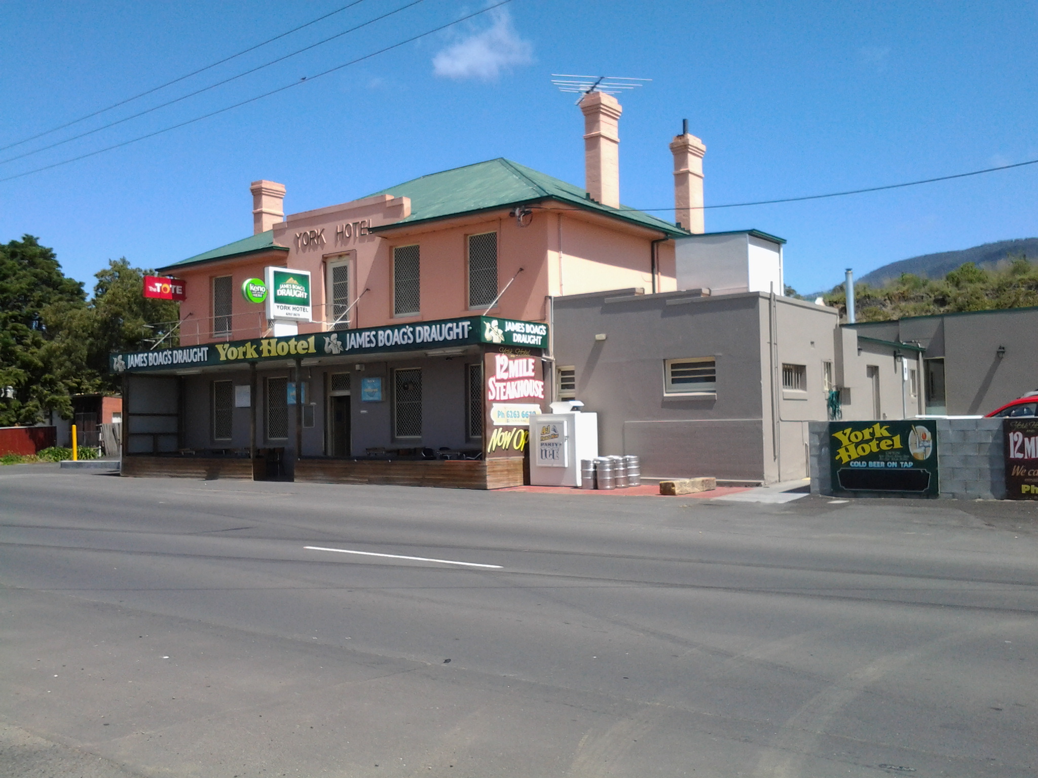
I felt myself glow with delight in anticipation of making this my stopping point for the walk, enjoying a cold beer and meeting the locals. However, as I got closer, two locals were walking towards the bus stop Number 47 located opposite the Hotel.  They let me know that a bus was expected in the next few minutes. My feet hurt, it would be quite a while before another bus would pass this way, and so I decided to forego the pleasures of the pub and start my bus trip home. The locals led me to believe the publican ‘has done a really good job’ and ‘this is a good pub now’.  So, perhaps with friends in the future, I will venture back here for the missed cold one.

I was on the bus at 1.57pm, reached the Glenorchy Bus Mall at 2.15, and caught the Metro bus 694 via Risdon Vale to the Eastlands Shopping Centre at Rosny when it left around 2.30pm.  Most of all I was surprised how long it took the bus from the York Hotel to Glenorchy – almost 20 minutes. That represents a great deal of walking time so it is difficult for me to guess where I can reach on the next Stage 9 of my walk along the Derwent River. I am guessing that somewhere in the suburb of Claremont might be achievable, but who knows! Finding out is what gives me something to look forward to next week when I tackle Stage 9 of my walk.

Bridgewater Bridge; getting ready to cross it on 8th stage of walk along Derwent River

The Bridgewater Bridge and the attached Bridgewater Causeway crosses the Derwent River upstream approximately 38.5kms from the sea. I crossed from the eastern shore to the western shore last Tuesday near the end of my 8th walking stage along the River.

According to http://www.aussietowns.com.au/town/bridgewater-tas, “In the early nineteenth century Bridgewater was a vital link on the north-south route from Hobart to Launceston with one of Tasmania’s earliest buildings and the remarkable achievement of the causeway which helped to cross the Derwent River. The settlement was originally known as Green Point until it became known as Bridgewater simply because it was the bridge (actually a causeway) crossing a shallow section of the waters of the Derwent River.

The first ferry service across the Derwent was established in 1816 by James Austin and his cousin James Earl. It remained vital to travellers journeying from Hobart Town to Launceston until the completion of the causeway. By 1820 Austin and Earl were using a punt capable of transporting 30 cattle, 200 sheep or two carts and 16 oxen. In 1829 construction began on a causeway across the Derwent River. It was 1.3 km long and was built by a gang of 200 convicts using nothing but wheelbarrows, shovels and picks. By the time it was completed the convicts had shifted 2 million tonnes of sand, soil, stones and clay. Defined as secondary punishment for serious recidivists, if the convicts were adjudged to have not done a full day’s work they were placed in solitary confinement in a cell which was only 2 m high and 50 cm square. The causeway was completed in 1836. It did not traverse the river and so a ferry plied the deepest section of Derwent River for twenty years from 1829-49.

In 1849 a bridge across the Derwent was opened. Bridgewater, which had been laid out on the southern shore, was moved (down to the last surveying detail) to the northern bank. The present lift bridge was started in 1939, interrupted by the war, and completed in 1946.”

 From further south, as I walked along the eastern shore, I could see the Bridge. As I walked northwards the length and shape of it came into stronger focus.

20141111_114933  20141111_111830  20141111_130209  20141111_130216  20141111_130627  20141111_131133  20141111_131441

All the photos are taken from the eastern shore side of the Bridge.

Around Bridgewater on the 8th stage of my walk along the Derwent River

After Green Point and looking southwards, I could see Mount Direction in the distance (overlooking the Bowen Bridge – which I could not see). In the photo below, the swell of land on the right of the Derwent River is the foothills of Mount Wellington.

20141111_122916

Early, on this leg of the walk, I stopped and looked northwards along the Derwent River. In the distance Mount Dromedary peered over the landscape.

20141111_120951   20141111_124958

The early highlight of this part of the walk was seeing a collective of about 3 dozen plovers together. I don’t think I have ever seen such a group. The plovers were mostly standing around although some were walking around on an open mowed park area near a cluster of gum trees.  Perhaps some were older ‘young’ plovers because from a distance they all looked the same size, give or take a bit.  This seemed so unusual because I am only familiar with the two parents hanging about and guarding their one or two baby birds.  In some paddocks, in the past, I have seen a number of pairs of parents but the pairs don’t hang out together and keep their own territory quite some distance from each other.

How pleasant this walk was.  Consider the sublime calmness represented in the photo below.

20141111_125006

Around 12.45pm I stopped and sat on a bench seat with a view and watched what amounted to a natural cygnet farm. Dozens of cygnets about the size of a small duck were on the water close to shore.  Only one adult black swan seemed to be on supervision duty. I wondered if the swan bureaucracy had been suffering major cutbacks of ‘staff’ like our Australian and State public agencies where services are meant to continue with less staff.

Opposite where I sat the Mount Faulkner Conservation Area was the main feature on the western shore of the Derwent River.

20141111_125008

At 12.56pm I reached Woods Point, sat under a shelter structure and consulted my maps. Five minutes later I left this Point and began walking north along Gunn St all the while having a good look at Mount Dromedary rising on the eastern shore but away in the distance north of Bridgewater.

I was walking through suburban streets when a letterbox, under the shade of a tree, captured my attention.

20141111_130517 20141111_130527

A poor sad concrete koala (maybe commiserating with the live koalas in Brisbane given to G20 leaders for a cuddle)!  The postman would push his letters into a slit in the koala’s stomach.

I also had a larger view of part of two uprights of the Bridgewater Bridge.

20141111_130214

I seemed so close.  My day’s goal to nearly reach the Bridge had to be superseded. I was compelled to reach the Bridge and kept on walking, even passing bus stops.  When I could see the golden arches of McDonalds at the end of the right hand road I veered left and headed for the Bridge nearby.

20141111_131010

I stopped to photograph the semi-ornate gates of Memorial Reserve commemorating locals who died in various overseas wars (after all, this walk was occurring on the 11th November, Australia’s official Remembrance Day).

20141111_131258

Then I was at the Bridgewater Bridge. Now it wasn’t enough for me to reach the Bridge: I felt compelled to walk across it rather than waiting to do so in the next stage of the walk.

20141111_131431

Across the Jordon and into Greens Point as I walked northwards along the Derwent River

In leaving Herdsmans Cove, I was back on the East Derwent Highway and immediately crossing the bridge northwards across the Jordan River.

20141111_105455

Looking towards the Green Point peninsula at the far end (Derwent River is on the other side of the peninsula) from the Jordan River Bridge: suburbs of Herdsmans Cove on the left and Green Point on the right.

20141111_105605

I was off the bridge by 11am and walking up the bitumen path beside the Highway until I reached a yellow gravel path to the left, where I turned and continued on with wild fennel flourishing on the sides of the path along with brightly flowering gazanias growing wild, walked around another gate and by 11.11am I reached the sign for the Bridgewater Foreshore Trail.

20141111_110243   20141111_111122

In the distance I could see rain showers softening over Mount Wellington but I was dry and walking in the sunshine. After rounding another gate, a sign pointed out the Green Point Scenic Loop off to the left. I headed along this in a southward direction enjoying the fresh smell of the gum trees and the perfume of the wattle flowers.

20141111_111239  20141111_111236  20141111_111233  20141111_111231  20141111_111500  20141111_112105

At 11.35am I reached the point of Green Point at the junction of the Jordan River with the Derwent River and sat on the grass beside the path for a brunch break.  My breakfast was eaten at 6am so I was a smidgin hungry by this time. A strong south westerly wind blew across the Derwent River and buffeted me. The freshness was invigorating.

20141111_113217 20141111_114835

Ten minutes later I was up and walking on.

A few minutes after midday I had passed some more gates and signs and had chosen the trail closest to the shore leading north. On my right were the fences of some houses, and either someone had dumped their rubbish over the fence or the wind had blown it there. I was amused to see a blue hard plastic chair hanging on a washing line.

Just after 12.30pm I walked around the Green Point Waste Water Treatment Centre, or as some maps have it, the Sewage Works.  The fresh smells of wattle or gum trees couldn’t reach my nose here. For some reason?

20141111_123316

Near the Treatment Works I walked back on a street for some metres before coming around a corner where I was able to return to the yellow gravel road (am I Tasmania’s version of Dorothy from the Wizard of Oz?).

Now I was about to walk around the suburb of Bridgewater.

Herdsmans Cove

On my walk northwards towards the Bridgewater Bridge, the next Brighton Municipality suburb that I will walk through as I continue along the Derwent River, will be Herdsmans Cove.  I hope I will be discovering this residential development tomorrow; the weather forecast is good.

According to http://www.yourinvestmentpropertymag.com.au/top-suburbs/tas-7030-herdsmans-cove.aspx, this northern suburb of the Greater Hobart Area has a population of 1134. The median weekly income is $675, the median age of residents is 25 years, with the median monthly house loan repayment is $879, 52% are not married and a further 20% are in a de facto relationship, 56% are not in the labour force and only 20% work full time.  Of those employed, 30% are labourers.  67% of people in Herdsmans Cove rent their accommodation. There is a sense from newspaper articles that this is a suburb suffering from a range of social problems including irregular school attendance, low educational achievement, unemployment and higher than average crime rates. Surely sitting next to the beautiful Derwent River with a stunning view of Mount Wellington in the distance and the Mount Faulkner Conservation Area across the way could be enough to lift people’s spirits.  But I guess that the superb natural features do not lift the bank accounts of local residents.

I will be most interested to see the natural features of this suburb tomorrow.

Discovering the suburb of Old Beach – 7th stage of my walk along the Derwent River

At 12.40pm I reached the town sign for Old Beach at Cassidy’s Bay. The Bay was covered with ducks of every age.  Families of ducklings are always a pleasure to see. Seemed like a safe haven for them.  Tall grasses grew into the water but there was no beach.

I continued walking along the highway, passed the turn off to the Baskerville raceway, and was eventually forced down into a clay sogged ditch almost until I reached the roundabout at 12.50pm.  At the roundabout, with the hilly section of Old Beach up on the right, the choice was to continue on to Bridgewater or turn left into Fouche Avenue. I turned left to the lowlands and walked through a reasonably affluent area. Back on proper footpaths. Just before 1pm I reached the Old Beach Neighbourhood Store claiming to serve hot food 7 days a week.  I didn’t enter to check.

20141031_125642

By 1.03pm, after passing a house outlandishly decorated for Halloween, I came to the end of the road.  It seems like one of those roads which will connect up with a street coming from the other direction at some other time. Everywhere I looked, new houses were being built so that I feel confident roads will connect sooner than later. I walked through the open paddock in the photo below in order to reach the ‘golden’ pathway in the distance which I assumed might lead me onwards next to the Derwent River.

20141031_130307

At 1.06pm I reached the lower path, which was appropriately signposted as the Old Beach Foreshore Trail, and enjoyed seeing more black swans, swooping swallows, flocks of starlings, and the usual screaming plovers. Closer to the water the path divided.  To the left it returned to Cassidy’s Bay (although I saw no signs of a path when I was there), to the right the path would continue to the Jetty at Jetty Road.  The spot where I stood was named the ‘Calm Place’.

20141031_131028

The photo above faces south across the lowlands of Old Beach (which doesn’t seem to have a beach), and provides a view of Mount Direction in the distance.

I headed north by taking the right hand trail. Not long after, on the right hand non River side of the path, I saw a tiny man-made lake, with its quota of swimming ducks and a rusting large sculptural tower on a central island with two Dominican Gulls on top (the expression ‘kings of the castle’ came to mind), amidst a stack of new houses and others being built. The sign on the fence worried me.

20141031_131049

I was concerned that because the land was so low and the lake depended on a levee to contain the water, any River flooding could be of great concern to the new property owners.  I wondered how much of that being built on was reclaimed land. I am surprised the local government allows new buildings here. With global warming increasing the sea level, these houses won’t be around in hundreds of years.

Blue skies opened above Mount Wellington in the distance but heavy clouds sat overhead.  Spits of rain persisted off and on for the rest of my time at Old Beach.  But it was time to have lunch. In the absence of any seats or rocks or other raised area, at 1.20pm I sat on the grass beside the Foreshore Trail, emptied my pack, and started munching as I absorbed the details of my low lying surroundings.  I could see heavy rain clouds that darkened the day travelling across the Derwent from the Mount Faulkner Conservation Area on the western shore.

20141031_132509  20141031_132519

At 1.35pm I was on my feet and continuing along the path, passing an alternative walk to Sun Valley Drive, and spotting a pair of native hens pecking ahead on my path.  A private fence made from large pieces of driftwood festooned with creeping bright flowering geraniums, caught my attention.

20141031_134059

At 1.43pm I arrived at the Old Beach jetty

20141031_134047

where I found an interpretative panel explaining some of the early 19th century history associated with the location of the jetty.

20141031_135134

As early as 1821, an Inn was established near the current jetty, and people would ferry across the Derwent from the western side of the River.

This 7th stage of my walk was coming to a quick close.  I knew a bus would be travelling along Jetty Road at 2pm, and that the next service would not be in the vicinity for another couple of hours. I had wanted to finish walking through all of Old Beach before I finished this stage, but the potential for a long wait for a bus inclined me to cut the anticipated walk short.  I walked along Jetty Road and waited at a bus stop.

Metro bus 114, destined for the Glenorchy Bus Mall on the western shore, picked me up.  I did not travel the entire way but if I had, I would have needed to catch a Hobart city bus to reach the CBD, then a bus to take me back to my home suburb of Bellerive on the eastern shore. A long way. A long time. From Old Beach there are no bus services travelling along the eastern shore.  All the buses travel to the northern city of the Greater Hobart Area of Glenorchy via the Bowen Bridge. Since I live in Bellerive on the eastern shore, I resolved to try Plan B. I proposed to catch a bus from Glenorchy to Hobart via the eastern shore and close to the Bellerive area. Once over the Bowen Bridge from Old Beach, I got off the bus at the first stop which was outside the Elwick racecourse at 2.15pm. I crossed the road and waited in a bus shelter for Metro bus 694. As the rain started to pour in earnest at 2.35pm, the bus arrived. Phew!

I loved the return trip. While again on the Bowen Bridge I looked northward and could see where I had walked earlier in the day. Ahead and looming over the land, was Mount Direction. Looking southward I could see the Cleburne Spit was empty of cars and people, the suburb of Risdon looked quiet, and a thick eddy of smoke rose from behind Risdon Cove. Closer to the area with the fire, a sweet wood smoke smell spread through the bus and reminded me of camping fires I have enjoyed in the past. That was a great conclusion. Memories of the immediate day and memories of the past coming together.

Now I am looking forward to preparing for and then walking the 8th stage of my walk along the Derwent River.  This next walk is likely to happen early next week, weather willing. Let the discoveries continue!

Rocks 240 million years old – 7th stage of my walk along the Derwent River

Having left Otago Bay and now walking along the Derwent River edge of the East Derwent Highway, the green hills soon disappeared. I calculated that to have entered the Highway from Otago Bay Road and stayed on it would have cut half an hour off the walk, at least.  Once a little way north, I looked back to the river edge near the end of Murtons Road and reflected on the insanity of the path I chose. I like the photo below because I can see where I have just been at the water’s edge in the distance. In addition, I am seeing one side of Mount Wellington with the awareness that once I travel inland further, this will disappear from sight.

As I continued the walk, over the Highway was a wall of rock which continued for a while.

20141031_120644

When I spotted an interpretative sign installed on the rocks, I crossed the road to investigate.  The rocks and ground were teeming with Portuguese Millipedes crawling over the surface looking for a mate.  Rain encourages them to get on the move and, trust me, they were moving.  Thankfully they are completely harmless to humans.

I arrived at the sign at 12.15pm and was glad to be able to read some geological information that was related to the fauna which was living 240 million years ago. This was the time when the Paleozoic era was in transition to the Mesozoic era.  Dinosaurs were dominant in the later period, while in the earlier time, fish, insects, spiders and shells developed.  It seems that increasingly large water creatures were around at the time when these sandstone rocks were formed.

20141031_121240

Once walking along the river again, I stopped to admire the views in all directions.  Looking back, Mount Direction rose up (I knew it sat just behind the Bowen Bridge where I had walked earlier in the day). The rural nature of the area below the small mountain is evident closer to the water’s edge.

20141031_122945

By 12.25pm, I had passed a sign indicating I had reached the locale of Old Beach, and I’d stopped and looked at the headland containing the Cadbury’s chocolate factory on the western side of the Derwent River.

20141031_122520

Walking beside the guard rail on the water side for safety, rather than the road side, was not an easy experience.  Also, it was not safe in parts especially where the slippery gravel dropped down to the water side. Nevertheless I persisted where I could and, after brushing beneath a wattle tree, came out the other side perfumed. A clean sweet smell. Very refreshing. On the rocks, a lone Pied Oyster Catcher wobbled away nervously.  I could see his future meals through the clear water.

Around some more corners, and I arrived at Cassidy’s Bay.

Into and through the suburb of Otago Bay – part of the 7th stage of my walk along the Derwent River

Before long I could see the water of Otago Bay, and I could see the rusty remnants of the two boats, the Otago and the Westralian. In the photo below, the low mountain on the other side of the Derwent is Mount Faulkner.

20141031_102131

Ja and her dog were lively company and walking with her was a big change from my normal solo experiences. We enjoyed photographing each other in this quiet and peaceful place and parted once we reached the interpretative panel near the sunken ribs of the two boats (Westralian on the left and Otago on the right in the photo below).

20141031_104822

I was disappointed that the main point of the interpretative panel was not to talk broadly about the history of both boats but to laud the last Captain of the Otago, the esteemed novelist Joseph Conrad.  Over the road, Conrad Drive wound up the hill into a residential area. It seems the author has become most important.  The Westralian is not mentioned at all so I can only imagine other visitors must leave the site quite puzzled about what they are seeing. In an earlier posting I provided detailed information about the Otago, after which the Bay and suburb have been named. The Westralian was a steam ship abandoned and cut down during the 1930s.

It was 10.40am before I left the boats of Otago Bay. I walked uphill – yet again without a formal pathway so I was alert for cars travelling through. There are always ‘lead foot Larrys’ whose press on the car’s accelerator speeds them through the suburban streets as they veer unexpectedly onto whichever side of the road gives them the shortest path to whatever their destination.  Could be a shortcut to God if they are not careful.

This leafy gum-treed suburb is mostly high above the Derwent River and many of the houses sit with grand views. At one point I could see that I was level with the height of the Bowen Bridge in the distance.  It was not possible to walk around the water’s edge and it was impossible to walk around the edge of the cliffs because access to these has been cut off by the gates and fences of private property.

I stayed walking up and down and then up and then downhill on undulating Otago Bay Road.

20141031_110555

Some houses were located on 5 acre lots. Some parts of the suburb seemed quite rural without any sign of active agricultural businesses. I passed a creek with croaking frogs and others making a soft booming bom bom, bom bom; a repetitive but very musical sound. Wild blackberry canes flourished. Sulphur crested cockatoos screamed through the trees. The sounds of so many other birds reverberated through the bush. Beautiful. Wonderful.

At 11.10am, I noted a left hand road led to accommodation; the Penenjou Bed and Breakfast. I didn’t walk this road but I imagine that tourists staying out here might find the country to be very attractive and peaceful.  Apparently the homestead is located on a hectare of developed gardens overlooking Mount Wellington.

I continued walking along Otago Bay Road, close to and parallel to the Highway.

At the intersection with Restdown Drive reached at 11.18am, a sign pointed to another accommodation option Otago Cottage (http://www.otagocottage.com.au/). Again, knowing this was a No Through Road, I stayed walking along Otago Bay Road.

Looking inland I could see the smallish mound of Mount Direction.  From experience I know that walking tracks on this mountain can be accessed from the Risdon Dam Reserve near to the Prison and Willow Tavern, way back near Risdon Cove.

20141031_111945

I reconnected with the East Derwent Highway at 11.22am, edged the road dodging rain spits, and continued walking northwards.

20141031_111957  20141031_111951

From Risdon Cove walking towards Otago Bay along the Derwent River- part of the 7th stage of my walk

For safety’s sake I continued walking along on the Derwent River side rather than on the road side of the guard rail, although there were moments when the edge fell away and so I was forced temporarily back onto the road. This stage certainly would not be one that someone using crutches or a wheel chair could follow. There were no official paths and so I made do with whatever I could in terms of a suitable walking path.

I enjoyed this part of the walk observing more black swans in pairs and families of ducklings out for a paddle.  At the end of the bay of Risdon Cove, I exchanged friendly greetings with a couple of woman who were selling bunches of colourful flowers from the boot of their car on a set back on the other side of the road.

I continued up an incline still on the ‘safe’ side of the railing amidst blown and thrown rubbish, tall weeds, and native grasses.  Whispering casuarina trees separated me from the River. Clearly people have walked here before but it is a rough ‘non-path’.

At 9.54am I reached the turn off signposted to Bridgewater, began the left hand walk downhill, and passed the furry remains of dead possums (unfortunately ex- road-kill).  To my right, on the other side of the road, the 19th century heritage listed Cleburne Homestead and its scatter of old sandstone buildings popped occasionally into view through large trees and bushes.  The Homestead operates as a luxury bed and breakfast art hotel style establishment (http://www.visitcleburne.com.au/).

The photo below shows the Cleburne Spit which inserts itself into the Derwent River, with the Bowen Bridge crossing the River in the distance.

20141031_095246

At 10am I arrived at the junction road leading left to the Cleburne Spit. The Spit looked very much like a man made raised wall approximately one or two car widths wide that extends out in a straight line into the Derwent River.  Perhaps it was a series of rocks that once could be walked upon and then someone dropped filling rocks to create a breakwater to fish from or some other activity. I wonder what the real story is. My guess is that the Spit was named after 19th century settler Richard Cleburne.  He was an interesting character who had a property in the area and was suspected of smuggling. Did the Spit figure in such illegal activities I wonder? More information about Richard can be read at http://adb.anu.edu.au/biography/cleburne-richard-1903.

My view across the Derwent took in the noisy Nystar works previously seen and heard on Stage 6 of the walk.  Immediately next to Nystar and further north, I could see another major industrial site: Incat, a manufacturer of very large catamarans.  In the photo below, a massive white structure has two dark ends. Inside each of these spaces, a new catamaran is being built – usually for an overseas market.

20141031_095558

The East Derwent Highway curved in a sweeping right-hand bend from its junction with the road to Cleburne Spit. I walked straight ahead to the River and then curved around to the right keeping parallel with the Highway.  Amidst discarded rubbish, straggling weeds and under the casuarina trees I discovered two plaques: one commemorating the beginning of the building of the nearby Bowen Bridge and the second marking the official opening ceremony of the Bridge. On both occasions an Australian Prime Minister was given the honoured task. Two very strong and formidable men: Malcolm Fraser began the bridge and Bob Hawke opened the bridge.

20141031_100200

I followed a short bitumen pathway and stood underneath the Bowen Bridge a few minutes after 10am. Eventually I walked beside the guard rail and, depending on the safety of the ‘non-path’, I walked on one side or the other.  Sometimes there was a sandy rough drop to the water below, and sometimes I was walking next to the River at ‘sea level’.

By 10.07am I reached the sign indicating I had moved from the Risdon area into the Otago Bay suburb.  At 10.11am another sign gave me advance warning that Otago Bay Road was up ahead.

In a pull-off-the-road siding, a middle aged man wearing clean moleskin trousers and a sporting peaked cap advertised new season South Arm Pink Eye potatoes. The back of his truck was open and he sold his vegetables to people who, once their cars had skidded to a halt on the gravelly surface, climbed out of their vehicles for a stretch and then a leisurely meander over to check the goods. There was something slightly furtive about the way he wouldn’t meet my eyes which left me wondering why.

The photo below looks southward towards the Bowen Bridge. One of the vehicles in the distance on the right is the truck selling the potatoes.

20141031_101844

At 10.18am I turned left off the East Derwent Highway onto Otago Bay Road.  The sound of traffic in the distance as it poured along the Highway, and the way the wind boxed my ears, meant it was difficult to hear cars coming behind me. Constantly I was watching my back as I walked along non-existent road verges.  I did not discover a safer path for this part of the walk.

Earlier, near the Cleburne Spit, I had exchanged brief friendly words with a woman walking southwards with her dog.  When she caught up with me on her northward return journey, we found we had a great deal in common and spent some time walking together towards Otago Bay.

Leaving home last Friday towards the start of Stage 7 of my walk along the Derwent

From my house early morning, I could see a mirror sheen across the Derwent River. This promised a great day for walking and so I was eager to get going.  Unfortunately the bus service to the area I was starting from departs only every couple of hours. Eventually I caught the Metro bus 694 when it passed through the Eastlands Shopping Centre bus mall at 9.13am.

The bus passed through upper Lindisfarne as it headed along the East Derwent Highway. When I looked left across the Derwent River, my view of the top of the mountain was cut off by a thick resting white cloud. The roads were calm. People were at work and kids at school. When we passed Geilston Bay I could the water was serenely flat. By this point, I was the only passenger on the bus and felt luxuriously chauffeured.  We detoured for a scenic view through the upper Geilston Bay residential area, then back to the highway.  As we travelled onwards, I noted the start of the trail to Bedlam Walls which I had walked previously, then the electricity pylons and fire trails marking the East Risdon State Reserve. The Willows Tavern loomed on the left and on the right hand side of the highway I glimpsed the starkness of the barb wired fencing of the state Prison.

At the roundabout (where I wanted to go left) the bus turned right to travel through the suburb of Risdon Vale.  Lots of small weatherboard houses and lawns with a few bushes rather than complex luscious gardens. ‘Donut’ burnout tyre marks on the intersections of roads. Rooves needing paint.  Neat and tidy. Streets prettily named after plants: Spinifex, Sycamore, Lindon (although Lindon Park had no Lindon trees), Poplar, Heather, Banksia, Kerria, Hawthorn, Marlock, Gardenia, Lantana and Holly.

Side view of the mountain: I marvelled at the speed with which clouds were being pushed across the top of the mountain southwards.

At 9.39 I was off the bus just before the junction of Saundersons Road, Risdon with the East Derwent Highway.  This is on the southern side of Risdon Cove. Around the corner of the road in the photo below, I could look over the railing in the direction of the Derwent River.

20141031_093816

I walked to that distant railing and realised that walking on the road would be very dangerous with traffic speeding on the narrow lanes.  I legged it over the railing and walked on the River side. The photo below is one of my first views.  Note the pair of black swans.

20141031_094126  20141031_094118

No longer did I have Mount Wellington as my standard backdrop across the water. In the photos above, the elevated section on the other side of the Derwent River (above the Bowen Bridge) is the Mount Faulkner Conservation Area.

Yesterday I completed Stage 7 of my walk along the Derwent River

I will write details at length in later posts, however these few words record the walk between Risdon Cove and half way into Old Beach happened amidst spitting rain, strong breezes, gloomy clouds across the northern suburbs, beautiful vistas across the Derwent River, rich native bushlands and bird wandering wetlands, the sunken remains of historic boats, interesting people met along the way, new angles on the mountain (Mt Wellington), and reliable bus services.

I was away from home for around 6 and a half hours, walked about 14 or so kilometres, and covered an extra 8 kms of the Derwent River as it snaked around the suburbs (different from its straight run out to sea on previous walks). All up, I have now covered approximately 34 kilometres of the Derwent River, and the walking experience continues to inspire me.

The photo below shows the sunken remains of the ship Otago.  Notice the calm waters of the Derwent River.  Sensationally beautiful. Through the branches on the top right of the photo is the blue shape of Mount Wellington.  Only when I looked at this photo and registered the relatively small size of our mountain, did I truly understand the distances I have walked from the mouth of the river to this spot on Otago Bay. In the beginning, I was south of the mountain and now I am north. There will come a time when I can no longer see the mountain as I walk along the Derwent River.

20141031_104811

Alas

Regretfully I sit here at my computer at the time I had planned to leave home for Stage 7 of my walk along the Derwent River.  As promised the sky is mostly cloudy and, while I would have preferred a clear blue sky, clouds in themselves are not the problem.  The clouds are trying to be ordinary cumulus stacks but there is too much a sense of snow cloud around their edges, so I do not trust the day. The mountain (Mt Wellington) still has a covering of snow from yesterday’s storms and today’s winds blowing from there are icy.  Since quite a bit of today’s walk was over exposed roads, the thought of being blasted by the wind all day isn’t attractive. So … I expect Friday’s weather to be suitable and will try again then.  It’s such a shame. My lunch was made and bag packed. Nature wins!


Weather – please be kind tomorrow

People who live in Hobart know the persistently wet and windy spring weather we have felt and seen for the past few days.  This afternoon my windows were pelted with white stones of ice; yes hail. I haven’t seen hail for a long while. But I shouldn’t be surprised.  After a major storm over the mountain (Mt Wellington) this morning, the top half was white with snow. Then strong fronts passed over Tasmania bringing the ferocious inclement weather with it. Stories about the wild weather have been covered in http://www.themercury.com.au/news/tasmania/hobarts-hadleys-hotel-damaged-in-storm-squall-with-thousands-of-homes-without-power/story-fnj4f7k1-1227104947517.

But the Bureau of Meteorology indicates a minimal chance of rain tomorrow around Hobart, and cloudy but with a high of 19 degrees.  This seems perfect for walking, and I am desperate to get back out there in the fresh air walking along the Derwent. I will be travelling on an early Metro bus 694 ready to get off at Risdon Cove near the intersection of the East Derwent Highway with  Saundersons Road, the entry to the suburb or Risdon. I will be walking northwards through two suburbs; Otago Bay and then Old Beach before jumping on a bus to return home in the afternoon.

Right now, looking out from my window, the sky is dark grey, the hills are dark grey and the edges of buildings are blurred by the rain. My fingers and toes are crossed for good weather tomorrow.

On through the East Risdon State Reserve along the Derwent River

Mostly I noticed the absence of birds (except for a pair of huge glossy Black Currawongs) in the motionless dry sclerophyll forests – was it the buzz of the electricity from the pylons, was it the relative lack of shelter or was it the heating day which might have sent the birds to the shady valleys? The only sound was the relentlessly growling and metallic-sawing industrial sound piercing the air from Nystar over the River. A constant.

At 11.45am, although I saw a tiny track heading towards the River, I continued uphill on the main trail with a Kookaburra laughing at me somewhere in the distance, and tiny moths flitting around my feet camouflaged to the ochre-brown-grey earth but noticeable for their motion. A tiny black jumping spider looked like a small glossy beetle when it landed and stayed still.

20141015_115218

I pondered whether I should have made my own way along closer to the shore by ‘bush bashing’.  The vegetation was sufficiently open to have made this easy enough, however it would still have slowed me down, and since I didn’t know the end game (the time it would take to get to the bus stop), I chose to stay on the main track.  Even when the path split (at 11.50 am)with a red ribbon hanging on a tree to indicate this was a reliable alternative, I chose to stay on the main right hand path. With hindsight the left path may have given me a shorter route to Risdon – but I don’t know.

At midday the road split again.  This time, as a Black Currawong flew overhead with its wonderful tail edging of white (made me think of the black and white dress Audrey Hepburn wore to Ascot in the movie My Fair Lady), I chose the left hand route.  Small clusters of pink native flowers, with fragile connections to nurturing soil, presented posies left and right. Perfection.

20141015_121749

This track dipped downhill to the left soon after, as I could see large water tanks on the hill to my right.  Almost no undergrowth. Evidence of past bush fires through part of the forest.

In the valley, lots of different wild flowers bloomed offering me a visual gift.

20141015_121456  20141015_121612  20141015_121654

At 12.10 and through the trees, I caught a glimpse of Risdon suburban houses but it was still a long while before I reached the suburb – obviously I missed tracks which could have taken me down more quickly, and instead I took the longer route, Shady. More bird song. Clean fresh smells. A vine entangling other plants with a delicate lilac-blue flower. Scenic it was and I have no regrets.

At 12.23 I took the left of a new split in the road and continued downhill. Lines of cobwebs occasionally floated across my arms and face indicating no-one else had walked here since the spider had swung across the path.

By 12.30 I reached a fenced enclosure for a water storage tank, the East Risdon Reservoir. I chose the road curving downhill on the left amidst a fresh burnt smell from the blackened bush on my right.  At the time I thought it smelt like a cup of tea freshly made – but perhaps that was wishful thinking. Three minutes later I reached a locked bar gate preventing road traffic entry but with an easy walk around. Now I passed houses on my right as I walked the length of Risdon Street down to the Derwent River.

In Risdon at the T junction with Saundersons Road which edges the River, I stood and watched a fisherman in his lunch break, felt overwhelmed by the extent of Nystar opposite, noticed INCAT’s shipyard on Prince of Wales Bay a little further north on the western side, listened to the pervasive roar from industry on the other side of the River, and wondered if I my feet would take me further.

20141015_123942

In the distance southwards I could see the Tasman Bridge.

20141015_124203

Reaching Shag Bay as I walked along the Derwent River

From Bedlam Walls Point, tracks meandered northward and before long a large quarry was visible on the other side of Shag Bay. At its base I could see the rusting remnants of machinery parts.

20141015_103753

Descending to Shag Bay at this point seemed perilous so I turned right and found tracks moving inland parallel to the Bay.  Fresh wallaby poo beside the track: black olive sized and shaped, glistening in the sun. I did not see the wallaby which undoubtedly would be looking elsewhere for a midday shady rest spot. Large grey-brown fantailed birds darted amongst the trees.

I was back on the main track at 10.45am and a couple of minutes later reached a sign marking the start of the East Risdon State Reserve (dogs prohibited, even on leads). The deep dark brown green water of Shag Bay rested liked a solid plane behind the sign. Very seductive.  Once at the water’s edge I was surprised how clear the water was except for the natural colouring and tannins from native plants.

20141015_104855

I stepped carefully down the rocky crumbling path to the Bay.

20141015_104912

The quality of light was extraordinary. Rain during the night had cleared the air and the colours of the landscape were clear. I reached the bottom next to the water’s edge of Shag Bay after a further five minutes, and breathed in my surrounds, feeling very joyful to have such easy access to this beautiful environment.

Temporarily I was startled by the spectacle of a massive White Bellied Sea Eagle flying up and down Shag Bay. I stood spellbound unable to move to click a photograph.  Have a look at the photo on http://www.parks.tas.gov.au/?base=5115 and see the large fish in the eagle’s talons. It wasn’t long before a large (but much smaller than the eagle) black bird came and swooped at the eagle to drive it away.  It’s not an easy life for these birds; they have no rest.

As I continued along the foot of the Bay, I came across an old rusting boiler up on the rocks, a massive lump of concrete, and other rusting metal in the water and around about.

20141015_105602     20141015_105701

A couple of minutes before 11am I reached the boiler used as part of a blood and bone factory in the late 19th and early 20th centuries, shown in the photos above, then a few minutes later I reached the curve of the Bay and could see a second old boiler partly obscured by the bush.  Apparently the Tasmanian Fertiliser Company was operating here for many years until a massive boiler explosion caused death and destruction resulting in the business folding. You can read the records of the inquest at http://trove.nla.gov.au/ndp/del/article/10403147.

20141015_110028

Looking down the Bay, past two fishermen in their outboard motored runabout, I soaked in the view of the western shore of the Derwent River with Mount Wellington rising above it. Hardly any air movement and the temperature was cool enough to make standing in the sun a comfortable delight.

Prior to the walk I did uncover information (http://www.parks.tas.gov.au/indeX.aspX?base=1799) that Shag Bay was used for the demolition of boats such as the HMS Nelson in 1926. The photo below is from the collection of the State Library of Tasmania.

abandonedHMS Nelson Shag Bay

I saw no evidence of boat demolition during my walk around Shag Bay, however on a second visit if I investigate the quarry maybe I will find materials of interest.

The Clarence City Council (http://www.ccc.tas.gov.au/page.aspx?u=1487) suggests the 3km round trip from

Geilston Bay to Shag Bay will take 45 minutes (although another website suggests an hour and a half for the return trip). I took considerably longer by following unofficial tracks and taking time to observe the land around me as I walked. Apart from the two fishermen on the Bay there was not a soul around. I cannot recommend this walk too strongly. Everything about the walk and the location is attractive so I hope people living in Hobart will take themselves out to Geilston Bay and make their own discoveries.  The website at http://highteawithhominids.squarespace.com/ancient-humans/2011/8/19/bedlam-walls-a-walk-in-tasmania.html provides additional details which may help locate some of the historical sites that I missed.

Also on the Clarence City Council website, the claims are made that the track is well signposted. This is not true.  I saw three signs only: Geilston Creek track from the bus stop, Bedlam Walls sign including a map to Shag Bay at the start of the track, and the East Risdon State Reserve billboard close to Shag Bay. Considering the myriad of unofficial tracks that will attract the attention of many walkers, if you wander aimlessly, you will need to remember to keep the river on your left as you walk north to Shag Bay and on your right when you return to Geilston Bay.  I do not recall seeing any signs at Shag Bay so I missed the aboriginal midden and quarry.