Category Archives: Derwent River

Preparing for the next stage of my walk along the Derwent River

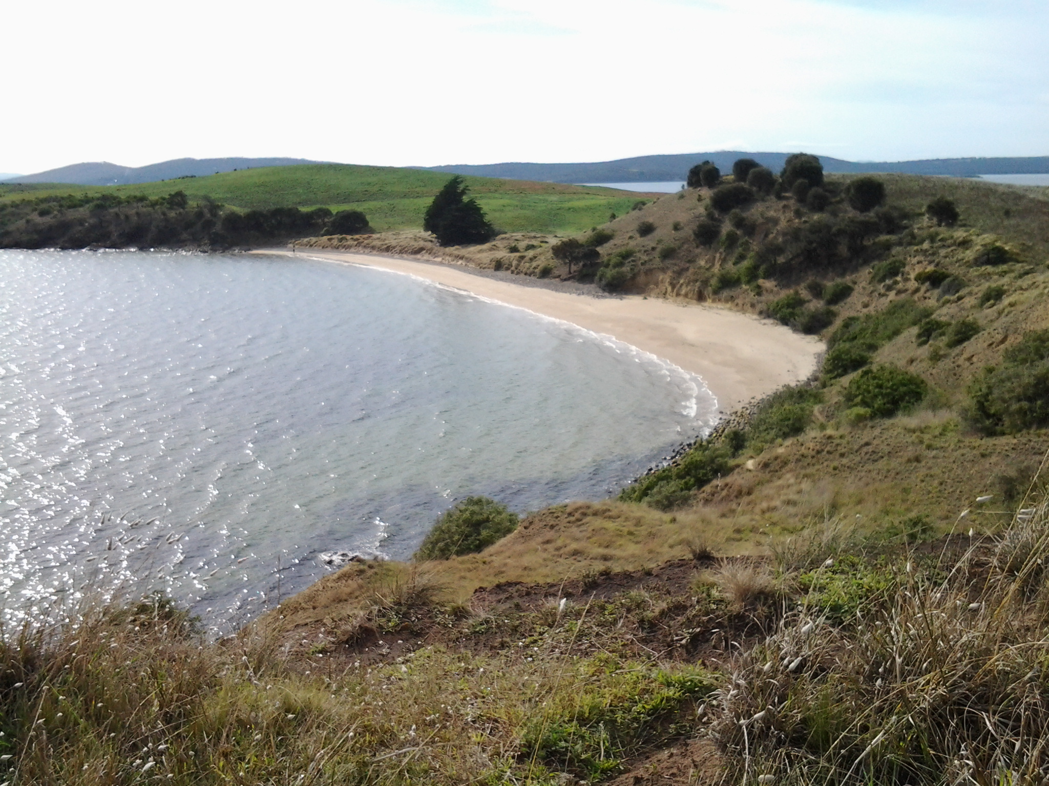
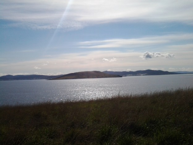
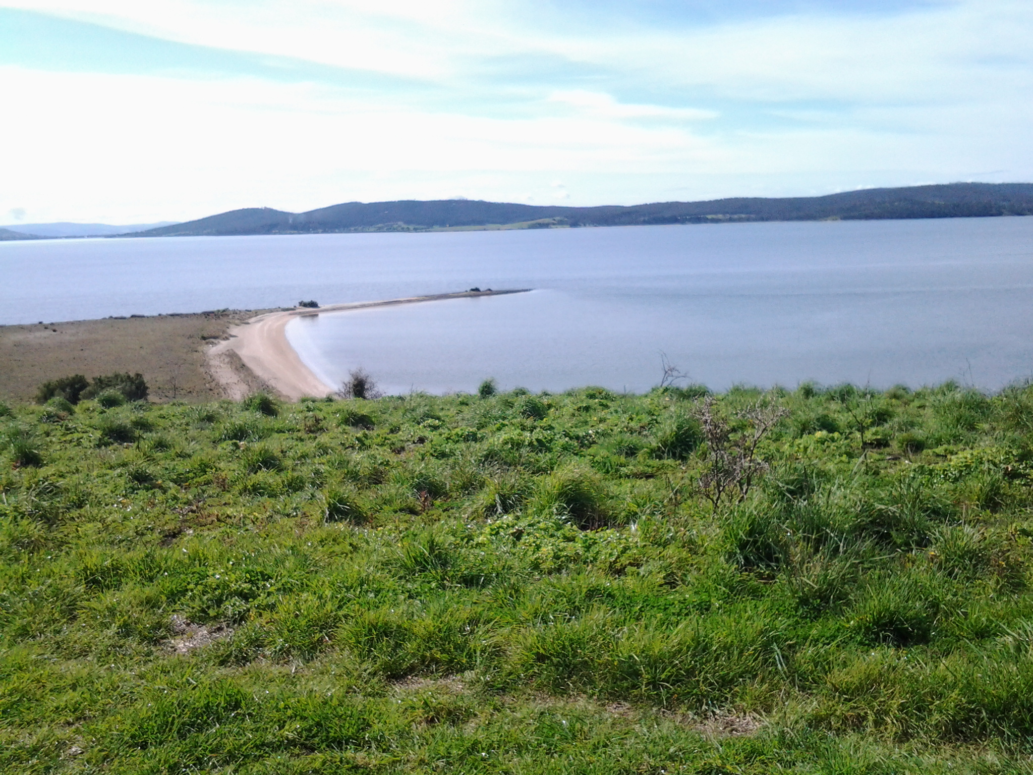
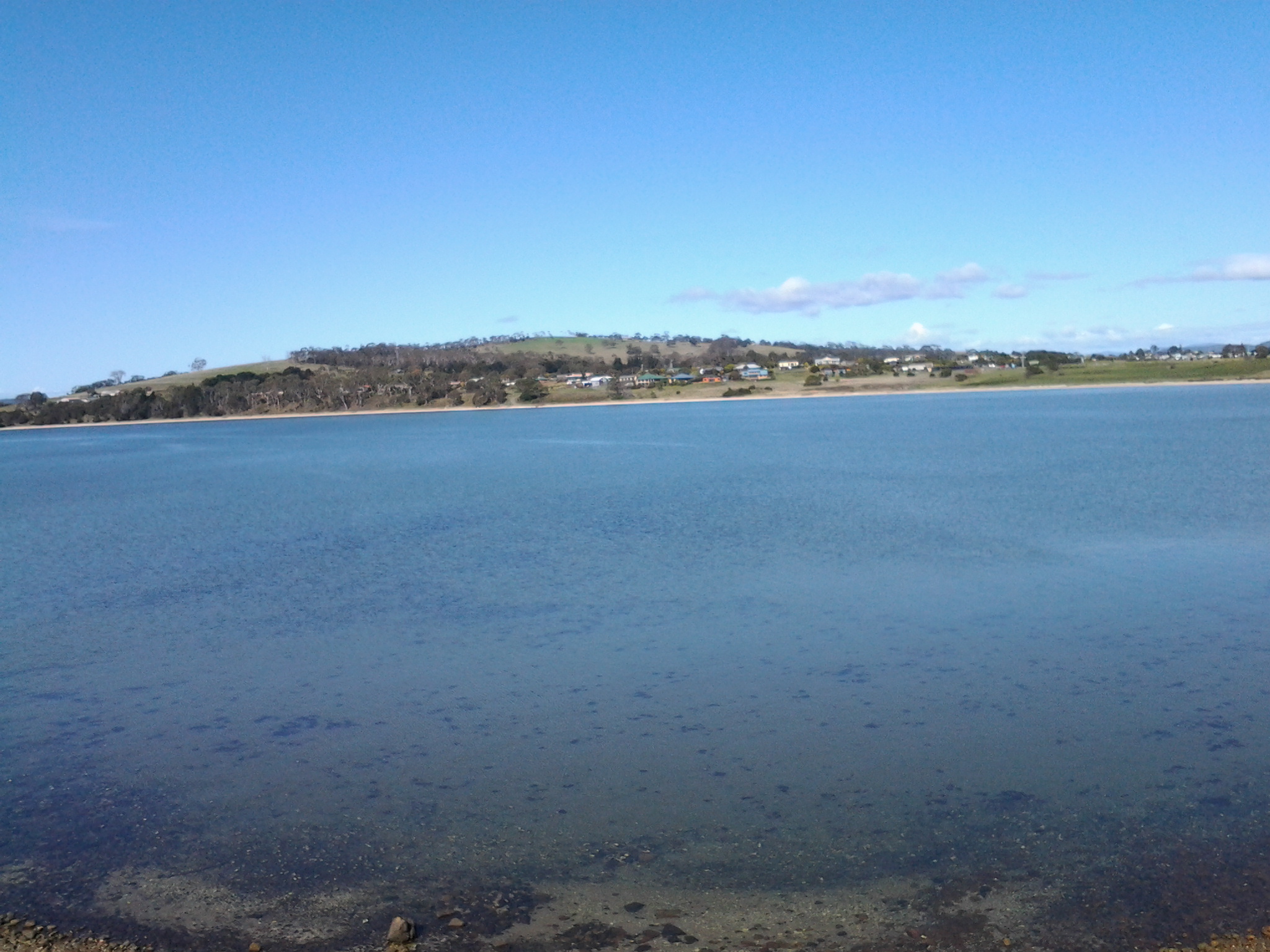
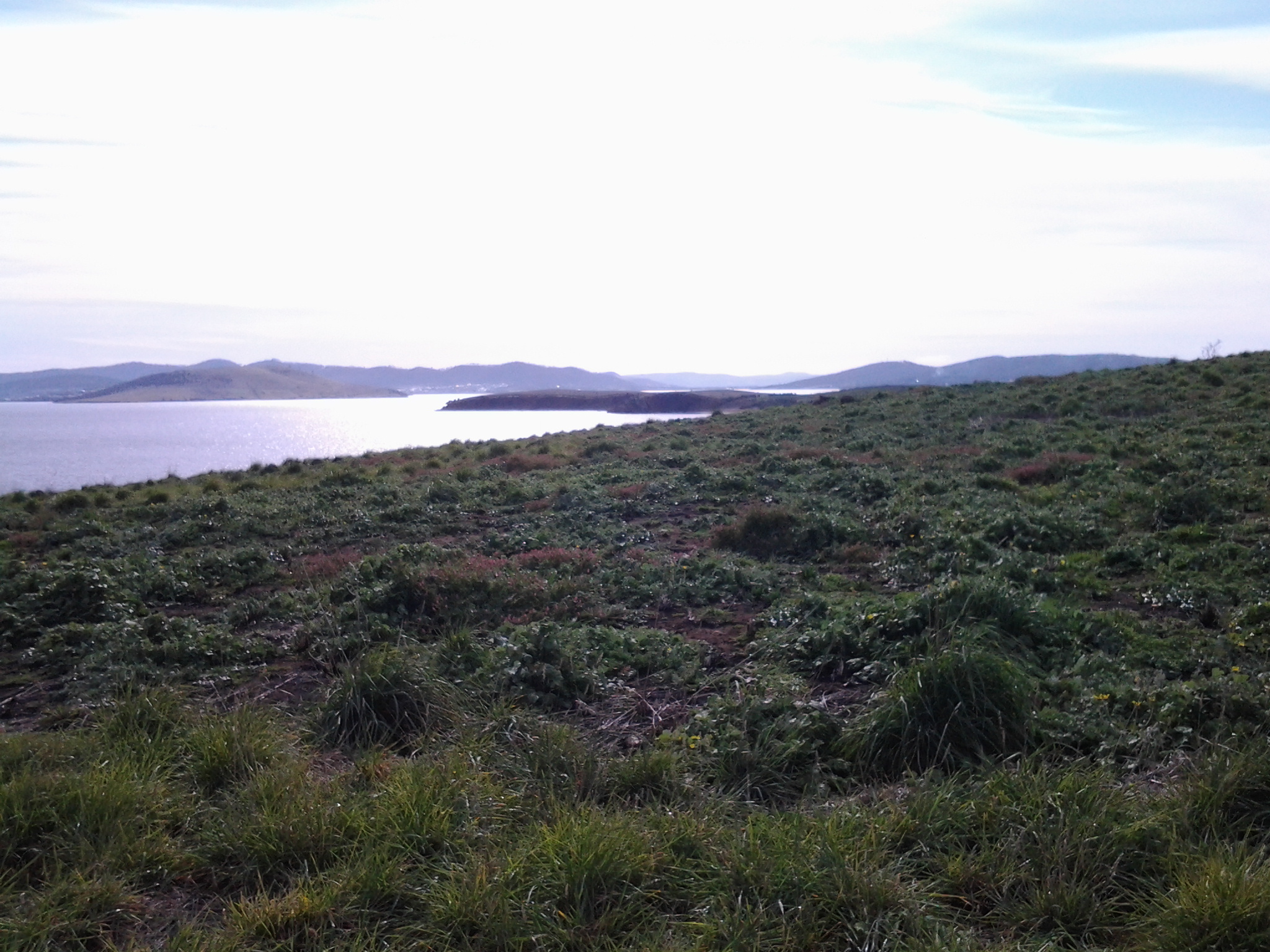
The image featured directly above is of the watery inlet from the Derwent River on the left into Ralph’s Bay on the right. The low hill in the distance is north of and opposite from Gellibrand Point (which is at the northern end of South Arm peninsula). The low hill is Droughty Hill: Trywork Point will be to the lower left of the hill.

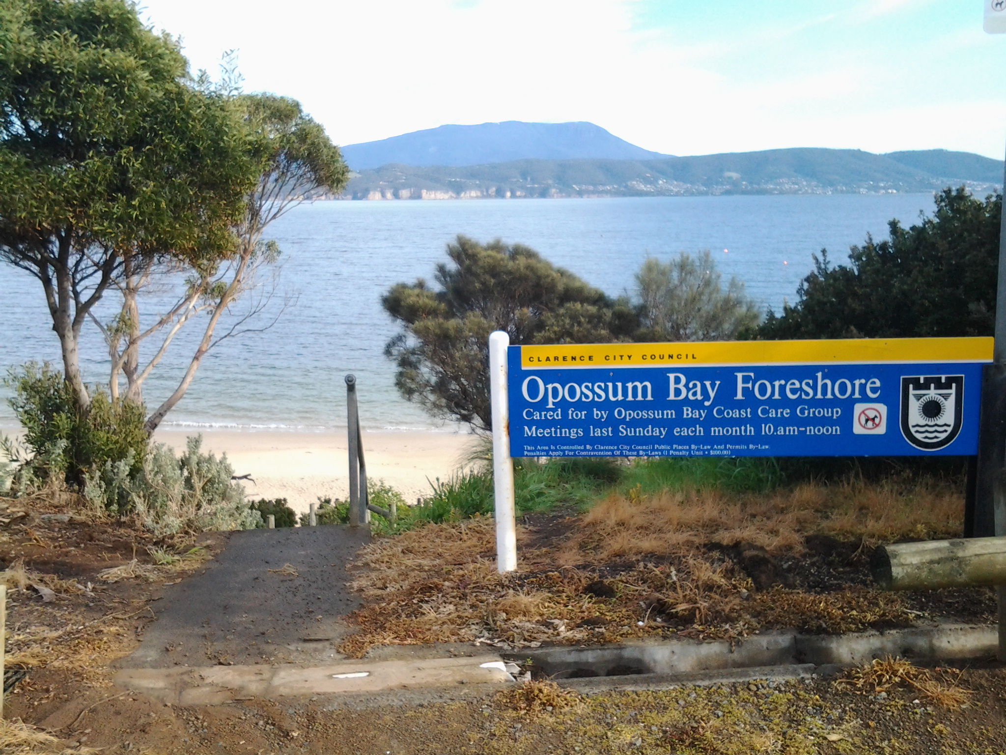
Previously, I walked from the mouth of the Derwent River and covered the length of the South Arm peninsula which amounts to approximately 11 km of the River. Stage 1 took me from Cape Direction to the Opossum Bay shop. Stage 2 took me from the Opossum Bay shop to Gellibrand Point. Only 238 Kms to go!

Continuing on from the last walk will require me to leap-frog over approximately 2kms of water for the next starting point Trywork Point which is south of the Rokeby Hills. The reason for my ‘jumping over’ is that I am guessing that the Derwent River was measured as a ‘straight’ length and did not count the many extra kilometres going in and out of every bay and crevice. The water between Gellibrand Point on the South Arm peninsula and Trywork Point is the entrance to the large Ralph’s Bay which feeds off the Derwent River.

So my initial destination for Stage 3 is Trywork Point – that will mark the start of the walk. To reach this starting point I will need to walk south from a bus stop and then later be prepared to retrace my steps or find a more suitable alternative route before continuing northwards through as many Hobart’s eastern shore suburbs as my feet will carry me.  The suburban area has frequent bus services (by comparison with the Opossum Bay bus service) so that timing the duration of Stage 3 is dependent on my health and inclination rather than on bus timetables.

Unfortunately, TasMAP Taroona 5224 is not a great deal of help for reaching Trywork Point. It clearly shows the acres of land between the bus stop and Trywork Point but offers no roads or tracks. I am clear that I will walk from the last Camelot Park bus stop (Metro Bus number 615) south to the Point – somehow. The Hobart and Surrounds Street Directory is only of marginally more use than the TasMAP. However this Directory will be especially useful with the names of streets as I return northwards and walk in and through the suburbs in the later part of this Stage 3 walk.

The most useful mapping and tracking information comes from the Google earth map of the area (which was also useful to see tracks on Gellibrand Point in Stage 2) – although the name Trywork Point is not recorded and does not appear on their map (Note that Trywork Point and some other landmarks are indicated on the TasMAP).  The best that Google can offer is Droughty Point Road. From there I moved the map westward until I found the T junction with Tranmere Rd and Oceana Drive – this intersection is the bus stop from where I will start walking.

Walking south, the bitumen road peters out and the tracks across the land are variously strong and faint on the Google earth map. With this limited information, finding my way will be an experimental process.

Years ago friend Je and I walked from the end of Tranmere Road across some of this land. However, I remember that we encountered stout almost impassable fences. This memory makes me wonder what I will find now, and how easy the access to Trywork Point will be. I look forward to my ongoing discovery of the land besides this wonderful Derwent River.


Stage 2 on 4/9/2014 Summing up Email 14 of 14

I arrived at the Opossum Bay shop at 9.10 am to start Stage 2 of the walking journey, and I caught the return bus (number 638 with a transfer onto bus number 632 at Lauderdale) across from the shop around 2.05 pm.

Between times I walked approximately 10 kilometres.  However, Stage 2 only represents around 4 kilometres of the length of the Derwent River. Adding this to the 7 kms covered in Stage 1, I have now covered 11 kms of the 249 kilometre long river.

I am persuaded that no-one could complete Stage 1 and 2 on one occasion to fit within these bus times. For someone to replicate my journeys two separate trips are required. Alternatively, one longer visit could finish with a return to Hobart on the bus which departs Opossum Bay near Shelly Beach at 5.55 pm.  Unfortunately this latter option would probably leave you with lots of time to fill in waiting for the bus; this eventuality would need to be expected and planned for.

As a post note, in 1995 the Gellibrand property was acquired by the state, on behalf of the people of Tasmania and in 2011 the area was declared a nature reserve and named Gellibrand Point Nature Recreation Area. I feel excited to have walked the trails and found my own way around, for the friendly people I met, the stunning views, the fascinating history, and the discovery of another part of Tasmania, one footstep at a time.  And all for the cost of a couple of bus fares.

 The photo below was taken from Gellibrand Point, Stage 2’s destination. It looks across the Derwent River towards Hobart city with Mount Wellington behind.

20140904_110649

Stage 2 on 4/9/2014 Shelly Beach Email 12 of 14

By 11.40 am (only 2½ hours since stepping off the bus) I had taken the trail around Gellibrand Point and south onto the northern end of the narrow sand-based Shelly Beach. Crunching underfoot, millions of sun-bleached shells shattered further. Large empty oyster shells everywhere. Their whites contrasted strongly with the golden dry-brown colours of the sandstone rocks.

The water hardly moved in or out.  Quiet. Calm.

Different schools of 5 inch long fishlings darted from the clear shallows into slightly deeper water.  The bank of sand beneath the Bay was very shallow and I suspect a swimmer might need to wade out quite a distance before being able to lie down and cover themselves comfortably with water. Out a little way in the bay, and like small mirrors, flashes of silver ovals lifted from the water’s surface when slightly larger fish came up for air. Or were they leaping with joy. Perhaps the fishlings that I disturbed when my feet vibrated the ground sending them scurrying for deeper and hopefully safer water, were a delicious meal for the larger fish.

The succulent Pigface with its bright pink flowers grew at the bottom of the sandy cliffs. Were the layers of shells in the cliff strata, remnants of aboriginal middens or simply an older beach level? Was I seeing the shells of the Late Pleistocene?

Sand can be dangerous because, when packed, it doesn’t usually have any structural integrity. Everywhere, I saw crumbling cliffs as a testament to a perpetually ravaging process.  Throughout my walk, on the western beaches and now on this eastern beach of the peninsula, all the sandy cliffs showed erosion and recent falls.  It was clear to me that walking close to the edges on top could lead to a mini landslide if you were unlucky. I feel confident that walking at the bottom of the sandy cliffs poses no risk if you walk nearer to the water’s edge.

20140904_114726

By midday, I had walked to a fence two thirds the way along this long beach.  This fence across the sand to the water of Ralph’s Bay marked one track back towards Opossum Bay.  Because a couple of new groups of older school children were now enjoying a drum playing class on the beach with their teachers near this fence, I decided to walk along the beach further.  Never let it be said that I was a distraction to their lessons!

20140904_115559

Five minutes’ walk past the fence, in the distance was a line of boulders across the sand from the grasses to the Bay.

 20140904_120341

These rocks became my lunch time pit stop while rich brown hawks and protective plover birds whirled nearby.

Looking back where I had walked, the long Shelly Beach stretched into the almost unseeable distance.

20140904_121324

My map informed me that Icehouse Bluff marked the southern end of Shelly Beach. 

Around 12.20 pm I was packed and on my way to the Bluff following in the footsteps of a strolling couple and their dog. We met as they were returning and I asked what they knew about the history of the Icehouse or the Bluff’s name.  Unfortunately, this remains a puzzle to us all.

The advantage of meeting these lovely locals was that I learnt the Bluff was private property and that no access would be possible – so I didn’t waste time looking for tracks up the slopes. We talked about the celebrity locals who have a house at Opossum Bay. I am led to believe that these include Brian Ritchie (MONA) who I thought I saw filling his car with petrol during my Stage 1 walk, Damon Thomas the Lord Mayor of Hobart, Gordon Brown well known heritage artefact collector and television personality, and John Cook who was the last lighthouse keeper for Tasmania’s last two manned light houses (Maatsuyker, Australia’s most southerly lighthouse and later at Cape Bruny).  Quite frankly I imagine everyone who lives on this peaceful South Arm peninsula will have interesting stories to tell and will be celebrities in their own worlds.

Stage 2 on 4/9/2014 Starting the return trip from Gellibrand Point Email 11 of 14

20140904_111425

While eating my morning tea on the gentle slopes at Gellibrand Point, the children had moved ahead but it wasn’t long before I had covered the distance to arrive at the tail of their walking party.

The teacher and I struck up a conversation. I learned that this was a special outing for the South Arm School, and children had to be at least 8 years old to be eligible to join in the 3 or so hours of their planned walk. From anecdotes, this length of walk was deemed potentially a challenge for their children, by some parents.  In this day and age of technological gadgets and constant car use, perhaps walkers are an increasingly rare breed of person. But there were no grumbles from the children and they seemed all very happy to be walking along.

 Just as I have my little project to walk the length of the Derwent River, I was reminded others have their wonderful special projects. The teacher surprised me when she explained that she and some friends had  set themselves the task of walking the 95 kilometres of all the Clarence City Council beaches (Clarence is one of the suburbs of greater Hobart – and the South Arm peninsula is part of that territory). Already they had covered 87 kilometres. What a great idea I enthused.  These are the simple pleasures that give real meaning to our lives.

It wasn’t long before a new geographical feature came into view within the smooth waters of Ralph’s Bay. The Spit.  A slim sandy piece of land that appeared as if the gods had yanked a slight sinew from the main land and pulled it out to a point. A large white cruiser rested languidly in the calm bay nearby.  No chance of sea sickness on that marine vehicle!

20140904_112358

The children decided to take a path in that direction to discover what they might. We parted company and I continued along the 4 wheel driving track.

 I circled around an old disused and collapsing quarry pit all the time enjoying the pleasure of putting one foot in front of the other.

20140904_112512

I passed corralling structures for holding sheep while watching circling hawks in hunting mode for small creatures on the ground.

20140904_113424

Bright sounding small birds tweeted madly. Unseen.

And in a few minutes, there before me was the arc of Shelly Beach – too long to fit into the frame of a photograph.

20140904_113730

Stage 2 on 4/9/2014 Onwards to Gellibrand Point Email 10 of 14

My journey continued up a hill where I recognised two track options; one inside a fence line, and another outside the fence at the top of the cliffs on the side of the Derwent River. I took the track outside the fence (I watched the following children and they were evenly divided between the inner and outer tracks- obviously their teachers thought the outer track to be safe), and at the top of the hill there was an opening to step through the fence and return to a 4 wheel drive track.

20140904_105455

The air was clear. The day was warming up. The views in every direction were sensational. One of those experiences that makes me so happy to be alive.

20140904_105300

The photo above looks across part of the northern end of that part of the Mary Ann Bay, and via the Derwent River, looks towards Hobart city suburbs and Mount Wellington.

Not far away I walked past a pile of broken old convict bricks.

20140904_105102

Gellibrand Point at the northern most point of the South Arm peninsula was the destination for Stage 2 of the walk.

I found the shape of this headland was blunt and rectangular so that there was no hint of a ‘point’. So it was a little difficult to say I had reached the exact spot representing the end of the second stage of my walk along the Derwent River edge. Across the watery opening into the large Ralph’s Bay I could see the goal for Stage 3 of the walk: Trywork Point. This headland is situated south of the suburb of Tranmere, and north of the South Arm peninsula.

20140904_110320

In the photo above, you are looking at Trywork Point across the water.

The photo below was taken from my lunchtime vantage point looking across Ralph’s Bay towards the mound in the distance over the water on the left hand side; this is Trywork Point.

20140904_121302

The Tasman Bridge, which provides the main city crossing between the eastern and western shores of Hobart, shimmered in the distance. Mt Wellington with spots in crevices of hard white ice left over from two or three weeks ago of heavy snow, was majestic.

I wandered along the headland until, between the track and a smattering of Casuarina trees near the water line, I spotted some sandstone boulders that looked perfect as resting spots; the first I had seen. By 11.15 I had rested, eaten a snack for morning tea, and set off again up to and onto the track that extends back to Opossum Bay via the eastern side of the peninsula.

Stage 2 on 4/9/2014 William Gellibrand’s burial Vault Email 9 of 14

Shortly after his arrival, in the 1820s William Gellibrand built a home using cedar with sandstone brick foundations, on Arm End. Marshall and Townsend claim the house was built in two parts consisting of nine rooms with stables located in the trees nearby (it is worth noting that the clearing of the land in this northern end of the peninsula was so thorough and complete that the numbers of trees could probably now be counted on two hands. Currently, the rolling hills are expanses of a variety of clumpy weeds. Open. Exposed. Desolate. The photo of weeds below was taken closer to the Communications tower however it is not atypical of other parts of this peninsula. Adding to the sense of barrenness is the frequent evidence of bandicoots digging across this large reserve. It is worth noting that a regeneration program is underway and so I would expect that the landscape will change its character in the coming years.)

20140904_101005

A visitor to William Gellibrand’s house, Miss Jane Mortimer recalled that every morning after breakfast, William went to dig his own burial vault located just below the house at the top of the dunes beneath She Oaks overlooking Mary Ann Bay. Apparently, he liked to spend sunny afternoons sitting on it and reading.

The land at Arm End remained in the Gellibrand family with the lease controlled by George Henry Blake Gellibrand who lived at ‘Terra Linna’. Young Christopher Calvert leased the land and lived in the house until he retired. There was an auction in 1914 of goods and chattels including animals. The homestead quickly fell into disrepair, was vandalised and eventually burnt down.

 I almost missed seeing the vault as I strolled along the track. The saviour was an information sign installed above the bank at the northern end of Mary Ann Bay beach. The sign informed me that not only was William buried in the vault, but also interred were two of his grandsons who had been members of the Parliament – Thomas and Walter Gellibrand. William Gellibrand died ‘after an illness of acute pain and suffering which he bore with Christian submission and resignation’ on 27 September 1840 (almost exactly 174 years ago) aged 75.

The sign refers to comments by a Mrs Ruby who ‘described the vault as having three shelves of stone more likely collected from the shoreline of Ralph’s Bay’.

The vault is located close by and downhill from the sign. Visitors are urged not to walk down and further degrade the collapsing dune. Thanks to the local land care group, it was very easy to see the vault from near the sign at the top because the surrounding vegetation had been cleared over the edge.

20140904_104535 

I left this remarkable site at 10.50 am as I could hear the school children coming along the track for their own experience.

Stage 2 on 4/9/2014 William Gellibrand’s convicts Email 8 of 14

Researchers, Penelope Marshall and Alan Townsend, have written “The Convicts of South Arm” (available from http://www.ccc.tas.gov.au/webdata/resources/files/The%20Convicts%20of%20South%20Arm.pdf) which offers information and insights.  Here below are some examples of workers on Gellibrand property.

  • John Asgill, a labourer and shoemaker from Coventry in England, was transported aged 19 years for stealing gowns and frocks. He arrived in November 1836 and worked for William Gellibrand until 1841, when he absconded and was caught across on the other side of the Derwent River at Sandy Bay pretending to be a free man.
  • Lydia Hines was tried in London in 1821 and sentenced to 14 years for felony. Despite standing 4 feet 11 and ¼ tall, she was impudent and insolent. Lydia was assigned to William Gellibrand in 1825. She spent six months at South Arm as his domestic servant before being returned to the Female Factory in South Hobart (currently open to tourists) for ‘insolence’.
  • Edmund Musk arrived in Hobart on 16 May 1832, married with five children (he and his wife had a further 10 children while at South Arm. John the eldest son drowned in Ralphs Bay while loading a boat. Their daughter Susannah drowned when a boat capsized at Rokeby.). Edmund was transported for stealing ‘beans and barley’. He was assigned to William Gellibrand, where his skills as a ploughman were used. He later gained his ticket of leave and leased a farm from the Gellibrand’s. By 1858 he was farming 120 acres at South Arm, and employing convicts himself. Edmund Musk is buried at St Barnabas’ at South Arm. The Opossum Bay bus passes this church. It is located on the left as you head back towards Hobart on the South Arm Road, after you have left Opossum Bay and not long before the South Arm Cenotaph corner is reached.
  • Thomas Kimble was transported in 1844 for the highway robbery of 1 ½ sovereigns. He received 15 years at His Majesty’s pleasure. After serving as a probationary convict at Maria Island isolated off the east coast of Tasmania, Kimble was employed at South Arm by George Gellibrand (William’s grandson) during the harvest time. His record lists him as a farm labourer who could plough, a shepherd and a hop grower all useful traits to establish the new colony. Thomas’s distinguishing features were a tattoo of a Mermaid on his left arm, a woman with a glass in hand on his right arm and the bust of a woman on the back of his right hand. He received a ticket of leave on 30 March 1852.

James Cumberland was sent to Sydney from his native home of Walthamstow in England for stealing geese but gained his Certificate of Freedom in 1827. In 1846, following his conviction for the manslaughter of his pregnant wife under the ‘spiritual influence’ of public house liquor, James was transported to Hobart for life. In Van Diemen’s Land, James worked for George Gellibrand at South Arm where he died from heart disease on 19 June 1853 aged 53.


Stage 2 on 4/9/2014 William Gellibrand Email 7 of 14

With feet wet from long dewy grasses in the trek around Mary Ann Bay, I slopped along ready for new natural wonders. The track changed from dirt to dry sand and the large paw prints of a wandering dog were freshly impressed.  Soon after, it seemed the track had not been driven on for a long while and quickly it reduced to a single file.  Around 10.40 am, I had already walked up a hill, and had passed a mesh fence with the beach below to my left where I could see a small sandy bay complete with unconcerned Pied Oyster Catcher birds foraging.

From research and from information shared by a friend, I knew the original white settler, William Gellibrand, was buried somewhere along this part of coastal Derwent River. I wondered if I would be able to find the spot and whether the site would be marked.

A local group http://friendsofthearm.wordpress.com have been particularly instrumental in researching the history of the first white settlers (remember this South Arm peninsula was part of the country of the Moomairremener indigenous people). In addition, the South Arm Landcare Group has been doing its best to preserve the environmental landscape. Currently the latter group are ensuring the land around William Gellibrand’s burial site is protected.

William Gellibrand accompanied his son Joseph Tice Gellibrand (who had been appointed Attorney General for the colony) from England to Van Diemen’s Land in 1824. William was granted approximately 2000 acres of land at South Arm and assigned ten convicts.  This was later increased to 3000 acres by a grant from his son.  As other settlers arrived Gellibrand leased land to them and later they were able to purchase their lot. By 1885, many had purchased land on the peninsula: some names are  Alomes, Calvert, and Potters and people with these family names are still in the district today.

I am sorry not to have found a photo of William Gellibrand for insertion here.Below is a photograph of George and Agnes Alomes courtesy of the site at http://www. southcom. com. au/~pottermj/pagef. htm

  [IMAGE]

 William Gellibrand’s claims to fame in Hobart Town include his appearance in the registrar of Magistrates Hobart Town from 1826 until 1827 and he is also remembered for setting up banking in Hobart.  In addition, William was a merchant and exporter and served as a Justice of Peace.

Stage 2 on 4/9/2014 Mary Ann Bay Email 6 of 14

From the communications Tower, I followed the reasonably flat four-wheel drive track north eastwards by the edge of the river and ten minutes later I was able to look down from a high cliff towards Mary Ann Bay.

20140904_101830

For a short while a solitary man stepped briskly along its short length. Despite the children stopping and starting as they took in the sights along the way, the group caught up with me as I looked down at the beach end of the very long and faceted Mary Ann Bay. These were relaxed country kids who said their ‘hellos’.  I had forgotten such differences exist between the city and country. Their openness reminded me of my experience on a Marquesas Island last year, when having talked to a primary school class one day, and then travelling to a remote part of the island the following day, a young girl came up to me in the car where I was sitting, simply to say hello. With each of our halting use of the French language (the Marquesan’s speak a Marquesan language as their first language and only French, the national language, occasionally) we were able to work out why she was greeting me. She had remembered me from the class room, and the country thing to do was always to acknowledge people you know, however slightly. But I have gone off at a tangent … back to the walk and to Mary Ann Bay.

After glorying in the views of the undulations of this part of the South Arm peninsula, the expanses of the Derwent River and the sparkles of the western shore, I had the choice to continue on the four-wheel drive track up and over a hill or follow a single track through tall wet grass that skirted the cliff edge. No contest. I avoid hills when I can.  Of course I had no idea where this track would go or whether I would need to retrace my steps. But all was well, and the track gave great views before curving around downhill from the main track. Quite quickly I found myself back joining the main track after it had dropped down from the hill. It was only 10.25 am and I had been walking for an hour and a quarter.

I continued for a few minutes along the main track until I reached a very steep hill for a 4 wheel drive to descend. Having owned a 4 wheel drive and enjoyed off road adventures in the Northern Territory, I know that if I had come across such a serious drop I would have been taking lots of very deep breaths and may have even prayed in what would be a swift if not hair-raising sliding descent.  On my walk down the hill, I avoided the slippery earth and enjoyed a safe descent courtesy of clumps of grass. Soon after this, I continued on and passed the sandy track that could have taken me onto the beach end of Mary Ann Bay.


Stage 2 on 4/9/2014 The Tower Email 5 of 14

Having ascended from Mitchell’s Beach a little after 10 am, I turned left and followed the four wheel drive track with Mount Wellington looming in the distance. Swallows swooping ahead of me along the track. An old windblown pine tree stood on the left between me and the Derwent River with thousands of new pine cones in their early growth phase – like small golden brown candles. The Derwent River was almost flat calm.

Then I could hear children. Ah ha! Hmmm. The sounds of their happy voices coming closer. Behind me across the land. Drat! Solitude about to disappear. Maybe.

Walking across the undulating landscape allowed me to be in sight of the tribe of primary school children with their two accompanying teachers and then, alternately, to be on my own as the hill crests obscured my view backwards. It only took me 10 minutes to reach the tower on the open and exposed White Point Rock headland.  The tower, in its caged environment, is an Australian Department of Communications radio and television transmitter which ensures some suburbs across the river receive their needed communications connections.

20140904_100850

Apparently the land at White Point Rock dates to the Late Pleistocene – that is, roughly 126,000 ± 5,000 years ago, and University of Tasmania researchers (http://ecite.utas.edu.au/62080) have documented the shell remains of the ancient marine fauna contained in the land there, now 24 metres above the current river level.

Stage 2 on 4/9/2014 Mitchell’s Beach Email 4 of 14

The roadway above Opossum Bay beach being narrow and without public footpaths meant it was important not to day dream and for me to be vigilant for the occasional car.  But Opossum Bay is a relaxed seaside village and even cars seem to move sedately.

I continued walking on the road from Opossum Bay beach until I reached a 50Km hour sign for cars, then I moved left off the road onto a well-trodden narrow track through a clutch of Casuarina trees and walked down to the next beach – Mitchell’s Beach. When I checked my watch, only 20 minutes had passed since I had left the bus. Yet already my head was filled with ideas and new information, and my heart was open with joy. The pleasure of walking in clean clear environments cannot be underestimated.

The winding track from the road finished on the sandstone rocks. After an easy few movements and a short distance, I walked onto the sand of Mitchell’s Beach. As I padded along the beach, a gentle breeze whispered across my face while the water lapped quietly onto the sandy shore. Silver gulls wandered around. Opened mussel and oyster shells strewn along the beach, were blanching in the sunlight. I marvelled at the various seaweeds thrown up at high tide, at the decaying ribbons of sea grass and at the fish eggs collapsed like bizarre multi-shaped condoms. The air was rich with the sweet and salty smell of dying seaplants. The water a soft greeny grey. Blissful.

When I come across a few bright orange starfish on the edge of the tide, I cartwheeled them into the dry sand at the upper edges of the beach. I was simply doing my tiny bit to reduce the infestation of these seastars (http://www.abc.net.au/science/slab/starfish/) as devastating invaders of our local marine environment.

20140904_094156

From Mitchell’s Beach I looked directly across the Derwent River and could see the suburbs of Kingston and Taroona with the Alum Cliffs below Bonnet Hill between them. Strikingly, Taroona’s Shot Tower stood tall.  Stunning.

20140904_091437

A pair of footprints impressed in the sand let me know that someone had walked the beach earlier.

Mitchell’s Beach was edged with three to four metre high dunes with tussocky grass on top, which were gradually crumbling into the beach. Demarcations between dirt and sand strata were clearly visible. Towards the northern end of the beach, small seas of water smoothed grey stones provided a separation layer between the beach and the dunes.

 20140904_095336

A lone Dominican gull with his pure white tail, pale grey legs and small yellow bill flew off leaving me in charge of his beach.

I reached the end of Mitchell’s beach 40 minutes or so after setting off from the Opossum Bay shop. Again a rocky headland stopped me continuing but I couldn’t see a defined track up the hill onto the land at the top.  Clearly people had found a way judging from a mishmash of bits of tracks.  I chose the least steep section and was surprised when after my first steps up I slid back down. The previous day’s rain had kept the ground lush and damp, and it was clear that the soil included slippery clay. By a more careful choice of foot placements, I eventually reached the top.

20140904_095847

Stage 2 on 4/9/2014 Opossum Bay Email 3 of 14

The bus trip from the city to the starting point for today’s walk takes approximately 1 hour 10 minutes.

Stage 1 of my walk finished at the Opossum Bay shop so Stage 2 needed to start from there.

20140904_090914

By the way, it makes sense to alert the bus driver that you do not know the area you are travelling to, that you want to get off at the Opossum Bay shop, and that you would like him or her to stop and let you off when you reach your destination.  Our Metro drivers are very happy to provide this simple customer service.

When I alight from the bus at 9.10 am, what I see ahead is excitement. I watch the bus disappearing along the road and know that this is the direction I must take, however on different paths. From the Taroona TasMAP, I know the bus will not travel nearly as far as I will walk, so that once I have reached my destination of Gellibrand Point, I will need to retrace my steps to a bus stop.

I am unsure if I might find trails, and whether I might need to exert some pioneering spirit and discover a way. I don’t know who I will meet or where. I wonder what I will smell and what I will hear.  This promises to be a terrific adventure which will use all my senses. Stepping off into an unknown world.  And so I take the first step along the road (no footpaths) from the Opossum Bay shop.

20140904_090925

The sun is shining. Air is crisp. Nobody is out and about and walking around. Opossum Bay is peaceful and quiet except for the soft sounds of water lapping onto a beach in the distance.

100 metres along the roadway a sign points to public toilets which, after an hour on the bus, are a good place to visit. At the bottom of the attached carpark, a large placard indicates a tiny walkway down onto Opossum Bay foreshore.

20140904_091422

I was filled with awe when I stepped onto the pristine white sandy foreshore, and looked along at relaxed houses and shacks overlooking the edge of the beach. Not a soul to be seen.

20140904_091601

Mt Wellington and the western shore of Hobart across the Derwent River looked particularly special.

10 to 15 minutes later I had walked north along the length of the beach until confronted by a rocky headland that needed to be rounded before I could continue the walk.

Instead, I chose to climb the concrete stairs near the end of the beach that returned me up to the road.  I noted that the rocks were reasonably smooth and could easily be accessed, but as usual and not knowing which future obstacles might present themselves I decided on the more obvious route; all the time I remembering my return bus departed at 2.02 pm and that I needed to make sure I caught it (because the later one did not depart until 5.55 pm).

Stage 2 on 4/9/2014 Travelling towards the South Arm peninsula Email 2 of 14

For people with lives normally immersed in the big cities of the world, travelling this route to Opossum Bay will be full of surprises.

Hobart is a capital city yet, after not many minutes of travelling, the bus passes through bush land from time to time, before coming out into clusters of developing real estate. Springing up around many corners, the landscape is meshed with strips of dark bitumen. These cul de sacs and neighbourhood streets are usually featured with white concrete lengths of soon-to-be driveways into soon-to-be built houses on blocks cleared of all vegetation. These new suburbs represent the interest in having and the will to live in your own home – even if it means a 20 minute or so travel time to the city. We know that by the standards of other capital cities around Australia and the world that such travel times are but a blink of time.  The easy accessibility to the centre of the city is a great reason to live in suburban Hobart.

As usual the bus travelled through the suburb of Rokeby. I was eager for another view of Ralph’s Bay remembering its sparkling crisp deep blue expanse when I travelled this way for Stage 1 of the walk. This time the colours were different however, despite the sun shining. Perhaps it was the high level wispy cirrus clouds that filtered the light and affected the colour of Ralph’s Bay on this journey. This time, when travelling the streets at the top of Rokeby, the spread of water was coloured a warmer tone of greys and pale greens. The Bay looked benign and neutral, and was all together welcoming. Further on in the journey, I passed the mud flats at the Lauderdale site of the Bay. The tide was in further than previously and covered most of the mud. I couldn’t help but think how time makes small differences in our world – it is only two weeks since I was travelling here on route for the first walk and, at that time, acres of mud flats were on show.

What else did I see during this bus trip?  Glossy dew on lawns. White blossom on fruit trees. Pink blossom. A well-painted graffiti wall, following a colourful display of clever mosaics in the suburb Clarendon Vale.  Road signs with the symbol of a horse with rider warning of the additional ‘traffic’ which the road might share. Paddocks with grazing horses. Horseboxes. White fences. As the bus started on the road across the isthmus to the South Arm peninsula one sign with a stylised image of a Pied Oyster Catcher bird indicated travellers should be aware that these birds may want to walk across the road from time to time.  Later, on the return to Hobart journey, I noted perhaps 50 Black Oyster Catcher birds resting as a large family, on the sandy edge of Ralph’s Bay near the sign.  They were not in the least put out by the rattling of the passing bus. 

Stage 2 on 4/9/2014 Clarence St Bellerive Email 1 of 14

As expected, the early morning (number 640) Metro bus arrived from Hobart at my eastern shore bus stop, and once on board I settled down ready for the new experience of Stage 2 of my walk along the Derwent River. After charging along Cambridge Road, the bus turned left at Bellerive village and commenced the long haul along Clarence St.  It occurred to me that the houses along both sides of the road represented many vintages of free-standing suburban house architecture for this part of Hobart. I was surprised to see Wunderlich panels of decorative pressed metal in the frontispieces of some houses in the gable beneath dual pitched roofs, indicating an architectural age of early in the last century. There were the flat roofs of houses that had more in common with Tasmanian shacks of the 1950s, the three fronted brick veneers, the fashionably rendered homes in tones of dark beige with their black roofs, the remnants of rural cottages from a time before the city sprawl had moved to fill the land on the eastern shore of Hobart, substantial pretty weatherboard family homes, and much much more. If your experience is of the repetitive rows in London streets, the towering repetitive apartment blocks of Moscow, or the repetitive white family group block houses of Athens, then the sight of the houses along Clarence St will be a revelation. Somewhat puzzling but fascinating nevertheless. You will not be familiar with the diversity of free standing houses with their own front and back gardens that so many Australians take for granted, and accept as their right. One family to a large block of land is a situation more prevalent and typical in Hobart perhaps than in other Australian capital cities and it is one of the features that attracts me to this beautiful and interesting city.

The second stage of the walking tour

Tomorrow, Thursday 4 September, I plan to walk a second stage of my foot journey along the eastern shore of the Derwent river.  As with the first leg, I need to take Bus 640 that departs from the Hobart city bus mall at 8am and heads towards Opossum Bay.  I will jump on the bus once it reaches the eastern shore and, as before, I know I must be patient because it will weave through the suburbs of Rokeby and Clarendon Vale before passing Lauderdale, Sandford and South Arm (details of these great locations are in the earlier postings related to the first stage of the walk). My bus destination is the Opossum Bay Shop. From there I will walk north to Gellibrand Point via beaches, roads and open landscape.  I hope to be able to enjoy my pre-packed lunch sitting looking towards Mount Wellington before returning to the Driftwood Drive bus stop for my journey back towards Hobart. The morning low temperature is expected to be around 9 degrees when I arrive and rise to about 14 degrees around 1pm. The return bus leaves Opossum Bay at 2.02 so I hope it doesn’t rain before then.  Keeping my fingers crossed!