Category Archives: Derwent River

How common is the name Otago and what is its history?

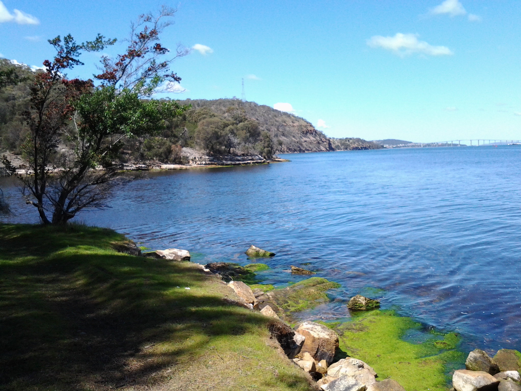
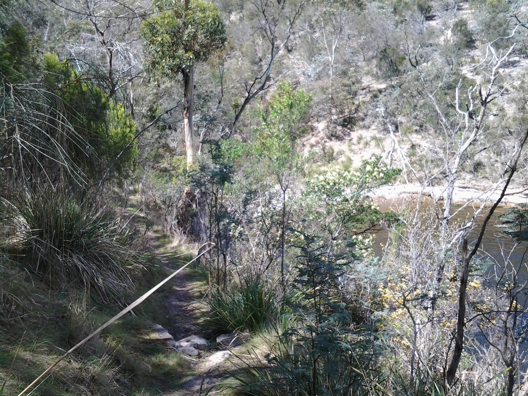
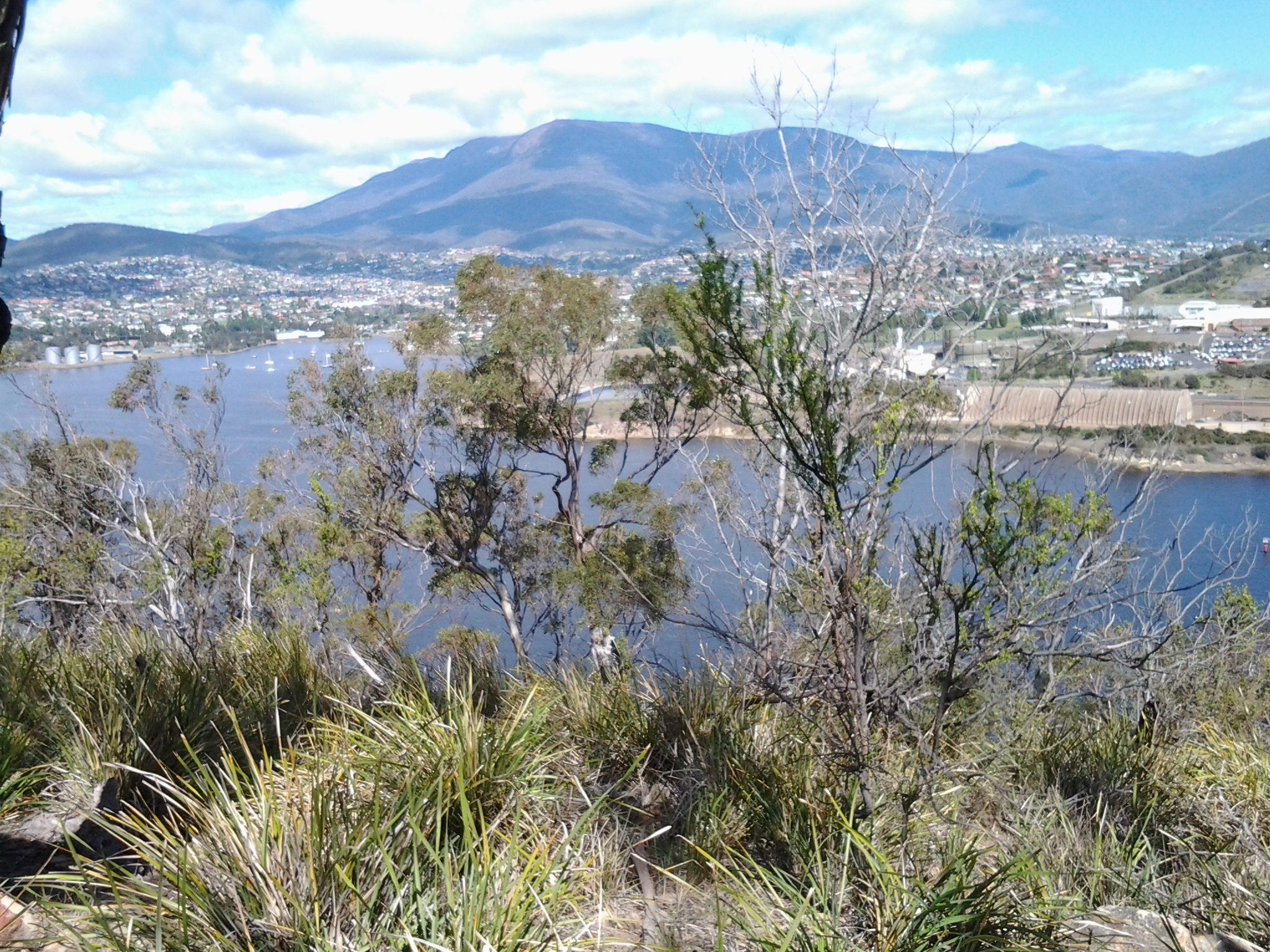
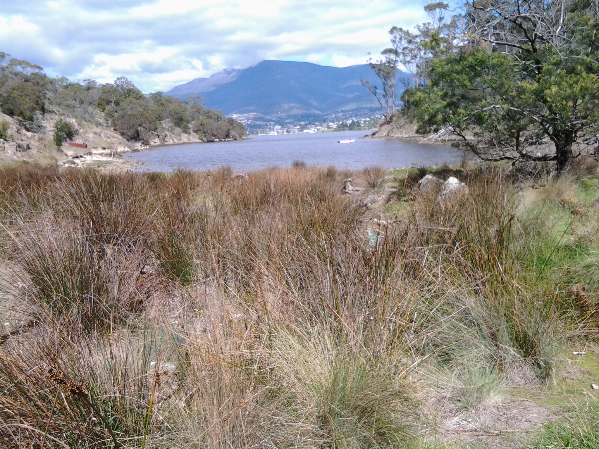
How did Tasmania come to name its Otago Bay, one of the suburbs in the broader Old Beach area, on my planned Stage 7 of the walk along the Derwent River?

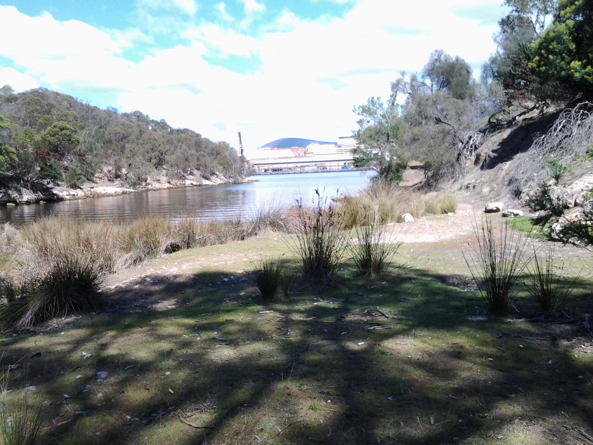
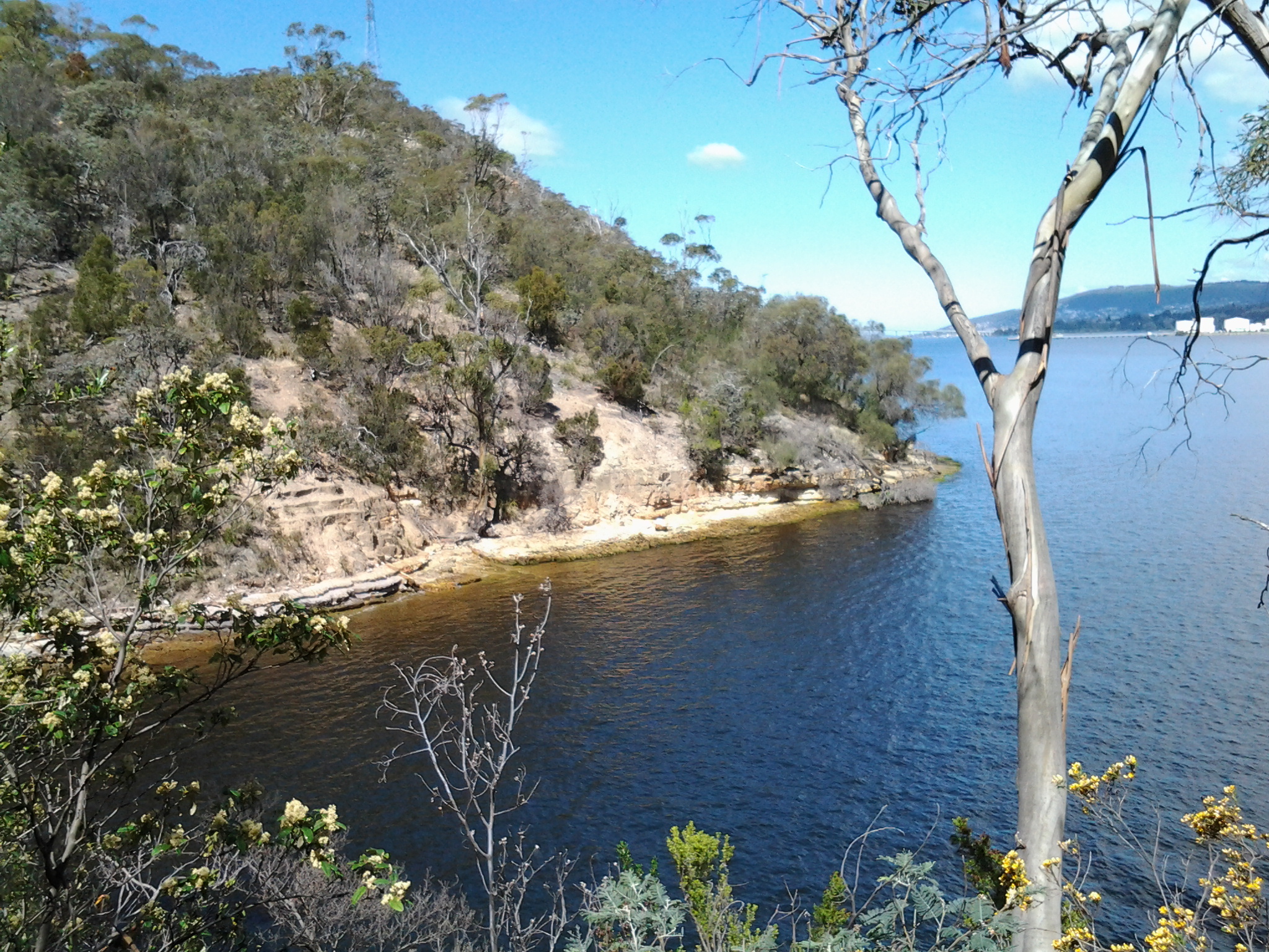
On the Clarence City Council site at http://www.ccc.tas.gov.au/page.aspx?u=1085, Otago Bay was named after the iron barque the Otago, the remains of which can still be seen on the shoreline of Otago Bay. Wikipedia reports that the remains of the Otago (beached in the Bay in 1931) and a steel river steamer the Westralian (beached in 1937) can both still be seen on the beach. The Otago was dismantled at a shipbreaking establishment that operated at the Bay between the 1920s and 1960s. Some excellent current photos of the remains of the Otago can be seen on http://pacific-edge.info/2014/01/otago/.  I look forward to clicking my own photographs later this week.

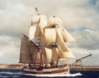
At http://www.nzgeographic.co.nz/archives/issue-78/joseph-conrads-ship, I learned the Otago was commissioned by Captain Angus Cameron and built by Alexander Stephen & Sons, Glasgow, Scotland. Once in Australasian waters, the Otago was used as a regular carrier of coal from Newcastle, New South Wales Australia to New Zealand’s city of Dunedin in the early 1870s.

The Otago page on the Parks and Wildlife Service website http://www.parks.tas.gov.au/index.aspx?base=1793 explained that the Otago was a three masted ship built in 1869. In 1872 the barque was transferred from Glasgow to Adelaide, South Australia. The Otago‘s chief claim to fame is that the vessel was the only command of the famous Joseph Conrad during 1888-9 (Conrad became a well-known novelist using some of his mariner experiences, after he gave up sea faring in the mid-1890s).

The vessel arrived at Hobart in July 1905. In January 1931 the Otago was sold to a local shipbreaker and towed to its present location in Otago Bay. The hulk was partially dismantled for scrap metal in 1937 and more completely in 1957. The bow of the vessel rests on the shoreline with the stern lying in approximately two metres of water. The iron hull has been cut back to the waterline and the bow and stern have disappeared entirely. The remains can easily viewed from the shore as the interior of the hull and the surrounding area contain a quantity of debris that make closer examination hazardous. The photo below, of the Otago, is from the parks and wildlife website.

Otago 1900 Adelaide

The Otago at Port Adelaide, c.1900 (in the collection of the Archives Office of Tasmania)

The photo below, dated a decade later, is also from the collection of the Archives Office of Tasmania.

Hulk Otago 1910

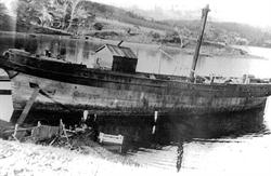
Hulk of the Otago, c.1910

That is all well and good. We know our Otago Bay was named after a boat that was dismantled in its Bay. But what does the name Otago mean?  How did the boat get its name?

Otago, a well-known region in the southern island of New Zealand, was settled by people from Scotland starting in 1848. Many people believe the name ‘Otago’ is a European corruption of the Maori word ‘Otakou’ which translates as ‘village’. It may be fitting to refer to our Otago Bay as a village because its population only numbers a few hundred and it is isolated from other suburbs by the natural landscape. However, there seems to be no connection between our Tasmanian Otago Bay and with Maori culture (although perhaps some New Zealanders live there – I don’t know).  More than one boat was built in Scotland and named Otago in the second part of the 19th century, so the impact of the Otago region in New Zealand on Scotland was significant.

The founder of the Otago settlement in New Zealand, William Cargill, died in 1860 and a Tasmanian sandstone monument to him was built in Dunedin in 1864. Why Tasmanian sandstone? According to http://freepages.genealogy.rootsweb.ancestry.com/~nzbound/otago_bdm1860.htm, son John Cargill stopped by Tasmania in 1841, before he helped his father to settle in Otago.  Did John collect some local sandstone during his visit? If so, what an extraordinary thing to do considering the Otago ship eventually had its resting place in the Derwent River.

Alas

Regretfully I sit here at my computer at the time I had planned to leave home for Stage 7 of my walk along the Derwent River.  As promised the sky is mostly cloudy and, while I would have preferred a clear blue sky, clouds in themselves are not the problem.  The clouds are trying to be ordinary cumulus stacks but there is too much a sense of snow cloud around their edges, so I do not trust the day. The mountain (Mt Wellington) still has a covering of snow from yesterday’s storms and today’s winds blowing from there are icy.  Since quite a bit of today’s walk was over exposed roads, the thought of being blasted by the wind all day isn’t attractive. So … I expect Friday’s weather to be suitable and will try again then.  It’s such a shame. My lunch was made and bag packed. Nature wins!


Weather – please be kind tomorrow

People who live in Hobart know the persistently wet and windy spring weather we have felt and seen for the past few days.  This afternoon my windows were pelted with white stones of ice; yes hail. I haven’t seen hail for a long while. But I shouldn’t be surprised.  After a major storm over the mountain (Mt Wellington) this morning, the top half was white with snow. Then strong fronts passed over Tasmania bringing the ferocious inclement weather with it. Stories about the wild weather have been covered in http://www.themercury.com.au/news/tasmania/hobarts-hadleys-hotel-damaged-in-storm-squall-with-thousands-of-homes-without-power/story-fnj4f7k1-1227104947517.

But the Bureau of Meteorology indicates a minimal chance of rain tomorrow around Hobart, and cloudy but with a high of 19 degrees.  This seems perfect for walking, and I am desperate to get back out there in the fresh air walking along the Derwent. I will be travelling on an early Metro bus 694 ready to get off at Risdon Cove near the intersection of the East Derwent Highway with  Saundersons Road, the entry to the suburb or Risdon. I will be walking northwards through two suburbs; Otago Bay and then Old Beach before jumping on a bus to return home in the afternoon.

Right now, looking out from my window, the sky is dark grey, the hills are dark grey and the edges of buildings are blurred by the rain. My fingers and toes are crossed for good weather tomorrow.

Aboriginal and European cultures clash at Risdon Cove

1804 was a memorable year for Van Diemen’s Land (later to be renamed Tasmania). Historical records show that in May 1804 a significant and deadly clash occurred between the European new settlers and the peoples of the local Moomairremener aboriginal tribes.

I have been trying to picture the circumstances which might have caused fighting to break out.

Starting with the European settlers

From January 1804 onwards, Bowen sailed to Sydney from Risdon Cove and back again before making a final departure from Van Diemen’s Land in August. It is not clear how many people remained at Risdon Cove while he was away. During the months from February to May, the two officers were confused in relation to who was in charge. It wasn’t until 8 May 1804 that Bowen officially handed control over to Collins.

Another problem is that personality conflicts existed between Bowen’s free settlers, and that there were difficulties working with the few members of the military which accompanied this initial settlement. The contributing factors to the uneasiness between people are easy enough to guess: an environment that is physically unusual and unknown to the new settlers, unpredictable weather conditions, inadequate food and water, no services or shelter buildings available and everything needing to be built, the hard labour required to eat and live each day, the fact that half the number were convicts and not free to do as they please, the fact the other half had to manage and feed those convicts.  In a small community of 49 people, should one person not like another, there would be no escape, and it is easy to imagine in these harsh pioneering days irritability could burst. Even minor civic scuffles would be unsettling for such a community.

In relation to the Moomairremener indigenous peoples

Their land entitlements and living practices had been established for thousands of years. Therefore, the incursion of the European strangers would have started as a puzzling surprise and then proceeded to become a despairing resentment as their land was taken over and their food sources mismanaged. The food stores brought by Bowen’s and Collins’ ships were often unusable leading the new settlers to kill kangaroo and other game for survival. Their means for obtaining such additional food supplies included using firearms. Not only were these weapons unfamiliar to the Moomairremener peoples, they were stronger and more efficiently deadly than the weapons which the aboriginal tribes owned. Without a common language nor shared cultural beliefs, the failure of the aboriginal and Europeans to communicate clearly with each other, set a path towards localised warfare.

According to Wikipedia, on the 3rd May 1804 “a large group of Abo­rigines blundered into the British settlement. The sol­diers mistakenly thought they were under attack and killed some of the intruders. About 300 aboriginals, men, women and children who had banded together, approached the Risdon Cove settlement whilst occupied on a kangaroo hunt during a seasonal migration. The Aborigines had arrived at the settlement and some were justifiably upset by the presence of the colonists. There had been no widespread aggression, but if their displeasure spread and escalated, Lieutenant Moore, the commanding officer at the time, and his dozen or so soldiers, could not be expected to be able to protect the settlement from a mob of such size. The soldiers were therefore ordered to fire a carronade (a small cannon used for firing salutes at the settlement) in an attempt to disperse the aboriginals; it is not known if this was a blank round, although some allege grape shot was used to explain an alleged but uncorroborated high figure of deaths.

In addition, two soldiers fired muskets in protection of a Risdon Cove settler being beaten on his farm by aboriginals carrying waddies (clubs). These soldiers killed one aboriginal outright, and mortally wounded another, who was later found dead in a valley. Lieutenant Moore’s account lists three killed and some wounded. It is therefore known that in the conflict, some aboriginals were killed, and that the colonists ‘had reason to suppose more were wounded, as one was seen to be taken away bleeding’. ‘There were a great many of the Natives slaughtered and wounded’ according to the Edward White, an Irish convict who later spoke before a committee of inquiry nearly 30 years later in 1830, but could not give exact figures. White alleged to have been an eyewitness, although he was working in a creek bed where the escarpment prevented him from viewing events, claiming to be the first to see the approaching aboriginals, and also said that ‘the natives did not threaten me; I was not afraid of them; (they) did not attack the soldiers; they would not have molested them; they had no spears with them; only waddies’, though that they had no spears with them is questionable, and his claims need to be assessed with caution. His contemporaries had believed the approach to be a potential attack by a group of aboriginals that greatly outnumbered the colonists in the area, and spoke of ‘an attack the natives made’, their ‘hostile appearance’, and ‘that their design was to attack us’.” Neither  Bowen or Collins were present at the time of this attack.

Ahhh. The sadness caused by misunderstandings, ignorance, fear and lack of leadership!

Another informative site is http://members.iinet.net.au/~rwatson1/bowen/risdon_cove.htm which includes  20th and 21st century history of Risdon Cove.

The birthplace of European Settlement in Tasmania (Van Diemen’s Land): Risdon Cove

The start of my walk along the next stage of the Derwent River will be at Risdon Cove.

Earlier blogs explained how Lieutenant John Hayes, with two ships, entered the River and named it the Derwent in 1793. Twenty six kilometres upstream, while mapping the River, he saw an inlet on the eastern shore and named it Risdon Cove. Risdon, Risdon Vale and Risdon Cove were named after Captain William Bellamy Risdon. Risdon took command of the Duke of Clarence, the second ship that was part of Hayes excursion up the Derwent River.

Another decade passed before European colonisation began.

The Lady Nelson was the first ship to arrive at Risdon Cove in September 1803 when Lieutenant Bowen was sent from Port Jackson (Sydney area) to establish the first settlement at Risdon Cove, and rename it Hobart. As an aside, in the late 1980s a replica was built and the new Lady Nelson became well known on the Derwent River round Hobart. Currently locals and visitors volunteer time to maintain and crew the ship. Short sails are scheduled throughout the year for those who are interested. The website http://www.ladynelson.org.au/ provides further information, and has published the photo which I have reproduced below.

Lady Nelson

Despite the recommendation of the explorer George Bass, Risdon Cove proved to be a bad choice for a settlement site because the soil was poor and fresh water minimal.

In early February 1804, Lieutenant Colonel David Collins arrived from establishing the first small settlement at Sullivan Bay in the state of, what is now known, as Victoria. Quickly Collins realised Risdon Cove was inadequate and ordered the relocation of the settlement to a new site at Sullivan’s Cove, the present wharf-front centre of today’s Hobart. By late February 1804, the military and convicts had been moved to Sullivan’s Cove on the western shore of the Derwent River.

How many settlers were there?

Gathering reliable figures for the numbers of people remaining at Risdon while Bowen was away sailing and exploring and once Collins had moved some of his people to Sullivan’s Cove has proved to be impossible. According to the reputable Australian Dictionary of Biography, Bowen’s landing party in 1803 numbered 49 persons in total including 24 convicts previously transported from England via Port Jackson (Sydney). The site http://www.treasury.tas.gov.au/domino/historyW.nsf/v-all/021976A07261DACBCA256EB400107431 declared that in 1803, 100 people were settled at Risdon Cove, so I assume that further ships arrived after Bowen later that year. The same website refers to “Collins’s expedition of more than 430 people.” Apparently by July 1804, Collins had ‘hutted’ 400 people on the western shore around Sullivan’s Cove and bays further along the Derwent River. Other reports indicate an unspecified number of people stole a boat and escaped from Risdon Cove, thereby reducing the number of people living in that tiny settlement.  I wanted to have a sense of the scale of the residents remaining at Risdon Cove in order to determine whether the settlers might be afraid of the aboriginals simply on the basis of being outnumbered.

Bus routes and public bus services are a great help to me as I walk along the Derwent River

Today’s TasWeekend insert magazine in The Saturday Mercury newspaper included a piece by Bushwalking enthusiast John Cannon. From the content of his article, it suggests to me that he may have been reading my walking the Derwent River blog, particularly when he talked about the possibilities for accessing walks amongst Hobart suburbs by using Metro bus services. I am sorry the address for my blog was not included in the article as an incidental extra to encourage more locals  to follow in my footsteps. I wonder whether one day I will find John Cannon getting off the bus when I do at one of the walking stage starting points.

Metro bus timetables are located on http://www.metrotas.com.au/. The bus below is travelling in the centre of Hobart (image is from www.totallysouth.com.au)

metro-bus-service

How far have I walked?

How far have I walked?

This is a question which I am frequently asked by people, including those who regularly read the blog as I walk along the Derwent River.

For an easy help, I have added a new page which summarises the information. You can find this by hovering your mouse over ‘About me’ on the top left of the blog.

A drop down menu will give you two choices: the answer to the question of how far I have walked, or the answers to other Frequently Asked Questions.

Inspiring tourism

Stephanie Williams’ article ‘The heartfelt journey to a better world’ was published in The Sunday Tasmanian newspaper on 12/12/14. I cannot locate a free copy online for you to access, however because her ideas resonated with me, I feel compelled to share them.

Dr Susanne Becken, Professor of Sustainable Tourism at Griffith University, Australia has coined the expression ‘inspired tourism’.  I like these words because they conjure up the idea of a richer and more meaningful travel experience.  One that can lift people’s spirit and extend the limits they might have set for themselves.  The concept of ‘inspired tourism’ opens the way for both traveller and local residents to have value and vitality added into their lives.

When Williams’s article talked about community conscious travellers, it is clear increasing numbers of people are changing the way they holiday.  While more Aussie travellers want authentic experiences, there is increasing acceptance that along with ‘an insatiable appetite for discovering the world comes a responsibility to respect and protect the places we travel to.’

My take on these ideas includes the notion that travelling locally and becoming a tourist in your own town or city, by using public transport, should become a mainstream travel option. To do so is easy on resources, has minimal impact on the environment and most importantly allows the traveller to see more and understand more of their local situation. Until I started walking along the Derwent River, I had no idea about so many of the communities, the landscape and the history of places through which I have passed. And yet I have lived in Hobart for many years. My walk along the Derwent River has been, and promises to continue to be, inspiring.

Silent travelling

Last weekend, The Age newspaper published Louise Southerden’s two page article ‘The quiet Australian’. I read her point of view with interest and agreement.  I am delighted to be able to share it because the article can be accessed at http://www.traveller.com.au/digital-detox-savouring-silence-how-to-escape-the-crowds-when-travelling-11580o. Online the title of the article is ‘Digital detox, savouring silence: How to escape the crowds when travelling’.

In particular, I loved her comment: “I’m all for silent appreciation…Why hoot and holler when you can stand and stare?”

Louise defines herself on https://twitter.com/noimpactgirl.  After all my resource intensive overseas trips in recent years, I recognise that my current project to walk the length of the Derwent River is a way to reduce my carbon footprint and reduce my impact as I move around.

From Risdon to Tommy’s Bight via Porters Bay and finally to the bus stop

Once I had walked through the East Risdon State Reserve and down the hill to the edge of the Derwent River in the suburb of Risdon, despite sore feet, I felt compelled to walk south along the water’s edge towards Tommy’s Bight. Much of my walk over the previous hour or so had not been at the edge of cliffs, so for an authentic walk along the River I liked the idea of following tracks to determine how far back south I could walk (all the while knowing I would need to retrace my steps to get to the bus stop for my return home).

I turned left into Saundersons Road from Risdon St and continued walking until, opposite the No Through Road and the 50km/hour speed signs, a gravel and dirt single-foot track led down around the water’s edge. The track seemed infrequently walked, and it was delightfully soft and gentle on my feet.

20141015_124824

I loved listening to the lightly lapping water and my world seemed very still until three sulphur crested cockatoos screamed overhead.

At 12.50pm I arrived at a Bay, and without checking my maps, mistakenly thought I had reached Tommy’s Bight.

20141015_124844  20141015_125201

I had a good look around the Bay before sitting on a sunny rock to eat my lunch.

20141015_125354

After munching I dragged out my map and discovered I had been enjoying the peace and quiet of Porter’s Bay.

Ignoring my aching feet, I began on the track towards Tommy’s Bight. When the track split into two directions, I walked uphill for a while before realising this would take me back to the top of the East Risdon State Reserve. I turned back until I could follow the track parallel to Porters Bay. The time was 1.20pm and the metal-saw whining noise from over the River was ever present.

Parts of this track were dappled with sunlight and the lack of direct searing sun was a relief.  However, it was difficult to read the irregular root strewn and rocky pathway and not roll my ankles. A number of splits in the track and a mess of tracks generally all led back to the one track. Usually the detours were the result of fallen trees along the way.

It was along this track that the walk’s greatest thrill materialised.

I had never seen one before and was staggered how large it was: a perfectly camouflaged Green Rosella. With deep olive green feathers and broad tail, the bird was resting on a low branch. I stood watching for the few seconds before it flew off through the trees and disappeared. Today, as I write this blog post, I have checked the internet for photos and I am sorry to say I cannot find an image showing a bird as green as the bird I saw. I realise the Green Rosella has other colours which should have flashed at me, but they didn’t and it is the overwhelming sense of the green that I remember – even on its head (although perhaps the shadows of the green surrounding foliage led me to ‘see’ green).  I feel immensely privileged to have seen this spectacular specimen.

At 1.30pm I was passing a tiny curved shell beach below and continued on to where the waters of the Derwent River and Tommy’s Bight met.

20141015_133435

By 1.35pm the bottom of Tommy’s Bight was in full view.

20141015_133405

Tracks on the other side of the bay made it obvious that it was possible to continue walking south. On the hill top in the distance I could see the electricity pylon against which I had walked earlier in the day.  Another day, I will return to discover more.

By 1.45pm I had begun the return walk north and was back at Porters Bay and by 1.50pm I was back on the bitumen at Risdon. Only then did I notice an electricity pole on the other side of the road with its own name, ‘The Leaning Pole of Risdon’!

By the way, there are no public toilets, no cafes or restaurants, and no other facilities and services during this walk or in the suburb of Risdon.  So be prepared.

The rest of my walk was undertaken on the edge of Saundersons Road as it wound around the Derwent River with Risdon’s houses on the right. I reached the bottom of Risdon St by 2pm and then continued on in full view of the Bowen Bridge further north

20141015_135550

before passing Cleburne Street and Cemetery/Church Point Road. I reached the intersection with the East Derwent Highway at 2.10pm.

The view below was photographed at Risdon Cove looking towards the Derwent River while waiting for the bus.  The suburb Risdon can be accessed to the left of the car that is seen travelling on the road.  Land has been reclaimed across the Cove so that the East Derwent Highway can continue uninterrupted further north. I will walk along that road in Stage 7.

20141015_141139

Once at the bus stop (an unnumbered bus stop) at 2.15pm, I relaxed into the wait for Metro Bus number 694 that arrived 20 minutes later. Meanwhile, I was able to take a broad view of Risdon Cove, knowing this to be the starting point for Stage 7 of my walk along the Derwent River.

On the return bus I was treated to a ride through the large and dispersed suburb of Risdon Vale located some kilometres away. This suburb sits in an open valley skirting behind Tasmania’s main prison site, the Risdon Prison Complex.  ‘The mountain’ (Mount Wellington) is ever visible.

Eventually the bus turned back onto the East Derwent Highway and travelled via some suburban detours to the Eastlands Bus mall at Rosny Park on its way to Hobart. I am excited by the rich experiences offered by Stage 6 of this walk and look forward to leading friends along these paths. I hope my stories inspire others to have a look at this area or find their own walks of discovery.

Geological history and the Bedlam Walls area

For readers interested in the rock foundations of the Bedlam Walls Point the information from http://www.mrt.tas.gov.au/mrtdoc/dominfo/download/TR12_116_118/TR12_116_118.pdf may be of help.

“The area examined is rectangular and measures about 700 yards from SW to NE and about 600 yards from NW to SE. It is on an elevated promontory projecting into the Derwent estuary, bounded on the N by Shag Bay, on the W by the Derwent River and on the S by Geilston Bay.

The rocks present are fine light grey sandstone and siltstone of the Malbina Formation of Permian age. The sandstone forms hard, compact massive beds from one foot to six feet in thickness which alternate with siltstone beds generally less than two feet in thickness. The siltstone weathers more readily and so is readily distinguished in outcrop, but it is not markedly softer than the sandstone.

The rocks dip at low angles up to 6° to the W, that is, towards the Derwent. They possess vertical joints usually from nine inches to four feet apart although locally they may be as little as one inch or as far as six feet apart. Scattered isolated pebbles up to eight inches in diameter are present in the Formation Cliffs and on the W side of the area they plunge into the Derwent River. Along the foreshore in the NW corner are three shallow sea caves about 30 feet along any diameter. Their floors are now about twenty feet above sea level. There has been some collapse. No evidence of groundwater was seen either on the promontory or along the shoreline. The soil cover is a shallow silty grey loam overlaying thin stony clay. This forms a podsolic profile up to  eighteen inches and usually less than one foot in thickness.

Comments: In view of the rock types present, the low angle of dip and the well-drained nature at the rocks, the general stability of the area is not in doubt. Locally, the presence of the caves has been mentioned but they are superficial features caused by marine erosion, and do not extend underground for any distance. Except on the steepest slopes, the rocks are adequate to support normal industrial structures. Excavation will be assisted by the jointed and bedded nature of the rocks. Where there are large joint spacings, explosives will be required but in the closely jointed areas heavy earth moving equipment will be sufficient. Blocks up to six feet in diameter could be quarried from the massive sandstone. Groundwater supplies are not likely, and in any case would be limited in quantity to, at the most, 1,000 gallons per hour from a bore hole, and in quality by the proximity of sea water.”

The photo below was taken off the rocks at Bedlam Walls Point.

20141015_101248

Bedlam and its Walls on the Derwent River. What are they all about?

You may be aware that the Hospital of St Mary of Bethlehem in London served from the 1377 as a lunatic asylum and is used today for people with mental illness. The word bedlam, used to describe a place of uproar and confusion, derives from the behaviour of the inmates of this institution and others like it in the early centuries.

I cannot find how or when the Bedlam Walls or the Bedlam Walls Point along the Derwent River were named.  Perhaps the quarrying and fertiliser production in a comparatively isolated location amounted to sheer madness? Does anyone know?

On through the East Risdon State Reserve along the Derwent River

Mostly I noticed the absence of birds (except for a pair of huge glossy Black Currawongs) in the motionless dry sclerophyll forests – was it the buzz of the electricity from the pylons, was it the relative lack of shelter or was it the heating day which might have sent the birds to the shady valleys? The only sound was the relentlessly growling and metallic-sawing industrial sound piercing the air from Nystar over the River. A constant.

At 11.45am, although I saw a tiny track heading towards the River, I continued uphill on the main trail with a Kookaburra laughing at me somewhere in the distance, and tiny moths flitting around my feet camouflaged to the ochre-brown-grey earth but noticeable for their motion. A tiny black jumping spider looked like a small glossy beetle when it landed and stayed still.

20141015_115218

I pondered whether I should have made my own way along closer to the shore by ‘bush bashing’.  The vegetation was sufficiently open to have made this easy enough, however it would still have slowed me down, and since I didn’t know the end game (the time it would take to get to the bus stop), I chose to stay on the main track.  Even when the path split (at 11.50 am)with a red ribbon hanging on a tree to indicate this was a reliable alternative, I chose to stay on the main right hand path. With hindsight the left path may have given me a shorter route to Risdon – but I don’t know.

At midday the road split again.  This time, as a Black Currawong flew overhead with its wonderful tail edging of white (made me think of the black and white dress Audrey Hepburn wore to Ascot in the movie My Fair Lady), I chose the left hand route.  Small clusters of pink native flowers, with fragile connections to nurturing soil, presented posies left and right. Perfection.

20141015_121749

This track dipped downhill to the left soon after, as I could see large water tanks on the hill to my right.  Almost no undergrowth. Evidence of past bush fires through part of the forest.

In the valley, lots of different wild flowers bloomed offering me a visual gift.

20141015_121456  20141015_121612  20141015_121654

At 12.10 and through the trees, I caught a glimpse of Risdon suburban houses but it was still a long while before I reached the suburb – obviously I missed tracks which could have taken me down more quickly, and instead I took the longer route, Shady. More bird song. Clean fresh smells. A vine entangling other plants with a delicate lilac-blue flower. Scenic it was and I have no regrets.

At 12.23 I took the left of a new split in the road and continued downhill. Lines of cobwebs occasionally floated across my arms and face indicating no-one else had walked here since the spider had swung across the path.

By 12.30 I reached a fenced enclosure for a water storage tank, the East Risdon Reservoir. I chose the road curving downhill on the left amidst a fresh burnt smell from the blackened bush on my right.  At the time I thought it smelt like a cup of tea freshly made – but perhaps that was wishful thinking. Three minutes later I reached a locked bar gate preventing road traffic entry but with an easy walk around. Now I passed houses on my right as I walked the length of Risdon Street down to the Derwent River.

In Risdon at the T junction with Saundersons Road which edges the River, I stood and watched a fisherman in his lunch break, felt overwhelmed by the extent of Nystar opposite, noticed INCAT’s shipyard on Prince of Wales Bay a little further north on the western side, listened to the pervasive roar from industry on the other side of the River, and wondered if I my feet would take me further.

20141015_123942

In the distance southwards I could see the Tasman Bridge.

20141015_124203

Along the northern side of Shag Bay and onwards along the Derwent River

I used the mini bridge to cross the tiny creek feeding into Shag Bay and began immediately to take the walking track uphill on the northern side.  From here on I was not particularly confident about the clarity of tracks or, in fact, whether there would be tracks. I was pleased to discover that many tracks existed and as I long as I kept the Derwent River on my left, I couldn’t get lost – even if I did not know at what part of the suburb of Risdon I would arrive (‘all roads lead to Rome’ even if entry is by a different gate).

On the way up the first hill I had stopped for a view and a swig of water. During that time I surprised a dog that came around the corner behind me with her mistress. They both stopped in their tracks.  She told me that in all the dozens of times she has walked this track, she has never seen anyone on it.  Peace and solitude. Yet only a dozen or so kilometres from the heart of a city.  A capital city.

The photo below through a wooded landscape extends a view southwards to the Derwent River with the MONA ferry coming my way.  At this point, I was as high as the uppermost part of the Tasman Bridge located closer to the mouth of the River.

20141015_111529

Around me eucalyptus gum nut shells lay on the ground exuding a clean fresh perfume (think of May Gibbs’ hats on the gumnut babies Snugglepot and Cuddlepie – Tales of Snugglepot and Cuddlepie: their adventures wonderful was first published in 1918.).  Not long afterwards, the track passed through a copse of self-seeding wattle trees: I know some varieties are considered to be weeds in certain parts of Australia and I suspect this collection of specimens may be ‘weeds’.  The problem is that it grows quickly and blocks out the opportunity for other trees to survive. Monocultures are death to the natural landscape.

At the top and moving along parallel to the Derwent River, I was on top of the Bedlam Walls.  Various unofficial tracks disappeared over the cliff but I stayed on the main path. My reasoning was that I had an infrequent bus service to connect with at Risdon Cove and I was not sure how long it would take to reach there.  The downside was that I missed experiencing the actual walls and their walkways and caves. I would have liked to have seen the following (https://www.flickr.com/photos/bleeter/7266025800/), but I must return for a closer inspection.

7266025800_c8d48839e8_b

Along the top I was afforded detailed views of the western shore and especially of the smelting works, Nystar as shown below.

20141015_112338

It is now obvious to me that when I walk south along the western shore of the Derwent I will not be able to be close to the river edge when I pass this massive Nystar industry covering many acres of land. I reached a major electricity pylon around 11.20am and watched its wires swing across the river to the power hungry industry (these wires are just visible in the photo above). Looking southwards and across the River from the top of Bedlam Walls, I could see Mount Wellington overshadowing Cornelian Bay and the Newtown suburb of Hobart.

20141015_112331

My track moved inland and parallel to the electricity pylons. After 5 minutes the track split and I turned left. It came to an end with a rough worker’s seating area in view of the Bowen Bridge crossing the Derwent River further north.  The cliff seemed to drop away and I judged that a slippery slide down might not be a good idea with no one else around if something should go wrong.  Later in the day when I was much further north, I was able to look back to the pylon and see I really should have braved it down the hill and kept closer to the water. But then again it might be safer to walk south and climb that hill rather than slip down it heading northwards. By 11.35am I had walked back to the divide with the original clear but rough 4WD track and chose the other arm along the pylons.

Reaching Shag Bay as I walked along the Derwent River

From Bedlam Walls Point, tracks meandered northward and before long a large quarry was visible on the other side of Shag Bay. At its base I could see the rusting remnants of machinery parts.

20141015_103753

Descending to Shag Bay at this point seemed perilous so I turned right and found tracks moving inland parallel to the Bay.  Fresh wallaby poo beside the track: black olive sized and shaped, glistening in the sun. I did not see the wallaby which undoubtedly would be looking elsewhere for a midday shady rest spot. Large grey-brown fantailed birds darted amongst the trees.

I was back on the main track at 10.45am and a couple of minutes later reached a sign marking the start of the East Risdon State Reserve (dogs prohibited, even on leads). The deep dark brown green water of Shag Bay rested liked a solid plane behind the sign. Very seductive.  Once at the water’s edge I was surprised how clear the water was except for the natural colouring and tannins from native plants.

20141015_104855

I stepped carefully down the rocky crumbling path to the Bay.

20141015_104912

The quality of light was extraordinary. Rain during the night had cleared the air and the colours of the landscape were clear. I reached the bottom next to the water’s edge of Shag Bay after a further five minutes, and breathed in my surrounds, feeling very joyful to have such easy access to this beautiful environment.

Temporarily I was startled by the spectacle of a massive White Bellied Sea Eagle flying up and down Shag Bay. I stood spellbound unable to move to click a photograph.  Have a look at the photo on http://www.parks.tas.gov.au/?base=5115 and see the large fish in the eagle’s talons. It wasn’t long before a large (but much smaller than the eagle) black bird came and swooped at the eagle to drive it away.  It’s not an easy life for these birds; they have no rest.

As I continued along the foot of the Bay, I came across an old rusting boiler up on the rocks, a massive lump of concrete, and other rusting metal in the water and around about.

20141015_105602     20141015_105701

A couple of minutes before 11am I reached the boiler used as part of a blood and bone factory in the late 19th and early 20th centuries, shown in the photos above, then a few minutes later I reached the curve of the Bay and could see a second old boiler partly obscured by the bush.  Apparently the Tasmanian Fertiliser Company was operating here for many years until a massive boiler explosion caused death and destruction resulting in the business folding. You can read the records of the inquest at http://trove.nla.gov.au/ndp/del/article/10403147.

20141015_110028

Looking down the Bay, past two fishermen in their outboard motored runabout, I soaked in the view of the western shore of the Derwent River with Mount Wellington rising above it. Hardly any air movement and the temperature was cool enough to make standing in the sun a comfortable delight.

Prior to the walk I did uncover information (http://www.parks.tas.gov.au/indeX.aspX?base=1799) that Shag Bay was used for the demolition of boats such as the HMS Nelson in 1926. The photo below is from the collection of the State Library of Tasmania.

abandonedHMS Nelson Shag Bay

I saw no evidence of boat demolition during my walk around Shag Bay, however on a second visit if I investigate the quarry maybe I will find materials of interest.

The Clarence City Council (http://www.ccc.tas.gov.au/page.aspx?u=1487) suggests the 3km round trip from

Geilston Bay to Shag Bay will take 45 minutes (although another website suggests an hour and a half for the return trip). I took considerably longer by following unofficial tracks and taking time to observe the land around me as I walked. Apart from the two fishermen on the Bay there was not a soul around. I cannot recommend this walk too strongly. Everything about the walk and the location is attractive so I hope people living in Hobart will take themselves out to Geilston Bay and make their own discoveries.  The website at http://highteawithhominids.squarespace.com/ancient-humans/2011/8/19/bedlam-walls-a-walk-in-tasmania.html provides additional details which may help locate some of the historical sites that I missed.

Also on the Clarence City Council website, the claims are made that the track is well signposted. This is not true.  I saw three signs only: Geilston Creek track from the bus stop, Bedlam Walls sign including a map to Shag Bay at the start of the track, and the East Risdon State Reserve billboard close to Shag Bay. Considering the myriad of unofficial tracks that will attract the attention of many walkers, if you wander aimlessly, you will need to remember to keep the river on your left as you walk north to Shag Bay and on your right when you return to Geilston Bay.  I do not recall seeing any signs at Shag Bay so I missed the aboriginal midden and quarry.