Category Archives: Walking

Bridgewater Bridge; getting ready to cross it on 8th stage of walk along Derwent River

The Bridgewater Bridge and the attached Bridgewater Causeway crosses the Derwent River upstream approximately 38.5kms from the sea. I crossed from the eastern shore to the western shore last Tuesday near the end of my 8th walking stage along the River.

According to http://www.aussietowns.com.au/town/bridgewater-tas, “In the early nineteenth century Bridgewater was a vital link on the north-south route from Hobart to Launceston with one of Tasmania’s earliest buildings and the remarkable achievement of the causeway which helped to cross the Derwent River. The settlement was originally known as Green Point until it became known as Bridgewater simply because it was the bridge (actually a causeway) crossing a shallow section of the waters of the Derwent River.

The first ferry service across the Derwent was established in 1816 by James Austin and his cousin James Earl. It remained vital to travellers journeying from Hobart Town to Launceston until the completion of the causeway. By 1820 Austin and Earl were using a punt capable of transporting 30 cattle, 200 sheep or two carts and 16 oxen. In 1829 construction began on a causeway across the Derwent River. It was 1.3 km long and was built by a gang of 200 convicts using nothing but wheelbarrows, shovels and picks. By the time it was completed the convicts had shifted 2 million tonnes of sand, soil, stones and clay. Defined as secondary punishment for serious recidivists, if the convicts were adjudged to have not done a full day’s work they were placed in solitary confinement in a cell which was only 2 m high and 50 cm square. The causeway was completed in 1836. It did not traverse the river and so a ferry plied the deepest section of Derwent River for twenty years from 1829-49.

In 1849 a bridge across the Derwent was opened. Bridgewater, which had been laid out on the southern shore, was moved (down to the last surveying detail) to the northern bank. The present lift bridge was started in 1939, interrupted by the war, and completed in 1946.”

 From further south, as I walked along the eastern shore, I could see the Bridge. As I walked northwards the length and shape of it came into stronger focus.

20141111_114933  20141111_111830  20141111_130209  20141111_130216  20141111_130627  20141111_131133  20141111_131441

All the photos are taken from the eastern shore side of the Bridge.

Around Bridgewater on the 8th stage of my walk along the Derwent River

After Green Point and looking southwards, I could see Mount Direction in the distance (overlooking the Bowen Bridge – which I could not see). In the photo below, the swell of land on the right of the Derwent River is the foothills of Mount Wellington.

20141111_122916

Early, on this leg of the walk, I stopped and looked northwards along the Derwent River. In the distance Mount Dromedary peered over the landscape.

20141111_120951   20141111_124958

The early highlight of this part of the walk was seeing a collective of about 3 dozen plovers together. I don’t think I have ever seen such a group. The plovers were mostly standing around although some were walking around on an open mowed park area near a cluster of gum trees.  Perhaps some were older ‘young’ plovers because from a distance they all looked the same size, give or take a bit.  This seemed so unusual because I am only familiar with the two parents hanging about and guarding their one or two baby birds.  In some paddocks, in the past, I have seen a number of pairs of parents but the pairs don’t hang out together and keep their own territory quite some distance from each other.

How pleasant this walk was.  Consider the sublime calmness represented in the photo below.

20141111_125006

Around 12.45pm I stopped and sat on a bench seat with a view and watched what amounted to a natural cygnet farm. Dozens of cygnets about the size of a small duck were on the water close to shore.  Only one adult black swan seemed to be on supervision duty. I wondered if the swan bureaucracy had been suffering major cutbacks of ‘staff’ like our Australian and State public agencies where services are meant to continue with less staff.

Opposite where I sat the Mount Faulkner Conservation Area was the main feature on the western shore of the Derwent River.

20141111_125008

At 12.56pm I reached Woods Point, sat under a shelter structure and consulted my maps. Five minutes later I left this Point and began walking north along Gunn St all the while having a good look at Mount Dromedary rising on the eastern shore but away in the distance north of Bridgewater.

I was walking through suburban streets when a letterbox, under the shade of a tree, captured my attention.

20141111_130517 20141111_130527

A poor sad concrete koala (maybe commiserating with the live koalas in Brisbane given to G20 leaders for a cuddle)!  The postman would push his letters into a slit in the koala’s stomach.

I also had a larger view of part of two uprights of the Bridgewater Bridge.

20141111_130214

I seemed so close.  My day’s goal to nearly reach the Bridge had to be superseded. I was compelled to reach the Bridge and kept on walking, even passing bus stops.  When I could see the golden arches of McDonalds at the end of the right hand road I veered left and headed for the Bridge nearby.

20141111_131010

I stopped to photograph the semi-ornate gates of Memorial Reserve commemorating locals who died in various overseas wars (after all, this walk was occurring on the 11th November, Australia’s official Remembrance Day).

20141111_131258

Then I was at the Bridgewater Bridge. Now it wasn’t enough for me to reach the Bridge: I felt compelled to walk across it rather than waiting to do so in the next stage of the walk.

20141111_131431

Across the Jordon and into Greens Point as I walked northwards along the Derwent River

In leaving Herdsmans Cove, I was back on the East Derwent Highway and immediately crossing the bridge northwards across the Jordan River.

20141111_105455

Looking towards the Green Point peninsula at the far end (Derwent River is on the other side of the peninsula) from the Jordan River Bridge: suburbs of Herdsmans Cove on the left and Green Point on the right.

20141111_105605

I was off the bridge by 11am and walking up the bitumen path beside the Highway until I reached a yellow gravel path to the left, where I turned and continued on with wild fennel flourishing on the sides of the path along with brightly flowering gazanias growing wild, walked around another gate and by 11.11am I reached the sign for the Bridgewater Foreshore Trail.

20141111_110243   20141111_111122

In the distance I could see rain showers softening over Mount Wellington but I was dry and walking in the sunshine. After rounding another gate, a sign pointed out the Green Point Scenic Loop off to the left. I headed along this in a southward direction enjoying the fresh smell of the gum trees and the perfume of the wattle flowers.

20141111_111239  20141111_111236  20141111_111233  20141111_111231  20141111_111500  20141111_112105

At 11.35am I reached the point of Green Point at the junction of the Jordan River with the Derwent River and sat on the grass beside the path for a brunch break.  My breakfast was eaten at 6am so I was a smidgin hungry by this time. A strong south westerly wind blew across the Derwent River and buffeted me. The freshness was invigorating.

20141111_113217 20141111_114835

Ten minutes later I was up and walking on.

A few minutes after midday I had passed some more gates and signs and had chosen the trail closest to the shore leading north. On my right were the fences of some houses, and either someone had dumped their rubbish over the fence or the wind had blown it there. I was amused to see a blue hard plastic chair hanging on a washing line.

Just after 12.30pm I walked around the Green Point Waste Water Treatment Centre, or as some maps have it, the Sewage Works.  The fresh smells of wattle or gum trees couldn’t reach my nose here. For some reason?

20141111_123316

Near the Treatment Works I walked back on a street for some metres before coming around a corner where I was able to return to the yellow gravel road (am I Tasmania’s version of Dorothy from the Wizard of Oz?).

Now I was about to walk around the suburb of Bridgewater.

Onwards into and around Herdsmans Cove on the 8th stage of my walk along the Derwent Rive

At 9.48 am I was leaving Old Beach and continuing my walk northwards along the East Derwent Highway with its noise of heavy trucks and speeding cars passing me by. To my left were masses of overgrowing blackberry brambles reminding me of the thicket scrambled through on my last walk.  Not long after, the hint of a track on the left took me away from the edge and above the Highway and a little closer to the River.  I continued for a while when it seemed like the track would descend into Gage Cove, but it petered out – I recommend anyone following in my tracks stays on the Highway. Overhead soared a large hawk or kite drifting on the breeze while looking down for a feed.   Below I could see black swans feeling safe on the waters of the reedy Cove. Back towards the road I walked, clambered over a collapsing barbed wire fence, and eventually down onto the unprotected road verge and again sometimes into the ditch (with the thrown cigarette butts and the jetsam of McHappy Meals). At 9.58am I reached the sign for Gage Brook and soon after observed some water ran below towards Gage Cove, amidst a conglomeration of marshy and spiky vegetation.

I continued past a second sign directing traffic to the Baskerville Raceway, and at 10.10am I turned left at a major roundabout (suburb of Gagebrook to the right, Bridgewater straight ahead and Herdsmans Cove to the left). A minute later I turned left at a T-junction then left again at Calvert Court at 10.19am.

I loved hearing the wind in the massive gum trees.  Majestic to look at. Thrilling to listen to. The photo bellows shows a stand of gums in a mowed parkland beside the Bellerive walk. The trees I saw at Herdsmans Cove were much larger.

20141111_121906

At 10.23am I turned left at a short unnamed cul de sac with an empty block leading to a foreshore trail. Two locals, who were mowing lawns, confirmed this was the way to go. On the track, a sign gave directions along this ‘Swan Park Trail’.

20141111_102504  20141111_104216

I never discovered if there was an actual Herdsmans Cove as in a bay or body of water, but I suspect it may be the small inlet adjacent and north of the Lamprill Circuit. If I had turned left I could have walked the Lamprill Circuit. However, because I could look down and could see a small shelter structure had been built at a vantage point where the River and mountain views could be appreciated and I realised going down meant coming back up a hill, I did not pursue this direction.

20141111_102911

Instead I turned right and headed northwards. This was the first of the Brighton local government signs and it made me more confident of where I was walking as I came across more.

At 10.30am I was rounding another gate and soon, away in the distance, I could see the tops of the Bridgewater Bridge.

20141111_111825

The walk around the suburb of Herdsmans Cove was uneventful. Lots of bird song beside the path and scattering tiny birds in the long grasses. A brilliant Blue Wren flitting. Mounds of black swans like dark rocks sleeping on the rocky shore. Foreshore Trail signs off and on. Gates to walk around.

20141111_104537

Eventually I was curving back towards the Highway and nearing the bridge over the Jordan River. Initially I was looking across the Jordan River at the suburb of Green Point (part of Bridgewater) –

20141111_104541

Then I was approaching the Bridge.

20141111_105339

A TasWater worker had parked his vehicle and was absorbed in problem solving inside a building alongside the Jordan. Beside him, I took an informal track up and onto the Jordan River Bridge.

20141111_105331

Starting stage 8 of my walk along the Derwent River

My starting point was the jetty half way through Old Beach on the eastern shore, and to reach this from my home in Bellerive on the eastern shore of the Derwent River was not straightforward. There are no direct buses from Bellerive to Old Beach.

Instead, I left home at 6.45am (way too early for my liking but no other choice), passed three Black Cockatoos feasting on a native tree in a private home (one acted as a sentry high up while the others gorged themselves), walked to the Eastlands bus mall and caught the first bus through to the bus mall in Elizabeth St in Hobart’s CBD. At 7.17am the X1 express bus to Glenorchy in the northern suburbs of the Greater Hobart Area (and beyond) departed. This arrived at 7.35am at the Glenorchy bus mall and, anticipating public toilets would be non-existent for my walk, I walked over to the Northgate shopping centre to use their facilities. I was back at the bus mall in time to catch Metro bus 126 to Old Beach which departed at 8am. At 8.20am I stepped off the bus ready for the day.

The sky was overcast and I was wearing a thermal top over my T-shirt and topped with a fleece jacket.  Blowy. Hard air hitting my face.

Since there was no direct water access from the jetty northwards, I walked through the suburban streets staying on the hard concrete footpaths. Plovers and Blackbirds were my constant companions and extravagant blooming roses and wattles perfumed the air. It was rubbish removal day and the streets were lined with bulging large faded red wheelie bins and yellow lidded green bins. The wind had lifted many lids and these were thrown back as if saluting when on parade (a vision that friend Jo exclaimed he saw).

At 8.33am I reached the intersection with the East Derwent Highway and lost a footpath. I turned left and walked beside the highway where it was obvious a few other people had walked but there was no formal pathway. At this point I could see the water of the Derwent River but I was not close. It was clear that property owners had fenced and gated off any access to the River and I need to determine whether they had the right to do this in all cases.  I continued on the Highway noticing the signpost to the Bonorong Wildlife Park and Compton Agistment Centre marking the turn off from the highway away from the River.

Not much further along I saw a track between new houses on the left and followed it then through the grassy bushland but, as lovely as it was, it was impassable offering no easy way to the River and so I had to retrace my steps. At 8.54am I was back on the Highway walking to the left of the guard rails (so that I wasn’t directly on the Highway) on rolling gravel where a path was never intended.  Then the guard rail disappeared so I walked carefully as far off the road on the narrow verge as I could.  Sometimes I walked in the ditch. By 8.58am I was passing Compton Road and at 9.01 I reached Clarrie’s Creek. I began to disrobe as the morning and the exercise began to warm me: off came my thermal top.

The perfume from the flowering wattle trees was invasive and pervasive in the nicest way.  Please feel free to use any of the photos below as a screen saver. I have.

20141111_103700 20141111_103704 20141111_103708 20141111_103711 20141111_103716

Continuing along the Highway, I walked up an incline until I could turn left on a bitumen roadway. This was blocked by a gate, but there was walking space around this, used by others. I had reached the newest part of Old Beach on its own rounded headland. Once past the gate I turned left towards the Verve Village site office signs and walked on. Through the mesh fence to my right I could see the Verve café, not open. The time was 9.10am.

Not long afterwards I was snapping photos of the low mountains and hills across the Derwent River on the western shore. Grandly beautiful in a simple way.

20141111_091212  20141111_091128

This ‘roadway’ eventually ended at a locked gate but again a regularly padded informal path was clearly visible around the obstacle.  I turned left and 100 metres along, a yellow gravel path appeared. The path had no sign but I hoped it was a foreshore trail and followed it. It was.  A trail with almost no signs of animal life except a massive black furry feral cat bounding away and a sole man out for exercise.  Crows carrhh carrhh carrhhed in the distance and overhead. Casuarina trees edged the path and through them the woodland was open and airy. Water lapped onto the shore. Mudstone rocks edged out of the soil on the banks. I enjoyed a flash of colour when I noticed yellow and orange flowering nasturtiums that had escaped from a suburban garden into the bush.

The photos below show a view southwards to the River from the first 100 metres of the path.

20141111_091838 20141111_091955  20141111_092155

The foreshore trail was easy to follow, wide and clear.

20141111_092752

At 9.36am I reached the point where the Derwent River and Gage Cove met.

20141111_093443

The trail curved into the Cove but not before a man-made construction, to the right of the path, seemed to flush deep below and then a dreadful stink followed. I tried not to think what was going on there.

20141111_093606

By 9.42am I was walking up into the suburb having enjoyed watching black swans floating around in the Cove, and a few minutes later I reached a gate which, as usual, I walked around.  I turned left and followed the road from the cul de sac amidst the noise of every neighbourhood dog barking to indicate a stranger was nearby.  Me.

At 9.45am I turned left at the T junction and by 9.48am I reached the intersection of Stanfield Drive with the East Derwent Highway.  Continuing on I could look down in Gage Cove with its coating of red algae or some other red plant.

20141111_100127

So far my morning had gone well and I was enjoying myself. Also, I was pleased that I had finished passing through all parts of the suburb of Old Beach and was ready for the next suburb.

Inspired follower of this blog

Follower of this blog, Ju, emailed me a list of more composers found to be associated with rivers. Ju claimed to be ‘obviously bored’ when undertaking the research. I prefer to see it as inspired by a reading of my posting at https://walkingthederwent.com/2014/11/09/more-music-close-to-the-derwent-river/.   Thanks Ju, I am inspired to continue researching other connections with rivers as I see fit over the period of my walk along the Derwent River. Ju found the following:

  • When Beethoven found refuge in the midst of nature, he jotted down themes inspired by the trill of birds, the trickling of creeks or the rustle of leaves. In one of his notebooks from 1803 was found an outline of a river’s trickling with the additional note: “The greater the river, the more grave the tone.” ‘By the Brook’ (The natural scene of the stream) from Beethoven’s Pastoral Symphony. This slow movement is a beautiful depiction of the delicate nature of… nature itself. It is a wonderful scene of nature with exceptionally musical themes in the pure pastoral air. You can almost breathe the fresh country air! It is more of a description of sensations rather than images. Towards the end, we find the onomatopoeic sounds of birds. Beethoven came back to Mödling during the summer of 1820; he lived in a house called “Christhof” (The “Yard of the Christ”) in Fischergasse (“Fisherman’s street “), near the little river that runs through the village.
  • Robert Schumann : On 27 February 1854 he threw himself into the River Rhine
  • Bedrich Smetana: The Moldau is a musical portrayal of the main river (Moldau is German for Vltava) which runs through the countryside of Bohemia (present day Czechoslovakia). The composer wrote the work following a trip he took down the river as part of a larger cycle of six symphonic poems written between 1874 and 1879 entitled Má Vlast (My Country). Note that each section of the work has its own descriptive title.
  • http://www.mhhe.com/socscience/music/kamien/student/olc/61.htm
  • Shostakovich: The Song of the Great Rivers https://www.youtube.com/watch?v=DZhQrAG3wjc
  • Delius: Summer Night on the River https://www.youtube.com/watch?v=Yvr4l-LufBs
  • Wagner: Das Rheingold (from The Ring Cycle) [The Rhine]
  • Handel: Water Music [Thames]
  • Tobias Picker: Old and Lost Rivers https://www.youtube.com/watch?v=dg2iPEKzqwo
  • Xian Xinghai: Yellow River Concerto https://www.youtube.com/watch?v=zJBU9TyRA80
  • William Blezard: The River http://landofllostcontent.blogspot.com.au/2010/01/william-blezard-river.html
  • Constant Lambert: The Rio Grande (Brazil)
  • Edward Elgar: Severn Suite
  • Sergei Kusevitsky Volga River concert tours of classical music 1910 – 1914
  • Alfred Schnittke was born November 24, 1934 in the city of Engels on the Volga River
  • Song of the Volga Boatmen https://www.youtube.com/watch?v=7nqlBp07j94
  • Duke Ellington: The River Suite – https://www.youtube.com/watch?v=Qg54v9qvDIU&list=PL4F793D8148DC1E2A and Swampy River – https://www.youtube.com/watch?v=tB7aBVPoFAw

Thanks Ju.

Major milestone achieved on 8th stage of my walk along the Derwent River

Originally, I decided to walk the length of Tasmania’s Derwent River without research, foreknowledge of the challenges, and without determining the possible milestones.

With hindsight, actually starting the walk and reaching the Bridgewater Bridge were my two main milestones held subconsciously and not recognised at the time.

In late August this year I started at the southern tip of the South Arm peninsula (Cape Direction) and today I have not only reached the Bridgewater Bridge but crossed it and started the walk back towards the mouth of the Derwent River on the western shore.

I am rather amazed that such a thing is possible; to walk such a distance in this day and age and to do so for pleasure doesn’t seem quite real. And yet it is truly possible, even when my feet feel permanently crippled and I want to crawl. Just one foot after the other and it doesn’t matter how long it takes me to put one foot in front of the other. It only matters that I keep doing it. And then and only then can such milestones as today’s be achieved.  And celebrated, which I am about to do.

I was also mindful that today Australia marked the ANZAC soldiers killed and injured in the World Wars and others more recently with Remembrance ceremonies and a minute’s silence across the nation at 11am (on the 11th day of the 11th month). I have nothing to complain about and only much for which to be grateful. The photo below was taken close to the Bridgewater Bridge on the eastern shore.

20141111_131254

Over the coming days, I will write detailed postings of today’s walks through the suburbs of Old Beach, Herdsmans Cove, Bridgewater and starting into Granton South; the areas that I have passed and the trails that I have followed. For now it is enough to know that I have walked yet again, and the countryside and cityside has simply rolled along beside me.

Today I was away from home for almost 9 hours partly because the walking area was relatively difficult to access and leave from by public transport. Some waiting and bus changes were required. Of these hours, just under 5 hours were involved with walking from the starting point in Old Beach to the start of the Bridge, and 1/2 hour was involved from the Granton end of the Bridgewater causeway until I jumped on a bus somewhere in Granton South. Including crossing the Bridge, I walked approximately 16 kms.  Approximately 14 and1/4 kms on the eastern shore, and 3/4 km on the western shore by the Derwent River. So far I have walked 93 kilometres.

At the end of the 7th stage of my walk I had covered 34kms of the length of the Derwent River. Add another 4.5kms for today’s 8th stage and the total distance from the mouth of the Derwent River to the Bridge on the eastern shore is 38.5 kms as ‘a crow might fly’ more or less straight down the centre of the River (by my reckoning – perhaps others will argue). The length covered today of the Derwent River from the Bridge southwards on the western shore is about 1/2km.

Before each stage of my walks along the Derwent River, I have been somewhat nervous about how everything will go and how my body will hold up, yet there has never been any event or location that has turned out to be a problem. My walks have been ‘smooth sailing’. This morning I was particularly anxious because of the less savoury activities of some of the people who live in Herdsmans Cove and Bridgewater. I was also thinking about Tasmania’s ‘ice’ epidemic and remembering that some addicts can go for 7 or more days without sleep and therefore can be totally irrational. I was hoping not to encounter any unpleasantness and I didn’t. So I am delighted to report that today’s walk was safe, beautiful and calm. Quite marvellous in its simplicity.

The photo below is a close up of wattle blossom. The seductive heady perfume surrounded me most of the day.

20141111_103716

Acknowledgement of Country – to the Paredarerme people

The first people to live along the Derwent River were the Paredarerme people otherwise known as the Oyster Bay tribe. The Moomairremener people, whose land I have been walking on from South Arm to Old Beach, were one band of the Paredarerme people. I cannot find the specific name of the Paredarerme people along the Herdsmans Cove and Bridgewater area where I will walk tomorrow, although the Moomairremener people did move up and down the Derwent River.

I will be walking on the land of the Paredarerme people as I continue my walk along the eastern side of the Derwent River.  Therefore,

“I acknowledge and pay respect to the Tasmanian Aboriginal community as the traditional and original owners and continuing custodians of this land.”


The Paredarerme people – the original indigenous owners of the land along the Derwent River

Prior to European settlement the district around Bridgewater and Herdsmans Cove was inhabited by the Paredarerme Aborigines, the largest indigenous tribe in Tasmania.  Geographical locations associated with this group include the Derwent estuary, Jordan River and New Norfolk and much further afield along the east coast and into central Tasmania. ‘Oyster Bay Tasmanian’ or ‘Paritarami’ is the aboriginal language of these people.

From http://www.heritage.tas.gov.au/media/pdf/September%202011.pdf , “the history of the Paredarerme (Oyster Bay) tribe, estimated to be the largest Tasmanian tribe at the time of European settlement with 10 bands totalling 700 to 800 people. Theirs was a nomadic, but complex society, with strong cultural traditions. The Paredarerme people constructed uniquely Tasmanian reed and bark boats. It is believed these vessels date back at least 4,000 years and were used to access offshore islands and traversing inland waterways.” The site, http://www.museumsaustralia.org.au/admin/email_templates_archive_message.php?id=428 continues with additional information: “Collecting the plant materials would have involved the whole tribe, with men collecting large pieces of bark and being responsible for the canoe’s construction. It would take considerable strength to lash the plant materials to form a strong and robust vessel.  These would have been used to collect shellfish, crayfish, and to hunt seals along the coast. They were also used to cross the stretch of water now known as Mercury Passage to Toarra-Marra-Monah (Maria Island), choosing good weather to cross from Rheban to Lachlan Island, then across to Maria Island.”

Paredarerme Tasmanian Aboriginals are now collectively referred to as Pungenna Culture. On http://pungennaart.wikifoundry.com/page/bush+tucker, I found photographs of traditional foods. I should not have been surprised to see pigface as one of the foods – in earlier postings I have included photos of this gorgeous pink flowering plant which grew by the Derwent River.

20140822_095628

Bridgewater

Tomorrow, on the 8th stage of my walk along the Derwent River, I expect to reach and walk through a second suburb. The suburb of Bridgewater is located within the Brighton Council municipality on the eastern shore of the Derwent River, adjacent to Herdsmans Cove the suburb of which is located slightly to the south. The original settlement was known as Green Point.

Bridgewater has four primary schools, one high school and a Trade Training Centre all linked into the Jordon River Learning Federation.  According to http://www.aussietowns.com.au/town/bridgewater-tas, “in the 1970s the area saw a public housing broad-acre estate which gave it a reputation. By 1997, Bridgewater was considered to have Australia’s lowest level of wellbeing. Whole streets of public housing stood vacant, houses smashed and torched. Housing Tasmania administrators remember people writing on their applications that they wouldn’t live in Bridgewater or Gagebrook – no matter how desperate they were.By 2003 Bridgewater was experiencing a housing boom and property prices, particularly for houses and land overlooking the Derwent River, tripled and quadrupled.”

I suspect Bridgewater has ‘grown up’ since those days and I look forward to seeing what it now offers.

A current profile of the suburb indicates the following: the median house price is $159,000; its population is 4024; its median household weekly income is $680; the median age of its residents is 32; the median housing loan repayment is $1036 monthly; 52% are not married and 14% are in a defacto relationship; 17% are under 14 years of age.  I wonder what this will all mean practically on the ground as I walk the paths along the Derwent River. Probably nothing at all.

Herdsmans Cove

On my walk northwards towards the Bridgewater Bridge, the next Brighton Municipality suburb that I will walk through as I continue along the Derwent River, will be Herdsmans Cove.  I hope I will be discovering this residential development tomorrow; the weather forecast is good.

According to http://www.yourinvestmentpropertymag.com.au/top-suburbs/tas-7030-herdsmans-cove.aspx, this northern suburb of the Greater Hobart Area has a population of 1134. The median weekly income is $675, the median age of residents is 25 years, with the median monthly house loan repayment is $879, 52% are not married and a further 20% are in a de facto relationship, 56% are not in the labour force and only 20% work full time.  Of those employed, 30% are labourers.  67% of people in Herdsmans Cove rent their accommodation. There is a sense from newspaper articles that this is a suburb suffering from a range of social problems including irregular school attendance, low educational achievement, unemployment and higher than average crime rates. Surely sitting next to the beautiful Derwent River with a stunning view of Mount Wellington in the distance and the Mount Faulkner Conservation Area across the way could be enough to lift people’s spirits.  But I guess that the superb natural features do not lift the bank accounts of local residents.

I will be most interested to see the natural features of this suburb tomorrow.

More music close to the Derwent River

One of my August blog postings extolled the magnificence of the Tasmanian Symphony Orchestra Chorus in a series of performances at MONA by the western shore of the Derwent River in the northern suburbs of the Greater Hobart Area.

Last night I travelled to another institution, the University of Tasmania, which has its lower boundary almost at Derwent River level on the western shore, south of the Hobart city centre. I was so pleased that to continue an annual visiting artist series, the Tasmanian Conservatorium of Music had joined forces with the Hobart Organ Society to bring world renowned pipe organist John O’Donnell to Hobart.

John O Donnell organist

In the University’s Stanley Burbury theatre, the only neoclassical pipe organ in Tasmania was on show for an appreciative audience. Served up was a 1 and a ¼ hour nonstop magical program: Georg Muffat Toccata Septima; Arcangelo Corelli Concerto in C minor, op. 6 no. 3, arr. Thomas Billington Largo/ Allegro/ Grave/ Vivace/ Allegro; Johann Pachelbel Wie schoen leuchtet der Morgenstern; Johann Sebastian Bach Wie schoen leuchtet der Morgenstern(BWV739); Johann Sebastian Bach Sonata no. 3 in D minor (BWV 527); Johann Sebastian Bach Fantasia sopra il Chorale Wo Gott der Herr nicht bei uns haelt (BWV1128); Johann Sebastian Bach Fantasia and Fugue in G minor (BWV542)

I have listened to pipe organs being played in various places around the world but last night’s performance exceeded all expectations. In the hands of a non-expert, the sounds from a pipe organ can sound muddily mixed and your ears can feel assaulted.  Or the playing can sound lack lustre, colourless, and dull. Or irregular pacing can make me, as a listener, believe the organist hasn’t practised well enough and isn’t able to keep to the time signature.  That he or she isn’t as familiar with the musical piece as they ought to be before they play for public entertainment and pleasure.  In those instances there is minimal or no pleasure. But last night, John O’Donnell was nimble of finger across the keyboards, agile with his hip and leg movements to control the multitude of foot pedals, and most importantly made music with his touch. This wasn’t sound it was music. Lyrical. Magical. He made the composer’s scores come alive.

Listening to such music through headphones as you walk along, or blasting from a sound system in your own home, is no substitute for hearing the sounds in an environment where the acoustics work and the nuances of the music embrace you.  The concert was intense.  Intensely rich and beautiful.

I wondered on the effects of significant rivers in the lives of the composers from last night’s concerts.

17th century composer Muffat spent 6 years in Paris near the Seine River before settling in Vienna next to the Fluviul Dunarea. Corelli lived for a time early in his life near the river Po in Italy and later when settled in Rome, he had access to the Fiume Tevere that winds its way through. Pachelbel started life in Nuremberg through which the Reglitz flows. Later he studied at Regensberg around the Fluviul Dunarea, before moving to Vienna also on the same river, then Stuttgart on the Neckar river before settling back in Nuremberg against the Reglitz river for the rest of his life. Johann Sebastian Bach moved as a teenager to Luneberg next to the Ilmenau River. During Bach’s time in Weimar he could have accessed a number of rivers which enter into or are nearby to this city. When he was in Mulhausen, the Unstrut river and a tributary were close at hand. A multitude of rivers and tributaries flow through Liepzig where Bach spent 27 years.

I don’t want to mislead any readers. The connections between composers and rivers is a geographical one and I do not believe the rivers that they lived near had direct musical relevance. But the advantage of this tiny research to me was that I was able to understand a little more of the world’s geography and the interconnectedness of so many things; history, people, musical development. As a result, the experience of my project to walk along the Derwent River is enriched.

The inspiration for my walk along the Derwent River

Due to popular demand I have added a new page onto the blog to provide details of the book which inspired me to walk along the Derwent River.

This new page titled ‘The inspiration for my walk along the Derwent River’ is located under the heading on the top left of the website: USEFUL ADDITIONAL INFORMATION.  When your mouse hovers over these words a drop down menu gives three options: ‘Frequently asked questions’, ‘How far have I walked?’, and now the new page ‘The inspiration for my walk along the Derwent River’.  Alternatively go to https://walkingthederwent.com/about/the-inspiration-for-my-walk-along-the-derwent-river/

Some followers who receive an automatic email when I make a new posting and therefore seldom visit the blogsite, have asked to be reminded how they can access the actual blogsite. When your email arrives, after reading the blog posting, if you click on the heading of the posting then immediately you will be rerouted to the blogsite.

Happy reading!

Discovering the suburb of Old Beach – 7th stage of my walk along the Derwent River

At 12.40pm I reached the town sign for Old Beach at Cassidy’s Bay. The Bay was covered with ducks of every age.  Families of ducklings are always a pleasure to see. Seemed like a safe haven for them.  Tall grasses grew into the water but there was no beach.

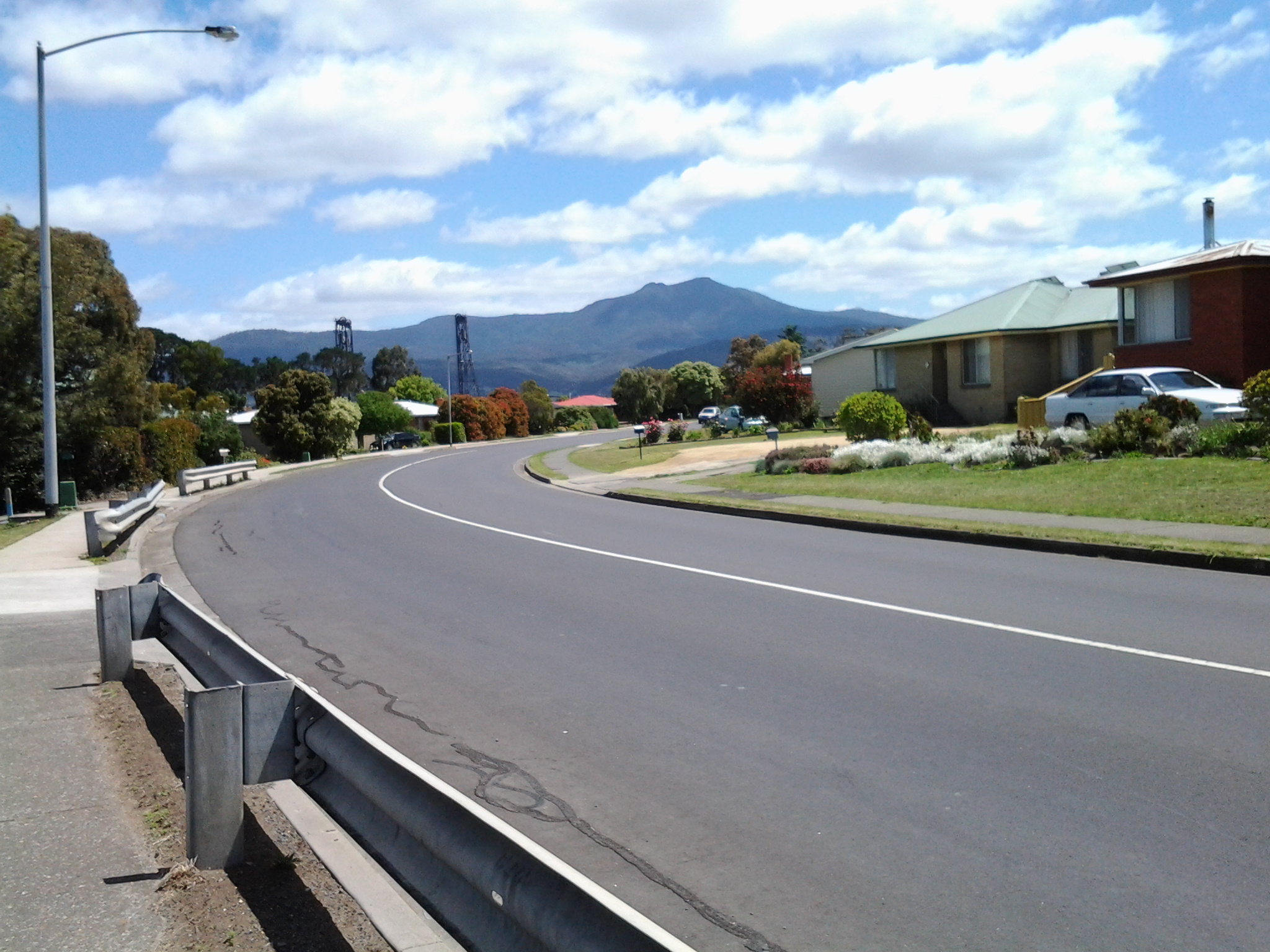
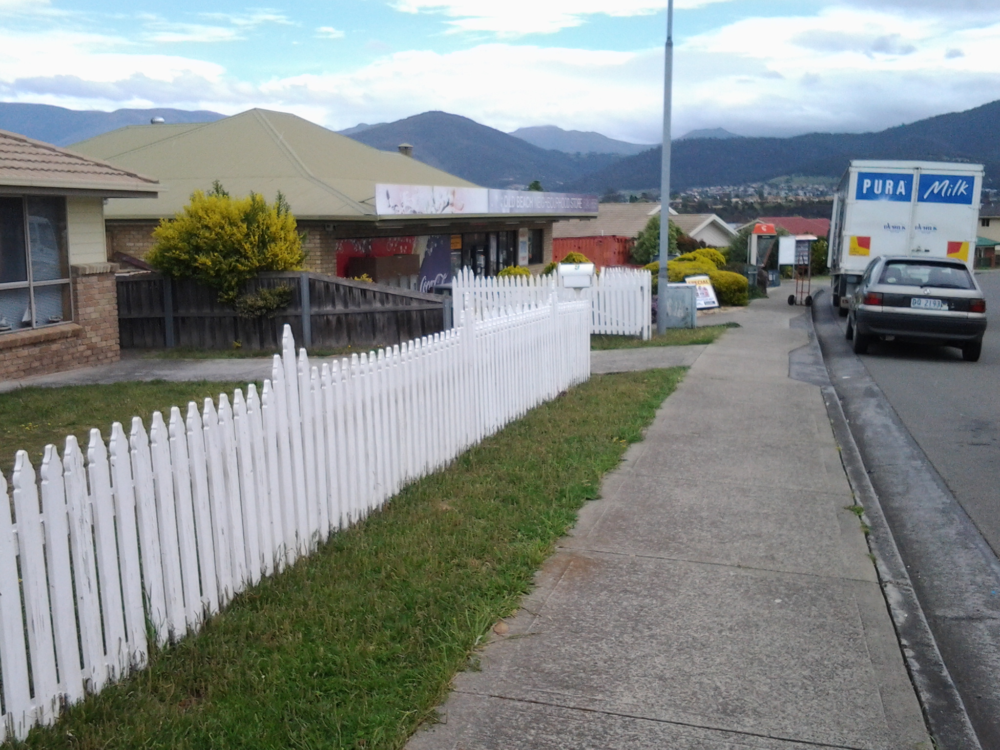
I continued walking along the highway, passed the turn off to the Baskerville raceway, and was eventually forced down into a clay sogged ditch almost until I reached the roundabout at 12.50pm.  At the roundabout, with the hilly section of Old Beach up on the right, the choice was to continue on to Bridgewater or turn left into Fouche Avenue. I turned left to the lowlands and walked through a reasonably affluent area. Back on proper footpaths. Just before 1pm I reached the Old Beach Neighbourhood Store claiming to serve hot food 7 days a week.  I didn’t enter to check.

20141031_125642

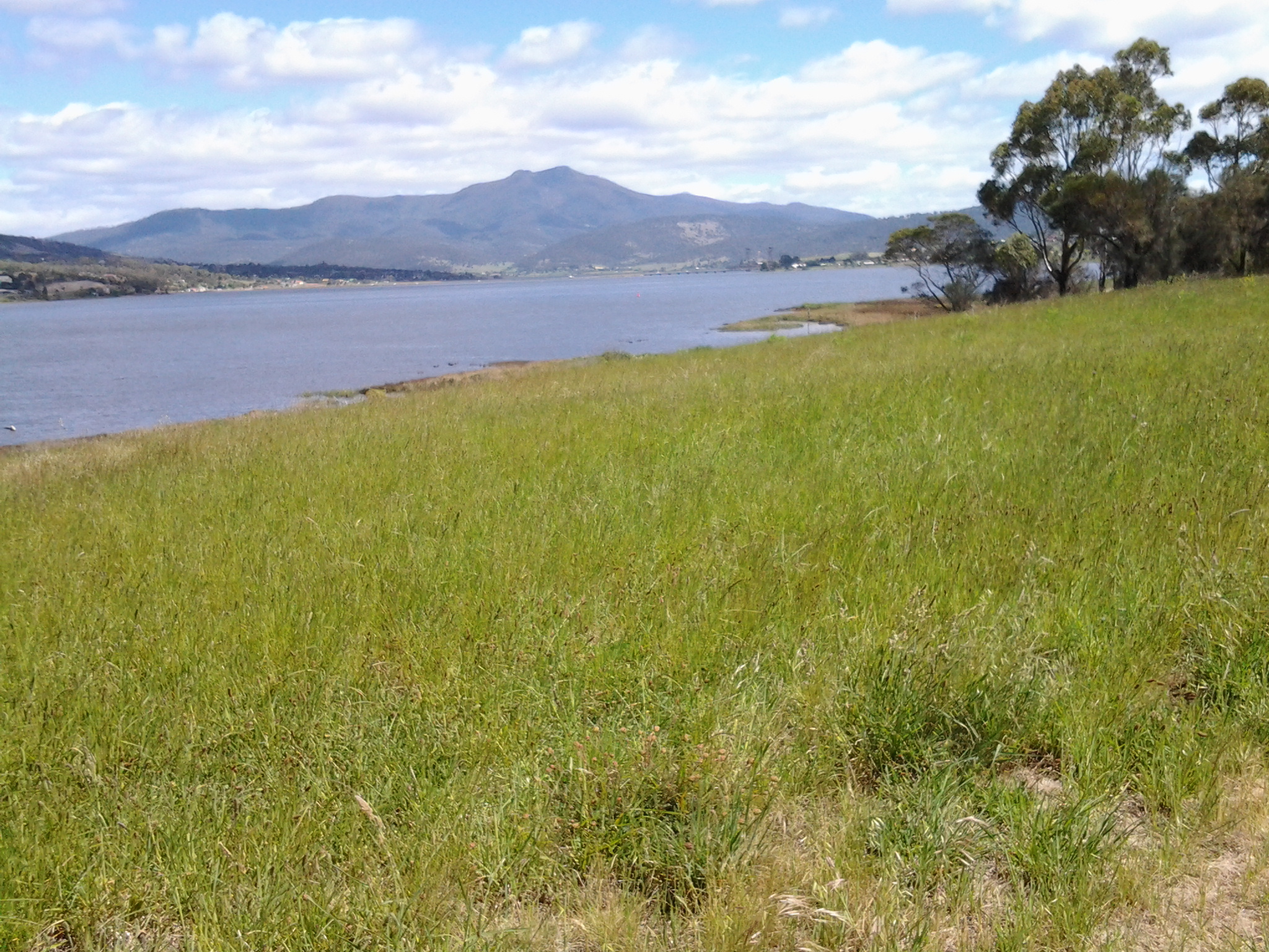
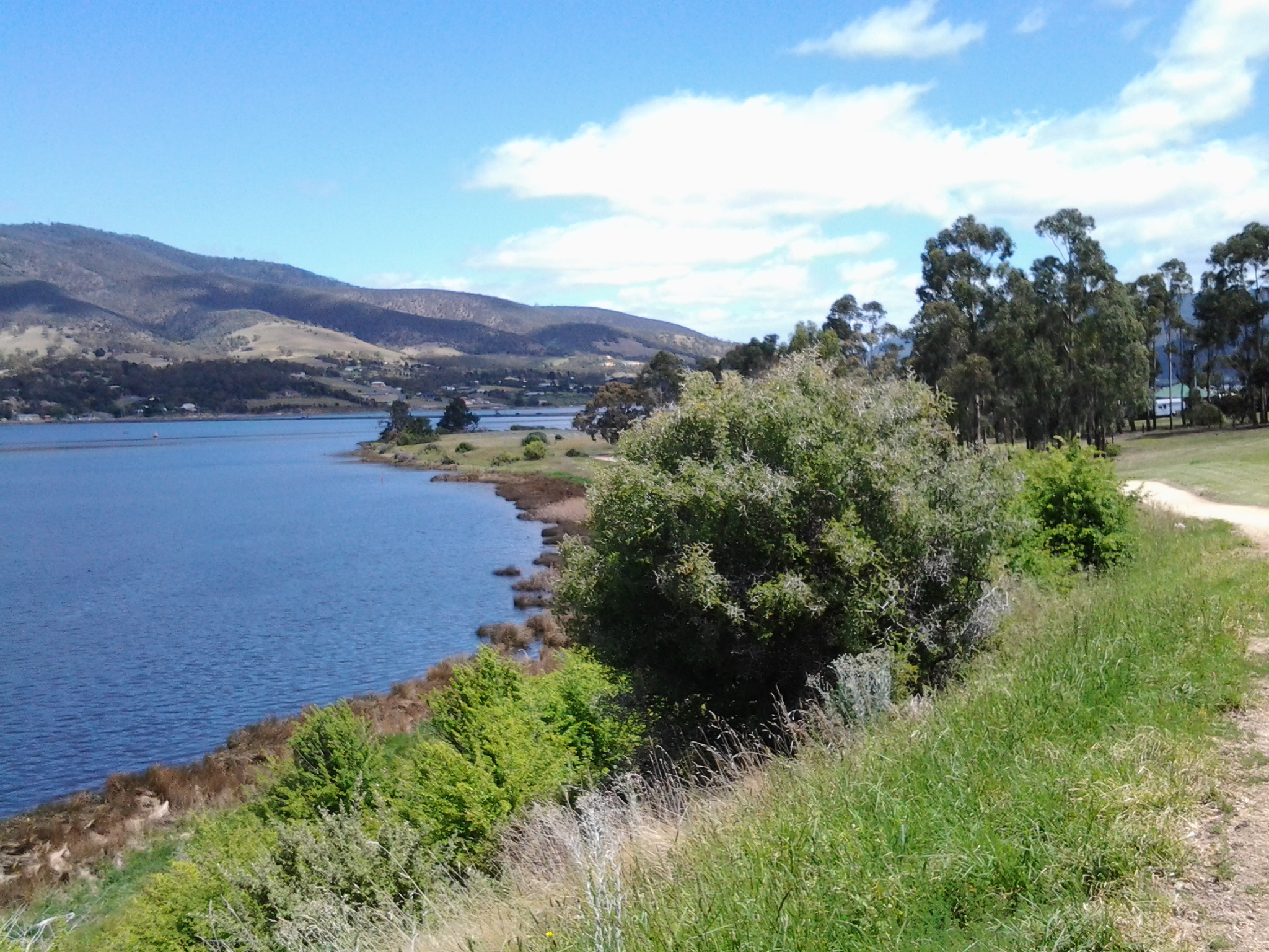
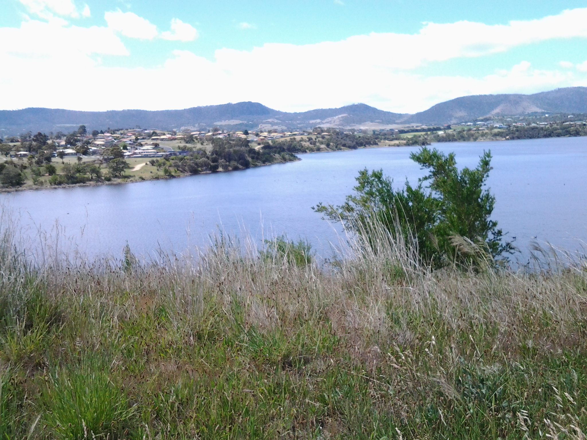
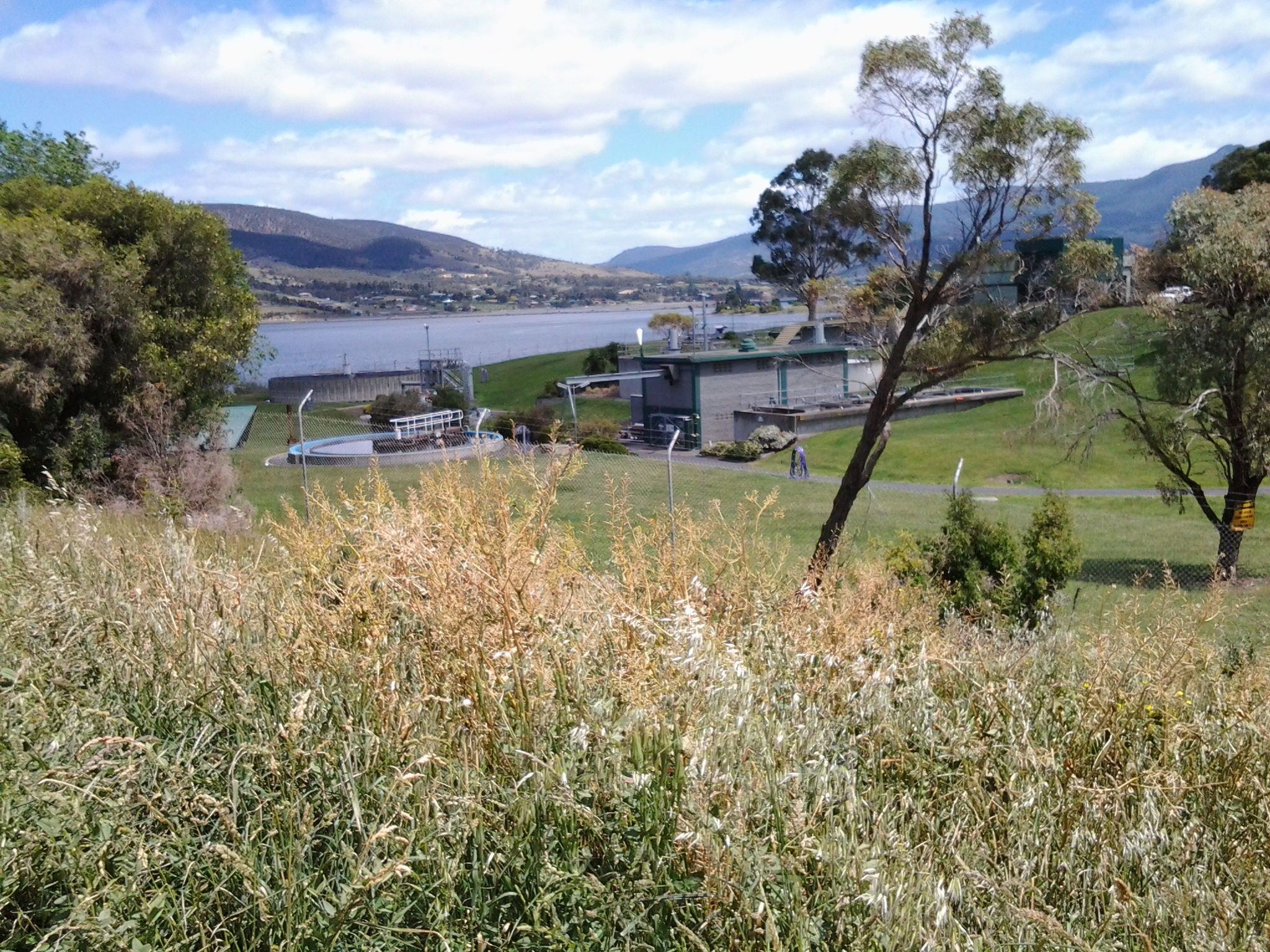
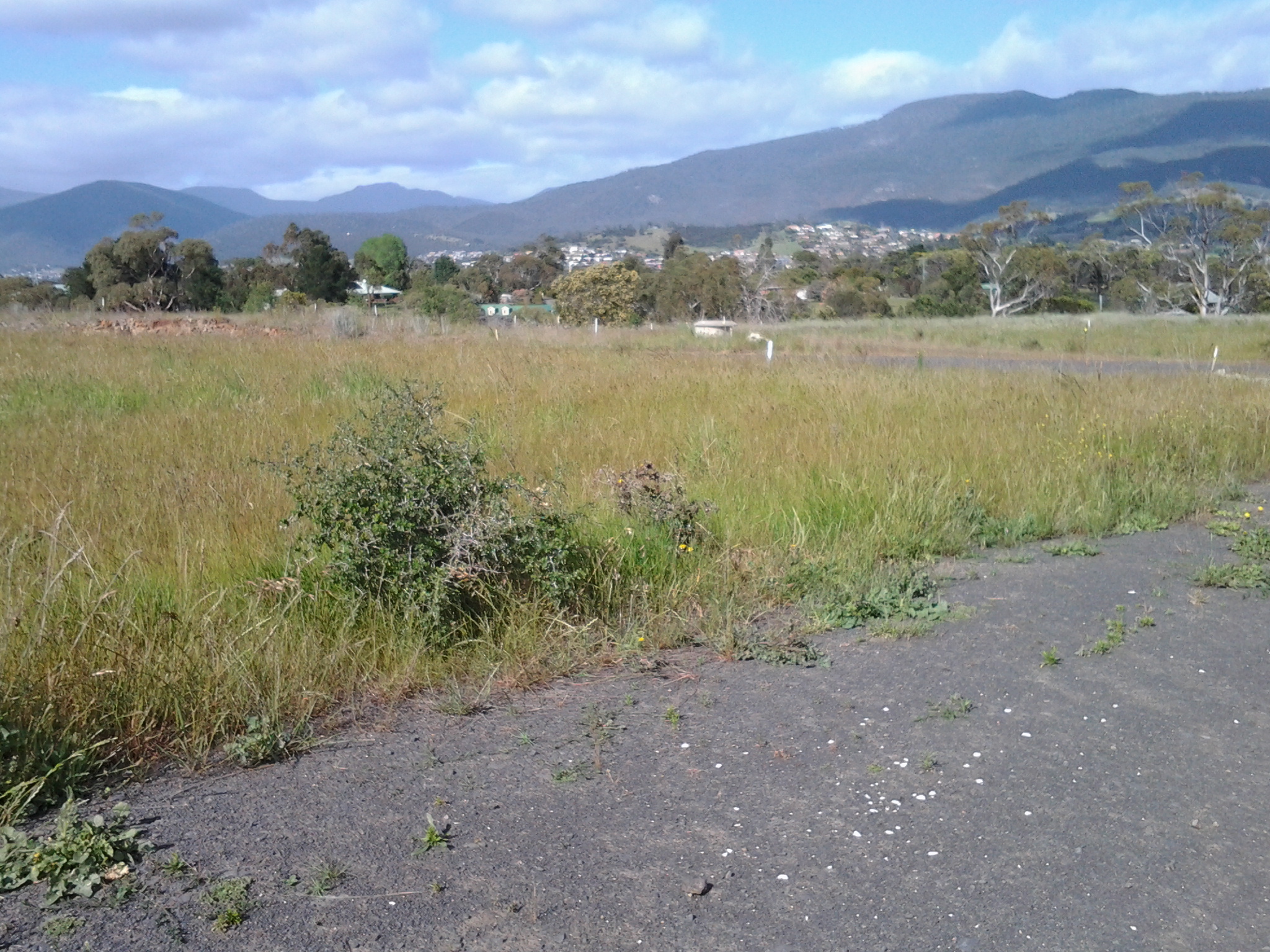
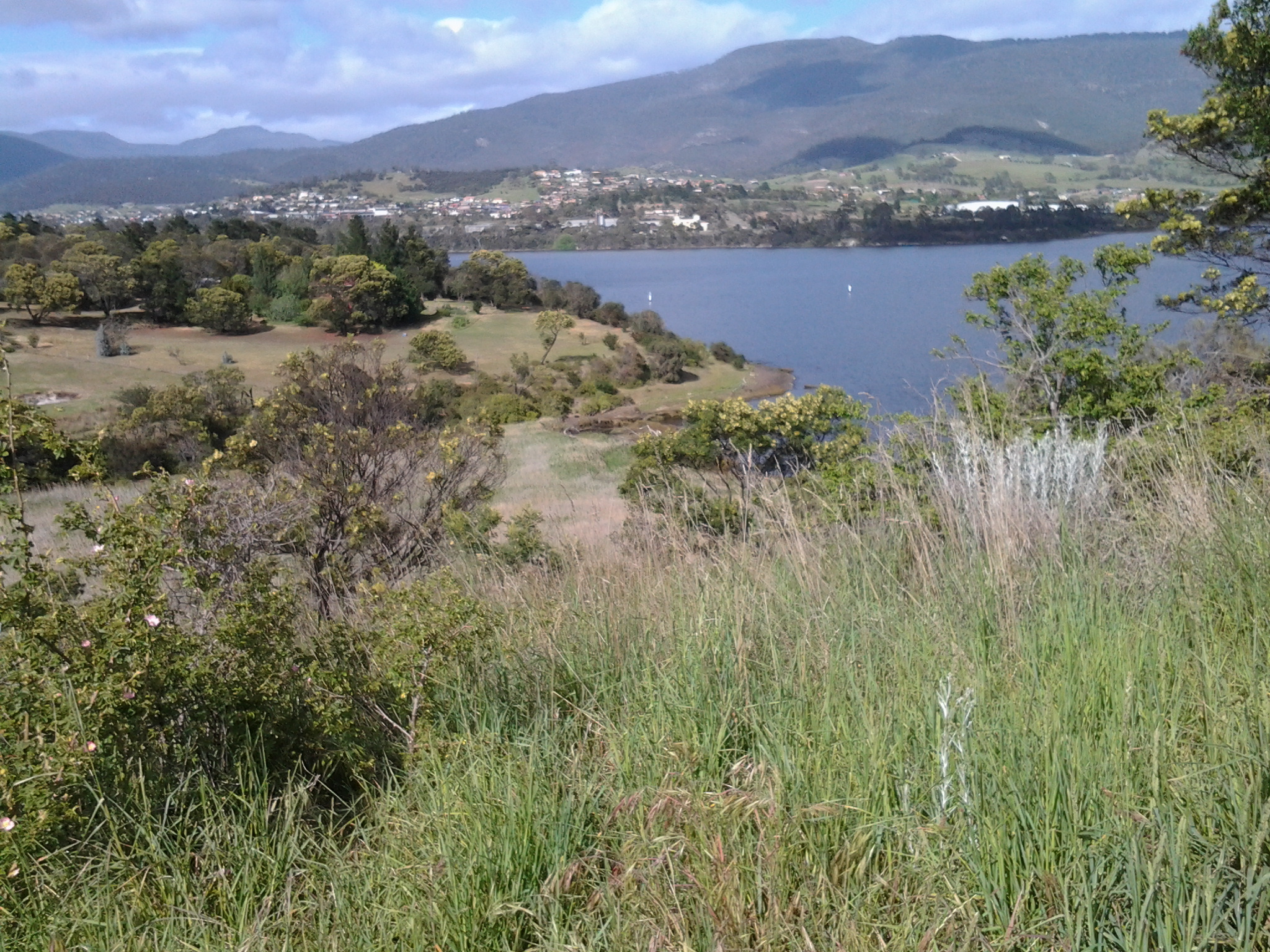
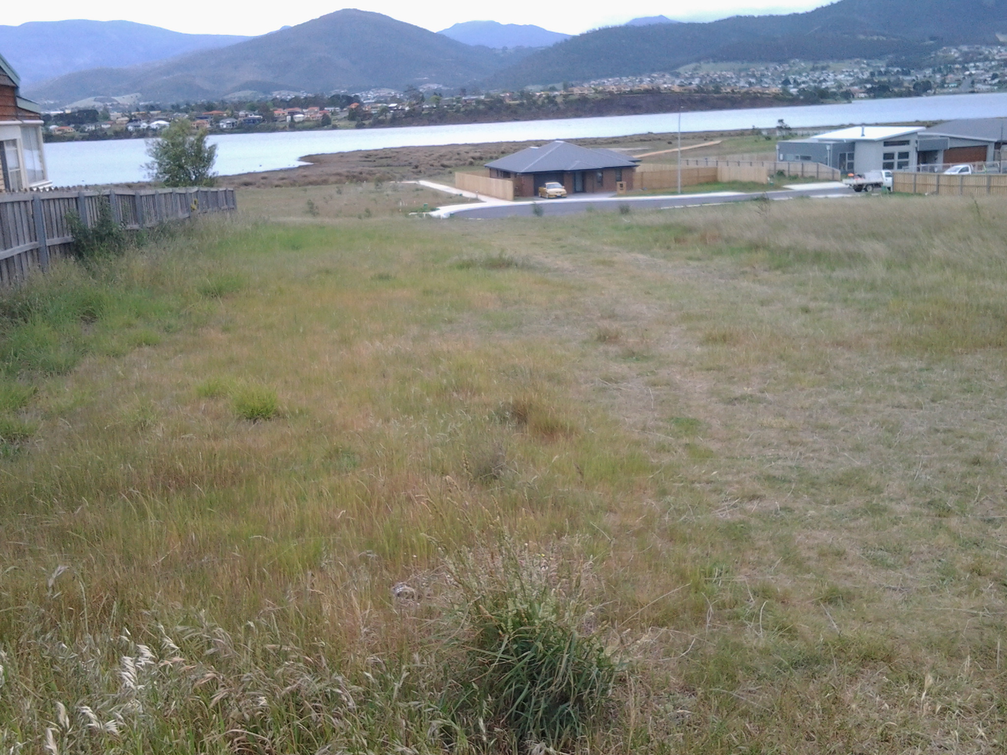
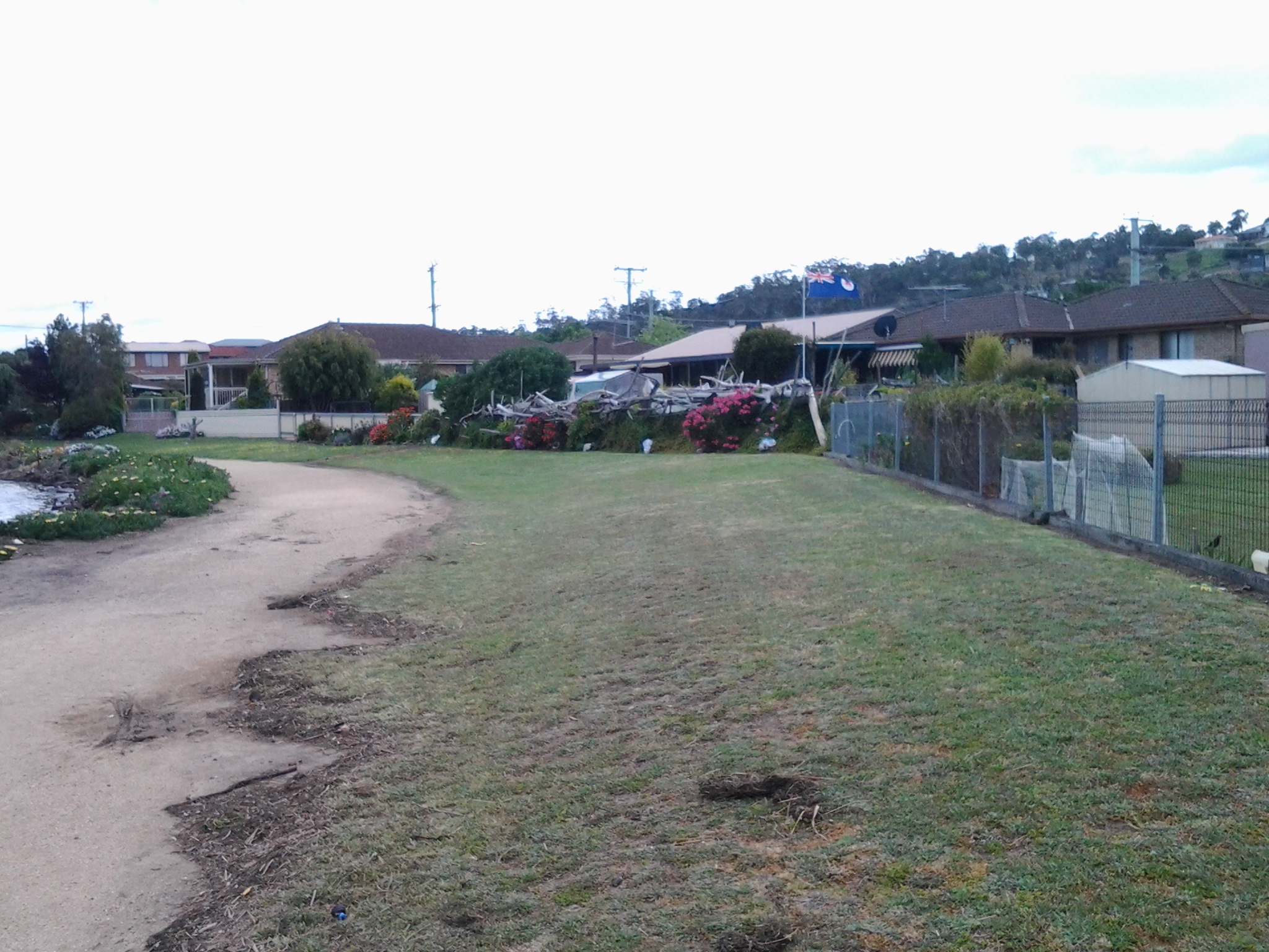
By 1.03pm, after passing a house outlandishly decorated for Halloween, I came to the end of the road.  It seems like one of those roads which will connect up with a street coming from the other direction at some other time. Everywhere I looked, new houses were being built so that I feel confident roads will connect sooner than later. I walked through the open paddock in the photo below in order to reach the ‘golden’ pathway in the distance which I assumed might lead me onwards next to the Derwent River.

20141031_130307

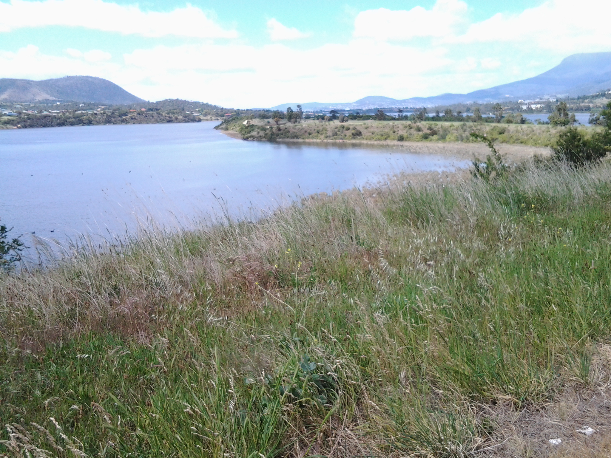
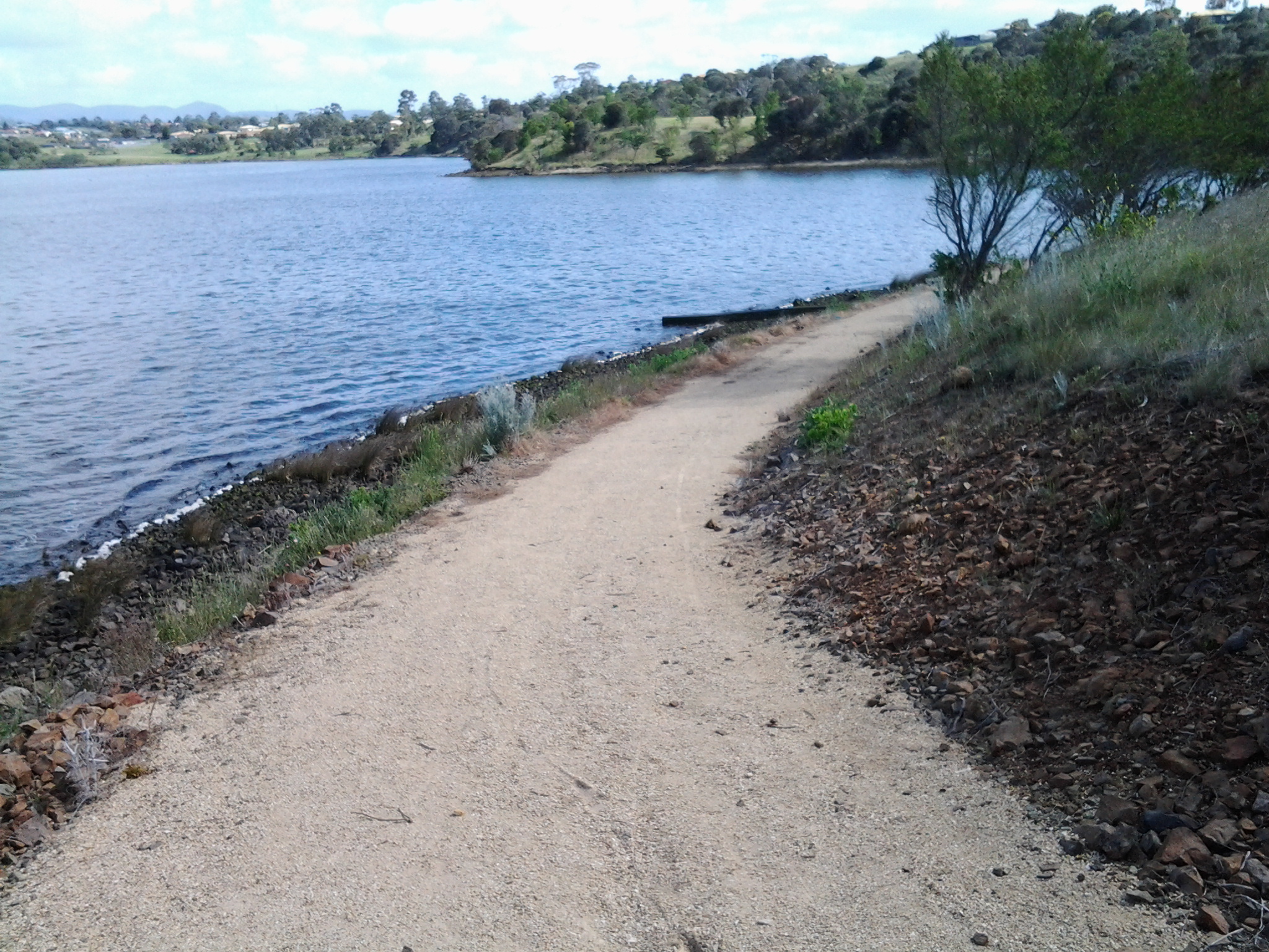
At 1.06pm I reached the lower path, which was appropriately signposted as the Old Beach Foreshore Trail, and enjoyed seeing more black swans, swooping swallows, flocks of starlings, and the usual screaming plovers. Closer to the water the path divided.  To the left it returned to Cassidy’s Bay (although I saw no signs of a path when I was there), to the right the path would continue to the Jetty at Jetty Road.  The spot where I stood was named the ‘Calm Place’.

20141031_131028

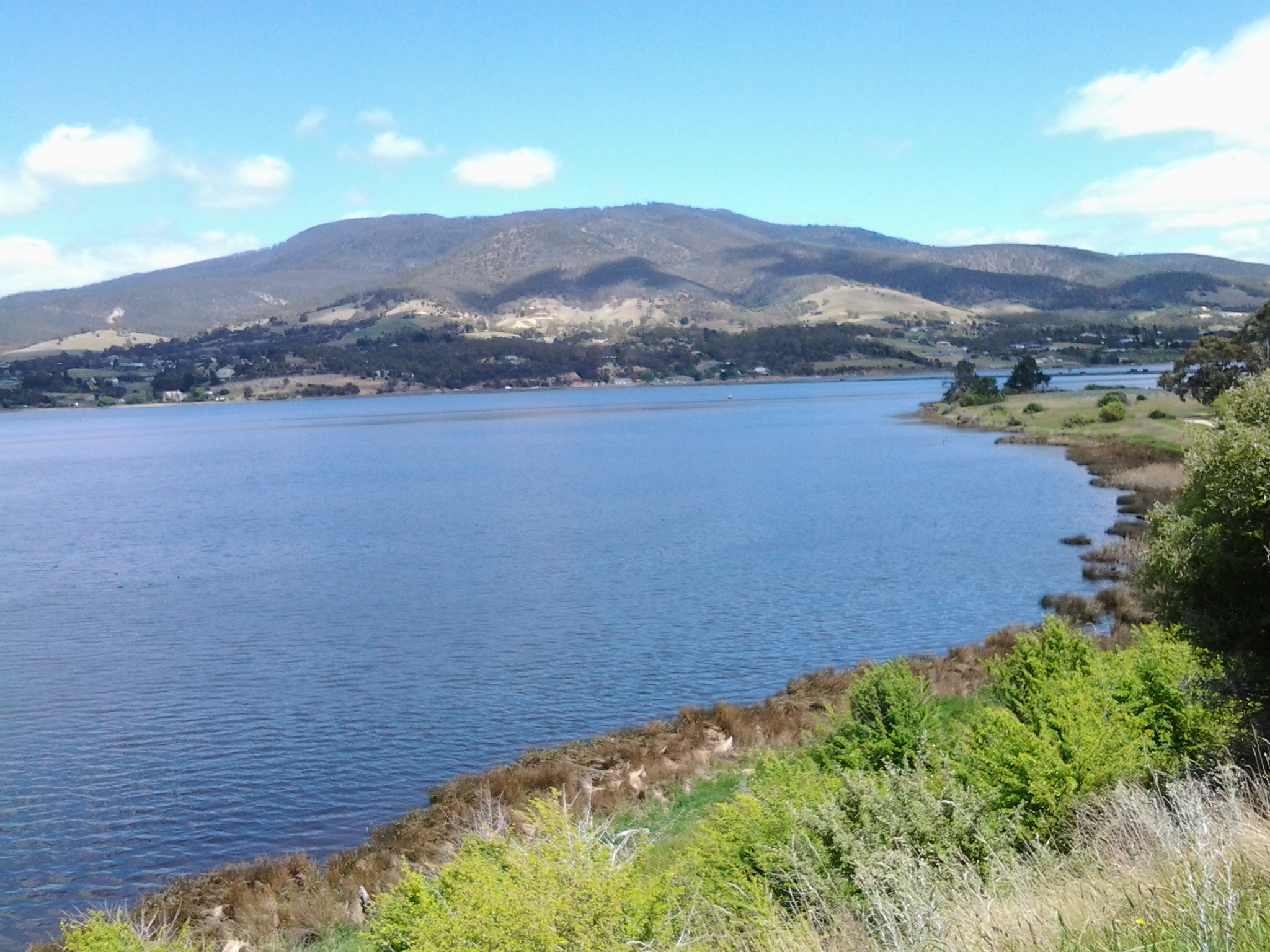
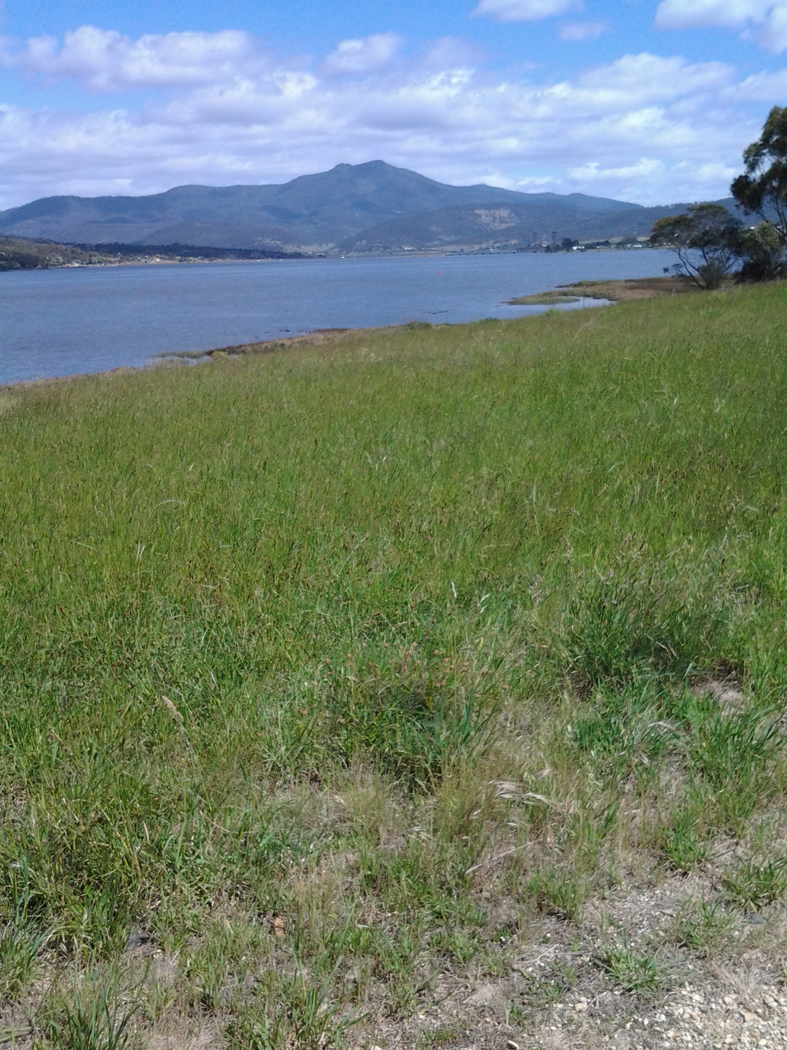
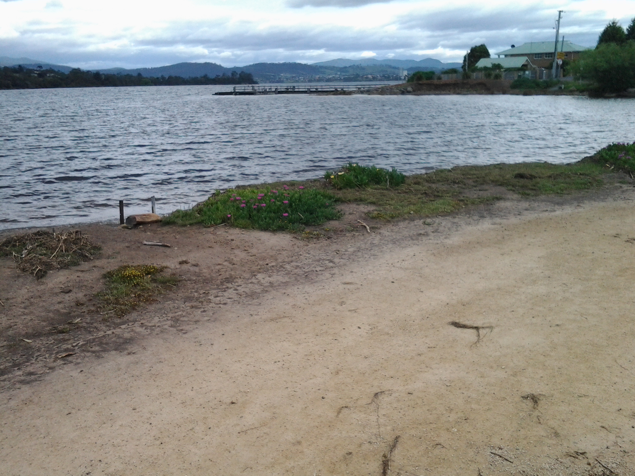
The photo above faces south across the lowlands of Old Beach (which doesn’t seem to have a beach), and provides a view of Mount Direction in the distance.

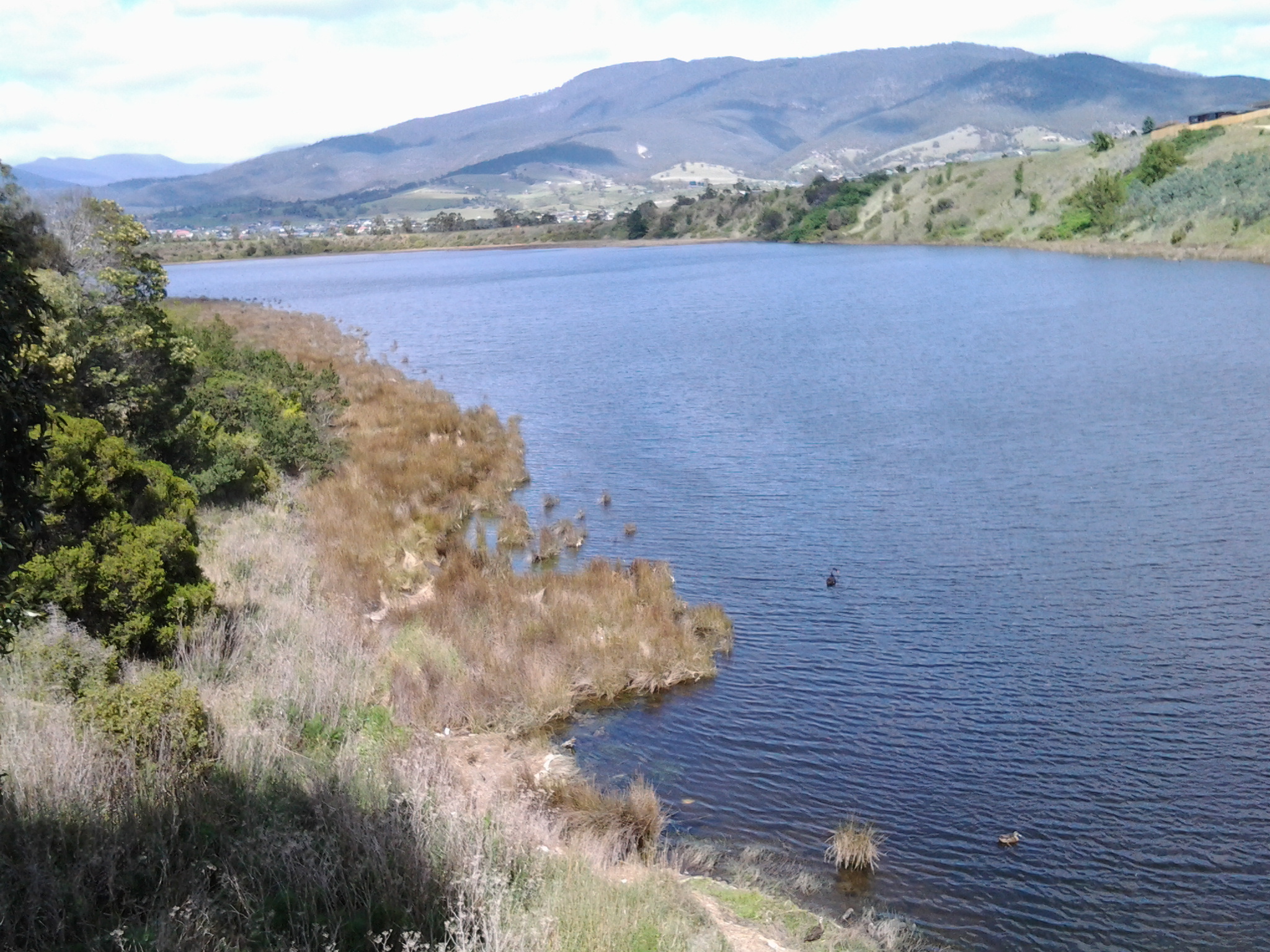
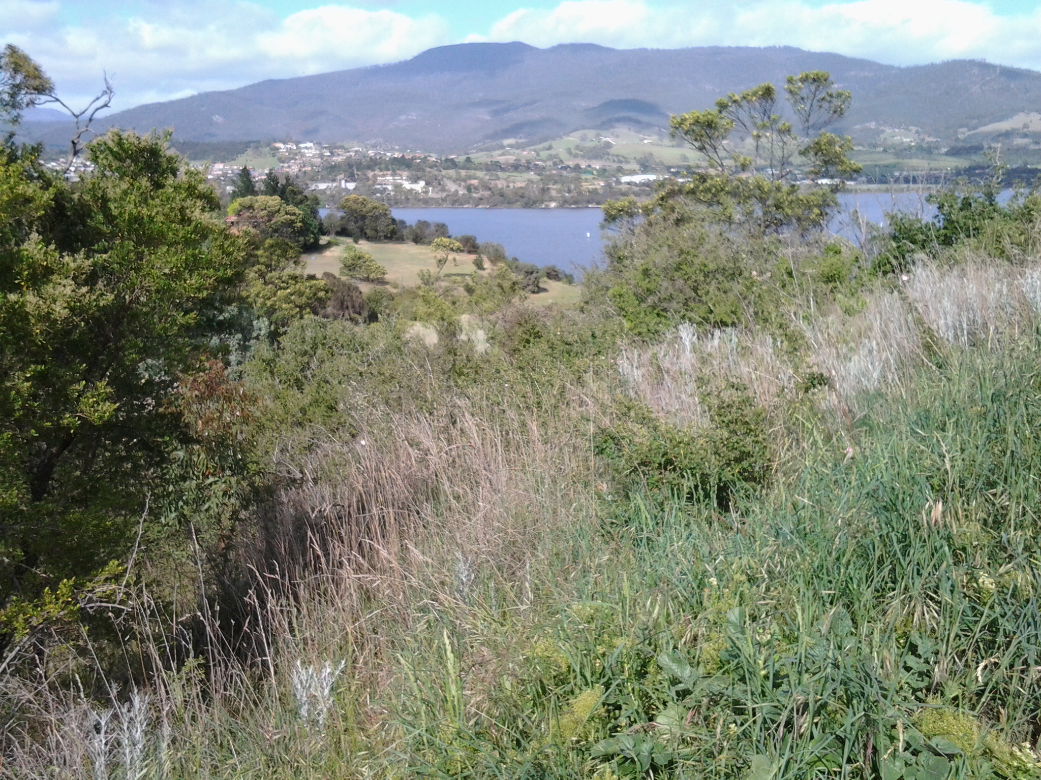
I headed north by taking the right hand trail. Not long after, on the right hand non River side of the path, I saw a tiny man-made lake, with its quota of swimming ducks and a rusting large sculptural tower on a central island with two Dominican Gulls on top (the expression ‘kings of the castle’ came to mind), amidst a stack of new houses and others being built. The sign on the fence worried me.

20141031_131049

I was concerned that because the land was so low and the lake depended on a levee to contain the water, any River flooding could be of great concern to the new property owners.  I wondered how much of that being built on was reclaimed land. I am surprised the local government allows new buildings here. With global warming increasing the sea level, these houses won’t be around in hundreds of years.

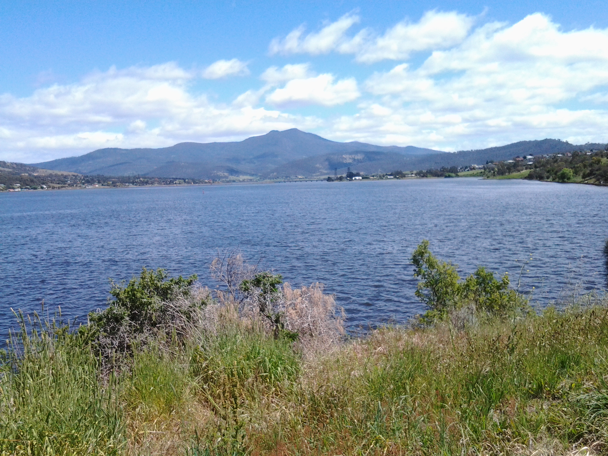
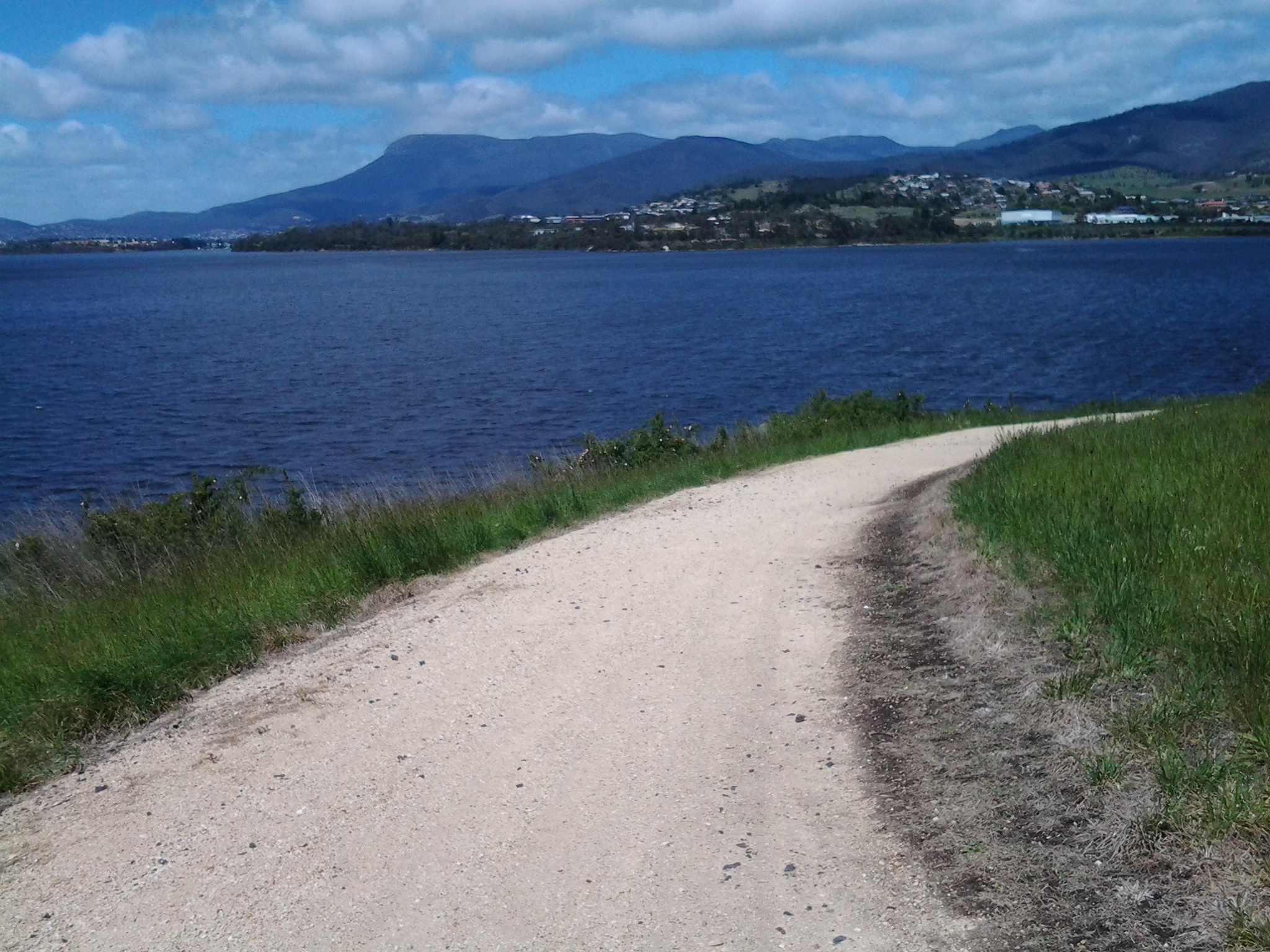
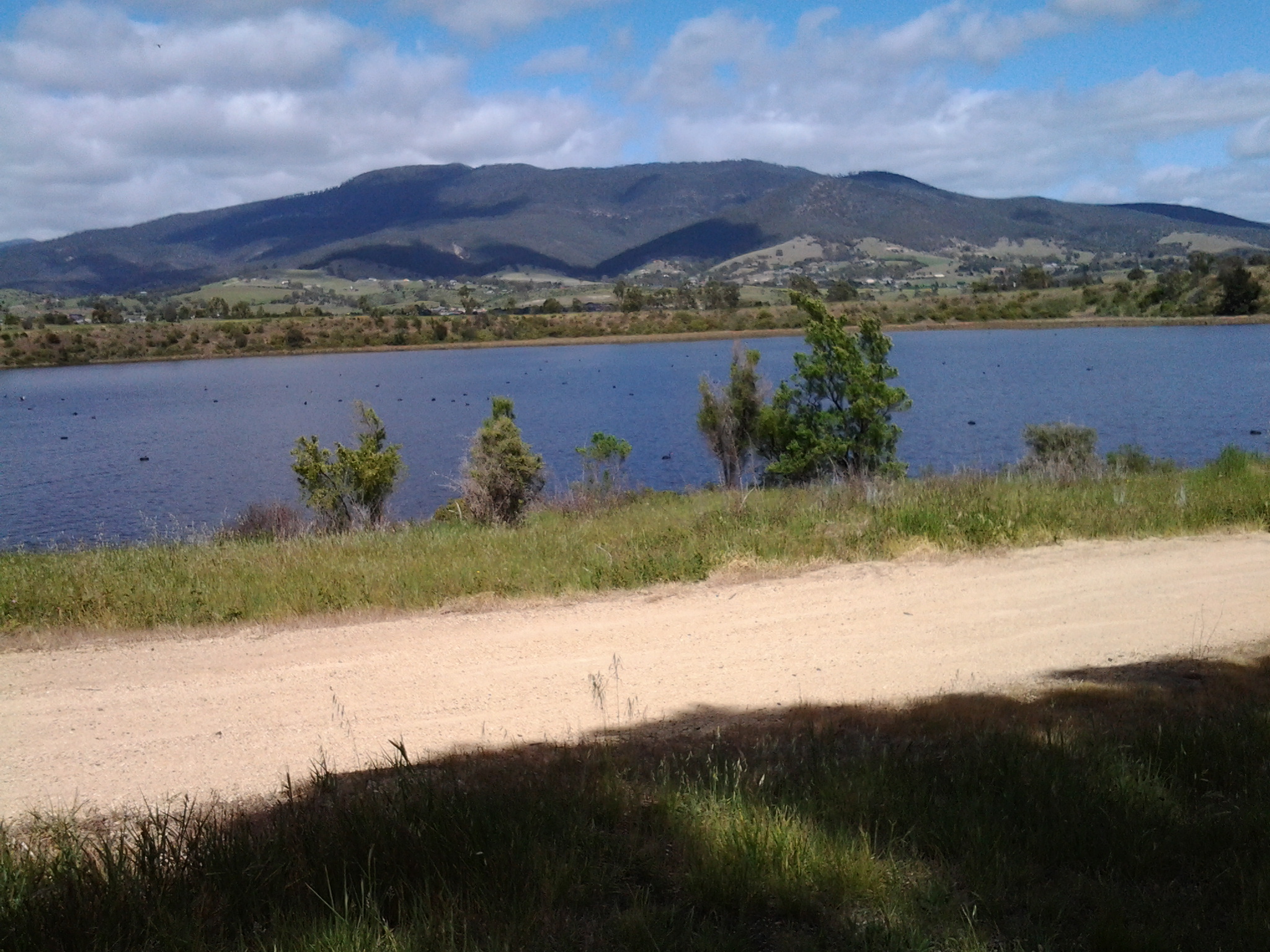
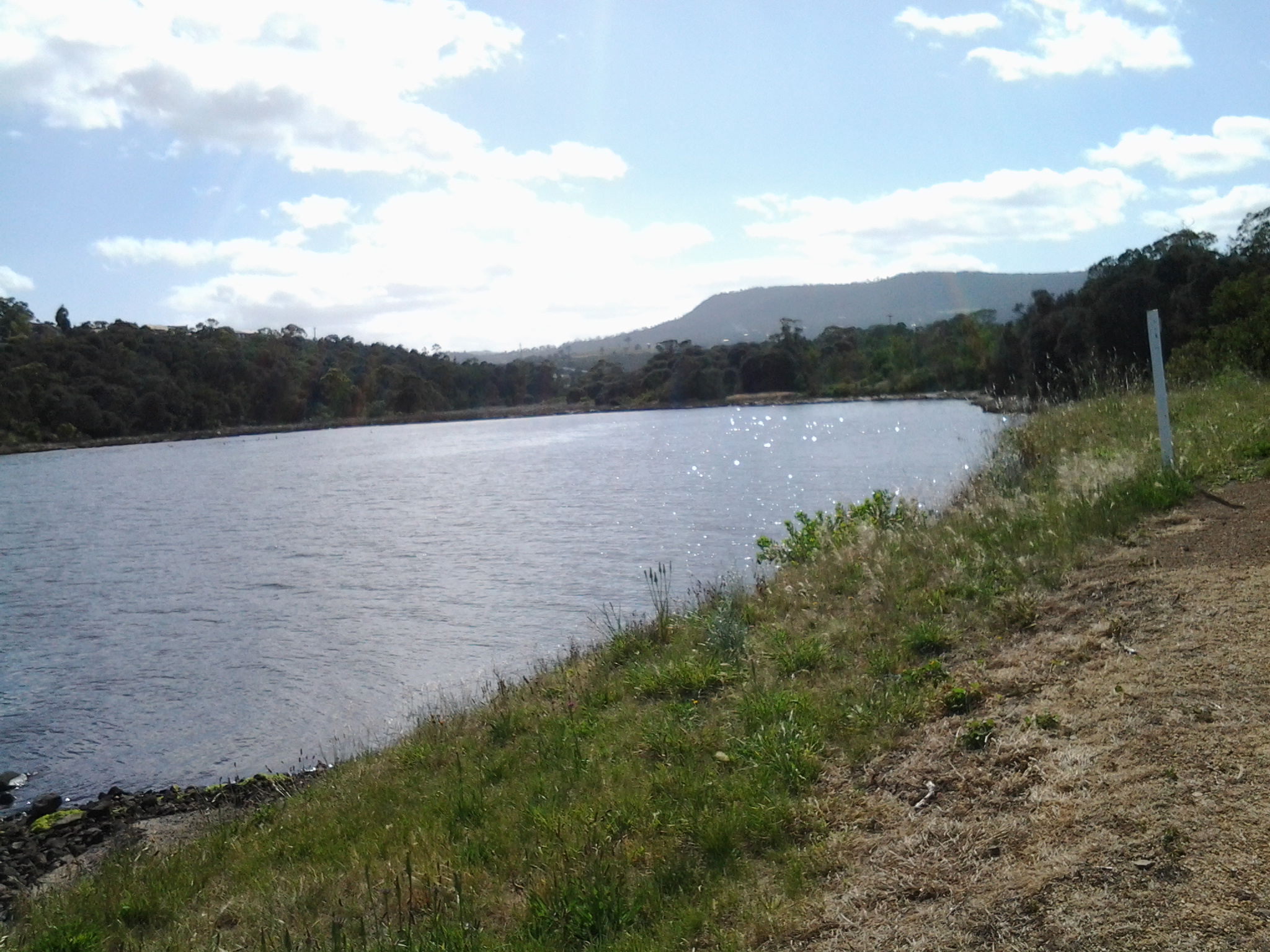
Blue skies opened above Mount Wellington in the distance but heavy clouds sat overhead.  Spits of rain persisted off and on for the rest of my time at Old Beach.  But it was time to have lunch. In the absence of any seats or rocks or other raised area, at 1.20pm I sat on the grass beside the Foreshore Trail, emptied my pack, and started munching as I absorbed the details of my low lying surroundings.  I could see heavy rain clouds that darkened the day travelling across the Derwent from the Mount Faulkner Conservation Area on the western shore.

20141031_132509  20141031_132519

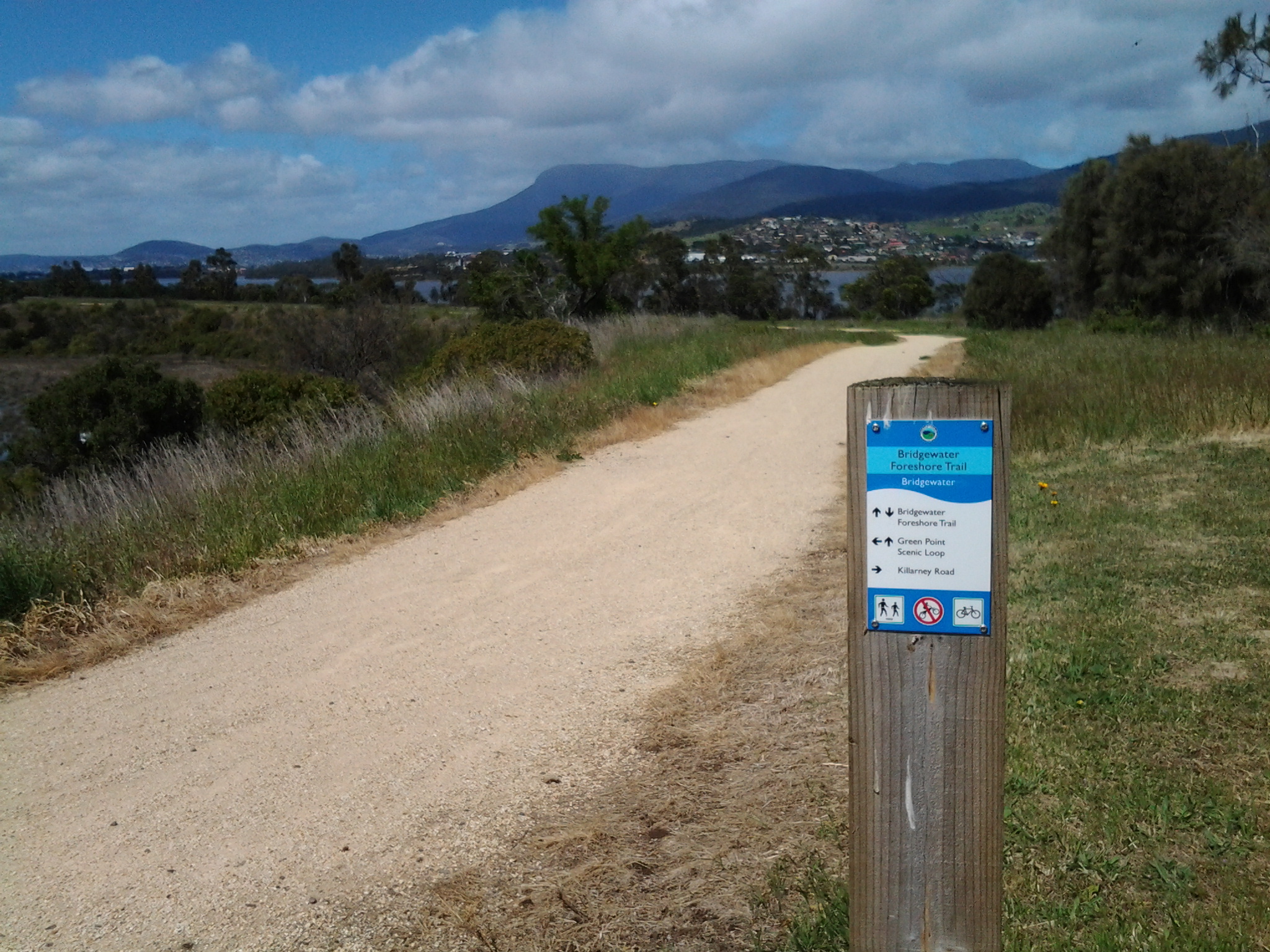
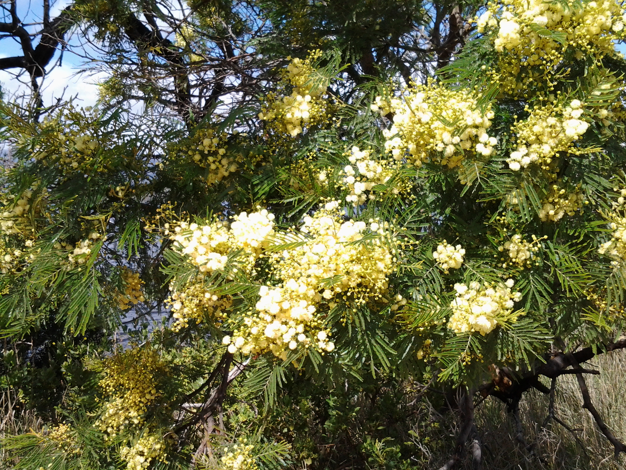
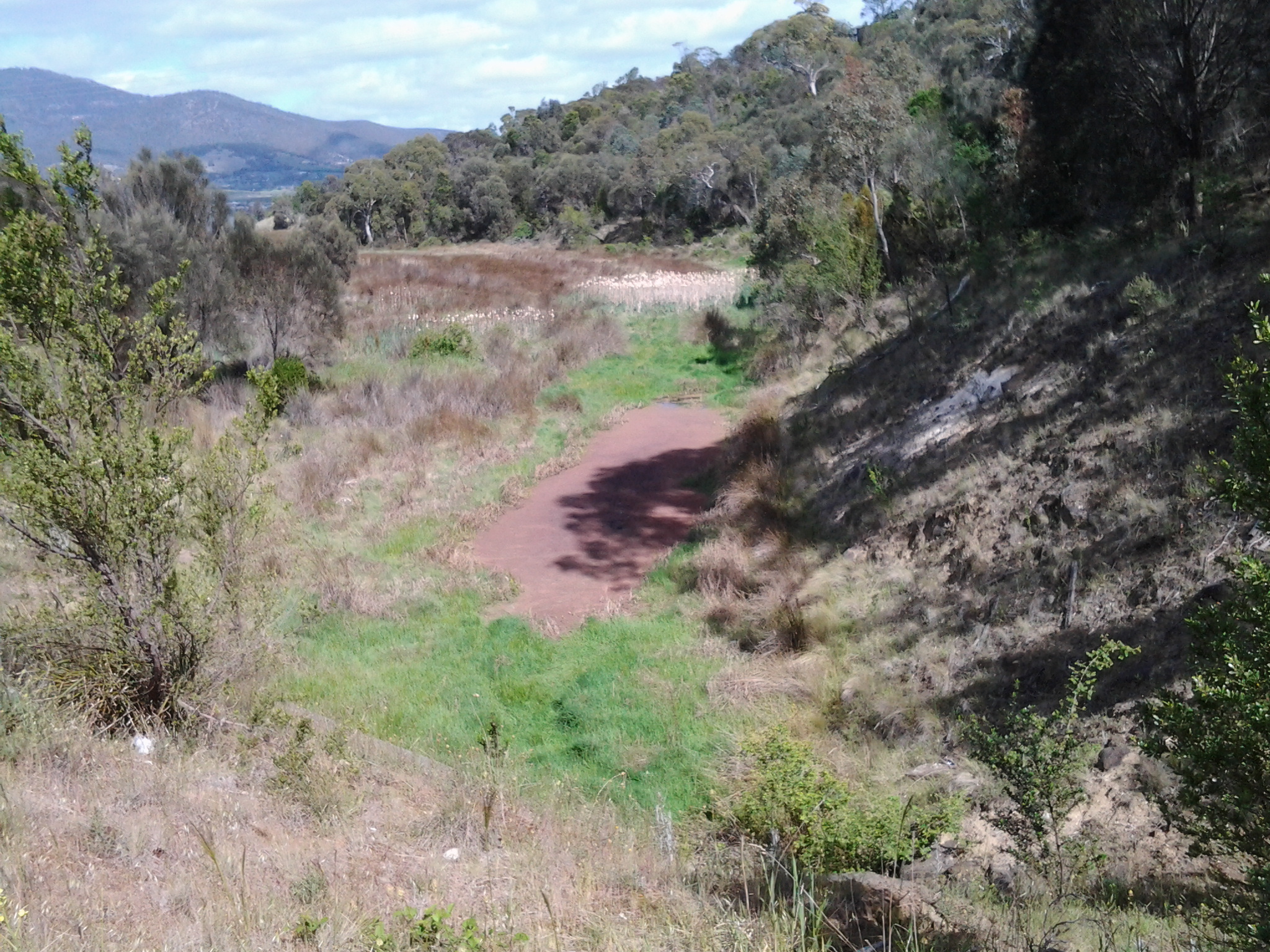
At 1.35pm I was on my feet and continuing along the path, passing an alternative walk to Sun Valley Drive, and spotting a pair of native hens pecking ahead on my path.  A private fence made from large pieces of driftwood festooned with creeping bright flowering geraniums, caught my attention.

20141031_134059

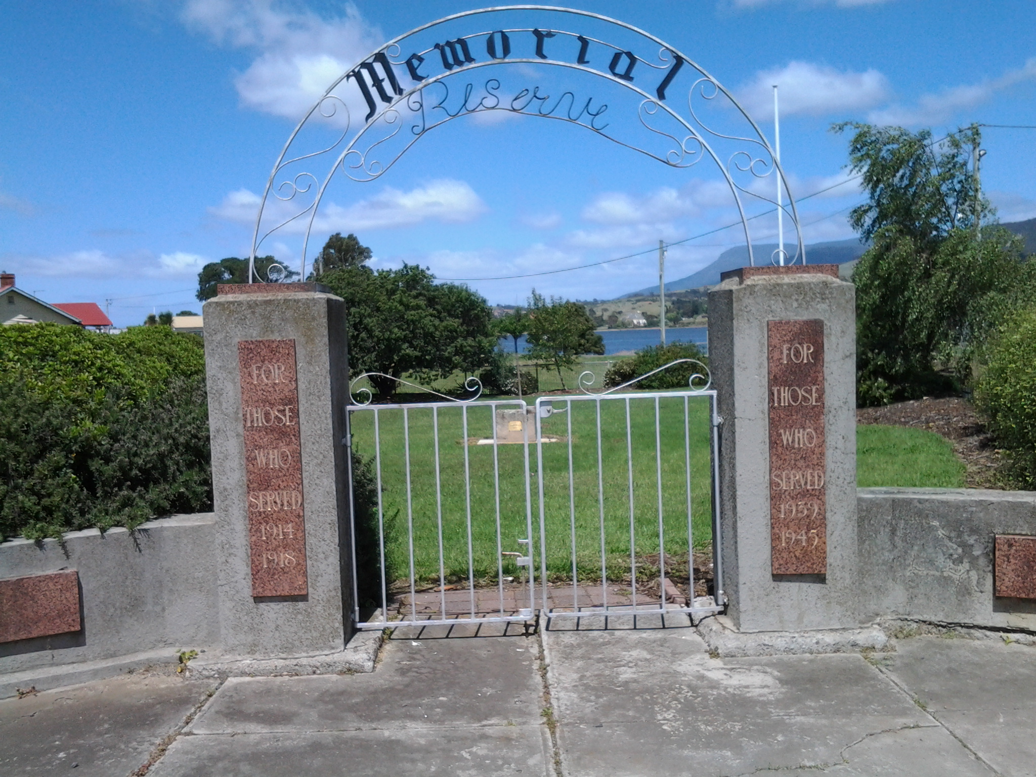
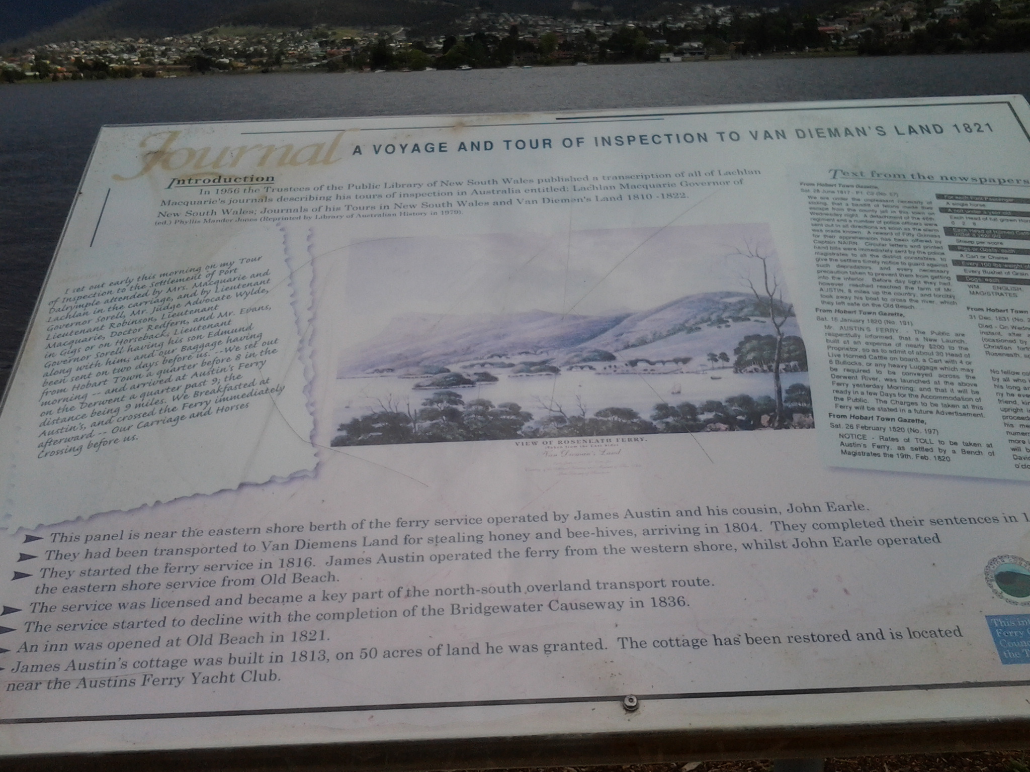
At 1.43pm I arrived at the Old Beach jetty

20141031_134047

where I found an interpretative panel explaining some of the early 19th century history associated with the location of the jetty.

20141031_135134

As early as 1821, an Inn was established near the current jetty, and people would ferry across the Derwent from the western side of the River.

This 7th stage of my walk was coming to a quick close.  I knew a bus would be travelling along Jetty Road at 2pm, and that the next service would not be in the vicinity for another couple of hours. I had wanted to finish walking through all of Old Beach before I finished this stage, but the potential for a long wait for a bus inclined me to cut the anticipated walk short.  I walked along Jetty Road and waited at a bus stop.

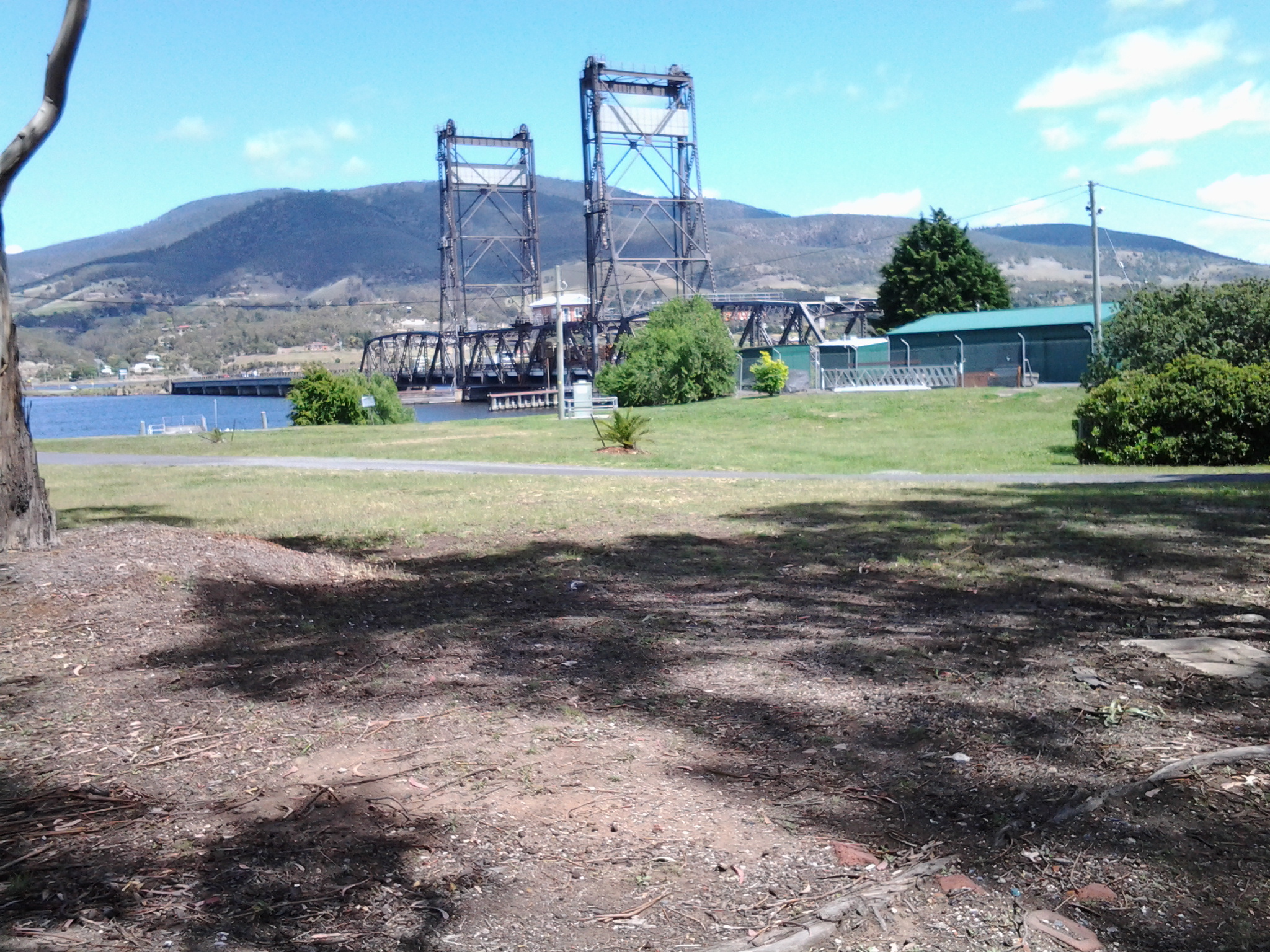
Metro bus 114, destined for the Glenorchy Bus Mall on the western shore, picked me up.  I did not travel the entire way but if I had, I would have needed to catch a Hobart city bus to reach the CBD, then a bus to take me back to my home suburb of Bellerive on the eastern shore. A long way. A long time. From Old Beach there are no bus services travelling along the eastern shore.  All the buses travel to the northern city of the Greater Hobart Area of Glenorchy via the Bowen Bridge. Since I live in Bellerive on the eastern shore, I resolved to try Plan B. I proposed to catch a bus from Glenorchy to Hobart via the eastern shore and close to the Bellerive area. Once over the Bowen Bridge from Old Beach, I got off the bus at the first stop which was outside the Elwick racecourse at 2.15pm. I crossed the road and waited in a bus shelter for Metro bus 694. As the rain started to pour in earnest at 2.35pm, the bus arrived. Phew!

I loved the return trip. While again on the Bowen Bridge I looked northward and could see where I had walked earlier in the day. Ahead and looming over the land, was Mount Direction. Looking southward I could see the Cleburne Spit was empty of cars and people, the suburb of Risdon looked quiet, and a thick eddy of smoke rose from behind Risdon Cove. Closer to the area with the fire, a sweet wood smoke smell spread through the bus and reminded me of camping fires I have enjoyed in the past. That was a great conclusion. Memories of the immediate day and memories of the past coming together.

Now I am looking forward to preparing for and then walking the 8th stage of my walk along the Derwent River.  This next walk is likely to happen early next week, weather willing. Let the discoveries continue!

Rocks 240 million years old – 7th stage of my walk along the Derwent River

Having left Otago Bay and now walking along the Derwent River edge of the East Derwent Highway, the green hills soon disappeared. I calculated that to have entered the Highway from Otago Bay Road and stayed on it would have cut half an hour off the walk, at least.  Once a little way north, I looked back to the river edge near the end of Murtons Road and reflected on the insanity of the path I chose. I like the photo below because I can see where I have just been at the water’s edge in the distance. In addition, I am seeing one side of Mount Wellington with the awareness that once I travel inland further, this will disappear from sight.

As I continued the walk, over the Highway was a wall of rock which continued for a while.

20141031_120644

When I spotted an interpretative sign installed on the rocks, I crossed the road to investigate.  The rocks and ground were teeming with Portuguese Millipedes crawling over the surface looking for a mate.  Rain encourages them to get on the move and, trust me, they were moving.  Thankfully they are completely harmless to humans.

I arrived at the sign at 12.15pm and was glad to be able to read some geological information that was related to the fauna which was living 240 million years ago. This was the time when the Paleozoic era was in transition to the Mesozoic era.  Dinosaurs were dominant in the later period, while in the earlier time, fish, insects, spiders and shells developed.  It seems that increasingly large water creatures were around at the time when these sandstone rocks were formed.

20141031_121240

Once walking along the river again, I stopped to admire the views in all directions.  Looking back, Mount Direction rose up (I knew it sat just behind the Bowen Bridge where I had walked earlier in the day). The rural nature of the area below the small mountain is evident closer to the water’s edge.

20141031_122945

By 12.25pm, I had passed a sign indicating I had reached the locale of Old Beach, and I’d stopped and looked at the headland containing the Cadbury’s chocolate factory on the western side of the Derwent River.

20141031_122520

Walking beside the guard rail on the water side for safety, rather than the road side, was not an easy experience.  Also, it was not safe in parts especially where the slippery gravel dropped down to the water side. Nevertheless I persisted where I could and, after brushing beneath a wattle tree, came out the other side perfumed. A clean sweet smell. Very refreshing. On the rocks, a lone Pied Oyster Catcher wobbled away nervously.  I could see his future meals through the clear water.

Around some more corners, and I arrived at Cassidy’s Bay.