Category Archives: Mount Wellington

Stage 3 Continuing the Derwent River walk 20 September 2014 Posting 5 of 6

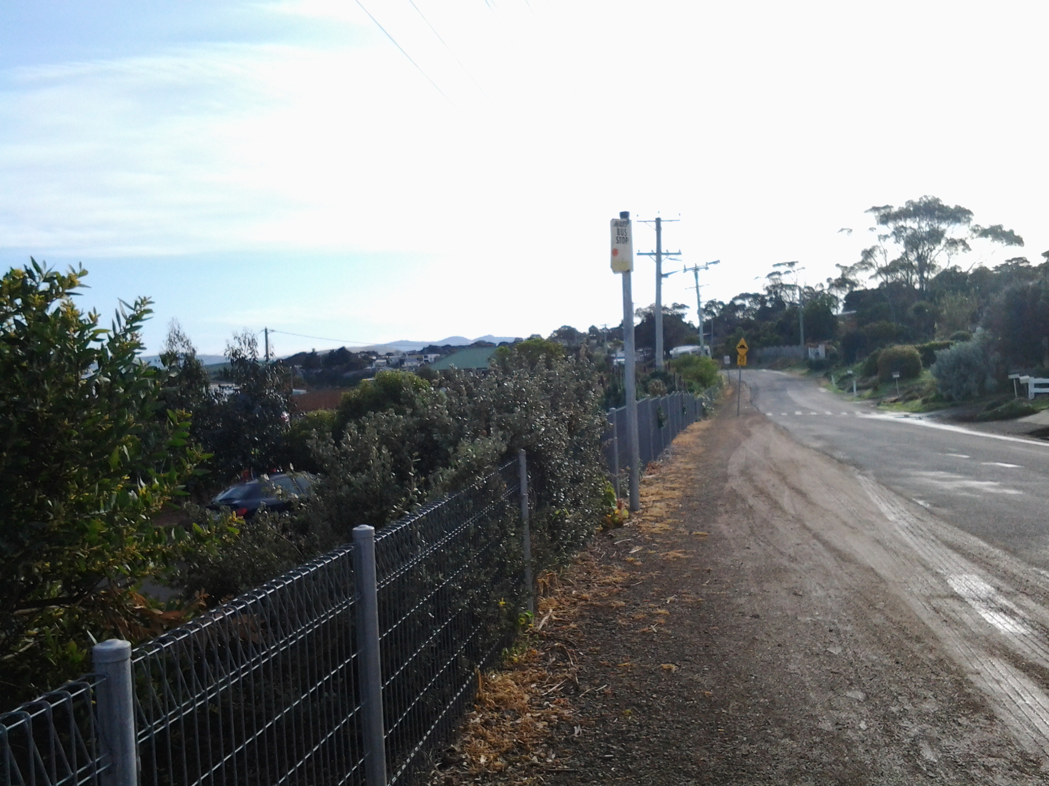
Leaving the Derwent River edge, I walked up the concrete path to Vaughan Court in Tranmere, turned left, walked until I reached the T junction with Oceana Drive, turned left and then followed the suburban footpath back in the direction of the original bus stop.  From the bottom of the concrete path until I reached that bus stop, it took approximately 15 minutes.

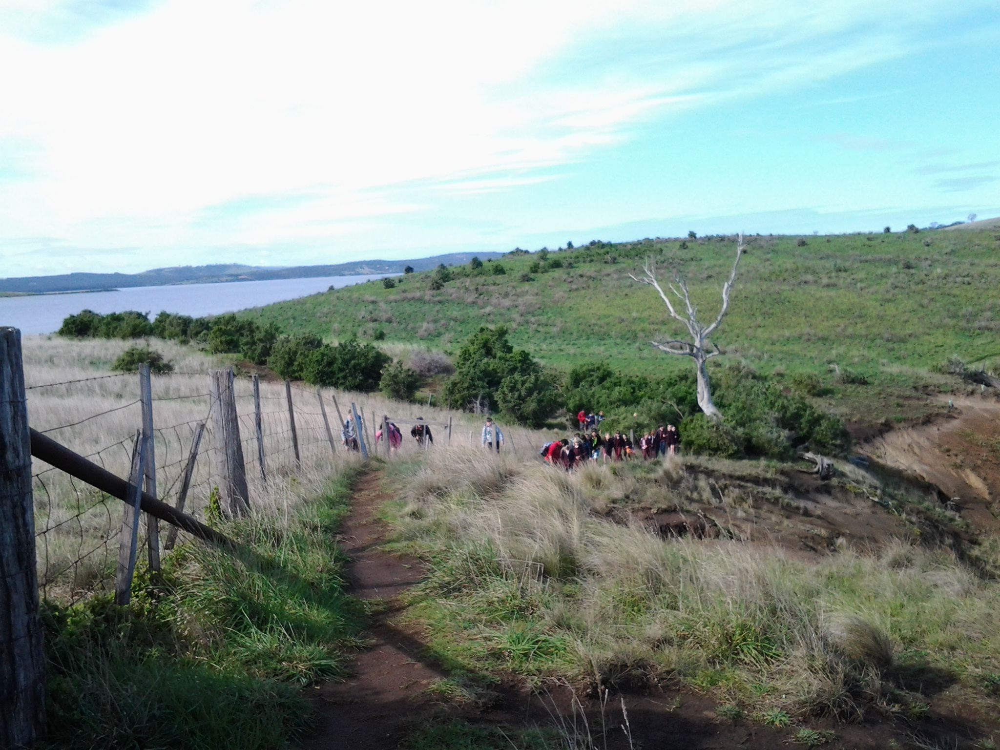
I turned left down into Tranmere Road. Three minutes later, when I reached Pindos Drive, a No Through road, I turned left and followed it to the end and arrived at midday. This road ending named Tranmere Point, is marked by Pindos Park, an area with children’s play equipment, seats to admire the views, and places to enjoy a family picnic. Locals were walking and cycling.

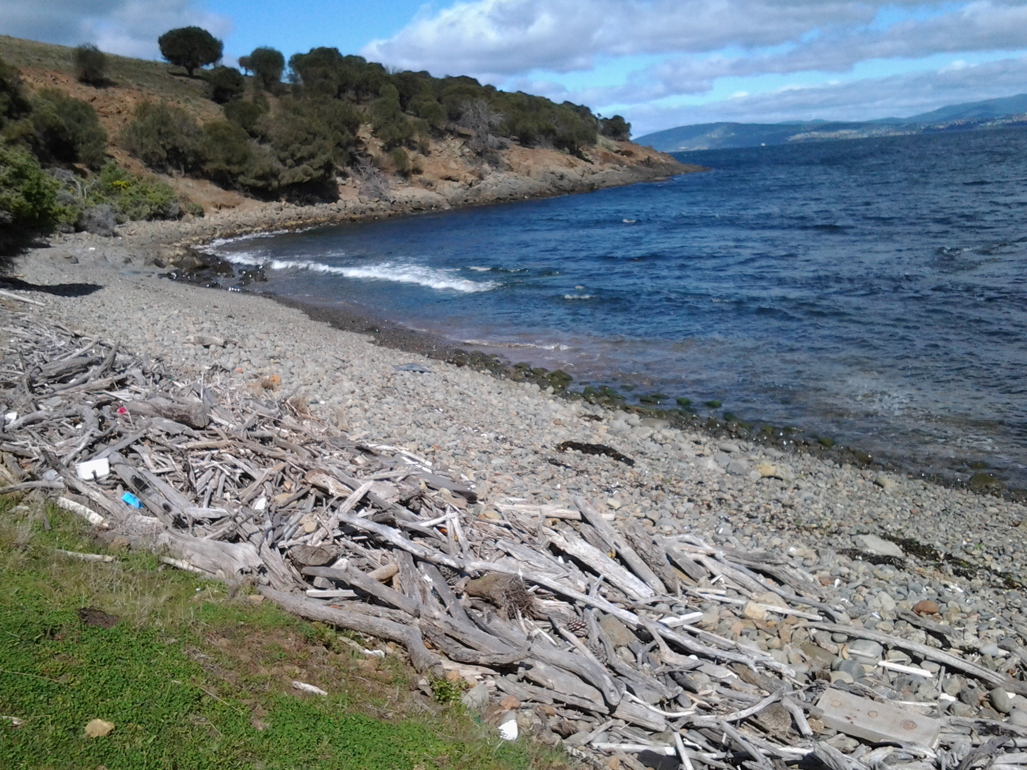
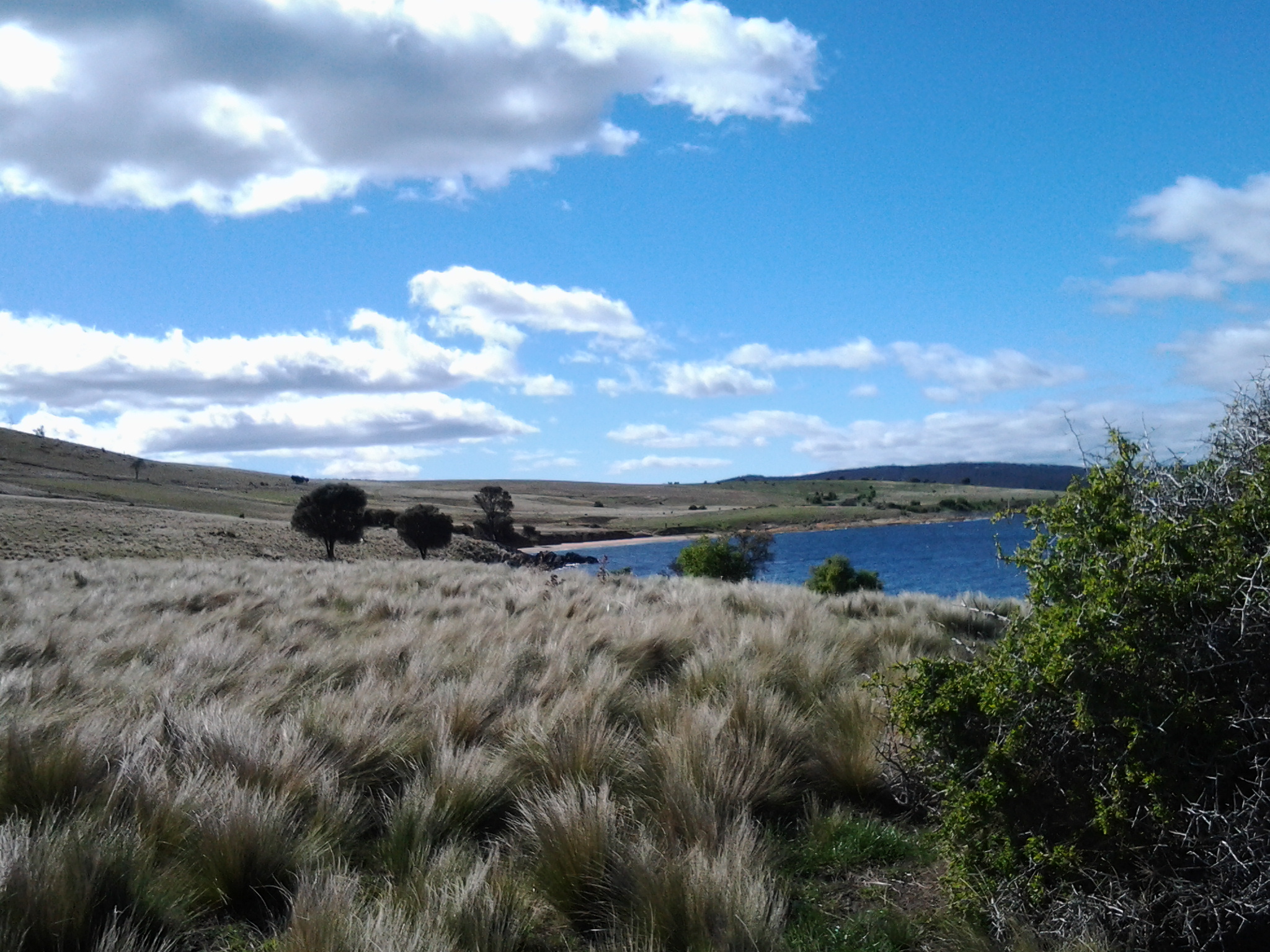
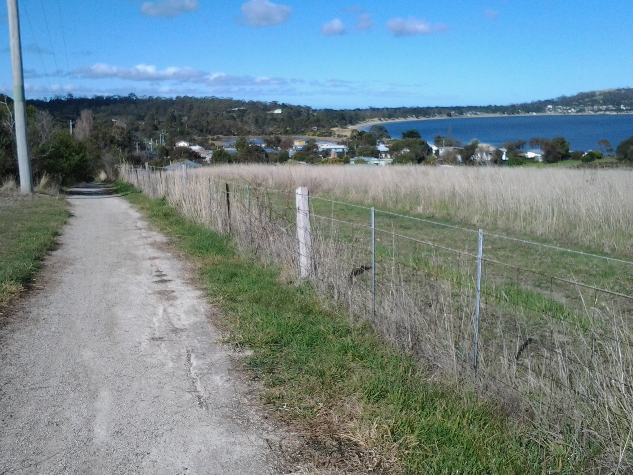
I looked southwards and could see that Pindos Park was another possible starting place for a walk to Trywork Point. The soft grassy track between the houses and the River was wide and clear and continues around until a connection is made with the track to the gate at the beginning of the small pebble beach.

20140920_120305

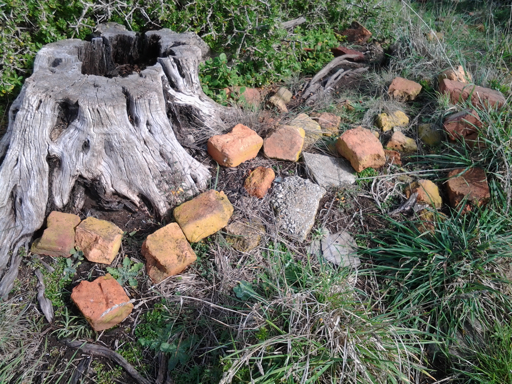
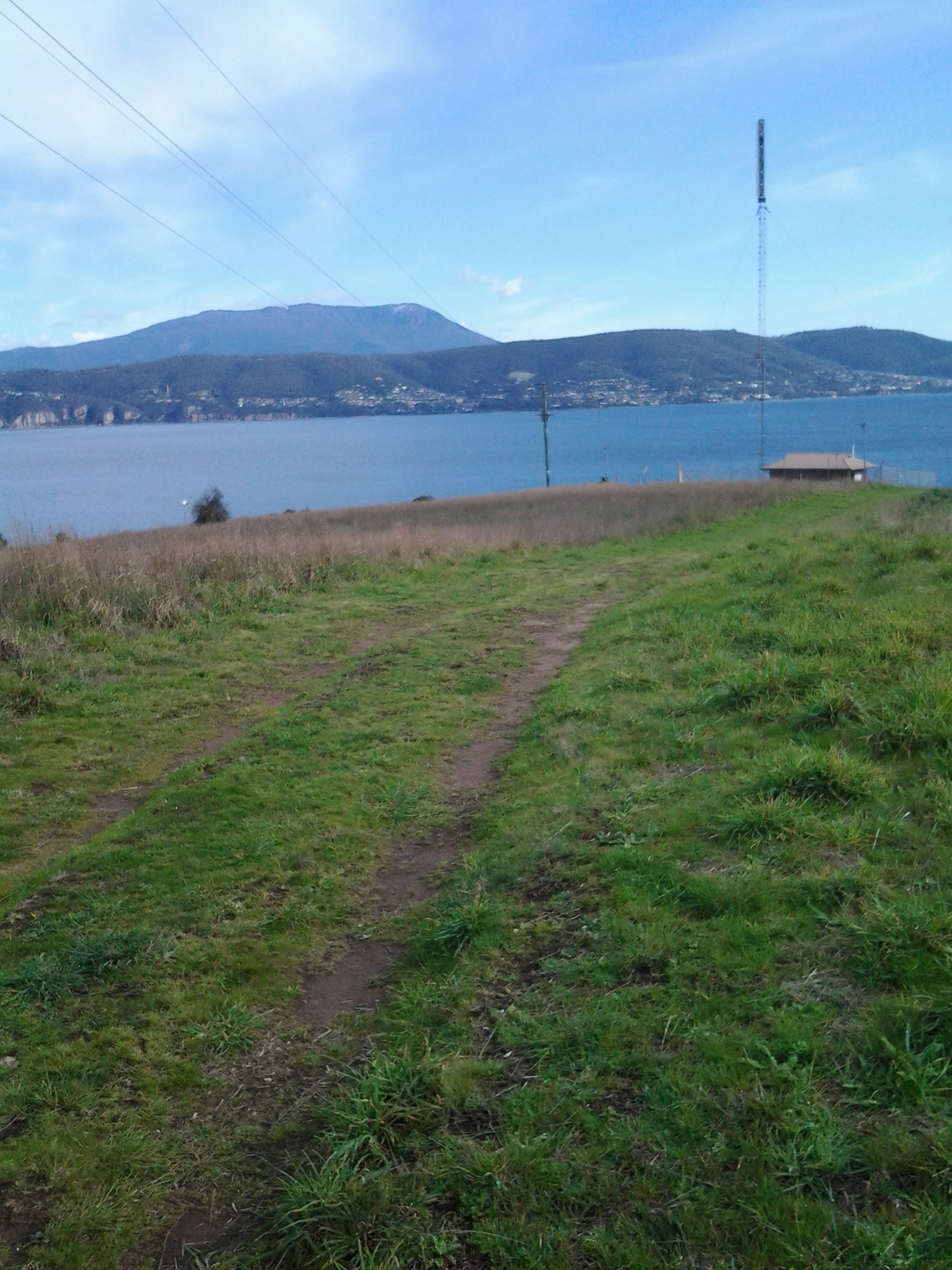
This photograph is taken from the Pindos Park area. The trees on the hill in the distance are the forest of Casuarina trees I referred to in an earlier posting.  I walked though those trees in order to reach the other side and then down to Trywork Point. What I am now suggesting is the walk to Trywork Point starts here at Tranmere Point and the track visible in this photograph can be followed eventually down onto the rocky shore and then around the bays and small headlands. In this way, walking on private land can be avoided.

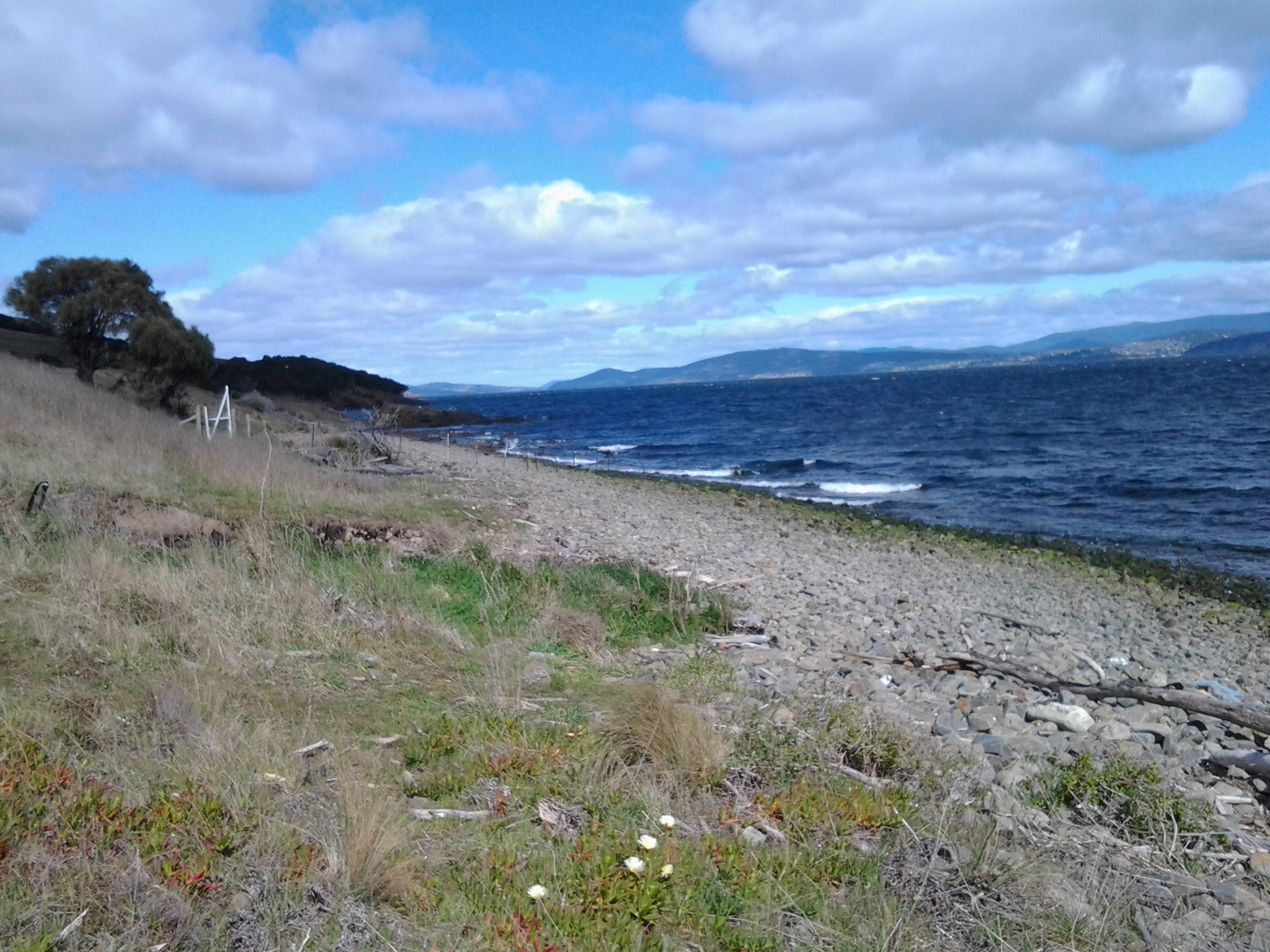
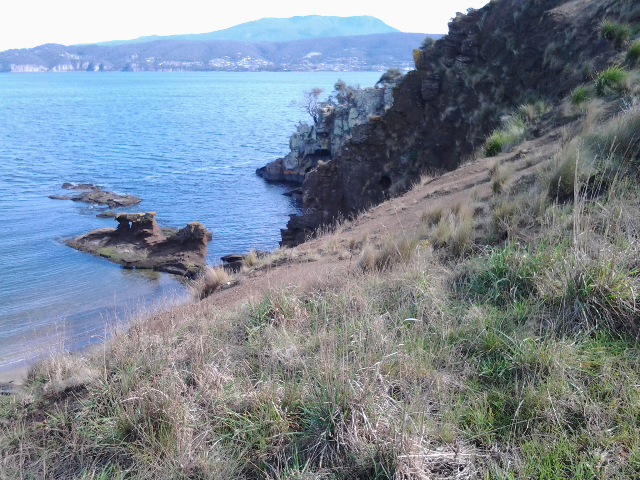
Once I turned away from this southwards direction to continue my walk northwards, I was blown around the Pindos Park headland with its markers indicating underwater pipes,

20140920_120623

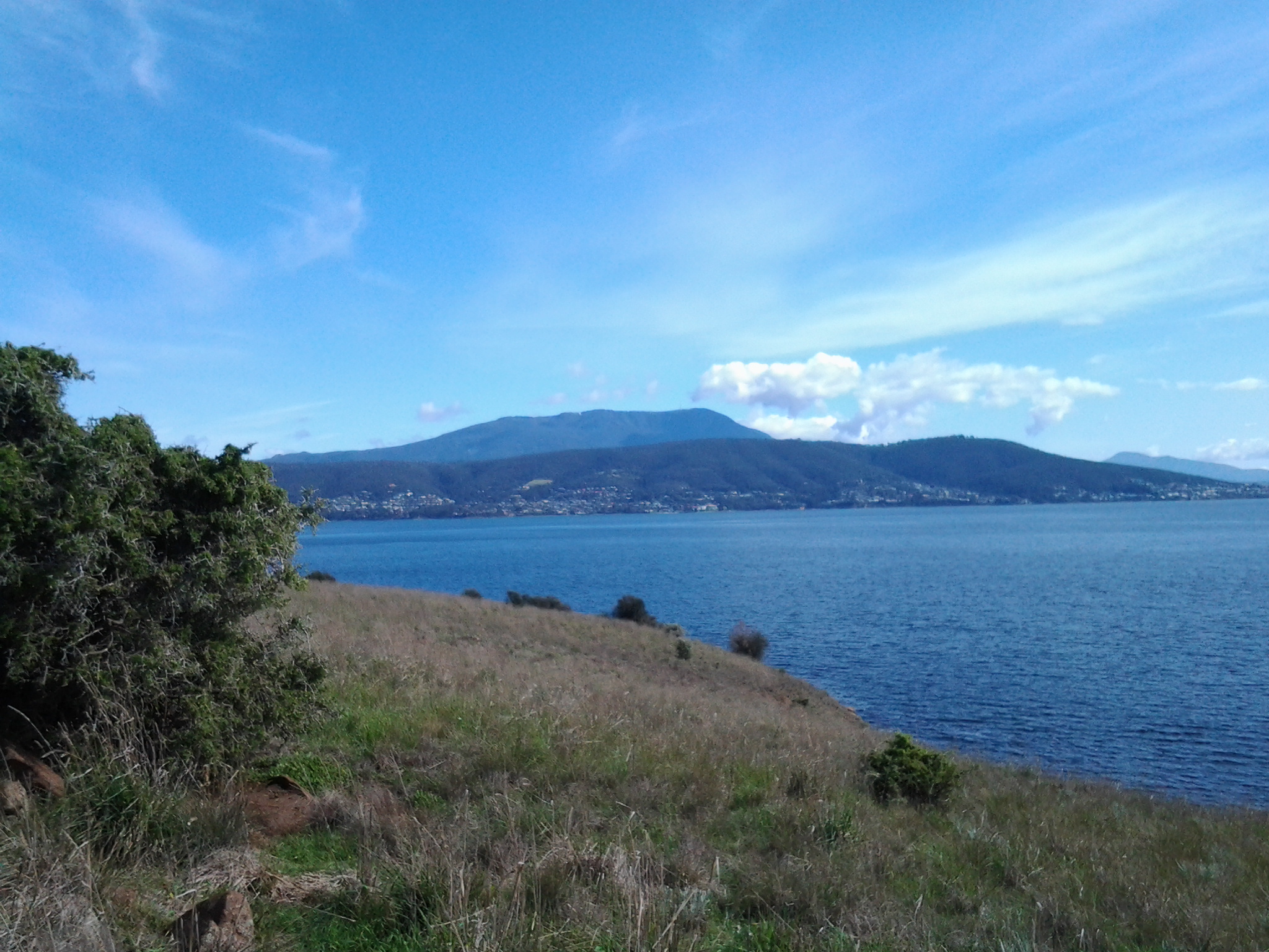
and continued on following the River into the sun. I could see the suburbs of Howrah and Bellerive with their golden sandy beaches in the far distance.

20140920_120655

Ten minutes later I reached the official start of the Clarence Foreshore Trail, a cemented path for both cyclists and pedestrians. By 12.15 I reached bus stop 32, and five minutes later I arrived at bus stop 31. However I was beginning to plod because my feet were sore so I waited for a few minutes by the rocky foreshore of Tranmere in the glaring sun amidst a stiff wind, for the 12.23 pm bus which was scheduled to return to Hobart. It came on time, and when I hopped on and sat down I realised that I had not stopped or sat since the bus trip to Tranmere 3 hours earlier in the morning. During my walk, I hadn’t stop to have a morning tea snack – hadn’t felt the need. Was enjoying the scenery and the weather too much to consider food. Lost in all the gorgeous moments of the day.

I left the bus at the Shoreline shopping plaza for a toilet stop and a chance to buy a newspaper and a few groceries.

20140920_125804

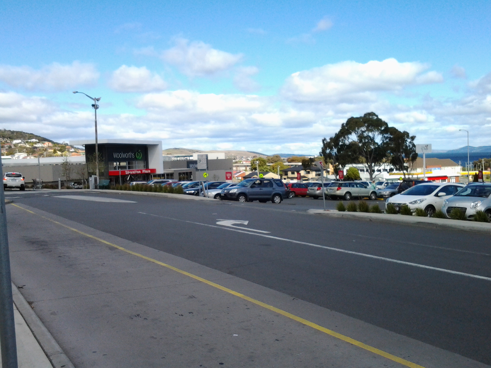
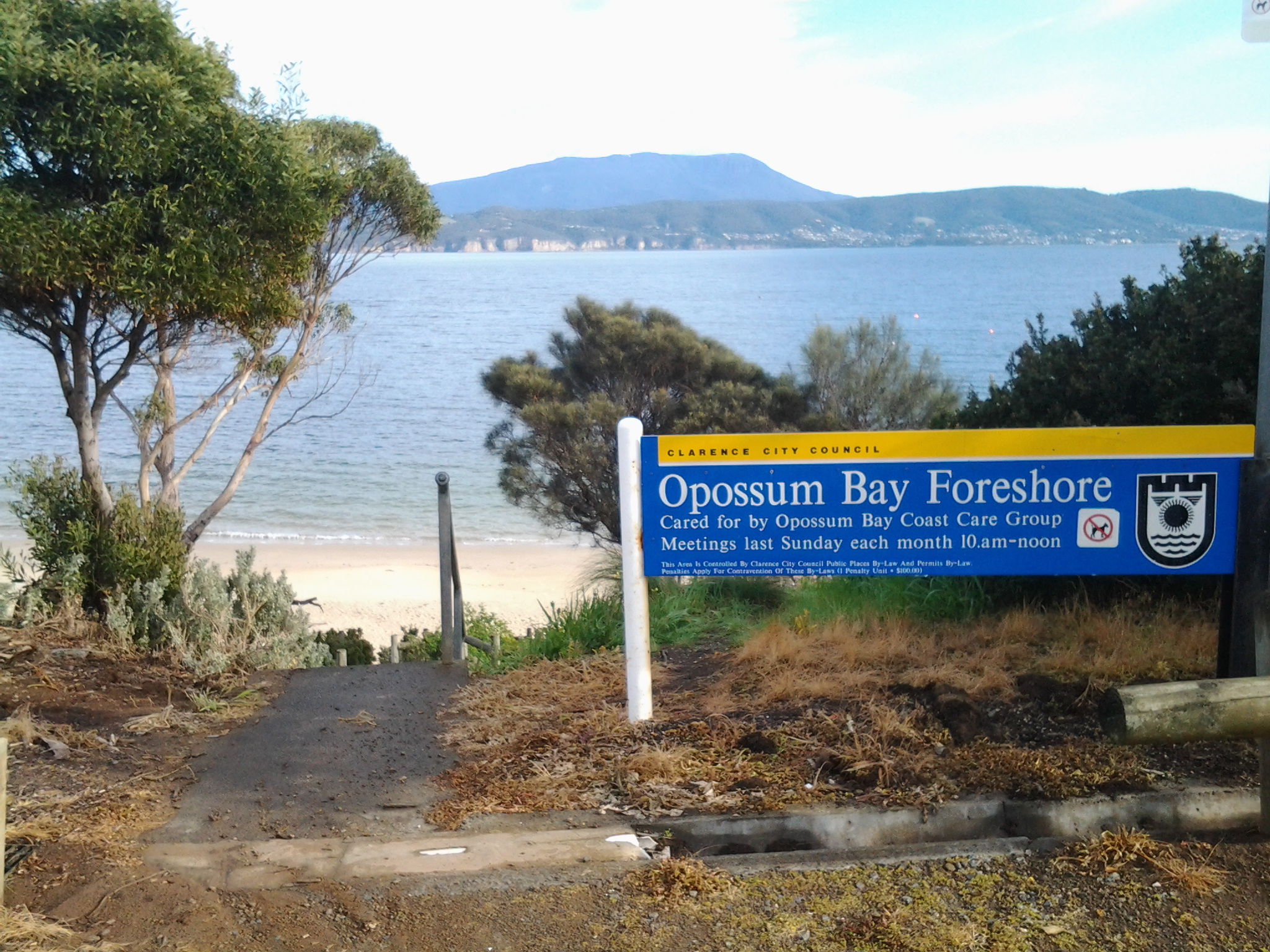
Note that in this photograph taken outside the Shoreline Plaza, there is a distant hill in the centre background. That’s the hill with the Casuarina trees through which I walked on the way to Trywork Point.

The Shoreline was very convenient. Then I jumped on a later bus heading towards Hobart.

Stage 3 One starting point for a Derwent River walk to Trywork Point 20 September 2014 Posting 4 of 6

If you choose to walk to Trywork Point, I recommend one starting point could be the pathway down from Vaughan Court (which runs off Oceana Drive to the right), and turn left at the bottom onto a grassy walking track. If my experience is a guide, you are likely to meet happy dogs and their owners enjoying a stroll along this route.

If you choose this route, I think you should allow at least 2 hours for a one way journey that has nil or minimal walking on the cattle tracks on private land.

This walk is not for everyone.

It requires specific equipment (supported walking boots) and a reasonable level of fitness, a tallish size and common sense. There are a number of dangers to be considered; the chance of rolling or spraining an ankle on the rolling rocks, the chance of injury on the slippery slopes where the needles from the Casuarina trees form a moving mat on the ground, and the surprising number of pieces of rusty fencing wire that pop up unexpectedly. In addition, if the herd of cattle was in the vicinity where you might be trying to edge along a cattle track, there might be some associated dangers. But above all, you are skirting around private land and that needs serious consideration.  If you are not very tall, you may find some of the rock climbing to be unsafe and perhaps impossible.

This walk is for the few.


Stage 3 Walking from Trywork Point back to the suburb of Tranmere 20 September 2014 Posting 3 of 6

I left Trywork Point at 10.30 am intending to walk back along the edge of the River in order to determine what could be achieved without walking on private land. I am delighted to say that the low rocky foreshore from Trywork Point is very walkable if you wear strong ankle supporting boots. Of course it is slower than walking the cattle tracks but quite spellbinding.

20140920_110119

I did come upon one section as shown in the photograph above of rocks that rose in the air, and I couldn’t descend (it would be perfectly easy to ascend if walking towards Trywork Point by the rocks, but long legs are required to descend – and mine are short) so I climbed back up to a cattle track and followed that until I reached a gully – no water running and grassed over – where I could easily step down onto a large pebble beach.

Smooth grey driftwood pieces in all sizes and shapes were washed up to where the pebbles met the land.

20140920_111446

The blanching shells of thousands of mussel shells and the occasional oyster shell fitted between the pebbles. Detritus, the flotsam and jetsam of human activity was interspersed across the beach. The remains of polystyrofoam containers, blue plastic containers, empty plastic drink bottles, beer bottles, and frayed ropes were typical. Attracted by its bright yellow colour, I picked up a perfect Spalding high-bounce ball which can be used when learning to play tennis.

Around a tiny rocky headland I walked from the large pebble beach to a beach of smaller pebbles. All the while treading slowly as the stones rocked and rolled, and as pieces of rusty metals thrust up unexpectedly from below. At the northern end of this pebble beach, and as I neared the first houses of suburban Tranmere, a falling down fence crossed from the land over the pebbles and continued into the water. Once near the fence, I could see that someone had built a gate that swings in the wind, so that locals can access the beach from the suburban side of the fence.  I passed through the gate and continued on a home grown track for the occasional pedestrian traffic.  There were no signs here or around about indicating entry to the beaches and rocks where I had been walking, was prohibited.

20140920_112751

The white structure is the make shift gate through which I had walked.  Note that in the foreground a variety of native pigface fleshy foreshore plant are growing.  Today, the flowers were like jewels as they gleamed in the sun.

20140920_112746

When I looked across the Derwent River, Mount Wellington in all its magnificence towered over Hobart city. The pebble beaches and later pathways offered superb vantage points.

After walking for ten minutes from the gate, on the public verge above the river in front of many houses, I came to a public pathway leading uphill to the road; a steep concrete path that would be impossibly slippery when wet.  The pathway is located between 24a and 26 Vaughan Court and could be the starting point for a legitimate walk to Trywork Point via the rocky foreshore.

Stage 3 On the way to Trywork Point along the Derwent River 20 September 2014 Posting 2 of 6

It was 9.13 am when I got off the bus at Tranmere (that is, a 25 minute bus ride from the Hobart city centre) and I was ready to walk but unsure which route to take.  My first idea was to walk up some side streets hoping their ends would be in open paddocks which I could walk across. I can now tell you not to walk up Norla St or Spinnaker Crescent to the locked gates and fences,

Top of Norla St- gates blocking progress

unless you want to appreciate the fabulous views of the River and beyond. At 9.45 am I was back down onto Oceana Drive near its southern end where the Crescent makes its connection.

The sealed bitumen road of Oceana Drive quickly changes into a gravel road. Then across my path a padlocked gate and a barbed wire fence that descends towards the River, effectively blocked my progress.  The tiny yellow sign glowed in the sunlight: Keep out private property.

Ahead of me on the other side of the gate, a car track wound into the distance and then disappeared into a gully. On the crest of the distant hill sat a forest of casuarina trees. Before these trees, and across the hill, golden grasses rippled when the wind blew onshore.  The sky was blue.

Sometimes there is a correct way and an incorrect way to go about doing things.

My intention has always been to provide directions for people who would like to follow in my footsteps and so if I was to describe a way that cannot be repeated, then I would mislead you. It is sufficient to say that I went the wrong way but returned the right way.  Yes yes yes. You guessed it.  I jumped that gate onto private property and continued on with plovers wheeling overhead all the while trying to protect their little bird that ran in terror into the tussocky grass. 20140920_095305

In a later posting I will describe how to walk to Trywork Point without walking on private land.

It is clear that someone is currently subdividing this land and I guess that new blocks of land will be offered for sale at some time in the future. Once this happens, then the land will be opened up and become accessible. Well-worn single file cattle tracks, evidenced by hoof marks and weathered cow pats, ranged through this land. Everything was dry and disintegrating so that I didn’t believe a herd had passed along these tracks recently.

I reached a new fence with a prominent sign on the other side: This is NOT public land.  Uphill the fence stopped in the middle of nowhere so I continued across the hill towards the forest of Casuarina trees.  I was careful that the short tussocky grass and the occasional hidden rock didn’t roll and sprain my ankles.

20140920_100104

Once into the trees, and dodging low branches, I followed meandering tracks all the while making sure the Derwent River remained clearly on my right. Throughout today’s walk occasionally and unexpectedly rusty pieces of fencing wire wanted to trip me up and harm me, so constant vigilance was required to avoid these dangers.

Before long and once out of the trees, a wonderful vision of The Spit and Gellibrand Point on the South Arm peninsula greeted me. Between me and Trywork Point was an ocean of moving grasses. Golden. Shimmering. Glorious. Winds sweeping. Isolation.  Silver Gulls floated overhead.

20140920_101617

In the photo above, the two small green trees at the bottom of the hill mark Trywork Point. Gellibrand Point is on the left across the water. The dark blue represents the huge expanse of the Derwent River’s grand harbour.

The cattle hadn’t made tracks down to Trywork Point so I thumped my own path down through the tussocks and occasional scrawny remnants of rose bushes. Eventually I arrived and unfortunately disturbed a pair of Dominican Gulls who seemed to ‘own’ the rocky point. I couldn’t see evidence that people had been here in a long while.

20140920_102703

The photo above is the rocky edge of Trywork Point, with Gellibrand Point on the South Arm peninsula in the distance.

When I looked eastward towards Droughty Point, a headland at some distance inside Ralph’s Bay, I was surprised to see before the point was reached, a small secluded sandy beach.

20140920_102734

Between the beach and Droughty Point, a healthy herd of red brown cattle rested and munched comfortably on an area of luscious looking green grass.  I guess they are the beef steaks of the future.

Stage 3 Getting to Tranmere for another Derwent River walk 20 September 2014 Posting 1 of 6

This Saturday morning in Hobart was gloriously sunny so it was time to take a walk along the Derwent River. The Camelot Park number 615 Metro Bus departed from the city bus mall at 8.48am and travelled to the eastern shore of the Derwent River. I jumped on the bus a little after 9am having already enjoyed the short walk to the bus stop past ornamental cherry trees plump with green buds and a sprinkling of newly opened palest of pink flowers, past the mass of flowering jasmine strangling a fence between neighbours, and past the rich red pink jewels of a flowering nectarine tree that promises tasty juicy fruit in the new year.

The bus continued along Cambridge Road before turning left along Clarence Street, which runs parallel to the Derwent River.  I wondered whether the name was in remembrance of Lieutenant John Hayes’ ship the Duke of Clarence, a British Duke of Clarence from some era, or whether there had lived an interesting Mrs Clarence once upon a time whose memory is now enshrined in this long street.

Half way along the street, a sign noted the change of suburb from Bellerive to Howrah. Soon the bus was pulling into the mini bus mall in the Shoreline precinct of a hotel and a shopping plaza.  Moments later the bus was travelling down the road towards the River and, after sweeping around a bend, it continued through the suburb of Howrah then the suburb of Tranmere, always parallel to the River. I had a clear view of Mount Wellington and the city centre of Hobart on the western shore. Between sat an almost rippleless dark blue Derwent Harbour. It wasn’t long before I could see, in the distance, the treeless hills that I expected to be tramping across.

Around ten minutes after leaving the Shoreline, the bus circled into bus stop 33 at the corner of Tranmere Rd and Oceana Drive. This was the final stop, and as I got out the driver turned off the engine and stepped out to stretch his legs while waiting for his return departure time to arrive. The air was clean and the day was colourful. I stood on Oceana Drive edged by large suburban houses and felt the strength of a cool breeze.

A number of black and white magpies were broadcasting their fantastic singing voices. Their melodious sounds were crossed with a cacophony of the de daaa tt de daaa tt of the wattlebirds.

20140920_091642

I was standing at the bus stop when I took this photo looking along Oceana Drive in the direction that I needed to walk. But despite my maps and internet research I stood still looking and puzzling, and not clear where to walk or whether I would be able to access my starting destination: Trywork Point.

Stage 2 of my walk along the Derwent River finished at Gellibrand Point and the next point directly across the inlet to Ralph’s Bay was Trywork Point on an exposed headland. So today’s walk needed to start at Trywork Point, south of this bus stop, but I had to get there on foot somehow before retracing my steps to continue walking northwards along the Derwent River.

20140920_091918

I started walking along Oceana Drive then looked back from where I came and clicked this photograph. The bus is still ‘resting’ where I left it.

How did Hobart’s Derwent River get its name?

Dan Sprod’s information for the Centre for Tasmanian Historical Studies was a great help in understanding that our Derwent’s (http://www.utas.edu.au/library/companion_to_tasmanian_history/R/River%20Derwent.htm) European discovery was made during the second (1793) visit to what is now the island of Tasmania, by French explorer Bruny d’Entrecasteaux. The given French name ‘Rivière du Nord’ never took hold. When Englishman Lieutenant John Hayes arrived in April 1793, he was unaware of d’Entrecasteaux’s visit two months earlier, and named the river after the Derwent River in England.

Great Britain’s Derwent River flows through Cumbria, a sparsely populated non-metropolitan county in the north west of England.

Cumbria contains the famously beautiful Lakes District, and presents as a combination of mountains, rugged seashore, parkland and rural landscape. In the early eighteenth century, the landscape and climate similarities between Cumbria and our island’s river backed by the stunning Mount Wellington make it easy to understand how our river came to be named.  In England, the name Derwent is derived from a Celtic word for “oak trees”.  Australia and Tasmania do not have native trees with the same leaf and character as English Oaks. However the heavy thick forests with large stands of trees either side of Tasmania’s Derwent River, would have made a strong impression on Lieutenant Hayes.

The Cumbrian Derwent flows westwards towards the Irish Sea; the city of Workington sits at the mouth. Google Earth includes photos of a mountain, powdered with snow, showing similarities with our Mount Wellington at cooler times.  I imagine Lieutenant Hayes would have been away from England for many months, if not years, and so his ability to make direct comparisons between his English and our river would be based on hazy memories.  Notwithstanding this, when I look at a current photo of the Derwent in Cumbria, the landscape has a character similar to our local environment. Of course, the landscape and its features at both locations will not be the same as when seen in the late 1700s. However and despite the passing of centuries, I can see how and why Lieutenant Hayes chose to name our river, the Derwent.

But what about the man; what was Lieutenant Hayes connection with Cumbria and the Derwent River?

The Australian Dictionary of Biography (MUP Volume 1 1996) notes that Sir John Hayes (1768-1831), naval officer and explorer, was baptized on 11 February 1768, the son of Fletcher Hayes of Tallentire on the River Derwent, England. On 7 December 1781, when 13, he joined the Bombay Marine as a midshipman on the Bombay. By December 1788 he was promoted to second lieutenant and his rise through the ranks continued over the years. Hayes is best remembered for a private voyage undertaken between February 1792 and December 1794. Glowing accounts of New Guinea’s economic potential fired Hayes to lead an expedition financed by some Calcutta merchants. On 6 February 1793 the Duke of Clarence (250 tons) and the Duchess of Bengal (100 tons) left Calcutta, India. Because of adverse winds Hayes could not sail direct to New Guinea, so at the young age of 27 years, he decided to voyage round New Holland (this was the original European name for Australia). He reached Van Diemen’s Land on 24 April and left on 9 June. During that time, he discovered and named the Derwent River, and other features of the terrain. Risdon Cove and Cornelian Basin still bear the names he gave them. According to the publication “British Heritage of Tasmania’, (http://members.iinet.net.au/~rwatson1/britishheritage/BRITISH%20HERITAGE%20OF%20TASMANIA.pdf

Hayes named Ralphs’ Bay (a beautiful bay which I have mentioned during both my first and second stage of walking along the eastern shore of Tasmania’s Derwent River) at Lauderdale, after William Ralph who was in charge of the Duchess of Bengal.

While I would like to think that the City of Clarence (the eastern shore city of the Greater Hobart Area and the one in which I live) must have been named specifically after the ship which Hayes’ commanded, this apparently isn’t true.  It seems that the City of Clarence was named after King William IV of the United Kingdom who as he ascended the throne was titled His Royal Highness, The Duke of Clarence and St Andrews. However, let’s look at this a little more closely. In 1843, Prince William (the future King William IV crowned in 1830) began a career in the Royal Navy by becoming a midshipman at 13 years. In 1789 he was made Duke of Clarence, and then retired from the Navy in 1790.  The elements are: the future king is a naval man who held the title of Duke of Clarence before Lieutenant John Hayes (who started his naval career as a midshipman) set out from India towards Australia. Travelling to Tasmania, Hayes just happens to be in command of a ship named the Duke of Clarence in 1793. How did his ship get the name?  Considering the timing, surely Hayes ship was named in honour of the new Duke of Clarence (the Sailor King or Silly Willy as the future king was known). I would prefer to believe that the name of today’s City of Clarence lying along the eastern edges of the Derwent River, is a reference to the ship of the man who named our River, and only indirectly refers back to the early title of King William IV.

Yearning to walk the next stage

For the past almost two weeks I have yearned to be out walking and discovering another length of the Derwent River. Unfortunately, when snow storms powdered the mountain (Mt Wellington) last week it was simply too cold and then some of the days when I was free to walk were overcast. I find that I continue to make my own rules about what should happen as and when I walk the Derwent River. The latest ‘rule’ is that I will not walk unless the sun is shining.  The reason is that I only want to take photographs to show you the land and the river in full sparkle. I only want to see it that way myself as I walk.

Again yesterday snow storms on the mountain brought the temperature low and the forecast is for rain to continue off and on until this Saturday, when not only will the day be dry but the sun will shine.   Come on Saturday!

Another thing I must consider is the availability of public transport because, as you know, my walks must be able to be reached and finished in touch with our local public transport system, the Hobart Metro buses. If you have a car to duplicate my walks then you are lucky. Not everyone has access to their own transport.  Weekend bus times are not nearly as frequent as during the weekdays.  For example, the Camelot Park bus that I need for travel on Stage 3 of the walk is around in that suburb every half an hour during the week but only once an hour at the weekends. Research and vigilance is always the key.


Stage 2 on 4/9/2014 Summing up Email 14 of 14

I arrived at the Opossum Bay shop at 9.10 am to start Stage 2 of the walking journey, and I caught the return bus (number 638 with a transfer onto bus number 632 at Lauderdale) across from the shop around 2.05 pm.

Between times I walked approximately 10 kilometres.  However, Stage 2 only represents around 4 kilometres of the length of the Derwent River. Adding this to the 7 kms covered in Stage 1, I have now covered 11 kms of the 249 kilometre long river.

I am persuaded that no-one could complete Stage 1 and 2 on one occasion to fit within these bus times. For someone to replicate my journeys two separate trips are required. Alternatively, one longer visit could finish with a return to Hobart on the bus which departs Opossum Bay near Shelly Beach at 5.55 pm.  Unfortunately this latter option would probably leave you with lots of time to fill in waiting for the bus; this eventuality would need to be expected and planned for.

As a post note, in 1995 the Gellibrand property was acquired by the state, on behalf of the people of Tasmania and in 2011 the area was declared a nature reserve and named Gellibrand Point Nature Recreation Area. I feel excited to have walked the trails and found my own way around, for the friendly people I met, the stunning views, the fascinating history, and the discovery of another part of Tasmania, one footstep at a time.  And all for the cost of a couple of bus fares.

 The photo below was taken from Gellibrand Point, Stage 2’s destination. It looks across the Derwent River towards Hobart city with Mount Wellington behind.

20140904_110649

Stage 2 on 4/9/2014 Onwards to Gellibrand Point Email 10 of 14

My journey continued up a hill where I recognised two track options; one inside a fence line, and another outside the fence at the top of the cliffs on the side of the Derwent River. I took the track outside the fence (I watched the following children and they were evenly divided between the inner and outer tracks- obviously their teachers thought the outer track to be safe), and at the top of the hill there was an opening to step through the fence and return to a 4 wheel drive track.

20140904_105455

The air was clear. The day was warming up. The views in every direction were sensational. One of those experiences that makes me so happy to be alive.

20140904_105300

The photo above looks across part of the northern end of that part of the Mary Ann Bay, and via the Derwent River, looks towards Hobart city suburbs and Mount Wellington.

Not far away I walked past a pile of broken old convict bricks.

20140904_105102

Gellibrand Point at the northern most point of the South Arm peninsula was the destination for Stage 2 of the walk.

I found the shape of this headland was blunt and rectangular so that there was no hint of a ‘point’. So it was a little difficult to say I had reached the exact spot representing the end of the second stage of my walk along the Derwent River edge. Across the watery opening into the large Ralph’s Bay I could see the goal for Stage 3 of the walk: Trywork Point. This headland is situated south of the suburb of Tranmere, and north of the South Arm peninsula.

20140904_110320

In the photo above, you are looking at Trywork Point across the water.

The photo below was taken from my lunchtime vantage point looking across Ralph’s Bay towards the mound in the distance over the water on the left hand side; this is Trywork Point.

20140904_121302

The Tasman Bridge, which provides the main city crossing between the eastern and western shores of Hobart, shimmered in the distance. Mt Wellington with spots in crevices of hard white ice left over from two or three weeks ago of heavy snow, was majestic.

I wandered along the headland until, between the track and a smattering of Casuarina trees near the water line, I spotted some sandstone boulders that looked perfect as resting spots; the first I had seen. By 11.15 I had rested, eaten a snack for morning tea, and set off again up to and onto the track that extends back to Opossum Bay via the eastern side of the peninsula.

Stage 2 on 4/9/2014 The Tower Email 5 of 14

Having ascended from Mitchell’s Beach a little after 10 am, I turned left and followed the four wheel drive track with Mount Wellington looming in the distance. Swallows swooping ahead of me along the track. An old windblown pine tree stood on the left between me and the Derwent River with thousands of new pine cones in their early growth phase – like small golden brown candles. The Derwent River was almost flat calm.

Then I could hear children. Ah ha! Hmmm. The sounds of their happy voices coming closer. Behind me across the land. Drat! Solitude about to disappear. Maybe.

Walking across the undulating landscape allowed me to be in sight of the tribe of primary school children with their two accompanying teachers and then, alternately, to be on my own as the hill crests obscured my view backwards. It only took me 10 minutes to reach the tower on the open and exposed White Point Rock headland.  The tower, in its caged environment, is an Australian Department of Communications radio and television transmitter which ensures some suburbs across the river receive their needed communications connections.

20140904_100850

Apparently the land at White Point Rock dates to the Late Pleistocene – that is, roughly 126,000 ± 5,000 years ago, and University of Tasmania researchers (http://ecite.utas.edu.au/62080) have documented the shell remains of the ancient marine fauna contained in the land there, now 24 metres above the current river level.

Stage 2 on 4/9/2014 Opossum Bay Email 3 of 14

The bus trip from the city to the starting point for today’s walk takes approximately 1 hour 10 minutes.

Stage 1 of my walk finished at the Opossum Bay shop so Stage 2 needed to start from there.

20140904_090914

By the way, it makes sense to alert the bus driver that you do not know the area you are travelling to, that you want to get off at the Opossum Bay shop, and that you would like him or her to stop and let you off when you reach your destination.  Our Metro drivers are very happy to provide this simple customer service.

When I alight from the bus at 9.10 am, what I see ahead is excitement. I watch the bus disappearing along the road and know that this is the direction I must take, however on different paths. From the Taroona TasMAP, I know the bus will not travel nearly as far as I will walk, so that once I have reached my destination of Gellibrand Point, I will need to retrace my steps to a bus stop.

I am unsure if I might find trails, and whether I might need to exert some pioneering spirit and discover a way. I don’t know who I will meet or where. I wonder what I will smell and what I will hear.  This promises to be a terrific adventure which will use all my senses. Stepping off into an unknown world.  And so I take the first step along the road (no footpaths) from the Opossum Bay shop.

20140904_090925

The sun is shining. Air is crisp. Nobody is out and about and walking around. Opossum Bay is peaceful and quiet except for the soft sounds of water lapping onto a beach in the distance.

100 metres along the roadway a sign points to public toilets which, after an hour on the bus, are a good place to visit. At the bottom of the attached carpark, a large placard indicates a tiny walkway down onto Opossum Bay foreshore.

20140904_091422

I was filled with awe when I stepped onto the pristine white sandy foreshore, and looked along at relaxed houses and shacks overlooking the edge of the beach. Not a soul to be seen.

20140904_091601

Mt Wellington and the western shore of Hobart across the Derwent River looked particularly special.

10 to 15 minutes later I had walked north along the length of the beach until confronted by a rocky headland that needed to be rounded before I could continue the walk.

Instead, I chose to climb the concrete stairs near the end of the beach that returned me up to the road.  I noted that the rocks were reasonably smooth and could easily be accessed, but as usual and not knowing which future obstacles might present themselves I decided on the more obvious route; all the time I remembering my return bus departed at 2.02 pm and that I needed to make sure I caught it (because the later one did not depart until 5.55 pm).

The second stage of the walking tour

Tomorrow, Thursday 4 September, I plan to walk a second stage of my foot journey along the eastern shore of the Derwent river.  As with the first leg, I need to take Bus 640 that departs from the Hobart city bus mall at 8am and heads towards Opossum Bay.  I will jump on the bus once it reaches the eastern shore and, as before, I know I must be patient because it will weave through the suburbs of Rokeby and Clarendon Vale before passing Lauderdale, Sandford and South Arm (details of these great locations are in the earlier postings related to the first stage of the walk). My bus destination is the Opossum Bay Shop. From there I will walk north to Gellibrand Point via beaches, roads and open landscape.  I hope to be able to enjoy my pre-packed lunch sitting looking towards Mount Wellington before returning to the Driftwood Drive bus stop for my journey back towards Hobart. The morning low temperature is expected to be around 9 degrees when I arrive and rise to about 14 degrees around 1pm. The return bus leaves Opossum Bay at 2.02 so I hope it doesn’t rain before then.  Keeping my fingers crossed!

Shades of grey – how many?

Travelling to and from work, I routinely cross the Tasman Bridge, one of a number of bridges which span Hobart’s Derwent River. This morning, on the first day of Spring in the southern hemisphere, the air was clean and bright and eventually the temperature rose to a mild 18 degrees. In that peak rush hour on the roads, the Derwent featured a police boat speeding up the river, but otherwise all was quiet on that glittering watery surface. However, this afternoon the clouds moved over Mt Wellington and the world of the Derwent took on different colours.

 Yes it was raining as my city bus left the city for the eastern shore after work, however nothing unpleasant can be said about the glorious effect the lightly falling rain had on the landscape and the river.  The vista was outstandingly beautiful.

 As the rain melted onto the river, it patched the surface with the softest pale colours of grey-green jade. Delicate. So refined. The South Arm peninsula at the mouth of the river, blurred grey with a loose mesh of fine rain, barely remained visible as my bus crossed the Bridge. The sky was coloured with a combination of a softening yellowish charcoal grey and a light blowsy light beige grey. Collectively, the multi shades of grey were colourful. They embraced the river and the lands beyond.  Simply stunning. And I am lucky enough to live here!

22 Aug 2014 Leaving South Arm and heading home, and final thoughts – Posting 8 of 8

On the return journey towards Hobart, the bus deviated via large mudflats into the town of Cremorne adding 5 minutes to the trip, then it dropped me at a Lauderdale bus stop for transfer to another bus (because the Opossum Bay bus terminates at Lauderdale) approximately 5 minutes later (with his two way communication, the bus driver alerted the other driver there was a transferring passenger to be collected). Once on the Lauderdale bus, the trip towards Hobart deviated through the suburb of Oakdowns and so a further 5 minutes was added to the journey. After the bussing and the walking I was home in Bellerive at 3.20pm.

In this series of blogs for the first walk stage, I have provided approximate times for various sections of my walk as an indication only. I am short legged and plod slowly (and towards the end I felt I was shuffling like an old man). If you are tall and can happily stride long steps faster, then my walk will not be sufficient to fill the time between buses.  In fact some speedy walkers may be able to continue through the Opossum Bay community and walk to the end of Gellibrand Point, the most western tip of this piece of land before Ralph’s Bay makes its inlet.  My next walk will be designed to complete that section, and then I should be able to advise as to whether fitting it all into 5 hours is possible for the able.

Since it is unlikely anyone else will have my success if they turn up at the gate of Fort Direction and get driven through the site, the only general public approach is to walk along Fort Beach having walked most of Blessington Road.  Based on the information I recorded, I suggest one way on this route from the set down bus stop to the Lone Pine Memorial will take an hour if you take time to enjoy the views and click photographs. Add the half hour return walk between Cape Deliverance and Cape Direction with its gun placement bunker and the whole excursion takes approximately 2 ½ hours.  As an alternative, you could spice it up by jumping the shore rocks like a goat, from South Arm to Fort Beach. I would guess another hour could be added to the duration of the walk.

I noted that the tide was going out while I walked, and that the high tide merged with the dune verges in places on Fort Beach. It made me think that on a high tide, this route might be impassable. In such a circumstance and if you had made the special trip and your heart was set on a beach walk, the expanses of the South Arm beach with their outstanding views, old pines shadowing parts of the dunes, and soft roaring Casuarina trees, would make a very attractive substitute.  You might be lucky, as I was, to see a giant fresh squid washed onto the beach being enjoyed by immature grey feathered winged large Gulls.

Many of our native birds are various shades of black and brown but we also have an array of colourful specimens. During my walk, the sun brought out not only the musical black and white Magpies, the hard cawing jet black Crows, but also plump pink and grey Galahs feasting on the ground, Mr Blue Wren flitting in and out of the shadows, a glorious Mr Robin with his red breast, and a flock of multi-coloured Rosella parrots.

My guess is that I walked around 10-12 kms including getting to the start and then continuing on.  But how much of the 249km length of the Derwent River have I covered? About 7kms. A great start! A memorable day. A very positive experience.

22 Aug 2014 South Arm beach and the walking continues – Posting 7 of 8

Around 11.30 am, I made myself comfortable on a rock on the South Arm beach, ate some pre-packed lunch and enjoyed the glorious qualities of the day and the location. The view across the broad Derwent towards Blackmans Bay, Kingston, and Mount Wellington with a scribble of snow on its summit was sensational. South Arm beach stretched as a thinning arc and seemed impossibly long and pure.

The photo below is the viewpoint directly in front of me as I ate my lunch.  Glorious Mount Wellington on the western side of the Derwent River.  Closer to the shore, a platform bobbed with the comings and goings of Pied Cormorants while they searched for their fish dinners.

 20140822_114606

Meanwhile my feet hurt to walk on. I felt crippled. But I had two hours before the bus returned so, as with any days spent travelling overseas, time was not to be wasted simply sitting around.

It wasn’t part of the plan for my first day walking the Derwent, however I decided to walk (shuffle if I must) the length of the South Arm beach, then take to the road and continue on towards Opossum Bay to find a bus stop.

It took me 45 minutes to plod along the long South Arm beach. Apart from a few locals the beach was deserted, except for the Silver Gulls who entertained me with their happy feet.   George Miller – forget those penguins! Here were normal ordinary seagulls performing a manoeuvre that left me astonished. As the short cold waves spread up the sandy beach, a seagull would stand knee deep waiting for the water to recede. When the water thinned, the gull would stamp both feet alternately on the wet sand at a super speed. Obviously this practice dislodged some wonderful edibles from the wet sand. With speed and agility, the gulls grabbed their lunch with a peck of their beaks. Then the speedy stomping began all over again.  Very funny.  Very clever.

From the end of the beach it was clear there was no track around the headland and later, as I walked towards Opossum Bay, I saw a private house ‘owning’ the space – refer to the photo below.

20140822_130337

I used the gravel bicycle and walking track next to the main road which extended from the beach end of South Arm beach to Opossum Bay Store, with a bus stop opposite. This is where I finished my walk. 

During my walk from South Arm to Opossum Bay I looked back at the long stretch of South Arm Beach. Fort Hill is above the township to the upper right.  The photo below gives some idea of the beauty of the place, and I hope it inspires others to take the walk.

 20140822_124948

This last leg took about 45 minutes. On route to the store, I passed two tourist information stands, both of which referred to this roadway being part of a convict trail, something which a team of local residents have researched (http://www.abc.net.au/news/2013-12-22/a-trail-between-south-arm-and-opossum-bay-tells-tales-of-tasman/5171434). The information which I found most interesting was that approximately 70,000 people came to Hobart on the prison and other ships between 1804 and 1853. I reflected that, of course, they all had to pass by Cape Direction, Cape Deliverance, Johns Point and the beaches on which I had been walking. It’s impossible to imagine how foreign this land of ours would have looked. And to think I started the day with trepidation!

Celebrity spotting: Brian Ritchie, once of Violent Femmes and now of MONA fame, filling up his car with fuel at the Opossum Bay store. Well I think it was him.

If you follow my walk and are in need, the public toilets are located 100 metres further along from the Opossum Bay Shop toward Opossum Bay beach.

Outside the Opossum Bay store are tables and benches, so I took the opportunity to finish my lunch. Sitting nibbling and watching people come and go occupied me until it was time to catch the bus.