Category Archives: Hobart

There is more to GASP beside the Derwent River than perhaps seen in first inspection

During Stage 10 of my walk along the edge of the Derwent River and a few minutes before 9am I had walked to Wilkinson’s Point the mostly southern end of the GASP (Glenorchy Arts and Sculpture Park) where I was surprised to discover a redeveloped structure which now forms part of the GASP experience. This was the construction site used for the building of the Bowen Bridge which crosses the Derwent River nearby.

Now, from time, contemporary art installation exhibitions are staged here.  In fact, I expect to see something there in the next week as part of the extraordinary internationally acclaimed MOFO festival (refer http://mofo.net.au/).  The MOFO program indicates that this Friday Jan 16 at midday The Tea Cube will introduce a portable tatami tearoom for a spiritual brew.

I wandered around this site in amazement.

20150109_085808  20150109_08582020150109_085816

With my back to the Derwent River I took the following photograph with clouds over part of Mount Wellington.

20150109_085951

I loved the colour of the surface ‘weeds’.

20150109_085853

And then it was time to begin to wander southwards again back on a non -path, which some readers will recognise from my video of walking feet.  In the photo below you can see the low structure of the ex-construction site, as a dark line separating the land from the water.

20150109_090654

Looking northwards and back to the ex-construction site.

20150109_090856

Part of the new repurposed structure has been cantilevered over the Derwent River.

20150109_085938

Passing the Derwent Entertainment Centre brought back memories

Years and years ago, when I arrived back in Hobart after being away a while, I recall it was a very hot day and so I found myself sipping a cold beer in the Wheatsheaf Hotel in Davey St, Hobart.

As you do, I got chatting to a man at the bar and we both realised we were out of work and eager to find paid employment. In walked an arrogant man who mouthed off about dole bludgers and how he had lots of jobs but no one wanted to work. The stranger and I looked at each other and chorused ‘we do!’  This put the guy in an awkward position because I could see, in his body language, he did not think either of us would be up to any work on his construction site; the construction of the new Derwent Entertainment Centre. However, he had to save face and couldn’t say no to us.  I remember he threw obstacles at us but we countered each.

It was a Saturday when we met, and on the following Monday morning the stranger and I turned up on the construction site at 7.30am ready for whatever work could be thrown at us.

Mr Arrogant faced us with a new obstacle, one which he thought we could not overcome. He told us that we had to be paid-up union members even though he was only offering 2 day’s work initially otherwise we couldn’t walk any further onto the site. We made some calls and the stranger and I soon found ourselves sitting in the office of a Union boss having a comfortable chat. Accountability and compliance were not so important then, and unions had lots of unregulated powers and sometimes illegal behaviours. It is enough to say that the stranger and I returned to the construction site with our Union passes.

The Derwent Entertainment Centre is built on reclaimed land and eventually more land was built around the site for carparks, roads and walkways. At the time, the construction site was surrounded by water on three sides. Our job was to remove discarded construction material off the rocky shores and load into rubbish skips.  It was hard, heavy and constant work but it was an income albeit for a short while. Since I am female, the workers on the site found they needed to be able to see me all day and wolf whistle and carry on wondering how the stranger had found me and what the story was.  All immensely amusing to me. And the distraction was incredibly annoying for their foreman.

After finishing the two day’s work, we left a pristine set of rocks. We were not surprised that Mr Arrogant was unable to find any further work for us. All of us parted ways and moved on in our separate ways. I cannot remember what I did next. Guess it was not half as exciting as helping with the Derwent Entertainment Centre project.

The meld of Montrose and Rosetta on the shores of the Derwent River

Walking south from Berriedale, a blur exists between the two suburbs of Montrose and Rosetta and I am not sure where either starts or finishes.

Soon after leaving the Strathaven Home and Riverfront Motel, as I walked along the ‘bike’ path beside the Highway, on the right in the distance over the highway I could see an old two storey white painted building. Having just passed the sign indicating the Undine Colonial Bed & Breakfast was in that vicinity, I made what I believe is the reasonable guess that what I was seeing was the developed building that grew from the original Rosetta Cottage of the 1800s.

20150109_080054  20150109_080208

It was impossible to safely cross the highway at this point so I walked on.

By 8.06, I had passed the Montrose Park sign, alerting me to turn left towards the Derwent River in the distance.

20150109_080504

Not long afterwards, I walked past the Montrose Bay High School with its whimsical mosaic decorations, and tennis courts.

20150109_080603  20150109_080720  20150109_080816

Wild hens ran around the bull grasses of the Islet Rivulet.

20150109_080850

Once at the water’s edge I realised, that Montrose Park is the northern end of the Glenorchy Arts and Sculpture Park (GASP) that extends a few kilometres south and passes the Derwent Entertainment Centre.  Across the Montrose Bay High School Bus Mall, and then across the Derwent River I could see Mount Direction in the Risdon area.

20150109_081320

The white buildings of Cadbury’s chocolate factory were visible in the distance to the north.

20150109_081523

Also in a northerly direction, the dramatic walls of MONA were clearly visible.

20150109_081530

Looking south, the white Derwent Entertainment Centre was in view.

20150109_081540

Then I started walking again. By 8.20 I was walking passed the Montrose Bay Yacht Club (Making a great offer to help me learn to sail) and then the Glenorchy Rowing Club.

20150109_081817  20150109_081907

Public toilets were nearby, near a kid’s playground.

I enjoyed looking at other quirky mosaic constructions. The photo below shows the High school and another mosaic figure in the distance, plus the posts for an Australian Rules Football game.

20150109_081644

Continuing along, I passed pontoons and jetties, an immature Dominican Gull standing fluffily on one leg, flowering gums with squawking parrots, an outside adult’s gym with chest presses and other exercise equipment, and the Montrose Foreshore Project sign showing developments since 1946.  The spread of residential development over the years has been substantial.

20150109_082441

Getting started on Stage 10 along the Derwent River.

From the eastern shore I caught a bus to Hobart City and then transferred to a 7am bus destined for Bridgewater. At the Glenorchy Bus Mall we waited until it was time to continue … and until more passengers arrived.

20150109_072558

This bus travels along the main road via Berriedale, Claremont and Granton suburbs. At 7.32am I was off the bus outside the Grenada Tavern at Berriedale.

20150109_073246

Opposite the bus stop I glanced at the vineyards of Moorilla and thought of the Museum of New and Old Art (MONA) nearby.

20150109_073235

The view, down the road in the southerly direction I needed to follow, is blandly suburban.  At that hour, the road was very quiet.  I guess with school holidays and many adults taking a holiday away from work, there were lots of sleeping bodies in the vicinity.

20150109_073239

I crossed the road and headed south on the footpath looking to see how I could get past the houses edging Berriedale Bay and walk closer to the water.  Firstly I reached a parking area with a tall mesh fence partly blocking an area of profusely flowering weeds and Berriedale Bay water from me.

20150109_073650

I continued on the main road and turned left away from the highway overpass.

20150109_073954

When I reached a service station I spotted a gap to the water and deviated to see whether further access was possible. Looking north over a bramble of free sown blackberry bushes, I could see the vineyards of Moorilla, and the concrete and rusting building of MONA.

20150109_074116  20150109_074126

Looking south, Frying Pan Island could be seen joined to the land by a tiny isthmus.

20150109_074105

It was clear there would be no continual walking access directly along the River’s edge.  I returned to the main road and continued along until I reached the Strathaven Home for senior citizens and Riverfront Motel villas, arriving there about 20 minutes after I had stepped off the bus. I walked through these properties and continued along the foreshore until stalled by a high fence topped with barbed wire – this continued out into the water as a definite deterrent for further progress. Fat rabbits, and gangs of wild hens scattered across the mown grasses. Frying Plan Island can be accessed via the Strathaven Home  and Motel site. In the photo below, the tiny islet in the foreground and southern side of the Bay, almost blocks the rusting verticals which form part of MONA in the distance at the northern side of Berriedale Bay. It is rather difficult to separate these visually.

20150109_075100

So I retraced my steps back to the main road and joined the ‘bike path’ established for both cyclists and pedestrians by the joint efforts of the Cities of Hobart and Glenorchy. It was 8am.

Walking next to the Derwent River. The proof.

By accident, I videoed my feet as I walked across the ground near the Derwent Entertainment Centre in the southern extremities of the Glenorchy Arts and Sculpture Park (GASP).  The video lasts 53 seconds, which when you watch seems a long time, and reminds me of the unchanging nature and relentlessness of some of the films of Andy Warhol decades ago.

http://youtu.be/q5sNFzfmFuI

Yesterday I completed Stage 10 of my sequential walk along the Derwent River

The goal for Stage 10 was to start at my last stopping point, MONA in the middle of Berriedale on the western shore of the Derwent River, and continue to Lutana the last suburb of the City of Glenorchy before the City of Hobart starts. But I went further.  Much further.  Almost much further than my feet could take me.  I walked to Hobart.

Over future posts I will write up the stories of the walk, what I saw and what I experienced, but for now it’s enough to say that I am continuing with this massive project to walk both sides of the Derwent between the mouth and Bridgewater, and then onwards to Lake St Clair. Once I get walking it is always so addictive.  Even when my feet feel crippled, I say to myself … ‘go just a little bit further. What else will I be able to see with fresh eyes?’

The day was gloomy with a cloudy sky, and Mount Wellington had veils of clouds covering at least part of its prominence most of the day. But it didn’t rain and so was perfect for walking.  However, the weather ensured the photographs were without sunshine.

Yesterday I covered 12 kilometres of the length of the Derwent River on the western shore (making 22 kms in total on the western shore), and walked approximately 19 kilometres (making a total of 130 kms to date) to achieve that distance. This distance also takes in the streets and paths on which I walked that led to dead ends so that I needed to retrace my footsteps.

Of the many highlights of the walk, I saw the building that once started life as Rosetta Cottage, and powerful Clydesdale horses with their large hairy feet.

20150109_162649

I surprised a friend still in pyjamas when I went visiting for the first time in my walks. The hot cups of tea were most welcome.

I am always excited when I walk the striped edged boardwalks of GASP (Glenorchy Arts and Sculpture Park) or pass the boatsheds of Cornelian Bay and it was no different yesterday.  See the photos below for a taste of the colour.

20150109_084404  20150109_145335

I very much enjoyed looking at the eastern shore where I had walked during past stages and seeing the landscape from a different perspective.  I felt it made the Greater Hobart Area seem undeveloped in a way which is quite amazing for a capital city. For example, Bedlam Walls on the eastern shore from the western shore of the Derwent River, in the photo below.

20150109_123940

From comments I have received, I know my walks are inspiring others to think about what they might do. Even if you choose not to walk, perhaps you can set yourself other challenges.

My next walk will start at Hunter St at Sullivans Cove on the wharf in Hobart and probably extend to Kingston.  But before then I need to record the details of yesterday’s walk.

Rosetta on the Derwent River

My next walk along the Derwent River will start half way through Berriedale and pass by the suburb of Rosetta before moving onto others. I have tried to discover how Rosetta came to be named and, while I learned a little of its history, I am not certain why it was given this name.  However, I believe that our local suburb of Rosetta is indirectly named after an Egyptian town.

I suspect it all started around the time when the internationally known Rosetta Stone was found in 1799 (note: the first European settlement along our Derwent River started in 1803).  The Rosetta Stone was found by French soldiers, (under Napoleon Bonaparte’s command) who were rebuilding a fort in Egypt, in a small village called Rashid (but known as Rosetta by the Europeans).

Wikipedia offers the following information: “Rosetta (Arabic: رشيد‎ Rašīd IPA: [ɾɑˈʃiːd]; French: Rosette) is a port city on the Nile Delta in Egypt, located 65 km east of Alexandria. Both the Arabic name Rašīd (Interesting unrelated sideline is that Ar-Rašīd meaning “The Guide”, is one of the 99 names of Allah) and the western name Rosetta or Rosette (“little rose” in Italian and French respectively) are corruptions of a Coptic (language from the native Christians of Egypt) word, Rashit or Trashit.”  I can pronounce Trashit, Rashid and Rosette/Rosetta so that they sound similar. Can you?

Read http://www.touregypt.net/rashid.htm#ixzz3NvMb6Iyk for more information about the town of Rashid. Apparently the highly green Egyptian town on the Nile River was typically tranquil with vast gardens, orchards and date-palm plantations, in addition to a multitude of beautiful historical houses, inns and mosques adorned with exquisite decorative inscriptions and woodworks. The town was known as the ‘Rose of the Nile’ by Europeans. I guess the name Rosetta was given to our suburb for the underlying European meaning of rose; a thing of beauty.  Hobart’s Rosetta is located on the southern side of Tasmania’s major river in a beautiful setting within the City of Glenorchy as part of the Greater Hobart Area.  However it is neither a city nor a port.

In 1807 as part of the Alexandria/Fraser expedition to Rosetta in Egypt, British forces led one group of local inhabitants in a civil war against another group led by a local leader.  Britain’s intention was to break the Ottoman-French alliance. As a result, in the first decade of the 1800s, I suggest that Egypt would have been highly visible in English news and the battles would have been known in the colonies.

Irene Schaffer, a Rosetta resident and local researcher offers historical information about the original settlement at http://www.tasfamily.net.au/~schafferi/index.php?file=kop79.php. John Berrisford and wife arrived in Australia from England on the First Fleet in 1788. Then, in 1808 John and his family sailed to Hobart Town. In subsequent years, they settled along the Derwent River in the area now known as Berriedale Bay and which extended to the south-east past Rosetta High School, and they built Rosetta Cottage (later renamed Undine Inn). 140 acres of land, now part of our suburb of Rosetta, was granted by NSW’s Governor King to John Berrisford in 1813.

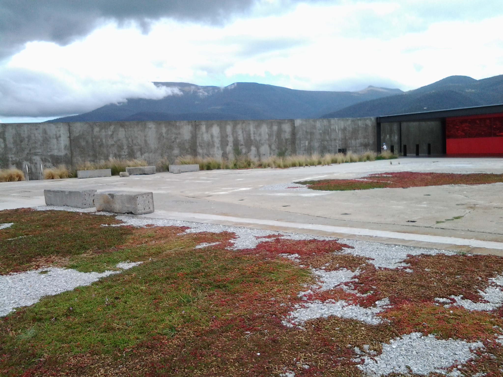
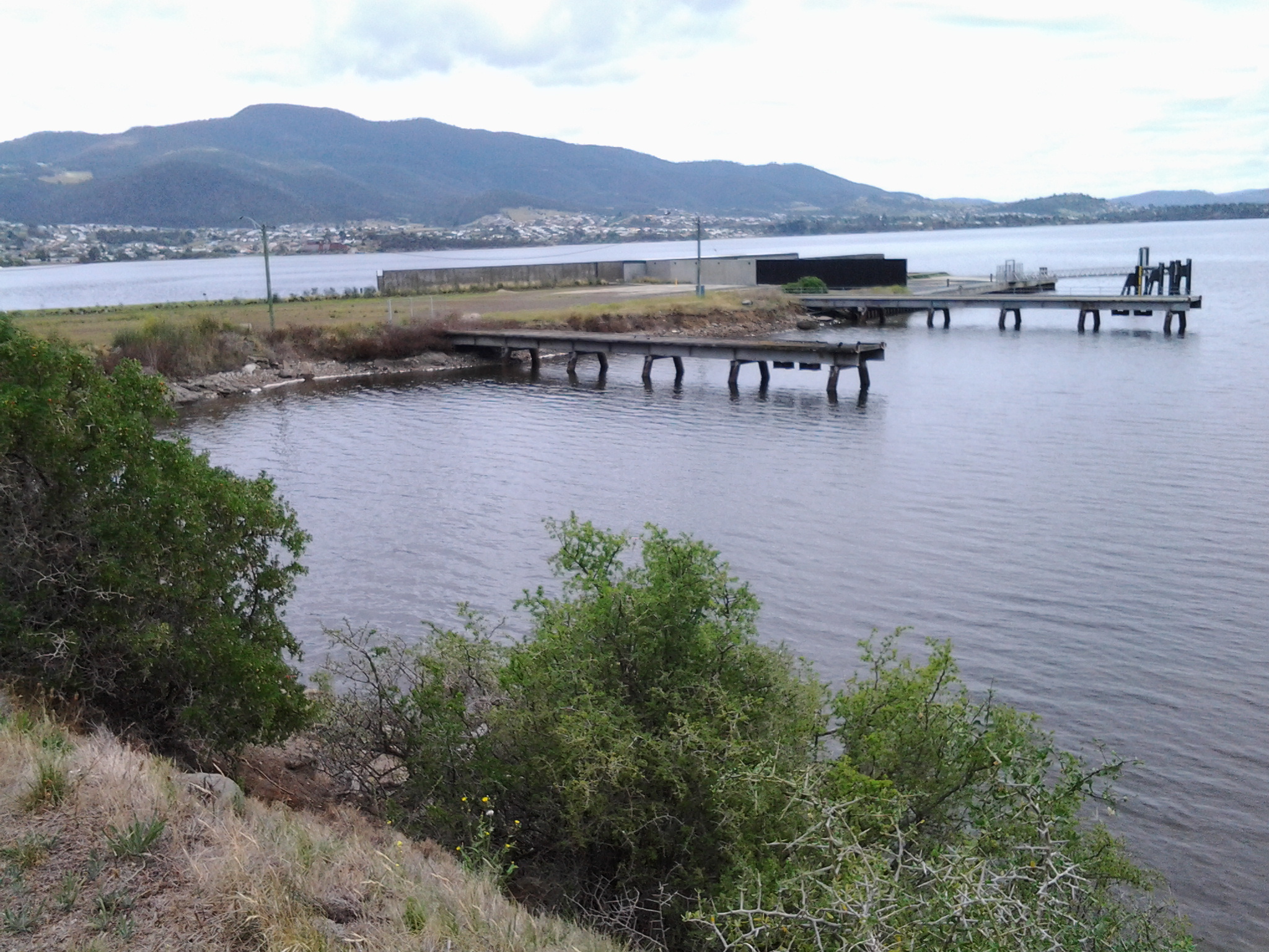
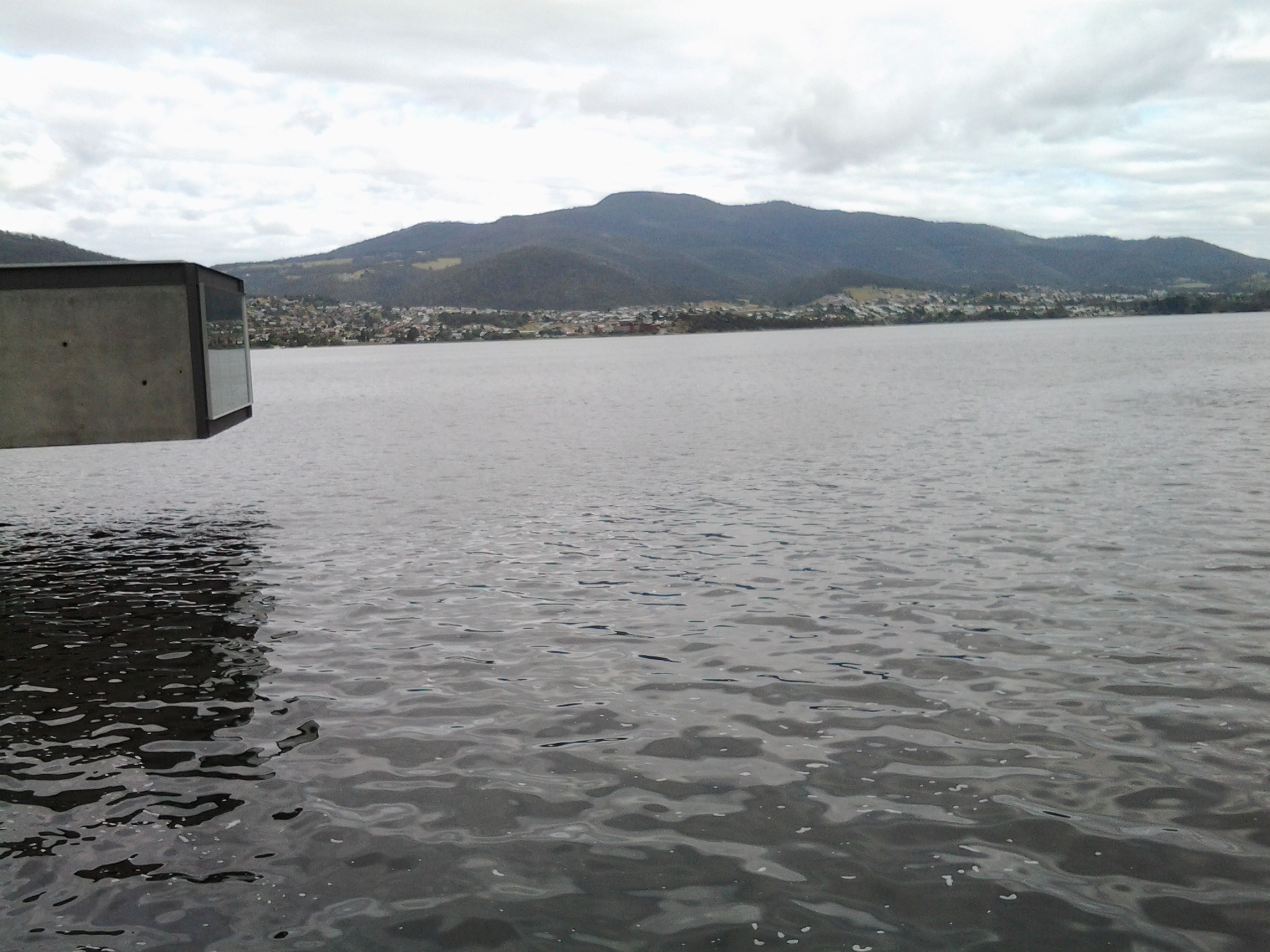
My last walk along the Derwent River finished at MONA a little to the north of Rosetta. My next walk will start by passing Berriedale Bay. I look forward to seeing the old house – albeit with extensions and renovations since John Berrisford was alive. A photograph of this property, now known as the Rosetta Colonial Accommodation, can be seen at http://firstfleetfellowship.org.au/stories/john-hannah-beresford/. This website also provides more detail about the Berrisford family and their history.

Perhaps, through news from England, John Berrisford heard that Rosetta was the ‘Rose of the Nile’ and, in believing the British intrusion into Egypt was glorious, named his house as a show of support.

As a contrast from the historical background, I have located a contemporary profile for Rosetta. The population is 2567, the median household weekly income is $1050, the median age of residents is 45 years, the average household size is 2.4, almost 60% are married or in a de facto relationship, almost 40% are either under 5 years of age or over 64 years of age, weekly rent is $340, and the median house price is $319,455.

40th anniversary of the collapse of the Tasman Bridge over the Derwent River

On the 5th January 1975 late at night, the link between the eastern and western shore of the Derwent River was broken.  It took 2 ½ years to rebuild. In the interim, residents of the eastern shore ferried across to Hobart city for work.  Last night a small gathering of people came together to remember that momentous occasion.  Read more at:

http://www.news.com.au/national/tasmania/tasman-bridge-collapse-remembered/story-fnn32rbc-1227175410862e

These days if a large ship is travelling upstream, traffic lights bring vehicles to a stop before they drive onto the Tasman Bridge. Bridge pedestrians are also alerted to stop and wait until a ship has passed before walking.  However, as I found one day when walking into Hobart city over the Bridge, the alert is not given soon enough for pedestrians and I was already on the Bridge when the cars were stopped. I recall walking to the highest point and looking down and watching the ship pass beneath. Safely.

Then there is remarkable story of the guy whose Monaro teetered over the edge of the broken bridge.  He stills drives the car. You can see pictures and learn more at http://www.news.com.au/national/tasmania/historic-monaro-out-from-under-wraps-for-anniversary-of-tasman-bridge-disaster/story-fnn32rbc-1227174793722

Berriedale on the Derwent River

I experienced the Berriedale Caravan Park, beautiful bays and water birds, the surprising memorial to dogs that were members of the defence forces in various international wars, sewage works and MONA at the end of the last stage of my walk along the Derwent River. But there is more to Berriedale.

1986 was the International Year of Peace and many Peace Gardens were created to celebrate the event. Others have been created since then for bringing communities together. Eve Masterman (1907-2014), a tireless worker for peace, social justice and the environment, was instrumental in the establishment of an International Peace Forest (Peace Park) at Berriedale in 1991. This Forest/Park does not appear on Google maps, is not listed as a park within the jurisdiction of the City of Glenorchy, and there are a number of online enquiries asking for the location. But I remember passing through a Peace Park on my walk – I just can’t remember where. I have scoured my handwritten notes (the precursors to the postings) and photographs and found them wanting. Does any reader know the location of the International Peace Forest (Peace Park) at Berriedale? Shouldn’t a Peace Park be considered significant and worthy of records, signage and directions?

Now, how about some older history?

The Scottish heritage of some residents of Tasmania’s City of Glenorchy may be represented in the name Berriedale. According to http://www.tasmaniatopten.com/lists/ancestries.php, “The third largest migrant group in Tasmania are the Scots. They were also numerous among the early settlers in the colony.” Firstly, it was interesting to learn that in Scotland; Glen Orchy is about 17 km long and follows the River Orchy through the Caledonian Forest. Secondly, there is a small village Berriedale located on the far north eastern coast of Scotland. I have looked at images of the Scottish countryside around Berriedale and they show no resemblance to Tasmania’s Berriedale. The Berriedale Inn was open for business near our Derwent River in 1834 and perhaps the name for the suburb derived from that. Alternatively, perhaps our suburb was named after someone with that surname rather than the town. The City of Clarence has a good website with historical information about its suburbs and so I wish that the City of Glenorchy offered something similar. I can’t believe I am the only one interested to understand the Hobart that I live in.

Around the corner from the mouth of the Derwent River, at Clifton Beach

Yesterday, the temperature at my home was in the high 30 degrees but today the temperature was much more pleasant and only rose to a little over the mid 20s. In the spirit of getting back out into the environment and not worrying about heat exhaustion, this afternoon Je and I headed off to have a look at Clifton Beach. This is not a place easily accessible by public transport unless you have time to take a long walk of many kilometres from a distant bus stop. So this Beach was accessed today by starting with a private car trip.

Neither of us had visited Clifton Beach or the adjacent Clifton Beach Conservation Area nature reserve for many years yet it’s a stunningly beautiful location only 25km from the centre of Hobart. The sky was cloudless, and the onshore breeze kept us comfortably relaxed.

This beachside suburb to the north of the South Arm peninsula and therefore north of the mouth of the Derwent River on the eastern shore, is part of the City of Clarence in which I live, and part of the Greater Hobart Area.

Clifton Beach is a 2.1km long wide sandy beach backed by deep revegetated 20 metre high sandy dunes. The beach is bordered by 54m high Cape Deslacs in the east and 50m high rocky cliffs in the west that run south for 3.5 km rising to 100m high at Cape Contrariety. At the southern end of the beach, a Surf Club is central to the protection of swimmers. However out on the waves, and typically clad in black wet suits, were sun-bleached surfers. Have a look at http://www.surf-forecast.com/breaks/Clifton-Beach which has a changing selection of photographs showcasing this amazing beach – plus you can check out the forecast if you want to go for a surf. One of the photos looks towards the southern end, another looks across Storm Bay to the Tasman Peninsula, and the other is a huge wave the like of which we did not see today.

The photo on http://en.wikipedia.org/wiki/Clifton_Beach,_Tasmania shows the cliffs at the northern end marking Cape Deslacs. When we followed a track out from a carpark, we found ourselves about half way along the long beach so we turned north and walked to the cliffs in the photo, passing a few happy walkers and joggers.  A multitude of empty shells and dying/dead jellyfish lined the high tide mark. Dominican and Silver Gulls hovered. The crumbly sandstone strata in the cliffs were majestic. The rocks at the water edge were covered in baby black mussels. Under the waves crashing onto the rocks were thick unforgiving ribbons of kelp – the sort that could strangle and drown you if you were foolish enough to swim here without care.

Our view across the white capped waters of Storm Bay included a glimpse of Bruny Island to the south west on our right, and the western side of the Tasman Peninsula on our left.

We paddled in the breaking waves of cold water then trailed wet trousers across the hot sand.  We longed to swim, but this is a very dangerous beach for undertows, powerful currents/rips and back surges, and unexpected changing sand bottom levels. People have died here from time to time after being seduced by the jade coloured waters, the clarity and cleanness of the water, and the seeming safety of it all.  But the message ‘to swim between the flags’ indicating you should not swim unless there are life guards present and when they have put up flags indicating the safest stretch to swim between, needs to be adhered to at Clifton Beach.  Today Je and I could see some of the turmoil beneath the waves, and the contrary action of waters moving in and out seemingly simultaneously.  The clear glassiness of the water was so very enticing and, when licking my lips I tasted salt, I had a difficult time resisting going into the water.  But the sand was soft and warm so a great lingering stroll was the wonderful substitute.

History of our Claremont by the Derwent River

It is one thing to muse on who my readers are but now I am focussing on our suburb of Claremont and its history. During my last walk I passed along the Derwent River foreshore of Claremont, discovered the Claremont Plaza, walked around the Claremont Golf course and spent some time in the Cadbury chocolate manufacturing factory.

Wikipedia informs me that “Claremont is a suburb of the City of Glenorchy, part of the greater Hobart area, Tasmania, Australia. It is named after Claremont House (at 12 Lady Clark Avenue, Claremont) which was built in the 1830s by local settler Henry Bilton, who named it after one of the royal homes of England.” When you read http://www.nationaltrust.org.uk/claremont-landscape-garden/, which provides some information about Claremont House in Surrey England, you will learn that it was “Once a Dukes’ retreat and a playground for princesses…” I could find no information about whether any of England’s royal family ever visited our Tasmanian Claremont House. Probably not.

Information about the original owner of the House, Henry Bilton can be read at http://claremonthouse.com.au/history/history-private-ownership-1825-1940/. He first settled in Van Diemen’s Land in 1825 and in the following year he acquired the property on which Claremont House was built. Apparently Bilton’s occupation was a General Merchant and Importer.  The site http://www.watersideaccommodation.com/downloads/HistoricalSummarytheClaremontAustinsFerryArea04May07.pdf declares: “Claremont, or Lady Clark House as it has come to be known as, was built by the early pioneer Henry Bilton. Henry came to Tasmania on medical advice in 1825. He became a merchant and later a gentleman farmer. As the first importer of Leicester sheep to Tasmania he gained significant wealth and turned his attention to politics.”

The following photo of Henry Bilton comes from http://www.glenorchy150.com.au/gallery/.

Henry-Bilton-re Claremont

Detailed information about Tasmania’s 1839 (decades before the Californian settlement) Claremont House can be read at http://claremonthouse.com.au/history/.  Right now, the house is up for sale: see photographs and details at http://www.domain.com.au/property/for-sale/house/tas/claremont/?adid=2009725372.  Perhaps you might want to buy it!  There is no range of prices given, so the sale is ‘by offer’.

Claremont House, in the Greater Hobart Area, is located away from the Derwent River foreshore so I did not go near this during my last walk.

Claremont beside the Derwent River

I have wondered why there has been so much interest from USA readers for my posting about the Claremont Bowling Club.  The Club is an ordinary lawn bowling club the like of which is found in every town and city across Australia.  My blog site statistics do not indicate which part of the USA my readers come from, so more research was required.

The name Claremont derives from the French for clear mountain, and was introduced into England by refugee French Hugenots in the early 18th century.  The concept of clear mountain works here in Hobart because our town of Claremont sits comfortably at the feet of Mount Wellington.

There a city named Claremont in Sullivan County, New Hampshire, USA. It was named after Claremont, also known historically as ‘Clermont’, an 18th-century Palladian mansion of Thomas Pelham-Holles, Earl of Clare less than a mile south of the centre of Esher in Surrey, England.  This New Hampshire city is located between the Ascutney State Park and the Hawks Mountain area to the west and Mount Sunapee to the east.  Presumably offering clear mountains.

In addition, Wikipedia informs me that “Claremont is a college town on the eastern border of Los Angeles County, California, United States. Claremont is known for its many educational institutions, its tree-lined streets, and its historic buildings. In July 2007, it was rated by CNN/Money magazine as the fifth best place to live in the United States. Due to its large number of trees and residents with doctoral degrees, it is sometimes referred to as “The City of Trees and PhDs.”

Our Claremont in the City of Glenorchy within the Greater Hobart Area is very different than the Californian town with the same name.

In America, the Gold Rush of 1849 opened up California so I suspect the name Claremont was probably given by someone remembering their English heritage when the town was created in the 1880s, or by someone who had travelled west from the New Hampshire town of the same name.  I understand that the peaks of Mount Baldy, Mount San Antonio, Timber Mountain and others in the distance overlook the Californian city.

So now I have either or both California readers on the west coast of USA and New Hampshire readers on the east coast of the USA.  Will the real reader/s stand up!

A sparkling night over the Derwent River

Happy New Year to readers. There is something about New Year’s Eve which becomes a great distraction; the focus on midnight. We can never have a foot in both one year and the other like we can when we straddle the borders between states, countries or at Greenwich when you can stand in two time zones at the one moment.  Al we can do is surrender to the ticking and suddenly the next moment is on us.  As it was when 2014 came to an end last night in Australia.

I realise, as I write, that some parts of the world are yet to reach midnight 2014. Australia is one of a very few countries to be able to celebrate entry into 2015 very early on. If you are not there yet, then I can only suggest you enjoy the countdown.

Tasmania and Hobart at the very south of the island in particular, have long days at this time of year. There is still light in the sky at 9.30pm (I know I know I know that many countries in the northern hemisphere, which stretch closer to the poles, have even longer days mid-year. I did experience the White Nights of St Petersburg in northern Russia in 2013.)

Hobart City Council stages two separate firework celebrations on New Year’s Eve; one at 9.30pm when the sky is not perfectly light and the other at midnight when the night sky is black.

Last night, nature created an early spectacle. At 9pm brilliant pink-red tinged clouds marbled across the intense blue sky over Mount Wellington, with the sun well set behind. The strident pinks rippled like the marks left when waves recede over sandy beaches. The unruffled surface of the Derwent River, singed with red, made my heart sing. Sensational.  As the mountain side darkened, spot lights from the headlight of cars driving up and down the mountain, and the street and house lights across the hillside suburbs on the western shore, began to sparkle.

Slowly, the under clouds developed grey tones and the air began to soften beautifully.  Magnificent. Gradually the clouds softened to transparent greys and whites patterning the sky over the mountain. A splendid ¾ moon gleamed nearby.

The first fireworks were well timed and blew their tops at 9.30pm as the last pink glow on grey clouds disappeared. 10 minutes of coloured light and light shapes flying through the air and the delayed booming bangs (reminding me light travels faster than sound) seemed to pass quickly. The grand finale was a crescendo of cascading lights falling from on high like a tree shaped waterfall. The light rained down. And the smoke drifted away down the Derwent River towards the mouth.

For a picture of one stage of the fireworks (although it seems mean by comparison with other stages that I saw) go to http://www.themercury.com.au/news/tasmania/thousands-of-tasmanians-party-in-the-new-year/story-fnj4f7k1-1227171557865.

Last year’s New Year’s Eve for me was dramatically different. I vividly recall 2013’s New Year’s Eve when I had a marvellous night along with thousands of others on the waterfront at Kowloon in Hong Kong.

20131228_183334

Then, after midnight, I had to walk many kilometres (along with everyone else like a swarm of insects packed across the six lane main road) back to my hotel because the train stations were so full that people couldn’t even walk into them, leave alone catch the trains.

Now we all have 12 months to consider where we might be and what we might do on New Year’s Eve at the end of this new year.  Best wishes.

2014 in review

The WordPress.com stats helper monkeys prepared a 2014 annual report for this blog.

In 2014 I made 153 postings. Not bad for the first year!

The section Useful Additional Information (https://walkingthederwent.com/about/) attracted a large numbers of visits over time.

The busiest day of the year was August 18th with 137 views. The most popular post that day was Floating Away (https://walkingthederwent.com/2014/08/16/floating-away/).

The next most visited post was The inspiration for my walk along the Derwent River (https://walkingthederwent.com/about/the-inspiration-for-my-walk-along-the-derwent-river/).

The page Frequently Asked Questions (https://walkingthederwent.com/about/faqs-frequently-asked-questions/) received the most comments.

Visitors to this blog came from 23 countries. The majority of readers were Australian, but hundreds of people from USA and UK found the site and many have become followers.  If you are not a follower currently and would like to be, on the right hand side of my Home Page below the glorious photograph of the Derwent River, you can add in your email address. Then, every time I write a new post, you will receive an automatic notice.

The top referring sites were Facebook, Linkedin, theparisreview.org, WordPress.com Reader, and buenosearch.com

Thank you to everyone who has sent me information and ideas over the past few months. I look forward to continuing the walk along the Derwent River over the coming months, and hope to receive more comments along the way.

Best wishes for a Happy New Year and 2015.

The end of the Rolex Sydney to Hobart 2014 yacht race

This afternoon I needed to walk to Bellerive’s Village for basic shopping. Once there (20 minute walk) it seemed a waste to be so close to the Derwent River and not to walk around Kangaroo Bay to Bellerive Bluff and see if any more yachts were sailing up to the finish line.

Today has been exceptionally blustery and Mount Wellington keeps disappearing from view as rain squalls and clouds move across in waves.

2014-12-30 13.37.39  2014-12-30 13.39.41

It was clear to me that a major storm was passing and could reasonably be expected to travel across the Derwent River and saturate me. Nevertheless, knowing its only water and that my umbrella could be expected to be blown inside out with the wind, I walked on.  And it was worth it.

The wild water of the River showed peaks and troughs and there in the blurry distance, trying to keep close to protection of the land on the western shore close to Wrest Point Hotel Casino, two of the last yachts were fighting it out to see who would cross the line first.

2014-12-30 13.40.23  2014-12-30 13.41.19

At home I have checked and learned that the two were Maluka of Kermandie and Charlie’s Dream.  As I stood on that windswept shore, I could see it was a battle between the two but I was surprised to discover their finish time had only 3 seconds between them. Can you imagine?  After hundreds of miles/kilometres in some very testing weather, three seconds separated these two at the line. Inspirational!  The message for me was that one must never give up; I must keep pushing onwards.

Only two yachts are yet to cross the line. One is charging up the Derwent as I type and has almost reached the finish line (Southern Myth) and the other seems almost to be stalled in Great Oyster Bay slightly south of Freycinet peninsula on Tasmania’s east coast.  I can only imagine that yacht is taking it slow and easy to cope with the weather and arrive in one piece.  Many yachts have withdrawn from the race with expensive rigging, sail, rudder, lost masts, and other boat damage. Perhaps the last yacht, Landfall, is considering making landfall earlier than the Hobart docks.

If you don’t mind thickly padded appearances and wind-blown hair, then today is a wonderful day to be wearing your winter woollies and outside walking and filling the lungs with fresh (and it is fresh) air.