Author Archives: Tasmanian traveller

Unknown's avatar

About Tasmanian traveller

Through travel, I have experienced the eccentricities of people and their environments around the world. At the same time, I love where I live. So, for people who cannot travel to discover the wonders of my home town, this blog is an attempt to introduce its exoticness. My goal was to walk along both sides of Hobart's Derwent River from the mouth to New Norfolk, and to walk on one or alternating sides of the River between New Norfolk and the source of the River at the southern end of Lake St Clair. The walk was undertaken in stages around my other commitments of my life. Almost all stages of the walk connected with Tasmanian public transport - my intentions was to inspire people, who do not have access to a vehicle, to feel they can replicate the walks. This blog reports on each stage in the hope it will encourage people to either follow in my steps or to create their own walking project where-ever they live. Please note: The blog background and headliner image of 'Hobart from Mt Wellington' is the work of Tourism Tasmania and Garry Moore. It is a free image with unrestricted copyright and available from http://www.tassietrade.com.au/visual_library

Cruise ships berthing at Hobart

On a recent afternoon I could see the Marina cruise ship berthed at MAC2/3 (the name of one of Hobart piers). This ship arrived early in the morning from Geelong in southern Victoria on mainland Australia.

20150217_145044 20150217_145014

For more information about the ship go to http://www.cruiseaway.com.au/ship/marina?gclid=Cj0KEQiA6ounBRCq0LKBjKGgysEBEiQAZmpvAxP6_HcT_3xcTvA4bqjanWX6gz9rMqc1ga4ZVAGuCFoaAiMt8P8HAQ

Later, I watched the Marina depart at 6pm.  The early evening sun sparkled across the Derwent River and brightened the ship so it made a spectacle as it gathered steam. The Marina’s next destination is Milford Sound on the south island of New Zealand.

20150217_181250

This cruise ship is one of many which dock in Hobart and release thousands of tourists across the city and further beyond, for day trips. If you want to know which ships  are due in port in the coming days then read http://www.tasports.com.au/port_services/arrivalshobart.html

The overall cruise ship schedule into Tasmanian ports can be read at http://www.tasports.com.au/port_services/arrivalscruise.html. This list is staggering because it shows the bookings up until 2020!

From my Bellerive home I can see these large ‘towns’ on water as they arrive and depart.  I can almost feel the thrill that I expect new arrivals might experience as they reach this new destination ready to discover a new world.  One day I hope one of my blog followers will be on such a cruise ship and will ask me to take them on a walk somewhere along the Derwent River.

T42 on the Derwent River, Tasmania

When a friend suggested we meet for a drink and named the place, I said ‘yes’ immediately. The Tavern 42 Degrees South Elizabeth St Pier Hobart ,usually known as T42, is one of my favourite haunts on the Hobart wharves edging the Derwent River. Late afternoon and into the evening a couple of days ago I enjoyed sitting outside in the fresh air while sipping a sparkling wine or two and, all the while, watching yachts and other boats and ships come and go, as tourists and locals wandered around.  Exceptionally easy and pleasant.

20150217_144651

What does 42 Degrees South mean?  If you read http://en.wikipedia.org/wiki/42nd_parallel_south you can see a list of the countries through which passes the 42nd latitude south of the equator (most of it passes across oceans). Historically Tasmania has made a noise about this parallel in order to make it easier for people elsewhere in the world to locate our island.  It is celebrated in an outstanding quarterly periodical aptly titled TASMANIA 40oSOUTH. More information including subscription details can be read at http://www.fortysouth.com.au.  The stories and the photographs contained in each issue are nothing short of inspiring and glorious.

The tavern T42 on the edge of Elizabeth Pier, one of Hobart’s easily accessible wharves, also acknowledges Tasmania’s location in its name.  To reach the restaurant at the end of Elizabeth Street in the centre of Hobart, firstly you will see another well patronised restaurant, Fish Frenzy, then you walk either to the left or right and find T42 which has entrances both sides of the Pier.

I always prefer to walk on the left side where the Lady Nelson is often moored.

20150217_144739 20150217_145310

Further along, another sailing ship, the SV Rhona H was sitting pretty.

20150217_145208 20150217_145220

Relaxing comfortably at outdoor tables I did not realise my view was so visually obstructed as the following photograph seems to indicate. Instead I found the changing view enthralling.

20150217_154406

The skies were clouded but the atmosphere was not gloomy. The day was mildly humid and not cold.  The water was often mirror smooth and picture perfect.

20150217_145202

This was the place to be!  And I will return.

Straight Up (from the Derwent River?)

When I find a good thing/place/event, I try to discern a connection with the Derwent River so that I can write a blog post.  A lunchtime restaurant named ‘Straight Up’, where I enjoyed a wonderful vegetarian meal yesterday with a friend, is one such place.  It is located in Liverpool St, Hobart between Harrington and Barrack St and is not in sight of the Derwent River.  But my friend An gave me the clue:  she said the restaurant is located ‘straight up’ Elizabeth St from the wharf on the Derwent River, and then straight up Liverpool.  After the meal, I walked ‘straight’ down Liverpool and turned right into Harrington St, then straight down and through St David’s historic Park and the Parliamentary Gardens to the water’s edge of the Derwent River.

Why is this restaurant ‘Straight Up’ worth mentioning?

Partly because the service provided by the waiters and other staff is fast, to the point, helpful, informative, and obliging. Mostly because the good clean vegetarian food has been transformed into sophisticated tasty dishes. The food is presented attractively but simply so that it doesn’t appear as if Masterchef contestants have been in the kitchen. There is plenty of food on the plate without seeming like it’s a dump from a smorgasbord. And perhaps because my friend and I always seem to be given a seat in the window (yes we have been before and we are working our way through the menu) away from other patrons. The ambience is one of space and privacy so that we relax over our meal.

You can visit ‘Straight Up’ for breakfast or lunch. Reservations are not required, although you may need to wait until someone leaves before you get a table.

More information and photos are available on http://www.designful.com.au/uncategorized/straight-up/,

https://www.facebook.com/straightupcoffeeandfood, and

http://twoclownstripping.com/2014/10/16/straight-up-vegetarian-hobart-tasmania/

I found a ratings page at http://www.eatability.com.au/hobart/cafes/straight-up-coffee-food/ indicating other people think like I do.  Although I might have awarded 10/10 ratings.

Clarence Jazz Festival (mostly bordering the Derwent River) in southern Tasmania

jazz-1-052314-akp

I don’t know when the Clarence Jazz Festival first started, but it was up and running when I returned to Tasmania to live, in 2000. Ever since, it has grown in scale and excitement.

From one Sunday to the next in the third week of each February, performances are scheduled in historic buildings such as the Rosny Barn, next to the water on various bays such as Kangaroo Bay and Lindisfarne Bay (that empty into the Derwent River, and which blog followers may remember from earlier stages of my walk), at beach reserves and on village greens across the local government area of Clarence City Council.

Most are free events and they culminate in the big day next Sunday.  On that day the Bellerive Boardwalk, with its stunning backdrop of sun-drenched water covered in yachts, hosts a grand finale when many different Tasmanian and national jazz musicians perform on an open stage in front of changing throngs of people sitting and moving around the Boardwalk.  Food, wine and coffee stalls surround the venue, and the Clarence City Council offers free sunscreen for those who come unprotected.  At the Jazz at the Boardwalk is where you can expect me to be next Sunday!  Bring on those sexy saxophones!

TheresaKnott-Saxophone

Typically people walk from home often carrying picnics and refreshments to drink.  Families sit outdoors and soak in the atmosphere while kids clamber over public playground equipment when nearby.  Where I live, sometimes the sounds of music float across the air and I am able to enjoy concerts when I cannot get away from home.

The festival Facebook site shows images of past musos and performances and some of the guests for this year (https://www.facebook.com/clarencejazzfestival).

If you are a Hobart local and have forgotten about the Festival go to http://www.ccc.tas.gov.au/page.aspx?u=933&c=386, read the program, and be prepared to see some musicians strut their stuff.

free_3807275 Trumpet in the lights

Claremont House, Tasmania

At the time of my walk along the Derwent River through the suburb of Claremont, I explained Claremont House was not close enough for me to deviate from the tracks near the shores of the River – so I did not visit.  However, yesterday I was delighted to be able to explore the historic property of Claremont House, tour its premises and enjoy High Tea with friends over three wonderful hours.  What a great experience!  A big thanks to one of my blog followers Me for organising this.

In my earlier posting History of our Claremont by the Derwent River, I referred to Claremont House (alternatively known as Lady Clark House), gave the street address, and explained it was built in the early 19th century by Henry Bilton who lived there for some time. If you revisit that posting you can click on many websites giving photographs and further information.

I now know that the property once extended to the edge of the Derwent River and included the entire peninsula on which the Cadbury chocolate factory and the Claremont Golf Course sit currently.  On this basis, and because Claremont House’s current view looks across the River, it seemed appropriate to include the story of my visit into this blog.

After turning off the main road through Claremont into Lady Clark Avenue, ornate wrought iron gates signalled arrival at the current boundary of the Claremont House property.

2015-02-15 17.21.11

I learnt these were not original gate structures and that the originals, excepting one, were removed and dumped into the Derwent River at some stage.  The one remaining original post, looking rather worse for wear, is currently located on Claremont’s main road around the corner from Lady Clark Avenue.

2015-02-15 17.24.03

We drove up a winding driveway then immediately enjoyed the moist summer air as we and other visitors strolled past a couple of horses towards the house.

2015-02-15 13.52.52

Looking along the bottom balcony it was clear the wisteria was doing its best to take over.  Tranquillity reigned.

2015-02-15 13.55.12

The 33 room house, with its ‘widows walk’ topping the structure, has suffered from a chequered history of public and private ownership, but the current owner Joel Van Sanden is passionate about restoring the property in alignment with a specialist conservation plan, and the changes are proceeding.  It has been a painstaking and slow process enlisting the involvement of the few remaining tradesmen who specialise in heritage work of the type needed for this House.

I was especially impressed by the ceiling ‘rose’ in the original ballroom for the fine quality of the tree fern fronds. It was the highlight of my visit.

2015-02-15 13.57.09

The full size pool table weighing over 4 tonnes, is a magnificent piece of furniture. I noted its feet rested on stone foundations.

2015-02-15 13.56.52

The generous and freshly made High Tea (scones jam and cream, mini quiches, egg sandwiches, chicken sandwiches, and much more) was served in a beautifully restored ballroom.  The photo below shows only a small portion of the space.

2015-02-15 13.59.27

We listened to the owner explain the history of ownership and the effects on the shape and state of the building. In small groups he led us on a series of interesting staircases up to the ‘widows walk’ from where we had a 360 degree view covering the Derwent River, Mount Wellington and much much more.

2015-02-15 14.25.17 2015-02-15 14.29.30

2015-02-15 14.33.39 2015-02-15 14.34.06 2015-02-15 14.27.46 2015-02-15 14.28.38

Later we strolled through the grounds and learnt about past extensions and outer buildings, extensive gardens and glass houses.

2015-02-15 15.35.28 2015-02-15 15.38.32

Finally I ambled down the hill to see the House from another angle, and found myself at a fountain below a walkway sided with apple trees.

2015-02-15 17.18.30

If I had been told in advance that the tour and tea visit would take 3 hours, I might have baulked. I am glad I did not know this because my time at Claremont House offered me a rich and varied experience.  The owner was energetic, well informed, and experienced with the process of turning Claremont House from what it had become, a sow’s ear, into a silk purse. The restoration process continues and I will look forward to revisiting from time to time, to see new developments. The price is $30 full adult and $25 concession.  This has to be the best value around.

Huon Quays has been purchased

On Stage 10 when I walked to the Hobart Regatta Grounds after passing under the Tasman Bridge on Stage, I stopped to have a look at the cluster of old white painted buildings, which had started their lives as a navy depot.

20150109_160439

These buildings, now known as Huon Quays, have been sold to Tasports.  Read more about it at: http://www.themercury.com.au/lifestyle/tasports-snaps-up-prime-huon-quays-waterfront-site/story-fnj64ocs-1227202042732 I wait with interest to see how this heritage site will be developed.  I hope the development will be sympathetic to its history and the surrounding environment.

Last weekend Hobart focused on the Derwent River

Last week I posted information in advance of the Royal Hobart Regatta and the Australian Wooden Boat Festival both of which celebrated Hobart’s water-based history on and in relation to the Derwent River.

On Friday afternoon, the Parade of Sails offered a flotilla of yachts and sailing ships which manoeuvred to the starting point of John Garrow Light and then headed upriver to Sullivans Cove at the wharf in Hobart. Followers may recall that, on an earlier stage of my walk along the Derwent River, I passed the John Garrow navigation light in Lower Sandy Bay when I reached Blinking Billy Point.

Last Friday I thought that a raised vantage point would give me a great view of the Parade of Sails, so I joined with neighbours from their balcony to watch.  I saw hundreds of marine craft sailing up the river on a heavenly blue sky day. The wind pushed them quickly upriver to Sandy Bay and then they seemed to stall. The sails congregated en masse close to shore between Wrest Point Hotel Casino and the suburb of Battery Point.

20150206_123340

This was so far away and unless you enlarge my photos you will believe there were few vessels on the Derwent River that day.  When not much forward movement happened, I realised that the finishing time for the Parade of Sails was 1.30pm but it wasn’t yet 1pm. Therefore, I presumed the ships decided to wait so the grand entrance/arrival into the Hobart docks could be on time.

On Monday I watched a swooping display from 4 synchronised planes, the Roulettes. They flew in complex formations around the city, across Mount Wellington and along the Derwent River, spewing steam behind to mark their athletic twists and turns.

It was a packed weekend and the media provided spectacular views of all the activities.  Have a look and consider being around when these events are held next time.

The Royal Hobart Regatta site is at: http://www.royalhobartregatta.com/

The Australian Wooden Boat Festival site is at: http://www.australianwoodenboatfestival.com.au/home

Colourful media coverage of this year’s events include:

Nudging into Blackmans Bay on Stage 12 of my walk along the Derwent River

At 3pm I turned left onto Roslyn Ave having walked up from Boronia Beach. Within 10 minutes I could see Blackmans Bay Beach.

20150202_150926

Five minutes later I turned left at Blowhole Road in search of a Blowhole. The road was narrow with no pathway and limited edges on which to walk.  Wattle trees were blooming and I passed an apple orchard laden with red globes. Flowering gums are spectacular at the moment.

20150202_150406

I reached the Blowhole sign, which indicated the entrance to a small park on a hill at the northern end of Blackmans Bay Beach, at 3.22 pm.

20150202_152145 20150202_152210

The weather wasn’t gusty and so the water ebbed and flowed rhythmically but undramatically beneath a rock bridge. There was no blowing of water through the gap.

20150202_152241

I continued down hill.

20150202_152611 20150202_153012

I reached beach level at 3.34pm and proceeded to walk on the path beside Ocean Esplanade. Inset into the pavement were handmade tiles and mosaics presumably made by community effort.  These were similar to those impressed into the footpath in parts of Kingston.

20150202_153808 20150202_153822

A little way along the Esplanade public toilets and a kid’s playground provided useful amenities.

I decided to stop, look, listen and smell. Looking over the Derwent River to the South Arm peninsula and around about me watching people enjoying the beach and surrounds, listening to the seagulls calling, and smelling the salty air kept me seated for 10 minutes. I had walked two thirds of the way along Blackmans Bay Beach and it seemed a reasonable place to stop for Stage 12.  So I headed for  a bus stop.  I found one by turning into Hazell St and then into Wells Parade.  As I arrived at the stop, a Metro bus came over the hill in the distance.  Wonderful timing.  It was 4pm. The experiences of the day had been rich. I enjoyed the bus trip back into Hobart via the main Kingston shopping centre, and then the southern outlet highway. The view when we came to the top of the final hill is majestic (please ignore the dirty bus windows in the photos below).

20150202_161915 20150202_162002 20150202_162024

Some of Hobart and the eastern shore suburbs are laid out below with the blue Derwent River flowing between. Always stunning. After half an hour on the bus I arrived in Hobart city, then headed off for my Bellerive bus and was home before 5pm.  All together a brilliant day.  Stage 12 was complete!  Because of personal commitments and what I have seen in the weather forecast, I do not expect to walk Stage 13 until next week.

An extra historical morsel regarding Browns River which runs out into the Derwent River

Browns River separates Tyndall Beach (below the Alum Cliffs) from Kingston Beach. On the Kingston side, a plaque remembers Robert Brown.

According to http://www.rampantscotland.com/placenames/placename_hobart.htm  the township of “Browns River was named after the noted Scottish botanist Robert Brown who explored the area a week after Hobart was founded. “  Apparently Hobart (Sullivans Cove) was established on 21 February 1804 (I shall remember the date because it is my birthday – well not the 1804 bit) and therefore before the end of February this ‘township’ of Browns River was in its infancy. A week – ye gods!  How quickly these pioneering settlers got around.  Nothing could happen so fast these days.  But, is the timing true or simply a legend? I don’t know.

The name was changed to Kingston in 1851 by the Governor of Van Diemens Land, Sir William Thomas Denison.  The website http://tasmaniaforeveryone.com/tasmanias-names-the-suburbs-of-hobart suggests “The name Kingston was advocated by the then Police Magistrate, Mr Lucas. Although his exact reason for deciding on the name of Kingston is unknown, there are many theories. His parents, Thomas and Anne Lucas, the district’s first settlers, lived at Norfolk Island before coming to Van Diemen’s Land and the capital of Norfolk Island was Kingston. Another possible reason is that Thomas was born in Surrey, England in a village close to New Kingston. It had been settled in 1808 by Thomas Lucas and his family, who were evacuated from Norfolk Island. He named his property ‘Kingston’, after the settlement on Norfolk Island. “

More information about Boronia Beach and its surrounds

From http://www.greaterhobarttrails.com.au/track/boronia-beach-track I understand that “Descending through the bushland past the cypress pines, to the clear blue secluded waters of Boronia Beach feels like you’ve stumbled into the Mediterranean. The historic private residence behind the beach is ‘Boronia’, which was once the Boronia Hotel (circa 1900). It was popular in the days when the old ferry docked at the jetty at Kingston Beach bringing day-trippers from Hobart. Folk would visit the hotel for a cup of tea and wander through its terraced rhododendron gardens down to Boronia Beach. The sheltered waters are great for snorkelling, with sea dragons commonly seen.

Obviously I will need to return and have a closer look. On my recent walk I never saw the old house ‘Boronia’ (probably looking down to be careful placing my feet and not fall over) and I would have loved to look around the water for the sea dragons if I had known they might be swimming there. Oh well. Another time. This too will go onto my list of places I need to return to and discover more.

These findings have prompted one more memory. Last year in north eastern Tasmania authors and book readers travelled from all over Australia to attend the inaugural Golden Words Literary Festival.  I stayed in the township of Beauty Point and one afternoon wandered along the road until I found Seahorse World (http://www.seahorse-australia.com.au/). I never stepped inside the building but I learned that in Tasmania we have native seahorses and seadragons swimming in our oceans.  I was born in Tasmania.  How could I not have known that we had something so special out there in the briny seas. My experience at Beauty Point led me to draft a short story about the S bends of a very special cormorant and a feisty seahorse; the former trying to swallow the latter. I watched the flexible throat of a Pied Cormorant repeatedly trying to swallow a seahorse, however the curves of the marine animal never seemed to fit the curves of the Cormorant’s throat. Up and down and up and down the gullet the seahorse went. I watched this remarkable performance when I stood on the end of the Seahorse World jetty and was amazed that the seahorse survived to live another day.  Staff on the premises were amazed and had never witnessed such a feat. It was obviously a case of my being in the right place at the right time.  So … if I can return to Boronia Beach, I wonder what I might see.

On through Kingston still heading southwards past Boronia Beach

I finished my lunch on the south side of Browns River, crossed the pedestrian bridge over Browns River at 12.17 pm then proceeded along Osborne Esplanade (parallel and next to the Derwent River) towards the Kingston shops.  Over Christmas I holidayed in Kingston and my 3 posts titled I am on holiday watching over the Derwent River, Getting out into the air at Kingston Tasmania and Kingston Beach, Tasmania offer more information about this leg of my walk along the Derwent River.

I had the pleasure of meeting with Em for cups of tea and a long happy chat and saying hello to people I knew as they walked past the outdoor café Beachfront 32.  Immensely pleasant.

At 1.52 pm I restarted my walk southwards amidst foreshore joggers, walkers and seagulls – the sun was shining again and my world was warm.

By 1.59 pm I reached the Kingston Beach Sailing Club and could look back northwards across the sweep of water and the arc of Kingston’s white sandy beach.

20150202_135849 20150202_135818 20150202_135809 20150202_135813

The last photo looks north to the headland at the end of Tyndall Beach which was spread at the bottom of the southern end of the Alum Cliffs.

A minute later I reached the Boronia Beach Walking Track and turned left.

20150202_135909

A gentle shady path meandered along above the water and I could hear happy voices on the rocks below.   The views through the trees were spectacular.

20150202_140623

Up above me on my right were large houses with massive picture windows surrounded by high mesh fences. Then the landscape opened out and I could still look northwards to the Alum Cliffs where I had walked during the morning.

20150202_141612

At 2.18 pm I reached a gate marking the entrance to the track down to Boronia Beach, a beach that I had previously not known existed.

20150202_141714 20150202_141816 20150202_141954 20150202_142008

By 2.24 pm I was walking on the beach.

20150202_142513 20150202_142154

I remembered the chitons which had featured on a public art work at Taroona Beach and wondered whether they could be found on this beach (refer back to my posting Public art works along the Derwent River –Taroona’s Chiton for more information). I checked the rocks but found none.  I  concluded the chitons must collect together only on the Taroona Beach rocks.

The rock formations at the southern end of the beach were a surprise.  The soft sandstone has been weathered and small caves were formed into the cliff.

20150202_142346 20150202_142436

Seeing these caves cast my mind back to Kalambaka in north western Greece. Last year I visited this town and marvelled at the stunning beauties of the Meteora (refer http://en.wikipedia.org/wiki/Meteora for more information) Below is one of my photos showing the caves in some of the cliffs which hermits used to climb up and live in (and which Roger Moore as James Bond climbed over dramatically in the movie “For Your Eyes Only”).

20140607_190315 20140608_094209

Boronia Beach’s caves are smaller and different in many ways from those of the Meteora.  However they surprised me in this tucked away gem of a beach.

For those who loved the photo of mussels growing on Boronia Beach rocks which I provided in an earlier posting about the Stage 12 walk, here is another.

20150202_142536

Five or so minutes later I began the trek uphill out of Boronia Beach under old pine trees.

20150202_143006 20150202_143214

I was horrified to see thousands of escaped ‘forget me not’ plants, some flowering as they carpeted lots of the area near the beach and up the hill. I pulled out a few dozen and their roots came out easily but a concerted effort of a few days’ work to remove these before they spread any further is essential if the wild bush is to stay as pure as it can.

A gate half way up the hill let me out onto a continuing walking track at 2.36pm.  Not long after I decided to sit on the steep steps and smell, look and listen to the environment. Very peaceful.

By 2.45pm  I was walking again and a couple of minutes later I reached a gate to exit the entire walking track area.

20150202_144535

The entry was signed but, while the exit was easy, it was entirely unclear whether to turn left or right.  At the end of the dirt road in both directions I could see gates closed over the road.  Murphy’s Law has it that I will often make the wrong choice and it was no different at that point. I chose to walk down to the gate at the bottom of the road but found it entered into private property. Back up the road, lined one side with large girthed pine trees, I walked to the other gate and found no obstacle to walk around it. At 2.54 pm, I was continuing along the road watching a family of magpies fossicking in an open paddock, and later marvelling at an old crab apple and a pear tree both of which were laden with fruit.

At 3 pm I arrived at the junction with Kingston and Blackmans Bay’s main linking road, Roslyn Avenue.  The address for the dirt road on which I had been walking is Roslyn Ave 82-88, and it is directly across from Jindabyne St over the roundabout on Roslyn Ave.  One corner of the intersection is occupied by the Catholic Church of Christ the Priest and the Aloysius Primary School.

Tawas

One follower asked what was tawas, which I mentioned in the posting: Alum – what is it?

The powder of some alums is used as a ‘natural’ deodorant, and in some countries is named as Tawas. Wikipedia explains “Alum’s antiperspirant and antibacterial properties contribute to its traditional use as an underarm deodorant. It has been used for this purpose in Europe, Mexico, Thailand (where it is called sarn-som), throughout Asia and in the Philippines (where it is called tawas).

In Hobart and other places in Australia, potassium alum is sold commercially as a “deodorant crystal”. This information prompted me to check my deodorant which is marketed as Body Crystal comprised of natural mineral salts. I was surprised to read its main constituent is Potassium Alum. I have been using this deodorant for years and years and years as an alternative to the usual aluminium based deodorants which I understand are more toxic to the body over time.  Besides it has always worked effectively whatever the climate or the situation.

Thanks for the question because it forced me to learn more.

By the way, a new reader today was from the Phillipines. I wonder whether he or she was searching on the word Tawas and came up with the connection to my blog.

Down from the Alum Cliffs onto Tyndall Beach on the edge of the Derwent River

Discovering the Alum Cliffs had been a goal and now this part of the Stage 12 walk (on the cliffs) along the edge of the Derwent River was coming to an end. At 11.42 am I was walking above Tyndall Beach and a minute later reached the sign indicating a steep pathway leading down to the beach.

20150202_114250 20150202_114603

By 11.49am I was walking on the softly squishing expressive white sand. The day was now overcast, but it was refreshing to be at sea/river level again and feel the onshore breeze.  I noticed a track continued at the cliff bottom along a grassy area but chose not to take that route when I saw a sign indicating snakes might be around.

20150202_114838

I have never seen this sign before in Australia.

20150202_114944 20150202_115006 20150202_115435 20150202_115423

I walked along the sand until I reached Browns River, then turned inland along the river until I arrived at the Christopher Johnson Memorial Park with its public toilet, picnic tables and kids play area near the cross bridge.

At midday I stopped for a lunch break on this reserve and watched contented dogs and owners roaming.  A very brave Mr Blue Wren grabbed at insects in the grass around my feet and talked away to me (or someone – never saw Mrs Wren) incessantly. Parts of his wings were iridescent blue in the light of the greying day. I was afraid to move and frighten him away.  Wonderful.

The ebb and flow of the Derwent River against the Alum Cliffs

I made a 25 second video of the seemingly gentle movement on the surface of the Derwent River as it moved backwards and forwards to and from the Alum Cliffs, as seen through dry forest. It was rather hypnotic and I can now see the video would have been more powerful if longer.

To see South of Hinsby Beach with waves on the Derwent River Tasmania go to : https://www.youtube.com/watch?v=MdnLETfiRWA

Onto the ‘proper’ Alum Cliffs track near Taroona Tasmania

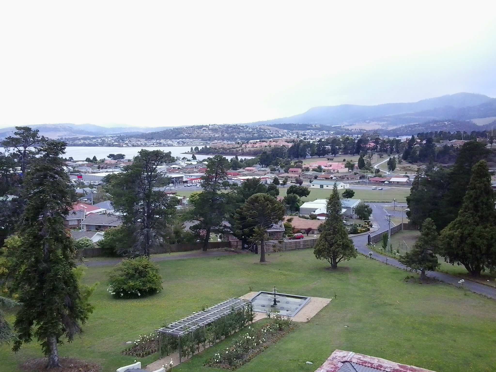
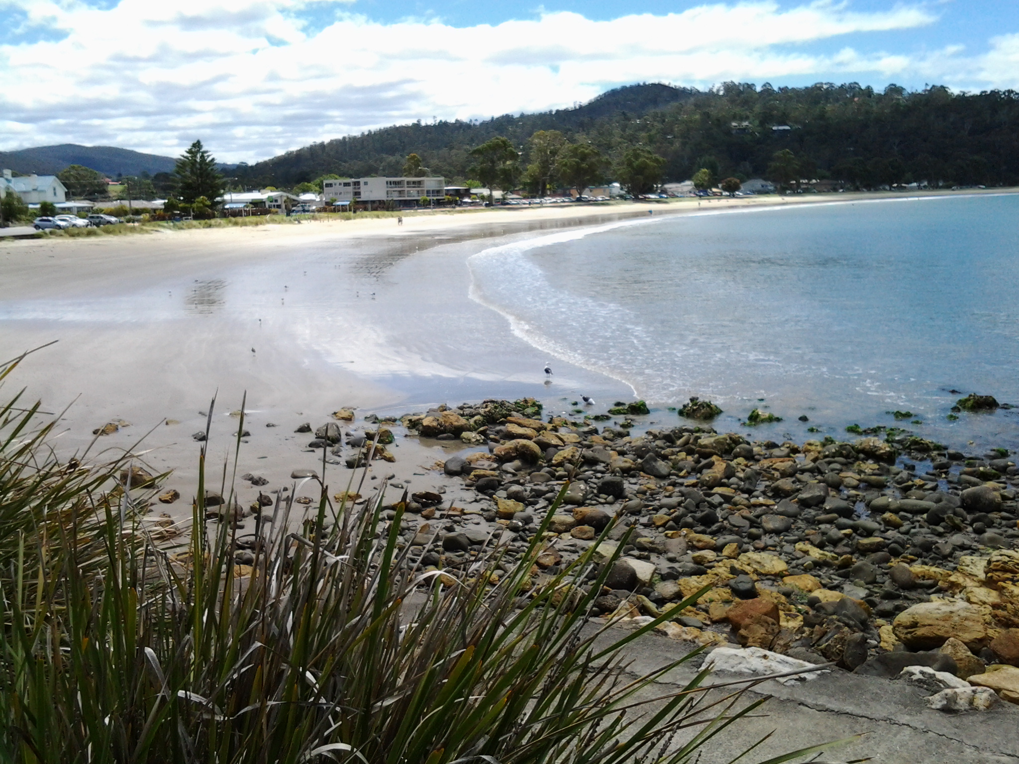
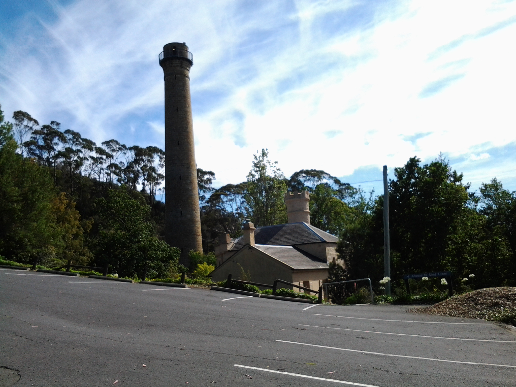
After walking across the Shot Tower carpark I had one last look back to where I had been. The sky was amazing.

20150202_100551

In the trees then and often further again along the track, Kookaburra birds laughed at me many times. Ha Ha Ha Ha!  Ha Ha Ha! Ha Ha Ha Ha Ha.  Their feathers camouflaged perfectly with the shadows from leaves and the colours of tree trunks and branches.  They were impossible to photograph. Ha Ha Ha Ha!  Ha Ha Ha!

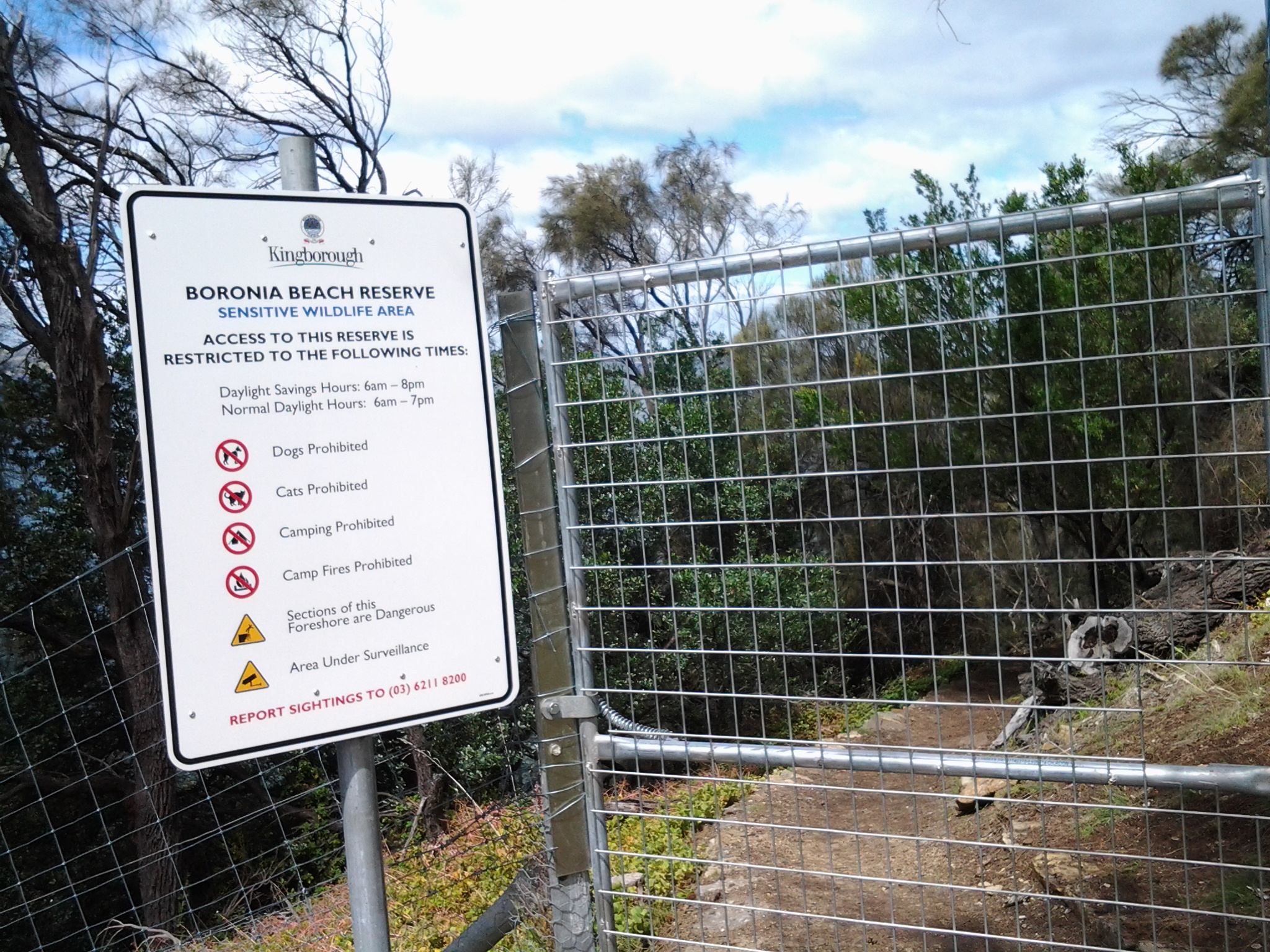
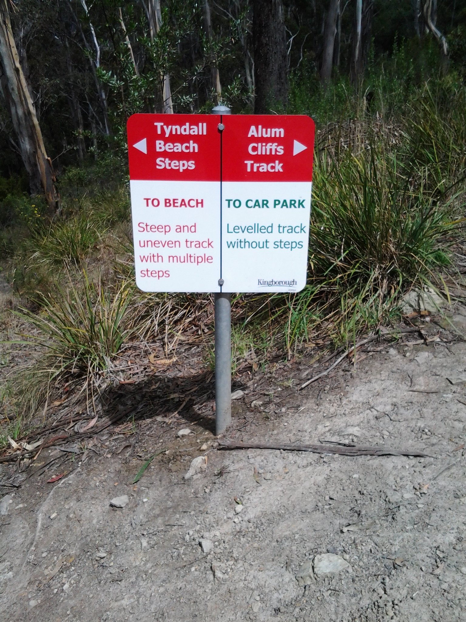
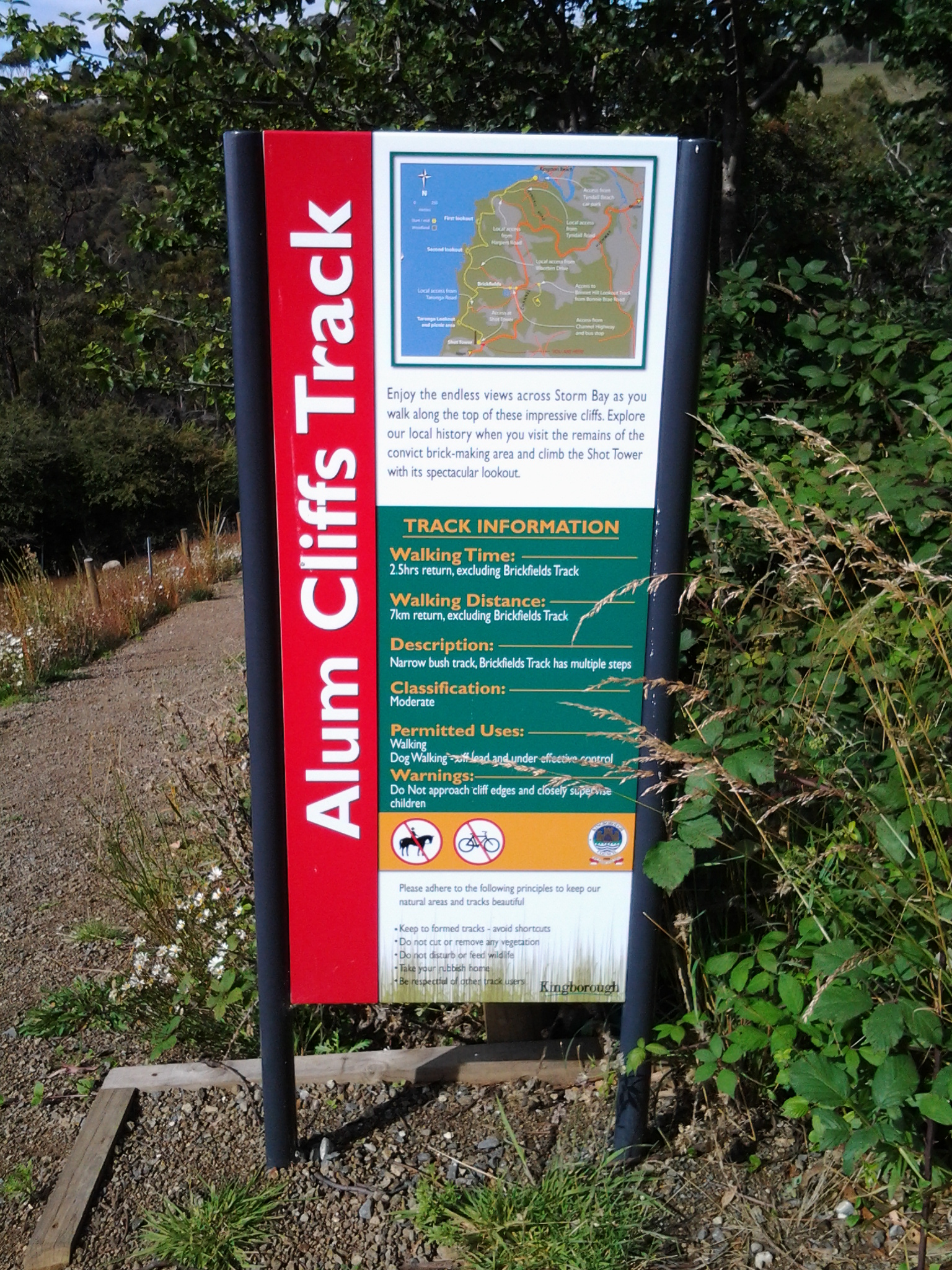
A sign seen at 10.08am indicated the start of the Alum Cliffs track.

20150202_100632

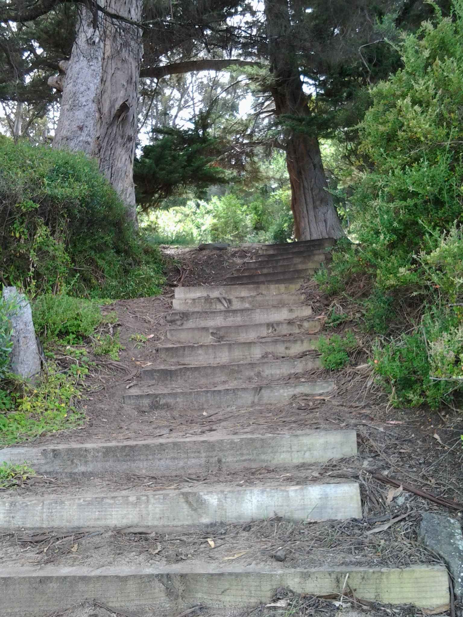
Then I began the careful descent on a steep 100 metres or so length of a four wheel drive wide smooth gravel track. Partly eroded. Basic stairs were irregularly constructed on one side of this incline.  Bush either side.  A small wallaby surprised me bouncing through the undergrowth.

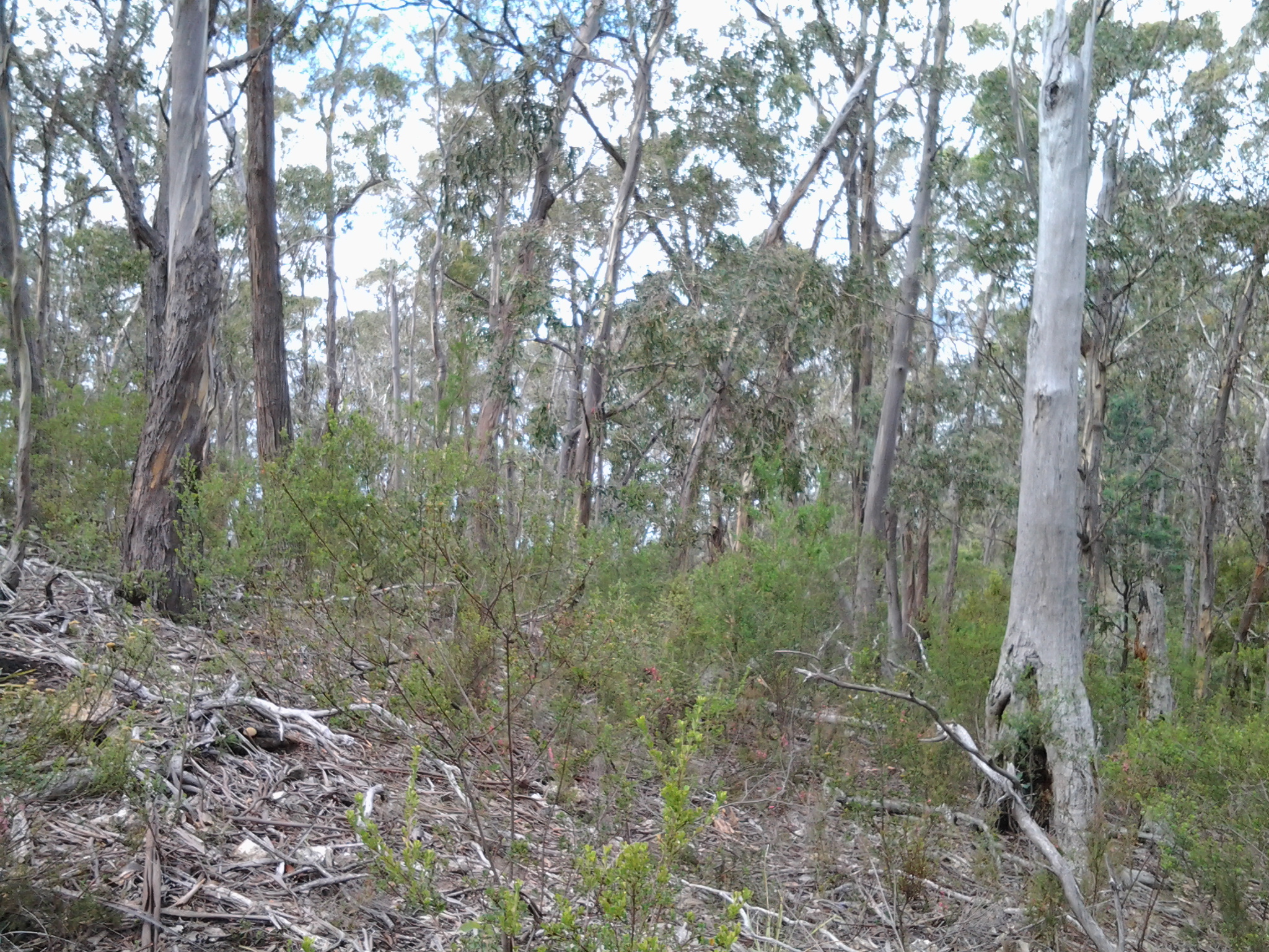
At 10.15 am I reached the creek crossing below. Peaceful.  Looking up, an even longer climb on the other side was rather dispiriting. On the trek uphill I stopped and sat for a while to take in the view of dense gum tree foliage. There were smooth gum trunks as far as the eye could see.  No wind. Trickling creek below. Peaceful.   As I walked higher, the Shot Tower came into view bit by bit over the trees.

20150202_102950

It was 10.33am when I reached a picnic table and lookout at the top of the Alum Cliffs.

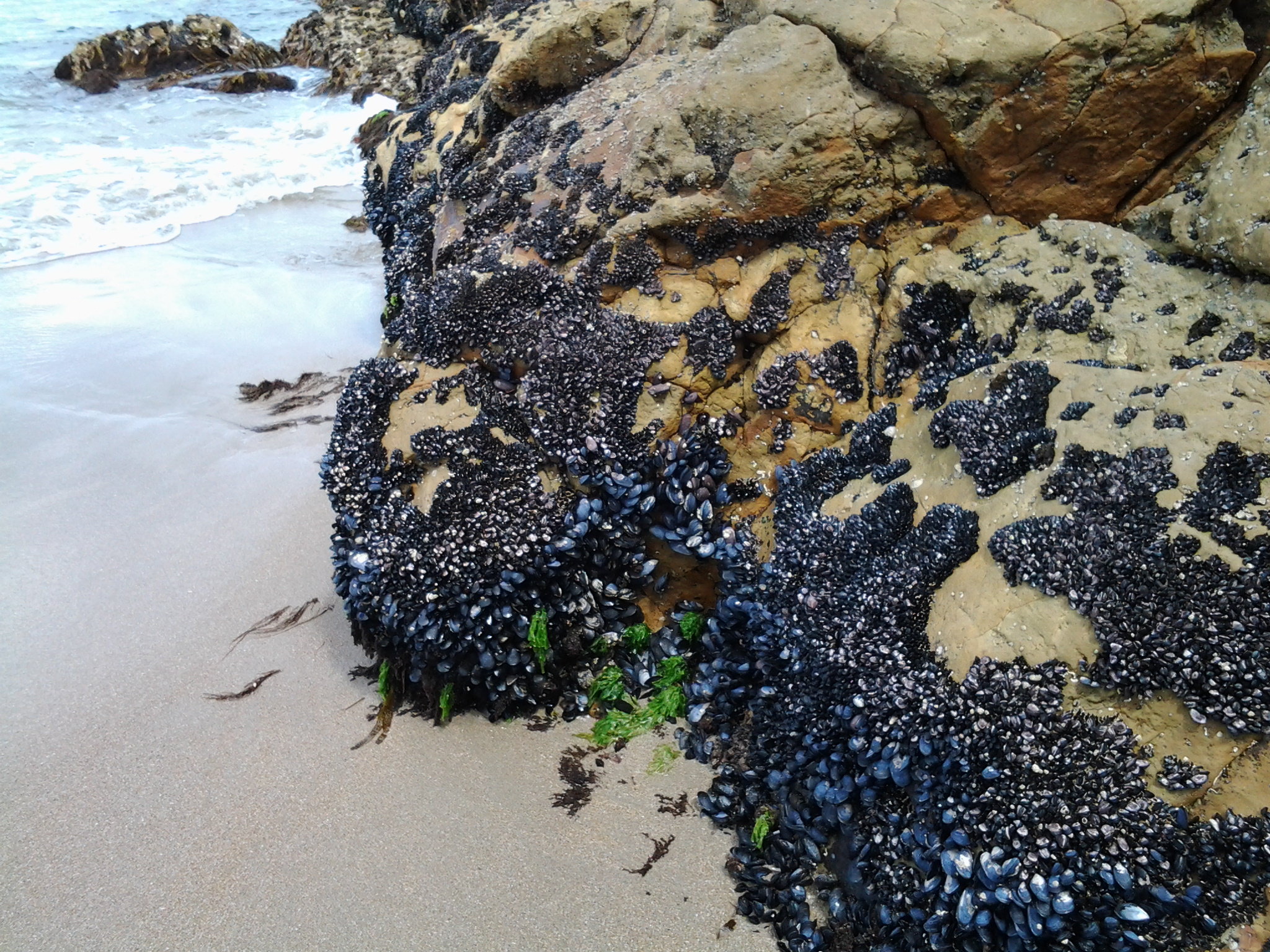
Passing white crowned toadstools with sharp white gills when open, I walked along a shady path which was quiet except for the occasional birdsong, rustling water in the creek below, or the soft voices of other walkers. I learnt from one of the walkers that the Alum Cliffs track used to follow the edge and in order to cross creek gullies, ropes were installed up and down the cliff to steady yourself during the climbs.  Part of those walks included rock hopping along the shoreline as well.

At 10.45am I reached the turn-off to Taronga Road – I did not want to exit the Cliff walk so I continued on. At 10.53am I reached the junction with the Brickfields Track – another time I will return to this area and walk that track to look at the remains of any social history along the way.

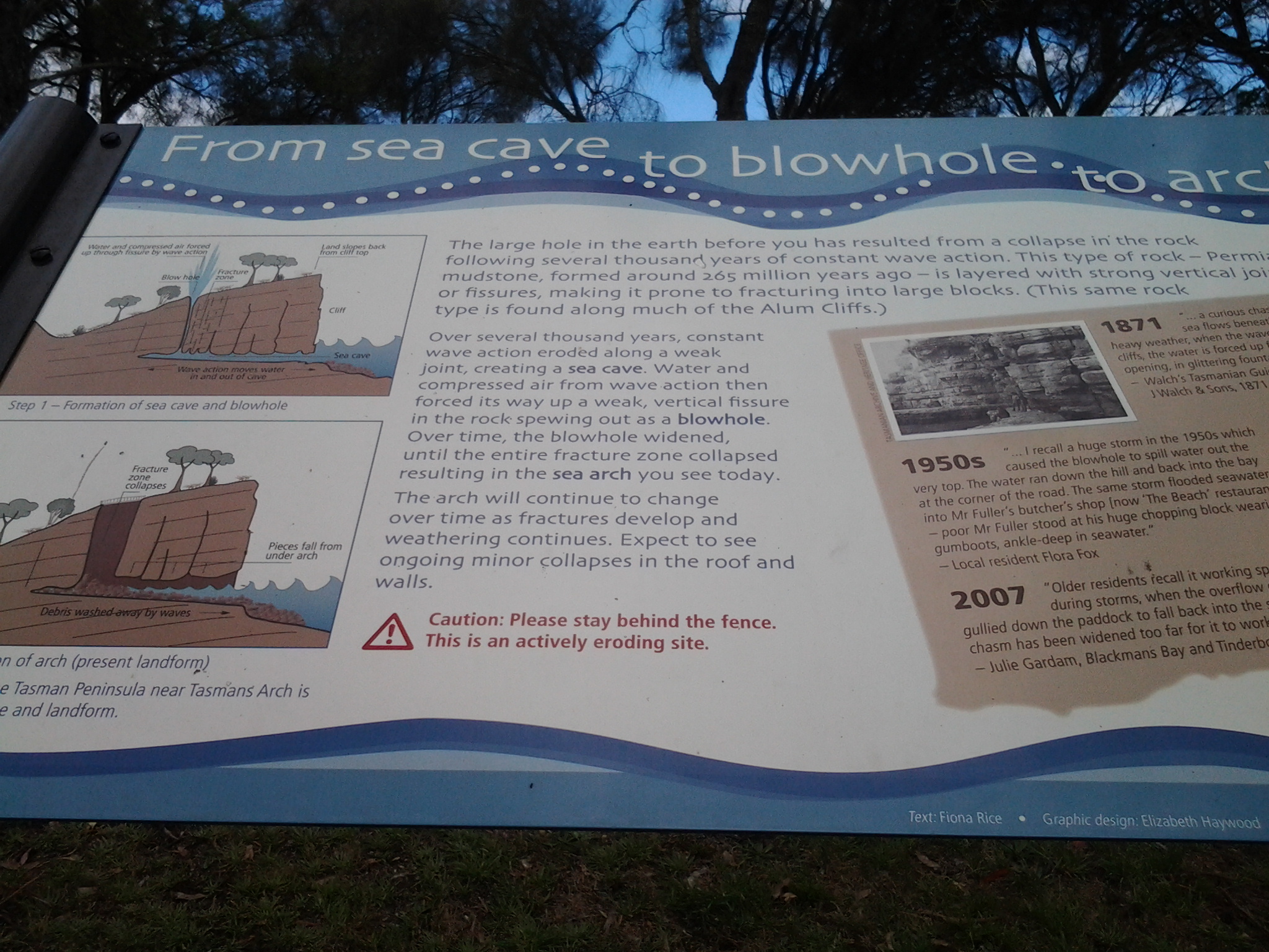
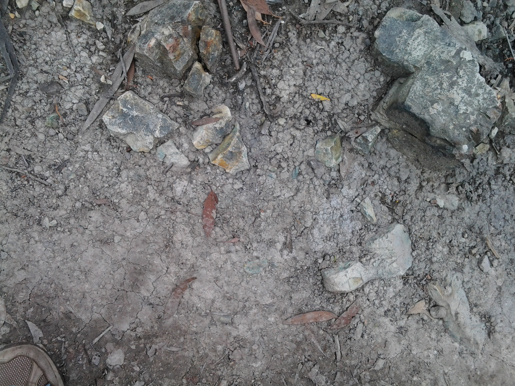
A few minutes afterwards, I felt I was identifying exposed alum rock.  I decided it was the rock which had partly oxidised into a greenish colour in places. Whether or not it is the real deal I cannot say.

20150202_105708

Despite tree roots and rocks intruding on this track, the well-trodden dirt with a slight leaf covering made for very easy walking.  Off to the side of the track walking would not have been quick and easy.

20150202_104740 20150202_113018

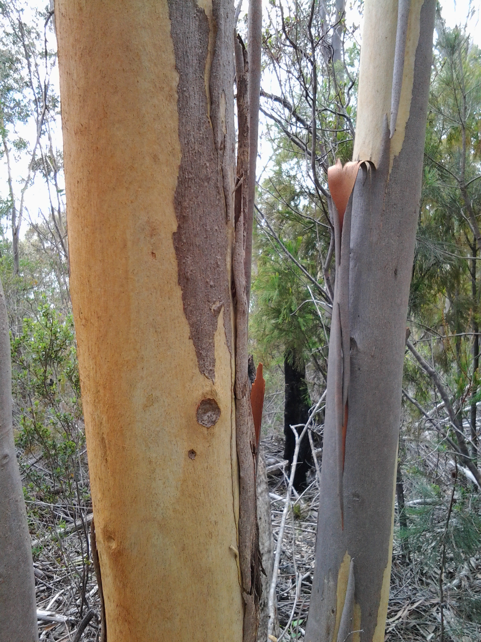
I loved the colours on gum tree trunks as bark peeled away naturally.

20150202_105347

I loved seeing the signs of insects which once burrowed their way under the tree bark.

20150202_112428

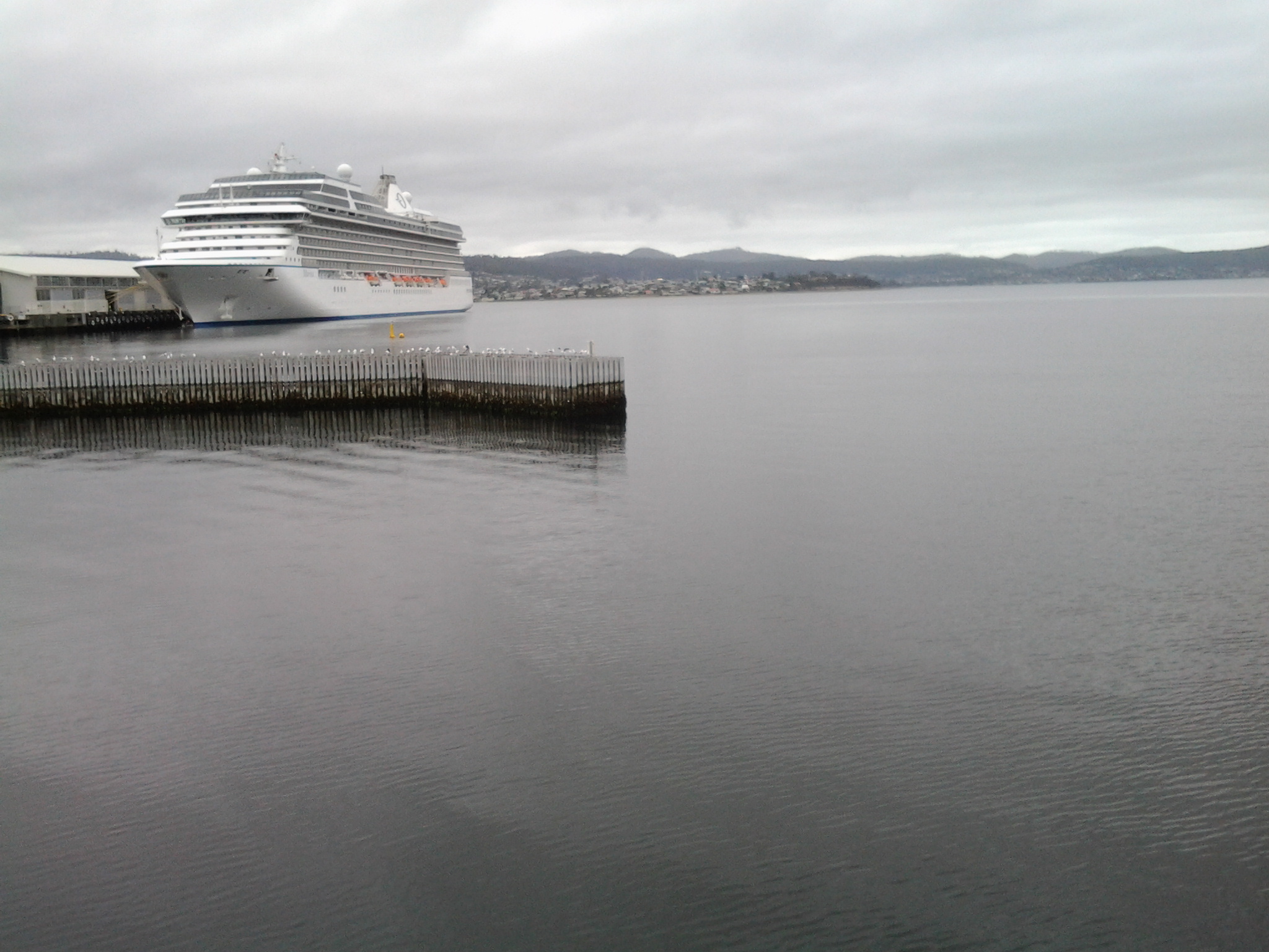
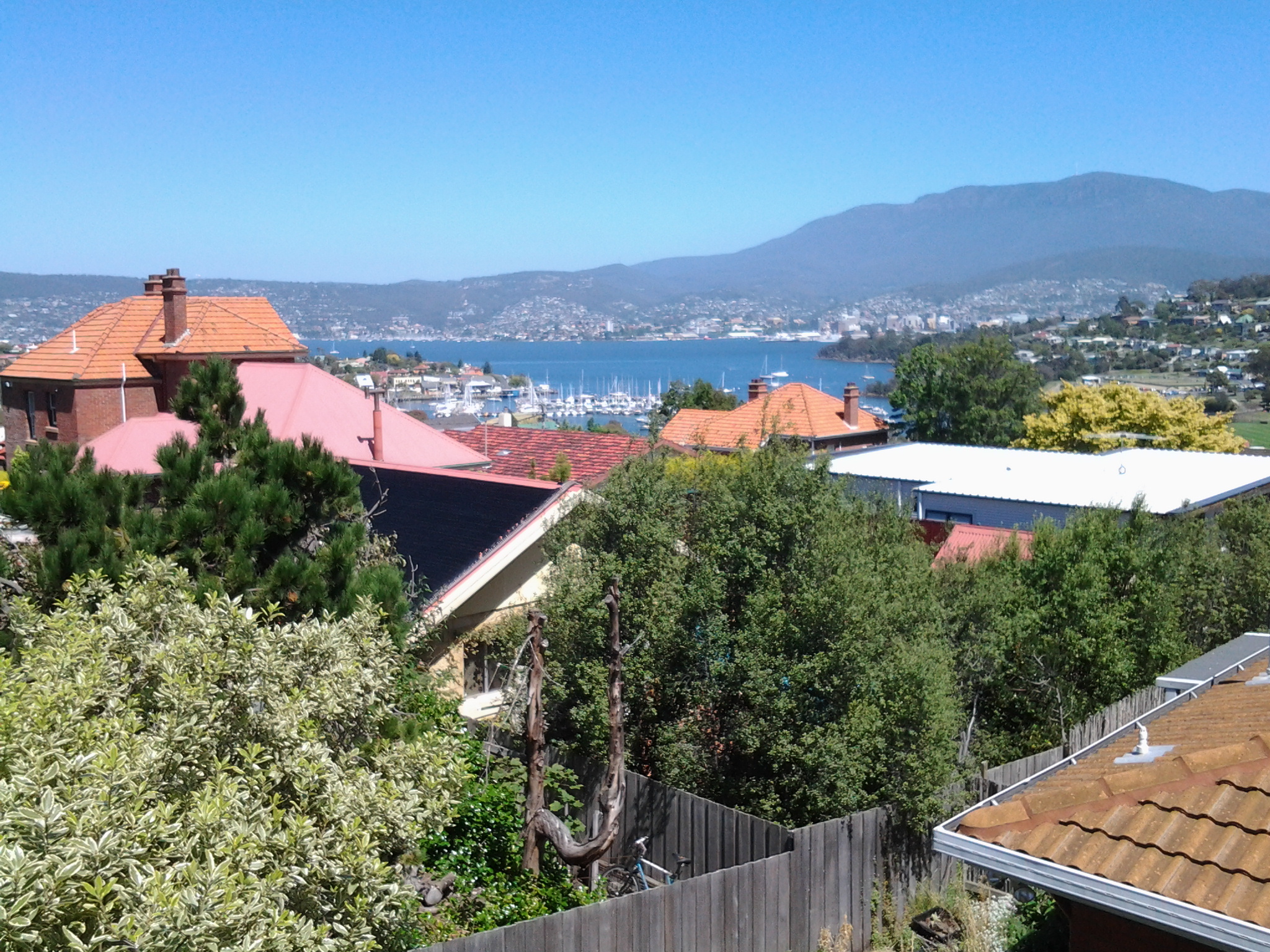
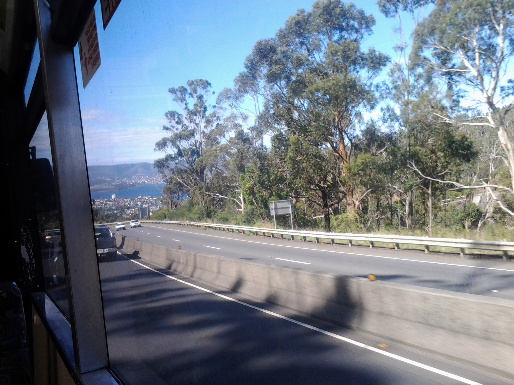
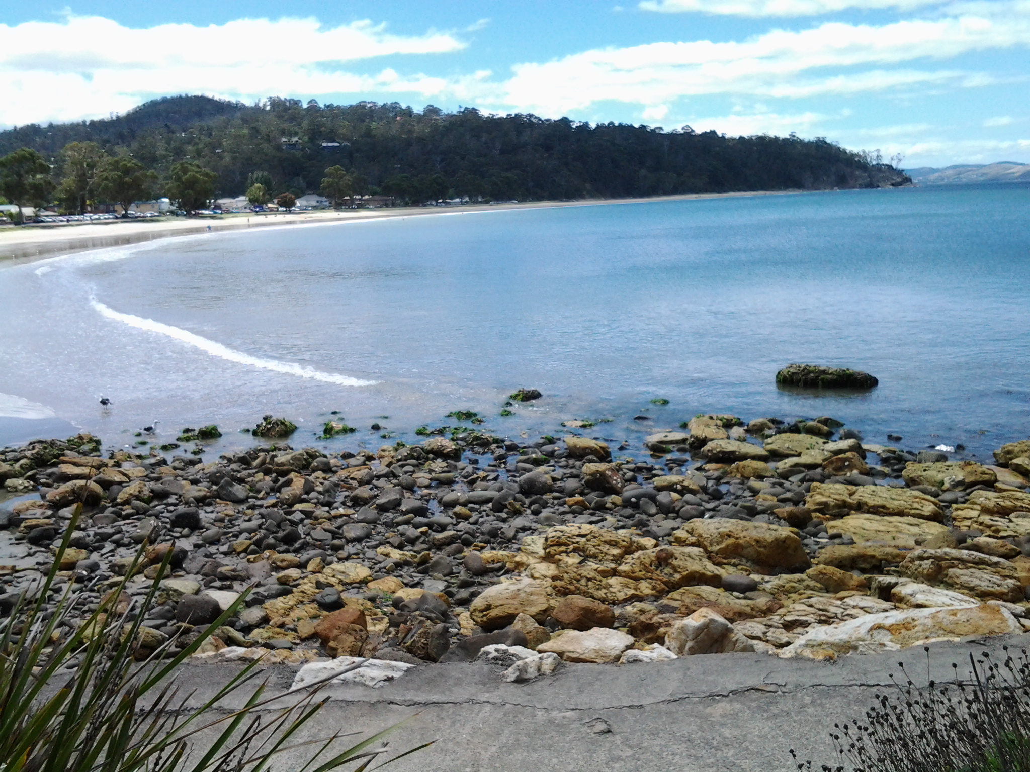
At 11.07am I reached a seat with a viewing platform from where I watched an oil tanker motoring up the Derwent, having passed Gellibrand Point on the eastern shore.

20150202_110637

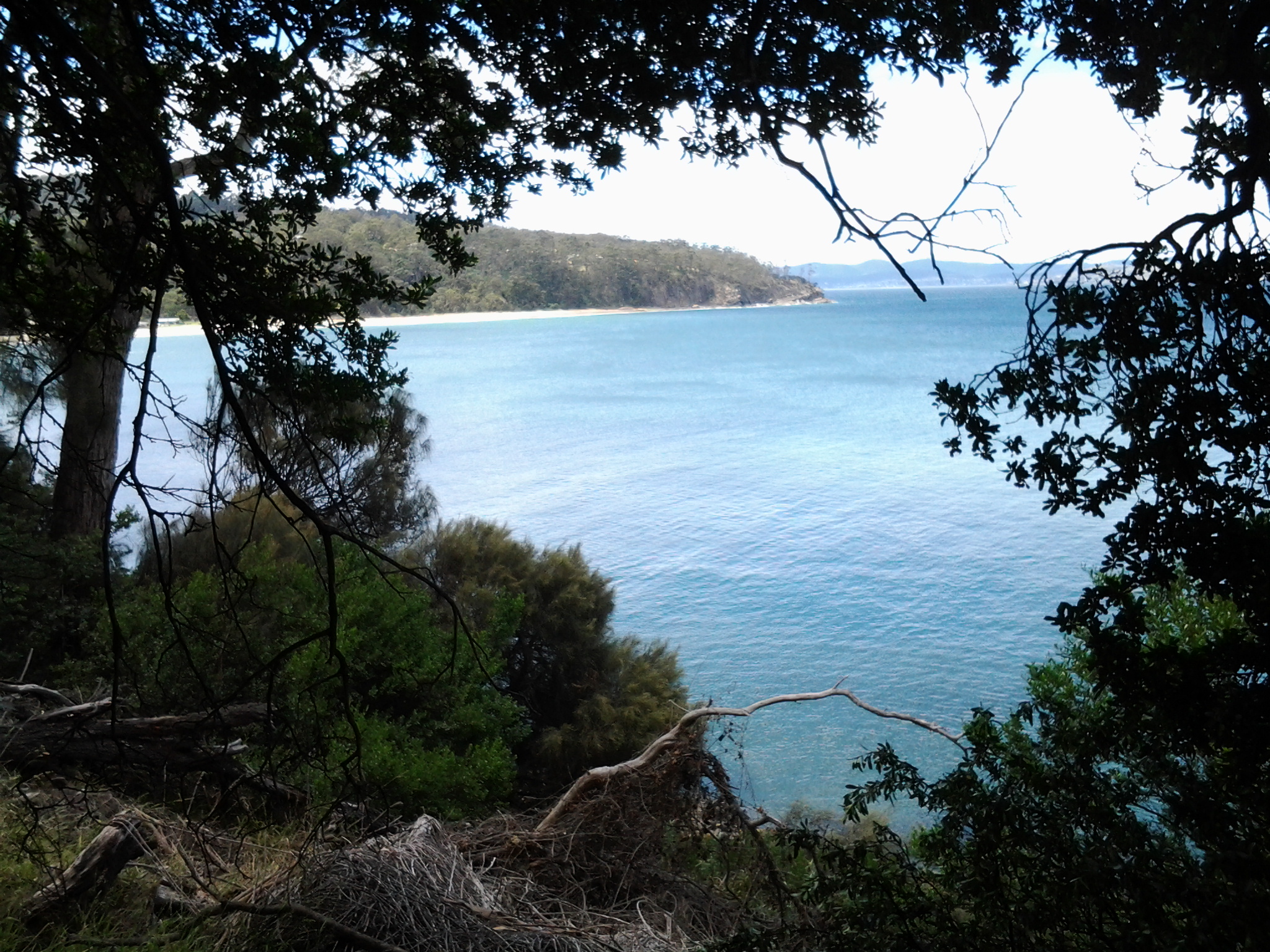
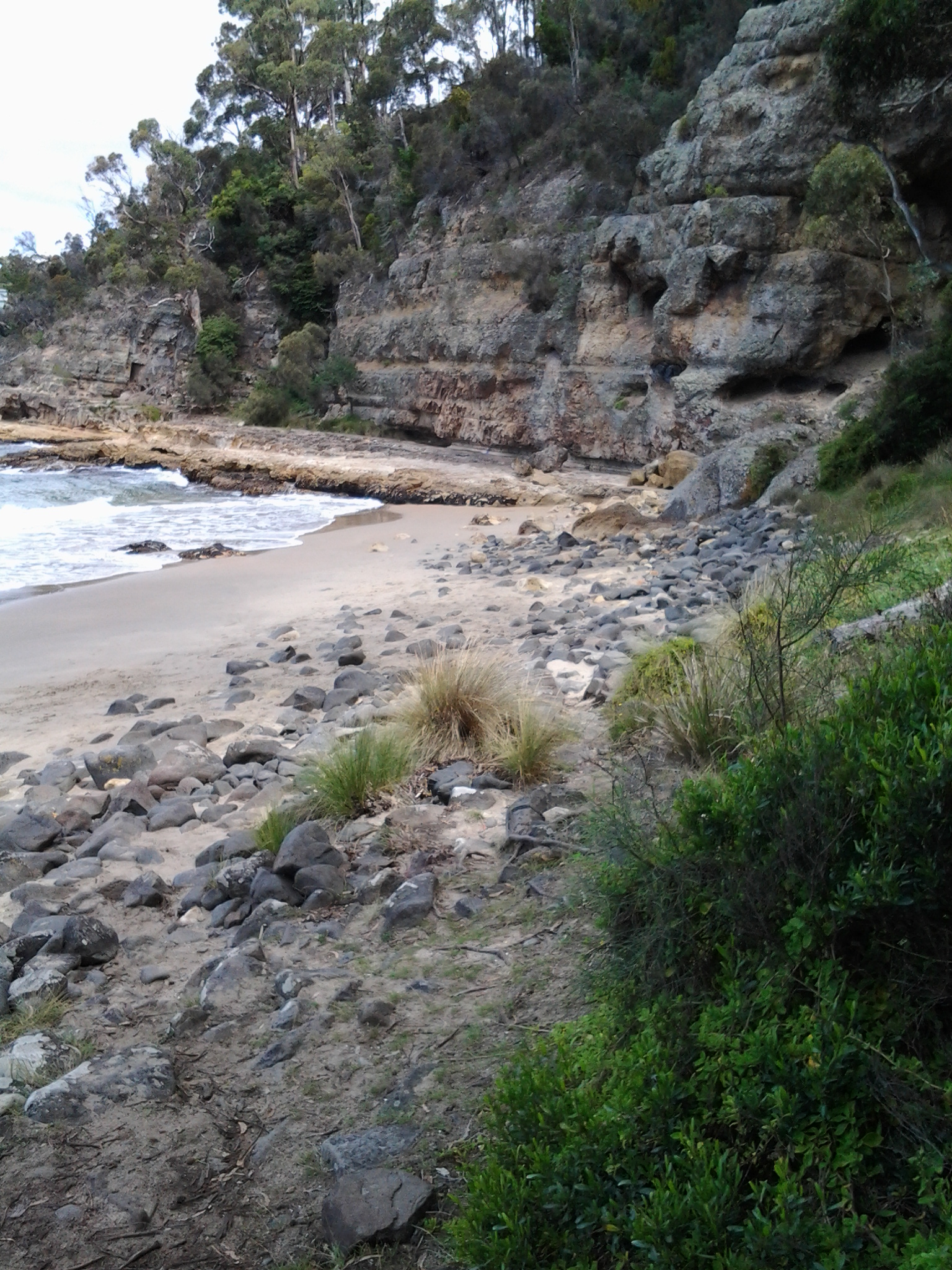
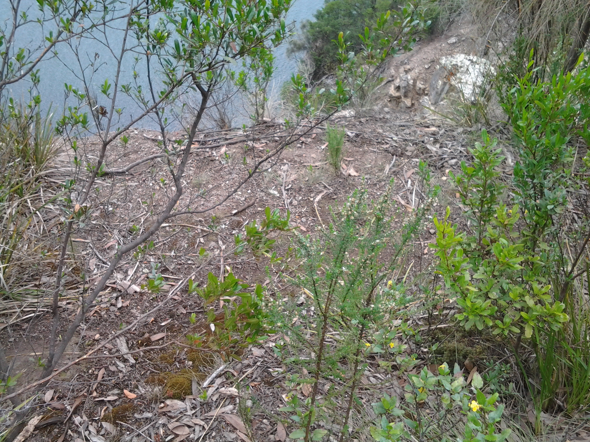
It was a long way down to the River over the Cliffs.

20150202_110656

Then I walked some way with another walker until I needed to stop and start with notetaking and the clicking of photographs.  I continued down across another creek and stopped when I noticed the clay at the bottom.  My earlier research/posting had indicated a connection between the alum rock and clay.

20150202_113327 20150202_113303

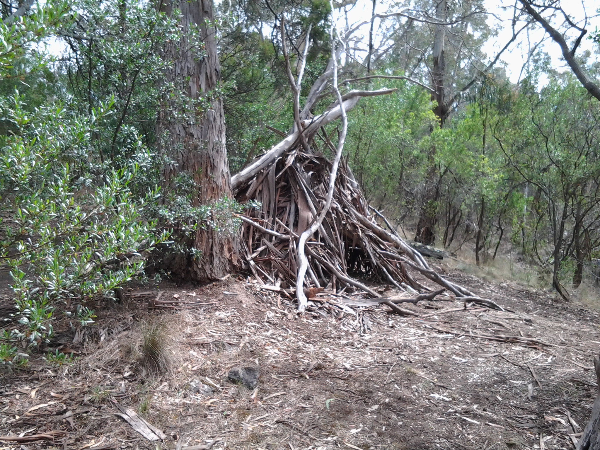
The track passed through a tiny wet forest area with green pronged tree ferns.  Back up onto a drier track I reached a picnic table at 11.26am. Nearby, a teepee of tree branches and leaves had been built casually.  Would it be better than no shelter in a rainy storm?  Not too sure how long the ‘tent’ would survive much wind.

20150202_112545

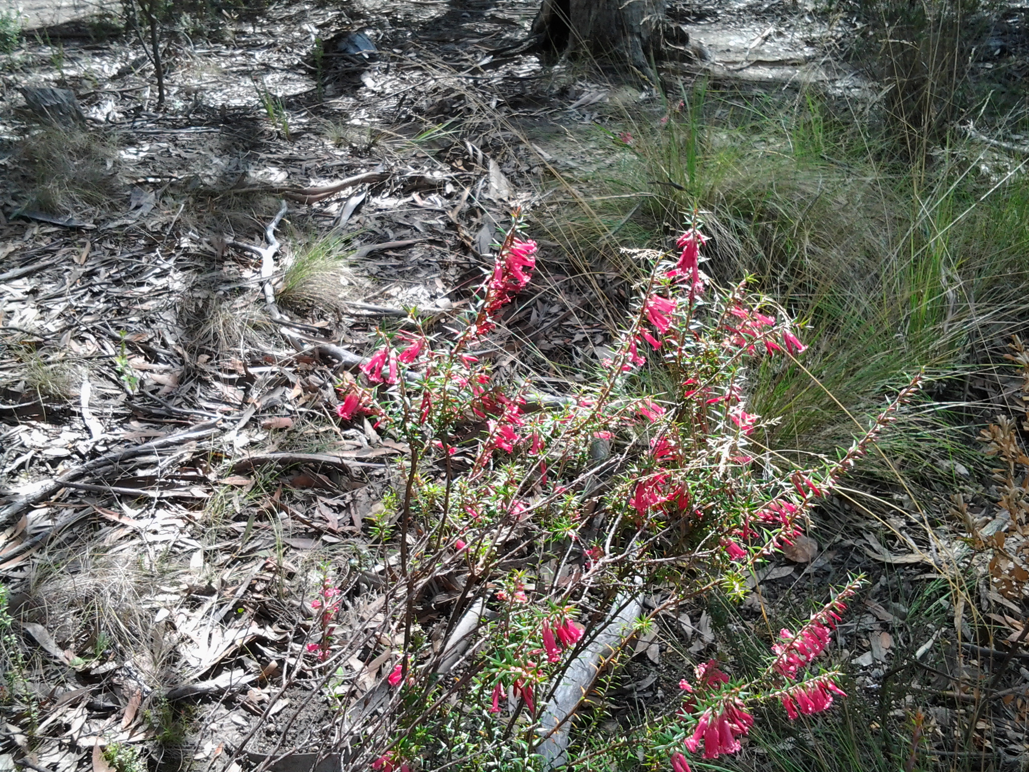
Walking past native flowers; pink heath, lots of yellow tiny daisy like flowers, and a delicate 5 petal lavender blue coloured solitary flower.

20150202_103455

I passed smaller tracks off to the left which ended by hovering over the edge of the Cliff, and some to the right which I imagine found their way back into suburbia or onto the Channel Highway.

A glossy scarlet red spider, black legs with a blue iridescent tail crossed my path.  I have never seen one before and knew nothing until I researched once back home; this was Nicodamidae –Red and Black Spider.  Apparently, ‘toxicity unknown, treat with caution’.  Trust me – I didn’t touch it.  The size was that of a woman’s finger nail.

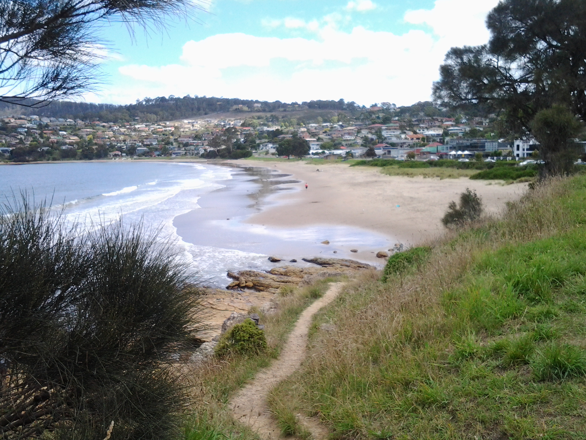
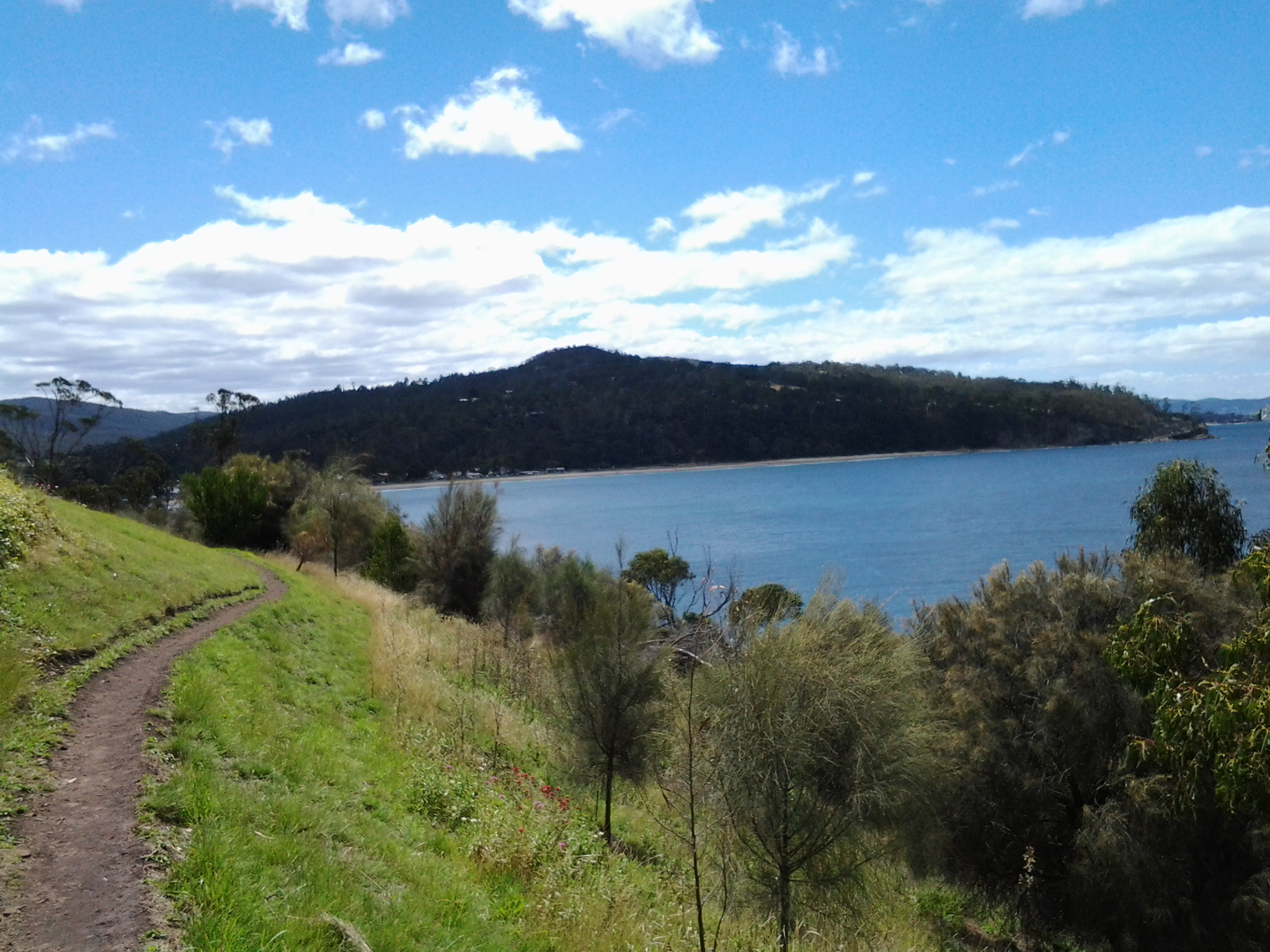
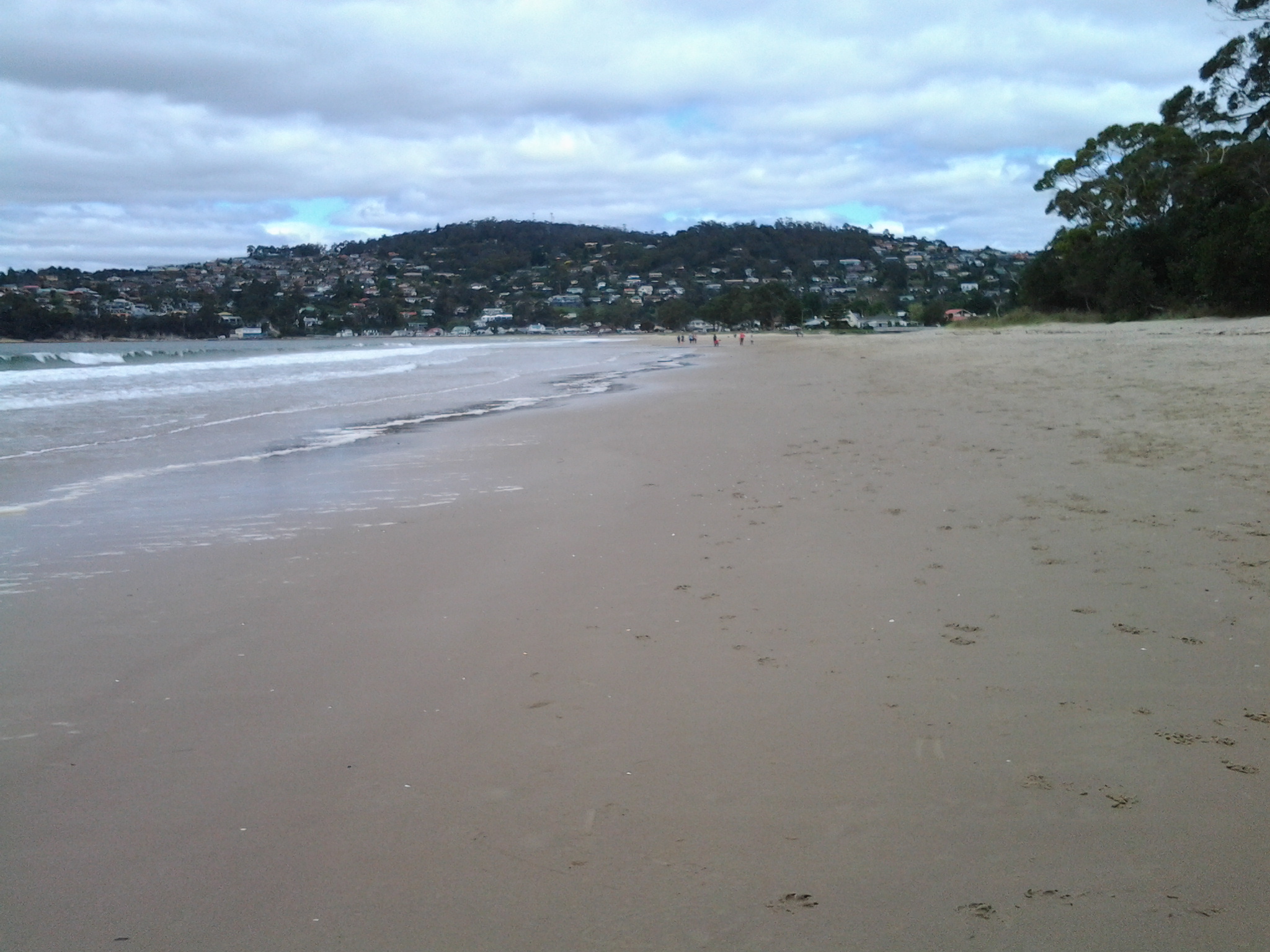
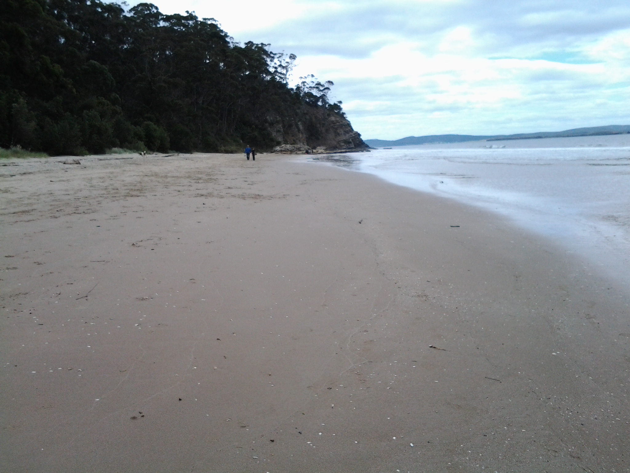
Not long after chatting with a man and his dog, at 11.40am through the trees I could see bits and pieces of Kingston Beach.  My trek across the Alum Cliffs was almost over.