Author Archives: Tasmanian traveller

Unknown's avatar

About Tasmanian traveller

Through travel, I have experienced the eccentricities of people and their environments around the world. At the same time, I love where I live. So, for people who cannot travel to discover the wonders of my home town, this blog is an attempt to introduce its exoticness. My goal was to walk along both sides of Hobart's Derwent River from the mouth to New Norfolk, and to walk on one or alternating sides of the River between New Norfolk and the source of the River at the southern end of Lake St Clair. The walk was undertaken in stages around my other commitments of my life. Almost all stages of the walk connected with Tasmanian public transport - my intentions was to inspire people, who do not have access to a vehicle, to feel they can replicate the walks. This blog reports on each stage in the hope it will encourage people to either follow in my steps or to create their own walking project where-ever they live. Please note: The blog background and headliner image of 'Hobart from Mt Wellington' is the work of Tourism Tasmania and Garry Moore. It is a free image with unrestricted copyright and available from http://www.tassietrade.com.au/visual_library

Stage 2 on 4/9/2014 William Gellibrand’s convicts Email 8 of 14

Researchers, Penelope Marshall and Alan Townsend, have written “The Convicts of South Arm” (available from http://www.ccc.tas.gov.au/webdata/resources/files/The%20Convicts%20of%20South%20Arm.pdf) which offers information and insights.  Here below are some examples of workers on Gellibrand property.

  • John Asgill, a labourer and shoemaker from Coventry in England, was transported aged 19 years for stealing gowns and frocks. He arrived in November 1836 and worked for William Gellibrand until 1841, when he absconded and was caught across on the other side of the Derwent River at Sandy Bay pretending to be a free man.
  • Lydia Hines was tried in London in 1821 and sentenced to 14 years for felony. Despite standing 4 feet 11 and ¼ tall, she was impudent and insolent. Lydia was assigned to William Gellibrand in 1825. She spent six months at South Arm as his domestic servant before being returned to the Female Factory in South Hobart (currently open to tourists) for ‘insolence’.
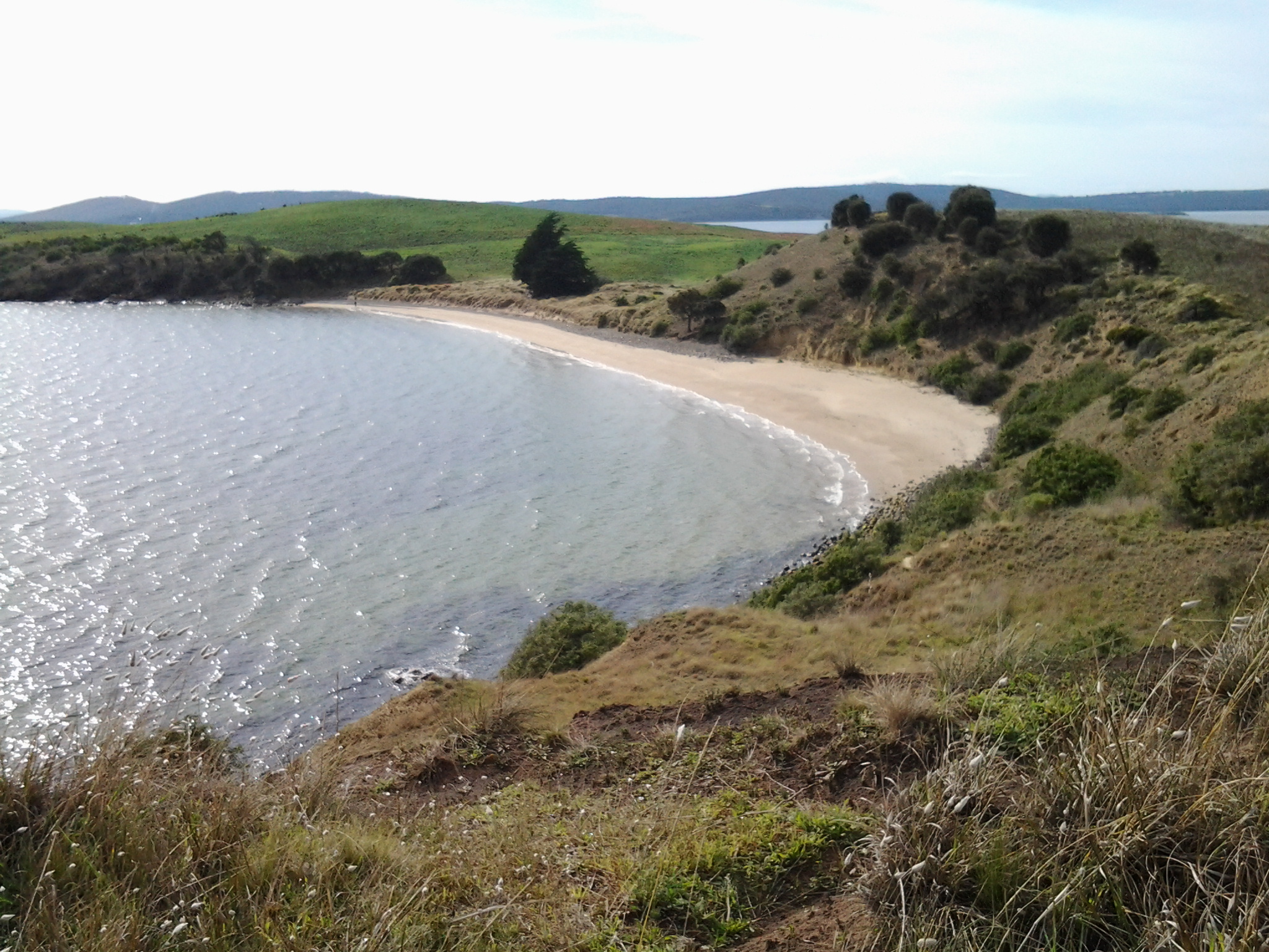
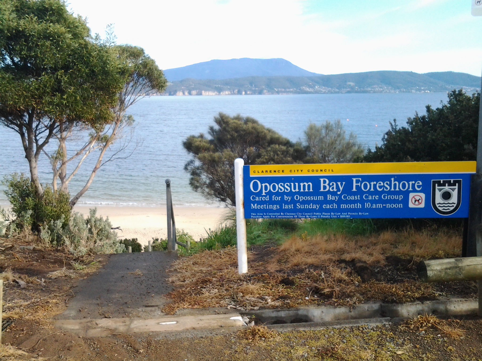
  • Edmund Musk arrived in Hobart on 16 May 1832, married with five children (he and his wife had a further 10 children while at South Arm. John the eldest son drowned in Ralphs Bay while loading a boat. Their daughter Susannah drowned when a boat capsized at Rokeby.). Edmund was transported for stealing ‘beans and barley’. He was assigned to William Gellibrand, where his skills as a ploughman were used. He later gained his ticket of leave and leased a farm from the Gellibrand’s. By 1858 he was farming 120 acres at South Arm, and employing convicts himself. Edmund Musk is buried at St Barnabas’ at South Arm. The Opossum Bay bus passes this church. It is located on the left as you head back towards Hobart on the South Arm Road, after you have left Opossum Bay and not long before the South Arm Cenotaph corner is reached.
  • Thomas Kimble was transported in 1844 for the highway robbery of 1 ½ sovereigns. He received 15 years at His Majesty’s pleasure. After serving as a probationary convict at Maria Island isolated off the east coast of Tasmania, Kimble was employed at South Arm by George Gellibrand (William’s grandson) during the harvest time. His record lists him as a farm labourer who could plough, a shepherd and a hop grower all useful traits to establish the new colony. Thomas’s distinguishing features were a tattoo of a Mermaid on his left arm, a woman with a glass in hand on his right arm and the bust of a woman on the back of his right hand. He received a ticket of leave on 30 March 1852.

James Cumberland was sent to Sydney from his native home of Walthamstow in England for stealing geese but gained his Certificate of Freedom in 1827. In 1846, following his conviction for the manslaughter of his pregnant wife under the ‘spiritual influence’ of public house liquor, James was transported to Hobart for life. In Van Diemen’s Land, James worked for George Gellibrand at South Arm where he died from heart disease on 19 June 1853 aged 53.


Stage 2 on 4/9/2014 William Gellibrand Email 7 of 14

With feet wet from long dewy grasses in the trek around Mary Ann Bay, I slopped along ready for new natural wonders. The track changed from dirt to dry sand and the large paw prints of a wandering dog were freshly impressed.  Soon after, it seemed the track had not been driven on for a long while and quickly it reduced to a single file.  Around 10.40 am, I had already walked up a hill, and had passed a mesh fence with the beach below to my left where I could see a small sandy bay complete with unconcerned Pied Oyster Catcher birds foraging.

From research and from information shared by a friend, I knew the original white settler, William Gellibrand, was buried somewhere along this part of coastal Derwent River. I wondered if I would be able to find the spot and whether the site would be marked.

A local group http://friendsofthearm.wordpress.com have been particularly instrumental in researching the history of the first white settlers (remember this South Arm peninsula was part of the country of the Moomairremener indigenous people). In addition, the South Arm Landcare Group has been doing its best to preserve the environmental landscape. Currently the latter group are ensuring the land around William Gellibrand’s burial site is protected.

William Gellibrand accompanied his son Joseph Tice Gellibrand (who had been appointed Attorney General for the colony) from England to Van Diemen’s Land in 1824. William was granted approximately 2000 acres of land at South Arm and assigned ten convicts.  This was later increased to 3000 acres by a grant from his son.  As other settlers arrived Gellibrand leased land to them and later they were able to purchase their lot. By 1885, many had purchased land on the peninsula: some names are  Alomes, Calvert, and Potters and people with these family names are still in the district today.

I am sorry not to have found a photo of William Gellibrand for insertion here.Below is a photograph of George and Agnes Alomes courtesy of the site at http://www. southcom. com. au/~pottermj/pagef. htm

  [IMAGE]

 William Gellibrand’s claims to fame in Hobart Town include his appearance in the registrar of Magistrates Hobart Town from 1826 until 1827 and he is also remembered for setting up banking in Hobart.  In addition, William was a merchant and exporter and served as a Justice of Peace.

Stage 2 on 4/9/2014 Mary Ann Bay Email 6 of 14

From the communications Tower, I followed the reasonably flat four-wheel drive track north eastwards by the edge of the river and ten minutes later I was able to look down from a high cliff towards Mary Ann Bay.

20140904_101830

For a short while a solitary man stepped briskly along its short length. Despite the children stopping and starting as they took in the sights along the way, the group caught up with me as I looked down at the beach end of the very long and faceted Mary Ann Bay. These were relaxed country kids who said their ‘hellos’.  I had forgotten such differences exist between the city and country. Their openness reminded me of my experience on a Marquesas Island last year, when having talked to a primary school class one day, and then travelling to a remote part of the island the following day, a young girl came up to me in the car where I was sitting, simply to say hello. With each of our halting use of the French language (the Marquesan’s speak a Marquesan language as their first language and only French, the national language, occasionally) we were able to work out why she was greeting me. She had remembered me from the class room, and the country thing to do was always to acknowledge people you know, however slightly. But I have gone off at a tangent … back to the walk and to Mary Ann Bay.

After glorying in the views of the undulations of this part of the South Arm peninsula, the expanses of the Derwent River and the sparkles of the western shore, I had the choice to continue on the four-wheel drive track up and over a hill or follow a single track through tall wet grass that skirted the cliff edge. No contest. I avoid hills when I can.  Of course I had no idea where this track would go or whether I would need to retrace my steps. But all was well, and the track gave great views before curving around downhill from the main track. Quite quickly I found myself back joining the main track after it had dropped down from the hill. It was only 10.25 am and I had been walking for an hour and a quarter.

I continued for a few minutes along the main track until I reached a very steep hill for a 4 wheel drive to descend. Having owned a 4 wheel drive and enjoyed off road adventures in the Northern Territory, I know that if I had come across such a serious drop I would have been taking lots of very deep breaths and may have even prayed in what would be a swift if not hair-raising sliding descent.  On my walk down the hill, I avoided the slippery earth and enjoyed a safe descent courtesy of clumps of grass. Soon after this, I continued on and passed the sandy track that could have taken me onto the beach end of Mary Ann Bay.


Stage 2 on 4/9/2014 The Tower Email 5 of 14

Having ascended from Mitchell’s Beach a little after 10 am, I turned left and followed the four wheel drive track with Mount Wellington looming in the distance. Swallows swooping ahead of me along the track. An old windblown pine tree stood on the left between me and the Derwent River with thousands of new pine cones in their early growth phase – like small golden brown candles. The Derwent River was almost flat calm.

Then I could hear children. Ah ha! Hmmm. The sounds of their happy voices coming closer. Behind me across the land. Drat! Solitude about to disappear. Maybe.

Walking across the undulating landscape allowed me to be in sight of the tribe of primary school children with their two accompanying teachers and then, alternately, to be on my own as the hill crests obscured my view backwards. It only took me 10 minutes to reach the tower on the open and exposed White Point Rock headland.  The tower, in its caged environment, is an Australian Department of Communications radio and television transmitter which ensures some suburbs across the river receive their needed communications connections.

20140904_100850

Apparently the land at White Point Rock dates to the Late Pleistocene – that is, roughly 126,000 ± 5,000 years ago, and University of Tasmania researchers (http://ecite.utas.edu.au/62080) have documented the shell remains of the ancient marine fauna contained in the land there, now 24 metres above the current river level.

Stage 2 on 4/9/2014 Mitchell’s Beach Email 4 of 14

The roadway above Opossum Bay beach being narrow and without public footpaths meant it was important not to day dream and for me to be vigilant for the occasional car.  But Opossum Bay is a relaxed seaside village and even cars seem to move sedately.

I continued walking on the road from Opossum Bay beach until I reached a 50Km hour sign for cars, then I moved left off the road onto a well-trodden narrow track through a clutch of Casuarina trees and walked down to the next beach – Mitchell’s Beach. When I checked my watch, only 20 minutes had passed since I had left the bus. Yet already my head was filled with ideas and new information, and my heart was open with joy. The pleasure of walking in clean clear environments cannot be underestimated.

The winding track from the road finished on the sandstone rocks. After an easy few movements and a short distance, I walked onto the sand of Mitchell’s Beach. As I padded along the beach, a gentle breeze whispered across my face while the water lapped quietly onto the sandy shore. Silver gulls wandered around. Opened mussel and oyster shells strewn along the beach, were blanching in the sunlight. I marvelled at the various seaweeds thrown up at high tide, at the decaying ribbons of sea grass and at the fish eggs collapsed like bizarre multi-shaped condoms. The air was rich with the sweet and salty smell of dying seaplants. The water a soft greeny grey. Blissful.

When I come across a few bright orange starfish on the edge of the tide, I cartwheeled them into the dry sand at the upper edges of the beach. I was simply doing my tiny bit to reduce the infestation of these seastars (http://www.abc.net.au/science/slab/starfish/) as devastating invaders of our local marine environment.

20140904_094156

From Mitchell’s Beach I looked directly across the Derwent River and could see the suburbs of Kingston and Taroona with the Alum Cliffs below Bonnet Hill between them. Strikingly, Taroona’s Shot Tower stood tall.  Stunning.

20140904_091437

A pair of footprints impressed in the sand let me know that someone had walked the beach earlier.

Mitchell’s Beach was edged with three to four metre high dunes with tussocky grass on top, which were gradually crumbling into the beach. Demarcations between dirt and sand strata were clearly visible. Towards the northern end of the beach, small seas of water smoothed grey stones provided a separation layer between the beach and the dunes.

 20140904_095336

A lone Dominican gull with his pure white tail, pale grey legs and small yellow bill flew off leaving me in charge of his beach.

I reached the end of Mitchell’s beach 40 minutes or so after setting off from the Opossum Bay shop. Again a rocky headland stopped me continuing but I couldn’t see a defined track up the hill onto the land at the top.  Clearly people had found a way judging from a mishmash of bits of tracks.  I chose the least steep section and was surprised when after my first steps up I slid back down. The previous day’s rain had kept the ground lush and damp, and it was clear that the soil included slippery clay. By a more careful choice of foot placements, I eventually reached the top.

20140904_095847

Stage 2 on 4/9/2014 Opossum Bay Email 3 of 14

The bus trip from the city to the starting point for today’s walk takes approximately 1 hour 10 minutes.

Stage 1 of my walk finished at the Opossum Bay shop so Stage 2 needed to start from there.

20140904_090914

By the way, it makes sense to alert the bus driver that you do not know the area you are travelling to, that you want to get off at the Opossum Bay shop, and that you would like him or her to stop and let you off when you reach your destination.  Our Metro drivers are very happy to provide this simple customer service.

When I alight from the bus at 9.10 am, what I see ahead is excitement. I watch the bus disappearing along the road and know that this is the direction I must take, however on different paths. From the Taroona TasMAP, I know the bus will not travel nearly as far as I will walk, so that once I have reached my destination of Gellibrand Point, I will need to retrace my steps to a bus stop.

I am unsure if I might find trails, and whether I might need to exert some pioneering spirit and discover a way. I don’t know who I will meet or where. I wonder what I will smell and what I will hear.  This promises to be a terrific adventure which will use all my senses. Stepping off into an unknown world.  And so I take the first step along the road (no footpaths) from the Opossum Bay shop.

20140904_090925

The sun is shining. Air is crisp. Nobody is out and about and walking around. Opossum Bay is peaceful and quiet except for the soft sounds of water lapping onto a beach in the distance.

100 metres along the roadway a sign points to public toilets which, after an hour on the bus, are a good place to visit. At the bottom of the attached carpark, a large placard indicates a tiny walkway down onto Opossum Bay foreshore.

20140904_091422

I was filled with awe when I stepped onto the pristine white sandy foreshore, and looked along at relaxed houses and shacks overlooking the edge of the beach. Not a soul to be seen.

20140904_091601

Mt Wellington and the western shore of Hobart across the Derwent River looked particularly special.

10 to 15 minutes later I had walked north along the length of the beach until confronted by a rocky headland that needed to be rounded before I could continue the walk.

Instead, I chose to climb the concrete stairs near the end of the beach that returned me up to the road.  I noted that the rocks were reasonably smooth and could easily be accessed, but as usual and not knowing which future obstacles might present themselves I decided on the more obvious route; all the time I remembering my return bus departed at 2.02 pm and that I needed to make sure I caught it (because the later one did not depart until 5.55 pm).

Stage 2 on 4/9/2014 Travelling towards the South Arm peninsula Email 2 of 14

For people with lives normally immersed in the big cities of the world, travelling this route to Opossum Bay will be full of surprises.

Hobart is a capital city yet, after not many minutes of travelling, the bus passes through bush land from time to time, before coming out into clusters of developing real estate. Springing up around many corners, the landscape is meshed with strips of dark bitumen. These cul de sacs and neighbourhood streets are usually featured with white concrete lengths of soon-to-be driveways into soon-to-be built houses on blocks cleared of all vegetation. These new suburbs represent the interest in having and the will to live in your own home – even if it means a 20 minute or so travel time to the city. We know that by the standards of other capital cities around Australia and the world that such travel times are but a blink of time.  The easy accessibility to the centre of the city is a great reason to live in suburban Hobart.

As usual the bus travelled through the suburb of Rokeby. I was eager for another view of Ralph’s Bay remembering its sparkling crisp deep blue expanse when I travelled this way for Stage 1 of the walk. This time the colours were different however, despite the sun shining. Perhaps it was the high level wispy cirrus clouds that filtered the light and affected the colour of Ralph’s Bay on this journey. This time, when travelling the streets at the top of Rokeby, the spread of water was coloured a warmer tone of greys and pale greens. The Bay looked benign and neutral, and was all together welcoming. Further on in the journey, I passed the mud flats at the Lauderdale site of the Bay. The tide was in further than previously and covered most of the mud. I couldn’t help but think how time makes small differences in our world – it is only two weeks since I was travelling here on route for the first walk and, at that time, acres of mud flats were on show.

What else did I see during this bus trip?  Glossy dew on lawns. White blossom on fruit trees. Pink blossom. A well-painted graffiti wall, following a colourful display of clever mosaics in the suburb Clarendon Vale.  Road signs with the symbol of a horse with rider warning of the additional ‘traffic’ which the road might share. Paddocks with grazing horses. Horseboxes. White fences. As the bus started on the road across the isthmus to the South Arm peninsula one sign with a stylised image of a Pied Oyster Catcher bird indicated travellers should be aware that these birds may want to walk across the road from time to time.  Later, on the return to Hobart journey, I noted perhaps 50 Black Oyster Catcher birds resting as a large family, on the sandy edge of Ralph’s Bay near the sign.  They were not in the least put out by the rattling of the passing bus. 

Stage 2 on 4/9/2014 Clarence St Bellerive Email 1 of 14

As expected, the early morning (number 640) Metro bus arrived from Hobart at my eastern shore bus stop, and once on board I settled down ready for the new experience of Stage 2 of my walk along the Derwent River. After charging along Cambridge Road, the bus turned left at Bellerive village and commenced the long haul along Clarence St.  It occurred to me that the houses along both sides of the road represented many vintages of free-standing suburban house architecture for this part of Hobart. I was surprised to see Wunderlich panels of decorative pressed metal in the frontispieces of some houses in the gable beneath dual pitched roofs, indicating an architectural age of early in the last century. There were the flat roofs of houses that had more in common with Tasmanian shacks of the 1950s, the three fronted brick veneers, the fashionably rendered homes in tones of dark beige with their black roofs, the remnants of rural cottages from a time before the city sprawl had moved to fill the land on the eastern shore of Hobart, substantial pretty weatherboard family homes, and much much more. If your experience is of the repetitive rows in London streets, the towering repetitive apartment blocks of Moscow, or the repetitive white family group block houses of Athens, then the sight of the houses along Clarence St will be a revelation. Somewhat puzzling but fascinating nevertheless. You will not be familiar with the diversity of free standing houses with their own front and back gardens that so many Australians take for granted, and accept as their right. One family to a large block of land is a situation more prevalent and typical in Hobart perhaps than in other Australian capital cities and it is one of the features that attracts me to this beautiful and interesting city.

The second stage of the walking tour

Tomorrow, Thursday 4 September, I plan to walk a second stage of my foot journey along the eastern shore of the Derwent river.  As with the first leg, I need to take Bus 640 that departs from the Hobart city bus mall at 8am and heads towards Opossum Bay.  I will jump on the bus once it reaches the eastern shore and, as before, I know I must be patient because it will weave through the suburbs of Rokeby and Clarendon Vale before passing Lauderdale, Sandford and South Arm (details of these great locations are in the earlier postings related to the first stage of the walk). My bus destination is the Opossum Bay Shop. From there I will walk north to Gellibrand Point via beaches, roads and open landscape.  I hope to be able to enjoy my pre-packed lunch sitting looking towards Mount Wellington before returning to the Driftwood Drive bus stop for my journey back towards Hobart. The morning low temperature is expected to be around 9 degrees when I arrive and rise to about 14 degrees around 1pm. The return bus leaves Opossum Bay at 2.02 so I hope it doesn’t rain before then.  Keeping my fingers crossed!

Shades of grey – how many?

Travelling to and from work, I routinely cross the Tasman Bridge, one of a number of bridges which span Hobart’s Derwent River. This morning, on the first day of Spring in the southern hemisphere, the air was clean and bright and eventually the temperature rose to a mild 18 degrees. In that peak rush hour on the roads, the Derwent featured a police boat speeding up the river, but otherwise all was quiet on that glittering watery surface. However, this afternoon the clouds moved over Mt Wellington and the world of the Derwent took on different colours.

 Yes it was raining as my city bus left the city for the eastern shore after work, however nothing unpleasant can be said about the glorious effect the lightly falling rain had on the landscape and the river.  The vista was outstandingly beautiful.

 As the rain melted onto the river, it patched the surface with the softest pale colours of grey-green jade. Delicate. So refined. The South Arm peninsula at the mouth of the river, blurred grey with a loose mesh of fine rain, barely remained visible as my bus crossed the Bridge. The sky was coloured with a combination of a softening yellowish charcoal grey and a light blowsy light beige grey. Collectively, the multi shades of grey were colourful. They embraced the river and the lands beyond.  Simply stunning. And I am lucky enough to live here!

Gellibrand

The destination for Stage 2 of my walk along the Derwent River will be Gellibrand Point, at the northern end of the South Arm peninsula.

The name was conferred as the result of the first European settler in this area, William Gellibrand. William arrived in Hobart Town on the Ides of March in 1824 as a companion to his son Joseph Tice Gellibrand who been asked to take up the role of local Attorney General. William became a Magistrate in Hobart from 1826-1827. In addition, he has a special place in Hobart’s history because he set up banking here.

Initially, he was granted 2220 acres of land on the South Arm peninsula, and then later this was later increased by further grants. Land grants were routinely made to free settlers who then were allowed the assistance of several convicts to help clear and work the fields.

The site http://www.  southcom.  com.  au/~pottermj/pagef.  htm tells us that “as other settlers arrived, Gellibrand leased land to them and later they were able to purchase their lots. By 1885, many had purchased land on the Peninsula – some names are Musk, Alomes, Calvert, and Potters. Members of these family names are still in the district today.”

The site http://www.ccc.tas.gov.au/webdata/resources/files/The%20Convicts%20of%20South%20Arm.pdf

provides well researched detail: “William Gellibrand was a significant figure in Colonial society; he was a merchant and exporter but also served as a Justice of the Peace. After William died, his property at Arm End then passed to his grandson George Gellibrand who after leasing out some of the land placed it on the market in 1844 describing it as being studded with the tallest trees in the colony and having the very best vinery on the island, covering two acres of fertile ground with full bearing fruit.”

Preparing for Stage 2 of the walk along the Derwent

Last week, I used TasMAP 5223 Blackmans Bay to help me navigate the South Arm / Cape Direction start of the walk. Stage 2, taking me northwards along the South Arm peninsula, will require a tiny portion of the same map. However, most of the Stage 2 walk will require TasMAP 5224 Taroona. Having said that, I believe it would be possible to walk  in the two ends of the South Arm peninsula without either map simply by asking locals to point them in useful directions.

Fort Direction memories

My posting about Fort Direction prompted the following response from a friend:

“Well in 1961, and I can’t find any reference to it on Google, the Fort Direction site was lent to the Methodist youth whatever to have an Easter camp and I was there.  I can remember the chapel and the kitchens etc and my friend Sue and I wandered far and wide and kept coming across rolled barbwire fences that kept us in rather than let us out.  We ventured as far as Roaring Beach which impressed me no end.  Christian youth camps in the 50s and early 60s were the hotbed for discussion especially philosophy and I can remember one of the groups that camp, discussing objectivity and subjectivity.  Lots of the brightest students went to these camps.

And this is when I first saw Ralph’s Bay as we travelled at dusk in a bus to South Arm and Fort Direction.  Over the years I thought this image of the tidal flats, so different from my experience on the north west coast of Tasmania, was something in my imagination. So when I had moved to live in Hobart and was exploring to buy a place, imagine my excitement when I found that very image and it was la de dardle!!!!”  (Or, as the map lists it, Lauderdale)

22 Aug 2014 Leaving South Arm and heading home, and final thoughts – Posting 8 of 8

On the return journey towards Hobart, the bus deviated via large mudflats into the town of Cremorne adding 5 minutes to the trip, then it dropped me at a Lauderdale bus stop for transfer to another bus (because the Opossum Bay bus terminates at Lauderdale) approximately 5 minutes later (with his two way communication, the bus driver alerted the other driver there was a transferring passenger to be collected). Once on the Lauderdale bus, the trip towards Hobart deviated through the suburb of Oakdowns and so a further 5 minutes was added to the journey. After the bussing and the walking I was home in Bellerive at 3.20pm.

In this series of blogs for the first walk stage, I have provided approximate times for various sections of my walk as an indication only. I am short legged and plod slowly (and towards the end I felt I was shuffling like an old man). If you are tall and can happily stride long steps faster, then my walk will not be sufficient to fill the time between buses.  In fact some speedy walkers may be able to continue through the Opossum Bay community and walk to the end of Gellibrand Point, the most western tip of this piece of land before Ralph’s Bay makes its inlet.  My next walk will be designed to complete that section, and then I should be able to advise as to whether fitting it all into 5 hours is possible for the able.

Since it is unlikely anyone else will have my success if they turn up at the gate of Fort Direction and get driven through the site, the only general public approach is to walk along Fort Beach having walked most of Blessington Road.  Based on the information I recorded, I suggest one way on this route from the set down bus stop to the Lone Pine Memorial will take an hour if you take time to enjoy the views and click photographs. Add the half hour return walk between Cape Deliverance and Cape Direction with its gun placement bunker and the whole excursion takes approximately 2 ½ hours.  As an alternative, you could spice it up by jumping the shore rocks like a goat, from South Arm to Fort Beach. I would guess another hour could be added to the duration of the walk.

I noted that the tide was going out while I walked, and that the high tide merged with the dune verges in places on Fort Beach. It made me think that on a high tide, this route might be impassable. In such a circumstance and if you had made the special trip and your heart was set on a beach walk, the expanses of the South Arm beach with their outstanding views, old pines shadowing parts of the dunes, and soft roaring Casuarina trees, would make a very attractive substitute.  You might be lucky, as I was, to see a giant fresh squid washed onto the beach being enjoyed by immature grey feathered winged large Gulls.

Many of our native birds are various shades of black and brown but we also have an array of colourful specimens. During my walk, the sun brought out not only the musical black and white Magpies, the hard cawing jet black Crows, but also plump pink and grey Galahs feasting on the ground, Mr Blue Wren flitting in and out of the shadows, a glorious Mr Robin with his red breast, and a flock of multi-coloured Rosella parrots.

My guess is that I walked around 10-12 kms including getting to the start and then continuing on.  But how much of the 249km length of the Derwent River have I covered? About 7kms. A great start! A memorable day. A very positive experience.