Tag Archives: Hobart

Stage 3 Walking from Trywork Point back to the suburb of Tranmere 20 September 2014 Posting 3 of 6

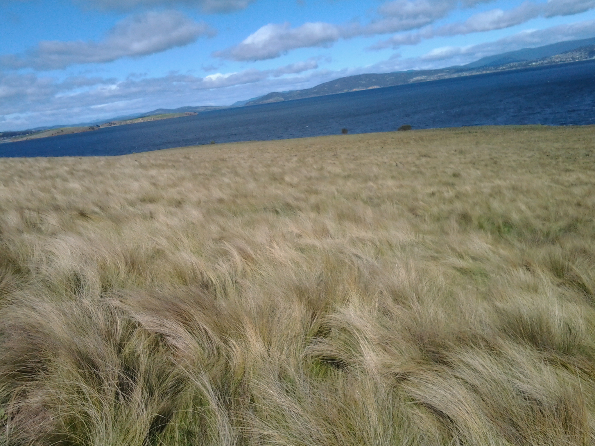
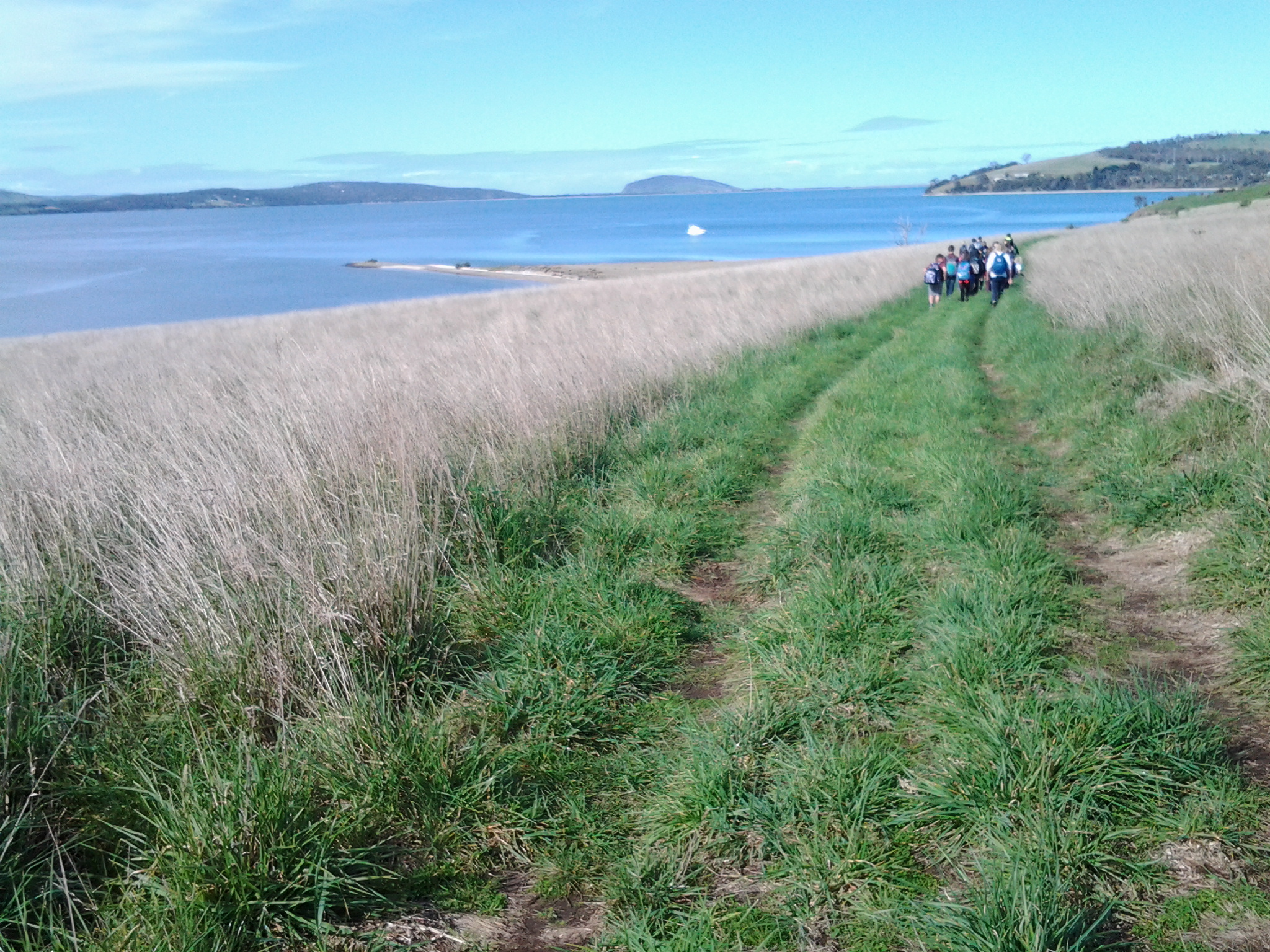
I left Trywork Point at 10.30 am intending to walk back along the edge of the River in order to determine what could be achieved without walking on private land. I am delighted to say that the low rocky foreshore from Trywork Point is very walkable if you wear strong ankle supporting boots. Of course it is slower than walking the cattle tracks but quite spellbinding.

20140920_110119

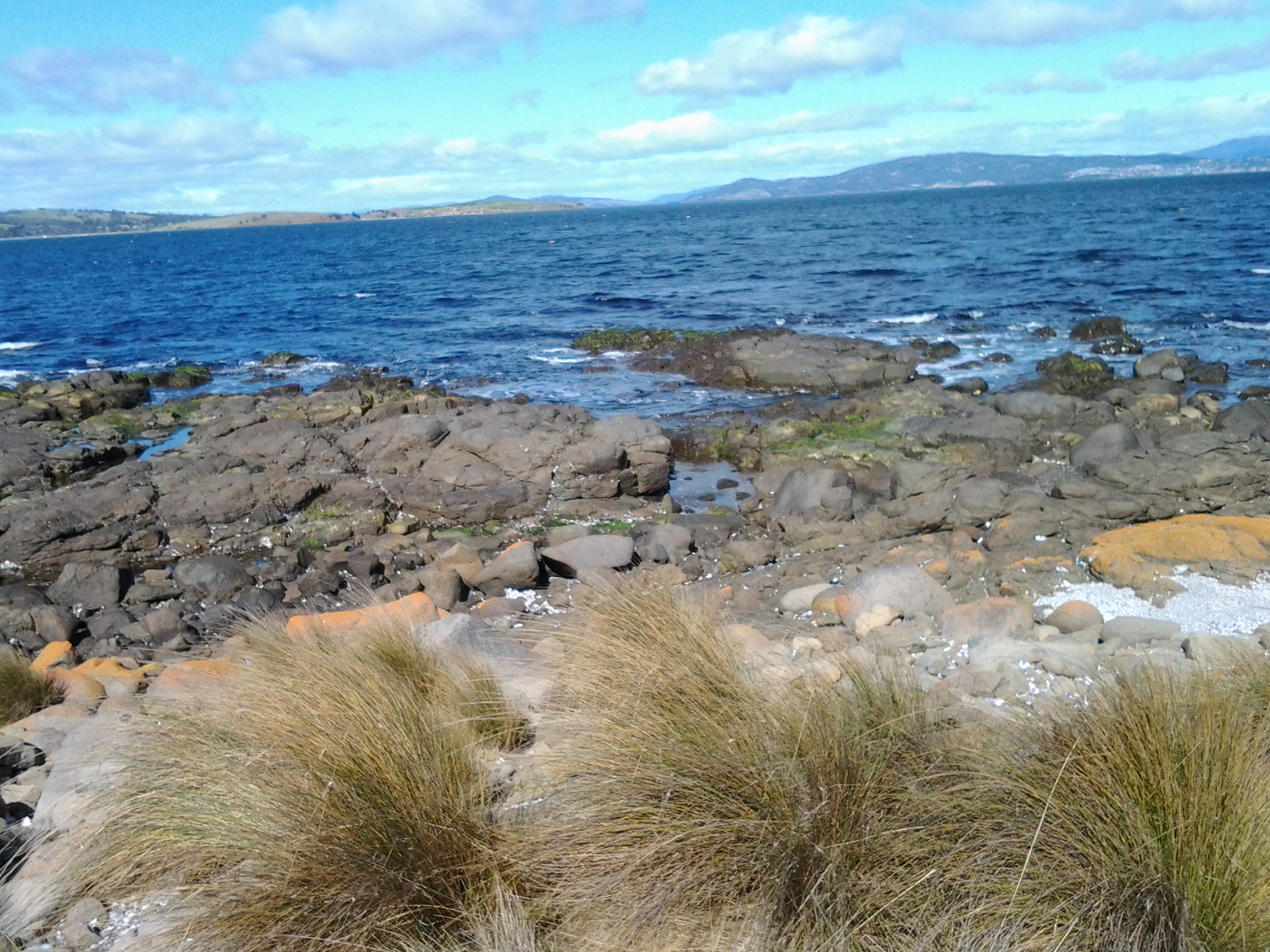
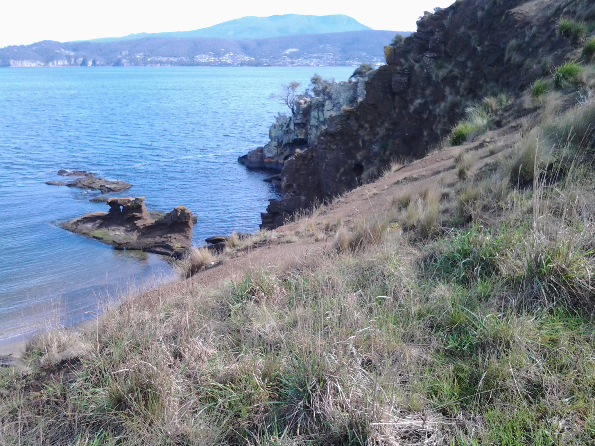
I did come upon one section as shown in the photograph above of rocks that rose in the air, and I couldn’t descend (it would be perfectly easy to ascend if walking towards Trywork Point by the rocks, but long legs are required to descend – and mine are short) so I climbed back up to a cattle track and followed that until I reached a gully – no water running and grassed over – where I could easily step down onto a large pebble beach.

Smooth grey driftwood pieces in all sizes and shapes were washed up to where the pebbles met the land.

20140920_111446

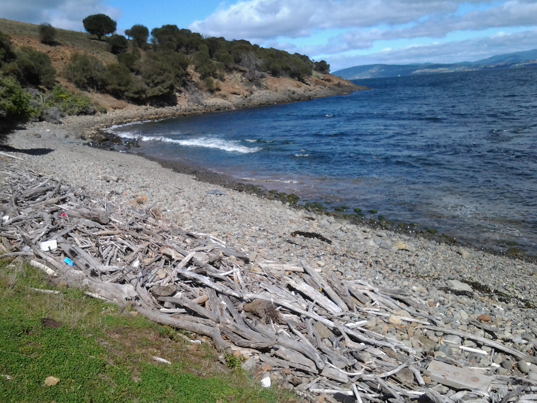
The blanching shells of thousands of mussel shells and the occasional oyster shell fitted between the pebbles. Detritus, the flotsam and jetsam of human activity was interspersed across the beach. The remains of polystyrofoam containers, blue plastic containers, empty plastic drink bottles, beer bottles, and frayed ropes were typical. Attracted by its bright yellow colour, I picked up a perfect Spalding high-bounce ball which can be used when learning to play tennis.

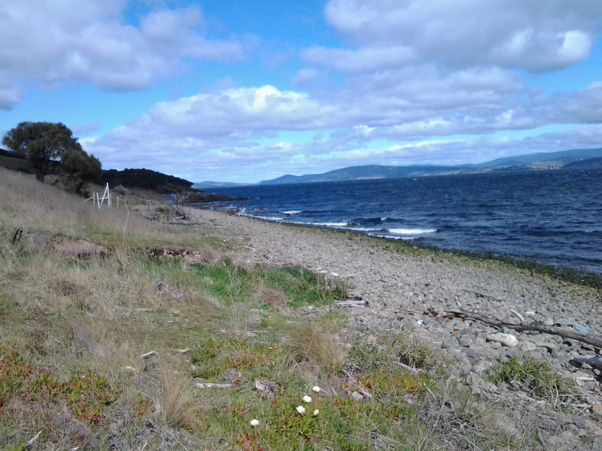
Around a tiny rocky headland I walked from the large pebble beach to a beach of smaller pebbles. All the while treading slowly as the stones rocked and rolled, and as pieces of rusty metals thrust up unexpectedly from below. At the northern end of this pebble beach, and as I neared the first houses of suburban Tranmere, a falling down fence crossed from the land over the pebbles and continued into the water. Once near the fence, I could see that someone had built a gate that swings in the wind, so that locals can access the beach from the suburban side of the fence.  I passed through the gate and continued on a home grown track for the occasional pedestrian traffic.  There were no signs here or around about indicating entry to the beaches and rocks where I had been walking, was prohibited.

20140920_112751

The white structure is the make shift gate through which I had walked.  Note that in the foreground a variety of native pigface fleshy foreshore plant are growing.  Today, the flowers were like jewels as they gleamed in the sun.

20140920_112746

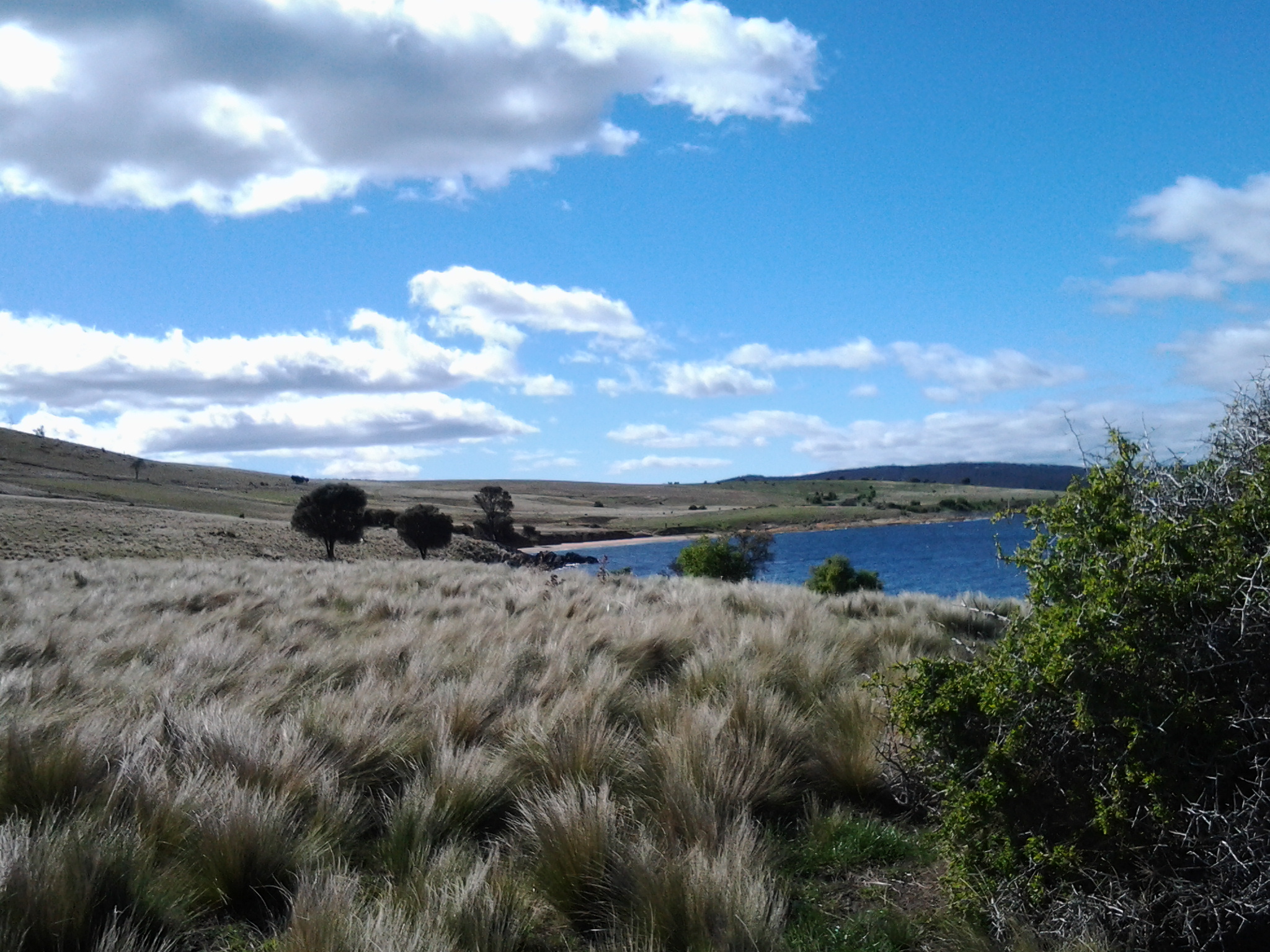
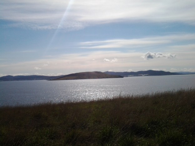
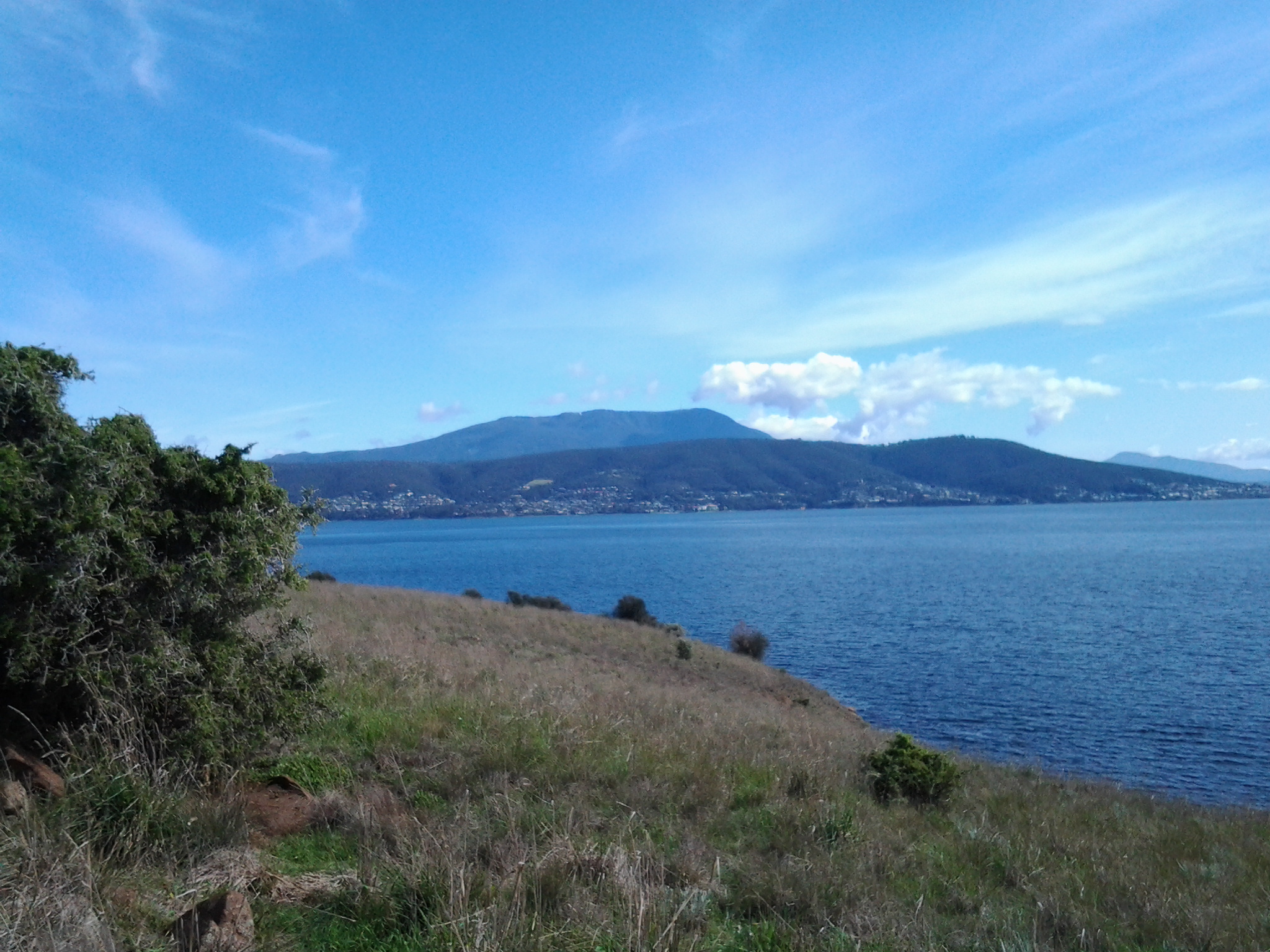
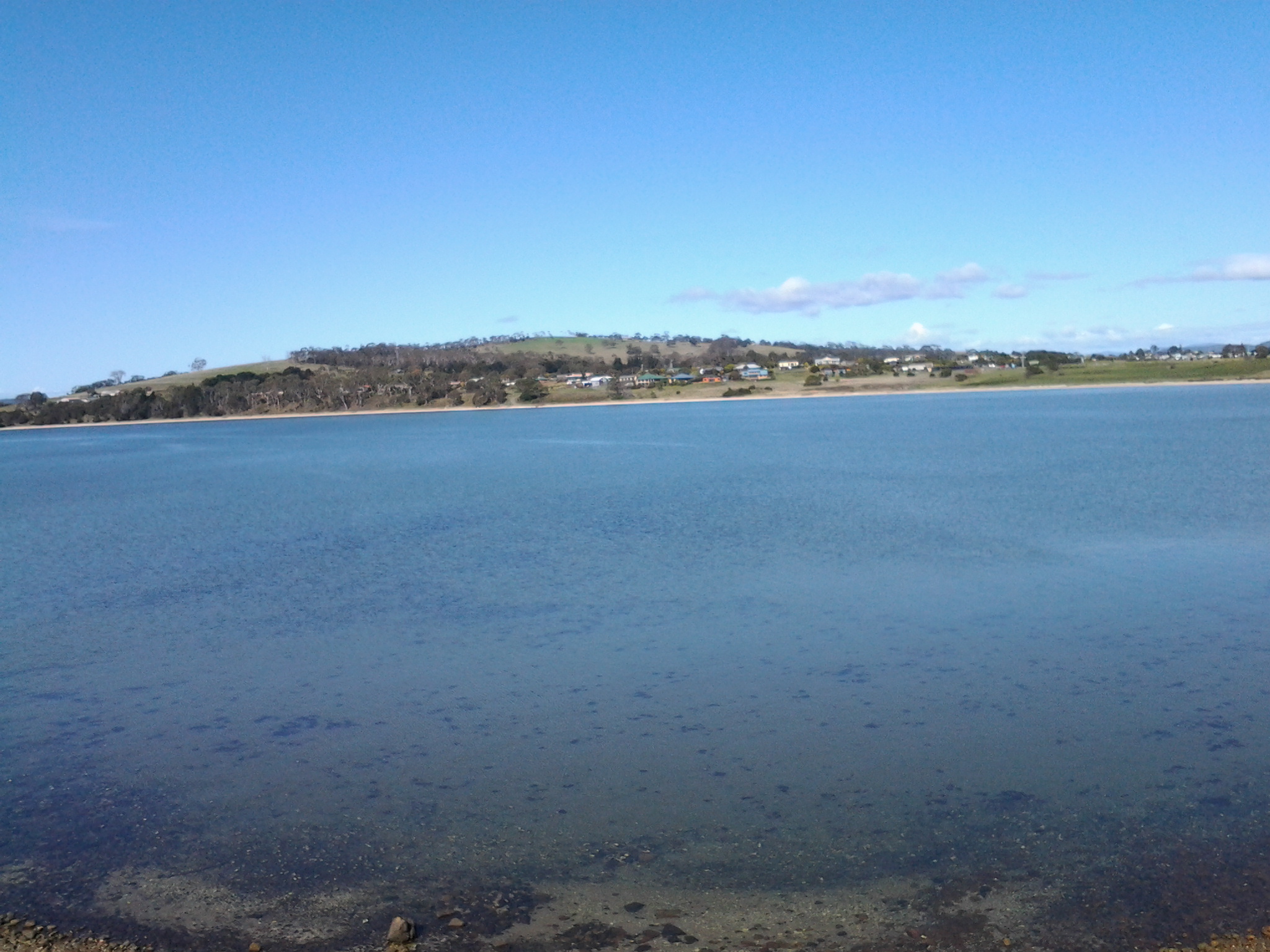
When I looked across the Derwent River, Mount Wellington in all its magnificence towered over Hobart city. The pebble beaches and later pathways offered superb vantage points.

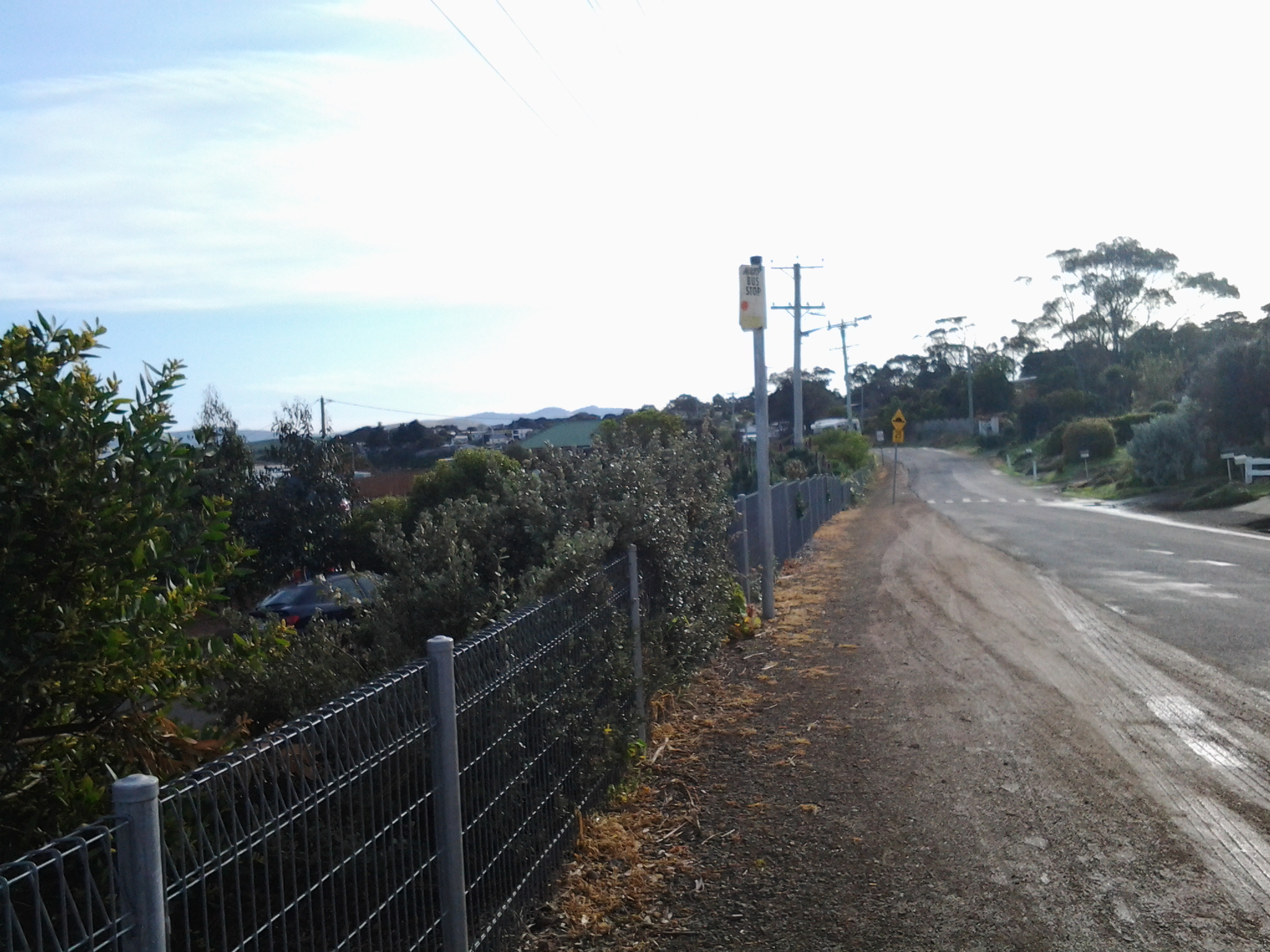
After walking for ten minutes from the gate, on the public verge above the river in front of many houses, I came to a public pathway leading uphill to the road; a steep concrete path that would be impossibly slippery when wet.  The pathway is located between 24a and 26 Vaughan Court and could be the starting point for a legitimate walk to Trywork Point via the rocky foreshore.

Stage 3 On the way to Trywork Point along the Derwent River 20 September 2014 Posting 2 of 6

It was 9.13 am when I got off the bus at Tranmere (that is, a 25 minute bus ride from the Hobart city centre) and I was ready to walk but unsure which route to take.  My first idea was to walk up some side streets hoping their ends would be in open paddocks which I could walk across. I can now tell you not to walk up Norla St or Spinnaker Crescent to the locked gates and fences,

Top of Norla St- gates blocking progress

unless you want to appreciate the fabulous views of the River and beyond. At 9.45 am I was back down onto Oceana Drive near its southern end where the Crescent makes its connection.

The sealed bitumen road of Oceana Drive quickly changes into a gravel road. Then across my path a padlocked gate and a barbed wire fence that descends towards the River, effectively blocked my progress.  The tiny yellow sign glowed in the sunlight: Keep out private property.

Ahead of me on the other side of the gate, a car track wound into the distance and then disappeared into a gully. On the crest of the distant hill sat a forest of casuarina trees. Before these trees, and across the hill, golden grasses rippled when the wind blew onshore.  The sky was blue.

Sometimes there is a correct way and an incorrect way to go about doing things.

My intention has always been to provide directions for people who would like to follow in my footsteps and so if I was to describe a way that cannot be repeated, then I would mislead you. It is sufficient to say that I went the wrong way but returned the right way.  Yes yes yes. You guessed it.  I jumped that gate onto private property and continued on with plovers wheeling overhead all the while trying to protect their little bird that ran in terror into the tussocky grass. 20140920_095305

In a later posting I will describe how to walk to Trywork Point without walking on private land.

It is clear that someone is currently subdividing this land and I guess that new blocks of land will be offered for sale at some time in the future. Once this happens, then the land will be opened up and become accessible. Well-worn single file cattle tracks, evidenced by hoof marks and weathered cow pats, ranged through this land. Everything was dry and disintegrating so that I didn’t believe a herd had passed along these tracks recently.

I reached a new fence with a prominent sign on the other side: This is NOT public land.  Uphill the fence stopped in the middle of nowhere so I continued across the hill towards the forest of Casuarina trees.  I was careful that the short tussocky grass and the occasional hidden rock didn’t roll and sprain my ankles.

20140920_100104

Once into the trees, and dodging low branches, I followed meandering tracks all the while making sure the Derwent River remained clearly on my right. Throughout today’s walk occasionally and unexpectedly rusty pieces of fencing wire wanted to trip me up and harm me, so constant vigilance was required to avoid these dangers.

Before long and once out of the trees, a wonderful vision of The Spit and Gellibrand Point on the South Arm peninsula greeted me. Between me and Trywork Point was an ocean of moving grasses. Golden. Shimmering. Glorious. Winds sweeping. Isolation.  Silver Gulls floated overhead.

20140920_101617

In the photo above, the two small green trees at the bottom of the hill mark Trywork Point. Gellibrand Point is on the left across the water. The dark blue represents the huge expanse of the Derwent River’s grand harbour.

The cattle hadn’t made tracks down to Trywork Point so I thumped my own path down through the tussocks and occasional scrawny remnants of rose bushes. Eventually I arrived and unfortunately disturbed a pair of Dominican Gulls who seemed to ‘own’ the rocky point. I couldn’t see evidence that people had been here in a long while.

20140920_102703

The photo above is the rocky edge of Trywork Point, with Gellibrand Point on the South Arm peninsula in the distance.

When I looked eastward towards Droughty Point, a headland at some distance inside Ralph’s Bay, I was surprised to see before the point was reached, a small secluded sandy beach.

20140920_102734

Between the beach and Droughty Point, a healthy herd of red brown cattle rested and munched comfortably on an area of luscious looking green grass.  I guess they are the beef steaks of the future.

Stage 3 Getting to Tranmere for another Derwent River walk 20 September 2014 Posting 1 of 6

This Saturday morning in Hobart was gloriously sunny so it was time to take a walk along the Derwent River. The Camelot Park number 615 Metro Bus departed from the city bus mall at 8.48am and travelled to the eastern shore of the Derwent River. I jumped on the bus a little after 9am having already enjoyed the short walk to the bus stop past ornamental cherry trees plump with green buds and a sprinkling of newly opened palest of pink flowers, past the mass of flowering jasmine strangling a fence between neighbours, and past the rich red pink jewels of a flowering nectarine tree that promises tasty juicy fruit in the new year.

The bus continued along Cambridge Road before turning left along Clarence Street, which runs parallel to the Derwent River.  I wondered whether the name was in remembrance of Lieutenant John Hayes’ ship the Duke of Clarence, a British Duke of Clarence from some era, or whether there had lived an interesting Mrs Clarence once upon a time whose memory is now enshrined in this long street.

Half way along the street, a sign noted the change of suburb from Bellerive to Howrah. Soon the bus was pulling into the mini bus mall in the Shoreline precinct of a hotel and a shopping plaza.  Moments later the bus was travelling down the road towards the River and, after sweeping around a bend, it continued through the suburb of Howrah then the suburb of Tranmere, always parallel to the River. I had a clear view of Mount Wellington and the city centre of Hobart on the western shore. Between sat an almost rippleless dark blue Derwent Harbour. It wasn’t long before I could see, in the distance, the treeless hills that I expected to be tramping across.

Around ten minutes after leaving the Shoreline, the bus circled into bus stop 33 at the corner of Tranmere Rd and Oceana Drive. This was the final stop, and as I got out the driver turned off the engine and stepped out to stretch his legs while waiting for his return departure time to arrive. The air was clean and the day was colourful. I stood on Oceana Drive edged by large suburban houses and felt the strength of a cool breeze.

A number of black and white magpies were broadcasting their fantastic singing voices. Their melodious sounds were crossed with a cacophony of the de daaa tt de daaa tt of the wattlebirds.

20140920_091642

I was standing at the bus stop when I took this photo looking along Oceana Drive in the direction that I needed to walk. But despite my maps and internet research I stood still looking and puzzling, and not clear where to walk or whether I would be able to access my starting destination: Trywork Point.

Stage 2 of my walk along the Derwent River finished at Gellibrand Point and the next point directly across the inlet to Ralph’s Bay was Trywork Point on an exposed headland. So today’s walk needed to start at Trywork Point, south of this bus stop, but I had to get there on foot somehow before retracing my steps to continue walking northwards along the Derwent River.

20140920_091918

I started walking along Oceana Drive then looked back from where I came and clicked this photograph. The bus is still ‘resting’ where I left it.

Vistas of water

I am fortunate to live in a part of Hobart with daily views of the Derwent River.  Travelling to and from work in the city, I bus over one of the river’s main bridges the Tasman Bridge. In these ways, I see the wonderful watery play of the moods, colours and water traffic across the Derwent River.

Since many people from around the world now read this blog I am reminded of the watery views near some of those readers. Most recently, the blog statistics indicated I have some Greek readers.

A few months ago I visited Greece, and while I am probably one of few travellers who did not ferry around the islands, from the mainland I did look out at the glorious expanses of the Aegean Sea and marvel at the islands in the distance. The joys of discovery were not limited to searching in the distance. Sometimes, as I found, you can enjoy the sea even more because of structures on the land – you can see through them and they create frames for seeing other landscapes. South-east of Athens is a ruined temple, the Temple of  Poseidon. Almost picture postcard imagery. I had to keep pinching myself.  I was there.  I smelled the freshness of the wind.  I tasted the salt on the air. I felt the sparkle of the sun in my eyes. I heard the passing of seabirds. And I touched the remnants of the workmanship of creativity from over 2000 years ago. And there below and spread out into the distance was the deep blue of the water capped by the blue of the sky.  The gods certainly found one part of paradise.
20140602_121813

The photo shows the ruins of the Temple of Poseidon at Cape Sounio/Sounion located south east of Athens, Greece.  I hope you can you feel the sun in the air.

Yearning to walk the next stage

For the past almost two weeks I have yearned to be out walking and discovering another length of the Derwent River. Unfortunately, when snow storms powdered the mountain (Mt Wellington) last week it was simply too cold and then some of the days when I was free to walk were overcast. I find that I continue to make my own rules about what should happen as and when I walk the Derwent River. The latest ‘rule’ is that I will not walk unless the sun is shining.  The reason is that I only want to take photographs to show you the land and the river in full sparkle. I only want to see it that way myself as I walk.

Again yesterday snow storms on the mountain brought the temperature low and the forecast is for rain to continue off and on until this Saturday, when not only will the day be dry but the sun will shine.   Come on Saturday!

Another thing I must consider is the availability of public transport because, as you know, my walks must be able to be reached and finished in touch with our local public transport system, the Hobart Metro buses. If you have a car to duplicate my walks then you are lucky. Not everyone has access to their own transport.  Weekend bus times are not nearly as frequent as during the weekdays.  For example, the Camelot Park bus that I need for travel on Stage 3 of the walk is around in that suburb every half an hour during the week but only once an hour at the weekends. Research and vigilance is always the key.


Preparing for the next stage of my walk along the Derwent River

The image featured directly above is of the watery inlet from the Derwent River on the left into Ralph’s Bay on the right. The low hill in the distance is north of and opposite from Gellibrand Point (which is at the northern end of South Arm peninsula). The low hill is Droughty Hill: Trywork Point will be to the lower left of the hill.

Previously, I walked from the mouth of the Derwent River and covered the length of the South Arm peninsula which amounts to approximately 11 km of the River. Stage 1 took me from Cape Direction to the Opossum Bay shop. Stage 2 took me from the Opossum Bay shop to Gellibrand Point. Only 238 Kms to go!

Continuing on from the last walk will require me to leap-frog over approximately 2kms of water for the next starting point Trywork Point which is south of the Rokeby Hills. The reason for my ‘jumping over’ is that I am guessing that the Derwent River was measured as a ‘straight’ length and did not count the many extra kilometres going in and out of every bay and crevice. The water between Gellibrand Point on the South Arm peninsula and Trywork Point is the entrance to the large Ralph’s Bay which feeds off the Derwent River.

So my initial destination for Stage 3 is Trywork Point – that will mark the start of the walk. To reach this starting point I will need to walk south from a bus stop and then later be prepared to retrace my steps or find a more suitable alternative route before continuing northwards through as many Hobart’s eastern shore suburbs as my feet will carry me.  The suburban area has frequent bus services (by comparison with the Opossum Bay bus service) so that timing the duration of Stage 3 is dependent on my health and inclination rather than on bus timetables.

Unfortunately, TasMAP Taroona 5224 is not a great deal of help for reaching Trywork Point. It clearly shows the acres of land between the bus stop and Trywork Point but offers no roads or tracks. I am clear that I will walk from the last Camelot Park bus stop (Metro Bus number 615) south to the Point – somehow. The Hobart and Surrounds Street Directory is only of marginally more use than the TasMAP. However this Directory will be especially useful with the names of streets as I return northwards and walk in and through the suburbs in the later part of this Stage 3 walk.

The most useful mapping and tracking information comes from the Google earth map of the area (which was also useful to see tracks on Gellibrand Point in Stage 2) – although the name Trywork Point is not recorded and does not appear on their map (Note that Trywork Point and some other landmarks are indicated on the TasMAP).  The best that Google can offer is Droughty Point Road. From there I moved the map westward until I found the T junction with Tranmere Rd and Oceana Drive – this intersection is the bus stop from where I will start walking.

Walking south, the bitumen road peters out and the tracks across the land are variously strong and faint on the Google earth map. With this limited information, finding my way will be an experimental process.

Years ago friend Je and I walked from the end of Tranmere Road across some of this land. However, I remember that we encountered stout almost impassable fences. This memory makes me wonder what I will find now, and how easy the access to Trywork Point will be. I look forward to my ongoing discovery of the land besides this wonderful Derwent River.


Stage 2 on 4/9/2014 Summing up Email 14 of 14

I arrived at the Opossum Bay shop at 9.10 am to start Stage 2 of the walking journey, and I caught the return bus (number 638 with a transfer onto bus number 632 at Lauderdale) across from the shop around 2.05 pm.

Between times I walked approximately 10 kilometres.  However, Stage 2 only represents around 4 kilometres of the length of the Derwent River. Adding this to the 7 kms covered in Stage 1, I have now covered 11 kms of the 249 kilometre long river.

I am persuaded that no-one could complete Stage 1 and 2 on one occasion to fit within these bus times. For someone to replicate my journeys two separate trips are required. Alternatively, one longer visit could finish with a return to Hobart on the bus which departs Opossum Bay near Shelly Beach at 5.55 pm.  Unfortunately this latter option would probably leave you with lots of time to fill in waiting for the bus; this eventuality would need to be expected and planned for.

As a post note, in 1995 the Gellibrand property was acquired by the state, on behalf of the people of Tasmania and in 2011 the area was declared a nature reserve and named Gellibrand Point Nature Recreation Area. I feel excited to have walked the trails and found my own way around, for the friendly people I met, the stunning views, the fascinating history, and the discovery of another part of Tasmania, one footstep at a time.  And all for the cost of a couple of bus fares.

 The photo below was taken from Gellibrand Point, Stage 2’s destination. It looks across the Derwent River towards Hobart city with Mount Wellington behind.

20140904_110649

Stage 2 on 4/9/2014 Starting the return trip from Gellibrand Point Email 11 of 14

20140904_111425

While eating my morning tea on the gentle slopes at Gellibrand Point, the children had moved ahead but it wasn’t long before I had covered the distance to arrive at the tail of their walking party.

The teacher and I struck up a conversation. I learned that this was a special outing for the South Arm School, and children had to be at least 8 years old to be eligible to join in the 3 or so hours of their planned walk. From anecdotes, this length of walk was deemed potentially a challenge for their children, by some parents.  In this day and age of technological gadgets and constant car use, perhaps walkers are an increasingly rare breed of person. But there were no grumbles from the children and they seemed all very happy to be walking along.

 Just as I have my little project to walk the length of the Derwent River, I was reminded others have their wonderful special projects. The teacher surprised me when she explained that she and some friends had  set themselves the task of walking the 95 kilometres of all the Clarence City Council beaches (Clarence is one of the suburbs of greater Hobart – and the South Arm peninsula is part of that territory). Already they had covered 87 kilometres. What a great idea I enthused.  These are the simple pleasures that give real meaning to our lives.

It wasn’t long before a new geographical feature came into view within the smooth waters of Ralph’s Bay. The Spit.  A slim sandy piece of land that appeared as if the gods had yanked a slight sinew from the main land and pulled it out to a point. A large white cruiser rested languidly in the calm bay nearby.  No chance of sea sickness on that marine vehicle!

20140904_112358

The children decided to take a path in that direction to discover what they might. We parted company and I continued along the 4 wheel driving track.

 I circled around an old disused and collapsing quarry pit all the time enjoying the pleasure of putting one foot in front of the other.

20140904_112512

I passed corralling structures for holding sheep while watching circling hawks in hunting mode for small creatures on the ground.

20140904_113424

Bright sounding small birds tweeted madly. Unseen.

And in a few minutes, there before me was the arc of Shelly Beach – too long to fit into the frame of a photograph.

20140904_113730

Stage 2 on 4/9/2014 Onwards to Gellibrand Point Email 10 of 14

My journey continued up a hill where I recognised two track options; one inside a fence line, and another outside the fence at the top of the cliffs on the side of the Derwent River. I took the track outside the fence (I watched the following children and they were evenly divided between the inner and outer tracks- obviously their teachers thought the outer track to be safe), and at the top of the hill there was an opening to step through the fence and return to a 4 wheel drive track.

20140904_105455

The air was clear. The day was warming up. The views in every direction were sensational. One of those experiences that makes me so happy to be alive.

20140904_105300

The photo above looks across part of the northern end of that part of the Mary Ann Bay, and via the Derwent River, looks towards Hobart city suburbs and Mount Wellington.

Not far away I walked past a pile of broken old convict bricks.

20140904_105102

Gellibrand Point at the northern most point of the South Arm peninsula was the destination for Stage 2 of the walk.

I found the shape of this headland was blunt and rectangular so that there was no hint of a ‘point’. So it was a little difficult to say I had reached the exact spot representing the end of the second stage of my walk along the Derwent River edge. Across the watery opening into the large Ralph’s Bay I could see the goal for Stage 3 of the walk: Trywork Point. This headland is situated south of the suburb of Tranmere, and north of the South Arm peninsula.

20140904_110320

In the photo above, you are looking at Trywork Point across the water.

The photo below was taken from my lunchtime vantage point looking across Ralph’s Bay towards the mound in the distance over the water on the left hand side; this is Trywork Point.

20140904_121302

The Tasman Bridge, which provides the main city crossing between the eastern and western shores of Hobart, shimmered in the distance. Mt Wellington with spots in crevices of hard white ice left over from two or three weeks ago of heavy snow, was majestic.

I wandered along the headland until, between the track and a smattering of Casuarina trees near the water line, I spotted some sandstone boulders that looked perfect as resting spots; the first I had seen. By 11.15 I had rested, eaten a snack for morning tea, and set off again up to and onto the track that extends back to Opossum Bay via the eastern side of the peninsula.

Stage 2 on 4/9/2014 William Gellibrand’s convicts Email 8 of 14

Researchers, Penelope Marshall and Alan Townsend, have written “The Convicts of South Arm” (available from http://www.ccc.tas.gov.au/webdata/resources/files/The%20Convicts%20of%20South%20Arm.pdf) which offers information and insights.  Here below are some examples of workers on Gellibrand property.

  • John Asgill, a labourer and shoemaker from Coventry in England, was transported aged 19 years for stealing gowns and frocks. He arrived in November 1836 and worked for William Gellibrand until 1841, when he absconded and was caught across on the other side of the Derwent River at Sandy Bay pretending to be a free man.
  • Lydia Hines was tried in London in 1821 and sentenced to 14 years for felony. Despite standing 4 feet 11 and ¼ tall, she was impudent and insolent. Lydia was assigned to William Gellibrand in 1825. She spent six months at South Arm as his domestic servant before being returned to the Female Factory in South Hobart (currently open to tourists) for ‘insolence’.
  • Edmund Musk arrived in Hobart on 16 May 1832, married with five children (he and his wife had a further 10 children while at South Arm. John the eldest son drowned in Ralphs Bay while loading a boat. Their daughter Susannah drowned when a boat capsized at Rokeby.). Edmund was transported for stealing ‘beans and barley’. He was assigned to William Gellibrand, where his skills as a ploughman were used. He later gained his ticket of leave and leased a farm from the Gellibrand’s. By 1858 he was farming 120 acres at South Arm, and employing convicts himself. Edmund Musk is buried at St Barnabas’ at South Arm. The Opossum Bay bus passes this church. It is located on the left as you head back towards Hobart on the South Arm Road, after you have left Opossum Bay and not long before the South Arm Cenotaph corner is reached.
  • Thomas Kimble was transported in 1844 for the highway robbery of 1 ½ sovereigns. He received 15 years at His Majesty’s pleasure. After serving as a probationary convict at Maria Island isolated off the east coast of Tasmania, Kimble was employed at South Arm by George Gellibrand (William’s grandson) during the harvest time. His record lists him as a farm labourer who could plough, a shepherd and a hop grower all useful traits to establish the new colony. Thomas’s distinguishing features were a tattoo of a Mermaid on his left arm, a woman with a glass in hand on his right arm and the bust of a woman on the back of his right hand. He received a ticket of leave on 30 March 1852.

James Cumberland was sent to Sydney from his native home of Walthamstow in England for stealing geese but gained his Certificate of Freedom in 1827. In 1846, following his conviction for the manslaughter of his pregnant wife under the ‘spiritual influence’ of public house liquor, James was transported to Hobart for life. In Van Diemen’s Land, James worked for George Gellibrand at South Arm where he died from heart disease on 19 June 1853 aged 53.


Stage 2 on 4/9/2014 Opossum Bay Email 3 of 14

The bus trip from the city to the starting point for today’s walk takes approximately 1 hour 10 minutes.

Stage 1 of my walk finished at the Opossum Bay shop so Stage 2 needed to start from there.

20140904_090914

By the way, it makes sense to alert the bus driver that you do not know the area you are travelling to, that you want to get off at the Opossum Bay shop, and that you would like him or her to stop and let you off when you reach your destination.  Our Metro drivers are very happy to provide this simple customer service.

When I alight from the bus at 9.10 am, what I see ahead is excitement. I watch the bus disappearing along the road and know that this is the direction I must take, however on different paths. From the Taroona TasMAP, I know the bus will not travel nearly as far as I will walk, so that once I have reached my destination of Gellibrand Point, I will need to retrace my steps to a bus stop.

I am unsure if I might find trails, and whether I might need to exert some pioneering spirit and discover a way. I don’t know who I will meet or where. I wonder what I will smell and what I will hear.  This promises to be a terrific adventure which will use all my senses. Stepping off into an unknown world.  And so I take the first step along the road (no footpaths) from the Opossum Bay shop.

20140904_090925

The sun is shining. Air is crisp. Nobody is out and about and walking around. Opossum Bay is peaceful and quiet except for the soft sounds of water lapping onto a beach in the distance.

100 metres along the roadway a sign points to public toilets which, after an hour on the bus, are a good place to visit. At the bottom of the attached carpark, a large placard indicates a tiny walkway down onto Opossum Bay foreshore.

20140904_091422

I was filled with awe when I stepped onto the pristine white sandy foreshore, and looked along at relaxed houses and shacks overlooking the edge of the beach. Not a soul to be seen.

20140904_091601

Mt Wellington and the western shore of Hobart across the Derwent River looked particularly special.

10 to 15 minutes later I had walked north along the length of the beach until confronted by a rocky headland that needed to be rounded before I could continue the walk.

Instead, I chose to climb the concrete stairs near the end of the beach that returned me up to the road.  I noted that the rocks were reasonably smooth and could easily be accessed, but as usual and not knowing which future obstacles might present themselves I decided on the more obvious route; all the time I remembering my return bus departed at 2.02 pm and that I needed to make sure I caught it (because the later one did not depart until 5.55 pm).

Stage 2 on 4/9/2014 Travelling towards the South Arm peninsula Email 2 of 14

For people with lives normally immersed in the big cities of the world, travelling this route to Opossum Bay will be full of surprises.

Hobart is a capital city yet, after not many minutes of travelling, the bus passes through bush land from time to time, before coming out into clusters of developing real estate. Springing up around many corners, the landscape is meshed with strips of dark bitumen. These cul de sacs and neighbourhood streets are usually featured with white concrete lengths of soon-to-be driveways into soon-to-be built houses on blocks cleared of all vegetation. These new suburbs represent the interest in having and the will to live in your own home – even if it means a 20 minute or so travel time to the city. We know that by the standards of other capital cities around Australia and the world that such travel times are but a blink of time.  The easy accessibility to the centre of the city is a great reason to live in suburban Hobart.

As usual the bus travelled through the suburb of Rokeby. I was eager for another view of Ralph’s Bay remembering its sparkling crisp deep blue expanse when I travelled this way for Stage 1 of the walk. This time the colours were different however, despite the sun shining. Perhaps it was the high level wispy cirrus clouds that filtered the light and affected the colour of Ralph’s Bay on this journey. This time, when travelling the streets at the top of Rokeby, the spread of water was coloured a warmer tone of greys and pale greens. The Bay looked benign and neutral, and was all together welcoming. Further on in the journey, I passed the mud flats at the Lauderdale site of the Bay. The tide was in further than previously and covered most of the mud. I couldn’t help but think how time makes small differences in our world – it is only two weeks since I was travelling here on route for the first walk and, at that time, acres of mud flats were on show.

What else did I see during this bus trip?  Glossy dew on lawns. White blossom on fruit trees. Pink blossom. A well-painted graffiti wall, following a colourful display of clever mosaics in the suburb Clarendon Vale.  Road signs with the symbol of a horse with rider warning of the additional ‘traffic’ which the road might share. Paddocks with grazing horses. Horseboxes. White fences. As the bus started on the road across the isthmus to the South Arm peninsula one sign with a stylised image of a Pied Oyster Catcher bird indicated travellers should be aware that these birds may want to walk across the road from time to time.  Later, on the return to Hobart journey, I noted perhaps 50 Black Oyster Catcher birds resting as a large family, on the sandy edge of Ralph’s Bay near the sign.  They were not in the least put out by the rattling of the passing bus. 

Stage 2 on 4/9/2014 Clarence St Bellerive Email 1 of 14

As expected, the early morning (number 640) Metro bus arrived from Hobart at my eastern shore bus stop, and once on board I settled down ready for the new experience of Stage 2 of my walk along the Derwent River. After charging along Cambridge Road, the bus turned left at Bellerive village and commenced the long haul along Clarence St.  It occurred to me that the houses along both sides of the road represented many vintages of free-standing suburban house architecture for this part of Hobart. I was surprised to see Wunderlich panels of decorative pressed metal in the frontispieces of some houses in the gable beneath dual pitched roofs, indicating an architectural age of early in the last century. There were the flat roofs of houses that had more in common with Tasmanian shacks of the 1950s, the three fronted brick veneers, the fashionably rendered homes in tones of dark beige with their black roofs, the remnants of rural cottages from a time before the city sprawl had moved to fill the land on the eastern shore of Hobart, substantial pretty weatherboard family homes, and much much more. If your experience is of the repetitive rows in London streets, the towering repetitive apartment blocks of Moscow, or the repetitive white family group block houses of Athens, then the sight of the houses along Clarence St will be a revelation. Somewhat puzzling but fascinating nevertheless. You will not be familiar with the diversity of free standing houses with their own front and back gardens that so many Australians take for granted, and accept as their right. One family to a large block of land is a situation more prevalent and typical in Hobart perhaps than in other Australian capital cities and it is one of the features that attracts me to this beautiful and interesting city.

The second stage of the walking tour

Tomorrow, Thursday 4 September, I plan to walk a second stage of my foot journey along the eastern shore of the Derwent river.  As with the first leg, I need to take Bus 640 that departs from the Hobart city bus mall at 8am and heads towards Opossum Bay.  I will jump on the bus once it reaches the eastern shore and, as before, I know I must be patient because it will weave through the suburbs of Rokeby and Clarendon Vale before passing Lauderdale, Sandford and South Arm (details of these great locations are in the earlier postings related to the first stage of the walk). My bus destination is the Opossum Bay Shop. From there I will walk north to Gellibrand Point via beaches, roads and open landscape.  I hope to be able to enjoy my pre-packed lunch sitting looking towards Mount Wellington before returning to the Driftwood Drive bus stop for my journey back towards Hobart. The morning low temperature is expected to be around 9 degrees when I arrive and rise to about 14 degrees around 1pm. The return bus leaves Opossum Bay at 2.02 so I hope it doesn’t rain before then.  Keeping my fingers crossed!

Shades of grey – how many?

Travelling to and from work, I routinely cross the Tasman Bridge, one of a number of bridges which span Hobart’s Derwent River. This morning, on the first day of Spring in the southern hemisphere, the air was clean and bright and eventually the temperature rose to a mild 18 degrees. In that peak rush hour on the roads, the Derwent featured a police boat speeding up the river, but otherwise all was quiet on that glittering watery surface. However, this afternoon the clouds moved over Mt Wellington and the world of the Derwent took on different colours.

 Yes it was raining as my city bus left the city for the eastern shore after work, however nothing unpleasant can be said about the glorious effect the lightly falling rain had on the landscape and the river.  The vista was outstandingly beautiful.

 As the rain melted onto the river, it patched the surface with the softest pale colours of grey-green jade. Delicate. So refined. The South Arm peninsula at the mouth of the river, blurred grey with a loose mesh of fine rain, barely remained visible as my bus crossed the Bridge. The sky was coloured with a combination of a softening yellowish charcoal grey and a light blowsy light beige grey. Collectively, the multi shades of grey were colourful. They embraced the river and the lands beyond.  Simply stunning. And I am lucky enough to live here!