Category Archives: Hobart

Fort Direction memories

My posting about Fort Direction prompted the following response from a friend:

“Well in 1961, and I can’t find any reference to it on Google, the Fort Direction site was lent to the Methodist youth whatever to have an Easter camp and I was there.  I can remember the chapel and the kitchens etc and my friend Sue and I wandered far and wide and kept coming across rolled barbwire fences that kept us in rather than let us out.  We ventured as far as Roaring Beach which impressed me no end.  Christian youth camps in the 50s and early 60s were the hotbed for discussion especially philosophy and I can remember one of the groups that camp, discussing objectivity and subjectivity.  Lots of the brightest students went to these camps.

And this is when I first saw Ralph’s Bay as we travelled at dusk in a bus to South Arm and Fort Direction.  Over the years I thought this image of the tidal flats, so different from my experience on the north west coast of Tasmania, was something in my imagination. So when I had moved to live in Hobart and was exploring to buy a place, imagine my excitement when I found that very image and it was la de dardle!!!!”  (Or, as the map lists it, Lauderdale)

22 Aug 2014 Leaving South Arm and heading home, and final thoughts – Posting 8 of 8

On the return journey towards Hobart, the bus deviated via large mudflats into the town of Cremorne adding 5 minutes to the trip, then it dropped me at a Lauderdale bus stop for transfer to another bus (because the Opossum Bay bus terminates at Lauderdale) approximately 5 minutes later (with his two way communication, the bus driver alerted the other driver there was a transferring passenger to be collected). Once on the Lauderdale bus, the trip towards Hobart deviated through the suburb of Oakdowns and so a further 5 minutes was added to the journey. After the bussing and the walking I was home in Bellerive at 3.20pm.

In this series of blogs for the first walk stage, I have provided approximate times for various sections of my walk as an indication only. I am short legged and plod slowly (and towards the end I felt I was shuffling like an old man). If you are tall and can happily stride long steps faster, then my walk will not be sufficient to fill the time between buses.  In fact some speedy walkers may be able to continue through the Opossum Bay community and walk to the end of Gellibrand Point, the most western tip of this piece of land before Ralph’s Bay makes its inlet.  My next walk will be designed to complete that section, and then I should be able to advise as to whether fitting it all into 5 hours is possible for the able.

Since it is unlikely anyone else will have my success if they turn up at the gate of Fort Direction and get driven through the site, the only general public approach is to walk along Fort Beach having walked most of Blessington Road.  Based on the information I recorded, I suggest one way on this route from the set down bus stop to the Lone Pine Memorial will take an hour if you take time to enjoy the views and click photographs. Add the half hour return walk between Cape Deliverance and Cape Direction with its gun placement bunker and the whole excursion takes approximately 2 ½ hours.  As an alternative, you could spice it up by jumping the shore rocks like a goat, from South Arm to Fort Beach. I would guess another hour could be added to the duration of the walk.

I noted that the tide was going out while I walked, and that the high tide merged with the dune verges in places on Fort Beach. It made me think that on a high tide, this route might be impassable. In such a circumstance and if you had made the special trip and your heart was set on a beach walk, the expanses of the South Arm beach with their outstanding views, old pines shadowing parts of the dunes, and soft roaring Casuarina trees, would make a very attractive substitute.  You might be lucky, as I was, to see a giant fresh squid washed onto the beach being enjoyed by immature grey feathered winged large Gulls.

Many of our native birds are various shades of black and brown but we also have an array of colourful specimens. During my walk, the sun brought out not only the musical black and white Magpies, the hard cawing jet black Crows, but also plump pink and grey Galahs feasting on the ground, Mr Blue Wren flitting in and out of the shadows, a glorious Mr Robin with his red breast, and a flock of multi-coloured Rosella parrots.

My guess is that I walked around 10-12 kms including getting to the start and then continuing on.  But how much of the 249km length of the Derwent River have I covered? About 7kms. A great start! A memorable day. A very positive experience.

22 Aug 2014 Setting out to travel to South Arm – Posting 1 of 8

The first stage of my walk along the Derwent River took me away from home for 7.5 hours. This included walking to the tip of the eastern side of the mouth of the Derwent River in the South Arm area, then gradually plodding northward on the eastern side of the river.  I am exhausted but exhilarated. When I stand on my feet or move around, my body screams ‘sit down, stay still, and never move again!’

My walk started at Bellerive when I jumped on the Metro bus No 640 that departed from Hobart at 8am. The sky was blue and cloudless but I was rugged up and beanied to avoid the early morning chill. I was nervous, and queasily excited. This felt so much like travelling into the unknown when overseas; an unknown destination (years ago Ru took me to a weekend market at South Arm, and prior to that I had driven down and back to Opossum Bay – but I have never spent time in or explored the area), unknown bus stops and reliability of timetables, new maps, unknown people and circumstances, and no idea how long it would take me to cover the stage I had planned.  The return bus was leaving Opossum Bay at 2.02pm and the next one wasn’t leaving until 5.55pm. I wanted to time my walk to catch the earlier rather than the later bus because I knew my feet wouldn’t last long. I calmed myself with the realisation, that unlike the situation with most of my travels, I had a mobile phone and sufficient funds for a taxi if need be.

Nothing I imagined turned out to be.

I had thought there would be no one on the bus because everyone would be heading towards Hobart.  Of course, this was a dopey idea. But I was the only passenger from Lauderdale onwards as the bus sped along the uneven bitumen rattling strongly (these buses are not designed for nonurban areas).

What did I see during the bus trip? Peak hour traffic streaming towards the city. The Bridgewater Jerry steaming down the Derwent to the sea. The early morning sun in the driver’s eyes. Hard winter sun on the new growth on gum trees.  Yellow floral masses on wattle trees.  Dew still sparkling on wet grass. Rare smoke trails from occasional chimneys.  Sheep, horses, llamas, billy goats, olive trees and small house orchards. It was a simply gorgeous day to behold.

The bus route deviated through the back streets of Rokeby, a tiny suburb still 30 kilometres from Opossum Bay. From the upper streets the blue flat glittering expanse of Ralph’s Bay (which is fed by the Derwent River) was stunning.

Acknowledgement of Country – to the Moomairremener people

I will be walking on the land of the Moomairremener people as I walk along the eastern side of the Derwent River.  Therefore, 

“I acknowledge and pay respect to the Tasmanian Aboriginal community as the traditional and original owners and continuing custodians of this land.”

The first people to live in Clarence were the Moomairremener, a band of the Oyster Bay tribe. Their home was all of present-day Clarence as well as Pittwater. In summer the Moomairremener went up the Derwent to the New Norfolk area to hunt, while the people there came down to the coast. In autumn they returned to the coast. Europeans later recorded some Aboriginal place names: More.der.tine.ner and Reemere were South Arm, Trum.mer.ner pine.ne was Droughty Point, Nannyeleebata was Rokeby, Mole.he.ac Kangaroo Bluff, Lore.by.larner was Betsey Island, and Ray.ghe.py.er.ren.ne was one name for the Derwent River. The Moomairremener people continued their usual life in Clarence until 1803. (http://www.ccc.tas.gov.au/webdata/resources/files/FINALClarence_01_to_1805.pdf)

Planning the first walk

Thanks to Je I was reminded that the grid on a map represents a distance and so, before I started fancifully imagining huge distances could be covered in a single leap, I have slowed down and thought through what is possible. And also what is desirable considering public transport times.

I have made the decision to start on my side of the river, the eastern shore of the Derwent. While stages along the river might be taken in any order, making a start on this epic journey at a key point seemed like the proper thing to do. I will start at the mouth of the river.  I am sure my decision as to where the mouth of the Derwent river starts will be controversial. But this is my walk. My Derwent River walk. Having consulted the maps, I can start where I think it is appropriate.

Previously I have remarked that all walks must be able to connect with public bus services – I don’t own a car, and I realise other future walkers of the Derwent might want to travel without worrying about car ferrying to get them to start and finish points. I accept the bus timetables may limit my possibilities and that I may need to walk additional kilometres simply to reach starting points, or after a finishing point along the Derwent. However, I know I will see and experience additional wonders that someone travelling in a car might miss.

Tomorrow morning the 8.09 Opossum Bay Metro bus from the Eastlands bus stop will convey me to South Arm where I plan to follow the Fort Direction road and continue on to Cape Direction.The Cape will be the starting point of my walk along the eastern side of the Derwent River. Tomorrow’s walk is a study in getting a feel for the time it takes to cover territory in a plodding easy way. It will also give me an indication of the reliability of the State Government maps. I expect to cover about 6-7 kilometres including historical sites, but only a portion of that will be along the Derwent.  This area is serviced by an infrequent bus run and I am aware that I need to be back at a bus stop for the next bus departing Opossum Bay at 2.02 pm.

Today is bright and sunny with that gorgeous cloud free Spring look. I am sorry that I hadn’t planned to start walking today. But my excitement is now building for the start of this epic adventure tomorrow!

The Bridgewater Jerry … or is it Gerry?

This morning the Bridgewater Jerry obliterated my view of much of Hobart from the eastern shore. The Derwent River stopped being visible. In the sunshine, its fast moving roll down the river towards the sea was spectacular.

The Bridgewater Jerry moving down the Derwent River with Mount Wellington in the background. Taken from the eastern shore 17 August 2014

The Bridgewater Jerry moving down the Derwent River with Mount Wellington in the background. Taken from the eastern shore 17 August 2014

2014-08-17 08.51.00 2014-08-17 08.51.29

The internet offers many sources of further images and information. Examples are listed below (I was surprised to learn the Jerry has its own website, a public sculpture has been created in its honour, and Australia’s premier dictionary contains an entry. That’s not all – have a look at the websites listed below).

http://www.bridgewaterjerry.com/  … The Jerry has its own site showing one glorious photo but with no identifiers, date or other information.

 http://prelive.themercury.com.au/article/2012/07/02/342041_tasmania-news.html … In 2012, the local newspaper The Mercury published a short story with a couple of views when “ ‘Ol Jerry rolled into town”.

 https://www.flickr.com/photos/esereth/9252562361/ … this Flickr site offers a sensational air view of the jerry

 https://www.youtube.com/watch?v=gDsVB5Nz3K8 … thanks to Damien Brockie’s time lapse video you can see the movement of the fog down the Derwent river heading towards the sea.

 http://trove.nla.gov.au/ndp/del/article/26190783

This site shows a scanned copy of a 1946 newspaper article which described the draught as keeping ‘the thermometer at freezing point’. The article pointed out that the township of Bridgewater has been libelled because the fog starts further up the valley. Apparently, at the inland town of Bushy Park the fog is known as the ‘Bushy Park Blizzard’.

 http://www.abc.net.au/local/stories/2009/05/13/2569108.htm  …..

In May 2009, Carol Raabus wondered where the name ‘Bridgewater Jerry’ came from.  She reflected that “It’s that time of year when the mornings are crisp and you just don’t want to get out of bed. You look out the window and see nothing but a thick fog, blanketing Hobart’s suburbs from the Hobart docks, up to Bridgewater and further up the Derwent Valley. But where did the fog get its name? And should it be spelt ‘Jerry’, or the less common, ‘Gerry’? One theory of the origin of the name is that word ‘jerry’ came from London, where it was thieves’ slang for mist or fog, and the term was transported to Tasmania with the convicts. David James writes in The Companion to Tasmanian History that the first written reference to the fog, although not using the name Jerry and not coming from Bridgewater, was in 1821 when Governor Macquarie wrote he couldn’t leave Austins Ferry for Hobart until 12.30 one day, due to the thick fog.”

 http://www.utas.edu.au/library/companion_to_tasmanian_history/B/Bridgewater%20Jerry.htm ….

David James (2006, Centre for Tasmanian Historical Studies) declared “the ‘Bridgewater Jerry’ is a fog which occasionally affects the Bridgewater Hobart area. At night, in cooler months, cold air drains down the mountains of southern Tasmania as katabatic winds and collects in the Derwent Valley. Fog will form if this invading air is moist and cool enough. It drains out of the valley in the mornings, blowing the fog with it. The fog mainly affects the Derwent and the northern and western suburbs of Hobart, but occasionally reaches the Eastern Shore.

https://www.macquariedictionary.com.au/resources/aus/word/map/search/word/Bridgewater%20Jerry/Tasmania/

The Bridgewater Jerry has an entry in Australia’s Macquarie Dictionary. “A dense, remarkably compact stream of fog which occasionally rolls down the western shore of the Derwent River (presumably from Bridgewater) into parts of Hobart.

  • Contributor’s comments:A front of fog Cold air drainage condensing. Usually ‘Bridgewater gerry’ describing the phenomena on the Derwent River from Bridgewater to Hobart but I have often heard it generalised in southern Tas. Not in any Tas lexicons. Suspect origin is post-WWI Gerry = German and looks like a gas cloud. The effect usually is that a bright clear and crisp Hobart morning swamped by cold fog flowing down the Derwent from Bridgewater: “Did you see the gerry running this morning? I was on the bridge when it hit.” Generalised: “Careful about buying a place in that valley, there might be a right old gerry running down there in the winter.”

  • Contributor’s comments:The Bridgewater Jerry gently rolls its way down the Derwent at the start of a winter day, often shrouding the low-lying riverside suburbs for most of the morning. Those people living in Hobart’s hillside suburbs would often be basking in brilliant warm sunshine before plunging into the dense, wet and cold on their way to work or school.

  • Contributor’s comments:I believe this term comes from the days when the Bridgewater Causeway was being built by the convicts – there was one named “Jerry” who was always smoking a pipe leaving a cloud behind him. Therefore when a fog was seen on the river it was associated with Jerry’s pipe.”

 http://www.arts.tas.gov.au/news_archive/unlikely_icon_celebrated_in_sculpture  … The Bridgewater Jerry, a unique fog that rolls down the Derwent Valley, has been immortalised in a public art project led by artist Tony Woodward.  Unfortunately all the links to an image of the sculpture, its location and other information do not work.  Where is this sculpture?  Does anyone know?

Floating away

At Synaesthesia 2014 today and yet again honouring their brilliant inaugural performance last year at MONA’s first Synaesthesia event, the Tasmanian Symphony Orchestra Chorus were the stars: their performances all triumphs of ingenuity, great craftsmanship, elegance and beautiful musicality.

Two different types of ethereal performance were on offer.

For the first, the only instruction to the would-be audience was to head to the Barrel room. MONA, the Museum Of Old and New Art is located within a vineyard and winery, and the Wine Bar on the hill away from the museum, sits atop a number of rooms lined with wine carrying barrels. Rugged up against the low temperatures, visitors climbed the steps away from the museum and found the entrance to the Barrel room inside the Wine Bar. I knew that only 50 people were being allowed in to see each of the three scheduled performances, so I joined the queue early. Soon we were being counted through the door, and urged down stairs and into a large concrete room.

In the centre of the room, seated in four rows with two facing the other two rows, were chorus members dressed in black.  Chorus Master June Tyzack stood at one end of the rows with her back to a wall laden with dun coloured barrels. The audience filed in and spread around the chorus. Some sat and others stood.

A strong smell pervaded the space. Ga reminded me that this was like the pure alcohol floating off a fruit pudding when brandy is set alight at Christmas. Astringent. At Christmas the smell bursts and disappears almost instantaneously. By contrast, the odour in the barrel room was permanent, invasive and not particularly pleasant.

Then someone flicked all the switches. I closed my eyes. And bravely the chorus sang in the dark without the benefit of a conductor and sheet music. Without being able to see. In the pitch black. With perfect pitch. Remarkable. Marvellous. Between three short choral pieces, the chorus master acted as a narrator and mood creator with a voice-over that provided a seamless link from the past to the later sounds. In addition, occasionally members of the chorus hummed, breathed, and made other sounds so that the continuity of the whole event was maintained.

The concept was original. The execution total quality. This was breathtaking. The Barrel room performance provided a feast for the aural senses, without the distraction of things visual. The performance, despite being sophisticated and complex, appeared to be deceptively simple. This made the offerings by the chorus instantaneously accessible to listeners.  People filed out feeling some new richer space had been created in their beings to hold more.

The two different performances also had spiritual power.

When the Chorus returned to perform anew, this time they gathered in an arc at one end of the Nolan room. With barely sufficient light, they watched their chorus master lead them to make a string of sweet and discordant sounds. Sounds which echoed. Sounds which bounced along the walls. Sounds that whished into crevices. Sounds that whispered and scuttled. Sounds that dragged and stopped suddenly. When their lights were switched off, the chorus members formed into a line, gathered lit candles and ascended the stairs.  Their procession through a long gallery was led by two choristers dragging a cello case. What was this all about one wondered. The parade, with its character of a monastic religious observance, was punctuated by ritual stops that provided the space for lines of a song to be sung by different voices in the chorus, and then they moved on through the gallery spaces towards a cellist playing rich mellow tones.

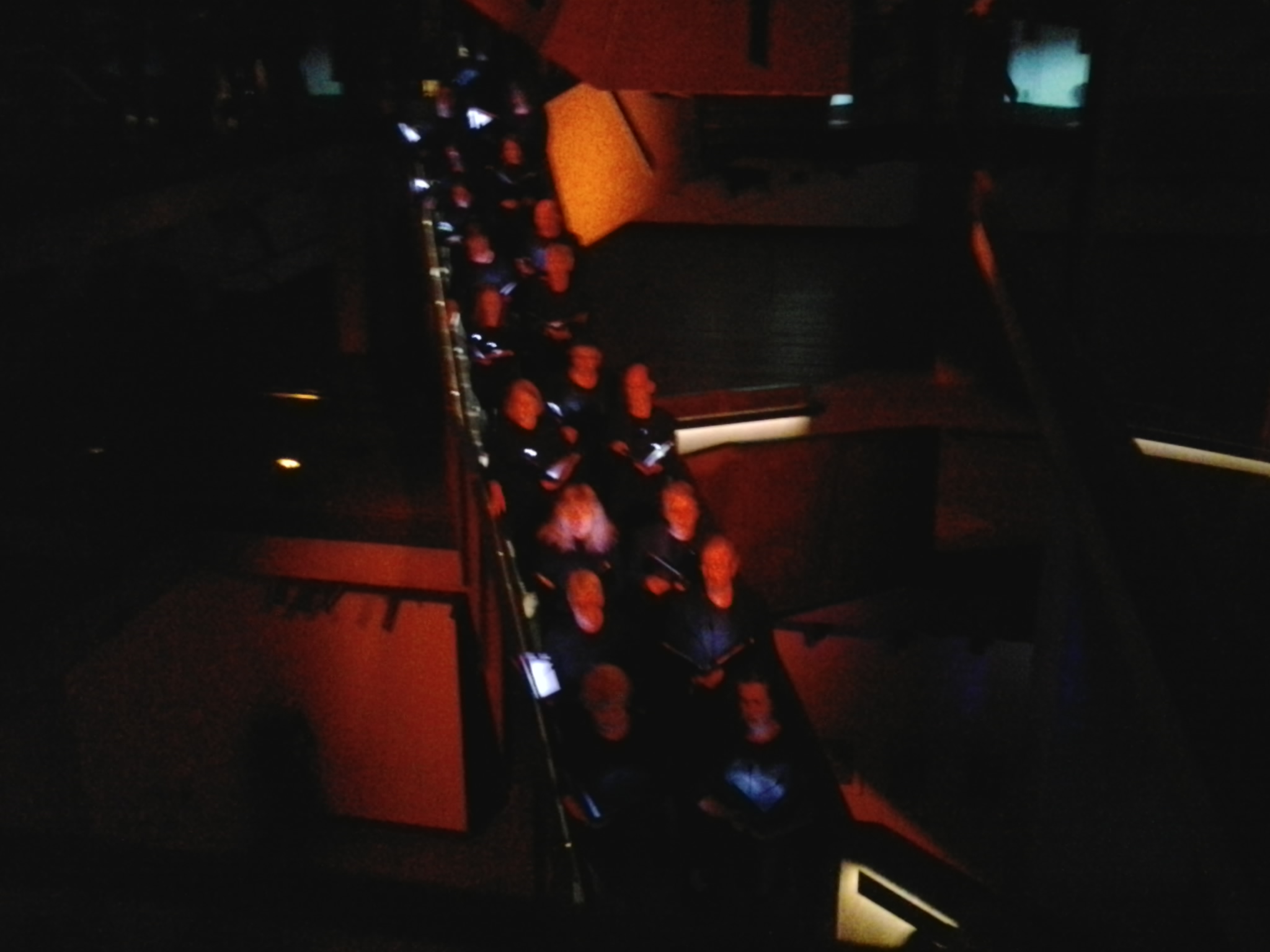
Near the cellist, the instrument case was laid on the floor and the candles were arranged around in the form of an offering. Meanwhile, the chorus members prostrated themselves before this icon and wailed cries to the gods. The picture of a religious ceremony was complete.  Duties complete, the chorus rose and walked on towards the switchback-stairwell. Eventually a core of singers arranged themselves down one section of the staircase and sang. When the remainder of the chorus filled other sections of the stairs and opened their hearts and voices, the sound was sublime.

Chorus of Tasmanian Symphony Orchestra singing sublimely on stairs within MONA 16 August 2014

Chorus of Tasmanian Symphony Orchestra singing sublimely on stairs within MONA 16 August 2014

This performance was profoundly moving.

Why was listening to the Chorus special to experience? And why was their performances more interesting and exciting than the instrumental pieces? I can think of a few reasons.

Not only did I have the pleasure of listening to thrilling musical sounds, but I also had the pleasure of seeing and understanding that this music is made directly by people as living breathing entities. There was life and vitality in the people and in the performance. These performances were not dedicated to music as something separate from people.

As an audience member I was taken on a journey. The physical journey took me out of my comfort zone (in the lightless Barrel room), and it encouraged me to walk as the Chorus moved around the Gallery (during the second performance). Both performances provoked me to question what was happening and why, and because I was required to think, these performances gave me more to do than simply acting like a sponge or acquiring the music by something like osmosis.  Having ‘work’ to do was exciting.

The inventiveness of costume, lights and location, all contributed to a series of spectacles today.  But most importantly, the arrangement and performance of the music was entertaining. I came to Synaesthesia 2014 hoping to be enthralled, taken away from myself, uplifted and entertained on many levels. I am delighted to say my expectations were exceeded. I floated away with (not away from) the Tasmanian Symphony Orchestra Chorus. A truly pleasurable and memorable experience. Next to the Derwent river.

MONA is a key destination on the edge of the Derwent river

I am excited that today I will be travelling by a series of local Metro buses to MONA (our wonderful comparatively new, Museum of Old and New Art – which incidentally also houses ancient Egyptian art). The award winning architectural edifice sits on the banks of the Derwent river in Hobart’s northern suburb, Berriedale.  In the future, one of the walking stages will include passing by MONA.

Today, however, the only walking to be done involves getting to bus stops, and then walking up the driveway past Alcorso’s old house and the green leafed rows of grapevines to the new museum. Inside a treat is waiting for me: Synaesthesia. This is where a select few visitors will be asked to submerge themselves in a ‘reverberating, subterranean private playground’. Presented by MONA and the Tasmanian Symphony Orchestra, Synaesthesia will create an immersive experience for its patrons with musicians spread out across the entirety of the museum.  This is edgy stuff and having attended one day of the inaugural event last year, I can’t be sure what lies ahead – and therein lies the attraction.  I do know the Tasmanian Symphony Orchestra chorus will be giving me a new experience when they sing in total darkness while listeners are contained in an unlit room: Black Bach.

A new idea – starting out

A year or so ago, I read the true story of an English man who walked the length of the Thames River in England. He did not start one day at one end and continue walking until he reached the other end. Instead the walker fitted many stages of the walk around his normal working life. Through his eyes, and via his words on the page, I discovered a new way of seeing and understanding the everyday world one step at a time.

Half a world away in Hobart Tasmania Australia, the mighty river Derwent wends its way from further north moving south over approximately 249 kilometres past Hobart towards the sea. Last weekend, I realised that if I could walk the edges of the Derwent, then a wonderful adventure might unfold.

As I reread the above, my writing seemed unimpassioned and lacking the excitement I feel about this idea.  How fabulous to walk along our wonderful river with all its changing temperaments and colours; on some days to walk beside its ruffled surface or its mirror sheen. To look across at parts of the city, the hills and the mountain.  To enjoy the bobbing and sails of the yachts. To be reminded that I live in this marvellous place.

And when I walk, I want to share my discoveries. I will write the story of the walk firstly on a blog followed by a later publication in a hard copy format – complete with photos.  In addition, I will align the walk with the various set down and pick up points of commuter buses of the public transport system. In this way, I will make the walks accessible for anyone without a car.

Alive with the idea, I alerted Ju and Jo. I knew they would contribute valuable information. Already the ideas are flowing.  Immediately, Ju expected to walk some stages with me – an obvious and appropriate response.  I expect other friends may wish to join some stages.

It is unlikely the stages will be walked sequentially. Rather we agreed that I should buy detailed maps on which to mark out the length and track of distinct stages. Then, depending on the weather of a day or my mood, I can select the stage that best meets the situation.  Stages will not last more than a day, but the length of any stage may vary. In winter a stage may last a few hours.  However, during the long days of summer, a stage may last many hours.

The walks will not always be on the rocky or sandy foreshores of the Derwent river. Sometimes these river edges may be place for our footfalls. At other times we may cross grassy slopes over hills or pass along the concrete pavements or bitumen roads of suburban streets. On occasion, permissions may be needed to pass through private land.  But such possibilities are ahead.

Each walk will be an incremental path through unknowns. Only once the length on both sides of the river has been covered on foot, can the patchwork of stages be brought together and moulded to tell a story.

Today I purchased five maps: New Norfolk (5026); Richmond (5226), Hobart (5225), Taroona (5224) and Blackmans Bay (5223). Collectively these cover a small part of the length of the Derwent river.  The initial aim will be to determine the walks from the sea ends of the river at a point in the Blackmans Bay suburb (on the western side) and near the township of Opossum Bay (on the eastern side) then continuing upriver and finishing at some point in the vicinity of New Norfolk.  Further west then north some of the river flows through untracked wilderness so that serious bushwalking plans will need to be developed for those distances.  The aim is to walk the most easily accessible bits first.

A wind ruffled Derwent River shows off the the pleasures of the water. being overlooked by snowcapped Mount Wellington

A wind ruffled Derwent River shows off the the pleasures of the water. being overlooked by snowcapped Mount Wellington