Category Archives: Derwent River

I was horrified to learn that maps may contain deliberate errors

In January this year, the story that cartographers make deliberate errors made me catch my breath.   You can read it in full here.

As long term readers of this blog will know from an earlier post, to walk from the mouth to the source of the Derwent River has required me to work across 17 maps.  Because they were generated by a government agency I would like to believe they were accurate at the time of printing.

While my maps are scaled at 1:25,000 (I always wished they were finer in detail), I depended on them as much as I could. I registered that many were grossly out of date – too many were last printed in the 1990s and so I was cautious with my expectations. However I never once thought that a deliberate error might have been introduced.

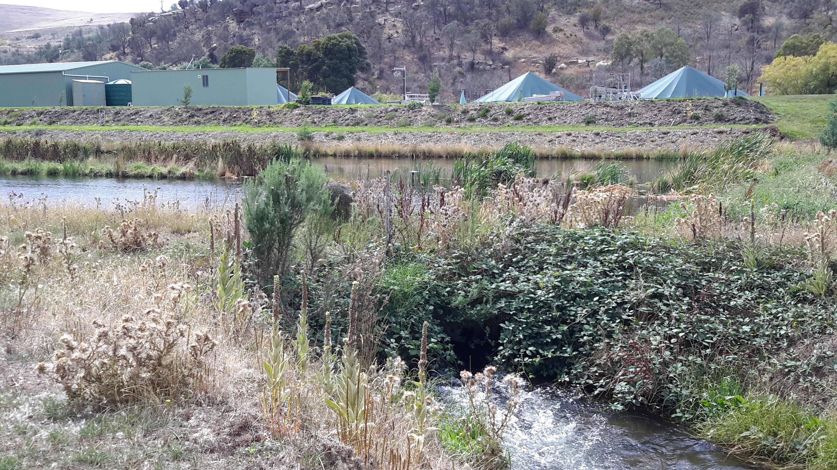
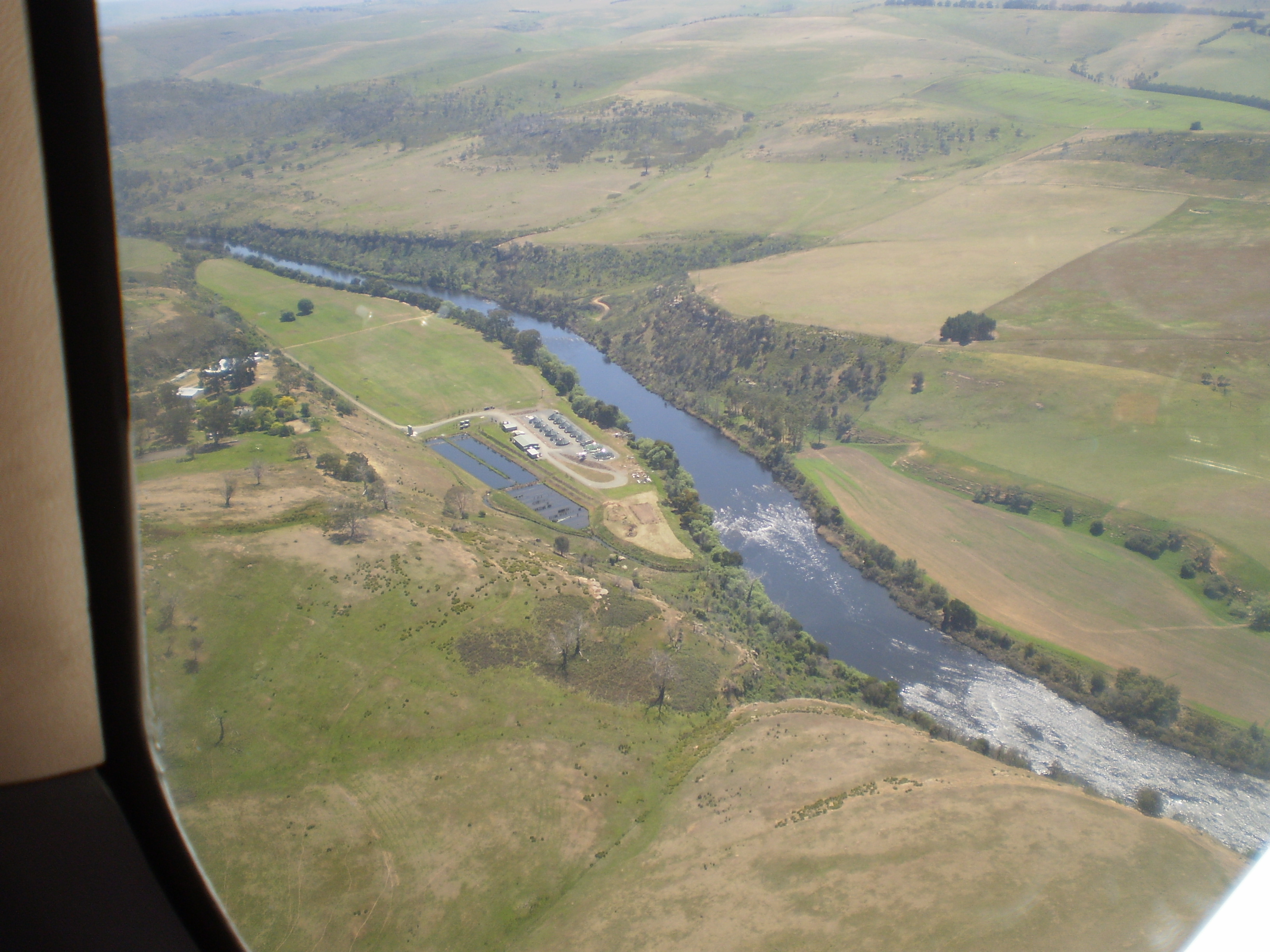
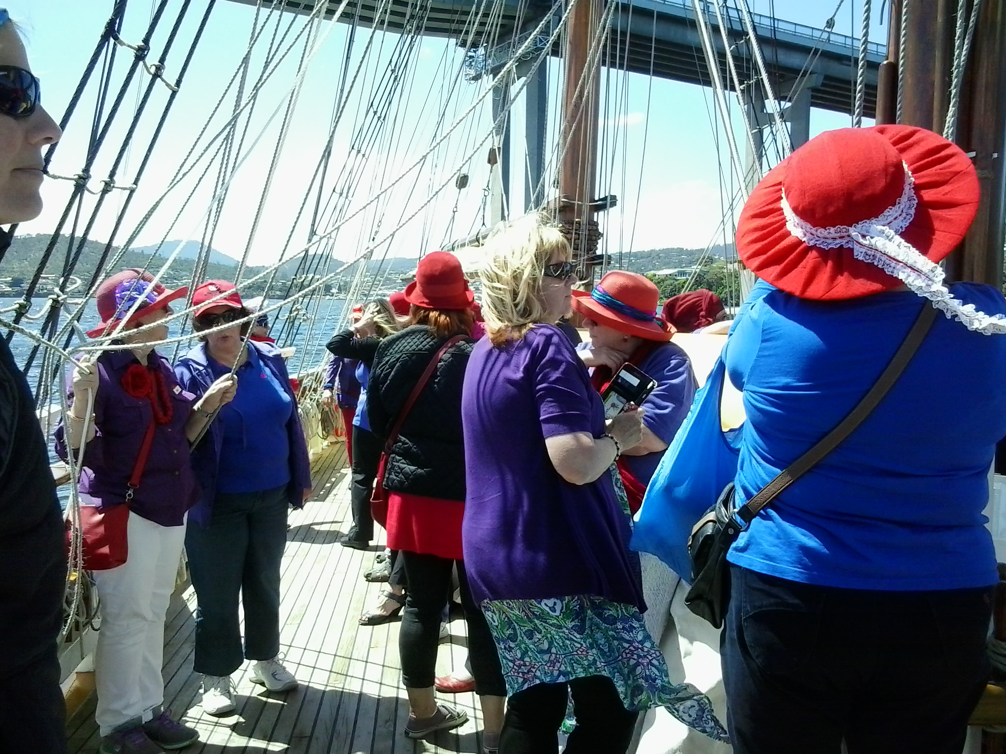
For walkers like myself, trekking independently great distances from help and civilisation, having accurate maps seems a sensible requirement.  Many readers will know that I always check with Google Earth imagery but again they are out of date – although not as old as some of the official maps I was using.  I was fortunate to be flown in a small aircraft up and back along the Derwent so the photos taken contributed to understanding what the land was like below.

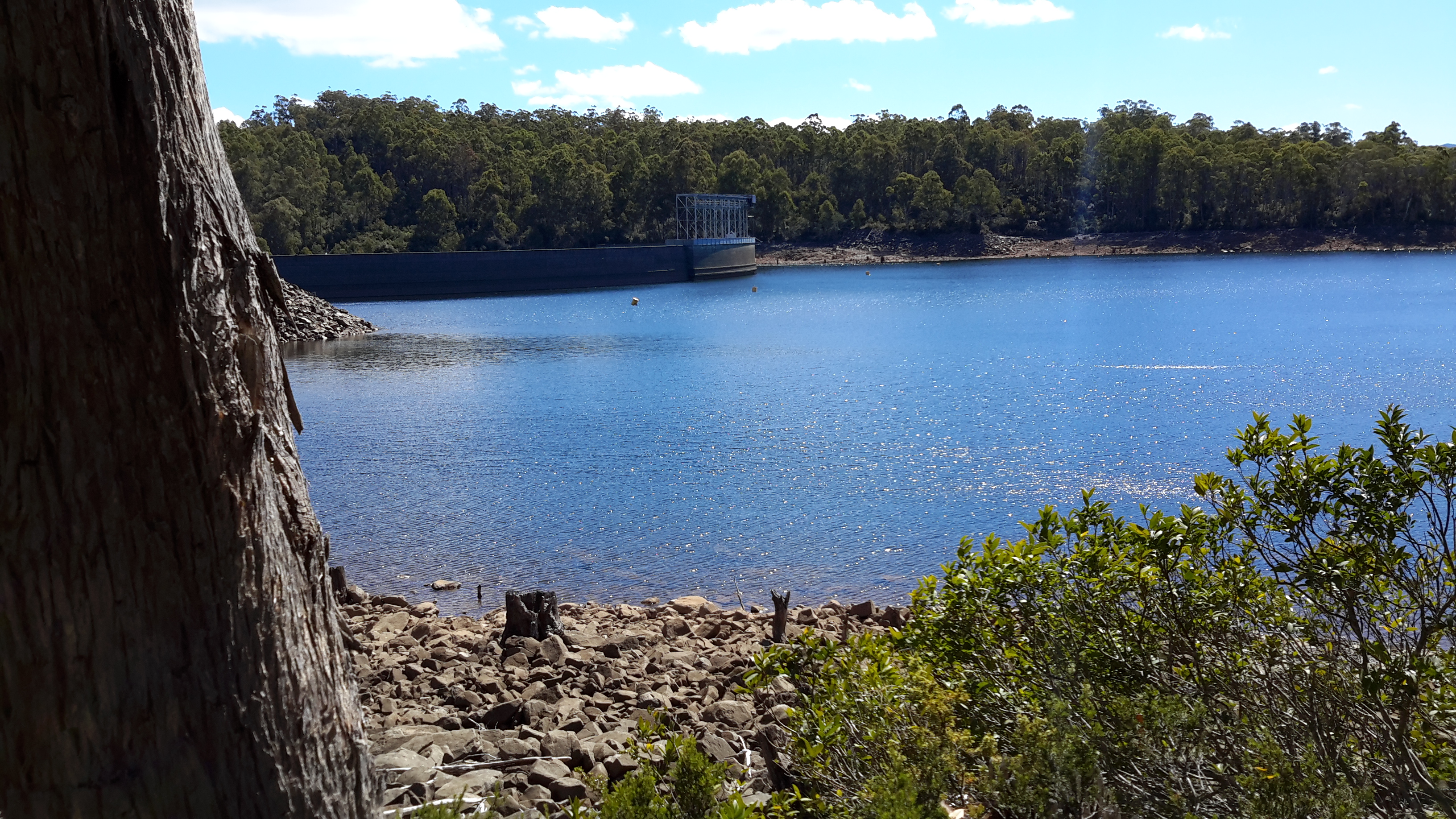
In recent days I have been horrified to learn that the Tasmanian State Government will never print further copies of the 1:25,000 scale maps and the common map for purchase in the future will be 1:100,000.  People get lost in our dense bush, and some have died after wandering around for days. From a public safety perspective for tourists and locals who want to make their own way into our bush, where tracks are non-existent and using a compass and a map is the only means of knowing where you are, I am somewhat fearful for people in the future.

Danger – mostly it’s in the mind

“Security is mostly a superstition. It does not exist in nature, nor do the children of men as a whole experience it. Avoiding danger is no safer in the long run than outright exposure. Life is either a daring adventure, or nothing.” – Helen Keller

The world is a wonderful place but not everyone is someone I want to meet, especially not when I am alone in remote or isolated areas of the landscape.  Through our population there are a small number of people who are addicted to drugs which can make them irrational and dangerous, there are others who find humour in physically hurting strangers, and there are a few who like to go in for the kill.  I do not want to be at the receiving end of any such activity.

When I first started writing the Walking the Derwent blog, I would provide advance information about which bus I was catching and from where.  Early blog followers pointed out to me this might be an encouragement to a weirdo to join me on my walks, and so I stopped giving out this information.

Then  one day I surrendered to those fears and stopped worrying: partly because I was well prepared for  most adverse circumstances. Despite the concerns of others,  all my walks have been safe.

For the past months I am sorry not to have been able to immerse myself in the stimulating isolation, the grandness of the sky and the clean freshness of our bush; instead for much of this year I have been hunched over the computer tapping out my books.  I am particularly grateful for the blogs of others who continue to photograph our wonderful Tasmanian bush nooks and crannies – especially those locations which few get to see. In particular I would like to draw your attention to This Amazing Planet .  Mark adds a photo or two each week and they never cease to amaze me – if you wanted another blog to follow then you will love the regular outpourings  from this site.

Fish Farms


There are two Tasmanian Atlantic Salmon fish farms adjacent to different sections of the Derwent River; one near Wayatinah Lagoon and the other downstream from Meadowbank Dam.  The privately owned company Salmon Enterprises of Tasmania (SALTAS), which are Australia’s largest producer of Tasmanian Atlantic Salmon smolt, operates the hatchery near Wayatinah.  The second photo below was taken by Michelle and the rest by me.

201 etc cropped.JPG

PA280093Florentine & derwent intersection.JPG

20151028_115422.jpg

20151029_113829.jpg

The family owned and operated Huon Aquaculture operates the farm at Meadowbank. More can be read here.

20160301_125255.jpg

20160301_123045.jpg

20160301_123048.jpg

Michelle’s photo presents an aerial view of the Meadowbank area.

PA280073.JPG

Air quality

You may recall one night I was woken in my tent by the smell of smoke; you can refer to the post with the details.  Apart from that night and the following day as I walked further inland with smoke in my nostrils and not knowing whether I was walking towards or from a fire (I was in an area where access to the internet and mobile telephone reception is non-existent), one of the great delights has been the clean air. Being able to breathe deeply and feel clean on the inside has been a bonus.

From time to time thousands of hectares/acres of our land suffer from unplanned Bush Fires (called Wild Fires in the USA) the source of which may be lightning strikes on dry forests.

In addition various government agencies organise planned burns to reduce the amount of dry vegetation (‘fuel reduction’ being the current term), with the view of preventing major out-of-control Bush Fires when the temperatures increase and the wind blows strongly.  The media always alerts the public so those with respiratory problems can plan to stay indoors or take other precautions.

So at different times, Tasmania no longer has pristine air.  I was amazed when I read this article and found that the air in the Derwent Valley was compared with the extremely unfavourable air quality of industrial India and China.  Back then, the air in that particular locality could be labelled as severe pollution.   Thankfully, the circumstances have reverted to normal … until the next burn.

Aboriginal inclusion

My last post explained how someone or some people made their destructive marks on a culturally significant site. In so doing they were showing disdain and attempting to wipe away part of Tasmania’s aboriginal heritage.  Their act sits in stark contrast to a November 2015 document, which was reported in the media a few weeks before the vandalism, that promoted inclusion rather than exclusion.  Refer The Mercury article of 11 April 2016.

ICOMOS (International Council on Monuments and Sites) and IUCN (International Union for Conservation of Nature) produced a report Reactive Monitoring Mission to the Tasmanian Wilderness, Australia with many recommendations.  These included:  ‘The term “wilderness” should be retained in the property name, while future dual naming is strongly encouraged to reflect both the Aboriginal heritage and the relationship of the Tasmanian Aboriginal Community with the property’;’The “Wilderness Zone”, as currently used and interpreted, should be retained in the zonation of the TWWHA, while explicitly providing for Aboriginal access for cultural practices as an integral part of the management of the zone’, and ‘The State Party should support and consolidate the emerging joint management of the TWWHA with the Tasmanian Aboriginal Community’.

The vandal or vandals who defaced the rock art are obviously out of step with growing community attitudes of support for aboriginal heritage and understanding of the values inherent in special sites.

Rock art vandalised

One morning I read the devastating news that paintings, made by aboriginals before white settlement (Tasmania began to be settled by Europeans in 1803), in a rock shelter near the Derwent River had been vandalised. The images were made by the Big River people, also known as the teen toomele menennye and the cave is considered a sacred site for aboriginal people.

Such caves are unknown among the general public, they are not advertised or signposted, there are no roads to them, and their location cannot be discovered in books.  This shelter is located on private property so that casual walkers are unlikely to have access.

To give some sort of perspective about the number of people who would know about aboriginal sites along the Derwent, inland Tasmania’s country is mostly either under primary production, forest plantations or related to electricity generation. Agricultural properties change hands over time and so it is reasonable to suggest that knowledge of any special sites would be shared across more people than the current owners and property managers.  Caves on Hydro Tasmanian property would be known to a few employees. Nevertheless, outside the aboriginal community, the pool of people who know their whereabouts would be small.  So when I learned of this tragedy I wondered why and who defiled the paintings.

I find it interesting that within a month of Hydro Tasmania releasing a newsletter mentioning the rock shelter, without giving a location, the vandalism was discovered. I wonder if there is a connection between that article and the damage; whether a reader of that newsletter who knew the rock shelter shared information about the site with someone who did not value the cultural history of our indigenous people. If you have more information please talk to Tasmania Police.

Here are some of the media stories:

The Mercury  

The ABC 

The Smithsonian Magazine

Sheets of silk and other flood coping mechanisms


With the rains earlier this year came an intriguing phenomenon not seen often.  Stunningly beautiful nets spread across bushes and trees- what were these and where did they come from?  Refer article 1 .  Refer article 2

Incidentally, the tiger snake shown in the Mercury newspaper article produces a highly toxic venom and I am surprised to see it being handled in a seemingly casual manner.  Parks and Wildlife Service Tasmania provide further information: “The highly toxic venom is produced in large amounts. The venom is mainly neurotoxic, affecting the central nervous system, but also causes muscle damage and affects blood clotting. The breakdown of muscle tissue can lead to kidney failure.” I never saw a tiger snake during my walks but they would have been around me on many occasions.  Thankfully they are shy and will not attack unless cornered or threatened in some way. I was always wary of accidentally standing on one if it crossed my path.

Floods and water levels rising


When I walked  along bodies of water dammed on the Derwent River such as Lake King William, I remarked on the low water levels, showed photos of deep barren shores, and posted about the coming danger to Tasmania’s electricity supply.  You can refer to a range of posts for different views on this topic including the following examples: Tarraleah Canal No 1 walk – where is the water?,  Lake King William, The rocky shore, Looking for a place to camp overnight, Death and Lake King William, Rise and shine, Trackless under the powerlines, and Andrew Hughes has walked, rafted and canoed the Derwent over the past month.

Newspapers recorded some of the extremes; here is one of The Mercury examples.

Hydro Tasmania is the organisation which manages water resources  by selling power not only to Tasmanians but via an undersea link to Victorians and further afield on mainland Australia.  For a very long while Tasmania had an unusually low rainfall, then when the Bass Link failed at the end of last year, this meant Tasmania could not buy power from the mainland if in crisis.  Over half a year passed before the fault was repaired and in that time water levels in dams, lakes and the river dropped steadily. In damage control, as politicians and the community worried about the reducing water levels, Hydro Tasmania released the information that our State could survive and continue to generate sufficient electricity in the local newspaper with dams at an even lower capacity . Nevertheless failure for rains to fall, created a situation where massive banks of diesel power generators were installed.  The operation of these generators cost Tasmania millions of dollars. The photo in this article shows an area being prepared for generators, and then the next article shows the installation outside Catagunya Power Station.  Generators were placed in many locations.  This article shows banks of generators outside the Meadowbank Power Station;  this is the closest power station to Hobart and is one of many that operates using the water from the Derwent River.

The dry situation was desperate.  Cloud Seeding was being practised as an option to bring on the rain.

Eventually the gods or nature heeded the call and the heavens opened.  As winter approached, welcome rain poured and began to replenish our dams and lakes.  The rain was heavy and persisted so that the water levels improved dramatically.  In the process, many parts of Tasmania experienced severe floods.  Dramatic stories were released in the media . The Ouse River, which feeds into the Derwent River, was the site of the death of one man.

These were terrible days for many.

Now the climate seems has returned to some sense of balance.  Our glorious spring time, albeit with some hotter days than normal, has passed and summer has arrived.  We all hope for prudent management of electricity generating water resources and for intelligent planning for extreme events – which we know are now more frequent around the world. In this way, the Derwent River will remain a living and useful flow of water which poses little risk to affecting people, animals and the surrounding landscape.

Tackling the backlog

Two sets of posts will be written before I write up the backlog of Walking the Derwent posts.

  1. Over the past six months I collected an assortment of ideas for stories about our Tasmanian Derwent River: these will be expanded and added to the blog.
  2. Then, I will summarise where I have walked, to give the last posts a context.

For now and over the next few weeks, you should expect to read pieces of non-walking but Derwent River related information that grabbed my attention during the year.

I do not plan to offer you a daily post rather a new post every few days because, after my big year, I plan to enjoy the summer weather and take a holiday approach to life for a few weeks.  I apologise in advance for those readers who have asked for daily posts again.

Where have I been?

Answer: Mostly looking through my windows and watching the seasons pass across snippets of Derwent River and Mount Wellington.

032 cropped.JPG

Helens_AirBnB_11.jpg

snow clouds over mountain 27-04-2009 11-03-53 AM.JPG

mt-wellington-with-snow-from-10-veronica-cropped

mountain under snow 1July 08 002.jpg

moon over mountain-auto.jpg

For the past six months, the almost daily posts of earlier times on this Walking the Derwent blogsite stopped. While my thoughts have never been far from the Derwent River, since March I have posted only two or three stories. Avid followers of my walk along the Derwent River from the mouth to the source,  will realise that stories of particular sections of the walk have not been recorded.   Over the next month or two that gap will be filled.

When I halted writing this blog, I focused on compiling and publishing the book William Baker Tyzack and descendants in Australia  and running a blog associated with the anniversary of my great great grandfather’s arrival in Australia 150 years ago. Then I authored and published a book of an artist friend’s letters that had been sent to me over a quarter of a century.  During the processes of putting both books together, an opportunity to author and publish a third book came to my attention. Recently I published a book about my goddaughter. All non-fiction. All personal. I have been enthralled by the wonderful ease of self-publishing resources, and the professional look of the final publications.

Now I am inspired to turn my Walking the Derwent blog into a user-friendly book, which can be purchased both in book shops and on the internet.  But first, I need to finish writing the posts which record the remainder of my walk. I aim to complete the posts within the next two months then, early next year, begin the massive task to condense over 200,000 words and thousands of photos into a comparatively tiny tome.

Tasmania’s Derwent River continues to remain a feature of magic for me. I have missed my past regular walks inland discovering its nature and its pathway through the landscape.  Thankfully, here in Hobart, I live with a constant view of the changing appearances of the Derwent and the glorious sky above.

Whispy sky  over Hobart from Veronica St with removed aerial.jpg

clouds in dusty red 009.jpg


Sailing ships

Yesterday I had the pleasure of sailing around the Derwent River Harbour in a full scale replica of the Lady Nelson sailing ship.  The original was built in 1798 in England and plied the waters between Newcastle and Norfolk Island and Tasmania for the next  twenty five years.  My day on the water was glorious with blue skies, golden sunshine and a firm breeze. When all the sails went up, we scudded along at 7 knots.  Quite wonderful. The image below is of the replica in which I sailed.

Lady nelson from theirwebsite.jpg

The water surface had an almost millpond quality as we returned to the wharf. I couldn’t imagine how sailing ships would cope with heavy seas.

2016-11-18 14.52.17.jpg

I spent a great deal of time thinking about earlier sailing ships and I tried to imagine what it might have been like, with so many ropes and so many sails being part of the picture for months at sea.

The Lady Nelson came out to Australia with around 20 people. The original crew size was 12.

Records show that at times there were perhaps 60 or more people sailing for days on the Lady Nelson.  Yesterday with passengers and crew I suspect our number was around 40. It was standing room only on the deck when all were assembled. Sailing for days would have been very cramped and most uncomfortable by today’s standards (although I recognise that people were generally physically smaller back then than we are today). Add to that, on the original Lady Nelson, the area below deck remained unstructured with one open hold. Apparently people slept on boxes and ropes and all.

My photos below give some idea of the majesty of a sailing ship however small (and it also shows how glorious it is to be out on the Derwent River in Hobart).

2016-11-18 13.34.22.jpg

2016-11-18 14.10.08.jpg

2016-11-18 13.58.40.jpg

2016-11-18 14.14.43.jpg

2016-11-18 14.04.14.jpg

2016-11-18 14.06.14.jpg


The Lady Nelson was approx 53 feet long ,  approx 17 feet wide and weighed 61 tons. I have compared this with the larger ships that arrived in the Derwent River in the early part of the 19th century and so,  after yesterday’s most stimulating sail, I feel I have a small but greater understanding of what travellers (convicts and free settlers) might have been exposed to at sea before they started their comparatively mild run up the Derwent.

The Lady Nelson replica runs trips lasting a few days; I am considering taking one of these small voyages. Part of the deal, if you wish, is to learn to handle the ropes and even climb around the sails.  I wonder if the 19th century crews allowed such liberties to its passengers.

Do what makes you happy


This blog post is not about my walking the Derwent River however it is about the spirit in which I tackled the trek.

I made my own mind up about where I would go, how I would get there and return, how long I would take, and the shape of the overall experience.  While some people were exceptionally nervous about my walking along some parts of the river, only two people told me not to walk particular sections. But I didn’t listen. I knew that, despite my bad ankles, feet, and knees I could do anything I wanted and would.  Even if it was at the rate of half the speed of what ‘normal’ people do – whatever that is.

My project to walk from the mouth to the source has always been intended to inspire others to find their own projects – not necessarily walking projects – but always discovery projects where you face the uncertainty of not knowing the outcome.  Let me tell you – you can do so much more than you believe.

One of the blogs which I follow, Soul Trekkers, has published a post telling how she follows her own path despite other people wanting to decide for her where she goes.  You can read it at Choose your Own Adventure.

Be inspired and find your own projects.  Push yourself out of your comfort zone (but keep safe) and enjoy finding out more about this wonderful world of ours.


Andrew Hughes has walked, rafted and canoed the Derwent over the past month

My last post introduced the Expedition Class’s  latest project.  The key man during the journey was Andrew Hughes and now his trek is complete.

The first newspaper coverage of this story was published in The Mercury last May.

The Mercury published another story recently ‘Warm welcome for adventurer Andrew Hughes as he paddles into GASP‘. His journey started north east of Lake St Clair in central Tasmania and now Andrew has crossed an imaginary finish line between the Iron Pot on the eastern side of the Derwent River and Tinderbox on the western side and this conclusion has been covered again in The Mercury.

If you go to the web,  you can read the mini ‘Live Reports’ of the 28 sections of his journey. You can peruse a collection of photos for each section. The information in the reports is limited and no information is offered with the photographs.  Unless you have travelled the  edge of or on the Derwent River, it would be difficult if not impossible to identify locations.

A comparison of some of Andrew’s photos with those I took during my walk from the mouth to the source of the Derwent River, makes for interesting viewing.

Firstly I would like to compare the rush of water over the river rocks between Wayatinah and Butlers Gorge that Andrew saw compared to the low almost absent water level that I experienced on two occasions. Since I completed my walks along the Derwent earlier this year, Tasmania has been inundated with unexpected high levels of rain which have raised the water levels in the dams and the Derwent River.

The photo below was taken by me in October 2015.

20151029_113841.jpg

The next photo was taken by me in January 2016

20160115_130427.jpg

The photo below is by Andrew as shown in his Live Report 18.

1471514898-IMG_3177 from 18 of expedition class live reports.JPG

My photo below shows the water level of the huge 15 kilometre Lake King William was so much lower in October 2015.

20151029_123314.jpg

My photo taken only 2 ½ months later at the beginning of January this year, showed the water level  had dropped dramatically so that the Tasmanian government was considerably worried about our electricity generation options.

20160102_155721.jpg

In Live Report 15 Andrew shows the Lake King William water backed up to Clark Dam at Butlers Gorge. Tasmania is no longer worrying about our water storage facilities and power generation. Again we have enough water to create clean electricity.

1471254936-IMG_3085 from live report 15.JPG

These photos are wonderful reminders of the unpredictability and power of nature.   Andrew’s reports and photos are an excellent example of people getting out into our Tasmanian wilderness and experiencing it’s challenges and wonders.  I hope his trek inspires others not necessarily to cover the same territory, but to find new country to discover and enjoy.  To be refreshed by the purity of the bush.

More adventurous walkers are tackling the Derwent

Last January artist Justy Phillips and writer Margaret Woodward walked along sections of the Derwent finishing at Lake St Clair using the support of friends.  On some days they were accompanied by others.

This week  I discovered that a group of children are currently engaged in a ‘Derwent River catchment school program’. They started their supported walk further inland in the upper catchment areas of the Derwent River, north west of Lake St Clair, and are yet to commence their trek towards the sea. In winter!  What a strange choice of season to walk with inexperienced young bushwalkers in central Tasmania.

You can read more about their walk in the news story 

Details of the program are available on the Expedition Class website.  The site includes ‘Live reports’ which record the extreme weather rather than their progress.  They are yet to walk around Lake St Clair before tackling some of the most challenging sections of the Derwent River.  I wish them all the best.

Since starting my walk from the mouth to the source of the Derwent River late in 2014, I have met people and heard of others who are considering walking the Derwent.  Currently there are no walking paths for most of the 215 kilometres, and the dense almost impenetrable bush along the river edges in the upper reaches, makes this a dangerous activity for inexperienced bush walkers.  Readers of my blog will recall that permission to walk on private land is not always given making some river sections inaccessible – this means that future walkers might not be able to accomplish their goal.  If the numbers of people who seek to walk on private agricultural land increases, then even the most positive and supportive of landowners may decline to allow access to protect their livestock and property.

With the growing interest in undertaking such a journey, the time has come for Tourism Tasmania and the Department of Parks and Wildlife Service to examine the obstacles which need surmounting, to make a walk along the Derwent River possible and safe.

Has the river of blogs dried up? Is my write up of the walks along the Derwent River over?

from MountWellington.jpg

 This wonderful image of ‘Hobart from Mt Wellington’ is the work of Tourism Tasmania and Garry Moore. This free photo has unrestricted copyright.

Has the river of blogs dried up?  Is my write up of the walks along the Derwent River over? The answer to both questions is no.

For a long time, blog followers have received a daily post covering my experiences after I have walked sections of the terrain from the mouth to the source of Tasmania’s Derwent River, plus my additional writings about various aspects of the social and natural history of the Derwent River.  Yesterday and this morning were a rude shock for some Australians – no blog post to absorb over the breakfast cuppas– and for my overseas followers spread across many countries, their regular daily dose arrived at many different times depending on the time zone in which they live.

Have I run out of stories to tell, descriptions to give and photos to show? The answer is a resounding no. I have much more to expose. Please be assured that you have not seen the sights of all the kilometres of the Derwent River, nor heard about all its challenges, in my blog yet.  So why the absence of new posts?

I have committed to another major project which cannot wait any longer for my sustained action. I like huge projects.

Last year I discovered that the first Tyzack in my line (3 different lines came to Australia from England in the 19th century) arrived at Port Melbourne 150 years ago this coming December.  Impulsively I decided (without research or planning just as I conceived the idea to walk the length of the Derwent River) to organise a family gathering later this year for all my great great grandfather’s descendants spread across Australia. Two family members agreed to support me –thankfully one has prepared a family tree. The Tyzack 150th anniversary organisation is now my priority, because there is a book to be put together and published, field trip guides to be developed, and much more – I still haven’t received responses to my introductory letters from most of the over 100 living descendants (almost all whom I have never heard of leave alone know) so I have a big job ahead tracking them down and getting them onside and involved.

This family event is scheduled early in October – so, if not before then, from mid-October onwards I expect to continue writing up the Derwent River walking blog stories.  Probably I won’t be able to restrain myself so that, from time to time, a post may appear.

The photo below taken by Michelle shows the eastern shore mouth of the Derwent River, Cape Direction (on the right) and the Iron Pot islet sits out within Storm Bay.

PA280012.JPG