Author Archives: Tasmanian traveller

Unknown's avatar

About Tasmanian traveller

Through travel, I have experienced the eccentricities of people and their environments around the world. At the same time, I love where I live. So, for people who cannot travel to discover the wonders of my home town, this blog is an attempt to introduce its exoticness. My goal was to walk along both sides of Hobart's Derwent River from the mouth to New Norfolk, and to walk on one or alternating sides of the River between New Norfolk and the source of the River at the southern end of Lake St Clair. The walk was undertaken in stages around my other commitments of my life. Almost all stages of the walk connected with Tasmanian public transport - my intentions was to inspire people, who do not have access to a vehicle, to feel they can replicate the walks. This blog reports on each stage in the hope it will encourage people to either follow in my steps or to create their own walking project where-ever they live. Please note: The blog background and headliner image of 'Hobart from Mt Wellington' is the work of Tourism Tasmania and Garry Moore. It is a free image with unrestricted copyright and available from http://www.tassietrade.com.au/visual_library

Getting started on Stage 10 along the Derwent River.

From the eastern shore I caught a bus to Hobart City and then transferred to a 7am bus destined for Bridgewater. At the Glenorchy Bus Mall we waited until it was time to continue … and until more passengers arrived.

20150109_072558

This bus travels along the main road via Berriedale, Claremont and Granton suburbs. At 7.32am I was off the bus outside the Grenada Tavern at Berriedale.

20150109_073246

Opposite the bus stop I glanced at the vineyards of Moorilla and thought of the Museum of New and Old Art (MONA) nearby.

20150109_073235

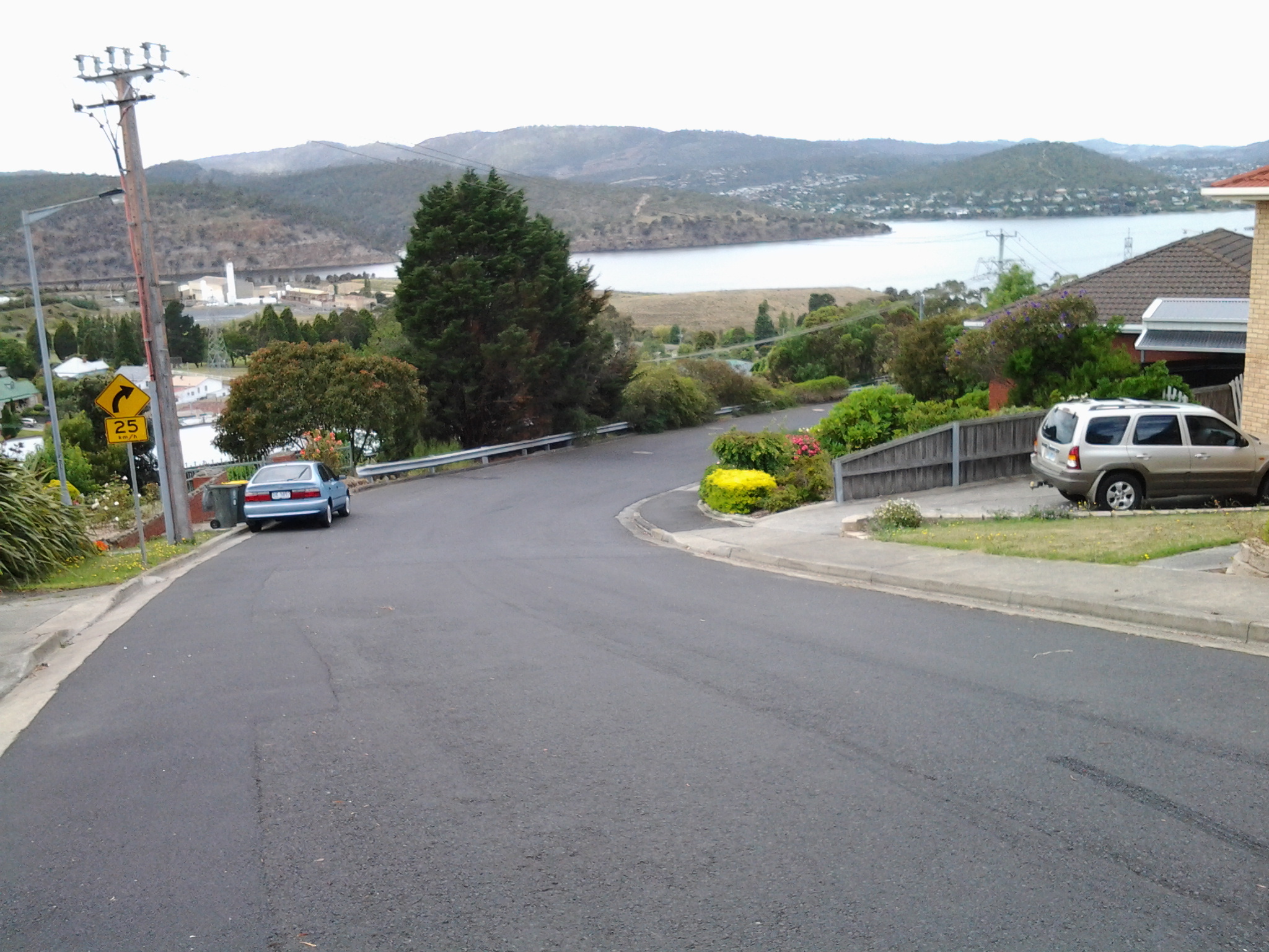
The view, down the road in the southerly direction I needed to follow, is blandly suburban.  At that hour, the road was very quiet.  I guess with school holidays and many adults taking a holiday away from work, there were lots of sleeping bodies in the vicinity.

20150109_073239

I crossed the road and headed south on the footpath looking to see how I could get past the houses edging Berriedale Bay and walk closer to the water.  Firstly I reached a parking area with a tall mesh fence partly blocking an area of profusely flowering weeds and Berriedale Bay water from me.

20150109_073650

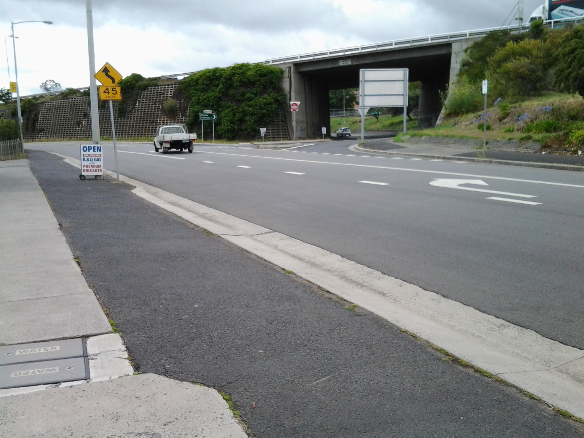
I continued on the main road and turned left away from the highway overpass.

20150109_073954

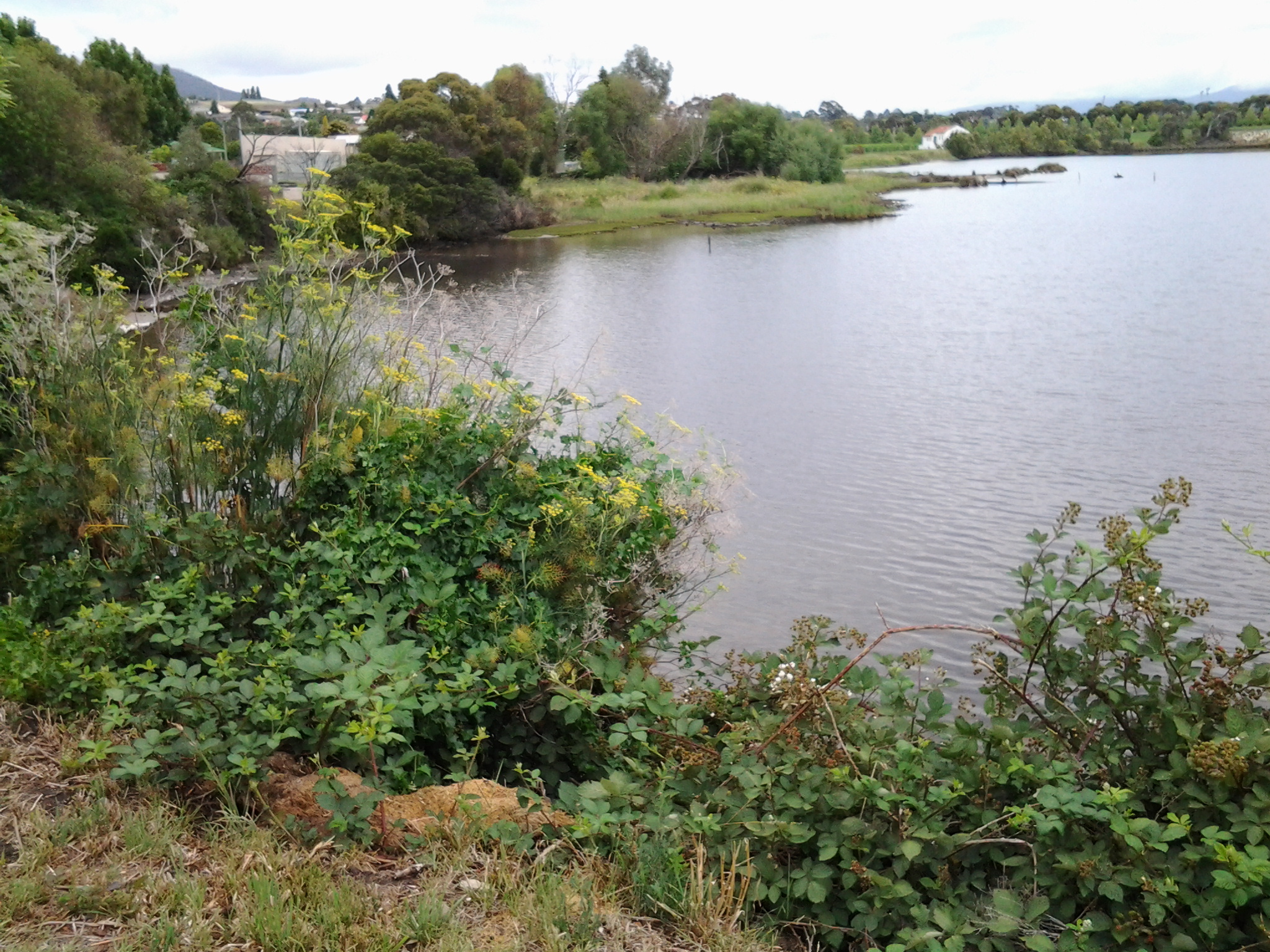
When I reached a service station I spotted a gap to the water and deviated to see whether further access was possible. Looking north over a bramble of free sown blackberry bushes, I could see the vineyards of Moorilla, and the concrete and rusting building of MONA.

20150109_074116  20150109_074126

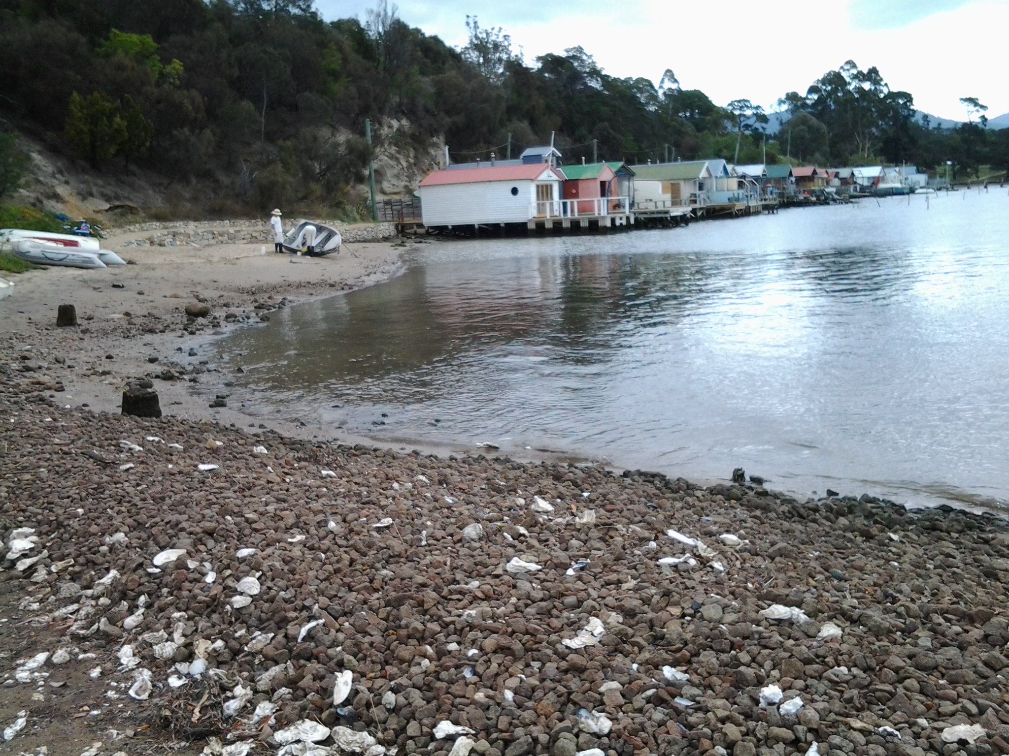
Looking south, Frying Pan Island could be seen joined to the land by a tiny isthmus.

20150109_074105

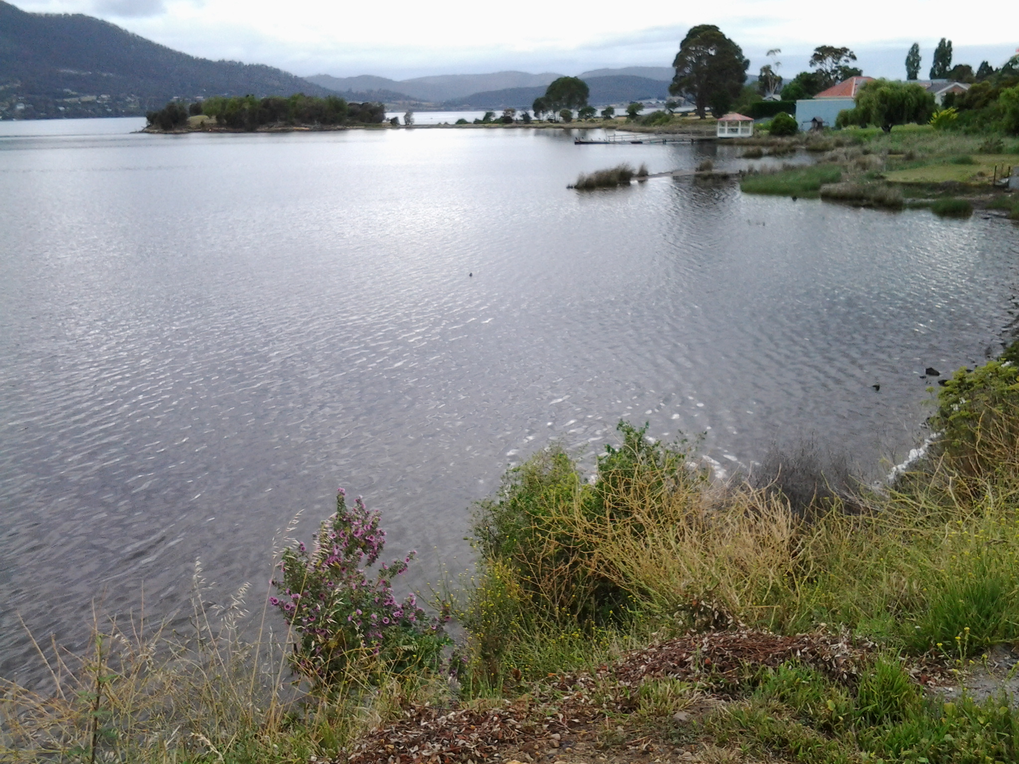
It was clear there would be no continual walking access directly along the River’s edge.  I returned to the main road and continued along until I reached the Strathaven Home for senior citizens and Riverfront Motel villas, arriving there about 20 minutes after I had stepped off the bus. I walked through these properties and continued along the foreshore until stalled by a high fence topped with barbed wire – this continued out into the water as a definite deterrent for further progress. Fat rabbits, and gangs of wild hens scattered across the mown grasses. Frying Plan Island can be accessed via the Strathaven Home  and Motel site. In the photo below, the tiny islet in the foreground and southern side of the Bay, almost blocks the rusting verticals which form part of MONA in the distance at the northern side of Berriedale Bay. It is rather difficult to separate these visually.

20150109_075100

So I retraced my steps back to the main road and joined the ‘bike path’ established for both cyclists and pedestrians by the joint efforts of the Cities of Hobart and Glenorchy. It was 8am.

Walking next to the Derwent River. The proof.

By accident, I videoed my feet as I walked across the ground near the Derwent Entertainment Centre in the southern extremities of the Glenorchy Arts and Sculpture Park (GASP).  The video lasts 53 seconds, which when you watch seems a long time, and reminds me of the unchanging nature and relentlessness of some of the films of Andy Warhol decades ago.

http://youtu.be/q5sNFzfmFuI

Yesterday I completed Stage 10 of my sequential walk along the Derwent River

The goal for Stage 10 was to start at my last stopping point, MONA in the middle of Berriedale on the western shore of the Derwent River, and continue to Lutana the last suburb of the City of Glenorchy before the City of Hobart starts. But I went further.  Much further.  Almost much further than my feet could take me.  I walked to Hobart.

Over future posts I will write up the stories of the walk, what I saw and what I experienced, but for now it’s enough to say that I am continuing with this massive project to walk both sides of the Derwent between the mouth and Bridgewater, and then onwards to Lake St Clair. Once I get walking it is always so addictive.  Even when my feet feel crippled, I say to myself … ‘go just a little bit further. What else will I be able to see with fresh eyes?’

The day was gloomy with a cloudy sky, and Mount Wellington had veils of clouds covering at least part of its prominence most of the day. But it didn’t rain and so was perfect for walking.  However, the weather ensured the photographs were without sunshine.

Yesterday I covered 12 kilometres of the length of the Derwent River on the western shore (making 22 kms in total on the western shore), and walked approximately 19 kilometres (making a total of 130 kms to date) to achieve that distance. This distance also takes in the streets and paths on which I walked that led to dead ends so that I needed to retrace my footsteps.

Of the many highlights of the walk, I saw the building that once started life as Rosetta Cottage, and powerful Clydesdale horses with their large hairy feet.

20150109_162649

I surprised a friend still in pyjamas when I went visiting for the first time in my walks. The hot cups of tea were most welcome.

I am always excited when I walk the striped edged boardwalks of GASP (Glenorchy Arts and Sculpture Park) or pass the boatsheds of Cornelian Bay and it was no different yesterday.  See the photos below for a taste of the colour.

20150109_084404  20150109_145335

I very much enjoyed looking at the eastern shore where I had walked during past stages and seeing the landscape from a different perspective.  I felt it made the Greater Hobart Area seem undeveloped in a way which is quite amazing for a capital city. For example, Bedlam Walls on the eastern shore from the western shore of the Derwent River, in the photo below.

20150109_123940

From comments I have received, I know my walks are inspiring others to think about what they might do. Even if you choose not to walk, perhaps you can set yourself other challenges.

My next walk will start at Hunter St at Sullivans Cove on the wharf in Hobart and probably extend to Kingston.  But before then I need to record the details of yesterday’s walk.

Rosetta on the Derwent River

My next walk along the Derwent River will start half way through Berriedale and pass by the suburb of Rosetta before moving onto others. I have tried to discover how Rosetta came to be named and, while I learned a little of its history, I am not certain why it was given this name.  However, I believe that our local suburb of Rosetta is indirectly named after an Egyptian town.

I suspect it all started around the time when the internationally known Rosetta Stone was found in 1799 (note: the first European settlement along our Derwent River started in 1803).  The Rosetta Stone was found by French soldiers, (under Napoleon Bonaparte’s command) who were rebuilding a fort in Egypt, in a small village called Rashid (but known as Rosetta by the Europeans).

Wikipedia offers the following information: “Rosetta (Arabic: رشيد‎ Rašīd IPA: [ɾɑˈʃiːd]; French: Rosette) is a port city on the Nile Delta in Egypt, located 65 km east of Alexandria. Both the Arabic name Rašīd (Interesting unrelated sideline is that Ar-Rašīd meaning “The Guide”, is one of the 99 names of Allah) and the western name Rosetta or Rosette (“little rose” in Italian and French respectively) are corruptions of a Coptic (language from the native Christians of Egypt) word, Rashit or Trashit.”  I can pronounce Trashit, Rashid and Rosette/Rosetta so that they sound similar. Can you?

Read http://www.touregypt.net/rashid.htm#ixzz3NvMb6Iyk for more information about the town of Rashid. Apparently the highly green Egyptian town on the Nile River was typically tranquil with vast gardens, orchards and date-palm plantations, in addition to a multitude of beautiful historical houses, inns and mosques adorned with exquisite decorative inscriptions and woodworks. The town was known as the ‘Rose of the Nile’ by Europeans. I guess the name Rosetta was given to our suburb for the underlying European meaning of rose; a thing of beauty.  Hobart’s Rosetta is located on the southern side of Tasmania’s major river in a beautiful setting within the City of Glenorchy as part of the Greater Hobart Area.  However it is neither a city nor a port.

In 1807 as part of the Alexandria/Fraser expedition to Rosetta in Egypt, British forces led one group of local inhabitants in a civil war against another group led by a local leader.  Britain’s intention was to break the Ottoman-French alliance. As a result, in the first decade of the 1800s, I suggest that Egypt would have been highly visible in English news and the battles would have been known in the colonies.

Irene Schaffer, a Rosetta resident and local researcher offers historical information about the original settlement at http://www.tasfamily.net.au/~schafferi/index.php?file=kop79.php. John Berrisford and wife arrived in Australia from England on the First Fleet in 1788. Then, in 1808 John and his family sailed to Hobart Town. In subsequent years, they settled along the Derwent River in the area now known as Berriedale Bay and which extended to the south-east past Rosetta High School, and they built Rosetta Cottage (later renamed Undine Inn). 140 acres of land, now part of our suburb of Rosetta, was granted by NSW’s Governor King to John Berrisford in 1813.

My last walk along the Derwent River finished at MONA a little to the north of Rosetta. My next walk will start by passing Berriedale Bay. I look forward to seeing the old house – albeit with extensions and renovations since John Berrisford was alive. A photograph of this property, now known as the Rosetta Colonial Accommodation, can be seen at http://firstfleetfellowship.org.au/stories/john-hannah-beresford/. This website also provides more detail about the Berrisford family and their history.

Perhaps, through news from England, John Berrisford heard that Rosetta was the ‘Rose of the Nile’ and, in believing the British intrusion into Egypt was glorious, named his house as a show of support.

As a contrast from the historical background, I have located a contemporary profile for Rosetta. The population is 2567, the median household weekly income is $1050, the median age of residents is 45 years, the average household size is 2.4, almost 60% are married or in a de facto relationship, almost 40% are either under 5 years of age or over 64 years of age, weekly rent is $340, and the median house price is $319,455.

40th anniversary of the collapse of the Tasman Bridge over the Derwent River

On the 5th January 1975 late at night, the link between the eastern and western shore of the Derwent River was broken.  It took 2 ½ years to rebuild. In the interim, residents of the eastern shore ferried across to Hobart city for work.  Last night a small gathering of people came together to remember that momentous occasion.  Read more at:

http://www.news.com.au/national/tasmania/tasman-bridge-collapse-remembered/story-fnn32rbc-1227175410862e

These days if a large ship is travelling upstream, traffic lights bring vehicles to a stop before they drive onto the Tasman Bridge. Bridge pedestrians are also alerted to stop and wait until a ship has passed before walking.  However, as I found one day when walking into Hobart city over the Bridge, the alert is not given soon enough for pedestrians and I was already on the Bridge when the cars were stopped. I recall walking to the highest point and looking down and watching the ship pass beneath. Safely.

Then there is remarkable story of the guy whose Monaro teetered over the edge of the broken bridge.  He stills drives the car. You can see pictures and learn more at http://www.news.com.au/national/tasmania/historic-monaro-out-from-under-wraps-for-anniversary-of-tasman-bridge-disaster/story-fnn32rbc-1227174793722

Berriedale on the Derwent River

I experienced the Berriedale Caravan Park, beautiful bays and water birds, the surprising memorial to dogs that were members of the defence forces in various international wars, sewage works and MONA at the end of the last stage of my walk along the Derwent River. But there is more to Berriedale.

1986 was the International Year of Peace and many Peace Gardens were created to celebrate the event. Others have been created since then for bringing communities together. Eve Masterman (1907-2014), a tireless worker for peace, social justice and the environment, was instrumental in the establishment of an International Peace Forest (Peace Park) at Berriedale in 1991. This Forest/Park does not appear on Google maps, is not listed as a park within the jurisdiction of the City of Glenorchy, and there are a number of online enquiries asking for the location. But I remember passing through a Peace Park on my walk – I just can’t remember where. I have scoured my handwritten notes (the precursors to the postings) and photographs and found them wanting. Does any reader know the location of the International Peace Forest (Peace Park) at Berriedale? Shouldn’t a Peace Park be considered significant and worthy of records, signage and directions?

Now, how about some older history?

The Scottish heritage of some residents of Tasmania’s City of Glenorchy may be represented in the name Berriedale. According to http://www.tasmaniatopten.com/lists/ancestries.php, “The third largest migrant group in Tasmania are the Scots. They were also numerous among the early settlers in the colony.” Firstly, it was interesting to learn that in Scotland; Glen Orchy is about 17 km long and follows the River Orchy through the Caledonian Forest. Secondly, there is a small village Berriedale located on the far north eastern coast of Scotland. I have looked at images of the Scottish countryside around Berriedale and they show no resemblance to Tasmania’s Berriedale. The Berriedale Inn was open for business near our Derwent River in 1834 and perhaps the name for the suburb derived from that. Alternatively, perhaps our suburb was named after someone with that surname rather than the town. The City of Clarence has a good website with historical information about its suburbs and so I wish that the City of Glenorchy offered something similar. I can’t believe I am the only one interested to understand the Hobart that I live in.

Around the corner from the mouth of the Derwent River, at Clifton Beach

Yesterday, the temperature at my home was in the high 30 degrees but today the temperature was much more pleasant and only rose to a little over the mid 20s. In the spirit of getting back out into the environment and not worrying about heat exhaustion, this afternoon Je and I headed off to have a look at Clifton Beach. This is not a place easily accessible by public transport unless you have time to take a long walk of many kilometres from a distant bus stop. So this Beach was accessed today by starting with a private car trip.

Neither of us had visited Clifton Beach or the adjacent Clifton Beach Conservation Area nature reserve for many years yet it’s a stunningly beautiful location only 25km from the centre of Hobart. The sky was cloudless, and the onshore breeze kept us comfortably relaxed.

This beachside suburb to the north of the South Arm peninsula and therefore north of the mouth of the Derwent River on the eastern shore, is part of the City of Clarence in which I live, and part of the Greater Hobart Area.

Clifton Beach is a 2.1km long wide sandy beach backed by deep revegetated 20 metre high sandy dunes. The beach is bordered by 54m high Cape Deslacs in the east and 50m high rocky cliffs in the west that run south for 3.5 km rising to 100m high at Cape Contrariety. At the southern end of the beach, a Surf Club is central to the protection of swimmers. However out on the waves, and typically clad in black wet suits, were sun-bleached surfers. Have a look at http://www.surf-forecast.com/breaks/Clifton-Beach which has a changing selection of photographs showcasing this amazing beach – plus you can check out the forecast if you want to go for a surf. One of the photos looks towards the southern end, another looks across Storm Bay to the Tasman Peninsula, and the other is a huge wave the like of which we did not see today.

The photo on http://en.wikipedia.org/wiki/Clifton_Beach,_Tasmania shows the cliffs at the northern end marking Cape Deslacs. When we followed a track out from a carpark, we found ourselves about half way along the long beach so we turned north and walked to the cliffs in the photo, passing a few happy walkers and joggers.  A multitude of empty shells and dying/dead jellyfish lined the high tide mark. Dominican and Silver Gulls hovered. The crumbly sandstone strata in the cliffs were majestic. The rocks at the water edge were covered in baby black mussels. Under the waves crashing onto the rocks were thick unforgiving ribbons of kelp – the sort that could strangle and drown you if you were foolish enough to swim here without care.

Our view across the white capped waters of Storm Bay included a glimpse of Bruny Island to the south west on our right, and the western side of the Tasman Peninsula on our left.

We paddled in the breaking waves of cold water then trailed wet trousers across the hot sand.  We longed to swim, but this is a very dangerous beach for undertows, powerful currents/rips and back surges, and unexpected changing sand bottom levels. People have died here from time to time after being seduced by the jade coloured waters, the clarity and cleanness of the water, and the seeming safety of it all.  But the message ‘to swim between the flags’ indicating you should not swim unless there are life guards present and when they have put up flags indicating the safest stretch to swim between, needs to be adhered to at Clifton Beach.  Today Je and I could see some of the turmoil beneath the waves, and the contrary action of waters moving in and out seemingly simultaneously.  The clear glassiness of the water was so very enticing and, when licking my lips I tasted salt, I had a difficult time resisting going into the water.  But the sand was soft and warm so a great lingering stroll was the wonderful substitute.

History of our Claremont by the Derwent River

It is one thing to muse on who my readers are but now I am focussing on our suburb of Claremont and its history. During my last walk I passed along the Derwent River foreshore of Claremont, discovered the Claremont Plaza, walked around the Claremont Golf course and spent some time in the Cadbury chocolate manufacturing factory.

Wikipedia informs me that “Claremont is a suburb of the City of Glenorchy, part of the greater Hobart area, Tasmania, Australia. It is named after Claremont House (at 12 Lady Clark Avenue, Claremont) which was built in the 1830s by local settler Henry Bilton, who named it after one of the royal homes of England.” When you read http://www.nationaltrust.org.uk/claremont-landscape-garden/, which provides some information about Claremont House in Surrey England, you will learn that it was “Once a Dukes’ retreat and a playground for princesses…” I could find no information about whether any of England’s royal family ever visited our Tasmanian Claremont House. Probably not.

Information about the original owner of the House, Henry Bilton can be read at http://claremonthouse.com.au/history/history-private-ownership-1825-1940/. He first settled in Van Diemen’s Land in 1825 and in the following year he acquired the property on which Claremont House was built. Apparently Bilton’s occupation was a General Merchant and Importer.  The site http://www.watersideaccommodation.com/downloads/HistoricalSummarytheClaremontAustinsFerryArea04May07.pdf declares: “Claremont, or Lady Clark House as it has come to be known as, was built by the early pioneer Henry Bilton. Henry came to Tasmania on medical advice in 1825. He became a merchant and later a gentleman farmer. As the first importer of Leicester sheep to Tasmania he gained significant wealth and turned his attention to politics.”

The following photo of Henry Bilton comes from http://www.glenorchy150.com.au/gallery/.

Henry-Bilton-re Claremont

Detailed information about Tasmania’s 1839 (decades before the Californian settlement) Claremont House can be read at http://claremonthouse.com.au/history/.  Right now, the house is up for sale: see photographs and details at http://www.domain.com.au/property/for-sale/house/tas/claremont/?adid=2009725372.  Perhaps you might want to buy it!  There is no range of prices given, so the sale is ‘by offer’.

Claremont House, in the Greater Hobart Area, is located away from the Derwent River foreshore so I did not go near this during my last walk.

Claremont beside the Derwent River

I have wondered why there has been so much interest from USA readers for my posting about the Claremont Bowling Club.  The Club is an ordinary lawn bowling club the like of which is found in every town and city across Australia.  My blog site statistics do not indicate which part of the USA my readers come from, so more research was required.

The name Claremont derives from the French for clear mountain, and was introduced into England by refugee French Hugenots in the early 18th century.  The concept of clear mountain works here in Hobart because our town of Claremont sits comfortably at the feet of Mount Wellington.

There a city named Claremont in Sullivan County, New Hampshire, USA. It was named after Claremont, also known historically as ‘Clermont’, an 18th-century Palladian mansion of Thomas Pelham-Holles, Earl of Clare less than a mile south of the centre of Esher in Surrey, England.  This New Hampshire city is located between the Ascutney State Park and the Hawks Mountain area to the west and Mount Sunapee to the east.  Presumably offering clear mountains.

In addition, Wikipedia informs me that “Claremont is a college town on the eastern border of Los Angeles County, California, United States. Claremont is known for its many educational institutions, its tree-lined streets, and its historic buildings. In July 2007, it was rated by CNN/Money magazine as the fifth best place to live in the United States. Due to its large number of trees and residents with doctoral degrees, it is sometimes referred to as “The City of Trees and PhDs.”

Our Claremont in the City of Glenorchy within the Greater Hobart Area is very different than the Californian town with the same name.

In America, the Gold Rush of 1849 opened up California so I suspect the name Claremont was probably given by someone remembering their English heritage when the town was created in the 1880s, or by someone who had travelled west from the New Hampshire town of the same name.  I understand that the peaks of Mount Baldy, Mount San Antonio, Timber Mountain and others in the distance overlook the Californian city.

So now I have either or both California readers on the west coast of USA and New Hampshire readers on the east coast of the USA.  Will the real reader/s stand up!

A sparkling night over the Derwent River

Happy New Year to readers. There is something about New Year’s Eve which becomes a great distraction; the focus on midnight. We can never have a foot in both one year and the other like we can when we straddle the borders between states, countries or at Greenwich when you can stand in two time zones at the one moment.  Al we can do is surrender to the ticking and suddenly the next moment is on us.  As it was when 2014 came to an end last night in Australia.

I realise, as I write, that some parts of the world are yet to reach midnight 2014. Australia is one of a very few countries to be able to celebrate entry into 2015 very early on. If you are not there yet, then I can only suggest you enjoy the countdown.

Tasmania and Hobart at the very south of the island in particular, have long days at this time of year. There is still light in the sky at 9.30pm (I know I know I know that many countries in the northern hemisphere, which stretch closer to the poles, have even longer days mid-year. I did experience the White Nights of St Petersburg in northern Russia in 2013.)

Hobart City Council stages two separate firework celebrations on New Year’s Eve; one at 9.30pm when the sky is not perfectly light and the other at midnight when the night sky is black.

Last night, nature created an early spectacle. At 9pm brilliant pink-red tinged clouds marbled across the intense blue sky over Mount Wellington, with the sun well set behind. The strident pinks rippled like the marks left when waves recede over sandy beaches. The unruffled surface of the Derwent River, singed with red, made my heart sing. Sensational.  As the mountain side darkened, spot lights from the headlight of cars driving up and down the mountain, and the street and house lights across the hillside suburbs on the western shore, began to sparkle.

Slowly, the under clouds developed grey tones and the air began to soften beautifully.  Magnificent. Gradually the clouds softened to transparent greys and whites patterning the sky over the mountain. A splendid ¾ moon gleamed nearby.

The first fireworks were well timed and blew their tops at 9.30pm as the last pink glow on grey clouds disappeared. 10 minutes of coloured light and light shapes flying through the air and the delayed booming bangs (reminding me light travels faster than sound) seemed to pass quickly. The grand finale was a crescendo of cascading lights falling from on high like a tree shaped waterfall. The light rained down. And the smoke drifted away down the Derwent River towards the mouth.

For a picture of one stage of the fireworks (although it seems mean by comparison with other stages that I saw) go to http://www.themercury.com.au/news/tasmania/thousands-of-tasmanians-party-in-the-new-year/story-fnj4f7k1-1227171557865.

Last year’s New Year’s Eve for me was dramatically different. I vividly recall 2013’s New Year’s Eve when I had a marvellous night along with thousands of others on the waterfront at Kowloon in Hong Kong.

20131228_183334

Then, after midnight, I had to walk many kilometres (along with everyone else like a swarm of insects packed across the six lane main road) back to my hotel because the train stations were so full that people couldn’t even walk into them, leave alone catch the trains.

Now we all have 12 months to consider where we might be and what we might do on New Year’s Eve at the end of this new year.  Best wishes.

2014 in review

The WordPress.com stats helper monkeys prepared a 2014 annual report for this blog.

In 2014 I made 153 postings. Not bad for the first year!

The section Useful Additional Information (https://walkingthederwent.com/about/) attracted a large numbers of visits over time.

The busiest day of the year was August 18th with 137 views. The most popular post that day was Floating Away (https://walkingthederwent.com/2014/08/16/floating-away/).

The next most visited post was The inspiration for my walk along the Derwent River (https://walkingthederwent.com/about/the-inspiration-for-my-walk-along-the-derwent-river/).

The page Frequently Asked Questions (https://walkingthederwent.com/about/faqs-frequently-asked-questions/) received the most comments.

Visitors to this blog came from 23 countries. The majority of readers were Australian, but hundreds of people from USA and UK found the site and many have become followers.  If you are not a follower currently and would like to be, on the right hand side of my Home Page below the glorious photograph of the Derwent River, you can add in your email address. Then, every time I write a new post, you will receive an automatic notice.

The top referring sites were Facebook, Linkedin, theparisreview.org, WordPress.com Reader, and buenosearch.com

Thank you to everyone who has sent me information and ideas over the past few months. I look forward to continuing the walk along the Derwent River over the coming months, and hope to receive more comments along the way.

Best wishes for a Happy New Year and 2015.

The end of the Rolex Sydney to Hobart 2014 yacht race

This afternoon I needed to walk to Bellerive’s Village for basic shopping. Once there (20 minute walk) it seemed a waste to be so close to the Derwent River and not to walk around Kangaroo Bay to Bellerive Bluff and see if any more yachts were sailing up to the finish line.

Today has been exceptionally blustery and Mount Wellington keeps disappearing from view as rain squalls and clouds move across in waves.

2014-12-30 13.37.39  2014-12-30 13.39.41

It was clear to me that a major storm was passing and could reasonably be expected to travel across the Derwent River and saturate me. Nevertheless, knowing its only water and that my umbrella could be expected to be blown inside out with the wind, I walked on.  And it was worth it.

The wild water of the River showed peaks and troughs and there in the blurry distance, trying to keep close to protection of the land on the western shore close to Wrest Point Hotel Casino, two of the last yachts were fighting it out to see who would cross the line first.

2014-12-30 13.40.23  2014-12-30 13.41.19

At home I have checked and learned that the two were Maluka of Kermandie and Charlie’s Dream.  As I stood on that windswept shore, I could see it was a battle between the two but I was surprised to discover their finish time had only 3 seconds between them. Can you imagine?  After hundreds of miles/kilometres in some very testing weather, three seconds separated these two at the line. Inspirational!  The message for me was that one must never give up; I must keep pushing onwards.

Only two yachts are yet to cross the line. One is charging up the Derwent as I type and has almost reached the finish line (Southern Myth) and the other seems almost to be stalled in Great Oyster Bay slightly south of Freycinet peninsula on Tasmania’s east coast.  I can only imagine that yacht is taking it slow and easy to cope with the weather and arrive in one piece.  Many yachts have withdrawn from the race with expensive rigging, sail, rudder, lost masts, and other boat damage. Perhaps the last yacht, Landfall, is considering making landfall earlier than the Hobart docks.

If you don’t mind thickly padded appearances and wind-blown hair, then today is a wonderful day to be wearing your winter woollies and outside walking and filling the lungs with fresh (and it is fresh) air.

In the right place at the right time watching the Derwent River

From my front windows I can look down the Derwent River, and when I am lucky, over the curve of Bellerive Bluff sloping into the water I can see tall masts suddenly appearing.  If I wait a few moments, the sails become visible and then the entire yacht sails into view, trying to fly to the finish line of the Sydney to Hobart yacht race.

Last night, my mind was full of stories and ideas. Earlier in the day I had relaxed in the large chairs within the Gold Class at the cinema courtesy of a friend, and been moved strongly by Russell Crowe’s new movie The Water Diviner.  We were both very impressed by the movie and were thrown into thinking and talking about World Wars, and the futility of lost lives and the consequences for families. Then later, once back at home, I finished reading our Tasmania’s Richard Flanagan’s Booker Prize winning novel The Narrow Road to the Deep North. Until then I had never truly felt the situation for our Prisoner of War soldiers forced by the Japanese army to build the Thai-Burma railway.  It is an extraordinary story, which made me feel quite breathless with despair about how different cultural values and beliefs can neutralise or destroy the natural talents of men.

So with two war stories swirling in my head, I dozed. When I woke from a half sleep at 2.20am I thought not of mud and death rather of water and the achievement of goals.

I ambled to my front windows and was brought wide awake. As I stood looking onto the dark Derwent River with the lights of streets, buildings and Wrest Point Hotel marking the western shore line, I realised something tall was slipping along behind Bellerive Bluff.  Within seconds the tall mast was momentarily blocking my view of bits of light on the other shore.  Before long the supermaxi was entirely in view and charging towards the finish line. I was surprised at its speed. Majestic. This morning, after checking the race standings, I now know I watched the third boat to arrive, Ragamuffin100.

Today’s arriving yachts have not been so lucky with the wind once they have come into my view. It’s almost as if once they pass Bellerive Bluff, the wind stalls.  I have watched yachts tacking across trying to make the most of a fickle breeze. Sometimes one almost passes another which had been way ahead.  It’s a beautiful clear morning in Hobart, and the surface of the Derwent River seems to be without a ruffle, but I doubt if any of the crew are thinking about that as they try to cover the last kilometre or so and improve their race standing and time.

Wild Oats XI took line honours for the 8th time when it crossed the finish line on the Derwent River

I bussed into Hobart seeking a spectacle and I wasn’t disappointed. I looked seaward when the bus crossed the Derwent River on the Tasman Bridge.  Hundreds of boats of all shapes and sizes were out on the water  welcoming the racing yachts into and up the River. Picture postcard imagery.  Perfect.

Once in the city and amidst thousands of people, I wandered down to the wharf. I loved the festive atmosphere and the sense of great achievements.

The tallness of the supermaxi masts always surprises me, and seeing the mast on the glossy Wild Oats XI was no exception. Gasp. So tall I had to move my head to see from the bottom to the top; simple eye movements were not enough.

The yacht was tied up and people, whether on or off the boat, were hugging and shaking hands, their tanned faces full of smiles. The crew had not slept but were exhilarated. Publically broadcast speeches followed. The sun beat down and it seemed the air reverberated with good will.  Today was definitely full of joy for those who have arrived safely in port at Hobart.  ABC Online was the first to transmit a story of the win.  Have a look at http://www.abc.net.au/news/2014-12-28/2014-sydney-to-hobart-yacht-race-winner/5990156 for colourful action photos, and a video.

The great and wonderful Sydney to Hobart Yacht race is about to enter the Derwent River

For 69 years annually on Boxing Day (26th December), over 100 yachts have set sail from Sydney Harbour for the internationally renowned Sydney to Hobart Yacht race.  Their well-trained crews have great ambitions of becoming line or overall winner depending on the size and class of their yachts.

The website (http://rolexsydneyhobart.com/about-the-race) explains this race is an egalitarian event, attracting yachts as small as 30-footers or large maxis, sailed by crews who range from weekend club sailors to professionals from the America’s Cup and Volvo Ocean Race circuits. The Rolex Sydney Hobart Race 2014 is a classic long ocean race open to anyone who owns a yacht that qualifies for this challenging event and which meets all the safety requirements of a Category 1 safety race.

Today is the exciting one for Hobart residents, thousands of yachtie fans and plane loads of tourists who expect to see the first two towering maxis come over the final line later this afternoon.  As I type this posting, an Australian yacht Wild Oats XI (which has won the race 7 times) leads the USA maxi Comanche which is trailing by 10 kilometres. The rest of the fleet are over 140 kilometres north and none of those yachts can be expected to arrive until tomorrow at the earliest.

But, for today’s two maxis, the big trial will be sailing the final 11 nautical miles of the Derwent River to the finish line.  A change in the wind is forecast and this could be to Comanche’s advantage.  The history of this race is littered with leaders who are overtaken during the last leg on the Derwent due to fickle, conflicting or no winds. Currently the winds around Hobart are north-westerly 15 to 20 km/h and are expected to shift south to south-easterly 15 to 25 km/h in the early afternoon then become light in the late evening.

As I sign off, Wild Oats XI has entered Storm Bay which is the last expanse of water before the Derwent River.

Check out the website http://rolexsydneyhobart.com/ for stunning photos of the yachts and in a few hours you will see the arrival of the first two in Hobart, on this gorgeous sunny blue sky day.