Tag Archives: Derwent River

Yesterday I completed Stage 7 of my walk along the Derwent River

I will write details at length in later posts, however these few words record the walk between Risdon Cove and half way into Old Beach happened amidst spitting rain, strong breezes, gloomy clouds across the northern suburbs, beautiful vistas across the Derwent River, rich native bushlands and bird wandering wetlands, the sunken remains of historic boats, interesting people met along the way, new angles on the mountain (Mt Wellington), and reliable bus services.

I was away from home for around 6 and a half hours, walked about 14 or so kilometres, and covered an extra 8 kms of the Derwent River as it snaked around the suburbs (different from its straight run out to sea on previous walks). All up, I have now covered approximately 34 kilometres of the Derwent River, and the walking experience continues to inspire me.

The photo below shows the sunken remains of the ship Otago.  Notice the calm waters of the Derwent River.  Sensationally beautiful. Through the branches on the top right of the photo is the blue shape of Mount Wellington.  Only when I looked at this photo and registered the relatively small size of our mountain, did I truly understand the distances I have walked from the mouth of the river to this spot on Otago Bay. In the beginning, I was south of the mountain and now I am north. There will come a time when I can no longer see the mountain as I walk along the Derwent River.

20141031_104811

Old Beach

Slightly to the north of Otago Bay is the Greater Hobart Area suburb of Old Beach. This suburb must have been settled early in Tasmania’s history because wonderful Wikipedia quotes an old postal record: Old Beach Post Office opened on 11 January 1866 and closed in 1975.” I can find no other records indicating the background to this suburb.

According to http://www.yourinvestmentpropertymag.com.au/top-suburbs/tas-7017-old-beach.aspx, Old Beach has a population of 3169, the median household weekly income is $1489, the median age of residents is 39 years, almost 60% are married, 45% work full-time and a further 21% work part-time, 59% are buying their own home, and the median monthly house loan repayment is $1517. 97% are living in separate houses as distinct from units or apartments, and semi-detached townhouses etc.

Old Beach is located in the local government area of Brighton Council, which means I will leave the Clarence City Council area for the first time in my walk along the Derwent River (hopefully tomorrow if the weather is suitable).  Throughout my walk along the Derwent I will pass through the territories of different municipalities – I will count them up once the walk is over.

Bus routes and public bus services are a great help to me as I walk along the Derwent River

Today’s TasWeekend insert magazine in The Saturday Mercury newspaper included a piece by Bushwalking enthusiast John Cannon. From the content of his article, it suggests to me that he may have been reading my walking the Derwent River blog, particularly when he talked about the possibilities for accessing walks amongst Hobart suburbs by using Metro bus services. I am sorry the address for my blog was not included in the article as an incidental extra to encourage more locals  to follow in my footsteps. I wonder whether one day I will find John Cannon getting off the bus when I do at one of the walking stage starting points.

Metro bus timetables are located on http://www.metrotas.com.au/. The bus below is travelling in the centre of Hobart (image is from www.totallysouth.com.au)

metro-bus-service

How far have I walked?

How far have I walked?

This is a question which I am frequently asked by people, including those who regularly read the blog as I walk along the Derwent River.

For an easy help, I have added a new page which summarises the information. You can find this by hovering your mouse over ‘About me’ on the top left of the blog.

A drop down menu will give you two choices: the answer to the question of how far I have walked, or the answers to other Frequently Asked Questions.

Inspiring tourism

Stephanie Williams’ article ‘The heartfelt journey to a better world’ was published in The Sunday Tasmanian newspaper on 12/12/14. I cannot locate a free copy online for you to access, however because her ideas resonated with me, I feel compelled to share them.

Dr Susanne Becken, Professor of Sustainable Tourism at Griffith University, Australia has coined the expression ‘inspired tourism’.  I like these words because they conjure up the idea of a richer and more meaningful travel experience.  One that can lift people’s spirit and extend the limits they might have set for themselves.  The concept of ‘inspired tourism’ opens the way for both traveller and local residents to have value and vitality added into their lives.

When Williams’s article talked about community conscious travellers, it is clear increasing numbers of people are changing the way they holiday.  While more Aussie travellers want authentic experiences, there is increasing acceptance that along with ‘an insatiable appetite for discovering the world comes a responsibility to respect and protect the places we travel to.’

My take on these ideas includes the notion that travelling locally and becoming a tourist in your own town or city, by using public transport, should become a mainstream travel option. To do so is easy on resources, has minimal impact on the environment and most importantly allows the traveller to see more and understand more of their local situation. Until I started walking along the Derwent River, I had no idea about so many of the communities, the landscape and the history of places through which I have passed. And yet I have lived in Hobart for many years. My walk along the Derwent River has been, and promises to continue to be, inspiring.

Geological history and the Bedlam Walls area

For readers interested in the rock foundations of the Bedlam Walls Point the information from http://www.mrt.tas.gov.au/mrtdoc/dominfo/download/TR12_116_118/TR12_116_118.pdf may be of help.

“The area examined is rectangular and measures about 700 yards from SW to NE and about 600 yards from NW to SE. It is on an elevated promontory projecting into the Derwent estuary, bounded on the N by Shag Bay, on the W by the Derwent River and on the S by Geilston Bay.

The rocks present are fine light grey sandstone and siltstone of the Malbina Formation of Permian age. The sandstone forms hard, compact massive beds from one foot to six feet in thickness which alternate with siltstone beds generally less than two feet in thickness. The siltstone weathers more readily and so is readily distinguished in outcrop, but it is not markedly softer than the sandstone.

The rocks dip at low angles up to 6° to the W, that is, towards the Derwent. They possess vertical joints usually from nine inches to four feet apart although locally they may be as little as one inch or as far as six feet apart. Scattered isolated pebbles up to eight inches in diameter are present in the Formation Cliffs and on the W side of the area they plunge into the Derwent River. Along the foreshore in the NW corner are three shallow sea caves about 30 feet along any diameter. Their floors are now about twenty feet above sea level. There has been some collapse. No evidence of groundwater was seen either on the promontory or along the shoreline. The soil cover is a shallow silty grey loam overlaying thin stony clay. This forms a podsolic profile up to  eighteen inches and usually less than one foot in thickness.

Comments: In view of the rock types present, the low angle of dip and the well-drained nature at the rocks, the general stability of the area is not in doubt. Locally, the presence of the caves has been mentioned but they are superficial features caused by marine erosion, and do not extend underground for any distance. Except on the steepest slopes, the rocks are adequate to support normal industrial structures. Excavation will be assisted by the jointed and bedded nature of the rocks. Where there are large joint spacings, explosives will be required but in the closely jointed areas heavy earth moving equipment will be sufficient. Blocks up to six feet in diameter could be quarried from the massive sandstone. Groundwater supplies are not likely, and in any case would be limited in quantity to, at the most, 1,000 gallons per hour from a bore hole, and in quality by the proximity of sea water.”

The photo below was taken off the rocks at Bedlam Walls Point.

20141015_101248

Walking the Derwent from Rosny Point to Geilston Bay – Stage 5 October 10th

A maximum temperature of 20 degrees but with a 70% chance of rain was Friday’s weather forecast.  However, I was so desperate to get out and walk another stage that I decided to brave whatever today would throw at me. I am delighted to record that only sunshine between partly clouded skies and the occasional warm breeze greeted me for the 4 and ¼ hours I was away from home.

First up, I was the only passenger to catch the 9.15am Metro bus number 675 to Rosny Point from the Eastlands Shopping Centre at Rosny (Note: this bus started at Eastlands and not from Hobart. Refer to my next posting to understand the range of bussing options for today’s walk).  Soon after passing Rosny College, the tennis courts and Bowling Club on the left in Bastick Street, I got off at bus stop number 21. I walked down Seabird Lane; this road angled down off Bastick Street between bus stops 20 and 21 and went along closer to the water of Kangaroo Bay. Seabird Lane leads into a continuing Clarence Foreshore Trail that passes along close to the River through the five suburbs: Rosny, Montagu Bay, Rose Bay, Lindisfarne and Geilston Bay. Later postings will detail how the quality of this path changes from one where a person in a wheelchair could comfortably navigate the Trail to other sections where a mountain bike would be more useful. I will also provide information about the challenges of lack of directions on and off the Trail from time to time.

Walking Time

The walking time between the point of Rosny Point and the point where the Derwent River meets the entrance to Geilston Bay is approximately 2 hours and 20 minutes. However, if you decide to take this walk, then in order to get to the starting point by bus from Eastlands and leave the Geilston Bay area by bus, the total walking time will be around 3 and ½ hours.

Walking distance

Today I walked approximately 12 kilometres, but this distance covered only 3.5 kms of the River length. Previously I had covered 19.5 kms of the length. Now I have achieved a total of 23 kms of the Derwent River.

Favourite photo

The photo below is my favourite from today’s walk. I clicked it while sitting eating my lunch on the wharf at Geilston Bay. The water reflections on the bow of the yachts on the left were sparkling, and the blue mountain provided a rich and colourful contrast in the background. Experiencing Geilston Bay for the first time was a treat. The starting point for Stage 6 of my walk along the Derwent River will begin here, so I look forward to seeing the place in the early morning light next time.

20141010_122959

The Perentie Lizard

The Perth Zoo in Western Australia looks after a Perentie Lizard (mentioned in the last posting) (http://perthzoo.wa.gov.au/animals-plants/australia/reptile-encounter/perentie/).

Perentie lizard at Perth Zoo

The Perentie is a Central Australian monitor (also known as a goanna) which is designated a ‘controlled animal’ under the Tasmanian Nature Conservation Act 2002. There is a low likelihood that this species could establish in Tasmania, with potential for minor impacts. The most significant impact is likely to be predation because Perenties have a broad diet and could potentially prey on a variety of native animals. These impacts are likely to be low because the Tasmanian climate is not suitable. This risk assessment categorises Perenties as a moderate threat to Tasmania and proposes that imports be restricted to those licence holders approved for keeping moderate threat species.

I have seen a few lizards during my walks along the Derwent River. Tasmania has fifteen different types of Skinks plus the Blue Tongue Lizard (some live in the rocks in my garden) and the Mountain Dragon. Delicate Skinks are a small, plain species, often found in suburban gardens in northern and eastern Tasmania.  Often I see a tiny Skink darting out of my way., but I do not know which type or types: more research is needed.  The photo below shows a Delicate Skink.

Delicate_Skink

The navy comes to town

From my home overlooking the Derwent River, on this grey overcast wintry Thursday around Hobart, I have just watched a small grey green naval ship charging up the Harbour accompanied by two tugs.  According to TasPORTS, the HMS Arunta was due to arrive at midday and it is now midday as it is edges along MAC4 wharf ready to moor. This perfect timing gives me great confidence in our Royal Australian Navy. Apparently HMS Arunta will depart on Monday at 10am.

HMAS Arunta (II)

When I checked the Royal Australian Navy website (http://www.navy.gov.au/), it referred to the historic ship, the HMAS Arunta (1) and provided information about the HMAS Arunta (II) (the ship which I have watched this morning). Apparently the HMAS Arunta (1) had a long history including action in World War II, was decommissioned in 1956 before sinking off the coast of NSW in 1969 having been sold for scrap.

The HMS Arunta (11) is a Frigate Helicopter (FHH) ship known as part of the Anzac class. Anzacs are long-range escorts with roles including air defence, anti-submarine warfare, surveillance, reconnaissance and interdiction.The ships are capable of countering simultaneous threats from the air, surface and sub-surface. Each Anzac frigate is fitted with an advanced package of air surveillance radars, omni-directional hull mounted sonar and electronic support systems which interface with a state-of-the-art combat data system.

The name “Arunta” comes from the Arrernte Aboriginal people (also spelt “Arunda” or “Aranda”) located in central Australia. Selection of the Arunta name and original motto ‘Conquer or Die’ recognises the ship’s proud history and the ongoing and special relationship with the ARRERNTE Aboriginal people. To maintain the warm and special bond between HMAS Arunta and the Arrernte people the Arrernte Council presented HMAS Arunta with a flag displaying a Perrente lizard. The lizard is an animal from the dreamtime for the Arrernte people. HMAS Arunta also sponsors a Perrente Lizard, the ships mascot, at Perth Zoo, Western Australia.

Est-ce que je suis un flâneur?

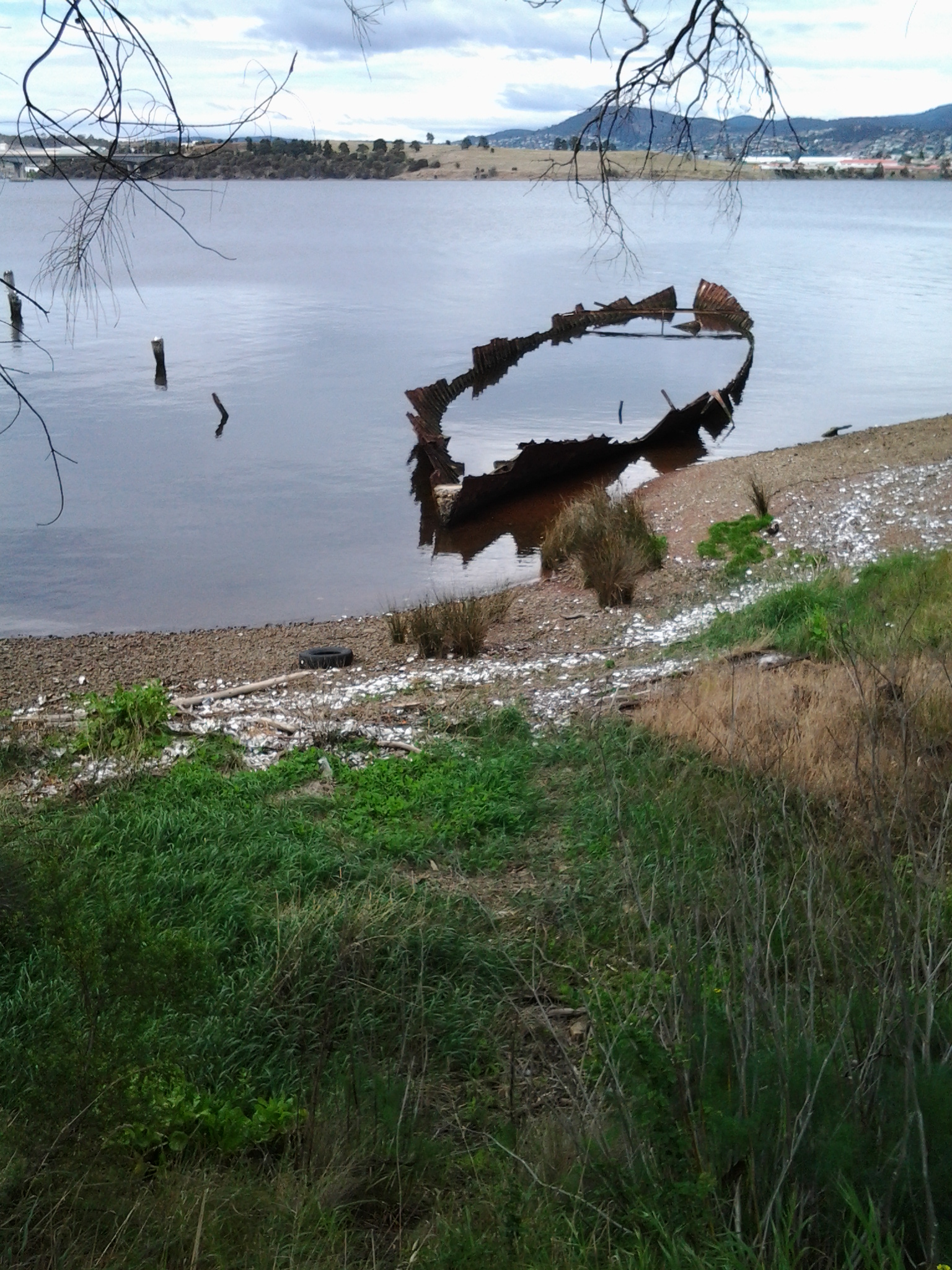
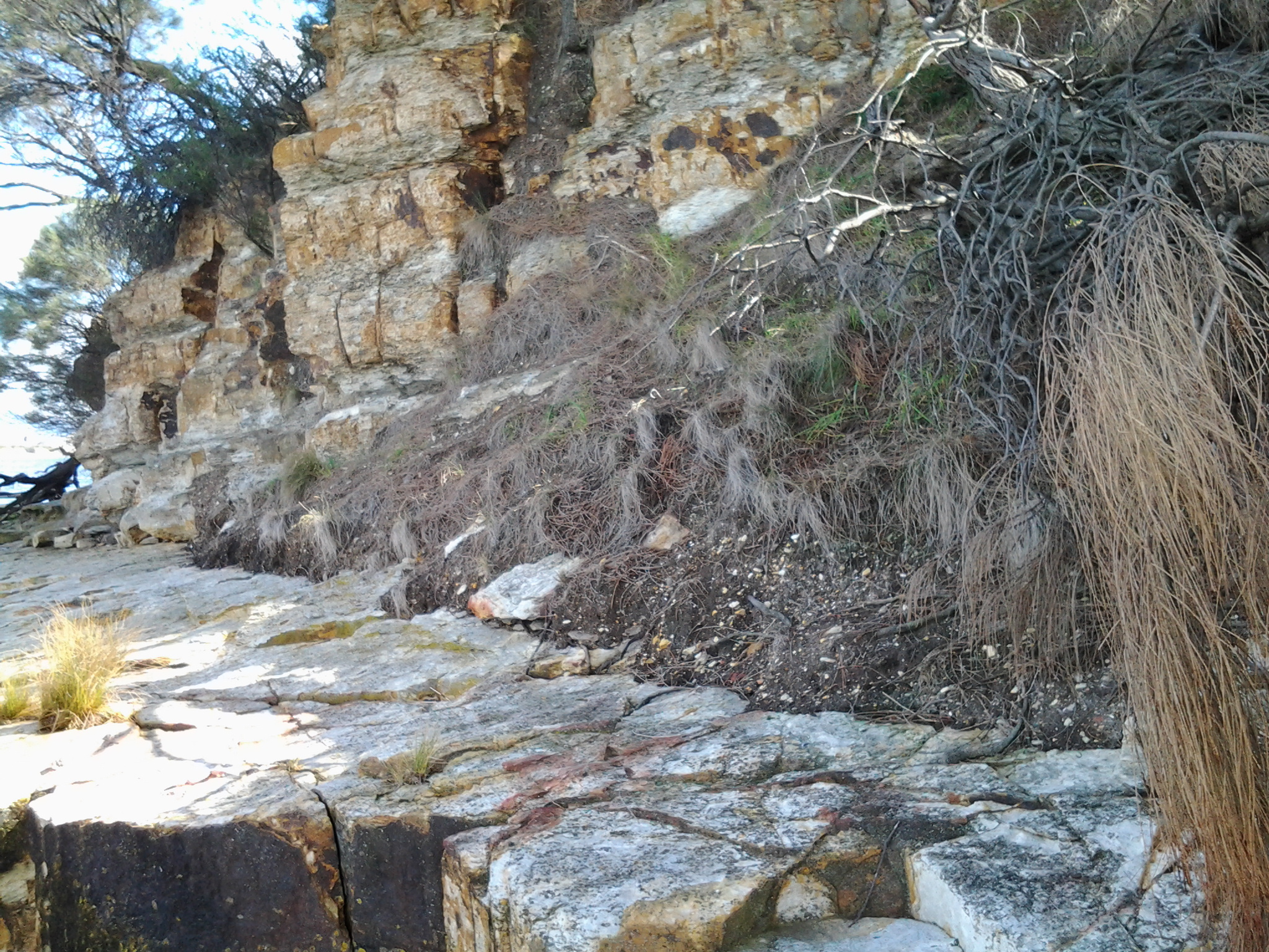
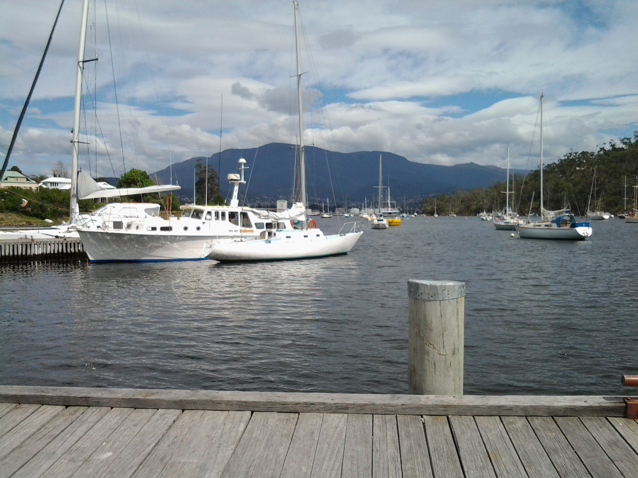
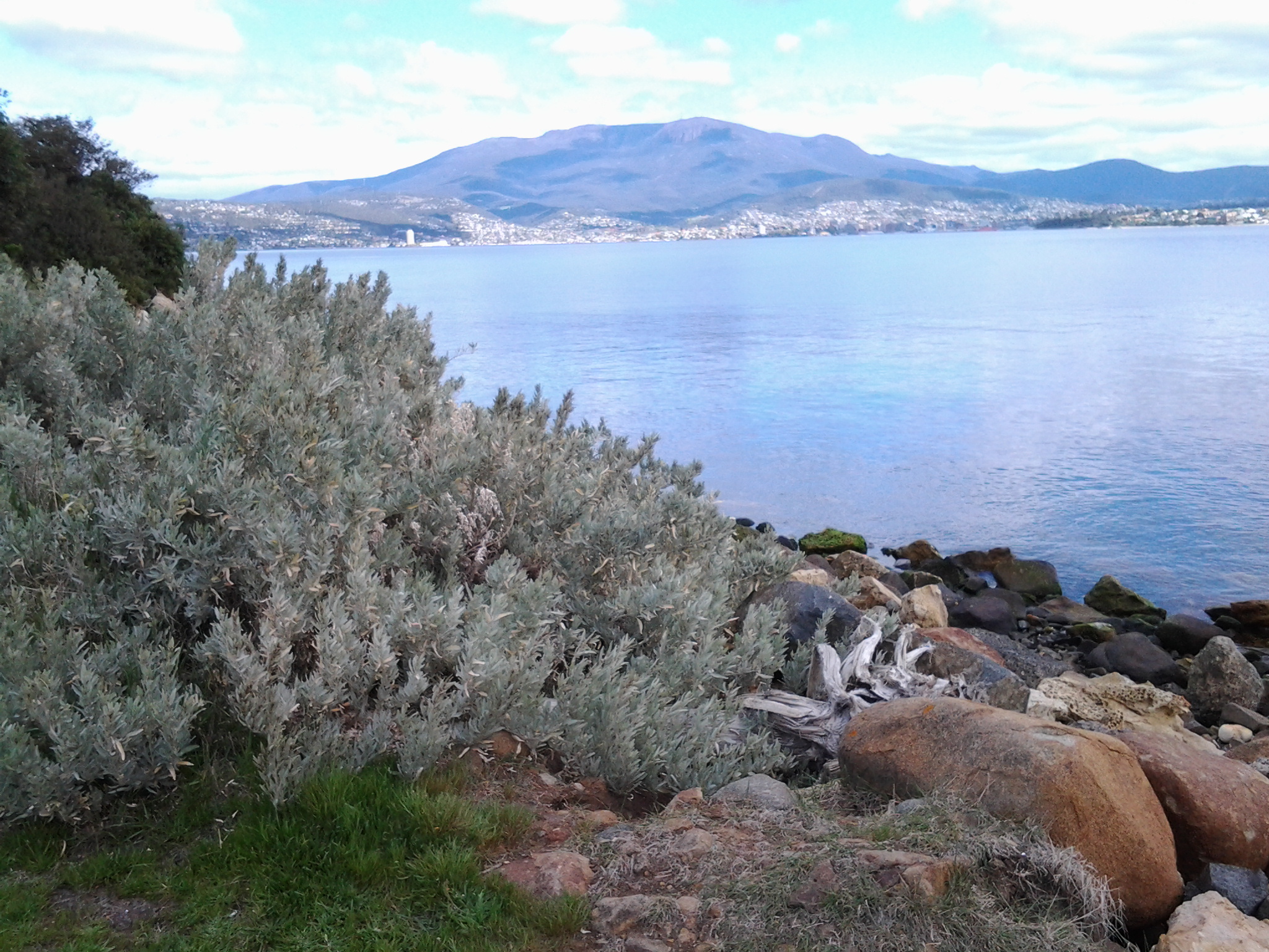
Friend Ka suggested that ,in my walks along the Derwent River, I may have become what the French term, a flâneur.

I had never heard this wonderful word before, and with a little research discovered a great deal of information – and some very heavy stuff. After reading it all, I wonder – am I un flâneur, or not? The Oxford Dictionaries informed me a flâneur is “A man who saunters around observing society” and is derived from the French flâner meaning to ‘saunter, lounge’.

Wikipedia offered further information: “The flâneur was a literary type from 19th century  France, essential to any picture of the streets of Paris. The word carried a set of rich associations: the man of leisure, the idler, the urban explorer, the connoisseur of the street.  The flâneur was defined by Larousse in ambivalent terms, equal parts curiosity and laziness and he presented a taxonomy of flânerieflâneurs of the boulevards, of parks, of the arcades, of cafés, mindless flâneurs and intelligent flâneurs. The image below is by artist Paul Gavarni in 1842 and titled Le Flâneur.

Paul Gavarni Le Flaneur 1842

Wikipedia continued: In the 1860s Charles Baudelaire presented a memorable portrait of the flâneur as the artist-poet of the modern metropolis: The crowd is his element, as the air is that of birds and water of fishes. His passion and his profession are to become one flesh with the crowd. For the perfect flâneur, for the passionate spectator, it is an immense joy to set up house in the heart of the multitude, amid the ebb and flow of movement, in the midst of the fugitive and the infinite. To be away from home and yet to feel oneself everywhere at home; to see the world, to be at the centre of the world, and yet to remain hidden from the world – impartial natures which the tongue can but clumsily define. The spectator is a prince who everywhere rejoices in his incognito. The lover of life makes the whole world his family. Thus the lover of universal life enters into the crowd as though it were an immense reservoir of electrical energy. Or we might liken him to a mirror as vast as the crowd itself; or to a kaleidoscope gifted with consciousness, responding to each one of its movements and reproducing the multiplicity of life and the flickering grace of all the elements of life. Charles Baudelaire, “The Painter of Modern Life”, (New York: Da Capo Press, 1964). Orig. published in Le Figaro, in 1863.”

The website for The Arcades Project at http://www.thelemming.com/lemming/dissertation-web/home/flaneur.html explained that “Flâneur” is a word understood intuitively by the French to mean “stroller, idler, walker. He has been portrayed in the past as a well-dressed man, strolling leisurely through the Parisian arcades of the nineteenth century – a shopper with no intention to buy. Traditionally the traits that mark the flâneur are wealth, education, and idleness. He strolls to pass the time that his wealth affords him, treating the people who pass and the objects he sees as texts for his own pleasure. An anonymous face in the multitude, the flâneur is free to probe his surroundings for clues and hints that may go unnoticed by the others.  As a member of the crowd that populates the streets, the flâneur participates physically in the text that he observes while performing a transient and aloof autonomy with a ‘cool but curious eye’ that studies the constantly changing spectacle that parades before him (Rignall 112). As an observer, the flâneur exists as both ‘active and intellectual’ (Burton 1). The flâneur  has no specific relationship with any individual, yet he establishes a temporary, yet deeply empathetic and intimate relationship with all that he sees – writing a bit of himself into the margins of the text in which he is immersed. Walter Benjamin posits in his description of the flâneur that ‘He flows like thought through his physical surroundings, walking in a meditative trance, (Lopate 88), gazing into the passing scene as others have gazed into campfires, yet ‘remain[ing] alert and vigilant’ all the while (Missac 61). The flâneur is acutely aware, a potent intellectual force of keen observation – a detective without a lead. If he were cast as a character in the ‘drama of the world’, he would be its consciousness.”

The Paris Review at http://www.theparisreview.org/blog/2013/10/17/in-praise-of-the-flaneur/ remarked: “the idea of flânerie as a desirable lifestyle has fallen out of favour, due to some arcane combination of increasing productivity – hello, fruits of the Industrial Revolution! – and the modern horror at the thought of doing absolutely nothing. But, as we grow inexorably busier – due in large part to the influence of technology – might flânerie be due for a revival?”

Am I … can I be a flâneur? Whatever the answer to this question I am so grateful for Ka introducing me to this fabulous new word and all its ideas.

Reconnaissance trip to and from New Norfolk

Last Sunday, friend Me took me on a discovery drive from Bellerive to New Norfolk along the eastern shore of the Derwent River.

We were curious to see how closely I would be able to walk along the edge of the River, and the extent to which I would need to deviate or stay on main roads.  It was an eye opener giving me advance warning of the walking challenges ahead.

The main handicap will be the limited opportunities to walk directly beside the River up on banks and not be required to jump along the often rocky shoreline or get lost in tall watery grasses. Even accessing the rocky or soft shores will be problematic. For example in one area, where maps indicate public roads branch off main roads, landowners with 5 acre blocks have fenced their properties and the roads down to their houses are blocked by gates. I believe that some of these roads are those mapped for public access and as such the landowners do not have the right to restrict access for the public to connect with the River beyond.  More research required.

Clearly public bus routes travel from Hobart through eastern shore suburbs on the way to Bridgewater, however bus stops are widely dispersed and the timetables indicate less frequent services, all of which will constrain me in the length and timing of my walks between these two suburban areas.

The future walking stage between the Bridgewater Bridge and New Norfolk has been concerning me.  I doubted whether bus stops existed along the way. We found there were no public bus stops on either side of the River, and the distance whether walking the road on the eastern or western shores amounts to a day walk rather than a morning or afternoon walk to cover that length. New Norfolk is 35 kilometres from Hobart. The distance from the Bridgewater Bridge to New Norfolk along the road on the western shore is the shortest at 17 kilometres compared to around 20 kms on the eastern side.

As a result of Sunday’s research, I plan to continue on the eastern shore of the Derwent River and walk to the Bridgewater Bridge, cross it, then walk back towards Hobart and ultimately finish at the mouth of the Derwent River in the Tinderbox area. Once those stages are complete, then I will return to the Bridgewater Bridge and proceed towards New Norfolk and beyond.

Thanks Me for all the laughs we had during our discoveries. It was a fun excursion.

Frequently asked questions

After discovering how to add a new page to this blog, I created one with a list of questions and answers to explain what I am doing and where I have walked. As my walks continue, this page will be updated. In addition, as people ask further questions frequently, new questions and answers will be added.

Go to www.walkingthederwent.com and near the top are two headings: HOME and ABOUT ME. Hover your mouse cursor over ABOUT ME to see the drop down FAQ option. When you click on this, a new page packed with information appears.

If any reader has a question they want answered, please ask.

People and their projects

This blog records my walk along the Derwent River, as my own special project. On my second walk, I met a woman who with a group of friends had started the project of walking every beach in the City of Clarence local government area – all 94 kilometres. When I met her, already 87 kilometres had been covered.

Today in the The Age newspaper journalist Lawrence Money introduced the story of “One woman’s epic bike trek to Timbuktu and beyond”. Kate Leeming, a Melbourne woman cycled on her own, from the west coast to the east coast of Africa over 10 months. In addition, I learnt previously she had cycled across Russia alone, and currently is planning to ride a ‘polar cycle’ across the Antarctic.

Kate’s cycling treks are really enormous personal projects, the like of which I could never consider. Nevertheless, it confirms me in the belief that we can all find our own projects, small or large, long or short and keep actively discovering the limits of ourselves and our environment, whether near or far from where we live.

Kangaroo Bluff Historic Reserve and Bellerive Fort

Near the end of my Stage 4 walk from Tranmere to Bellerive Bluff along the Derwent River, I saw a sign pointing to the Kangaroo Bluff Historic Reserve which I chose not to visit. However, my curiosity was aroused. So the next day, last Saturday, I made a special trip and walked to the Reserve to find out more.

20140927_091124

As I walked toward the entrance, I was puzzled. I could see a narrow road passing between two raised hills. On closer inspection when I discovered a massive deep and long ditch from the left to the right outside the stone edged wall of earth, clearly this site was the remains of a fortification.

20140927_091051

The site was a battery complex with underground tunnels and chambers for magazines, stores, the lamp room, a well and loading galleries. The public do not have access to the underground since these parts were bricked up in the 1920s: I would have been very interested to see the speaking tubes set into the walls used for communication purposes.

However there are many metres of well-preserved channels which can be walked in and around.

20140927_090522

20140927_090924

Signage provided useful information. I now understand that the idea of a protective Fort was first discussed in the 1830s as a means to protect the merchant ships travelling up the Derwent River, although I am unclear who might have attacked from the sea because Van Diemen’s Land (now named Tasmania) was very isolated from the rest of New Holland (now named Australia). However, it was not until difficulties were being felt between England and Russia in the 1870s that a renewed push for a Fort was made.

20140927_085957

By 1885 the defensive Fort was built – although I cannot imagine why anyone would think that Russia would believe it useful to send a war ship to the tiny colonial and penal colony in Hobart. It does not surprise me that the two canons were never used as war weapon.

20140927_090533


Enjoying Little Howrah Beach on Stage 4 of my walk along the Derwent River

It was a relief to arrive at the calm peaceful Little Howrah Beach, after the constancy of the rock hopping stage around Howrah Point.  Looking back in the direction from where I had walked, the photo below shows my view across five kilometres of Derwent Harbour towards Mount Wellington and Hobart city beneath.

20140926_104157

I sat on a boulder and comfortably munched on some morning tea snacks.  The serenity of this Beach was remarkable.

20140926_104110

Across the road from the Beach I could see a tiny shopping centre: including a newsagent, pharmacy, hair salon and paint shop.  Public Toilets were located closer to the northern end of the Beach.

20140926_104118

Once walking again, the end of the 200 metre sandy beach was reached quickly and I picked a path through a short cluster of rocks before coming again onto the sand.  At this point I had choices; I could walk up to the Shoreline Shopping Centre for a drink or continue along the 1.2 kilometre Howrah Beach.