Tag Archives: Bellerive

Starting stage 8 of my walk along the Derwent River

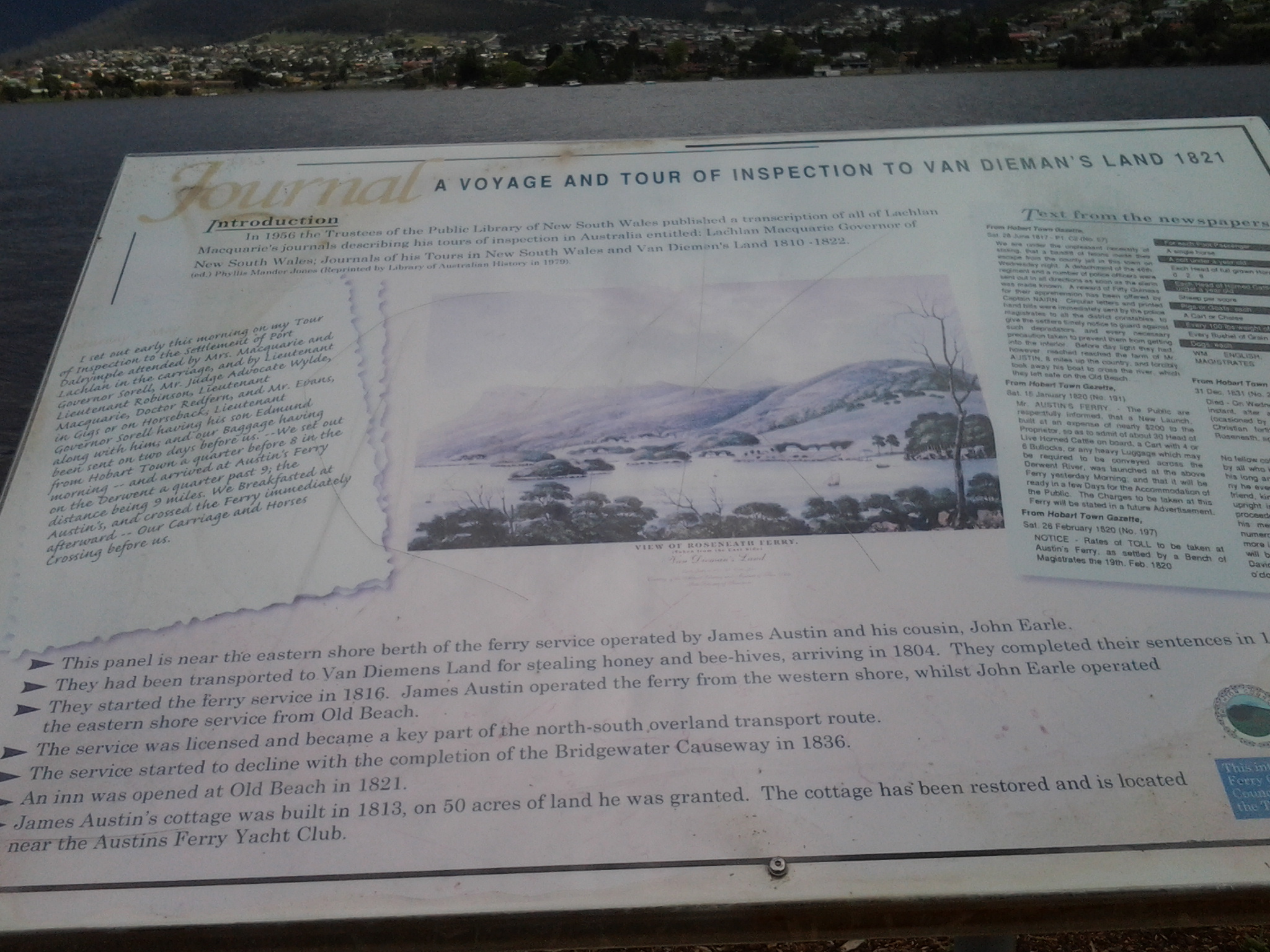
My starting point was the jetty half way through Old Beach on the eastern shore, and to reach this from my home in Bellerive on the eastern shore of the Derwent River was not straightforward. There are no direct buses from Bellerive to Old Beach.

Instead, I left home at 6.45am (way too early for my liking but no other choice), passed three Black Cockatoos feasting on a native tree in a private home (one acted as a sentry high up while the others gorged themselves), walked to the Eastlands bus mall and caught the first bus through to the bus mall in Elizabeth St in Hobart’s CBD. At 7.17am the X1 express bus to Glenorchy in the northern suburbs of the Greater Hobart Area (and beyond) departed. This arrived at 7.35am at the Glenorchy bus mall and, anticipating public toilets would be non-existent for my walk, I walked over to the Northgate shopping centre to use their facilities. I was back at the bus mall in time to catch Metro bus 126 to Old Beach which departed at 8am. At 8.20am I stepped off the bus ready for the day.

The sky was overcast and I was wearing a thermal top over my T-shirt and topped with a fleece jacket.  Blowy. Hard air hitting my face.

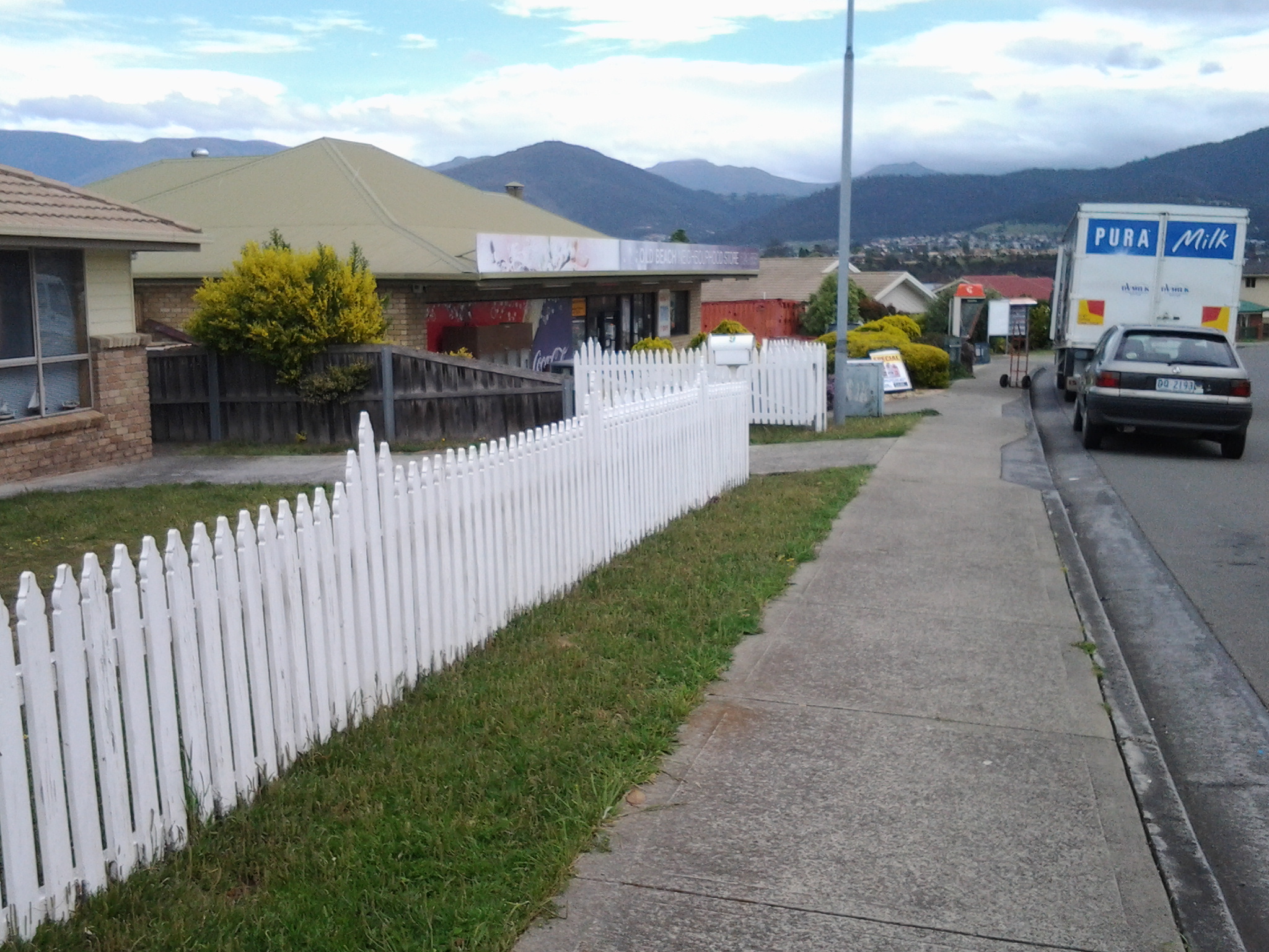
Since there was no direct water access from the jetty northwards, I walked through the suburban streets staying on the hard concrete footpaths. Plovers and Blackbirds were my constant companions and extravagant blooming roses and wattles perfumed the air. It was rubbish removal day and the streets were lined with bulging large faded red wheelie bins and yellow lidded green bins. The wind had lifted many lids and these were thrown back as if saluting when on parade (a vision that friend Jo exclaimed he saw).

At 8.33am I reached the intersection with the East Derwent Highway and lost a footpath. I turned left and walked beside the highway where it was obvious a few other people had walked but there was no formal pathway. At this point I could see the water of the Derwent River but I was not close. It was clear that property owners had fenced and gated off any access to the River and I need to determine whether they had the right to do this in all cases.  I continued on the Highway noticing the signpost to the Bonorong Wildlife Park and Compton Agistment Centre marking the turn off from the highway away from the River.

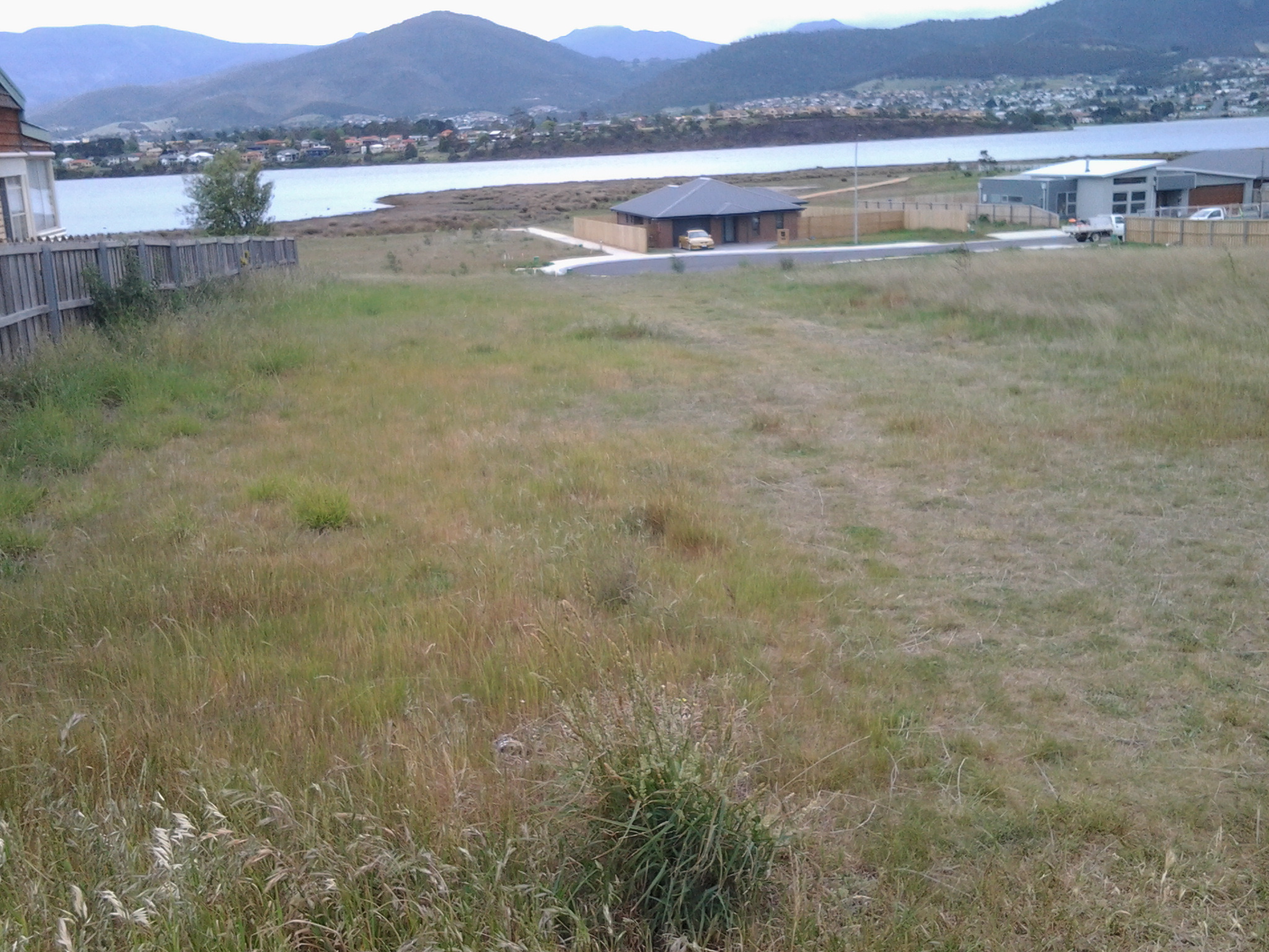
Not much further along I saw a track between new houses on the left and followed it then through the grassy bushland but, as lovely as it was, it was impassable offering no easy way to the River and so I had to retrace my steps. At 8.54am I was back on the Highway walking to the left of the guard rails (so that I wasn’t directly on the Highway) on rolling gravel where a path was never intended.  Then the guard rail disappeared so I walked carefully as far off the road on the narrow verge as I could.  Sometimes I walked in the ditch. By 8.58am I was passing Compton Road and at 9.01 I reached Clarrie’s Creek. I began to disrobe as the morning and the exercise began to warm me: off came my thermal top.

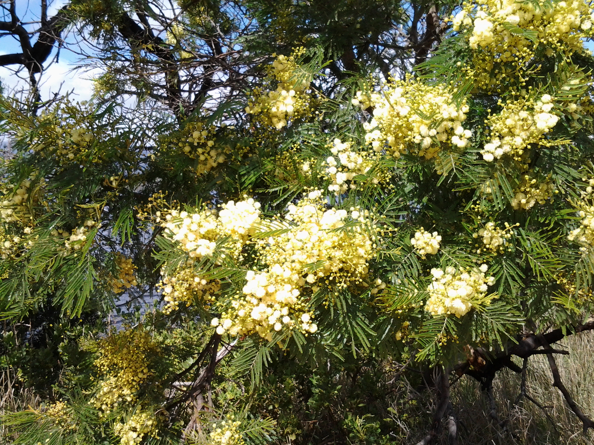
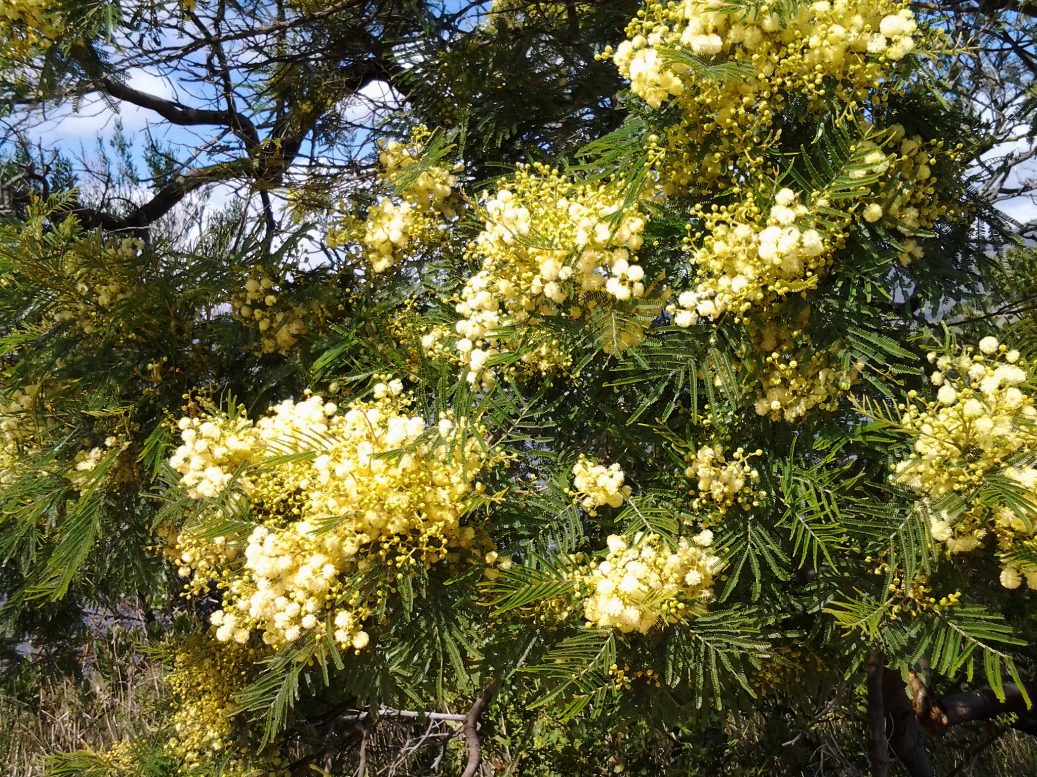
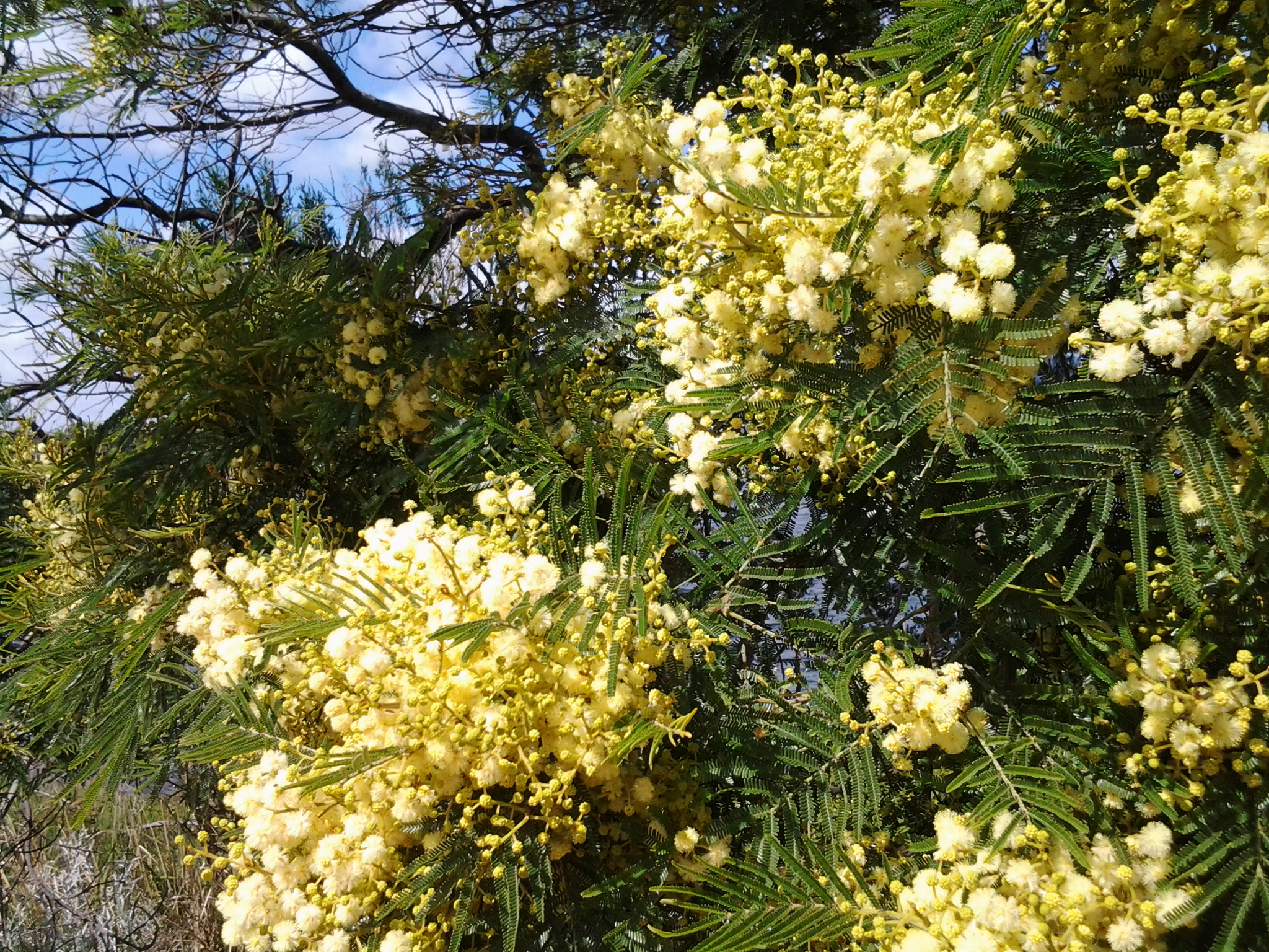
The perfume from the flowering wattle trees was invasive and pervasive in the nicest way.  Please feel free to use any of the photos below as a screen saver. I have.

20141111_103700 20141111_103704 20141111_103708 20141111_103711 20141111_103716

Continuing along the Highway, I walked up an incline until I could turn left on a bitumen roadway. This was blocked by a gate, but there was walking space around this, used by others. I had reached the newest part of Old Beach on its own rounded headland. Once past the gate I turned left towards the Verve Village site office signs and walked on. Through the mesh fence to my right I could see the Verve café, not open. The time was 9.10am.

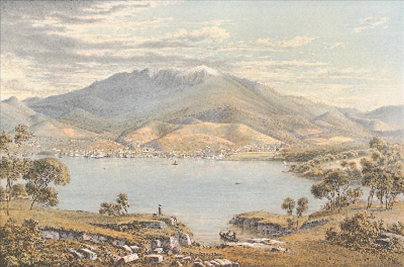
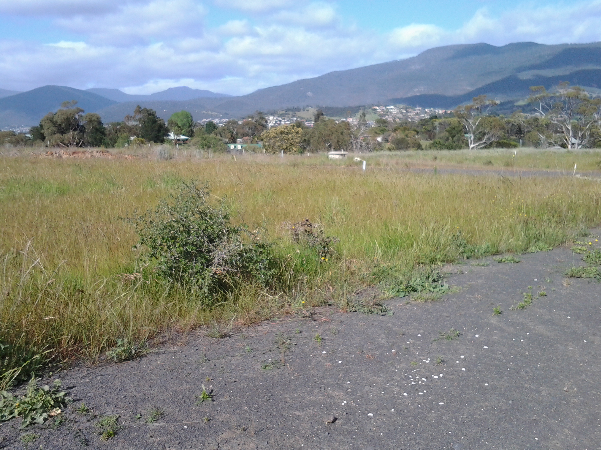
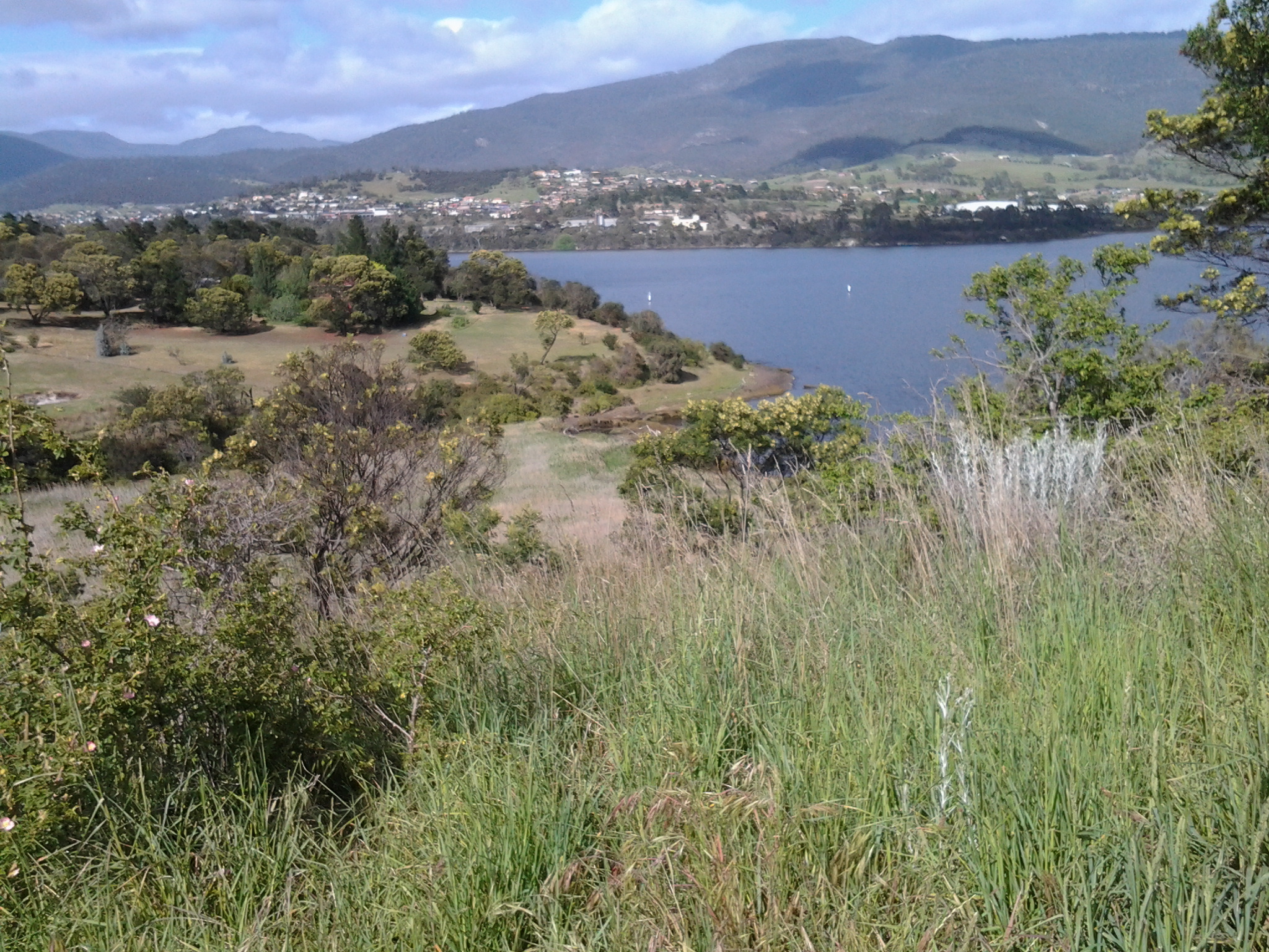
Not long afterwards I was snapping photos of the low mountains and hills across the Derwent River on the western shore. Grandly beautiful in a simple way.

20141111_091212  20141111_091128

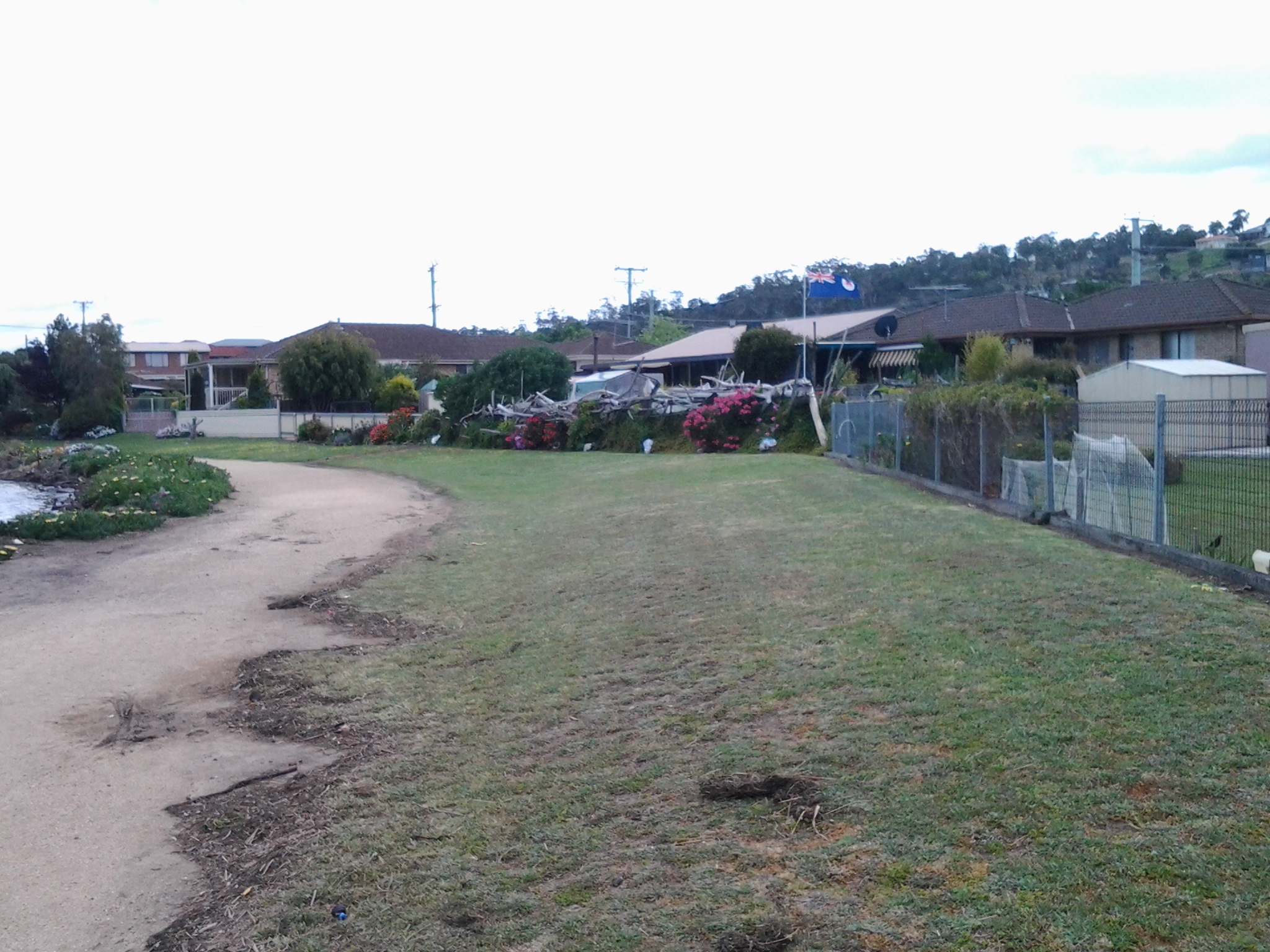
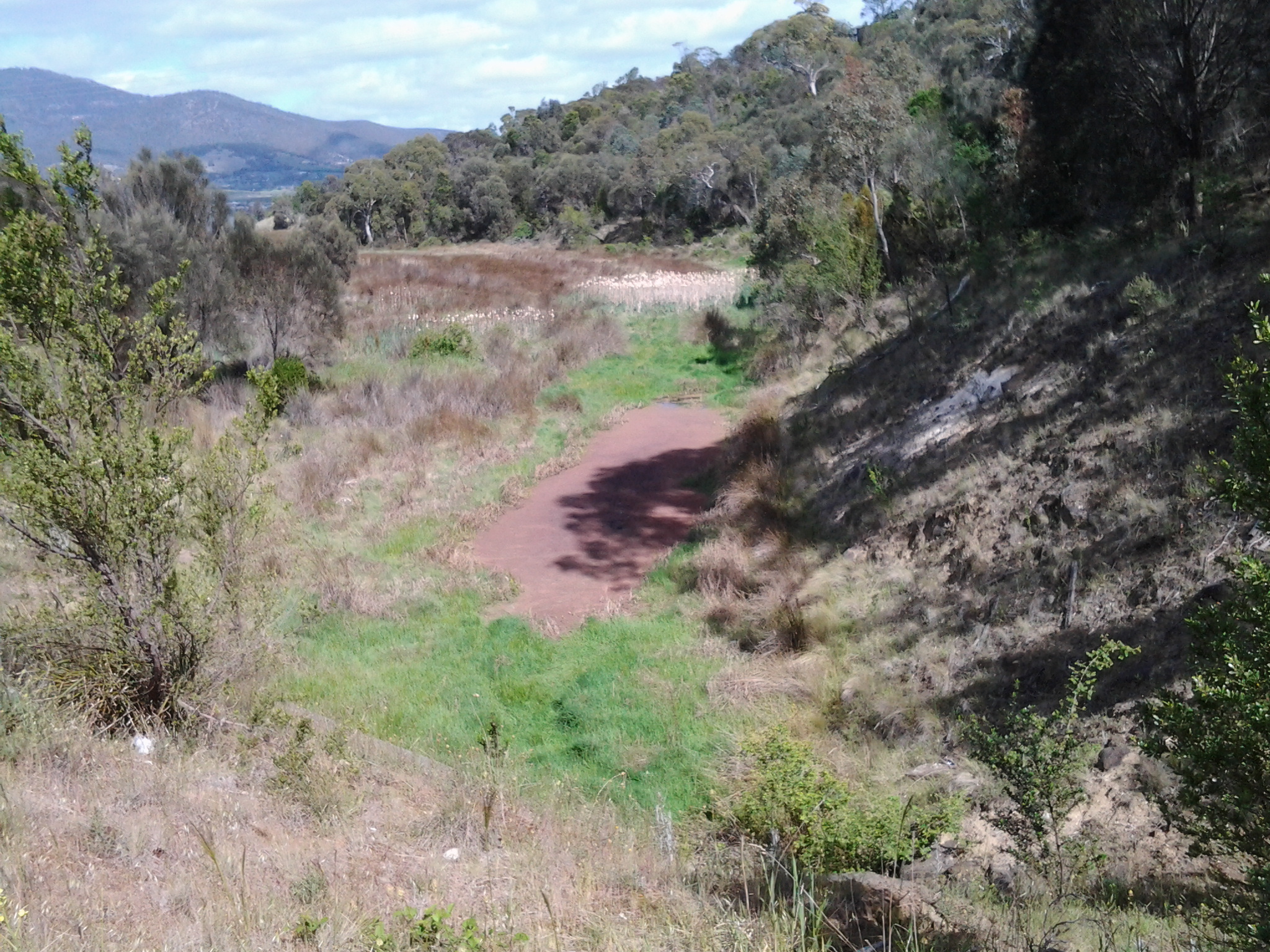
This ‘roadway’ eventually ended at a locked gate but again a regularly padded informal path was clearly visible around the obstacle.  I turned left and 100 metres along, a yellow gravel path appeared. The path had no sign but I hoped it was a foreshore trail and followed it. It was.  A trail with almost no signs of animal life except a massive black furry feral cat bounding away and a sole man out for exercise.  Crows carrhh carrhh carrhhed in the distance and overhead. Casuarina trees edged the path and through them the woodland was open and airy. Water lapped onto the shore. Mudstone rocks edged out of the soil on the banks. I enjoyed a flash of colour when I noticed yellow and orange flowering nasturtiums that had escaped from a suburban garden into the bush.

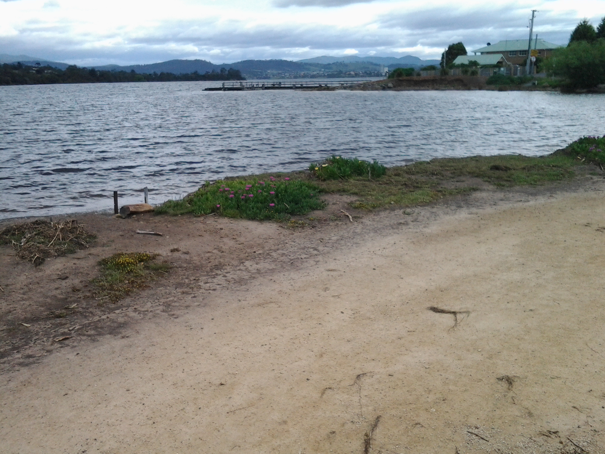
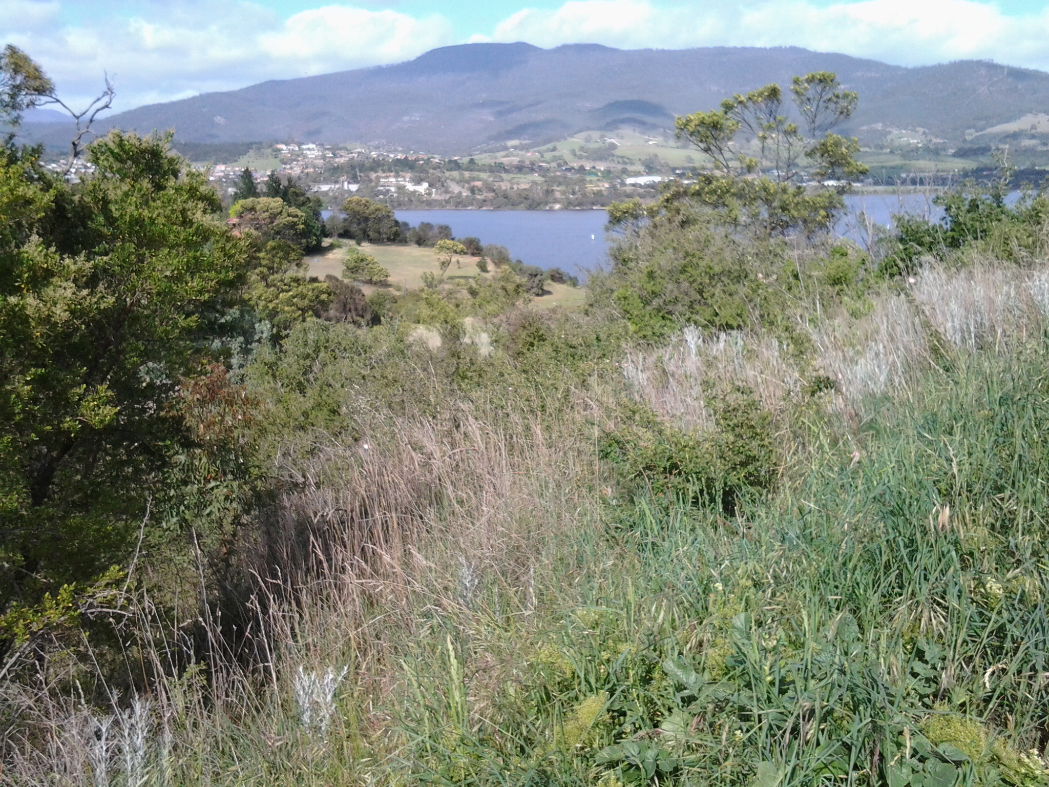
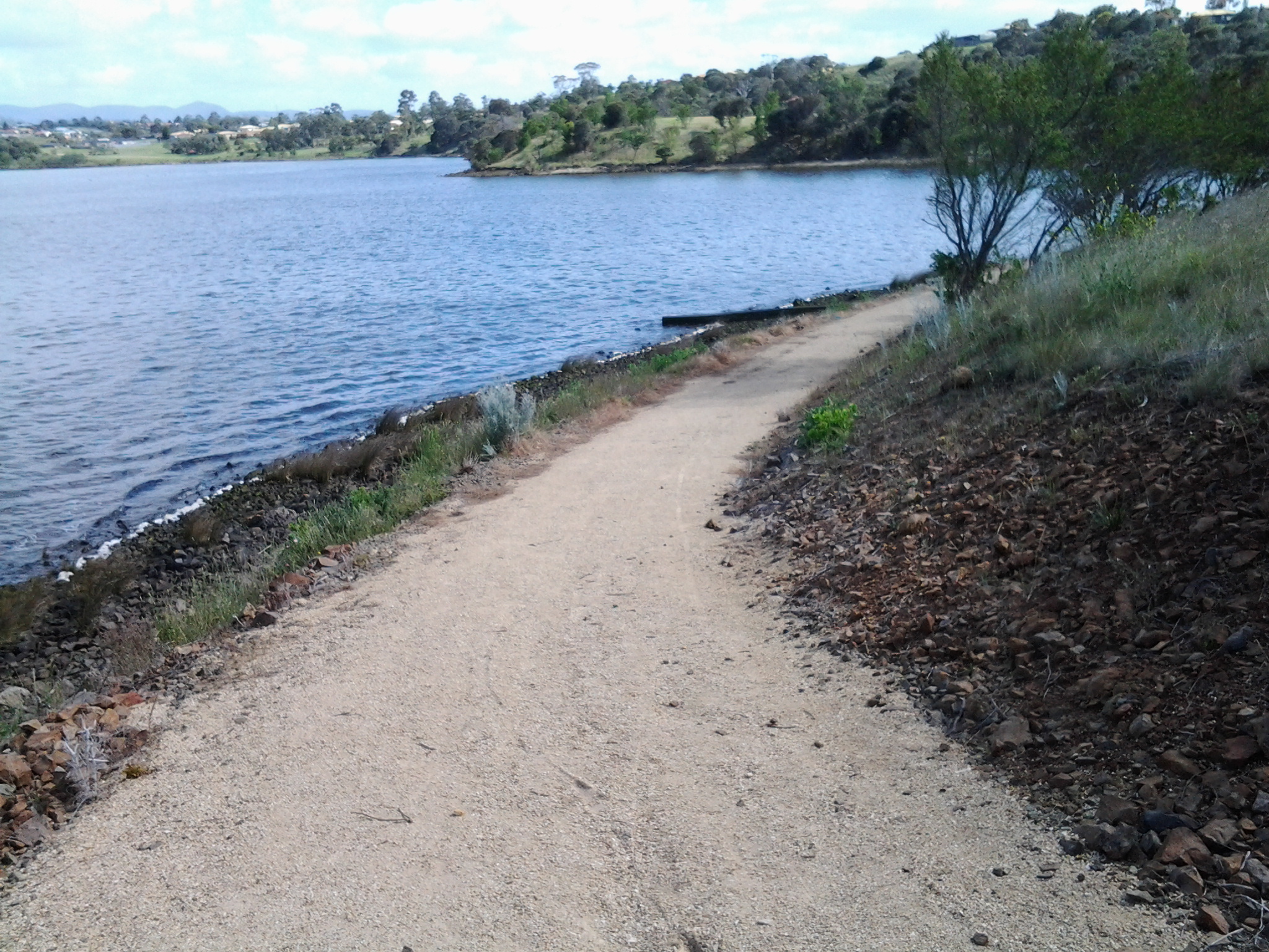
The photos below show a view southwards to the River from the first 100 metres of the path.

20141111_091838 20141111_091955  20141111_092155

The foreshore trail was easy to follow, wide and clear.

20141111_092752

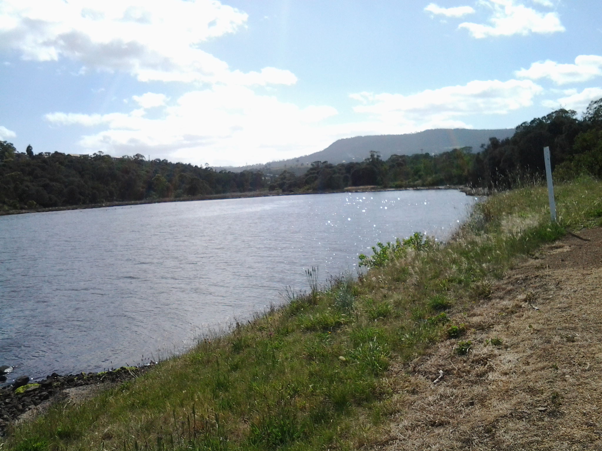
At 9.36am I reached the point where the Derwent River and Gage Cove met.

20141111_093443

The trail curved into the Cove but not before a man-made construction, to the right of the path, seemed to flush deep below and then a dreadful stink followed. I tried not to think what was going on there.

20141111_093606

By 9.42am I was walking up into the suburb having enjoyed watching black swans floating around in the Cove, and a few minutes later I reached a gate which, as usual, I walked around.  I turned left and followed the road from the cul de sac amidst the noise of every neighbourhood dog barking to indicate a stranger was nearby.  Me.

At 9.45am I turned left at the T junction and by 9.48am I reached the intersection of Stanfield Drive with the East Derwent Highway.  Continuing on I could look down in Gage Cove with its coating of red algae or some other red plant.

20141111_100127

So far my morning had gone well and I was enjoying myself. Also, I was pleased that I had finished passing through all parts of the suburb of Old Beach and was ready for the next suburb.

Discovering the suburb of Old Beach – 7th stage of my walk along the Derwent River

At 12.40pm I reached the town sign for Old Beach at Cassidy’s Bay. The Bay was covered with ducks of every age.  Families of ducklings are always a pleasure to see. Seemed like a safe haven for them.  Tall grasses grew into the water but there was no beach.

I continued walking along the highway, passed the turn off to the Baskerville raceway, and was eventually forced down into a clay sogged ditch almost until I reached the roundabout at 12.50pm.  At the roundabout, with the hilly section of Old Beach up on the right, the choice was to continue on to Bridgewater or turn left into Fouche Avenue. I turned left to the lowlands and walked through a reasonably affluent area. Back on proper footpaths. Just before 1pm I reached the Old Beach Neighbourhood Store claiming to serve hot food 7 days a week.  I didn’t enter to check.

20141031_125642

By 1.03pm, after passing a house outlandishly decorated for Halloween, I came to the end of the road.  It seems like one of those roads which will connect up with a street coming from the other direction at some other time. Everywhere I looked, new houses were being built so that I feel confident roads will connect sooner than later. I walked through the open paddock in the photo below in order to reach the ‘golden’ pathway in the distance which I assumed might lead me onwards next to the Derwent River.

20141031_130307

At 1.06pm I reached the lower path, which was appropriately signposted as the Old Beach Foreshore Trail, and enjoyed seeing more black swans, swooping swallows, flocks of starlings, and the usual screaming plovers. Closer to the water the path divided.  To the left it returned to Cassidy’s Bay (although I saw no signs of a path when I was there), to the right the path would continue to the Jetty at Jetty Road.  The spot where I stood was named the ‘Calm Place’.

20141031_131028

The photo above faces south across the lowlands of Old Beach (which doesn’t seem to have a beach), and provides a view of Mount Direction in the distance.

I headed north by taking the right hand trail. Not long after, on the right hand non River side of the path, I saw a tiny man-made lake, with its quota of swimming ducks and a rusting large sculptural tower on a central island with two Dominican Gulls on top (the expression ‘kings of the castle’ came to mind), amidst a stack of new houses and others being built. The sign on the fence worried me.

20141031_131049

I was concerned that because the land was so low and the lake depended on a levee to contain the water, any River flooding could be of great concern to the new property owners.  I wondered how much of that being built on was reclaimed land. I am surprised the local government allows new buildings here. With global warming increasing the sea level, these houses won’t be around in hundreds of years.

Blue skies opened above Mount Wellington in the distance but heavy clouds sat overhead.  Spits of rain persisted off and on for the rest of my time at Old Beach.  But it was time to have lunch. In the absence of any seats or rocks or other raised area, at 1.20pm I sat on the grass beside the Foreshore Trail, emptied my pack, and started munching as I absorbed the details of my low lying surroundings.  I could see heavy rain clouds that darkened the day travelling across the Derwent from the Mount Faulkner Conservation Area on the western shore.

20141031_132509  20141031_132519

At 1.35pm I was on my feet and continuing along the path, passing an alternative walk to Sun Valley Drive, and spotting a pair of native hens pecking ahead on my path.  A private fence made from large pieces of driftwood festooned with creeping bright flowering geraniums, caught my attention.

20141031_134059

At 1.43pm I arrived at the Old Beach jetty

20141031_134047

where I found an interpretative panel explaining some of the early 19th century history associated with the location of the jetty.

20141031_135134

As early as 1821, an Inn was established near the current jetty, and people would ferry across the Derwent from the western side of the River.

This 7th stage of my walk was coming to a quick close.  I knew a bus would be travelling along Jetty Road at 2pm, and that the next service would not be in the vicinity for another couple of hours. I had wanted to finish walking through all of Old Beach before I finished this stage, but the potential for a long wait for a bus inclined me to cut the anticipated walk short.  I walked along Jetty Road and waited at a bus stop.

Metro bus 114, destined for the Glenorchy Bus Mall on the western shore, picked me up.  I did not travel the entire way but if I had, I would have needed to catch a Hobart city bus to reach the CBD, then a bus to take me back to my home suburb of Bellerive on the eastern shore. A long way. A long time. From Old Beach there are no bus services travelling along the eastern shore.  All the buses travel to the northern city of the Greater Hobart Area of Glenorchy via the Bowen Bridge. Since I live in Bellerive on the eastern shore, I resolved to try Plan B. I proposed to catch a bus from Glenorchy to Hobart via the eastern shore and close to the Bellerive area. Once over the Bowen Bridge from Old Beach, I got off the bus at the first stop which was outside the Elwick racecourse at 2.15pm. I crossed the road and waited in a bus shelter for Metro bus 694. As the rain started to pour in earnest at 2.35pm, the bus arrived. Phew!

I loved the return trip. While again on the Bowen Bridge I looked northward and could see where I had walked earlier in the day. Ahead and looming over the land, was Mount Direction. Looking southward I could see the Cleburne Spit was empty of cars and people, the suburb of Risdon looked quiet, and a thick eddy of smoke rose from behind Risdon Cove. Closer to the area with the fire, a sweet wood smoke smell spread through the bus and reminded me of camping fires I have enjoyed in the past. That was a great conclusion. Memories of the immediate day and memories of the past coming together.

Now I am looking forward to preparing for and then walking the 8th stage of my walk along the Derwent River.  This next walk is likely to happen early next week, weather willing. Let the discoveries continue!

The pleasures of people along the Derwent River

The people that I see and meet during my walks along the Derwent River always give me unexpected value.  My experience last Friday walking from Rosny Point to Geilston Bay was no exception.  People of all ages, sizes and racial backgrounds enjoyed being out and about.

There were joggers, runners, walkers, dogs leading their owners, a mother and father wrestling their son on the grass all laughing loudly and not a mobile phone or other communication device in sight, a man with a hand reel trying to catch fish from the rocks, cyclists who surprised me when they came up behind me and passed speedily and silently, the excited father and son who had seen a wallaby in the trees, a line of twelve senior men cycling without wearing lycra, five young mums in lycra with five new-baby laden prams in a row, kids skateboarding along the Trail, and families meandering to fill in the end of the school holidays. There was a man rowing a dinghy somewhere, a paddler in his kayak, and a boat motoring with trailing fish lines held by a family of three all wearing their life jackets.  Some I chatted with, for some it was a nod of ‘hello’, and for others we exchanged a wave and a friendly smile. I find that until around midday most people expect to and enjoy acknowledging others, then in the afternoon for some unexplained reason the experience changes and people are more reserved; perhaps the weight of the day has started to drag on them.

Two specialities of my walk last Friday were:

  • Along our public reserves and walkways, dog walkers can collect a black plastic bag so that when their Big Dog or Little Missie does a poop, the owner can collect the droppings from the path into the bag and add it to the garbage bins further along. The common sight is to see owners swinging a bag of excrement as they continue their walk. But on Friday I watched an innovative practice – and not one that is likely to catch on (hopefully not).  A man was walking along and he was emptying his plastic bag. Inside his bag was a mix of dirt and straw.  After the dog had pooped on the path, he poured a little of this mix over the droppings to cover.
  • A woman doing interval training by walking and running along the path stopped to talk to me about the dolphins she had seen. Her eyes sparkled. Apparently 6 dolphins were playing around the boats in Kangaroo Bay (located between Bellerive Bluff and Rosny Point). Where I had left the bus to start the walk, trees obliterated my view of the Bay at the point where the dolphins would have been. I was pleased the dolphins felt safe to be there and sorry to have missed seeing them.  This event reminded me that years ago, after I met an internet dating partner for the first time at Bellerive’s Waterfront Hotel, we walked along the edge of Kangaroo Bay and watched a small pod of dolphins swimming and enjoying themselves. It says something about me that I enjoyed that experience more than the date.

The photo below shows one of the many dogs that enjoyed their morning walk last Friday.

20141010_093850

Update on the name Bellerive

New research, since that undertaken for my last posting where I indicated the name change happened in the 1830s, gives much more precise information. I have just discovered that the present name of Bellerive was officially proclaimed in 1892.  This news makes me understand clearly why Glover and von Guerard referred to the site as Kangaroo Point.

Bellerive

Last Friday/Saturday the fourth stage of my walk along the Derwent River finished in Bellerive. Being curious to know a little history of this Hobart suburb’s existence, I discovered it was first settled in the 1820s after years of people ferrying across the Derwent River from Hobart Town. Its first name was Kangaroo Point.  No prizes for guessing why.  Apparently the area abounded with native kangaroos (and/or perhaps the prolific Bennetts Wallaby which is often referred to as a kangaroo).

The name changed from Kangaroo Point to Bellerive around 1830, using the French language as inspiration: bel = ‘beautiful’ + rive = ‘bank’.

However, its original name seems to have been retained in common usage, because two eminent artists of the 19th century produced art work located from Kangaroo Point. The renowned English artist John Glover painted Mount Wellington and Hobart Town from Kangaroo Point in 1834, and the Austrian artist Eugene von Guerard, who was active in Australia in the middle of the 19th century, created a colour lithograph Hobart Town, from Kangaroo Point, Tasmania in the late 1860s.

The Glover painting is at home in the Tasmanian Museum and Art Gallery in Hobart.  This picture interests me because some of the original indigenous land owners, the Moomairremener people, have been depicted on the banks of Kangaroo Point, and there is very little sign of the ‘civilisation’ of Hobart Town on the other side of the Derwent River.  By contrast, 30 odd years later von Guerard’s print shows considerable build-up of Hobart Town beneath a snow capped Mount Wellington.

John Glover- from Kangaroo Point towards Mt W and Hbt Town

The von Guerard lithograph is at home in the National Gallery of Victoria in Melbourne.

Von Guerard Hbt Town from Kangaroo Point

These days, Bellerive is a suburb of the Greater Hobart Area completely covered with streets and houses of every vintage. With its easy access to excellent sandy beaches, a vibrant village shopping centre, the regular presentation of fantastic free public festivals, and safe marina, Bellerive is a great place to live or visit.

Reconnaissance trip to and from New Norfolk

Last Sunday, friend Me took me on a discovery drive from Bellerive to New Norfolk along the eastern shore of the Derwent River.

We were curious to see how closely I would be able to walk along the edge of the River, and the extent to which I would need to deviate or stay on main roads.  It was an eye opener giving me advance warning of the walking challenges ahead.

The main handicap will be the limited opportunities to walk directly beside the River up on banks and not be required to jump along the often rocky shoreline or get lost in tall watery grasses. Even accessing the rocky or soft shores will be problematic. For example in one area, where maps indicate public roads branch off main roads, landowners with 5 acre blocks have fenced their properties and the roads down to their houses are blocked by gates. I believe that some of these roads are those mapped for public access and as such the landowners do not have the right to restrict access for the public to connect with the River beyond.  More research required.

Clearly public bus routes travel from Hobart through eastern shore suburbs on the way to Bridgewater, however bus stops are widely dispersed and the timetables indicate less frequent services, all of which will constrain me in the length and timing of my walks between these two suburban areas.

The future walking stage between the Bridgewater Bridge and New Norfolk has been concerning me.  I doubted whether bus stops existed along the way. We found there were no public bus stops on either side of the River, and the distance whether walking the road on the eastern or western shores amounts to a day walk rather than a morning or afternoon walk to cover that length. New Norfolk is 35 kilometres from Hobart. The distance from the Bridgewater Bridge to New Norfolk along the road on the western shore is the shortest at 17 kilometres compared to around 20 kms on the eastern side.

As a result of Sunday’s research, I plan to continue on the eastern shore of the Derwent River and walk to the Bridgewater Bridge, cross it, then walk back towards Hobart and ultimately finish at the mouth of the Derwent River in the Tinderbox area. Once those stages are complete, then I will return to the Bridgewater Bridge and proceed towards New Norfolk and beyond.

Thanks Me for all the laughs we had during our discoveries. It was a fun excursion.

My route for Stage 4 walking along the Derwent River

Yesterday’s route took me from Tranmere to Bellerive on the Derwent River’s eastern shore of the Greater Hobart Area.

  1. I caught the Number 615 bus to Camelot Park and got off at bus stop 31 in Tranmere just before 9am. The bus continued onto it final stop 31, while I crossed the road to look down on the rocky foreshore, before striding out along the concreted Clarence Foreshore Trail (CFT) back towards the city.

20140926_085658

  1. When I reached bus stop 29, public toilets were located next to the Trail. I continued along the Trail to the left on a gravel path separating the rocks and water from the back yards of houses lining the river. Fifty odd minutes after leaving the bus, and after passing Punch’s Reef and Anulka Park, I arrived at a significant curve in the Trail. At that point it seemed to be returning up to the roadway for continuation on a concreted pathway next to Tranmere Road.
  2. Instead I walked on northwards, next to the river on a grassy terrace but was eventually forced down onto the rocks of Howrah Point. Fifty minutes later I arrived at the southern end of Little Howrah Beach where I sat and ate some of my lunch. I would not recommend followers take this route because when the tide is in, some rocks will be impassable. At other times some uncovered rocks will be slippery with moss. In addition, there are overhanging prickly bushes which will scratch if you follow this way. I suspect staying on the Clarence Foreshore Trail would have taken half an hour or more off my walk.

The photo below shows the tranquillity of Little Howrah Beach.

20140926_104107

  1. Half way along the road next to the Little Howrah Beach is bus stop 21. Close by are public toilets.
  2. It took 6 minutes to walk the length of this short beach, a minute to walk over a tiny rocky shoreline, and then 30 minutes to walk the long Howrah Beach. The photo below shows the Howrah Beach. Second Bluff is the treed area at the end of the beach.

20140926_105721

  1. From Howrah Beach, I walked up and around the Second Bluff headland on a well-marked path (the rocks below would be impossible to walk around) and arrived at the start of the Bellerive Beach approximately a quarter of an hour later. The leisurely stroll along Bellerive Beach took about 30 minutes. The photo below was clicked looking back along Bellerive Beach after my walk was completed.

20140926_121521

Near this end of the beach a large football and cricket ground is evident through the trees.  Between this ground and the beach you will find public toilets.

  1. I took the stairs at the northern end of Bellerive Beach up onto Victoria Esplanade, turned left and followed the road around Kangaroo Bluff to Bellerive Bluff where this fourth stage of my walk along the Derwent finished.

This Bluff marks the point where the small Kangaroo Bay opens off tto the east of the Derwent River. Northwards across the water I could see Rosny Point which will be the starting point for the next leg of this journey.

20140926_123316

On the other side of the river, the city centre featured prominently below Mount Wellington.

20140926_123103

A number 608 bus runs through this part of Bellerive and continues onto Hobart. Alternatively, if you continue walking along the edge of Kangaroo Bay, then through the Bellerive Village onto Cambridge Road, buses can be hailed to stop at Bus Stop 8 for travel into Hobart city.

How much of the Derwent River have I walked?

I strolled very slowly for almost five hours. If followers choose to stay on the Clarence Foreshore Trail and are not as engaged as I was in making notes and taking photographs, I believe this walk will take a comfortable 3 and a half hours including snack breaks. In total, I probably walked about 10 kilometres because of the convoluted nature of the Howrah Point rocks and other non-Clarence Foreshore Trail pathways which I followed from time to time.  In relation to meeting my goal to walk the 249 kilometre length of the Derwent River, I gained another 4 kms; the total distance covered so far is now 19.5 kilometres.

Stage 4 of the walk along the Derwent River will happen tomorrow

Tomorrow, Friday 26th September will be marked by my fourth walk along the Derwent River.  The first two stages were on the South Arm Peninsula from Cape Direction to Gellibrand Point, and the third walk covered a little territory from Trywork Point to mid Tranmere. Tomorrow I will take up where I left off. This means I will be taking the Metro bus, number 615 which leaves the Hobart City Bus Mall at 8.23am for Camelot Park and travels through Bellerive and Howrah to bus stop 31, the starting point for the walk. The direction I will take will be northwards through the last part of the suburb or Tranmere and into Howrah. My intention is to walk the length of the Howrah Beach, then the Bellerive Beach and beyond. The weather and my feet will be the factors controlling the distance.  There is a 10% chance of rain so I will be unlucky if any drops fall while I am out and about.  All in all this means it should be a great day for anyone to be out and about and enjoying our gorgeous spring weather.

Stage 3 Getting to Tranmere for another Derwent River walk 20 September 2014 Posting 1 of 6

This Saturday morning in Hobart was gloriously sunny so it was time to take a walk along the Derwent River. The Camelot Park number 615 Metro Bus departed from the city bus mall at 8.48am and travelled to the eastern shore of the Derwent River. I jumped on the bus a little after 9am having already enjoyed the short walk to the bus stop past ornamental cherry trees plump with green buds and a sprinkling of newly opened palest of pink flowers, past the mass of flowering jasmine strangling a fence between neighbours, and past the rich red pink jewels of a flowering nectarine tree that promises tasty juicy fruit in the new year.

The bus continued along Cambridge Road before turning left along Clarence Street, which runs parallel to the Derwent River.  I wondered whether the name was in remembrance of Lieutenant John Hayes’ ship the Duke of Clarence, a British Duke of Clarence from some era, or whether there had lived an interesting Mrs Clarence once upon a time whose memory is now enshrined in this long street.

Half way along the street, a sign noted the change of suburb from Bellerive to Howrah. Soon the bus was pulling into the mini bus mall in the Shoreline precinct of a hotel and a shopping plaza.  Moments later the bus was travelling down the road towards the River and, after sweeping around a bend, it continued through the suburb of Howrah then the suburb of Tranmere, always parallel to the River. I had a clear view of Mount Wellington and the city centre of Hobart on the western shore. Between sat an almost rippleless dark blue Derwent Harbour. It wasn’t long before I could see, in the distance, the treeless hills that I expected to be tramping across.

Around ten minutes after leaving the Shoreline, the bus circled into bus stop 33 at the corner of Tranmere Rd and Oceana Drive. This was the final stop, and as I got out the driver turned off the engine and stepped out to stretch his legs while waiting for his return departure time to arrive. The air was clean and the day was colourful. I stood on Oceana Drive edged by large suburban houses and felt the strength of a cool breeze.

A number of black and white magpies were broadcasting their fantastic singing voices. Their melodious sounds were crossed with a cacophony of the de daaa tt de daaa tt of the wattlebirds.

20140920_091642

I was standing at the bus stop when I took this photo looking along Oceana Drive in the direction that I needed to walk. But despite my maps and internet research I stood still looking and puzzling, and not clear where to walk or whether I would be able to access my starting destination: Trywork Point.

Stage 2 of my walk along the Derwent River finished at Gellibrand Point and the next point directly across the inlet to Ralph’s Bay was Trywork Point on an exposed headland. So today’s walk needed to start at Trywork Point, south of this bus stop, but I had to get there on foot somehow before retracing my steps to continue walking northwards along the Derwent River.

20140920_091918

I started walking along Oceana Drive then looked back from where I came and clicked this photograph. The bus is still ‘resting’ where I left it.

22 Aug 2014 Setting out to travel to South Arm – Posting 1 of 8

The first stage of my walk along the Derwent River took me away from home for 7.5 hours. This included walking to the tip of the eastern side of the mouth of the Derwent River in the South Arm area, then gradually plodding northward on the eastern side of the river.  I am exhausted but exhilarated. When I stand on my feet or move around, my body screams ‘sit down, stay still, and never move again!’

My walk started at Bellerive when I jumped on the Metro bus No 640 that departed from Hobart at 8am. The sky was blue and cloudless but I was rugged up and beanied to avoid the early morning chill. I was nervous, and queasily excited. This felt so much like travelling into the unknown when overseas; an unknown destination (years ago Ru took me to a weekend market at South Arm, and prior to that I had driven down and back to Opossum Bay – but I have never spent time in or explored the area), unknown bus stops and reliability of timetables, new maps, unknown people and circumstances, and no idea how long it would take me to cover the stage I had planned.  The return bus was leaving Opossum Bay at 2.02pm and the next one wasn’t leaving until 5.55pm. I wanted to time my walk to catch the earlier rather than the later bus because I knew my feet wouldn’t last long. I calmed myself with the realisation, that unlike the situation with most of my travels, I had a mobile phone and sufficient funds for a taxi if need be.

Nothing I imagined turned out to be.

I had thought there would be no one on the bus because everyone would be heading towards Hobart.  Of course, this was a dopey idea. But I was the only passenger from Lauderdale onwards as the bus sped along the uneven bitumen rattling strongly (these buses are not designed for nonurban areas).

What did I see during the bus trip? Peak hour traffic streaming towards the city. The Bridgewater Jerry steaming down the Derwent to the sea. The early morning sun in the driver’s eyes. Hard winter sun on the new growth on gum trees.  Yellow floral masses on wattle trees.  Dew still sparkling on wet grass. Rare smoke trails from occasional chimneys.  Sheep, horses, llamas, billy goats, olive trees and small house orchards. It was a simply gorgeous day to behold.

The bus route deviated through the back streets of Rokeby, a tiny suburb still 30 kilometres from Opossum Bay. From the upper streets the blue flat glittering expanse of Ralph’s Bay (which is fed by the Derwent River) was stunning.