Category Archives: Walking

Walking around Howrah Point to Little Howrah Beach on Stage 4 of my walk along the Derwent River

This is not a walk I would recommend to others.

After leaving the main Clarence Foreshore Trail and for a while, I seemed to be walking on private property in someone’s garden; however there were clear markings that others had walked this way before. I realised people would not own all the land they mowed and that the Foreshore here would be public land.

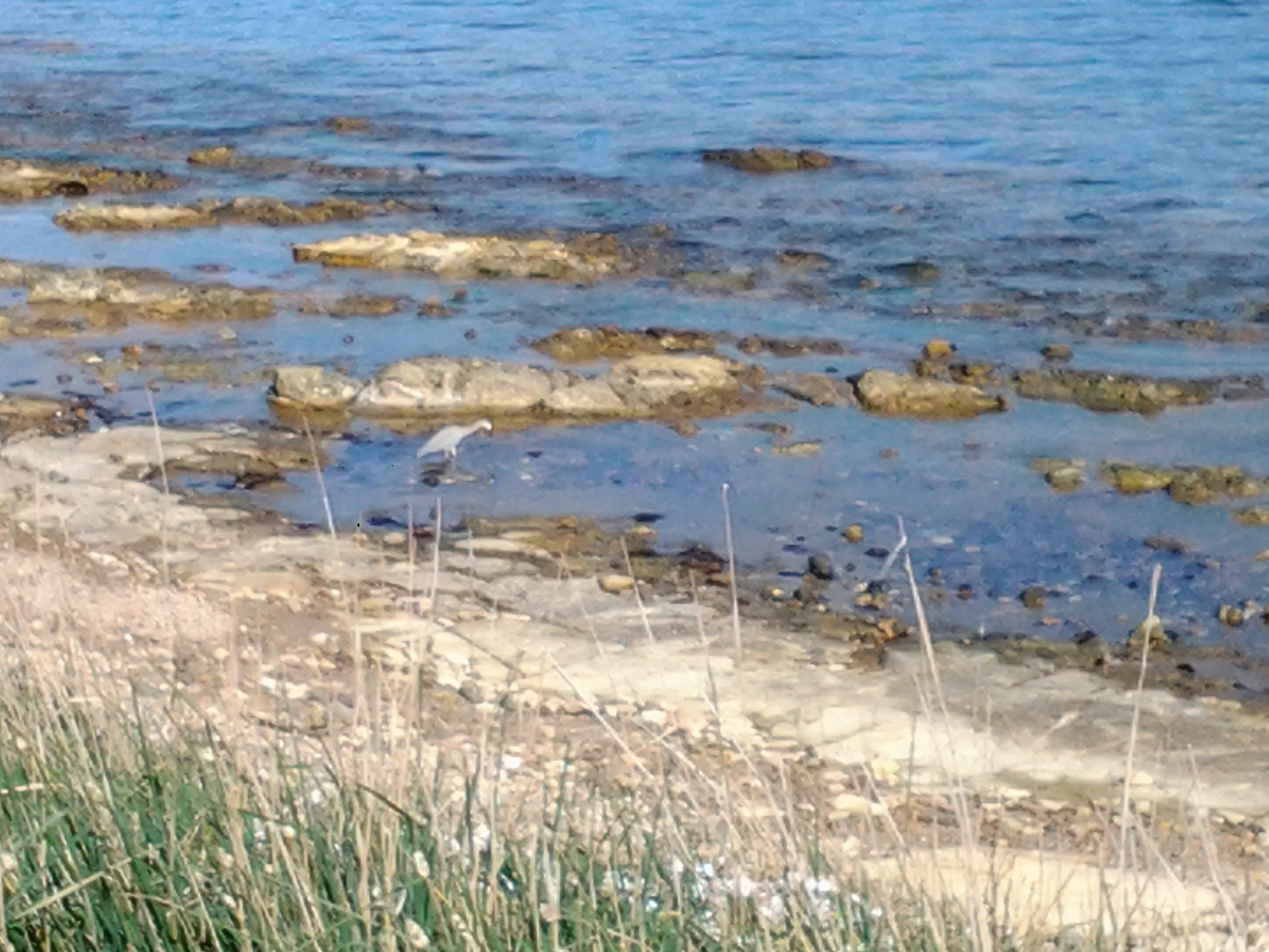
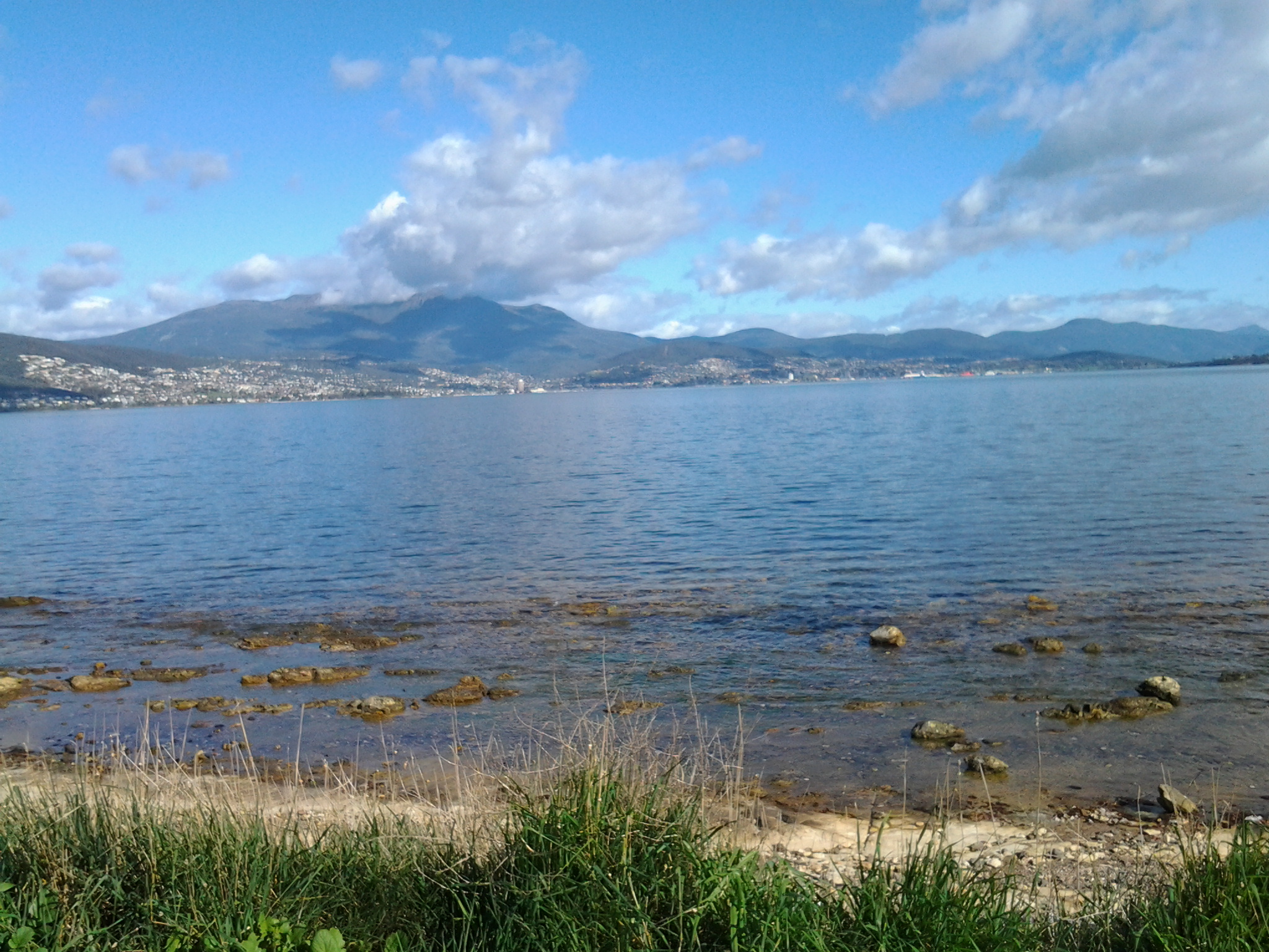
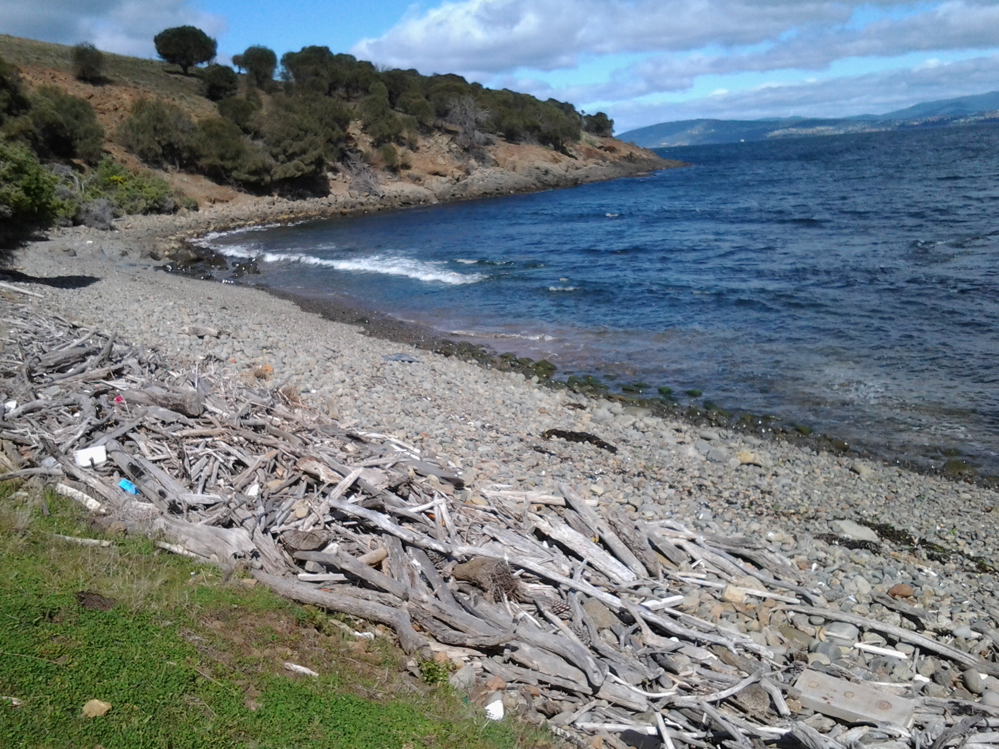
Six minutes into this walk, the only way forward was to clamber down onto the rocks and, like a happy goat, wander up and down and up and down to continue.  Initially I rocked and rolled on large moving pebbles (ankle twisters) and from then on I was more observant about where each footstep was placed than looking at the scenery.

20140926_095638

Another five minutes later I was surprised to look up at a house with a flag pole on which flew the Tasmanian State flag. It is not often this flag is seen except on Government House and near our State Parliament building.

Continuing along, I enjoyed the colour of endless rocks with their bright lichens in every shade of yellow through to burnt orange. In places, the lichens almost ‘inflamed’ the rocks. Fabulous!

20140926_095625

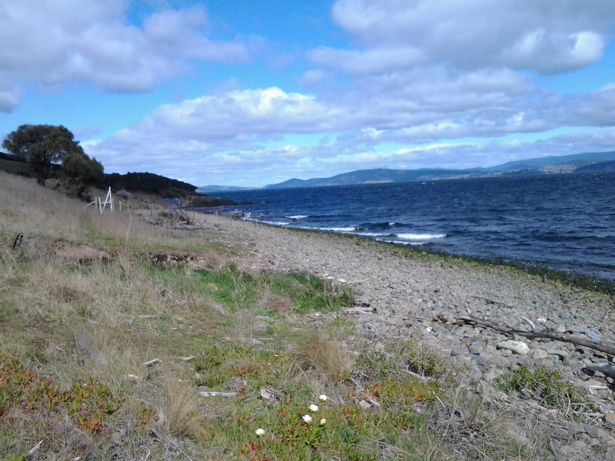
Fences and gateways often barred entry to the homes perched above the rocks. A woman mowing her lawn waved to me.  Only idiots or friends would walk where I did.  To be fair, a lot of the rock walking was easy and a pleasant experience. However, since it took around 50 minutes for me to walk around Howrah Point to Little Howrah Beach, you can imagine that towards the end of the time and when I could see the main Howrah Beach in the distance, I did not want to retrace my steps. The difficulties were yet to come. If I had stayed on the main Clarence Foreshore Trail, perhaps I needed only to have walked for 15 minutes to reach the first beach for the day.

Within metres of reaching Little Howrah Beach, the Derwent River’s water reached the inaccessible bank. The few rocks above the water level were smooth and slippery with green water plants. Overhanging the bank were spiky branches from dead bushes.  Need I say more? This was not a safe place to walk. But I did continue and quite soon I sloshed up at the open ground adjacent to Little Howrah Beach.

Walking through Tranmere to the start of Howrah Point on Stage 4 of my walk along the Derwent River

As I walked back towards the city, the Clarence Foreshore Trail started as a concreted pathway for cyclists and pedestrians, then stopped and started as a formal walkway; sometimes I walked on the road and sometimes on the grassy verge.  Car traffic was almost non-existent. At bus stop 30 there were seats to enjoy the view, and a shelter offered protection from the weather. The air was perfumed with the smell of cypress trees expressing their oils as the early morning sun heated their branches. Magpie birds warbled musically from the trees. I spotted the occasional Pied Oyster Catcher, Cormorants holding their breath and diving deep for fish, and a single speed boat whizzing up the River in the distance. Very few people around.

When the track dipped down as a gravel pathway edging the Derwent River, the mowed lawns of the back yards of houses edged this walkway. Green. Peaceful. And without fences, I could appreciate the large picture windows installed in many houses, for the view of the Derwent Harbour and further beyond. Groves of Casuarina trees barely whispered in the slightest of breezes. Stands of almighty gum trees occasionally blocked the sun. Plump yellow beaked Dominican Gulls rested on sunny rocks above the moving water. Pairs of plovers hoping to protect their babies screamed overhead. A tourist sight-seeing aeroplane droned along the river. Walkers with their smiling happy Labradors, German Shepherds, Shitsus and all manner of other canines greeted me.

This was easy strolling but I was always edgy and watchful for any cyclists that might wish to share the pathway.

I saw evidence of Landcare – new trees have been planted, staked and surrounded with protective plastic. Occasionally I noticed public tracks from this Trail that went back up the hill to Tranmere Road, giving walkers the option of where they walked as they continued along the River. Occasionally I came across public seats where you could, if you wished, rest and enjoy the magnificent views. Swings and slides could be used by kids at the small Anulka Park.

Around 50 minutes after leaving the bus, I arrived at a sign which provided a list of plant species in Clarence, and which offered information about weeds and escaping exotics and the dangers these pose to our native vegetation. At this point, the Trail curved uphill and this is the way any future walker should go.  The alternative is comparatively difficult and dangerous.  However, I did not know this at the time and I decided to stay low and hug the Derwent River edge. I was about to walk around Howrah Point.

Cranes, or should it have been Herons, at Tranmere on Stage 4 of my walk along the Derwent River?

In an earlier posting, I examined the name of the suburb Tranmere and discovered the word was derived from the Old Norse language and referred to the birds known as Cranes. Since Tasmania does not have Cranes, but some Herons have characteristics in common, I speculated that perhaps Herons might have been seen in our Tranmere area.

Imagine my joyful surprise when I looked down at the rocks and espied a White Faced Heron, near bus stop 31.  A lone bird. Standing ankle deep in the salt water, pecking his or her way seeking food. Oblivious to my goggled eye stare. Naturally going about its business. Almost camouflaged into the waterscape.

?????????????????????????????????????

Taking Bus 615 to Tranmere last Friday – Starting Stage 4 of walk along Derwent River

Having travelled across the Tasman Bridge, through the Eastlands bus mall near the shopping centre, and onwards, the bus takes the main route along Clarence Street. Along the way a sign marking the Clarence High School, established in 1959, looms large on the right. The 8.23am bus typically will carry a swarm of students who will jump off at this point and then the bus may quieten for the remainder of the trip.  But others will jump on after desperate running and laugh as they fall onto the bus with eyes sparkling from the exertion. Bus trips can be alive with life being expressed in all sorts of ways.

By 8.44am the bus pulled in at the Shoreline Shopping Centre mini bus mall.  Once moving again, the bus run goes the other way to a stream of traffic heading towards the city centre. Moving down the hill, and near bus stop 19, the bus passes the Howrah Primary School located across the intersection diagonally from the Shoreline shopping centre, and a Shell fuel service station which is located on the opposite corner. Further down, the bus passes The Sunshine Tennis Club and the Howrah Recreation Centre including the Guide Hall. Near bus stop 20, a Caltex fuel service station and a suite of small shops is located on the right with the Howrah Beach beyond.  It’s not long before, as a passenger, I am greeted by stupendous views of the Derwent Harbour, Hobart city on the western shore, and the all-powerful Mount Wellington peering over all.  Soon after the bus turns left into Tranmere Road, I noticed Tranmere Hall on the right, and then a little later near bus stop 23, I saw a sign designating the Tranmere Coastal Reserve and a nearby public walk way down to the Derwent River.

After passing Anulka Park at bus stop 25, I continued on and left the bus at stop 31 at 8.53am.

Yet again I was fortunate that the day was magical. As I crossed the road to stand next to the serene Derwent River, I listened to the lyrical lapping of soft tiny waves across the rocks.  Silver gulls were floating languidly. A lone Pied Oyster Catcher was watching and waiting. Fluffs of cumulus cloud like fairy floss hung suspended in front of the mountain.  Cabbage butterflies flew through the long grass. Orange flowering nasturtiums climbed through bushes edging the shore.

I soaked in the grandeur of the environment and prepared to start the walk – this fourth stage of my walk along the Derwent River.

20140926_085649

My route for Stage 4 walking along the Derwent River

Yesterday’s route took me from Tranmere to Bellerive on the Derwent River’s eastern shore of the Greater Hobart Area.

  1. I caught the Number 615 bus to Camelot Park and got off at bus stop 31 in Tranmere just before 9am. The bus continued onto it final stop 31, while I crossed the road to look down on the rocky foreshore, before striding out along the concreted Clarence Foreshore Trail (CFT) back towards the city.

20140926_085658

  1. When I reached bus stop 29, public toilets were located next to the Trail. I continued along the Trail to the left on a gravel path separating the rocks and water from the back yards of houses lining the river. Fifty odd minutes after leaving the bus, and after passing Punch’s Reef and Anulka Park, I arrived at a significant curve in the Trail. At that point it seemed to be returning up to the roadway for continuation on a concreted pathway next to Tranmere Road.
  2. Instead I walked on northwards, next to the river on a grassy terrace but was eventually forced down onto the rocks of Howrah Point. Fifty minutes later I arrived at the southern end of Little Howrah Beach where I sat and ate some of my lunch. I would not recommend followers take this route because when the tide is in, some rocks will be impassable. At other times some uncovered rocks will be slippery with moss. In addition, there are overhanging prickly bushes which will scratch if you follow this way. I suspect staying on the Clarence Foreshore Trail would have taken half an hour or more off my walk.

The photo below shows the tranquillity of Little Howrah Beach.

20140926_104107

  1. Half way along the road next to the Little Howrah Beach is bus stop 21. Close by are public toilets.
  2. It took 6 minutes to walk the length of this short beach, a minute to walk over a tiny rocky shoreline, and then 30 minutes to walk the long Howrah Beach. The photo below shows the Howrah Beach. Second Bluff is the treed area at the end of the beach.

20140926_105721

  1. From Howrah Beach, I walked up and around the Second Bluff headland on a well-marked path (the rocks below would be impossible to walk around) and arrived at the start of the Bellerive Beach approximately a quarter of an hour later. The leisurely stroll along Bellerive Beach took about 30 minutes. The photo below was clicked looking back along Bellerive Beach after my walk was completed.

20140926_121521

Near this end of the beach a large football and cricket ground is evident through the trees.  Between this ground and the beach you will find public toilets.

  1. I took the stairs at the northern end of Bellerive Beach up onto Victoria Esplanade, turned left and followed the road around Kangaroo Bluff to Bellerive Bluff where this fourth stage of my walk along the Derwent finished.

This Bluff marks the point where the small Kangaroo Bay opens off tto the east of the Derwent River. Northwards across the water I could see Rosny Point which will be the starting point for the next leg of this journey.

20140926_123316

On the other side of the river, the city centre featured prominently below Mount Wellington.

20140926_123103

A number 608 bus runs through this part of Bellerive and continues onto Hobart. Alternatively, if you continue walking along the edge of Kangaroo Bay, then through the Bellerive Village onto Cambridge Road, buses can be hailed to stop at Bus Stop 8 for travel into Hobart city.

How much of the Derwent River have I walked?

I strolled very slowly for almost five hours. If followers choose to stay on the Clarence Foreshore Trail and are not as engaged as I was in making notes and taking photographs, I believe this walk will take a comfortable 3 and a half hours including snack breaks. In total, I probably walked about 10 kilometres because of the convoluted nature of the Howrah Point rocks and other non-Clarence Foreshore Trail pathways which I followed from time to time.  In relation to meeting my goal to walk the 249 kilometre length of the Derwent River, I gained another 4 kms; the total distance covered so far is now 19.5 kilometres.

Tranmere, Howrah and Kolkata (or Calcutta if that’s how you remember it)

My last posting determined a connection between Howrah and Kolkata.

This triggered my memory of Saroo Brierley’s real life story published last year by Penguin Books, in ‘A Long Way Home’.  Having survived the streets of India including Kolkata as a lost child, Saroo was adopted by a Tranmere family. The book is an uplifting and enlightening read. Saroo’s story is one of luck, extreme persistence, love, family and self-belief.  He achieved his dream against all odds.  An extraordinary story.

Howrah

My walk today  (my fourth walk) along the Derwent River must pass through Howrah, an eastern shore suburb adjacent to Tranmere in the City of Clarence (part of the Greater Hobart Area).

The Clarence City Council records that Howrah was named after Howrah House (or Howrah Farm, an alternative source suggests), a property established in the 1830s on Clarence Plains by a retired Indian Army officer Captain James Fielder. According to the Asiatic Journal of the times, when Fielder was a branch pilot in Calcutta (which in our recent times has been renamed Kolkata), his wife had a son in Kolkata on 3 March 1830 so travel to Tasmania occurred sometime after that. On 25 March 1835, ‘the lady of Captain James Fielder’ gave birth to a daughter at Clarence Plains. Fielder arrived in Hobart at least a year earlier if the information in http://vdlworldimmigrants.wordpress.com/stories-of-immigrants-pre-1900 is correct.  “A newspaper notice by James Fielder of Howrah Farm, Clarence Plains, dated 17 November 1834 reads: Run Away On Friday the 14th instant, my apprentice boy, named Charles Connor, a native of India, between 16 and 17 years of age. I therefore warn all persons against harbouring him. He has on a narrow blue striped shirt, under a blue baize shirt, duck trowsers, lace shoes, and a tarpaulin hat. A reward of ten shillings will be given by the Undersigned to any constable who may take him up.”

Captain James Fielder took the name Howrah from a place of the same name near Kolkata. Clarence Plains is now known as Rokeby, a suburb I passed through on route to my first two walking stages on the South Arm peninsula. Rokeby is located over the hill from Howrah.

I found another historical connection when I recalled that Lieutenant John Hayes, who named our Derwent River, sailed from Kolkata in 1793.

With a little online research, I found that Howrah is the twin city to Kolkata in the state of Bengal in India, separated only by the Hoogly River. Back when Hayes was in the India, Kolkata was the capital of India during the British Raj so I imagine a bustling, active and expanding city.

On 11 October 1760, the Indian Howrah district came under control of the East India Company (EIC) – a massive trading company with ships travelling the world.  In 1823, when Bishop Reginald Heber described Howrah as the place “chiefly inhabited by shipbuilders”, it confirmed that location as a significant base for the 27 year old Hayes before he took leave of the EIC, acquired a couple of merchant sponsors who built him two ships, and sailed to Tasmania.  In addition to the shipbuilding industry, I have been pleased to learn that the British created a balance in the landscape by establishing the Indian Botanical Gardens in 1786. Perhaps Hayes experienced this maturing garden before he left in 1793. When he sailed into the Derwent River the Rokeby Hills would have been heavily forested (not cleared or edged with suburbs as they are today) and might have seemed similar to a botanical garden – a place with unusual vegetation.

Is there any chance Lieutenant John Hayes looked at our trees and remembered the Indian Botanical Garden?

Stage 4 of the walk along the Derwent River will happen tomorrow

Tomorrow, Friday 26th September will be marked by my fourth walk along the Derwent River.  The first two stages were on the South Arm Peninsula from Cape Direction to Gellibrand Point, and the third walk covered a little territory from Trywork Point to mid Tranmere. Tomorrow I will take up where I left off. This means I will be taking the Metro bus, number 615 which leaves the Hobart City Bus Mall at 8.23am for Camelot Park and travels through Bellerive and Howrah to bus stop 31, the starting point for the walk. The direction I will take will be northwards through the last part of the suburb or Tranmere and into Howrah. My intention is to walk the length of the Howrah Beach, then the Bellerive Beach and beyond. The weather and my feet will be the factors controlling the distance.  There is a 10% chance of rain so I will be unlucky if any drops fall while I am out and about.  All in all this means it should be a great day for anyone to be out and about and enjoying our gorgeous spring weather.

Tranmere

Last week I arrived in the suburb of Tranmere, walked to Trywork Point and then retraced my steps back into Tranmere.

Today I have been wondering why this suburb was named so. Wikipedia was my only source of information. If that information is true, then this Derwent River edge suburb in the City of Clarence was named after a suburb of Birkenhead in the Wirral Peninsula in England.  And where is that I wondered. This is the Liverpudlian part of England on the north western coast of England. Home of ‘Gerry and the Pacemakers’ ferrying across the Mersey River. English Tranmere skirted the edge of part of that River in a similar way to our Hobart Tranmere skirting the edge of part of the Derwent River.

In addition, I discovered that South Australia also contains a suburb named Tranmere in its capital city. However, so Wikipedia tells me, that Adelaide suburb was named after a town in Cheshire, England.   These bits of information raised more questions. Good ol’ Wikipedia.  Another of its sites tells me that Tranmere was, before local government reorganisation on 1 April 1974, a part of the County Borough of Birkenhead within the geographical county of Cheshire. It seems a reasonable guess that Adelaide and Hobart’s suburb are named after the same English town.

Vikings!

Apparently the name Tranmere was given by Norwegian Vikings who settled and colonised Wirral in the 10th century. Tranmere in Old Norse is Trani-melr, meaning “Cranebird sandbank” or “sandbank with the Cranebirds”. So … now I am wondering whether cranes rested on the shores of the Derwent in the area of Tranmere. Australia has only one cranebird: the Sarus Crane lives mostly in the northern tip of the Northern Territory. However Australia has a number of Herons and, despite being considerably smaller and shorter their long necks might have been considered comparable to a Crane. Tasmania welcomes both the White Necked Heron and the White Faced Heron. This former bird is similar to England’s Common Crane in colour. Is it possible that a person from England’s Tranmere area was walking along our river’s edge before the suburb spread, saw the White Necked Heron wandering around, felt the power of our Derwent River providing a separation ribbon from Hobart city on the other side, and remembered standing at Tranmere looking across at Liverpool city?  I don’t know the answer.

Music lovers

A final bit of trivia. Tranmere in England is home to Dave Nicholas the last resident cinema organist in the United Kingdom. You can read more about him at http://picturepalace.org/cinema-staff/organists/. In addition there are some extraordinary videos to be watched.


United effort for a clean River Derwent

This morning’s local newspaper The Mercury published a story about cleaning up the Derwent River. Please check out the site, at least to see a grand picture of the Derwent with the eastern shore in the distance, the Tasman Bridge and swimming black swans in the foreground. Go to: http://www.news.com.au/national/tasmania/united-effort-for-a-clean-river-derwent/story-fnn32rbc-1227069149722

You will read that the Derwent Estuary Program, established in 2001, is an attempt to reduce heavy metal contamination, encourage better urban planning to reduce river pollution and conserve animal habitats. There are some significant industrial sites such as Nyrstar zinc works and the Norske Skog paper mill located on the edge of the River, all of which I will walk past at some stage as I walk the River’s length.

Stage 3 Concluding the Trywork Point walk 20 September 2014 Posting 6 of 6

I walked for 3 hours and around 6 – 7 kilometres today. A comparatively short walk. But a walk of discovery of what not to do and what to do.

Approximately eleven kilometres of the Derwent River were walked on the South Arm Peninsula and today I covered a further 3 kilometres of the River’s length.  So far, 15.5 kilometres of the 249 kilometres have been accounted for on the eastern side of the Derwent River.  This includes the watery gap between Gellibrand Point and Trywork Point.

Note that there are no public toilets on this Trywork Point walk. There are no shops or other public facilities. Therefore it is important to take a supply of water, food, and a range of protective clothing for all weathers.

20140920_101614

This is my pick of the photographs taken today – it looks marvellous as a screen saver. The tufty moving grasses contrasted against the soft clouds scudding across the blue sky.


Stage 3 Continuing the Derwent River walk 20 September 2014 Posting 5 of 6

Leaving the Derwent River edge, I walked up the concrete path to Vaughan Court in Tranmere, turned left, walked until I reached the T junction with Oceana Drive, turned left and then followed the suburban footpath back in the direction of the original bus stop.  From the bottom of the concrete path until I reached that bus stop, it took approximately 15 minutes.

I turned left down into Tranmere Road. Three minutes later, when I reached Pindos Drive, a No Through road, I turned left and followed it to the end and arrived at midday. This road ending named Tranmere Point, is marked by Pindos Park, an area with children’s play equipment, seats to admire the views, and places to enjoy a family picnic. Locals were walking and cycling.

I looked southwards and could see that Pindos Park was another possible starting place for a walk to Trywork Point. The soft grassy track between the houses and the River was wide and clear and continues around until a connection is made with the track to the gate at the beginning of the small pebble beach.

20140920_120305

This photograph is taken from the Pindos Park area. The trees on the hill in the distance are the forest of Casuarina trees I referred to in an earlier posting.  I walked though those trees in order to reach the other side and then down to Trywork Point. What I am now suggesting is the walk to Trywork Point starts here at Tranmere Point and the track visible in this photograph can be followed eventually down onto the rocky shore and then around the bays and small headlands. In this way, walking on private land can be avoided.

Once I turned away from this southwards direction to continue my walk northwards, I was blown around the Pindos Park headland with its markers indicating underwater pipes,

20140920_120623

and continued on following the River into the sun. I could see the suburbs of Howrah and Bellerive with their golden sandy beaches in the far distance.

20140920_120655

Ten minutes later I reached the official start of the Clarence Foreshore Trail, a cemented path for both cyclists and pedestrians. By 12.15 I reached bus stop 32, and five minutes later I arrived at bus stop 31. However I was beginning to plod because my feet were sore so I waited for a few minutes by the rocky foreshore of Tranmere in the glaring sun amidst a stiff wind, for the 12.23 pm bus which was scheduled to return to Hobart. It came on time, and when I hopped on and sat down I realised that I had not stopped or sat since the bus trip to Tranmere 3 hours earlier in the morning. During my walk, I hadn’t stop to have a morning tea snack – hadn’t felt the need. Was enjoying the scenery and the weather too much to consider food. Lost in all the gorgeous moments of the day.

I left the bus at the Shoreline shopping plaza for a toilet stop and a chance to buy a newspaper and a few groceries.

20140920_125804

Note that in this photograph taken outside the Shoreline Plaza, there is a distant hill in the centre background. That’s the hill with the Casuarina trees through which I walked on the way to Trywork Point.

The Shoreline was very convenient. Then I jumped on a later bus heading towards Hobart.

Stage 3 One starting point for a Derwent River walk to Trywork Point 20 September 2014 Posting 4 of 6

If you choose to walk to Trywork Point, I recommend one starting point could be the pathway down from Vaughan Court (which runs off Oceana Drive to the right), and turn left at the bottom onto a grassy walking track. If my experience is a guide, you are likely to meet happy dogs and their owners enjoying a stroll along this route.

If you choose this route, I think you should allow at least 2 hours for a one way journey that has nil or minimal walking on the cattle tracks on private land.

This walk is not for everyone.

It requires specific equipment (supported walking boots) and a reasonable level of fitness, a tallish size and common sense. There are a number of dangers to be considered; the chance of rolling or spraining an ankle on the rolling rocks, the chance of injury on the slippery slopes where the needles from the Casuarina trees form a moving mat on the ground, and the surprising number of pieces of rusty fencing wire that pop up unexpectedly. In addition, if the herd of cattle was in the vicinity where you might be trying to edge along a cattle track, there might be some associated dangers. But above all, you are skirting around private land and that needs serious consideration.  If you are not very tall, you may find some of the rock climbing to be unsafe and perhaps impossible.

This walk is for the few.


Stage 3 Walking from Trywork Point back to the suburb of Tranmere 20 September 2014 Posting 3 of 6

I left Trywork Point at 10.30 am intending to walk back along the edge of the River in order to determine what could be achieved without walking on private land. I am delighted to say that the low rocky foreshore from Trywork Point is very walkable if you wear strong ankle supporting boots. Of course it is slower than walking the cattle tracks but quite spellbinding.

20140920_110119

I did come upon one section as shown in the photograph above of rocks that rose in the air, and I couldn’t descend (it would be perfectly easy to ascend if walking towards Trywork Point by the rocks, but long legs are required to descend – and mine are short) so I climbed back up to a cattle track and followed that until I reached a gully – no water running and grassed over – where I could easily step down onto a large pebble beach.

Smooth grey driftwood pieces in all sizes and shapes were washed up to where the pebbles met the land.

20140920_111446

The blanching shells of thousands of mussel shells and the occasional oyster shell fitted between the pebbles. Detritus, the flotsam and jetsam of human activity was interspersed across the beach. The remains of polystyrofoam containers, blue plastic containers, empty plastic drink bottles, beer bottles, and frayed ropes were typical. Attracted by its bright yellow colour, I picked up a perfect Spalding high-bounce ball which can be used when learning to play tennis.

Around a tiny rocky headland I walked from the large pebble beach to a beach of smaller pebbles. All the while treading slowly as the stones rocked and rolled, and as pieces of rusty metals thrust up unexpectedly from below. At the northern end of this pebble beach, and as I neared the first houses of suburban Tranmere, a falling down fence crossed from the land over the pebbles and continued into the water. Once near the fence, I could see that someone had built a gate that swings in the wind, so that locals can access the beach from the suburban side of the fence.  I passed through the gate and continued on a home grown track for the occasional pedestrian traffic.  There were no signs here or around about indicating entry to the beaches and rocks where I had been walking, was prohibited.

20140920_112751

The white structure is the make shift gate through which I had walked.  Note that in the foreground a variety of native pigface fleshy foreshore plant are growing.  Today, the flowers were like jewels as they gleamed in the sun.

20140920_112746

When I looked across the Derwent River, Mount Wellington in all its magnificence towered over Hobart city. The pebble beaches and later pathways offered superb vantage points.

After walking for ten minutes from the gate, on the public verge above the river in front of many houses, I came to a public pathway leading uphill to the road; a steep concrete path that would be impossibly slippery when wet.  The pathway is located between 24a and 26 Vaughan Court and could be the starting point for a legitimate walk to Trywork Point via the rocky foreshore.

Stage 3 On the way to Trywork Point along the Derwent River 20 September 2014 Posting 2 of 6

It was 9.13 am when I got off the bus at Tranmere (that is, a 25 minute bus ride from the Hobart city centre) and I was ready to walk but unsure which route to take.  My first idea was to walk up some side streets hoping their ends would be in open paddocks which I could walk across. I can now tell you not to walk up Norla St or Spinnaker Crescent to the locked gates and fences,

Top of Norla St- gates blocking progress

unless you want to appreciate the fabulous views of the River and beyond. At 9.45 am I was back down onto Oceana Drive near its southern end where the Crescent makes its connection.

The sealed bitumen road of Oceana Drive quickly changes into a gravel road. Then across my path a padlocked gate and a barbed wire fence that descends towards the River, effectively blocked my progress.  The tiny yellow sign glowed in the sunlight: Keep out private property.

Ahead of me on the other side of the gate, a car track wound into the distance and then disappeared into a gully. On the crest of the distant hill sat a forest of casuarina trees. Before these trees, and across the hill, golden grasses rippled when the wind blew onshore.  The sky was blue.

Sometimes there is a correct way and an incorrect way to go about doing things.

My intention has always been to provide directions for people who would like to follow in my footsteps and so if I was to describe a way that cannot be repeated, then I would mislead you. It is sufficient to say that I went the wrong way but returned the right way.  Yes yes yes. You guessed it.  I jumped that gate onto private property and continued on with plovers wheeling overhead all the while trying to protect their little bird that ran in terror into the tussocky grass. 20140920_095305

In a later posting I will describe how to walk to Trywork Point without walking on private land.

It is clear that someone is currently subdividing this land and I guess that new blocks of land will be offered for sale at some time in the future. Once this happens, then the land will be opened up and become accessible. Well-worn single file cattle tracks, evidenced by hoof marks and weathered cow pats, ranged through this land. Everything was dry and disintegrating so that I didn’t believe a herd had passed along these tracks recently.

I reached a new fence with a prominent sign on the other side: This is NOT public land.  Uphill the fence stopped in the middle of nowhere so I continued across the hill towards the forest of Casuarina trees.  I was careful that the short tussocky grass and the occasional hidden rock didn’t roll and sprain my ankles.

20140920_100104

Once into the trees, and dodging low branches, I followed meandering tracks all the while making sure the Derwent River remained clearly on my right. Throughout today’s walk occasionally and unexpectedly rusty pieces of fencing wire wanted to trip me up and harm me, so constant vigilance was required to avoid these dangers.

Before long and once out of the trees, a wonderful vision of The Spit and Gellibrand Point on the South Arm peninsula greeted me. Between me and Trywork Point was an ocean of moving grasses. Golden. Shimmering. Glorious. Winds sweeping. Isolation.  Silver Gulls floated overhead.

20140920_101617

In the photo above, the two small green trees at the bottom of the hill mark Trywork Point. Gellibrand Point is on the left across the water. The dark blue represents the huge expanse of the Derwent River’s grand harbour.

The cattle hadn’t made tracks down to Trywork Point so I thumped my own path down through the tussocks and occasional scrawny remnants of rose bushes. Eventually I arrived and unfortunately disturbed a pair of Dominican Gulls who seemed to ‘own’ the rocky point. I couldn’t see evidence that people had been here in a long while.

20140920_102703

The photo above is the rocky edge of Trywork Point, with Gellibrand Point on the South Arm peninsula in the distance.

When I looked eastward towards Droughty Point, a headland at some distance inside Ralph’s Bay, I was surprised to see before the point was reached, a small secluded sandy beach.

20140920_102734

Between the beach and Droughty Point, a healthy herd of red brown cattle rested and munched comfortably on an area of luscious looking green grass.  I guess they are the beef steaks of the future.