Category Archives: Mount Wellington

Glorious rain

Yesterday, I was excited by the weather and exclaimed “Oh this is so tropical!”

The day had been warm and humid with brooding clouds. Then, all of a sudden, I watched the weather front coming across Mt Wellington and the thick strong flashes of lightning. Booming thunder rolled through the air. Gradually the mountain, Hobart city then the Derwent River disappeared from view and rain spots larger than a 50 cent piece splattered and splashed heavily on my balcony.

Within seconds, the largest hail I have ever seen cracked down. Solid ice balls half the size of golf balls, settling on my garden, balcony and the street.  Torrential rain.

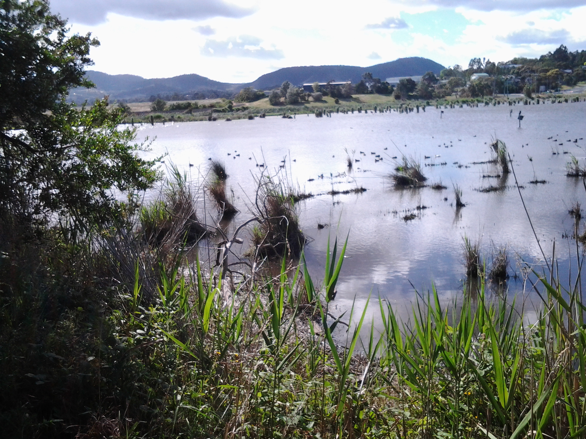
Five minutes later bits of sun struck through the rain, the mountain became visible again, and the storm had passed. But the white hail remained like a lace cover on my property – for almost 20 minutes. Marvellous!  Today’s newspaper has a story with an online video – have a look at the hail on http://www.news.com.au/national/tasmania/freak-storm-brings-hail-and-heavy-rain-to-southern-tasmania/story-fnn32rbc-1227158393426

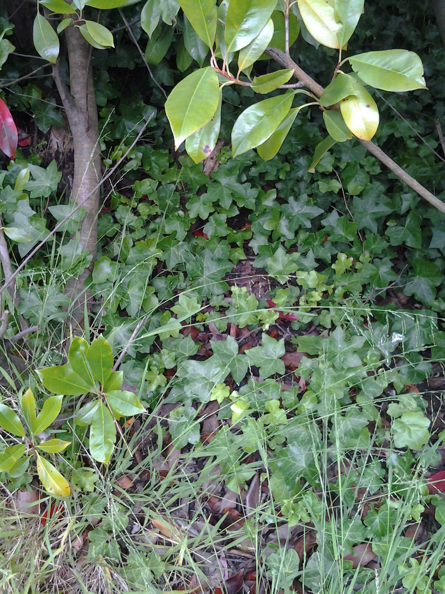
I wondered how others around Hobart fared.  Friends told me how they were caught in the wildness of the storm and were drenched even when they used an umbrella. Others remarked on the deafening noise of the hail on a tin roof.  To quote from one email (thanks An) “Some of our garden is less than happy. I had to pick all of the rhubarb as it had honeycomb leaves, my begonia lost all of its leaves and flowers, the water lilies are shredded as are most of the magnolia leaves. I feel sorry for the cherry and soft fruit growers. We had a few drifts of ice near our lemon tree and the cool air was quite spectacular! Our gutters overflowed due to ice too. Quite an eventful afternoon.”

We all seemed to love the drama of the storm.


And what are you doing in the week before Christmas?

Life before Christmas this year is conspiring to prevent me from taking a much-longed-for next walk along the Derwent River. Stage 10 seems so elusive. A weird flattish cloud hovers over Mount Wellington and the Derwent River is a silvery expanse striped with white ridges blown up by the wind. The sun is out and the temperature warm.  Perfect for walking.  Last week the problem was the weather and this week it is my unexpected and changing commitments that are delaying further exploration. So … apologies to my followers for the lack of new stories of discovery. Meanwhile, I hope you are making some of your own in your local area.

Looking forward to plodding again along the Derwent River.

Australian cartoonist Leunig has a point of view that I understand well.  It reflects the simplicity of walking.

Leunig as jpeg

Drat, drat and triple drat

It’s raining outside and the clouds are  are covering the ears of the hills. Mount Wellington has disappeared from view. Cars are flashing their windscreen wipers. Today is not the day to take stage 10 of my walk along the Derwent River.  Alas.

Where am I when I am on my walks? “Give me a map”, many cry.

Some readers have despaired for the lack of a running map which shows precisely the tracks where I have walked. I and others continue to try and solve the problem.

Meanwhile, for those who are unaware, I do create a location map with each posting. The map is static and simply pinpoints one place but at least it is a guide to where I was during that leg of the walk.  Sometimes if a location is not within Google maps then I cannot show it as the main location. For example I wanted to include a map with the McCarthy’s Point location but was limited to the two bays either side. This was problematic when the posting had nothing directly to do with the bays either side – but I chose one just to give readers a guide. When I want to pinpoint the Derwent River, the map highlights the southern suburb of Kingston.  Ahhhh I sigh.

There is another unfortunate matter. I now realise that those readers who are ‘followers’ by automatic email do not get direct access to that location map. For interested readers, when you receive the email you need to click onto the heading of the posting and this will take you to the website.  At the bottom of the posting on the website is a link which you click to open the map.

I realise that this is a tedious and tiresome process, but it may help some readers to orient themselves better.

The highlights of the 9th stage of my walk along the Derwent River

The 9th walk took place on 25th November. I loved every part of the day but a number of highlights stand out.

  • The tranquillity of Goulds Lagoon
  • Being at the Austins Ferry point and looking across to the Old Beach jetty
  • Finding James Austins House
  • Being surprised how long it took to walk around the water edge of Claremont Golf Course
  • Arriving at and walking around Dogshear Point
  • The down time at the Cadbury chocolate factory
  • Being followed by a duck
  • Pied Oyster Catchers on the golf course and parks
  • The rough-hewn bench seat near Lowestoft Bay
  • The memorial to defence force dogs
  • Discovering the Worm Mound at MONA

Earlier postings provide more information on these highlights or you can email me for further information

Please note; anyone choosing to walk this stage needs to be aware there are no public toilets. However, a number of businesses have toilet facilities to which you may be able to gain access.

My 10th walking stage will start at bus stop 33 in Berriedale and then will continue south towards Lutana.

From Lowestoft Bay to Cameron Bay

Before leaving Lowestoft Bay, I looked up through the rain showers to see three Pelicans fishing on the water.

20141125_150144

A temporary stop under a gazebo offered no respite from the off and on again rain nor the fierce wind bursts. By 3.15pm I reached the start of the Berriedale Caravan Park. I followed the road through from Lowestoft Bay to Cameron Bay and was accompanied by a very persistent duck.

The Duck

I was worried s/he might follow me home but after a few hundred metres the duck dropped off the pace.

Before long I was walking away from the Caravan Park on the gravel road towards the Berriedale Sewage Treatment Works.  What a pong hung around this area!

20141125_151751 20141125_152409  20141125_152417

I hurried past the fenced-in nasal offender and around a barred gate designed to prevent vehicular traffic. The sign warning fishermen to be careful indicated to me that public access was acceptable.

By 3.30pm I reached the point where the southern end of Cameron Bay meets with the main flow of the Derwent River. I sat above the water’s edge, admired the views and contemplated where I had been and considered how much further I could travel on the 9th stage.

20141125_153058

Lowestoft Bay in Berriedale on my 9th walk along the Derwent River

Wandering down the track towards Lowestoft Bay, Berriedale’s Caravan Park and the headland with MONA were visible.

Towards MONAacross Lowestoft and Cameron Bays  20141125_145110

Eventually at 3pm, I reached the northern end of the Lowestoft Bay and could see the Bay stretching around to the Berriedale Caravan Park.

20141125_145823

Once on the open mowed green parklands, clear walking tracks were easily accessible.

The most amazing discovery of this 9th stage of my walk along the Derwent River was a significant memorial to the dogs that had been part of Australia’s fighting forces.

Three different components constituted the memorial.

  • A panel detailed the stories of some of the dogs.

20141125_150411

  • Vertical panels placed at intervals along the Lowestoft Bay waterfront with the names of the dogs and the wars they had fought in. For example:

20141125_150551

  • A paved and constructed place for quiet contemplation

20141125_150441

This memorial was so unexpected; a remarkable series of features the like of which I have never seen before.  How many readers knew it was there?

From McCarthy’s Point to Berriedale on my 9th walk along the Derwent River.

When I turned around for my last look northwards from McCarthy’s Point across Connewarre Bay and the main body of the Derwent River, the Cadbury factory was sunlit. I found it difficult to believe I had been there only 1 ¼ hours ago because of my experiences with new vistas since then: now the Cadbury factory seemed so far away.

20141125_144658

The walk from McCarthy Point moved along a pretty trail, well-trodden by others. It made for excellent walking.

20141125_144433

The vegetation was often lush and overgrown with free sown exotic plants.

20141125_144540  20141125_144548  20141125_144652

Before reaching Lowestoft Bay in the distance I was puzzled by … was it a woman washing herself in the garden.

20141125_145547

Of course on closer inspection this clearly was not the case.  First impressions can be so wrong!

20141125_145610

I thought the concrete blocks flanking ‘her’ feet were rather special element of the installation of this sculpture.

Closer to the water’s edge in front of this property stood a flag pole. This Australian flag was protected from the wind by nearby trees.  Considering the gale that blew around me all day in every nook and cranny it was extraordinary to have a moment of calm here.  Perhaps winds don’t blow here. Perhaps the flag always droops.

20141125_145623

In the photo above, across the Lowestoft Bay a section of the Berriedale Caravan Park is visible.

But before I reached the Bay,  I surprised a clan of rabbits happily resting on the leaf strewn path ahead of me.

Rabbits

I had the feeling they were not used to pedestrians on a weekday and were most put out as they scurried off to hide.

From Windermere to McCarthy’s Point via Coonewarre Bay on my 9th walk along the Derwent River

The track from Windermere southwards was not signposted but with hunches I found a well walked and easy informal track, the start of which was rather obscure.

20141125_141924

20141125_142038

More black swans swimming.

20141125_142042

I loved the tall stand of pine trees which featured on one part of the track to Connewarre Bay.

20141125_143150

This was my first view of Connewarre Bay with the backdrop of prominent Mount Wellington.

20141125_143336

Once near the houses with their lawns extending to the water’s edge, I came across a wonderful piece of rustic furniture to be enjoyed by walkers such as myself. The wood’s soft grey weathered tones were immensely attractive.

20141125_143454

Further along, I came across a large family of what I think were Eurasian Coots – black feathered with white bills. My books suggest these birds are found on fresh water lakes and swamps. The Derwent River, at this distance from the sea, apparently still has a saltiness from the daily tidal flows. Perhaps my identification is incorrect. Anyway this family weren’t sure whether to scurry from the shore onto the water and ‘escape’ from me or not.

20141125_143827

I continued walking around the Bay towards McCarthy’s Point.

20141125_144259  20141125_144256  20141125_144422

It took half an hour reaching McCarthy’s Point from Windermere. I loved the view across the Derwent River towards the suburb of Otago Bay with Mount Direction behind.

20141125_144425

The Claremont Bowls Club

From the Cadbury factory, the Bournville Road curved around towards the Claremont Bowls Club. The houses that I walked past were all interesting architecturally and represented diverse styles deemed suitable for past employees of the Cadburys confectionery manufacturer (which operated in Claremont from the early 1920s).  It seemed to me to be a row of history.

At the end of the road was a carpark for the Claremont Bowls Club through which the Derwent River beckoned me. I walked down the hill until I reached an impasse of fence and vegetation. I walked along this barrier and was able to recognise the eastern shore suburb of Old Beach.

20141125_111938

The Derwent River stretched northwards and I was surprised to realise I had walked so far south already that the Bridgewater Bridge was no longer in sight.

20141125_112011

Mt Direction was clearly visible.

20141125_112111

And just for the record, I didn’t stop for a bowl. There were more exciting discoveries to be made next door at the Claremont Golf Club.

Walking south and into the suburb of Claremont on the 9th stage along the Derwent River

The intersection of Harbinger Lane and Ferry Road at Austins Ferry marks one corner of Weston Park. At 9.56am I turned left and walked across the Park parallel to Rusts Bay, crossed a single lane wooden bridge and rounded the Shoobridge sporting fields all the while enjoying the pleasures of dogs walking their owners along the edge of the Derwent River.

The photo below shows Shoobridge Park on the northern side of Beedhams Bay.

20141125_102813

I was amused and somewhat puzzled watching a Pied Oyster Catcher picking for worms on the sports oval, and not bothered by an interested German Shepherd. What happened to a little fear? What’s wrong with oysters?

I had an easy walk on mowed grasses to Beedhams Bay and was delighted when a White Faced Heron flew onto the path ahead of me. Slender. Petite. Soft grey.

At 10.10am I crossed the railway line following the tracks of others but there are no official paths. The Main Road was again to my right with the railway line to my left. Native Hens were feeding ahead and noisy plovers let them know I was coming.  Black swans floated on the Bay. I noticed bus stop 40, and realised 1 ¾ hours had passed since I started today’s trek from bus stop 47 in Granton South.

While at Beedhams Bay I was in full view of three mountains: Mount Direction on the eastern shore, and Mount Faulkner and Mount Wellington on the western shore.

I stopped for a morning tea break at 10.18 in a gazebo at the southern end of Beedhams Reserve.  Despite some protection from the elements, the food was blown off my spoon before I could transfer it to my mouth. My hair thwacked back and forwards at every angle across my head creating an interlocking mesh.

The photo below shows Beedhams Bay looking northwards across it.

20141125_102808

My maps indicated that the nearby building sunk low in the earth was a scout hall but I couldn’t see  signs of identification and the building looked locked up and unused. Foot tracks emerged from the area and crossed the railway line that cut through between packs of houses on either side. There was no evidence of being able to continue to walk close to the Derwent River so I walked up above but beside the railway line until I reached a road crossing at Bilton Street in Claremont.

20141125_102823

A local government bike and pedestrian path from Hobart reached its conclusion next to the railway line on the other side of the road. To my surprise Claremont Plaza, a multifaceted shopping village and other organisations, was located in the block diagonally opposite. This was a sensible location to make a toilet stop since there are no public toilets available during my 9th stage of the walk along the Derwent River.

By 10.46am I had returned to the rail/road crossing ready to continue the walk. I followed Bilton Street around the curve until its T junction with Cadbury Road and turned left. On the other side of the road, the lovely red brick unused old Claremont School stood boarded up.

The road turned uphill and passed the Bilton Bay Reserve (10.49am) and the entrance to the Derwent Waters Residential Club – an estate signed as private property thereby denying my access to the River’s edge (10.56am).  I continued walking on Cadbury Road flanked by tall pine trees thrashing in the wind, past the Cadbury Sports Grounds (11.05am), past the Cadbury Visitors Car Park (11.08) and turned left onto Bournville Road.  I knew I would be returning to have a closer look at the Cadbury chocolate confectionery manufacturing factory so I proposed to walk to Dogshear Point first and then be rewarded sweetly later.

20141125_110910

Onto Austins Ferry edging the Derwent River on the 9th walking stage

At 9.36am last Tuesday I had passed St Virgil’s College with its warbling magpies and raucous plovers flying overhead and turned left at Merley Road. I was in the heartland of the suburb of Austins Ferry and now walking down a hill towards the River. Opposite a street signposted Willow Walk, I crossed some land and then up and over the railway line. I walked across an open area with large fat rabbits quickly disappearing from view.

20141125_094210

The view from the water’s edge looking northwards was as follows:

20141125_094216

Once at the River’s edge I turned left towards the Austins Ferry Yacht Club and a jetty.

20141125_094200

An interpretative panel explained that the Austin’s Ferry was the main Hobart to Launceston link from 1816 until 1848 when the bridge was constructed up stream. James Austin managed the Roseneath Ferry from the western shore and his friend James Earl managed the Compton Ferry from the eastern shore. I peered across the brightly lit water but could barely distinguish the Old Beach jetty on the other side. Clouds were scudding across bringing light and shade so that all my photographs which try to record the jetty on the other side are abysmal failures. Nevertheless I know where to look for that jetty from this Austin’s Ferry jetty.

20141125_094543

Starting last Tuesday’s 9th walk along the Derwent River

On the first leg of this stage at 8.26am, I started by walking south on the Main Road from the York Hotel in Granton South with a view of white capped wind-blown waves on the Derwent River next to me, and the suburb of Bridgewater across on the other side.

20141125_082909

At 8.42am I passed the Lagoon General Store and Servo and by 8.49am I had reached the start of a pathway leaving from the Main Road and leading around the Goulds Lagoon Bird Sanctuary. This was a peaceful alternative to the noisy main road. All manner of wild fowl, other birds, animals and plants could be seen including ducks, rosella parrots, rabbits, wild mushrooms, seagulls, handsome gum trees with their fresh smell of eucalyptus, and a cluster of spectacular Eastern Great Egrets. Spotted across the Lagoon were bird-breeding boxes.  The air was deliciously moist and the grass was high. This was not a track for those in wheelchairs, pushing prams or walking with crutches.

20141125_085659  20141125_085652

By 9.07am I had circled Goulds Lagoon and was back on the main road at the edge of the Hestercombe Reserve.

20141125_090822

Continuing southwards, I passed by the area known as Ten Mile Hill without trying to squeeze through barbed-wire topped gates blocking roads to timber mills and other ‘private property’. By 9.24am I had reached the northern end of St Virgil’s College with its signage indicating ‘private property’.  Effectively these businesses and educational institutions prevented me having direct access to walk along the Derwent River.  I thought I might walk along the railway line corridor closer to the River, but since it passed through some of the private property I chose not to do so.

9th Stage of walk along Derwent River completed yesterday, Tuesday 25 November

I caught two buses from my home in Bellerive on the eastern shore, via the Elizabeth St CBD Hobart and the Glenorchy City bus malls, to reach Granton on the western shore of the Derwent River in the northern suburbs of the City of Glenorchy in the Greater Hobart Area.

At 8.26am I stepped off the Metro number X1 bus at stop 47 outside the York Hotel in Granton South and, with excitement about what the day might bring, I looked around and admired the view across the River to the suburb of Bridgewater before starting the tramp south.

20141125_082854

No footpaths or walk ways had been laid for pedestrians and so vigilance was required against the traffic on the Main Road. Occasionally a few metres of concrete or bitumen were laid for a new subdivision but generally a track for smooth safe walking was not on offer.

The weather started sunny but during the afternoon rain passed intermittently. In the photo below you can see the grey background blurred by rain, but meanwhile three pelicans were enjoying themselves on Lowestoft Bay.

20141125_150144

Relentless buffeting wind was the main feature all day. As a result, I couldn’t keep my sun hat attached to my head. Needless to say, I returned home with a blasted red face.  But happy from the pleasure of walking, discovery and the fresh air. Being a tourist in my home town is a revelation and a joy.

I walked southwards from Granton South to MONA (the world famous Museum of New and Old Art) at Berriedale and passed through the suburbs of Granton South, Austins Ferry, Claremont and half of Berriedale.

I experienced Goulds Lagoon, Austins Ferry Bay, Rusts Bay, Beedhams Bay, Bilton Bay, Dogshear Point, Windermere Bay, Knights Point, Windermere Beach, Connewarre Bay, McCarthy’s Point, Lowestoft Bay, and Cameron Bay. I plodded around bays and a golf course (I gained special permission to walk this private property but I would NOT recommend anyone else try it – see later postings), had a stopover at Cadbury’s, and hid from the rain in gazebos and art works. All up, I probably walked 18 kms.

Yesterday I covered 9 ¼ km of the River’s length on the western shore. This adds to my previous tally of 3/4km on the western shore making a total of 10kms covered as I trek southwards from the Bridgewater Bridge to the mouth of the Derwent on the western shore.

Specific details of the different legs of this 9th stage walk will be written up and posted in the coming days.

My favourite photo of the day was taken near the end of my walk, when I sat at the point where the southern end of Cameron Bay met the Derwent River (with MONA just over the hill). The water had been frothed by wind and I liked the lacy remnants floating by.  The intense colours are the result of the rich light quality caused by the heavy clouds overhead.

20141125_153054