Tag Archives: Bowen Bridge

Around Bridgewater on the 8th stage of my walk along the Derwent River

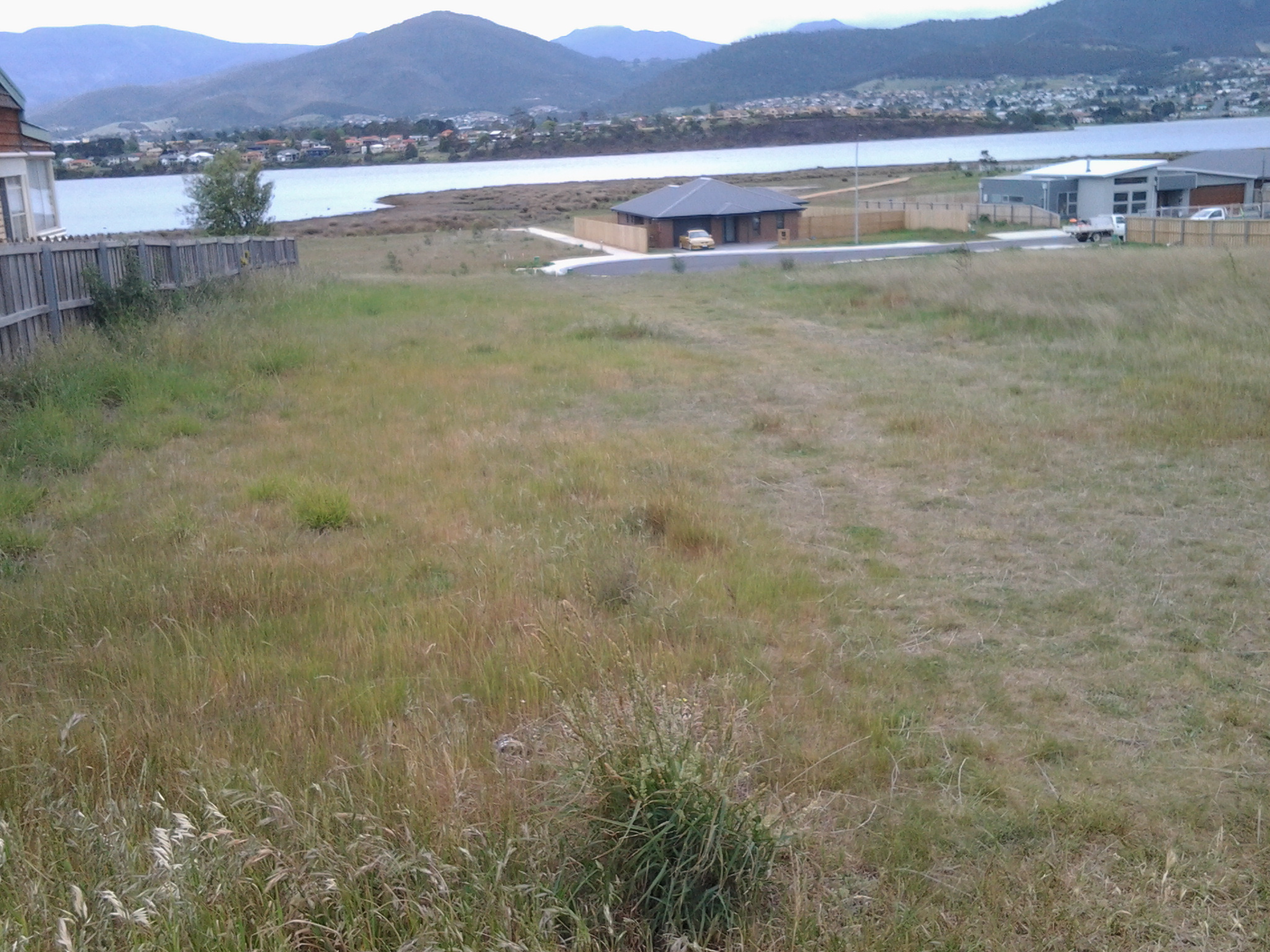
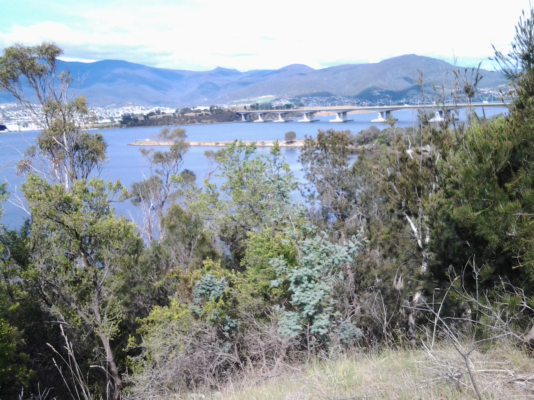
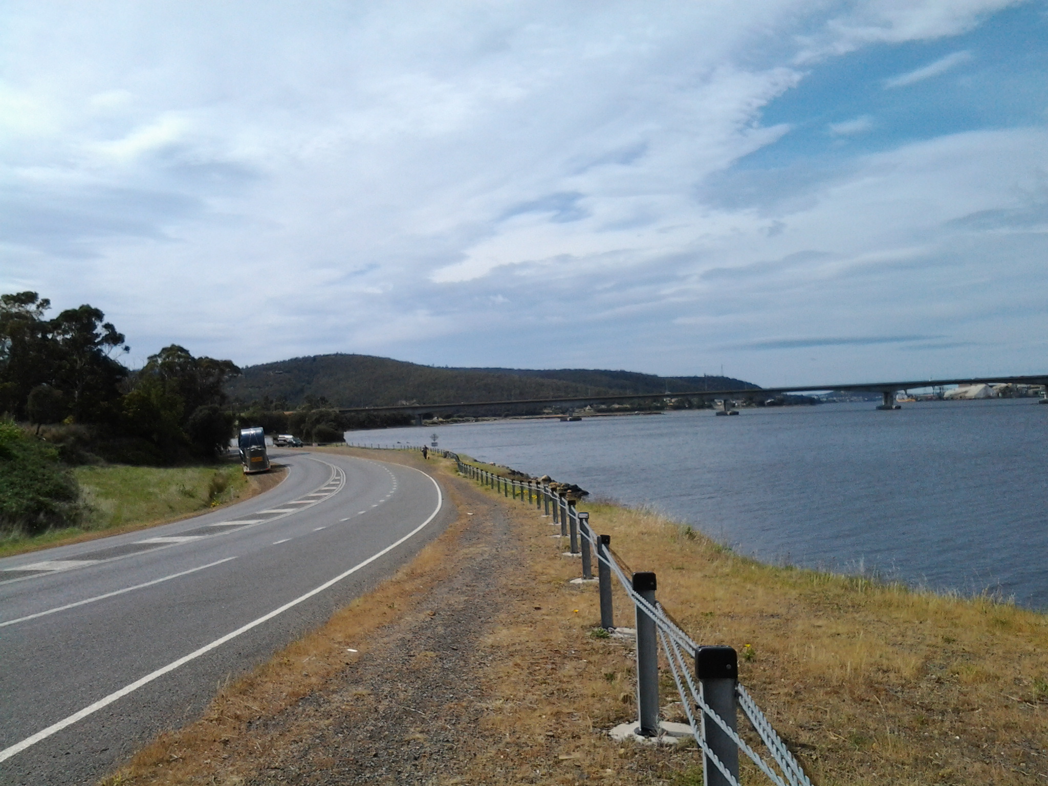
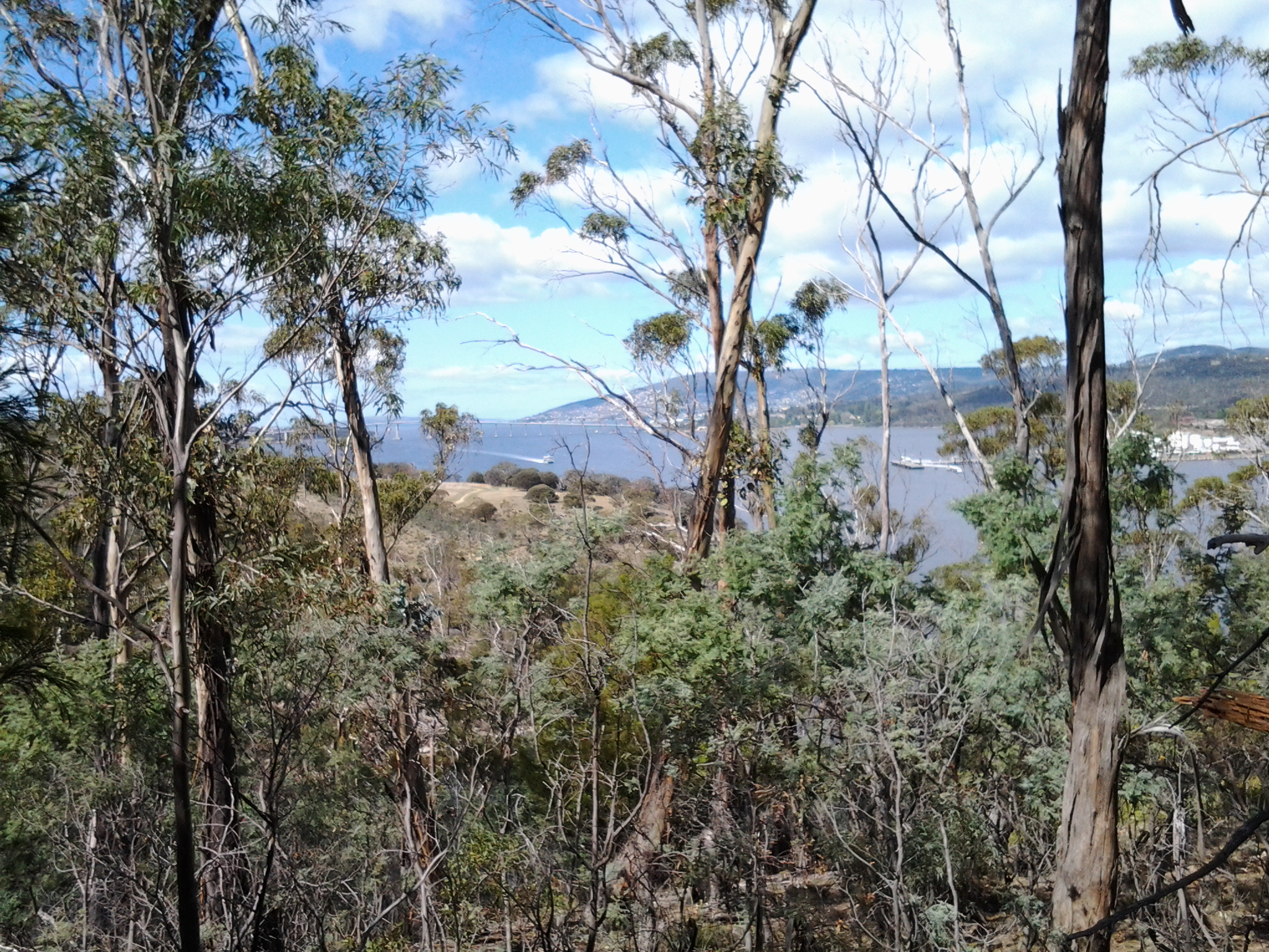
After Green Point and looking southwards, I could see Mount Direction in the distance (overlooking the Bowen Bridge – which I could not see). In the photo below, the swell of land on the right of the Derwent River is the foothills of Mount Wellington.

20141111_122916

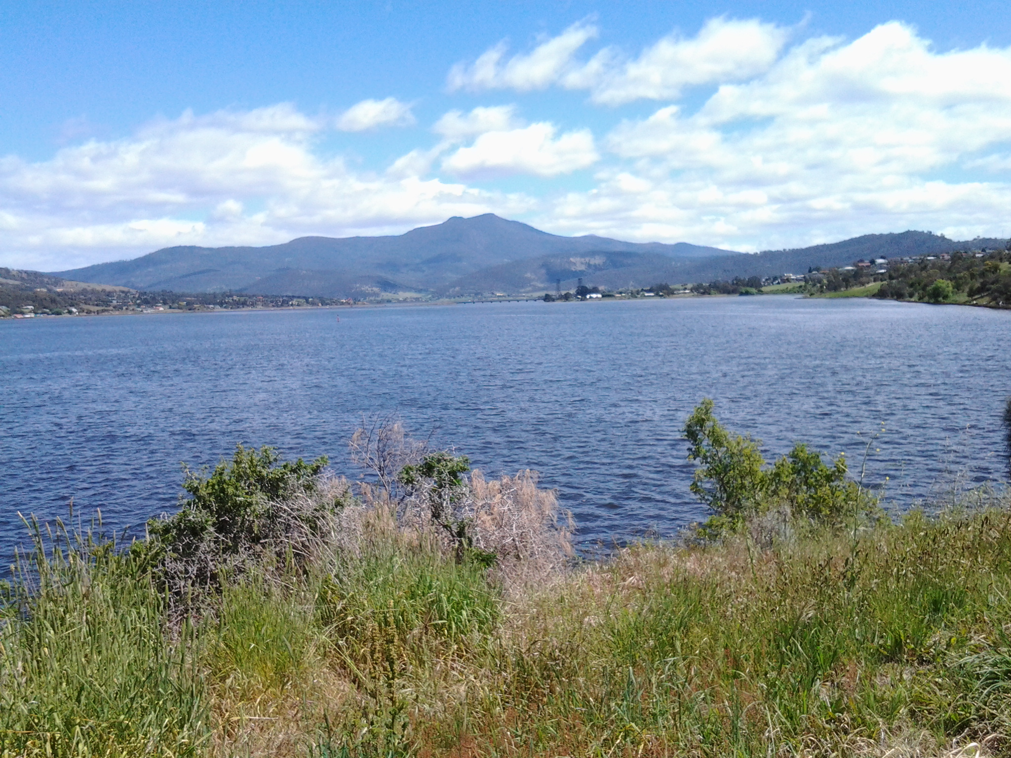
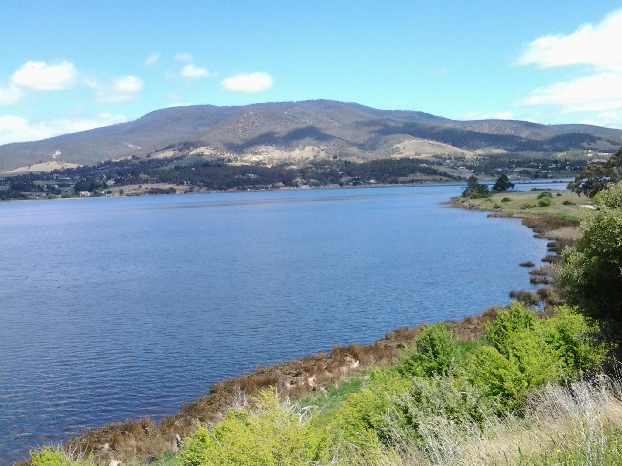
Early, on this leg of the walk, I stopped and looked northwards along the Derwent River. In the distance Mount Dromedary peered over the landscape.

20141111_120951   20141111_124958

The early highlight of this part of the walk was seeing a collective of about 3 dozen plovers together. I don’t think I have ever seen such a group. The plovers were mostly standing around although some were walking around on an open mowed park area near a cluster of gum trees.  Perhaps some were older ‘young’ plovers because from a distance they all looked the same size, give or take a bit.  This seemed so unusual because I am only familiar with the two parents hanging about and guarding their one or two baby birds.  In some paddocks, in the past, I have seen a number of pairs of parents but the pairs don’t hang out together and keep their own territory quite some distance from each other.

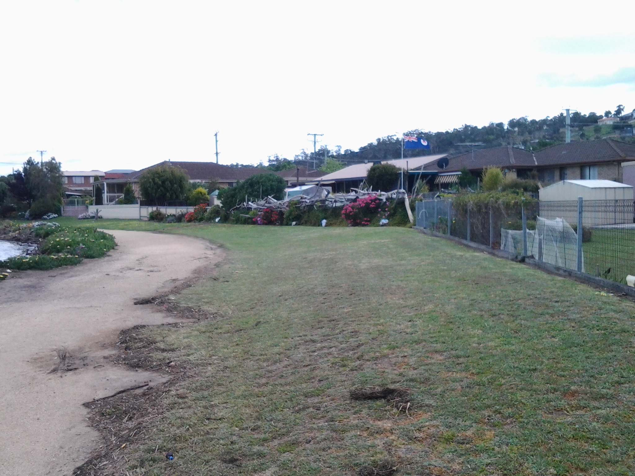
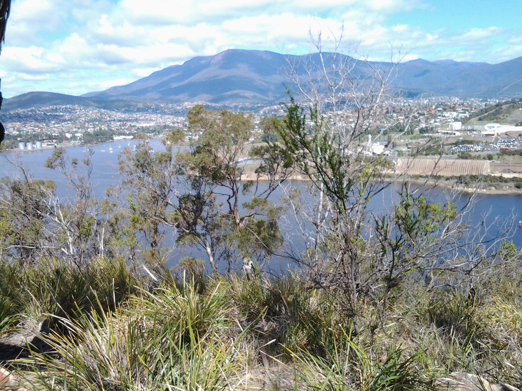
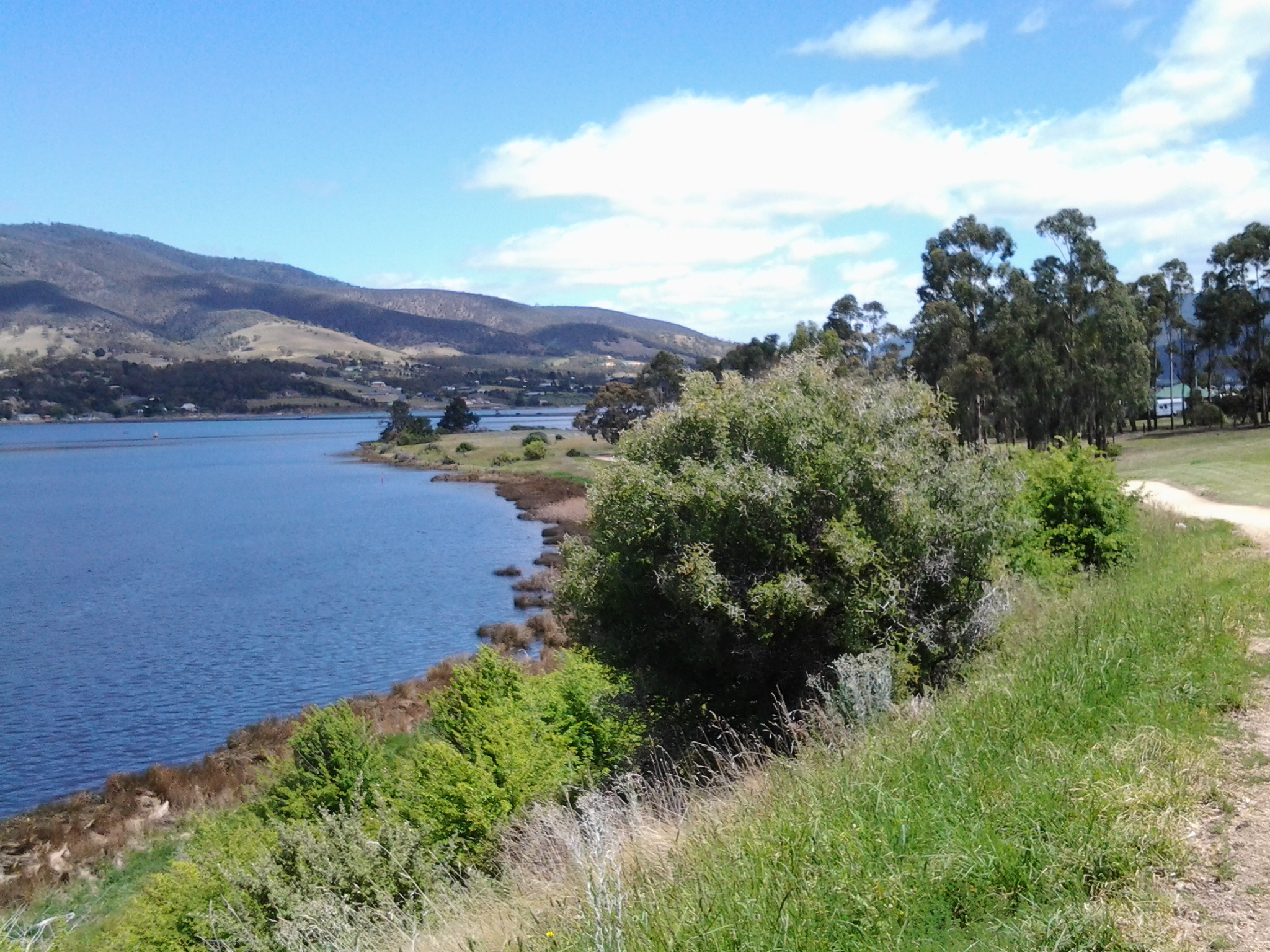
How pleasant this walk was.  Consider the sublime calmness represented in the photo below.

20141111_125006

Around 12.45pm I stopped and sat on a bench seat with a view and watched what amounted to a natural cygnet farm. Dozens of cygnets about the size of a small duck were on the water close to shore.  Only one adult black swan seemed to be on supervision duty. I wondered if the swan bureaucracy had been suffering major cutbacks of ‘staff’ like our Australian and State public agencies where services are meant to continue with less staff.

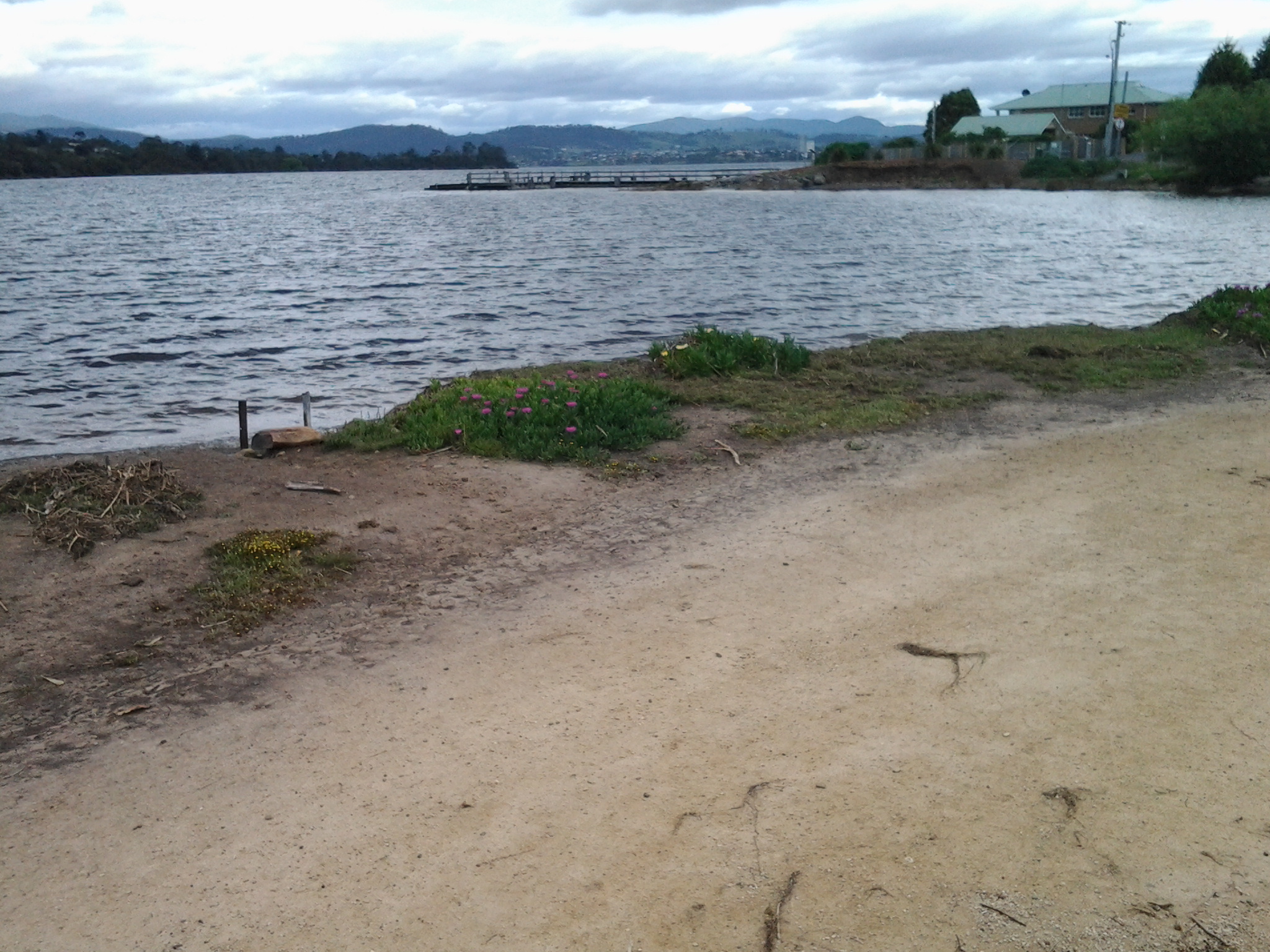
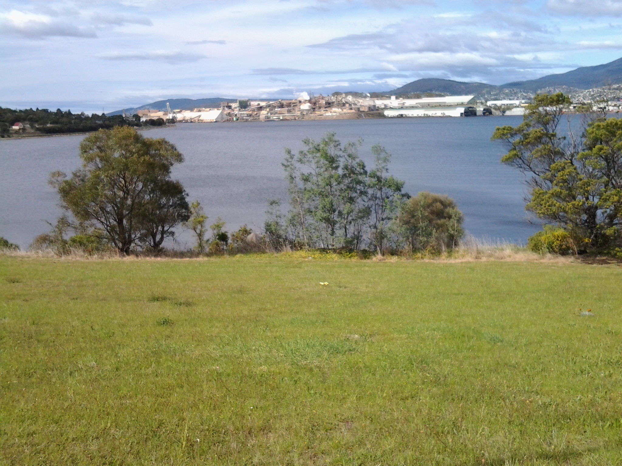
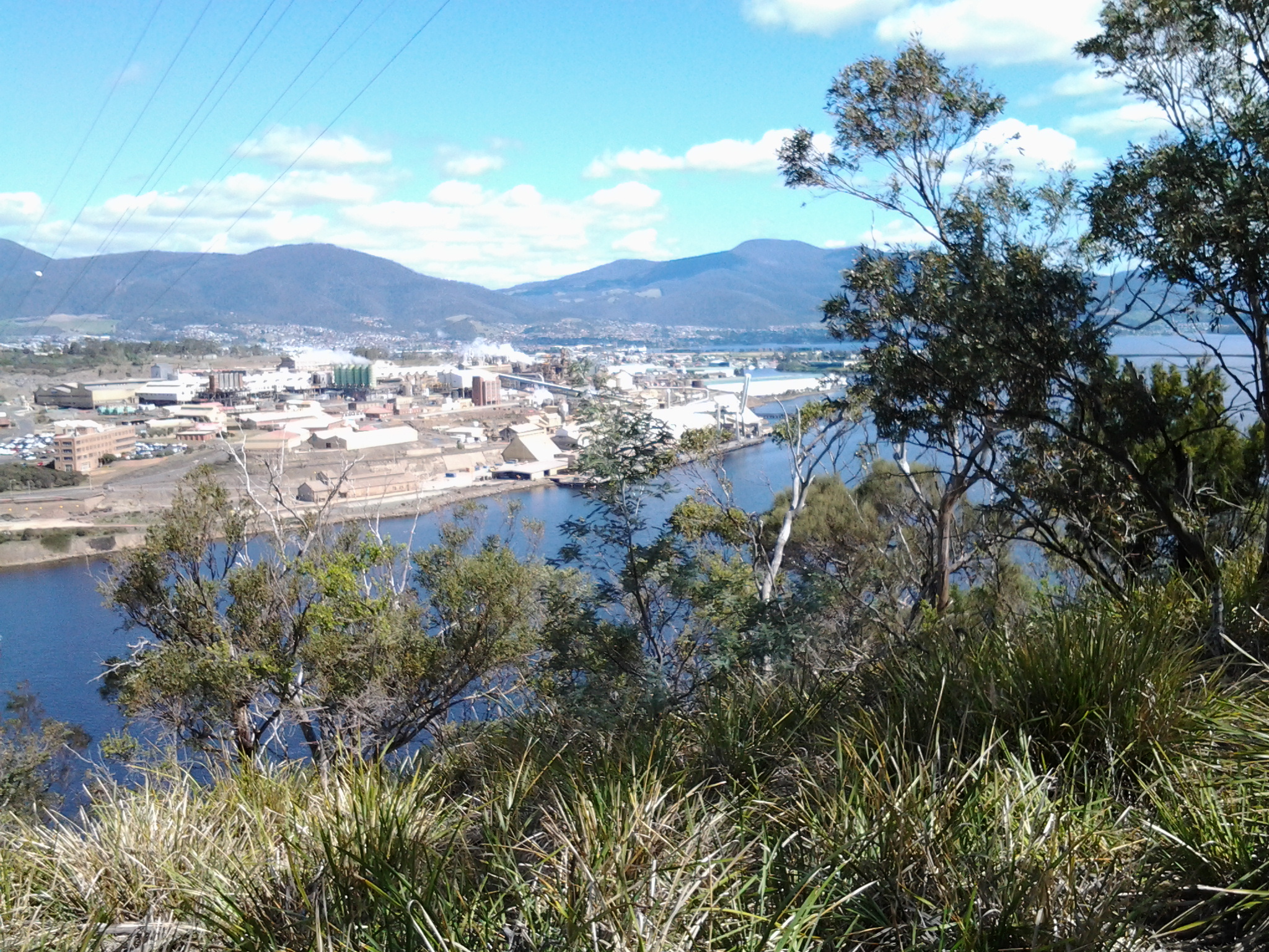
Opposite where I sat the Mount Faulkner Conservation Area was the main feature on the western shore of the Derwent River.

20141111_125008

At 12.56pm I reached Woods Point, sat under a shelter structure and consulted my maps. Five minutes later I left this Point and began walking north along Gunn St all the while having a good look at Mount Dromedary rising on the eastern shore but away in the distance north of Bridgewater.

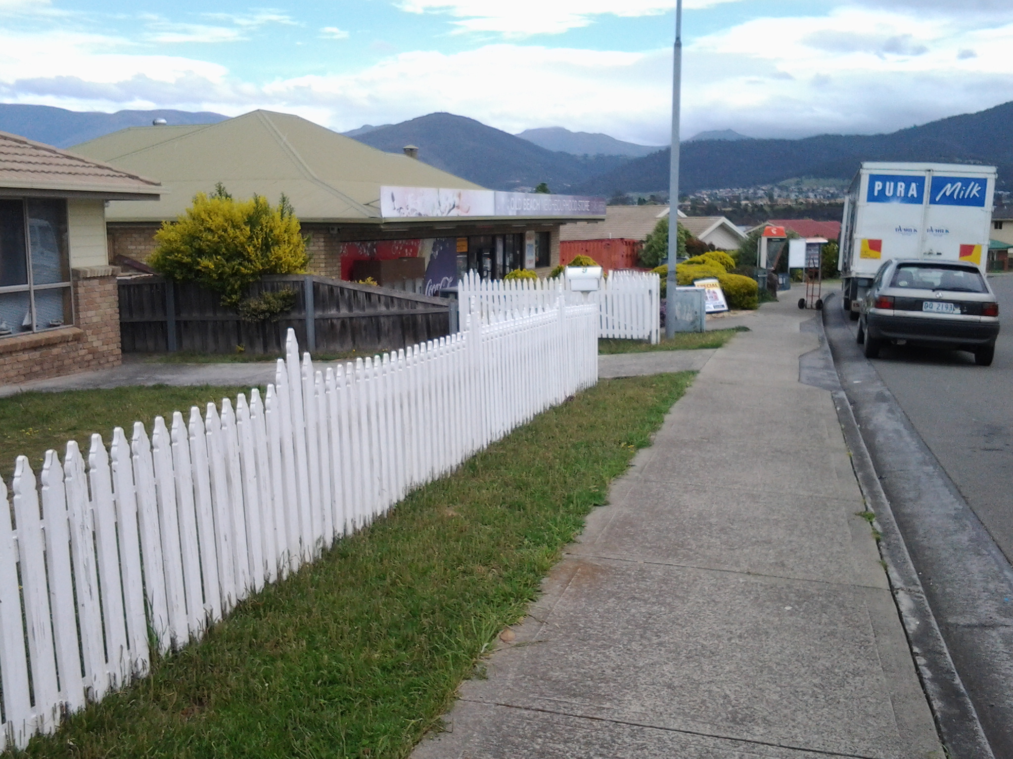
I was walking through suburban streets when a letterbox, under the shade of a tree, captured my attention.

20141111_130517 20141111_130527

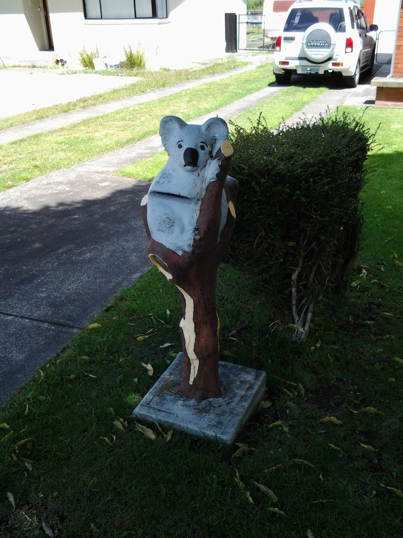
A poor sad concrete koala (maybe commiserating with the live koalas in Brisbane given to G20 leaders for a cuddle)!  The postman would push his letters into a slit in the koala’s stomach.

I also had a larger view of part of two uprights of the Bridgewater Bridge.

20141111_130214

I seemed so close.  My day’s goal to nearly reach the Bridge had to be superseded. I was compelled to reach the Bridge and kept on walking, even passing bus stops.  When I could see the golden arches of McDonalds at the end of the right hand road I veered left and headed for the Bridge nearby.

20141111_131010

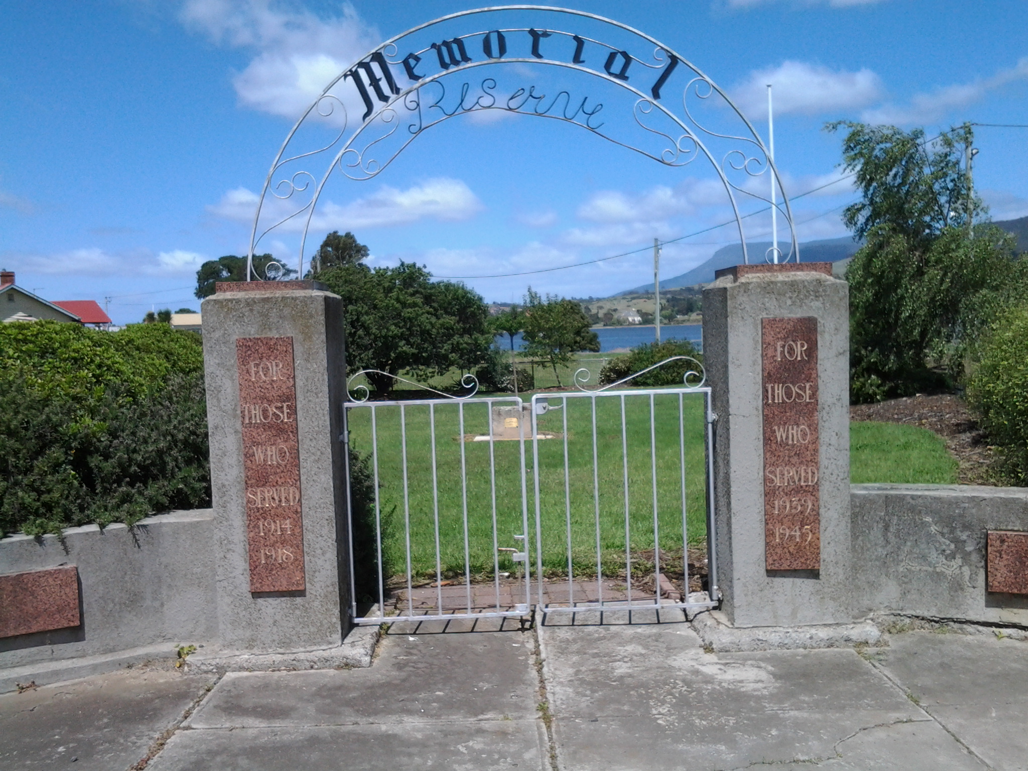
I stopped to photograph the semi-ornate gates of Memorial Reserve commemorating locals who died in various overseas wars (after all, this walk was occurring on the 11th November, Australia’s official Remembrance Day).

20141111_131258

Then I was at the Bridgewater Bridge. Now it wasn’t enough for me to reach the Bridge: I felt compelled to walk across it rather than waiting to do so in the next stage of the walk.

20141111_131431

Discovering the suburb of Old Beach – 7th stage of my walk along the Derwent River

At 12.40pm I reached the town sign for Old Beach at Cassidy’s Bay. The Bay was covered with ducks of every age.  Families of ducklings are always a pleasure to see. Seemed like a safe haven for them.  Tall grasses grew into the water but there was no beach.

I continued walking along the highway, passed the turn off to the Baskerville raceway, and was eventually forced down into a clay sogged ditch almost until I reached the roundabout at 12.50pm.  At the roundabout, with the hilly section of Old Beach up on the right, the choice was to continue on to Bridgewater or turn left into Fouche Avenue. I turned left to the lowlands and walked through a reasonably affluent area. Back on proper footpaths. Just before 1pm I reached the Old Beach Neighbourhood Store claiming to serve hot food 7 days a week.  I didn’t enter to check.

20141031_125642

By 1.03pm, after passing a house outlandishly decorated for Halloween, I came to the end of the road.  It seems like one of those roads which will connect up with a street coming from the other direction at some other time. Everywhere I looked, new houses were being built so that I feel confident roads will connect sooner than later. I walked through the open paddock in the photo below in order to reach the ‘golden’ pathway in the distance which I assumed might lead me onwards next to the Derwent River.

20141031_130307

At 1.06pm I reached the lower path, which was appropriately signposted as the Old Beach Foreshore Trail, and enjoyed seeing more black swans, swooping swallows, flocks of starlings, and the usual screaming plovers. Closer to the water the path divided.  To the left it returned to Cassidy’s Bay (although I saw no signs of a path when I was there), to the right the path would continue to the Jetty at Jetty Road.  The spot where I stood was named the ‘Calm Place’.

20141031_131028

The photo above faces south across the lowlands of Old Beach (which doesn’t seem to have a beach), and provides a view of Mount Direction in the distance.

I headed north by taking the right hand trail. Not long after, on the right hand non River side of the path, I saw a tiny man-made lake, with its quota of swimming ducks and a rusting large sculptural tower on a central island with two Dominican Gulls on top (the expression ‘kings of the castle’ came to mind), amidst a stack of new houses and others being built. The sign on the fence worried me.

20141031_131049

I was concerned that because the land was so low and the lake depended on a levee to contain the water, any River flooding could be of great concern to the new property owners.  I wondered how much of that being built on was reclaimed land. I am surprised the local government allows new buildings here. With global warming increasing the sea level, these houses won’t be around in hundreds of years.

Blue skies opened above Mount Wellington in the distance but heavy clouds sat overhead.  Spits of rain persisted off and on for the rest of my time at Old Beach.  But it was time to have lunch. In the absence of any seats or rocks or other raised area, at 1.20pm I sat on the grass beside the Foreshore Trail, emptied my pack, and started munching as I absorbed the details of my low lying surroundings.  I could see heavy rain clouds that darkened the day travelling across the Derwent from the Mount Faulkner Conservation Area on the western shore.

20141031_132509  20141031_132519

At 1.35pm I was on my feet and continuing along the path, passing an alternative walk to Sun Valley Drive, and spotting a pair of native hens pecking ahead on my path.  A private fence made from large pieces of driftwood festooned with creeping bright flowering geraniums, caught my attention.

20141031_134059

At 1.43pm I arrived at the Old Beach jetty

20141031_134047

where I found an interpretative panel explaining some of the early 19th century history associated with the location of the jetty.

20141031_135134

As early as 1821, an Inn was established near the current jetty, and people would ferry across the Derwent from the western side of the River.

This 7th stage of my walk was coming to a quick close.  I knew a bus would be travelling along Jetty Road at 2pm, and that the next service would not be in the vicinity for another couple of hours. I had wanted to finish walking through all of Old Beach before I finished this stage, but the potential for a long wait for a bus inclined me to cut the anticipated walk short.  I walked along Jetty Road and waited at a bus stop.

Metro bus 114, destined for the Glenorchy Bus Mall on the western shore, picked me up.  I did not travel the entire way but if I had, I would have needed to catch a Hobart city bus to reach the CBD, then a bus to take me back to my home suburb of Bellerive on the eastern shore. A long way. A long time. From Old Beach there are no bus services travelling along the eastern shore.  All the buses travel to the northern city of the Greater Hobart Area of Glenorchy via the Bowen Bridge. Since I live in Bellerive on the eastern shore, I resolved to try Plan B. I proposed to catch a bus from Glenorchy to Hobart via the eastern shore and close to the Bellerive area. Once over the Bowen Bridge from Old Beach, I got off the bus at the first stop which was outside the Elwick racecourse at 2.15pm. I crossed the road and waited in a bus shelter for Metro bus 694. As the rain started to pour in earnest at 2.35pm, the bus arrived. Phew!

I loved the return trip. While again on the Bowen Bridge I looked northward and could see where I had walked earlier in the day. Ahead and looming over the land, was Mount Direction. Looking southward I could see the Cleburne Spit was empty of cars and people, the suburb of Risdon looked quiet, and a thick eddy of smoke rose from behind Risdon Cove. Closer to the area with the fire, a sweet wood smoke smell spread through the bus and reminded me of camping fires I have enjoyed in the past. That was a great conclusion. Memories of the immediate day and memories of the past coming together.

Now I am looking forward to preparing for and then walking the 8th stage of my walk along the Derwent River.  This next walk is likely to happen early next week, weather willing. Let the discoveries continue!

Rocks 240 million years old – 7th stage of my walk along the Derwent River

Having left Otago Bay and now walking along the Derwent River edge of the East Derwent Highway, the green hills soon disappeared. I calculated that to have entered the Highway from Otago Bay Road and stayed on it would have cut half an hour off the walk, at least.  Once a little way north, I looked back to the river edge near the end of Murtons Road and reflected on the insanity of the path I chose. I like the photo below because I can see where I have just been at the water’s edge in the distance. In addition, I am seeing one side of Mount Wellington with the awareness that once I travel inland further, this will disappear from sight.

As I continued the walk, over the Highway was a wall of rock which continued for a while.

20141031_120644

When I spotted an interpretative sign installed on the rocks, I crossed the road to investigate.  The rocks and ground were teeming with Portuguese Millipedes crawling over the surface looking for a mate.  Rain encourages them to get on the move and, trust me, they were moving.  Thankfully they are completely harmless to humans.

I arrived at the sign at 12.15pm and was glad to be able to read some geological information that was related to the fauna which was living 240 million years ago. This was the time when the Paleozoic era was in transition to the Mesozoic era.  Dinosaurs were dominant in the later period, while in the earlier time, fish, insects, spiders and shells developed.  It seems that increasingly large water creatures were around at the time when these sandstone rocks were formed.

20141031_121240

Once walking along the river again, I stopped to admire the views in all directions.  Looking back, Mount Direction rose up (I knew it sat just behind the Bowen Bridge where I had walked earlier in the day). The rural nature of the area below the small mountain is evident closer to the water’s edge.

20141031_122945

By 12.25pm, I had passed a sign indicating I had reached the locale of Old Beach, and I’d stopped and looked at the headland containing the Cadbury’s chocolate factory on the western side of the Derwent River.

20141031_122520

Walking beside the guard rail on the water side for safety, rather than the road side, was not an easy experience.  Also, it was not safe in parts especially where the slippery gravel dropped down to the water side. Nevertheless I persisted where I could and, after brushing beneath a wattle tree, came out the other side perfumed. A clean sweet smell. Very refreshing. On the rocks, a lone Pied Oyster Catcher wobbled away nervously.  I could see his future meals through the clear water.

Around some more corners, and I arrived at Cassidy’s Bay.

From Risdon Cove walking towards Otago Bay along the Derwent River- part of the 7th stage of my walk

For safety’s sake I continued walking along on the Derwent River side rather than on the road side of the guard rail, although there were moments when the edge fell away and so I was forced temporarily back onto the road. This stage certainly would not be one that someone using crutches or a wheel chair could follow. There were no official paths and so I made do with whatever I could in terms of a suitable walking path.

I enjoyed this part of the walk observing more black swans in pairs and families of ducklings out for a paddle.  At the end of the bay of Risdon Cove, I exchanged friendly greetings with a couple of woman who were selling bunches of colourful flowers from the boot of their car on a set back on the other side of the road.

I continued up an incline still on the ‘safe’ side of the railing amidst blown and thrown rubbish, tall weeds, and native grasses.  Whispering casuarina trees separated me from the River. Clearly people have walked here before but it is a rough ‘non-path’.

At 9.54am I reached the turn off signposted to Bridgewater, began the left hand walk downhill, and passed the furry remains of dead possums (unfortunately ex- road-kill).  To my right, on the other side of the road, the 19th century heritage listed Cleburne Homestead and its scatter of old sandstone buildings popped occasionally into view through large trees and bushes.  The Homestead operates as a luxury bed and breakfast art hotel style establishment (http://www.visitcleburne.com.au/).

The photo below shows the Cleburne Spit which inserts itself into the Derwent River, with the Bowen Bridge crossing the River in the distance.

20141031_095246

At 10am I arrived at the junction road leading left to the Cleburne Spit. The Spit looked very much like a man made raised wall approximately one or two car widths wide that extends out in a straight line into the Derwent River.  Perhaps it was a series of rocks that once could be walked upon and then someone dropped filling rocks to create a breakwater to fish from or some other activity. I wonder what the real story is. My guess is that the Spit was named after 19th century settler Richard Cleburne.  He was an interesting character who had a property in the area and was suspected of smuggling. Did the Spit figure in such illegal activities I wonder? More information about Richard can be read at http://adb.anu.edu.au/biography/cleburne-richard-1903.

My view across the Derwent took in the noisy Nystar works previously seen and heard on Stage 6 of the walk.  Immediately next to Nystar and further north, I could see another major industrial site: Incat, a manufacturer of very large catamarans.  In the photo below, a massive white structure has two dark ends. Inside each of these spaces, a new catamaran is being built – usually for an overseas market.

20141031_095558

The East Derwent Highway curved in a sweeping right-hand bend from its junction with the road to Cleburne Spit. I walked straight ahead to the River and then curved around to the right keeping parallel with the Highway.  Amidst discarded rubbish, straggling weeds and under the casuarina trees I discovered two plaques: one commemorating the beginning of the building of the nearby Bowen Bridge and the second marking the official opening ceremony of the Bridge. On both occasions an Australian Prime Minister was given the honoured task. Two very strong and formidable men: Malcolm Fraser began the bridge and Bob Hawke opened the bridge.

20141031_100200

I followed a short bitumen pathway and stood underneath the Bowen Bridge a few minutes after 10am. Eventually I walked beside the guard rail and, depending on the safety of the ‘non-path’, I walked on one side or the other.  Sometimes there was a sandy rough drop to the water below, and sometimes I was walking next to the River at ‘sea level’.

By 10.07am I reached the sign indicating I had moved from the Risdon area into the Otago Bay suburb.  At 10.11am another sign gave me advance warning that Otago Bay Road was up ahead.

In a pull-off-the-road siding, a middle aged man wearing clean moleskin trousers and a sporting peaked cap advertised new season South Arm Pink Eye potatoes. The back of his truck was open and he sold his vegetables to people who, once their cars had skidded to a halt on the gravelly surface, climbed out of their vehicles for a stretch and then a leisurely meander over to check the goods. There was something slightly furtive about the way he wouldn’t meet my eyes which left me wondering why.

The photo below looks southward towards the Bowen Bridge. One of the vehicles in the distance on the right is the truck selling the potatoes.

20141031_101844

At 10.18am I turned left off the East Derwent Highway onto Otago Bay Road.  The sound of traffic in the distance as it poured along the Highway, and the way the wind boxed my ears, meant it was difficult to hear cars coming behind me. Constantly I was watching my back as I walked along non-existent road verges.  I did not discover a safer path for this part of the walk.

Earlier, near the Cleburne Spit, I had exchanged brief friendly words with a woman walking southwards with her dog.  When she caught up with me on her northward return journey, we found we had a great deal in common and spent some time walking together towards Otago Bay.

Leaving home last Friday towards the start of Stage 7 of my walk along the Derwent

From my house early morning, I could see a mirror sheen across the Derwent River. This promised a great day for walking and so I was eager to get going.  Unfortunately the bus service to the area I was starting from departs only every couple of hours. Eventually I caught the Metro bus 694 when it passed through the Eastlands Shopping Centre bus mall at 9.13am.

The bus passed through upper Lindisfarne as it headed along the East Derwent Highway. When I looked left across the Derwent River, my view of the top of the mountain was cut off by a thick resting white cloud. The roads were calm. People were at work and kids at school. When we passed Geilston Bay I could the water was serenely flat. By this point, I was the only passenger on the bus and felt luxuriously chauffeured.  We detoured for a scenic view through the upper Geilston Bay residential area, then back to the highway.  As we travelled onwards, I noted the start of the trail to Bedlam Walls which I had walked previously, then the electricity pylons and fire trails marking the East Risdon State Reserve. The Willows Tavern loomed on the left and on the right hand side of the highway I glimpsed the starkness of the barb wired fencing of the state Prison.

At the roundabout (where I wanted to go left) the bus turned right to travel through the suburb of Risdon Vale.  Lots of small weatherboard houses and lawns with a few bushes rather than complex luscious gardens. ‘Donut’ burnout tyre marks on the intersections of roads. Rooves needing paint.  Neat and tidy. Streets prettily named after plants: Spinifex, Sycamore, Lindon (although Lindon Park had no Lindon trees), Poplar, Heather, Banksia, Kerria, Hawthorn, Marlock, Gardenia, Lantana and Holly.

Side view of the mountain: I marvelled at the speed with which clouds were being pushed across the top of the mountain southwards.

At 9.39 I was off the bus just before the junction of Saundersons Road, Risdon with the East Derwent Highway.  This is on the southern side of Risdon Cove. Around the corner of the road in the photo below, I could look over the railing in the direction of the Derwent River.

20141031_093816

I walked to that distant railing and realised that walking on the road would be very dangerous with traffic speeding on the narrow lanes.  I legged it over the railing and walked on the River side. The photo below is one of my first views.  Note the pair of black swans.

20141031_094126  20141031_094118

No longer did I have Mount Wellington as my standard backdrop across the water. In the photos above, the elevated section on the other side of the Derwent River (above the Bowen Bridge) is the Mount Faulkner Conservation Area.

On through the East Risdon State Reserve along the Derwent River

Mostly I noticed the absence of birds (except for a pair of huge glossy Black Currawongs) in the motionless dry sclerophyll forests – was it the buzz of the electricity from the pylons, was it the relative lack of shelter or was it the heating day which might have sent the birds to the shady valleys? The only sound was the relentlessly growling and metallic-sawing industrial sound piercing the air from Nystar over the River. A constant.

At 11.45am, although I saw a tiny track heading towards the River, I continued uphill on the main trail with a Kookaburra laughing at me somewhere in the distance, and tiny moths flitting around my feet camouflaged to the ochre-brown-grey earth but noticeable for their motion. A tiny black jumping spider looked like a small glossy beetle when it landed and stayed still.

20141015_115218

I pondered whether I should have made my own way along closer to the shore by ‘bush bashing’.  The vegetation was sufficiently open to have made this easy enough, however it would still have slowed me down, and since I didn’t know the end game (the time it would take to get to the bus stop), I chose to stay on the main track.  Even when the path split (at 11.50 am)with a red ribbon hanging on a tree to indicate this was a reliable alternative, I chose to stay on the main right hand path. With hindsight the left path may have given me a shorter route to Risdon – but I don’t know.

At midday the road split again.  This time, as a Black Currawong flew overhead with its wonderful tail edging of white (made me think of the black and white dress Audrey Hepburn wore to Ascot in the movie My Fair Lady), I chose the left hand route.  Small clusters of pink native flowers, with fragile connections to nurturing soil, presented posies left and right. Perfection.

20141015_121749

This track dipped downhill to the left soon after, as I could see large water tanks on the hill to my right.  Almost no undergrowth. Evidence of past bush fires through part of the forest.

In the valley, lots of different wild flowers bloomed offering me a visual gift.

20141015_121456  20141015_121612  20141015_121654

At 12.10 and through the trees, I caught a glimpse of Risdon suburban houses but it was still a long while before I reached the suburb – obviously I missed tracks which could have taken me down more quickly, and instead I took the longer route, Shady. More bird song. Clean fresh smells. A vine entangling other plants with a delicate lilac-blue flower. Scenic it was and I have no regrets.

At 12.23 I took the left of a new split in the road and continued downhill. Lines of cobwebs occasionally floated across my arms and face indicating no-one else had walked here since the spider had swung across the path.

By 12.30 I reached a fenced enclosure for a water storage tank, the East Risdon Reservoir. I chose the road curving downhill on the left amidst a fresh burnt smell from the blackened bush on my right.  At the time I thought it smelt like a cup of tea freshly made – but perhaps that was wishful thinking. Three minutes later I reached a locked bar gate preventing road traffic entry but with an easy walk around. Now I passed houses on my right as I walked the length of Risdon Street down to the Derwent River.

In Risdon at the T junction with Saundersons Road which edges the River, I stood and watched a fisherman in his lunch break, felt overwhelmed by the extent of Nystar opposite, noticed INCAT’s shipyard on Prince of Wales Bay a little further north on the western side, listened to the pervasive roar from industry on the other side of the River, and wondered if I my feet would take me further.

20141015_123942

In the distance southwards I could see the Tasman Bridge.

20141015_124203

Along the northern side of Shag Bay and onwards along the Derwent River

I used the mini bridge to cross the tiny creek feeding into Shag Bay and began immediately to take the walking track uphill on the northern side.  From here on I was not particularly confident about the clarity of tracks or, in fact, whether there would be tracks. I was pleased to discover that many tracks existed and as I long as I kept the Derwent River on my left, I couldn’t get lost – even if I did not know at what part of the suburb of Risdon I would arrive (‘all roads lead to Rome’ even if entry is by a different gate).

On the way up the first hill I had stopped for a view and a swig of water. During that time I surprised a dog that came around the corner behind me with her mistress. They both stopped in their tracks.  She told me that in all the dozens of times she has walked this track, she has never seen anyone on it.  Peace and solitude. Yet only a dozen or so kilometres from the heart of a city.  A capital city.

The photo below through a wooded landscape extends a view southwards to the Derwent River with the MONA ferry coming my way.  At this point, I was as high as the uppermost part of the Tasman Bridge located closer to the mouth of the River.

20141015_111529

Around me eucalyptus gum nut shells lay on the ground exuding a clean fresh perfume (think of May Gibbs’ hats on the gumnut babies Snugglepot and Cuddlepie – Tales of Snugglepot and Cuddlepie: their adventures wonderful was first published in 1918.).  Not long afterwards, the track passed through a copse of self-seeding wattle trees: I know some varieties are considered to be weeds in certain parts of Australia and I suspect this collection of specimens may be ‘weeds’.  The problem is that it grows quickly and blocks out the opportunity for other trees to survive. Monocultures are death to the natural landscape.

At the top and moving along parallel to the Derwent River, I was on top of the Bedlam Walls.  Various unofficial tracks disappeared over the cliff but I stayed on the main path. My reasoning was that I had an infrequent bus service to connect with at Risdon Cove and I was not sure how long it would take to reach there.  The downside was that I missed experiencing the actual walls and their walkways and caves. I would have liked to have seen the following (https://www.flickr.com/photos/bleeter/7266025800/), but I must return for a closer inspection.

7266025800_c8d48839e8_b

Along the top I was afforded detailed views of the western shore and especially of the smelting works, Nystar as shown below.

20141015_112338

It is now obvious to me that when I walk south along the western shore of the Derwent I will not be able to be close to the river edge when I pass this massive Nystar industry covering many acres of land. I reached a major electricity pylon around 11.20am and watched its wires swing across the river to the power hungry industry (these wires are just visible in the photo above). Looking southwards and across the River from the top of Bedlam Walls, I could see Mount Wellington overshadowing Cornelian Bay and the Newtown suburb of Hobart.

20141015_112331

My track moved inland and parallel to the electricity pylons. After 5 minutes the track split and I turned left. It came to an end with a rough worker’s seating area in view of the Bowen Bridge crossing the Derwent River further north.  The cliff seemed to drop away and I judged that a slippery slide down might not be a good idea with no one else around if something should go wrong.  Later in the day when I was much further north, I was able to look back to the pylon and see I really should have braved it down the hill and kept closer to the water. But then again it might be safer to walk south and climb that hill rather than slip down it heading northwards. By 11.35am I had walked back to the divide with the original clear but rough 4WD track and chose the other arm along the pylons.