Category Archives: Walking

Completing the last northern part of Otago Bay suburb – on 7th stage of my walk along the Derwent River

Where I went and where followers should walk are two separate pathways.  I will describe my walk for your amusement, but you should stay on the highway and not deviate as I did. Only a  masochist would take my path.

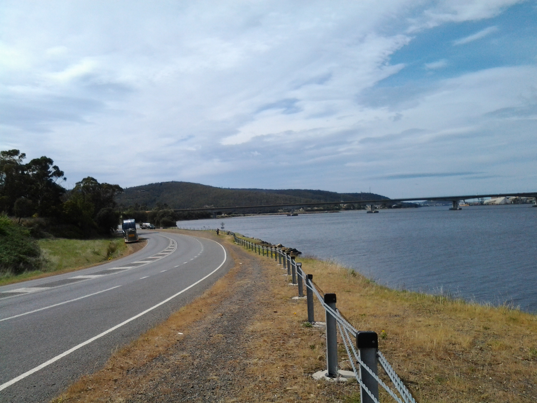
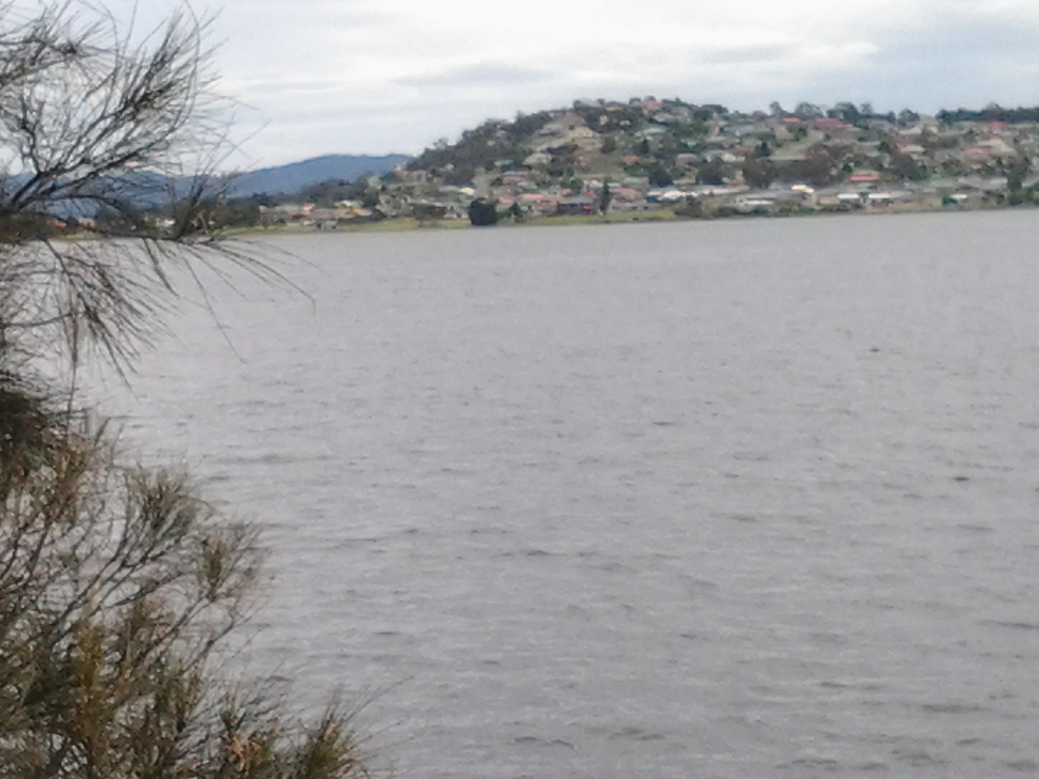
Having connected back onto the East Derwent Highway from Otago Bay Road I continued walking north. On route I looked north across the Derwent River to the next suburb Old Beach, as shown in the photo below. I loved the yellow/orange/burnt red coloured gazania flowers which grew wildly along many parts of this route.

20141031_112220

Not long afterwards, I reached Murtons Rd and turned left to walk towards the river edge. To my left was the small inlet Woodville Bay. In the photo of the Bay below, I believe the yellow flowers in the foreground are probably part of wild wind-sown canola plants.

20141031_112839

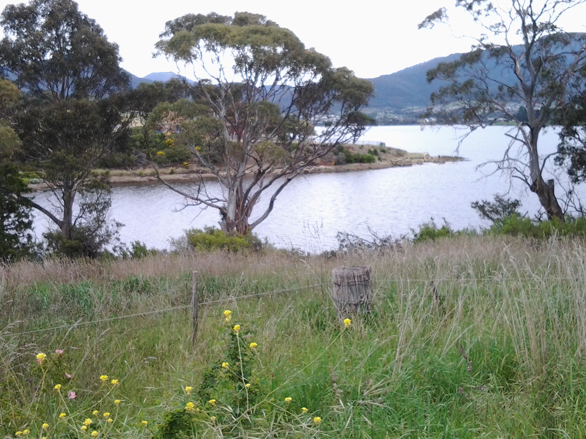
This area seemed very rural and I enjoyed the tufts of wild fennel growing near the edge of the road, the green grassy paddocks and the screaming plovers making it clear I was encroaching on their territory. I was delighted when two black lambs raced down their paddock to greet me, obviously hand-reared and very comfortable with humans.  If I had picked them up over the fence it would probably have been a case of ‘Mary had a little lamb … and everywhere that Mary went the lamb was sure to follow’.  Very cute. Very vocal.

20141031_113114

Further on, a couple of rough looking shetland ponies appeared on the hill above and in a later paddock, horses nibbled slim pastures.

20141031_113650

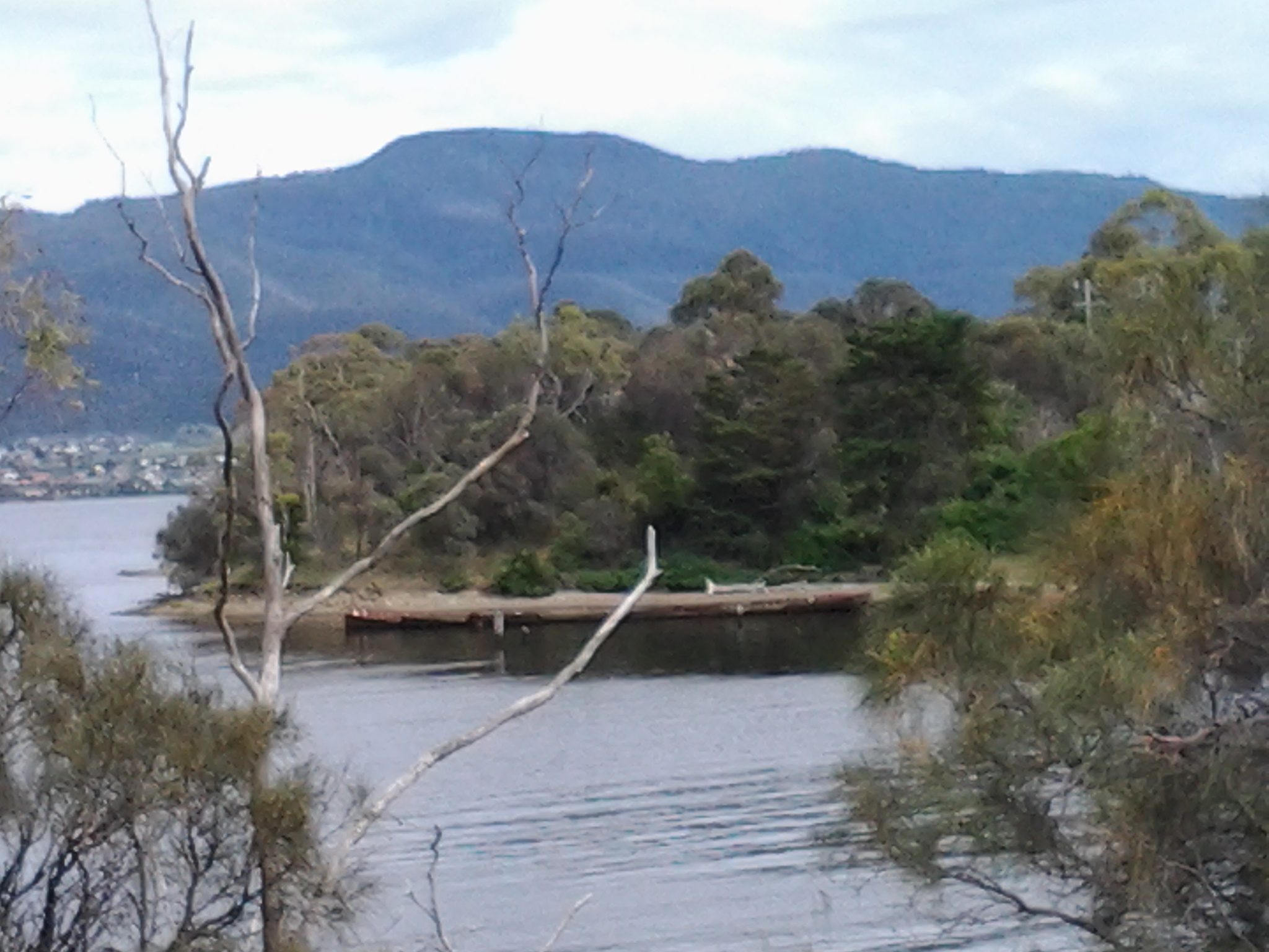
On my left I had clear views across the Derwent River to the suburb of Old Beach.

20141031_113536

I surprised a pair of native hens scratching in the undergrowth.  My arrival disturbed them so they skittered away.  If you look closely in the photo below you will see one running across the roadway leading to a private property.

20141031_113800

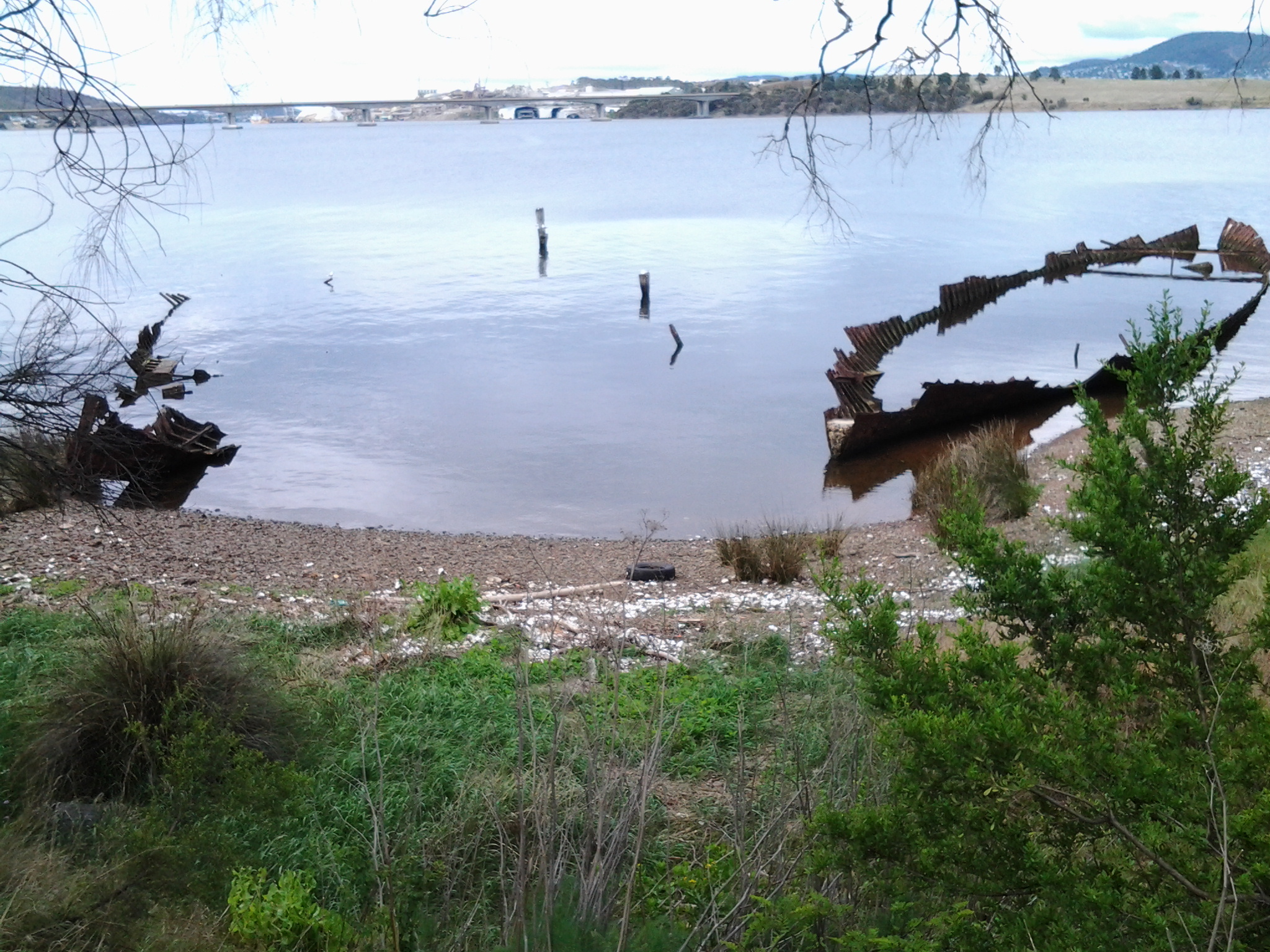
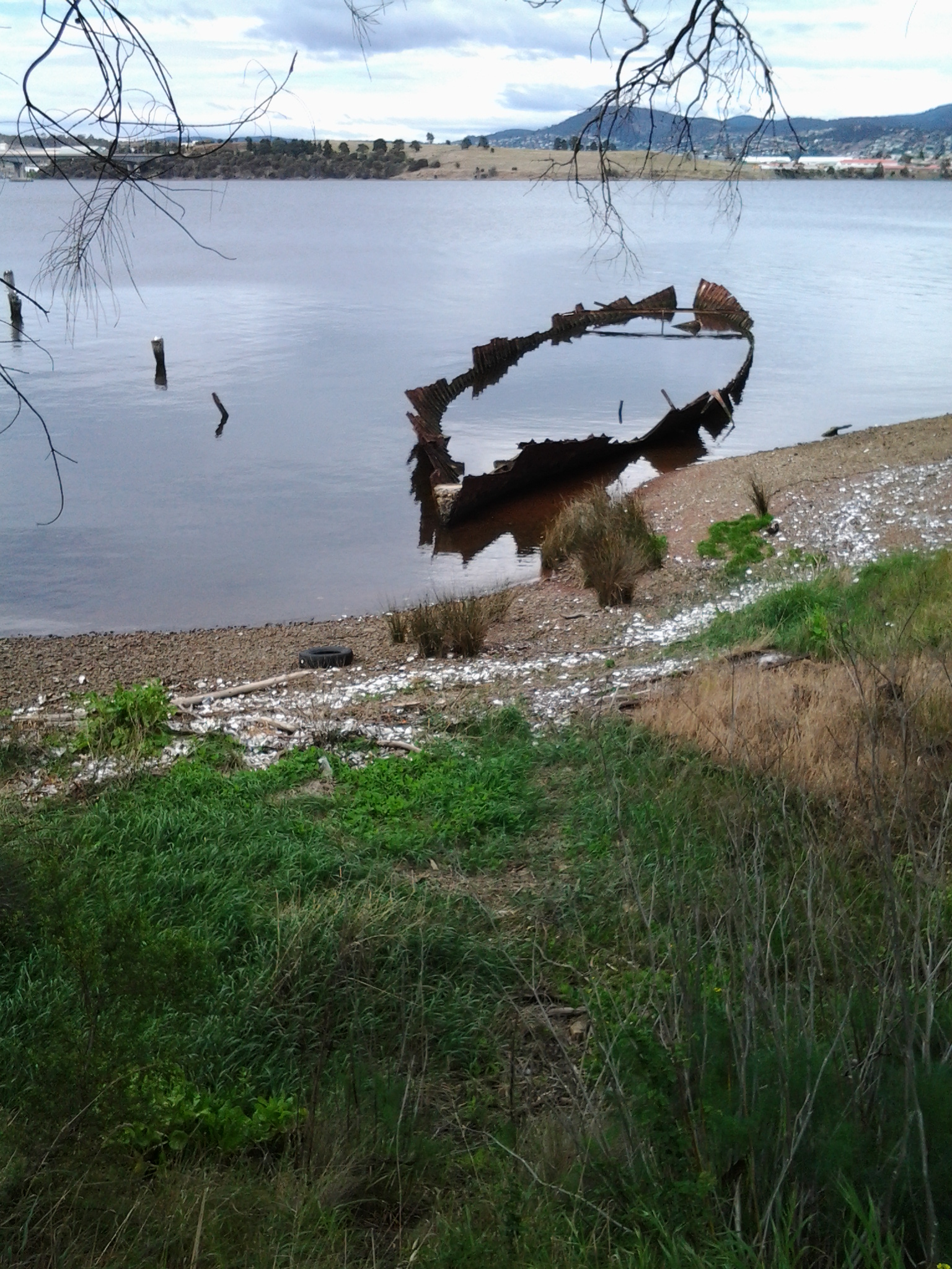
Soon afterwards, the road on which I was walking came to an end.  Ahead of me through the bushes was the barely visible remains of pathways that others, and perhaps animals, had walked very occasionally. I had the choice to step down onto the narrow easy rocky shore or work my way through these paths which were only a little above water level.  You may recall from an earlier blog, that friend Me and I did some advance research on the possibilities for my future walks. This was one cul de sac we reached. Back then the paths were much clearer.  In the few weeks since we investigated, spring rains and rising temperatures have encouraged the plant life to flourish. I was fine clambering over and under fallen trees and branches and avoiding abandoned car tyres and other rubbish, but then the track disappeared under a thicket. Not to be beaten, and never to retreat, I decided to drop down onto the rocks and continue walking along the foreshore.

Around one corner I was surprised to find a pair of duck parents and their totally camouflaged teenager sleeping on the rocks amidst the flotsam and jetsam of human kind. Their retreat to the water was slow and cumbersome. It was almost as if a human being had never passed this way before.

This was okay for a while until I met with a barrier of tree branches cascading into and across the water.  I realised there would be no easy way over or through. Spotting the makings of a rough pathway on the bank, I clambered up. Before long I was practising something like one does with that ‘pick up sticks’ children’s game: I was lifting one spiky branch and pieces of barbed wire off another and standing on others in order to move my way through an ever more tricky brambling landscape. Vaguely in the distance, through the vegetation, I could glimpse a hill which looked like soft grass. A very attractive vista considering my circumstances.  Between me and that escape route was a tangle of wild freely sown long waving branches of thorny roses, and a forest of healthy but spiky blackberry canes, all intertwined. Going back to Murtons Road was not an option I would consider.  So, rather like a snorting pig, and sometimes down on my knees, I edged my way through. It took quite a while. Surprisingly no clothes were ripped and I received only a few slight scratches. Climbing the small hill of weedy and native grasses was comparatively heavenly by comparison. Then I found myself back on the East Derwent Highway and strode off happily a few minutes after 12 noon.

Into and through the suburb of Otago Bay – part of the 7th stage of my walk along the Derwent River

Before long I could see the water of Otago Bay, and I could see the rusty remnants of the two boats, the Otago and the Westralian. In the photo below, the low mountain on the other side of the Derwent is Mount Faulkner.

20141031_102131

Ja and her dog were lively company and walking with her was a big change from my normal solo experiences. We enjoyed photographing each other in this quiet and peaceful place and parted once we reached the interpretative panel near the sunken ribs of the two boats (Westralian on the left and Otago on the right in the photo below).

20141031_104822

I was disappointed that the main point of the interpretative panel was not to talk broadly about the history of both boats but to laud the last Captain of the Otago, the esteemed novelist Joseph Conrad.  Over the road, Conrad Drive wound up the hill into a residential area. It seems the author has become most important.  The Westralian is not mentioned at all so I can only imagine other visitors must leave the site quite puzzled about what they are seeing. In an earlier posting I provided detailed information about the Otago, after which the Bay and suburb have been named. The Westralian was a steam ship abandoned and cut down during the 1930s.

It was 10.40am before I left the boats of Otago Bay. I walked uphill – yet again without a formal pathway so I was alert for cars travelling through. There are always ‘lead foot Larrys’ whose press on the car’s accelerator speeds them through the suburban streets as they veer unexpectedly onto whichever side of the road gives them the shortest path to whatever their destination.  Could be a shortcut to God if they are not careful.

This leafy gum-treed suburb is mostly high above the Derwent River and many of the houses sit with grand views. At one point I could see that I was level with the height of the Bowen Bridge in the distance.  It was not possible to walk around the water’s edge and it was impossible to walk around the edge of the cliffs because access to these has been cut off by the gates and fences of private property.

I stayed walking up and down and then up and then downhill on undulating Otago Bay Road.

20141031_110555

Some houses were located on 5 acre lots. Some parts of the suburb seemed quite rural without any sign of active agricultural businesses. I passed a creek with croaking frogs and others making a soft booming bom bom, bom bom; a repetitive but very musical sound. Wild blackberry canes flourished. Sulphur crested cockatoos screamed through the trees. The sounds of so many other birds reverberated through the bush. Beautiful. Wonderful.

At 11.10am, I noted a left hand road led to accommodation; the Penenjou Bed and Breakfast. I didn’t walk this road but I imagine that tourists staying out here might find the country to be very attractive and peaceful.  Apparently the homestead is located on a hectare of developed gardens overlooking Mount Wellington.

I continued walking along Otago Bay Road, close to and parallel to the Highway.

At the intersection with Restdown Drive reached at 11.18am, a sign pointed to another accommodation option Otago Cottage (http://www.otagocottage.com.au/). Again, knowing this was a No Through Road, I stayed walking along Otago Bay Road.

Looking inland I could see the smallish mound of Mount Direction.  From experience I know that walking tracks on this mountain can be accessed from the Risdon Dam Reserve near to the Prison and Willow Tavern, way back near Risdon Cove.

20141031_111945

I reconnected with the East Derwent Highway at 11.22am, edged the road dodging rain spits, and continued walking northwards.

20141031_111957  20141031_111951

From Risdon Cove walking towards Otago Bay along the Derwent River- part of the 7th stage of my walk

For safety’s sake I continued walking along on the Derwent River side rather than on the road side of the guard rail, although there were moments when the edge fell away and so I was forced temporarily back onto the road. This stage certainly would not be one that someone using crutches or a wheel chair could follow. There were no official paths and so I made do with whatever I could in terms of a suitable walking path.

I enjoyed this part of the walk observing more black swans in pairs and families of ducklings out for a paddle.  At the end of the bay of Risdon Cove, I exchanged friendly greetings with a couple of woman who were selling bunches of colourful flowers from the boot of their car on a set back on the other side of the road.

I continued up an incline still on the ‘safe’ side of the railing amidst blown and thrown rubbish, tall weeds, and native grasses.  Whispering casuarina trees separated me from the River. Clearly people have walked here before but it is a rough ‘non-path’.

At 9.54am I reached the turn off signposted to Bridgewater, began the left hand walk downhill, and passed the furry remains of dead possums (unfortunately ex- road-kill).  To my right, on the other side of the road, the 19th century heritage listed Cleburne Homestead and its scatter of old sandstone buildings popped occasionally into view through large trees and bushes.  The Homestead operates as a luxury bed and breakfast art hotel style establishment (http://www.visitcleburne.com.au/).

The photo below shows the Cleburne Spit which inserts itself into the Derwent River, with the Bowen Bridge crossing the River in the distance.

20141031_095246

At 10am I arrived at the junction road leading left to the Cleburne Spit. The Spit looked very much like a man made raised wall approximately one or two car widths wide that extends out in a straight line into the Derwent River.  Perhaps it was a series of rocks that once could be walked upon and then someone dropped filling rocks to create a breakwater to fish from or some other activity. I wonder what the real story is. My guess is that the Spit was named after 19th century settler Richard Cleburne.  He was an interesting character who had a property in the area and was suspected of smuggling. Did the Spit figure in such illegal activities I wonder? More information about Richard can be read at http://adb.anu.edu.au/biography/cleburne-richard-1903.

My view across the Derwent took in the noisy Nystar works previously seen and heard on Stage 6 of the walk.  Immediately next to Nystar and further north, I could see another major industrial site: Incat, a manufacturer of very large catamarans.  In the photo below, a massive white structure has two dark ends. Inside each of these spaces, a new catamaran is being built – usually for an overseas market.

20141031_095558

The East Derwent Highway curved in a sweeping right-hand bend from its junction with the road to Cleburne Spit. I walked straight ahead to the River and then curved around to the right keeping parallel with the Highway.  Amidst discarded rubbish, straggling weeds and under the casuarina trees I discovered two plaques: one commemorating the beginning of the building of the nearby Bowen Bridge and the second marking the official opening ceremony of the Bridge. On both occasions an Australian Prime Minister was given the honoured task. Two very strong and formidable men: Malcolm Fraser began the bridge and Bob Hawke opened the bridge.

20141031_100200

I followed a short bitumen pathway and stood underneath the Bowen Bridge a few minutes after 10am. Eventually I walked beside the guard rail and, depending on the safety of the ‘non-path’, I walked on one side or the other.  Sometimes there was a sandy rough drop to the water below, and sometimes I was walking next to the River at ‘sea level’.

By 10.07am I reached the sign indicating I had moved from the Risdon area into the Otago Bay suburb.  At 10.11am another sign gave me advance warning that Otago Bay Road was up ahead.

In a pull-off-the-road siding, a middle aged man wearing clean moleskin trousers and a sporting peaked cap advertised new season South Arm Pink Eye potatoes. The back of his truck was open and he sold his vegetables to people who, once their cars had skidded to a halt on the gravelly surface, climbed out of their vehicles for a stretch and then a leisurely meander over to check the goods. There was something slightly furtive about the way he wouldn’t meet my eyes which left me wondering why.

The photo below looks southward towards the Bowen Bridge. One of the vehicles in the distance on the right is the truck selling the potatoes.

20141031_101844

At 10.18am I turned left off the East Derwent Highway onto Otago Bay Road.  The sound of traffic in the distance as it poured along the Highway, and the way the wind boxed my ears, meant it was difficult to hear cars coming behind me. Constantly I was watching my back as I walked along non-existent road verges.  I did not discover a safer path for this part of the walk.

Earlier, near the Cleburne Spit, I had exchanged brief friendly words with a woman walking southwards with her dog.  When she caught up with me on her northward return journey, we found we had a great deal in common and spent some time walking together towards Otago Bay.

Leaving home last Friday towards the start of Stage 7 of my walk along the Derwent

From my house early morning, I could see a mirror sheen across the Derwent River. This promised a great day for walking and so I was eager to get going.  Unfortunately the bus service to the area I was starting from departs only every couple of hours. Eventually I caught the Metro bus 694 when it passed through the Eastlands Shopping Centre bus mall at 9.13am.

The bus passed through upper Lindisfarne as it headed along the East Derwent Highway. When I looked left across the Derwent River, my view of the top of the mountain was cut off by a thick resting white cloud. The roads were calm. People were at work and kids at school. When we passed Geilston Bay I could the water was serenely flat. By this point, I was the only passenger on the bus and felt luxuriously chauffeured.  We detoured for a scenic view through the upper Geilston Bay residential area, then back to the highway.  As we travelled onwards, I noted the start of the trail to Bedlam Walls which I had walked previously, then the electricity pylons and fire trails marking the East Risdon State Reserve. The Willows Tavern loomed on the left and on the right hand side of the highway I glimpsed the starkness of the barb wired fencing of the state Prison.

At the roundabout (where I wanted to go left) the bus turned right to travel through the suburb of Risdon Vale.  Lots of small weatherboard houses and lawns with a few bushes rather than complex luscious gardens. ‘Donut’ burnout tyre marks on the intersections of roads. Rooves needing paint.  Neat and tidy. Streets prettily named after plants: Spinifex, Sycamore, Lindon (although Lindon Park had no Lindon trees), Poplar, Heather, Banksia, Kerria, Hawthorn, Marlock, Gardenia, Lantana and Holly.

Side view of the mountain: I marvelled at the speed with which clouds were being pushed across the top of the mountain southwards.

At 9.39 I was off the bus just before the junction of Saundersons Road, Risdon with the East Derwent Highway.  This is on the southern side of Risdon Cove. Around the corner of the road in the photo below, I could look over the railing in the direction of the Derwent River.

20141031_093816

I walked to that distant railing and realised that walking on the road would be very dangerous with traffic speeding on the narrow lanes.  I legged it over the railing and walked on the River side. The photo below is one of my first views.  Note the pair of black swans.

20141031_094126  20141031_094118

No longer did I have Mount Wellington as my standard backdrop across the water. In the photos above, the elevated section on the other side of the Derwent River (above the Bowen Bridge) is the Mount Faulkner Conservation Area.

The race that stops the nation is being run today: the Melbourne Cup has a Derwent River connection

The first Tuesday in November is never a public holiday across Australia (although residents of the state of Victoria enjoy a day off) however it is the day when at 3pm, regardless of whether someone is at home, at work, or in the pub, they will be watching the Melbourne Cup.

I wondered whether I could find any connections between this world famous thoroughbred horse race (a 3,200 metre race for three-year-olds and over. It is the richest “two-mile” handicap in the world. One of the prizes is a large gold Cup) and my walk along the Derwent River.

I was pleased (and immensely surprised) to discover that the clean power generated by some of the waters from the upper reaches of our Derwent River has been supplied to the Victorian Racing Committee.  The Melbourne Cup event and all others at Flemington are powered by our Derwent River. Amazing!

At best, the other connections are slim.

  • Currently Australia has a horse named Derwent which is racing today in Sydney, but this horse is not part of the Melbourne Spring horse racing carnival.
  • There are endless Melbourne Cup luncheons and parties in the Greater Hobart Area along the Derwent River including one at the Derwent Sailing Squadron.
  • Hobart’s main race course is at Elwick (Tasmanian Racing Club) in the northern suburbs with a view across the Derwent River: live races will be run there today and big screens have been set up around the facilities for racegoers to flock to and watch the Melbourne Cup mid-afternoon.
  • In early October the actual physical Emirates Melbourne Cup was brought to Tasmania to generate publicity for the great event today. I was surprised to read the following “The $185,000 Emirates Melbourne Cup came bitingly close to a Tasmanian Devil at the Tasmanian Devil Conservation Park, found religion at Port Arthur Historic Site, took in the sights from the Tasmanian Air Adventures Seaplane and cruised the Derwent River with Pennicott Wilderness Journeys.” on the website http://southerntasmania.com.au/news/68/20/Cup-Fever-Hits-DST/.  I guess I shouldn’t say “it’s only a cup for heaven’s sake!”

Do you want to know more, or to see a photo of the Cup, then go to http://www.melbournecup.com/.

You can watch the race online at http://www.racingnetwork.com.au/


Yesterday I completed Stage 7 of my walk along the Derwent River

I will write details at length in later posts, however these few words record the walk between Risdon Cove and half way into Old Beach happened amidst spitting rain, strong breezes, gloomy clouds across the northern suburbs, beautiful vistas across the Derwent River, rich native bushlands and bird wandering wetlands, the sunken remains of historic boats, interesting people met along the way, new angles on the mountain (Mt Wellington), and reliable bus services.

I was away from home for around 6 and a half hours, walked about 14 or so kilometres, and covered an extra 8 kms of the Derwent River as it snaked around the suburbs (different from its straight run out to sea on previous walks). All up, I have now covered approximately 34 kilometres of the Derwent River, and the walking experience continues to inspire me.

The photo below shows the sunken remains of the ship Otago.  Notice the calm waters of the Derwent River.  Sensationally beautiful. Through the branches on the top right of the photo is the blue shape of Mount Wellington.  Only when I looked at this photo and registered the relatively small size of our mountain, did I truly understand the distances I have walked from the mouth of the river to this spot on Otago Bay. In the beginning, I was south of the mountain and now I am north. There will come a time when I can no longer see the mountain as I walk along the Derwent River.

20141031_104811

Old Beach

Slightly to the north of Otago Bay is the Greater Hobart Area suburb of Old Beach. This suburb must have been settled early in Tasmania’s history because wonderful Wikipedia quotes an old postal record: Old Beach Post Office opened on 11 January 1866 and closed in 1975.” I can find no other records indicating the background to this suburb.

According to http://www.yourinvestmentpropertymag.com.au/top-suburbs/tas-7017-old-beach.aspx, Old Beach has a population of 3169, the median household weekly income is $1489, the median age of residents is 39 years, almost 60% are married, 45% work full-time and a further 21% work part-time, 59% are buying their own home, and the median monthly house loan repayment is $1517. 97% are living in separate houses as distinct from units or apartments, and semi-detached townhouses etc.

Old Beach is located in the local government area of Brighton Council, which means I will leave the Clarence City Council area for the first time in my walk along the Derwent River (hopefully tomorrow if the weather is suitable).  Throughout my walk along the Derwent I will pass through the territories of different municipalities – I will count them up once the walk is over.

How common is the name Otago and what is its history?

How did Tasmania come to name its Otago Bay, one of the suburbs in the broader Old Beach area, on my planned Stage 7 of the walk along the Derwent River?

On the Clarence City Council site at http://www.ccc.tas.gov.au/page.aspx?u=1085, Otago Bay was named after the iron barque the Otago, the remains of which can still be seen on the shoreline of Otago Bay. Wikipedia reports that the remains of the Otago (beached in the Bay in 1931) and a steel river steamer the Westralian (beached in 1937) can both still be seen on the beach. The Otago was dismantled at a shipbreaking establishment that operated at the Bay between the 1920s and 1960s. Some excellent current photos of the remains of the Otago can be seen on http://pacific-edge.info/2014/01/otago/.  I look forward to clicking my own photographs later this week.

At http://www.nzgeographic.co.nz/archives/issue-78/joseph-conrads-ship, I learned the Otago was commissioned by Captain Angus Cameron and built by Alexander Stephen & Sons, Glasgow, Scotland. Once in Australasian waters, the Otago was used as a regular carrier of coal from Newcastle, New South Wales Australia to New Zealand’s city of Dunedin in the early 1870s.

The Otago page on the Parks and Wildlife Service website http://www.parks.tas.gov.au/index.aspx?base=1793 explained that the Otago was a three masted ship built in 1869. In 1872 the barque was transferred from Glasgow to Adelaide, South Australia. The Otago‘s chief claim to fame is that the vessel was the only command of the famous Joseph Conrad during 1888-9 (Conrad became a well-known novelist using some of his mariner experiences, after he gave up sea faring in the mid-1890s).

The vessel arrived at Hobart in July 1905. In January 1931 the Otago was sold to a local shipbreaker and towed to its present location in Otago Bay. The hulk was partially dismantled for scrap metal in 1937 and more completely in 1957. The bow of the vessel rests on the shoreline with the stern lying in approximately two metres of water. The iron hull has been cut back to the waterline and the bow and stern have disappeared entirely. The remains can easily viewed from the shore as the interior of the hull and the surrounding area contain a quantity of debris that make closer examination hazardous. The photo below, of the Otago, is from the parks and wildlife website.

Otago 1900 Adelaide

The Otago at Port Adelaide, c.1900 (in the collection of the Archives Office of Tasmania)

The photo below, dated a decade later, is also from the collection of the Archives Office of Tasmania.

Hulk Otago 1910

Hulk of the Otago, c.1910

That is all well and good. We know our Otago Bay was named after a boat that was dismantled in its Bay. But what does the name Otago mean?  How did the boat get its name?

Otago, a well-known region in the southern island of New Zealand, was settled by people from Scotland starting in 1848. Many people believe the name ‘Otago’ is a European corruption of the Maori word ‘Otakou’ which translates as ‘village’. It may be fitting to refer to our Otago Bay as a village because its population only numbers a few hundred and it is isolated from other suburbs by the natural landscape. However, there seems to be no connection between our Tasmanian Otago Bay and with Maori culture (although perhaps some New Zealanders live there – I don’t know).  More than one boat was built in Scotland and named Otago in the second part of the 19th century, so the impact of the Otago region in New Zealand on Scotland was significant.

The founder of the Otago settlement in New Zealand, William Cargill, died in 1860 and a Tasmanian sandstone monument to him was built in Dunedin in 1864. Why Tasmanian sandstone? According to http://freepages.genealogy.rootsweb.ancestry.com/~nzbound/otago_bdm1860.htm, son John Cargill stopped by Tasmania in 1841, before he helped his father to settle in Otago.  Did John collect some local sandstone during his visit? If so, what an extraordinary thing to do considering the Otago ship eventually had its resting place in the Derwent River.

Alas

Regretfully I sit here at my computer at the time I had planned to leave home for Stage 7 of my walk along the Derwent River.  As promised the sky is mostly cloudy and, while I would have preferred a clear blue sky, clouds in themselves are not the problem.  The clouds are trying to be ordinary cumulus stacks but there is too much a sense of snow cloud around their edges, so I do not trust the day. The mountain (Mt Wellington) still has a covering of snow from yesterday’s storms and today’s winds blowing from there are icy.  Since quite a bit of today’s walk was over exposed roads, the thought of being blasted by the wind all day isn’t attractive. So … I expect Friday’s weather to be suitable and will try again then.  It’s such a shame. My lunch was made and bag packed. Nature wins!


Weather – please be kind tomorrow

People who live in Hobart know the persistently wet and windy spring weather we have felt and seen for the past few days.  This afternoon my windows were pelted with white stones of ice; yes hail. I haven’t seen hail for a long while. But I shouldn’t be surprised.  After a major storm over the mountain (Mt Wellington) this morning, the top half was white with snow. Then strong fronts passed over Tasmania bringing the ferocious inclement weather with it. Stories about the wild weather have been covered in http://www.themercury.com.au/news/tasmania/hobarts-hadleys-hotel-damaged-in-storm-squall-with-thousands-of-homes-without-power/story-fnj4f7k1-1227104947517.

But the Bureau of Meteorology indicates a minimal chance of rain tomorrow around Hobart, and cloudy but with a high of 19 degrees.  This seems perfect for walking, and I am desperate to get back out there in the fresh air walking along the Derwent. I will be travelling on an early Metro bus 694 ready to get off at Risdon Cove near the intersection of the East Derwent Highway with  Saundersons Road, the entry to the suburb or Risdon. I will be walking northwards through two suburbs; Otago Bay and then Old Beach before jumping on a bus to return home in the afternoon.

Right now, looking out from my window, the sky is dark grey, the hills are dark grey and the edges of buildings are blurred by the rain. My fingers and toes are crossed for good weather tomorrow.

Aboriginal and European cultures clash at Risdon Cove

1804 was a memorable year for Van Diemen’s Land (later to be renamed Tasmania). Historical records show that in May 1804 a significant and deadly clash occurred between the European new settlers and the peoples of the local Moomairremener aboriginal tribes.

I have been trying to picture the circumstances which might have caused fighting to break out.

Starting with the European settlers

From January 1804 onwards, Bowen sailed to Sydney from Risdon Cove and back again before making a final departure from Van Diemen’s Land in August. It is not clear how many people remained at Risdon Cove while he was away. During the months from February to May, the two officers were confused in relation to who was in charge. It wasn’t until 8 May 1804 that Bowen officially handed control over to Collins.

Another problem is that personality conflicts existed between Bowen’s free settlers, and that there were difficulties working with the few members of the military which accompanied this initial settlement. The contributing factors to the uneasiness between people are easy enough to guess: an environment that is physically unusual and unknown to the new settlers, unpredictable weather conditions, inadequate food and water, no services or shelter buildings available and everything needing to be built, the hard labour required to eat and live each day, the fact that half the number were convicts and not free to do as they please, the fact the other half had to manage and feed those convicts.  In a small community of 49 people, should one person not like another, there would be no escape, and it is easy to imagine in these harsh pioneering days irritability could burst. Even minor civic scuffles would be unsettling for such a community.

In relation to the Moomairremener indigenous peoples

Their land entitlements and living practices had been established for thousands of years. Therefore, the incursion of the European strangers would have started as a puzzling surprise and then proceeded to become a despairing resentment as their land was taken over and their food sources mismanaged. The food stores brought by Bowen’s and Collins’ ships were often unusable leading the new settlers to kill kangaroo and other game for survival. Their means for obtaining such additional food supplies included using firearms. Not only were these weapons unfamiliar to the Moomairremener peoples, they were stronger and more efficiently deadly than the weapons which the aboriginal tribes owned. Without a common language nor shared cultural beliefs, the failure of the aboriginal and Europeans to communicate clearly with each other, set a path towards localised warfare.

According to Wikipedia, on the 3rd May 1804 “a large group of Abo­rigines blundered into the British settlement. The sol­diers mistakenly thought they were under attack and killed some of the intruders. About 300 aboriginals, men, women and children who had banded together, approached the Risdon Cove settlement whilst occupied on a kangaroo hunt during a seasonal migration. The Aborigines had arrived at the settlement and some were justifiably upset by the presence of the colonists. There had been no widespread aggression, but if their displeasure spread and escalated, Lieutenant Moore, the commanding officer at the time, and his dozen or so soldiers, could not be expected to be able to protect the settlement from a mob of such size. The soldiers were therefore ordered to fire a carronade (a small cannon used for firing salutes at the settlement) in an attempt to disperse the aboriginals; it is not known if this was a blank round, although some allege grape shot was used to explain an alleged but uncorroborated high figure of deaths.

In addition, two soldiers fired muskets in protection of a Risdon Cove settler being beaten on his farm by aboriginals carrying waddies (clubs). These soldiers killed one aboriginal outright, and mortally wounded another, who was later found dead in a valley. Lieutenant Moore’s account lists three killed and some wounded. It is therefore known that in the conflict, some aboriginals were killed, and that the colonists ‘had reason to suppose more were wounded, as one was seen to be taken away bleeding’. ‘There were a great many of the Natives slaughtered and wounded’ according to the Edward White, an Irish convict who later spoke before a committee of inquiry nearly 30 years later in 1830, but could not give exact figures. White alleged to have been an eyewitness, although he was working in a creek bed where the escarpment prevented him from viewing events, claiming to be the first to see the approaching aboriginals, and also said that ‘the natives did not threaten me; I was not afraid of them; (they) did not attack the soldiers; they would not have molested them; they had no spears with them; only waddies’, though that they had no spears with them is questionable, and his claims need to be assessed with caution. His contemporaries had believed the approach to be a potential attack by a group of aboriginals that greatly outnumbered the colonists in the area, and spoke of ‘an attack the natives made’, their ‘hostile appearance’, and ‘that their design was to attack us’.” Neither  Bowen or Collins were present at the time of this attack.

Ahhh. The sadness caused by misunderstandings, ignorance, fear and lack of leadership!

Another informative site is http://members.iinet.net.au/~rwatson1/bowen/risdon_cove.htm which includes  20th and 21st century history of Risdon Cove.

The birthplace of European Settlement in Tasmania (Van Diemen’s Land): Risdon Cove

The start of my walk along the next stage of the Derwent River will be at Risdon Cove.

Earlier blogs explained how Lieutenant John Hayes, with two ships, entered the River and named it the Derwent in 1793. Twenty six kilometres upstream, while mapping the River, he saw an inlet on the eastern shore and named it Risdon Cove. Risdon, Risdon Vale and Risdon Cove were named after Captain William Bellamy Risdon. Risdon took command of the Duke of Clarence, the second ship that was part of Hayes excursion up the Derwent River.

Another decade passed before European colonisation began.

The Lady Nelson was the first ship to arrive at Risdon Cove in September 1803 when Lieutenant Bowen was sent from Port Jackson (Sydney area) to establish the first settlement at Risdon Cove, and rename it Hobart. As an aside, in the late 1980s a replica was built and the new Lady Nelson became well known on the Derwent River round Hobart. Currently locals and visitors volunteer time to maintain and crew the ship. Short sails are scheduled throughout the year for those who are interested. The website http://www.ladynelson.org.au/ provides further information, and has published the photo which I have reproduced below.

Lady Nelson

Despite the recommendation of the explorer George Bass, Risdon Cove proved to be a bad choice for a settlement site because the soil was poor and fresh water minimal.

In early February 1804, Lieutenant Colonel David Collins arrived from establishing the first small settlement at Sullivan Bay in the state of, what is now known, as Victoria. Quickly Collins realised Risdon Cove was inadequate and ordered the relocation of the settlement to a new site at Sullivan’s Cove, the present wharf-front centre of today’s Hobart. By late February 1804, the military and convicts had been moved to Sullivan’s Cove on the western shore of the Derwent River.

How many settlers were there?

Gathering reliable figures for the numbers of people remaining at Risdon while Bowen was away sailing and exploring and once Collins had moved some of his people to Sullivan’s Cove has proved to be impossible. According to the reputable Australian Dictionary of Biography, Bowen’s landing party in 1803 numbered 49 persons in total including 24 convicts previously transported from England via Port Jackson (Sydney). The site http://www.treasury.tas.gov.au/domino/historyW.nsf/v-all/021976A07261DACBCA256EB400107431 declared that in 1803, 100 people were settled at Risdon Cove, so I assume that further ships arrived after Bowen later that year. The same website refers to “Collins’s expedition of more than 430 people.” Apparently by July 1804, Collins had ‘hutted’ 400 people on the western shore around Sullivan’s Cove and bays further along the Derwent River. Other reports indicate an unspecified number of people stole a boat and escaped from Risdon Cove, thereby reducing the number of people living in that tiny settlement.  I wanted to have a sense of the scale of the residents remaining at Risdon Cove in order to determine whether the settlers might be afraid of the aboriginals simply on the basis of being outnumbered.

Bus routes and public bus services are a great help to me as I walk along the Derwent River

Today’s TasWeekend insert magazine in The Saturday Mercury newspaper included a piece by Bushwalking enthusiast John Cannon. From the content of his article, it suggests to me that he may have been reading my walking the Derwent River blog, particularly when he talked about the possibilities for accessing walks amongst Hobart suburbs by using Metro bus services. I am sorry the address for my blog was not included in the article as an incidental extra to encourage more locals  to follow in my footsteps. I wonder whether one day I will find John Cannon getting off the bus when I do at one of the walking stage starting points.

Metro bus timetables are located on http://www.metrotas.com.au/. The bus below is travelling in the centre of Hobart (image is from www.totallysouth.com.au)

metro-bus-service

How far have I walked?

How far have I walked?

This is a question which I am frequently asked by people, including those who regularly read the blog as I walk along the Derwent River.

For an easy help, I have added a new page which summarises the information. You can find this by hovering your mouse over ‘About me’ on the top left of the blog.

A drop down menu will give you two choices: the answer to the question of how far I have walked, or the answers to other Frequently Asked Questions.

Inspiring tourism

Stephanie Williams’ article ‘The heartfelt journey to a better world’ was published in The Sunday Tasmanian newspaper on 12/12/14. I cannot locate a free copy online for you to access, however because her ideas resonated with me, I feel compelled to share them.

Dr Susanne Becken, Professor of Sustainable Tourism at Griffith University, Australia has coined the expression ‘inspired tourism’.  I like these words because they conjure up the idea of a richer and more meaningful travel experience.  One that can lift people’s spirit and extend the limits they might have set for themselves.  The concept of ‘inspired tourism’ opens the way for both traveller and local residents to have value and vitality added into their lives.

When Williams’s article talked about community conscious travellers, it is clear increasing numbers of people are changing the way they holiday.  While more Aussie travellers want authentic experiences, there is increasing acceptance that along with ‘an insatiable appetite for discovering the world comes a responsibility to respect and protect the places we travel to.’

My take on these ideas includes the notion that travelling locally and becoming a tourist in your own town or city, by using public transport, should become a mainstream travel option. To do so is easy on resources, has minimal impact on the environment and most importantly allows the traveller to see more and understand more of their local situation. Until I started walking along the Derwent River, I had no idea about so many of the communities, the landscape and the history of places through which I have passed. And yet I have lived in Hobart for many years. My walk along the Derwent River has been, and promises to continue to be, inspiring.