Author Archives: Tasmanian traveller

Unknown's avatar

About Tasmanian traveller

Through travel, I have experienced the eccentricities of people and their environments around the world. At the same time, I love where I live. So, for people who cannot travel to discover the wonders of my home town, this blog is an attempt to introduce its exoticness. My goal was to walk along both sides of Hobart's Derwent River from the mouth to New Norfolk, and to walk on one or alternating sides of the River between New Norfolk and the source of the River at the southern end of Lake St Clair. The walk was undertaken in stages around my other commitments of my life. Almost all stages of the walk connected with Tasmanian public transport - my intentions was to inspire people, who do not have access to a vehicle, to feel they can replicate the walks. This blog reports on each stage in the hope it will encourage people to either follow in my steps or to create their own walking project where-ever they live. Please note: The blog background and headliner image of 'Hobart from Mt Wellington' is the work of Tourism Tasmania and Garry Moore. It is a free image with unrestricted copyright and available from http://www.tassietrade.com.au/visual_library

Fields of Dreams

Under the subheading of Horns of Plenty in a local newspaper article, I read about the farmer of the Highland Cattle which I photographed during my walk from New Norfolk to Bushy Park.  By reading the article, I learnt how enterprising Bev Lynd has been, and how useful these cattle are to control the inroads of overwhelming vegetation.  I thought you might be interested in this information.

20150918_090330.jpg 20150918_090340.jpg

My original post can be read at Woolly Long Horned Cattle.

Getting perspective

I discovered the following graphic on the Australian Native T-Shirts website.

For readers who do not know Australia well, note Hobart is located at the southern end of the island state of Tasmania at the bottom of the country.  Slightly east of Hobart is where the Derwent River flows out into the sea.  The source of the Derwent River is located north west of Hobart roughly in the centre of Tasmania.

Map of Aust with Europe over it.jpg

A comparison map showing Australia and the United States of America is located at the site ‘On Walkabout’.

AustraliavUSA comparison map.jpg

Finally, I found a most amusing map with multiple overlays of Australia across the world.

Australia-over-the-world

Seeing such images certainly helps me to understand the scale of our nations.

Gretna to Lake Repulse Dam – an aerial perspective: 3 of 3

The Cluny Dam holds back the water of Cluny Lagoon, and pumps it through the Cluny Power Station.  At the western end of the Lagoon the wall of the Lake Repulse Dam rears high.

Between Cluny Dam and Power Station and Lake Repulse Dam, Michelle saw:

PA280086Cluny dam and lagoon.JPG

PA280087 Repulse dam.JPG

Between Cluny Dam and Power Station and Lake Repulse Dam, Chantale saw:

IMG_3895Cluny dam.JPG

IMG_3894.JPG

IMG_3893Repulse Dam.JPG

Between Cluny Dam and Power Station and Lake Repulse Dam, I saw:

20151028_114827.jpg

20151028_114747.jpg

20151028_114858.jpg

20151028_114913

When walking along the edge of the Derwent River, I am not so conscious of the constant winding of the river around the hilly landscape as when I look at the photos in this and the last two blog posts.  The beauty of this snaking quality is that as I take each step, new vistas become visible.

Gretna to Lake Repulse Dam – an aerial perspective: 2 of 3

Meadowbank Lake, through which the Derwent River runs, is an expanse measuring approximately 15 kms in length. A few kms of Derwent River flow between the Lake’s western end and Cluny Dam.  Between Meadowbank Dam and Cluny Dam, Michelle saw:

PA280076 Meadowbank Dam.JPG

PA280079 Doctors Flt and Tickleberry Flat on other side.JPGPA280081.JPGPA280084Top of Meadowbank Lane and then Derwent again.JPG

OLYMPUS DIGITAL CAMERA

OLYMPUS DIGITAL CAMERA

 Between Meadowbank Dam and Cluny Dam and Power Station, Chantale saw:

IMG_3907.JPGIMG_3905.JPGIMG_3904.JPGIMG_3901.JPGIMG_3898Dunrobin bridge.JPGIMG_3897Top of Meadowbank Lake

Between Meadowbank Dam and Cluny Dam and Power Station, I saw:

20151028_114338.jpg20151028_114404.jpg

20151028_114522.jpg


Gretna to Lake Repulse Dam – an aerial perspective: 1of 3

I have felt bereft at the constraint of not being able to provide details of where I have walked nor present photographs of grand scenery of the Derwent River and its surrounds.  Then I remembered the flight I took from the mouth to the source and return.  I realised I could use a selection of the photos that my two companions and I took during the flight. This series of postings will show you aerial shots covering the area between Gretna and Lake Repulse Dam.  I hope readers will be as thrilled as I am to see the rich expanses of our land by the River and then to be excited by that blue ribbon that winds through that landscape.

Sitting astride the Lyell Highway, Gretna is the tiny town at one end (the closest end to Hobart) of this Gretna to Lake Repulse Dam distance. Approximately 52 kms of Derwent River stretches between these two points and to walk it requires covering considerably more kms.

Between Gretna and Meadowbank Dam and Power Station, Michelle saw:

OLYMPUS DIGITAL CAMERA

OLYMPUS DIGITAL CAMERA

OLYMPUS DIGITAL CAMERA

OLYMPUS DIGITAL CAMERA

OLYMPUS DIGITAL CAMERA

OLYMPUS DIGITAL CAMERA

OLYMPUS DIGITAL CAMERA

PA280073.JPG

Between Gretna and Meadowbank Dam and Power Station, Chantale saw:

IMG_3912.JPG

IMG_3911.JPGIMG_3909.JPG

Between Gretna and Meadowbank Dam and Power Station, I saw:

20151028_11415220151028_114203.jpg20151028_114222.jpg20151028_114228.jpg


My camping stove


I like to travel light so I was relieved to discover the Kathmandu product, the Backpacker Titanium Stove.

61004_StoveTitanium_911.png

More information can be read at this site. Unfortunately, I purchased my stove at the top of the market – should I have waited for the sales?  No – I have no regrets. Already the stove has been used a few times and I love it. So tiny and compact, it weighs under 50gms and a mere 75gms when folded into its case. While its fold out arms appear delicate, they comfortably and strongly support my billy heavy with water and rehydrating food.

The burner screws easily onto a 230gm butane/propane mix gas canister.

Wet Notes

Science offers us treats at every corner or, if not treats, then convenience.

One of my inland Derwent River chauffeurs, Andrew, alerted me to Wet Notes.  When I bemoaned the difficulty of making written notes on paper notebooks in rain, I discovered Wet Notes was the answer.

Wet Notes

These pocket sized spiral bound waterproof notebooks, containing both lined and unlined pages are produced by The Royal Yachting Association in the United Kingdom; refer to their catalogue on their website . The lightweight books are small enough for notes, but not large enough if you wish to write a novel while walking in the wilderness.

In Hobart Tasmania, the notebooks can be purchased at The Tasmanian Map Centre in Elizabeth St.

I believe other varieties are published by other organisations.

Walking between Gretna and Lake Repulse Dam – 3 of 3

Tracks

Meandering at the edges of paddocks and sometimes across them, the deeply engrained cow and sheep trails were my usual pathways.  When I was not following these, I opted to walk on vehicular tracks. At all times, I deliberately set out to leave no trace of my passing.

Even when I climb fences, I make an extra effort to restore any reshaping to the original configuration. The last thing I want is for anyone to see that a fence has been climbed and believe this is a regular ‘pathway’.  When fences become distorted, they start the journey to break down and, with valuable livestock to be managed, no farmer wants to be worrying about maintaining fences when the deterioration is not time-related.

The Derwent River

The speed of the river flowing downstream always surprises me.  The power of that water, the changing colours of that deep mass, the scale of the River, and the variations in the unique landscapes on the edge impress me strongly. Time and again.

20151129_093815.jpg 20151129_114502.jpg

Where the Derwent passes through Cluny Lagoon and Meadowbank Lake, the wider expanses of water gleam.

Meadowbank Lake - Nov15 section larger photo.jpg

Section of larger photo on Meadowbank Lake.jpg


Walking between Gretna and Lake Repulse Dam – 2 of 3

Fences and gates

Avid readers of this blog know that locked and impassable gates, and barbed wire and electric fences have stymied my progress in recent walks. As I expected, these exist not only on the perimeters of properties but also throughout.

20151129_103034.jpg

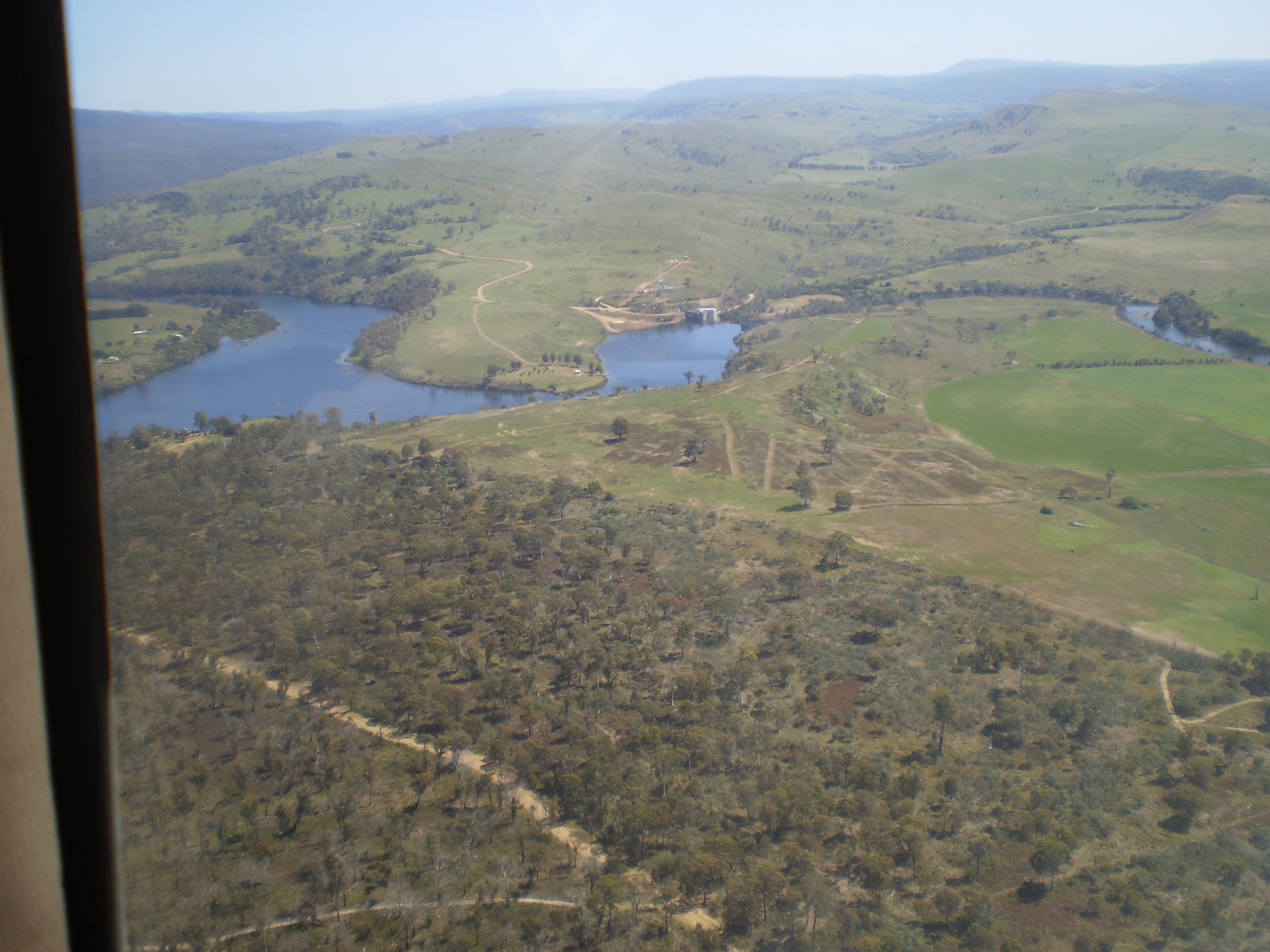
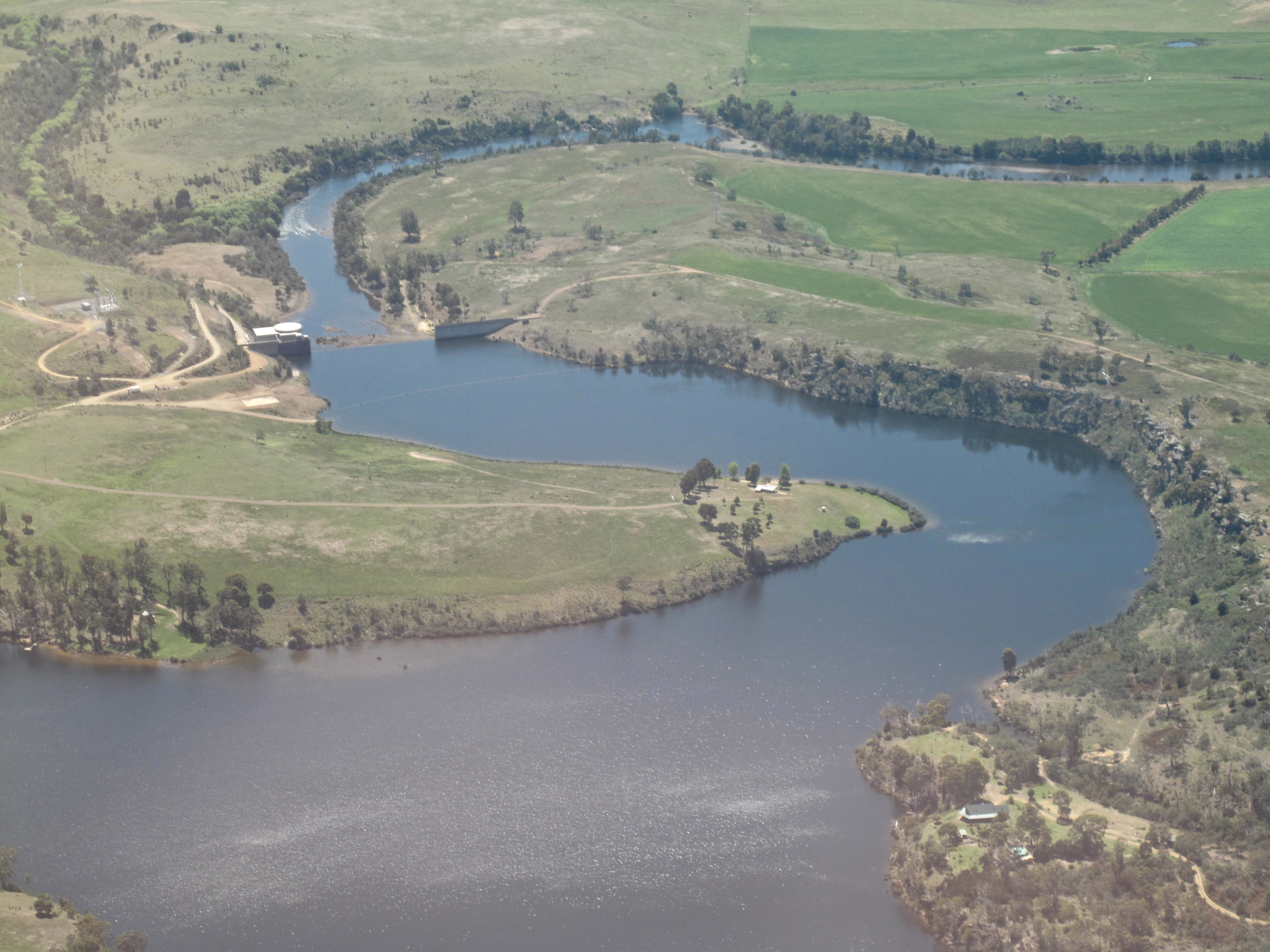
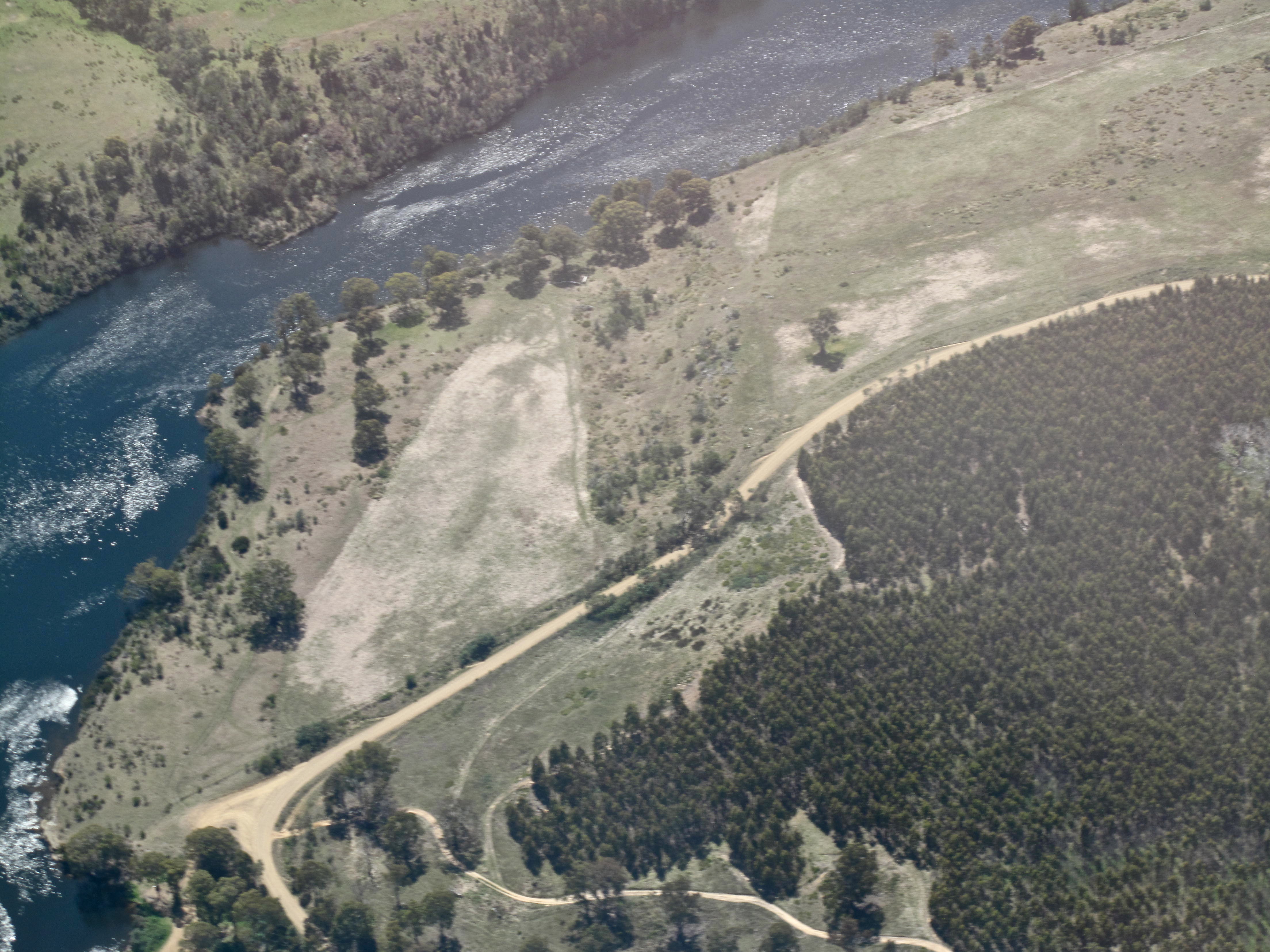
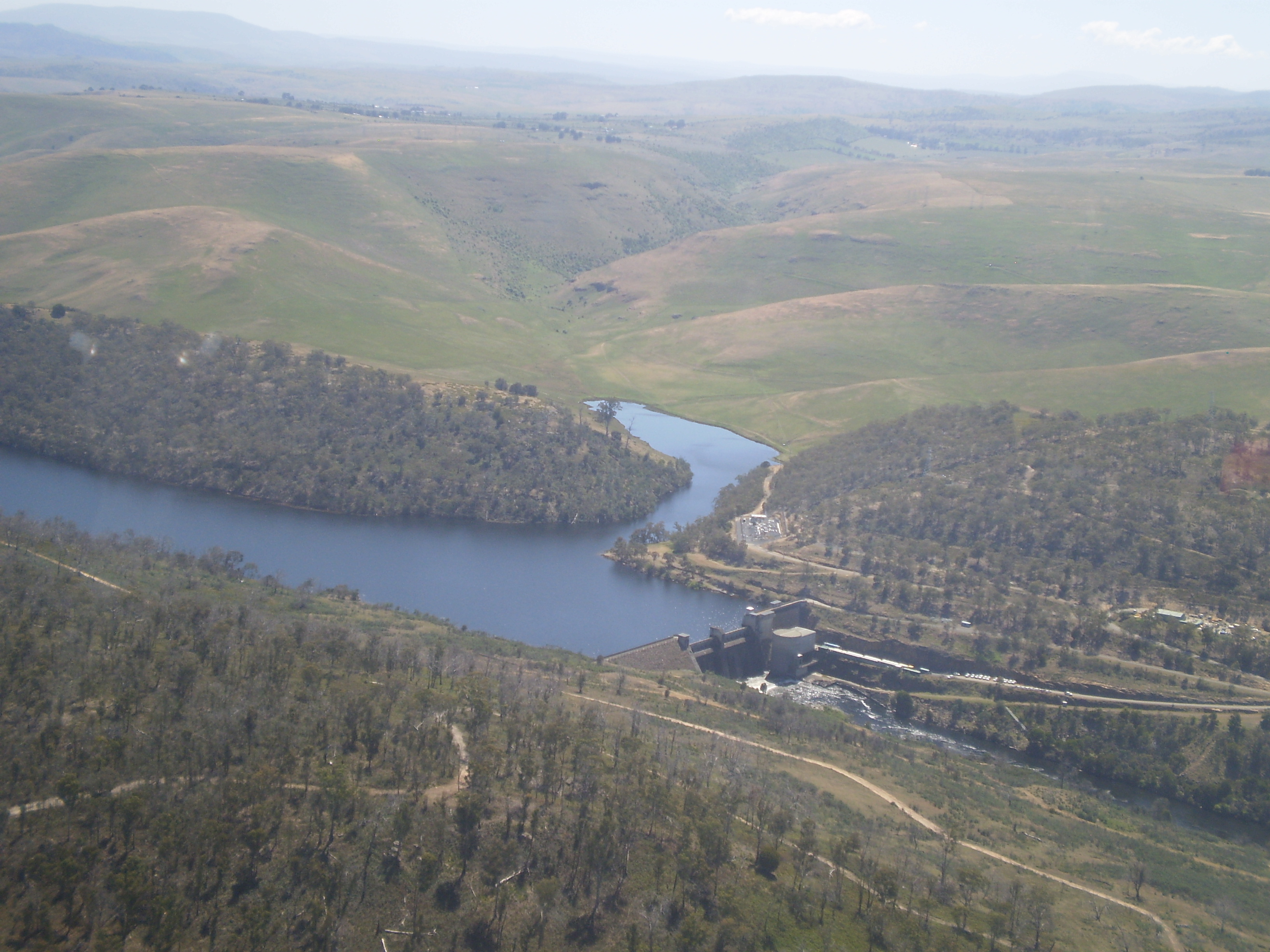
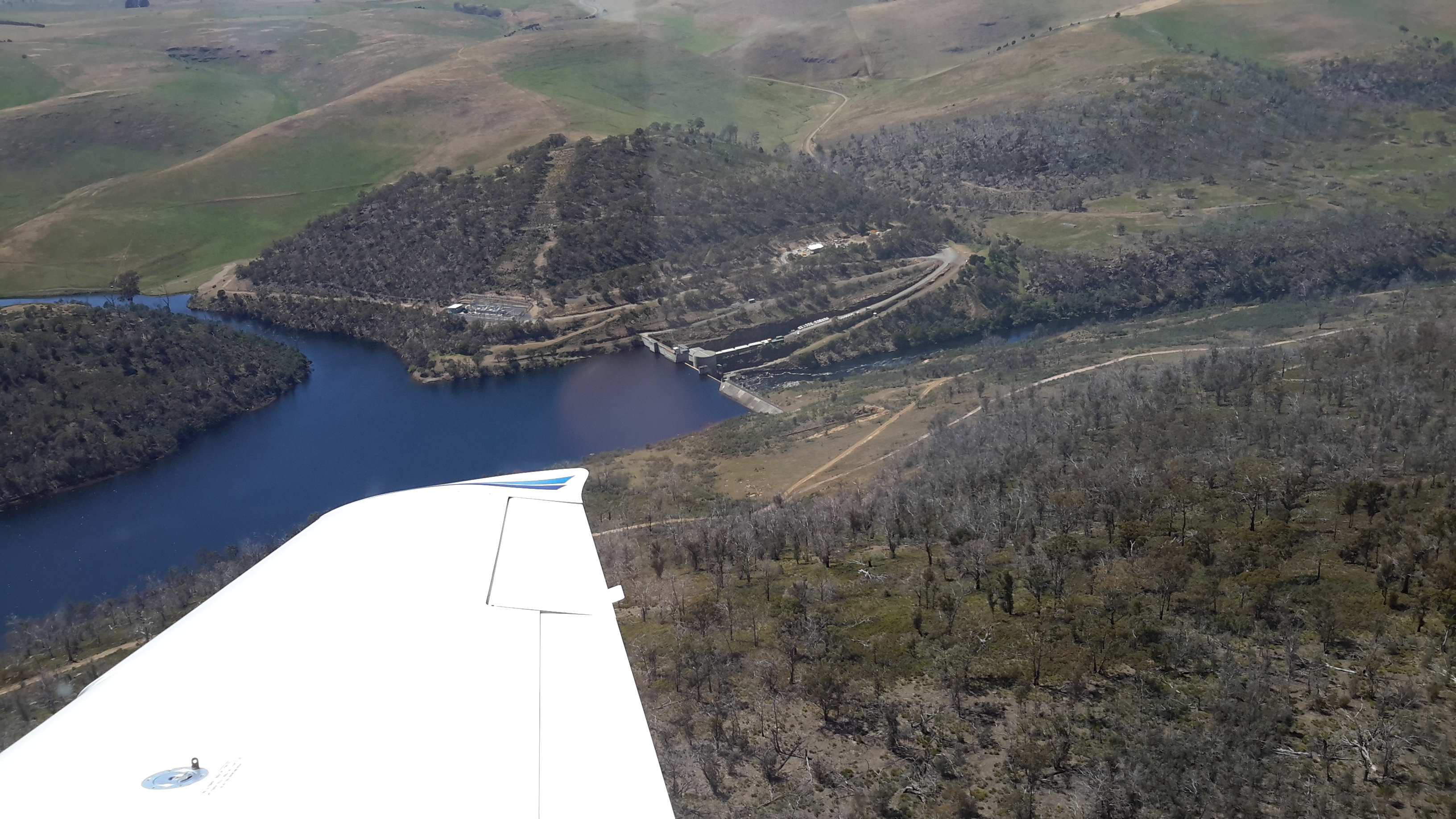
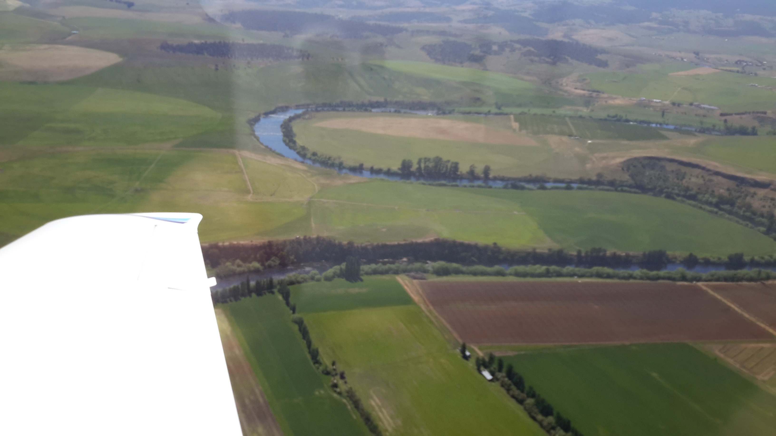
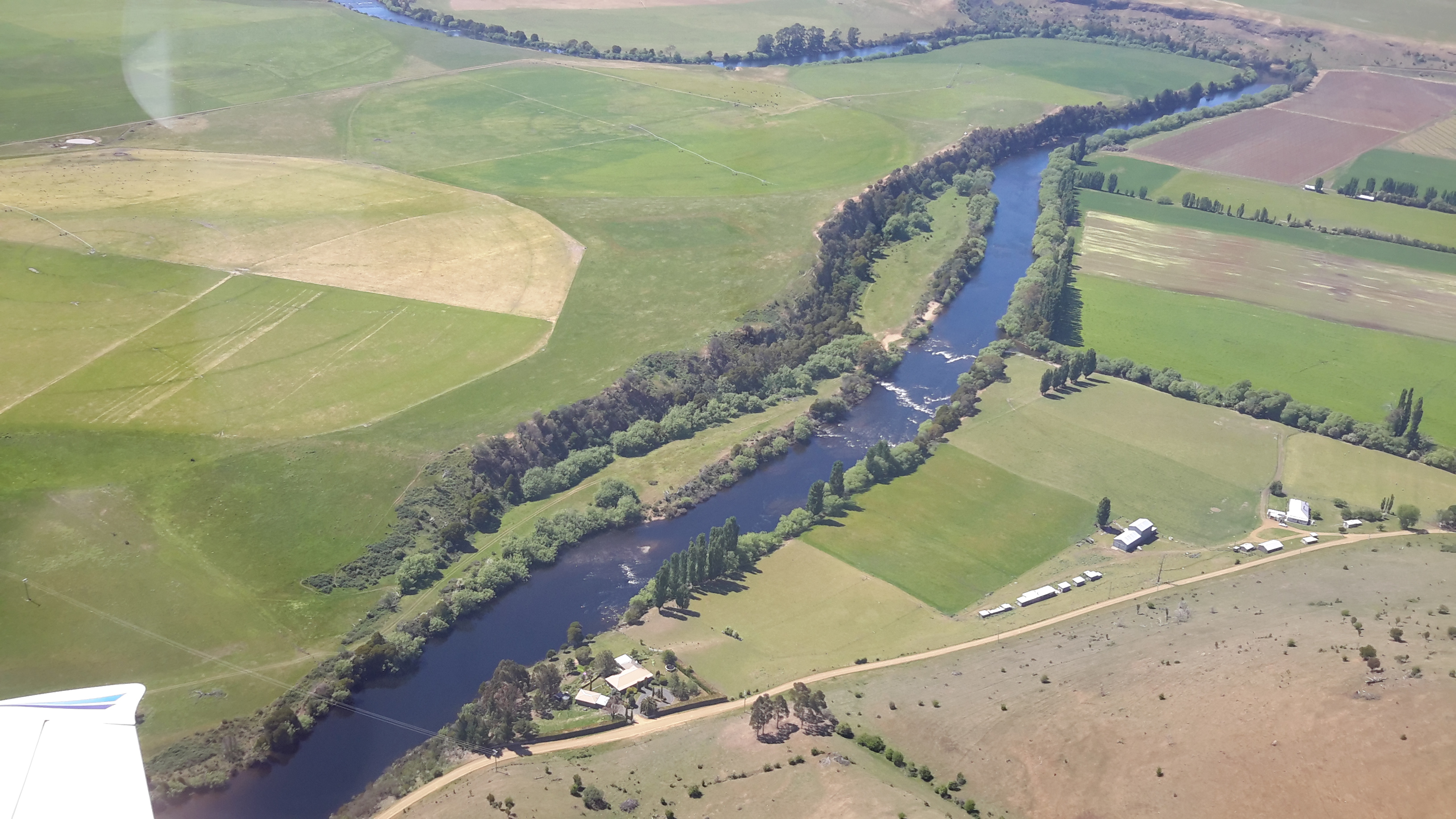
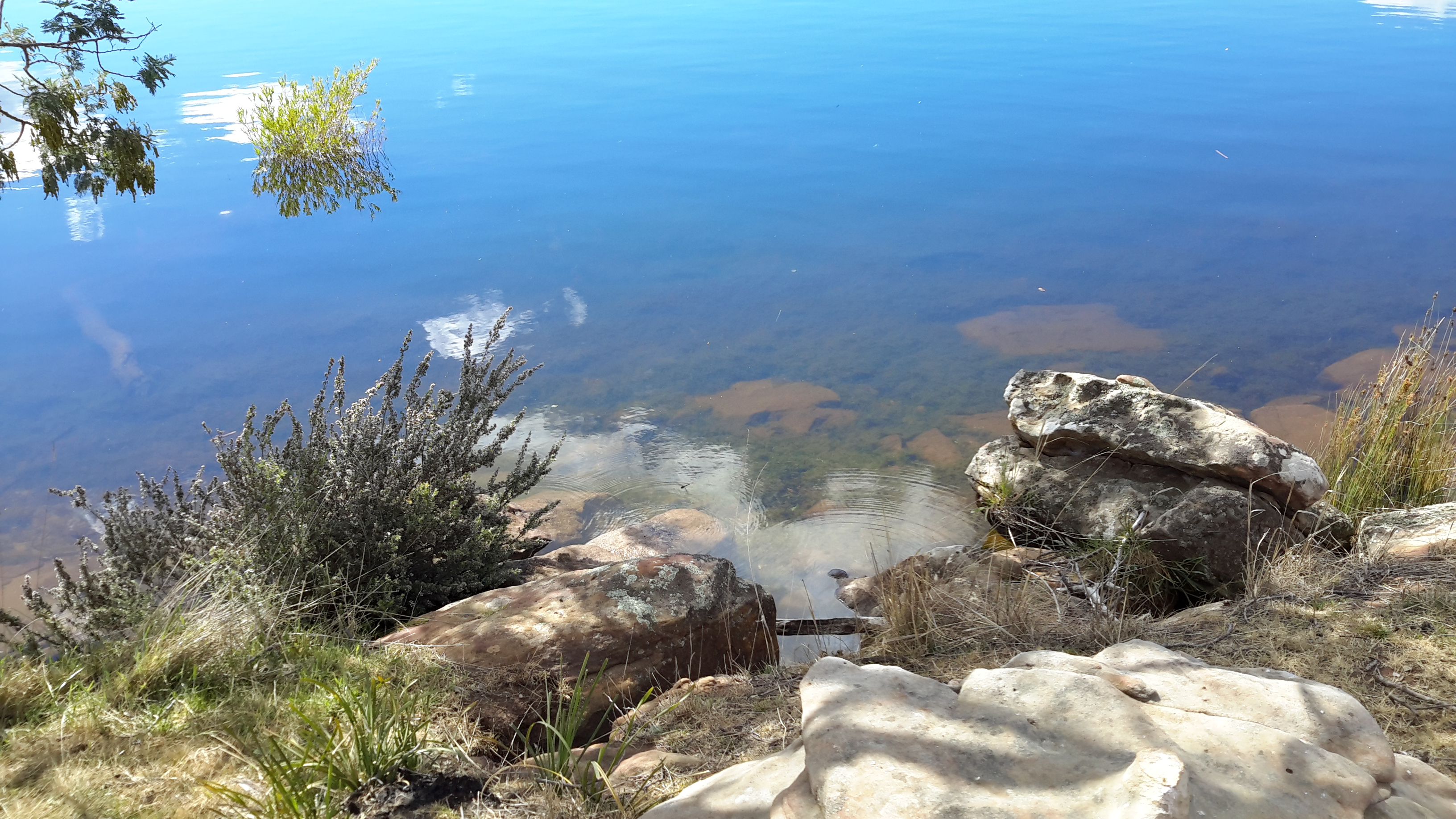
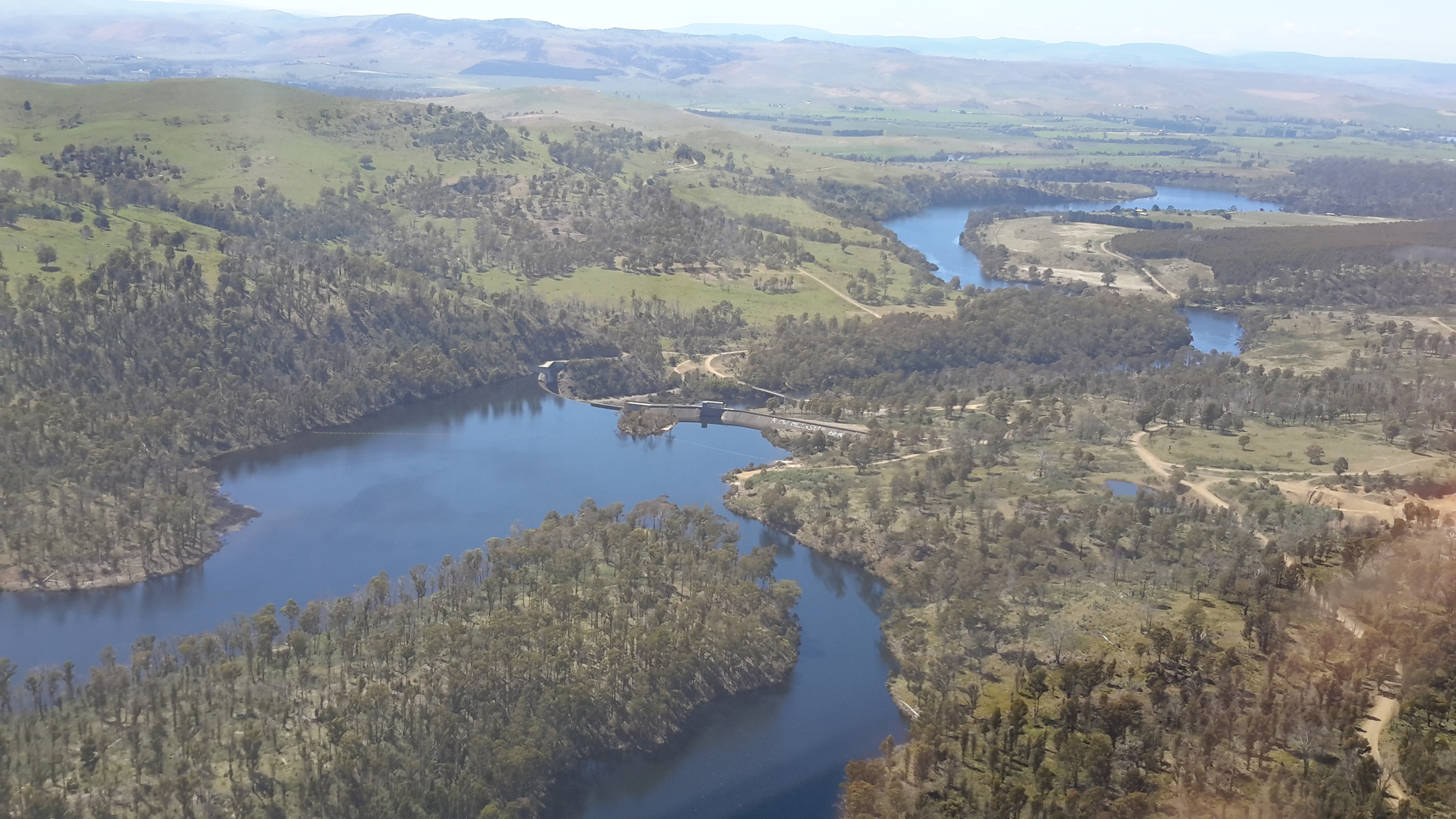
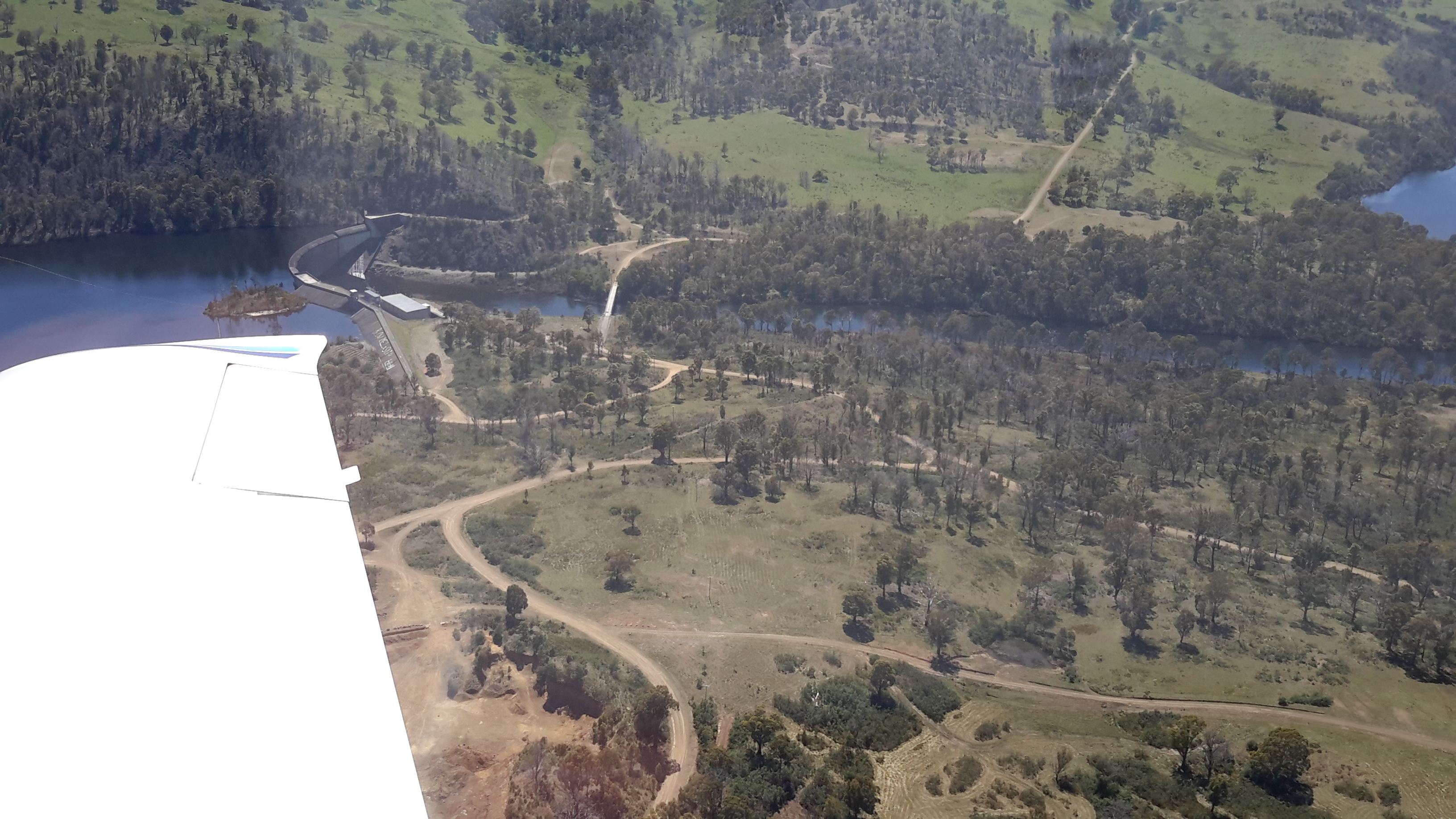
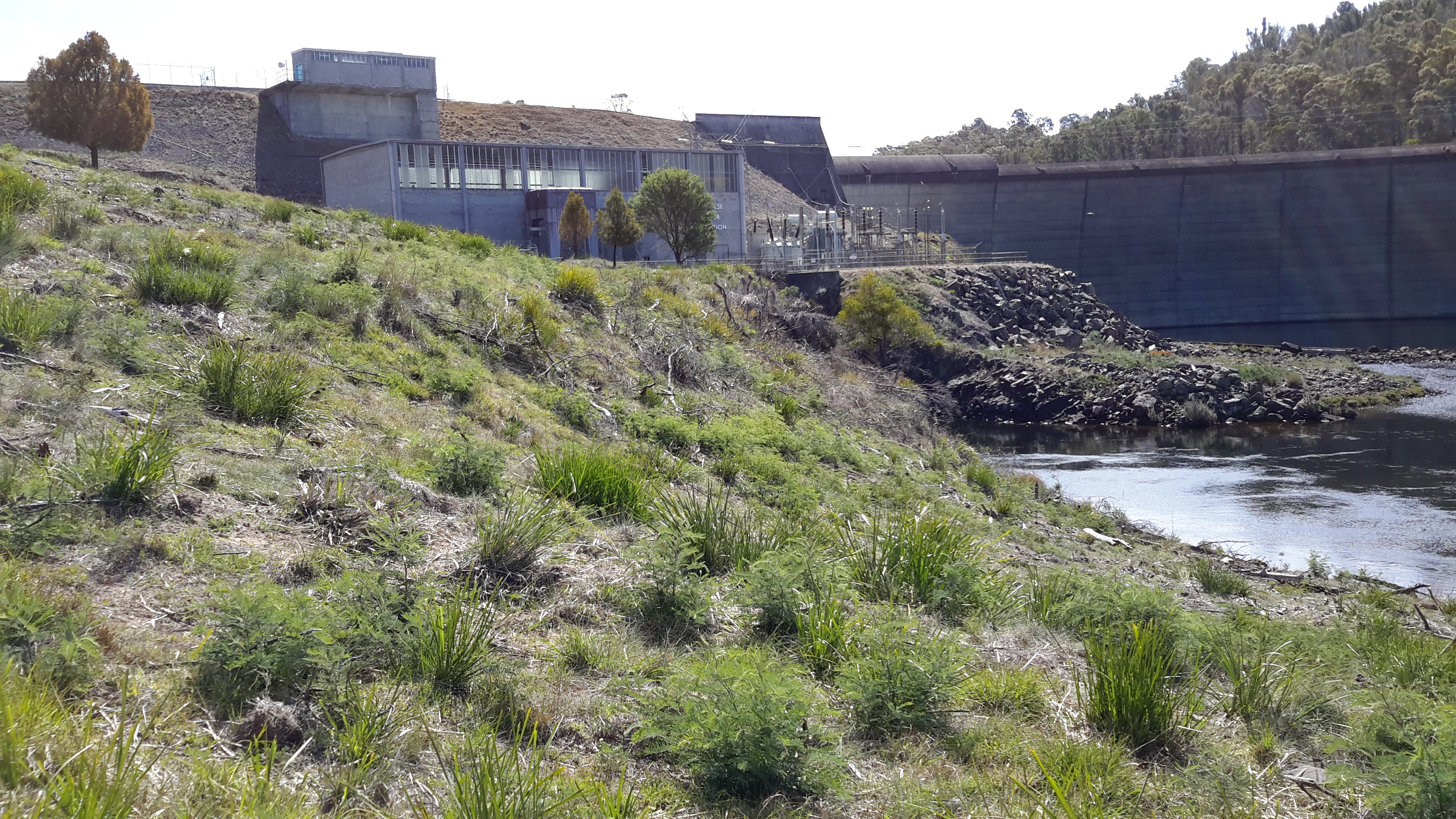
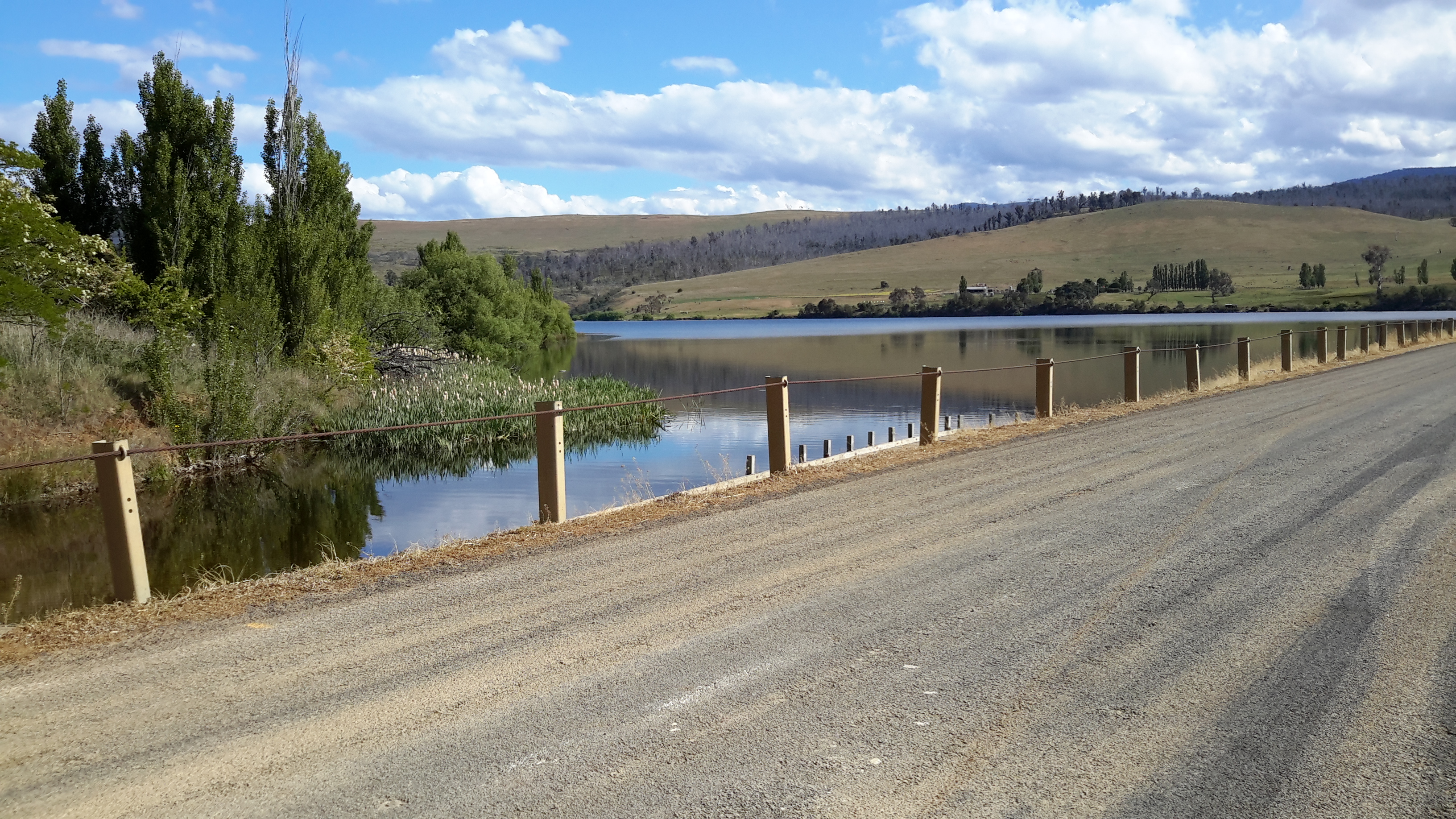
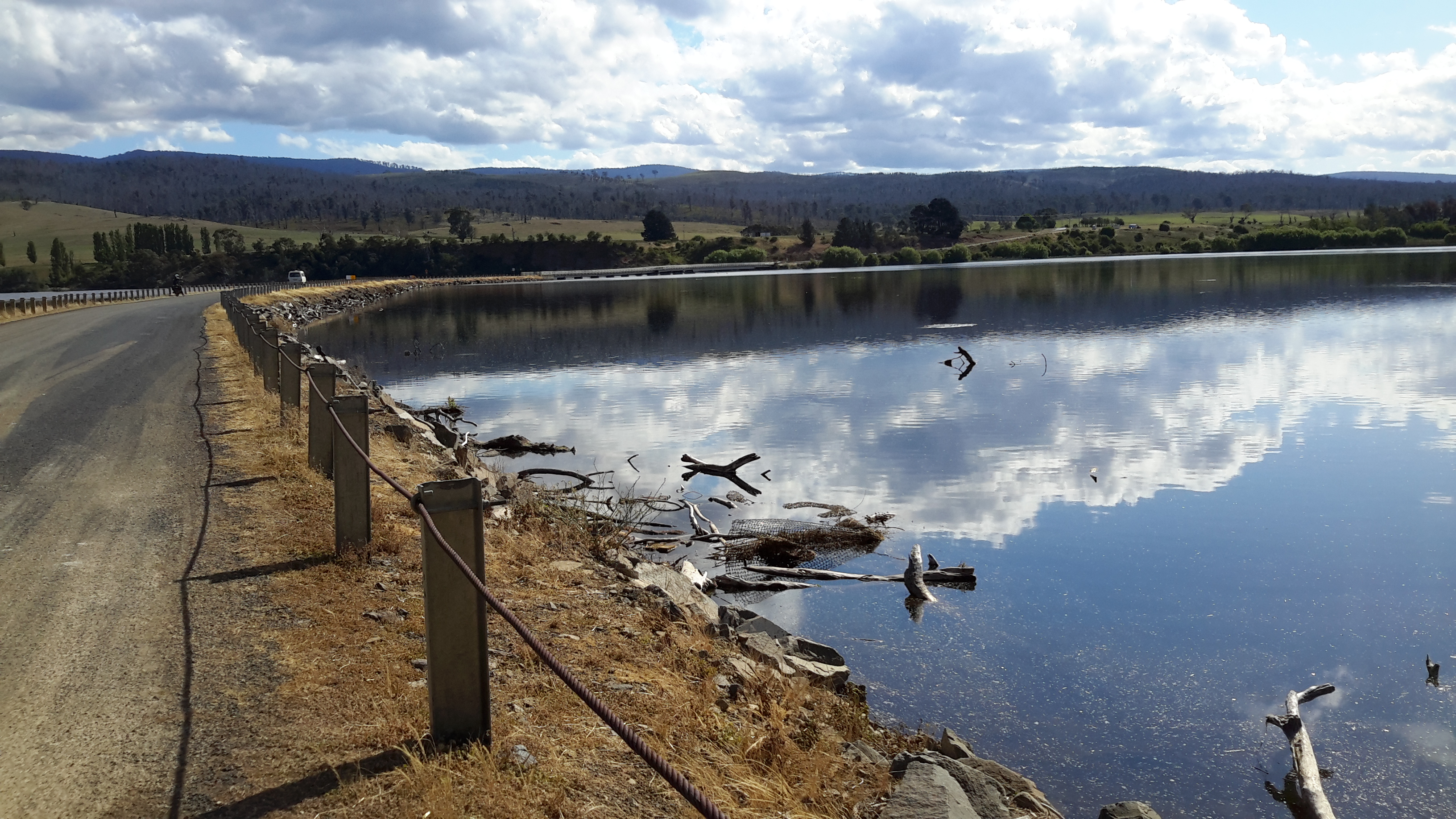
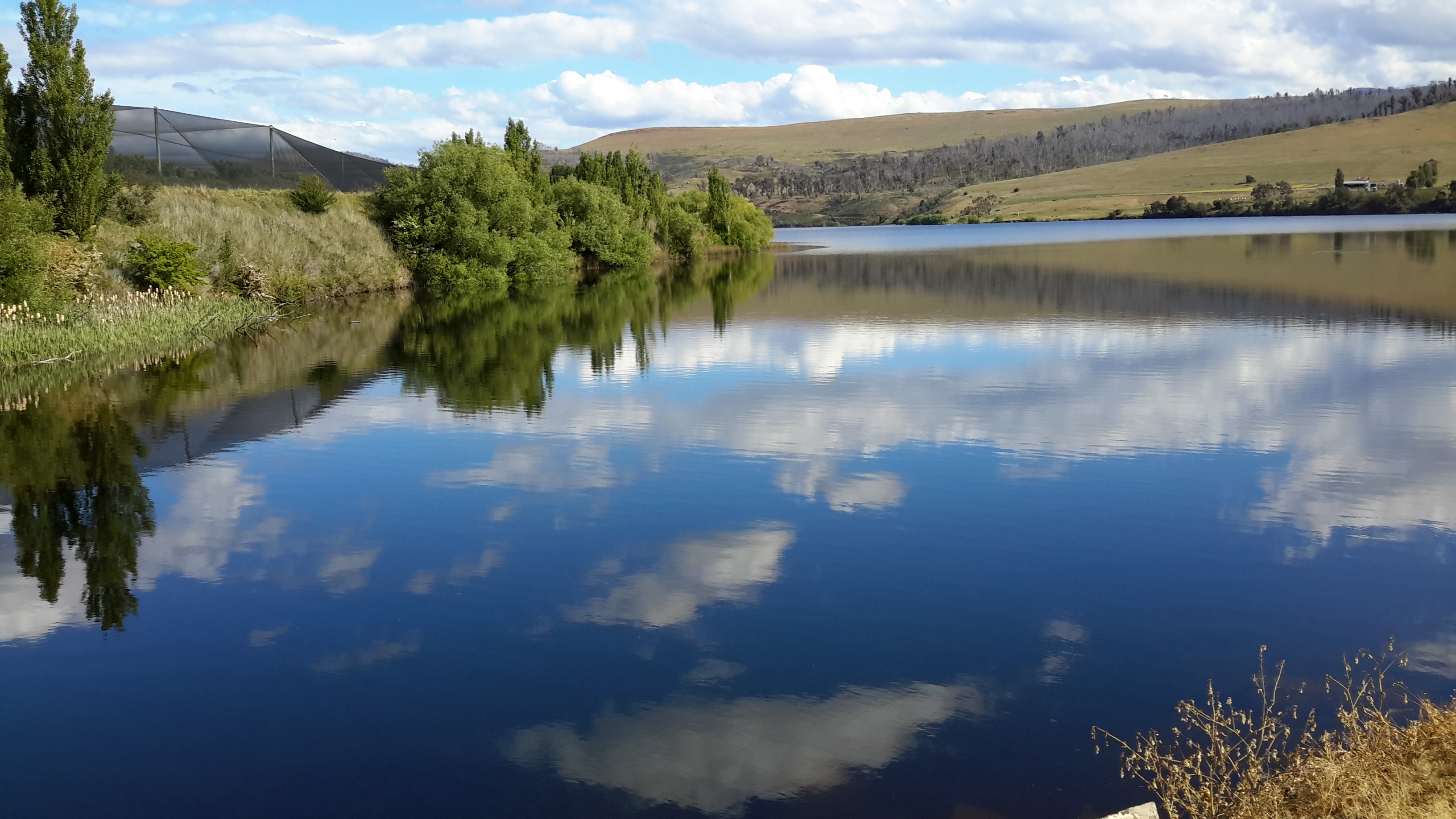
Therefore, my recent walks involved a great deal of walking away from the River in search of a way to continue; looking for a way to access the next paddock. I always hope for uninterrupted access to the river edge, but experience shows that hill climbing must be part of the process.  This means a simple 5 km section of the River might take 8 km of walking.  Being forever positive, I am glad for the expansive views of the River when I am up high.  But I am not in love with clambering up hills. Despite the deviations, I negotiated dozens of fences/gates.

The land

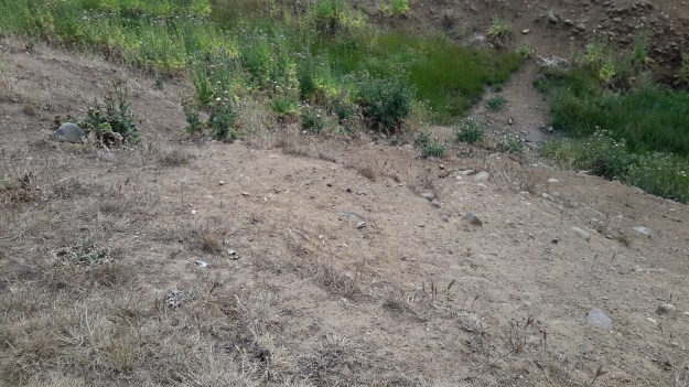
Farmers tell me that normally the land dries out in around six weeks’ time. However this year, the non-irrigated paddocks are parched.  The ‘soil’ of some land is sand and rock making me wonder whether it has been so for millennia or is only now tending towards a desert.  In other places, large fissures have cracked open the ground.

20151128_145455.jpg 20151129_124914.jpg

20151129_104801.jpg

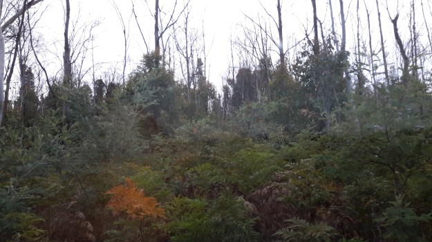
Elsewhere, I saw evidence of large bushfires that probably rushed through the bush three or so years ago. New growth surrounded blackened trunks.

20151128_093004.jpg

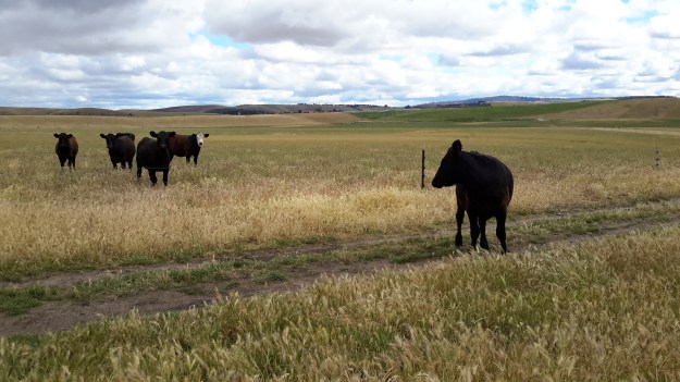
Negotiating paddocks with livestock

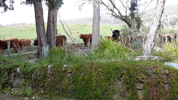
Sheep and cattle wander through large paddocks on either side of the River in much of this area.

I do my best not to enter a paddock with livestock and always try to find alternative routes.  The result is grand deviations from the ‘straight line’ of walking the Derwent.

Cattle are curious or expect food and with their big bodies swaying they tend to walk towards you. Then at a point when I begin to feel most uncomfortable, skittishly they run off.  On the other hand, sheep stand and stare until alarmed. Then they run off, bleating madly.

20151129_102014.jpg 20151129_102019.jpg

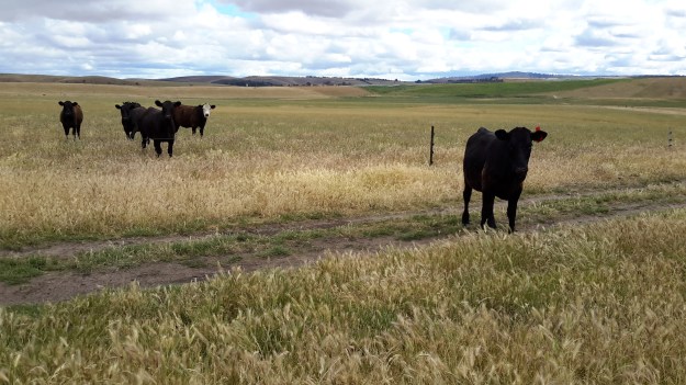
I don’t believe it is useful to raise either their or my stress levels.  At this time of the year when lots of mothers and their calves or lambs abound, the last thing I want to do is stress these creatures.

Occasionally, I have shared a paddock with either cattle or sheep. When in a paddock with the animals, I have done my best to walk in such a way that they move slowly away rather than charging off manically.  However, when I saw rams staring at me from under their sharp curly horns, I saw no point in confrontation, and took an alternative route – which in this particular circumstance required me to descend a very very steep hill, knowing I would have to climb back up further along. And I don’t like hills.

20151129_095124.jpg

20151129_104549.jpg

Crops

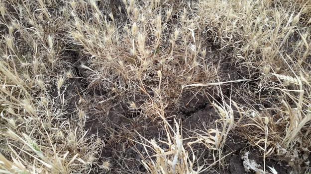
Commercial and feed crops cover some of the land. I am not a farmer but I think the following photo shows wheat. Can anyone advise me?

20151129_093640.jpg

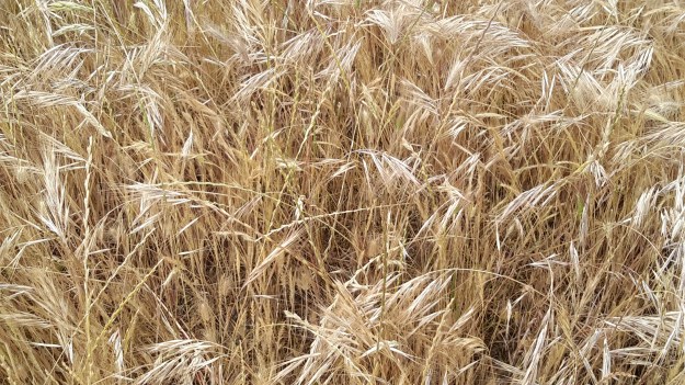
I feel sure this is barley below but am I correct?

20151129_122007.jpg

And I know the photo below shows oats.  I once had bales of oat straw brought to mulch my garden. Ever since, wild oats have sprouted and I have come to love their lacy heads.

20151129_121756.jpg

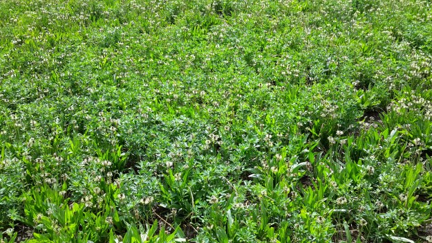
I have no idea what I was looking at when I came across this irrigated crop – can anyone identify the vegetation below?

20151129_101204.jpg


Walking between Gretna and Lake Repulse Dam – 1 of 3

I no longer believe that walking the Derwent River from the mouth to the source is possible as a normal public option. The reasons why others should not follow in my footsteps and expect to walk the length of the River include:

  1. Private landowners will not grant access permission to cross their land for a range of very sound reasons.
  2. There are no public pathways, roads or tracks near most of the River.
  3. Fences and gates make forward progress difficult or impossible.

Let me explain by focusing on the situation in one inland section.

The Derwent River winds around mostly cleared hills between Gretna and Lake Repulse Dam, and on two occasions its travel is impeded:  by the Meadowbank and Cluny Dams. The Derwent between these two locations measures approximately 52 kms.

As a result of privileged access and after a series of recent walks, I have covered the majority of these kilometres, sometimes walking on one side of the River and sometimes on the other.  I expect to finish this section by filling in the few small ‘gaps’ in the near future.  Once the 52 kms are completed then I will add the details into my blog under USEFUL ADDITIONAL INFORMATION. Weather (not snowing, raining, excessively windy or hot – I’m not fussy!) and the availability of chauffeurs will influence when and where I walk in the future.

Some of the many landowners along the way have granted me permission to walk on their land with the proviso that specific details which allow identification of them and their properties will not be provided.  I understand the reasons for their positions and will not share the information. Unfortunately, so many of my glorious panoramic photos of the Derwent River feature rapids or other indicators such as hills, dramatic cliffs and distant properties which show the side of the River on which I walked. As such, these would help locate the properties on which I walked.  Therefore, for the first time, I am disappointed to include only a couple of River shots in my blog posts.

20151128_155033

Many blog followers have enjoyed the details of what I see and experience in each walk.  Without providing identifying information, I will do my best to present some of the ‘flavour’ of the River between Gretna and Lake Repulse Dam in the next couple of blog posts.

Thanks to blog follower Jeanette, I was chauffeured to some starting points and collected from destinations in the section between Gretna and Lake Repulse Dam.  In addition, she walked with me on one occasion. At the time we tried out hand-me-down walking poles (my doctor says they will support my knees) but since they were no longer collapsible, we soon discarded them.  For blog followers wondering how my knees are holding up – very well, thank you.  Now that I wrap and support them, walking has become so much easier.

Tackling the Derwent in the Meadowbank Lake region

Meadowbank Lake, which backs up behind Meadowbank Dam and its Power Station, is approximately 15 kms long. Downstream, the Derwent River snakes its way through the landscape for about 23 kms until it passes Gretna and heads on towards the sea.  Upstream, after approximately 9 to 10 kms, the Derwent River finishes at Cluny Dam.  The Cluny Lagoon which extends to Lake Repulse Dam extends a further 4 kms.

To walk the Derwent between Lake Repulse Dam and Gretna is not straightforward because some private property owners cannot afford to let strangers on their property for insurance reasons, or their granted permission is a one off special case for me.  As a result, I have walked and will walk sometimes on the western and sometimes on the eastern side of the River and Lake, but I will not be providing a map and location details in my blog.  In this way I will protect the privacy of landowners, and respect the privilege their permission to access their property has given me.

I expect to tackle parts of the area on a total of 6 or 7 separate days. On each of these walks there will be a considerable amount of retracing of steps and walking away from the river/lake in order to reach roads where friends can collect me. For most of this area, public transport will either be absent or a great distance away.  Only the walk between Cluny and Lake Repulse Dams offers a reasonable amount of public access.

To date, I have walked a few sections, but I am not sure how to write up this Meadowbank area considering the confidentiality and privacy agreements I have made.  Once I have started moving west of Lake Repulse Dam and all the walks in the Meadowbank area are complete, then I will create one or more blogs that introduce at least some of the wonders of that environment.

Blogs can connect people purposefully and with pleasure

Some people refer to social media as a force which separates people, however in my experience I see it brings people together. Through my blog I have ‘met’ interesting people with whom I might not otherwise have connected and I have learnt a great deal.  My blog has introduced me to a world of wonderful ideas, beautiful environments, and to people who demonstrate they are vitally alive.  Every day I love to open my laptop and check who has sent me a comment or an email or to discover and read a recent blog posting by someone I am following.

Earlier this year, blogger Denise from upstate New York emailed to tell me she was coming to Tasmania and would love to walk in one of the locations I had previously written up.  This started what has now developed into a strong online relationship.  Eventually we met and walked when she visited Tasmania.

Denise at MONA 2015

The photo above shows Denise heading off towards the car park. It was the end of the day after we had walked from GASP (Glenorchy Arts and Sculpture Park), lunched at MONA (Museum of Old and New Art), checked out the current exhibitions, and realised it was time to travel home.

This November has been a special month for Denise because she decided to highlight special people in her life: she selected 30 people and wrote a daily post throughout November. I was immensely surprised when she added me in. Denise’s post can be read on her blog ‘Dee Scribes’  When you have read this, you may like to read some of her earlier postings.  As a thoughtful, intelligent and articulate advocate for redefining disability, she is second to none.  Denise is a professional with  humour and flair.  I have learnt so much more by reading her blog posts. Thank you Denise.

Lake Repulse Dam

Lake Repulse Map

Looking inland, Michelle’s photo shows the Lake Repulse Dam wall backed by Lake Repulse, with Cluny Lagoon in the foreground.

PA280087 Repulse dam.JPG

Looking towards Hobart, my aerial photo below shows Lake Repulse, the Repulse Dam and then Cluny Lagoon in the distance.

20151028_114913

Chantale’s photo provides an excellent overhead view of the Lake Repulse Dam. The photo also gives walkers an indication of the challenges which the landscape offers beside Lake Repulse.

IMG_3893Repulse Dam.JPG

For vehicle drivers, the Dam is reached by heading westward past the Ouse township, turning off the Lyell Highway and travelling down Lake Repulse Road. Aerial views show the roads at the Dam site clearly.

20151028_114858.jpg

The road continues across the Derwent River below Repulse Dam giving you an excellent opportunity for a close look at the structure.

20151029_151244

20151029_151355.jpg

The western end of Cluny Lagoon, located a little downstream from the Repulse Dam, is stunning.

20151029_151317.jpg

To walk further inland around the Dam wall and then along the edge of Lake Repulse, the following photograph gives an indication of the landscape to be encountered.

20151029_151400.jpg

Michelle’s photo below shows part of the 8 km long Lake Repulse is a handsome water storage area.

PA280088Lake repulse.JPG

Historical information can be read, although I cannot vouch for the accuracy of the information.  Hydro Tasmania provides details and adds a technical fact sheet.

Cluny Dam

Cluny Dam holds back the water of Cluny Lagoon.  Compared to other dam walls and other lagoons on the Derwent River, these are comparatively small.  The Cluny Dam wall is easily accessible by driving from the Lyell Highway down Lake Repulse Road and then making a left hand turn onto a road which takes you to the water.

20151029_155825.jpg 20151029_160029.jpg

20151029_160115.jpg

The westward end of the Lagoon finishes slightly east of Lake Repulse Dam further upstream.  Parts of the shore line are open forested and there are no walking challenges heading westward around the Lagoon, if you walk on the northern side (the side you arrive at from the Lyell Highway).  The river distance covered between Cluny and Lake Repulse Dams is a mere 4 kms.  Private property and creeks will make the southern side less accessible for walking.

Michelle’s aerial photo shows the beautiful Cluny Lagoon. The Cluny Dam Power Station structure is roughly  located in the middle of the photograph.

PA280086Cluny dam and lagoon.JPG

Chantale’s aerial photo shows the Cluny Dam.

IMG_3895Cluny dam.JPG

This is an extremely picturesque part of the world and one that is easily accessible by car for blog followers who want to take a picnic and enjoy the scenery.

Hydro Tasmania offers a technical factsheet about Cluny Power Station.

Dunrobin Bridge over Meadowbank Lake


Meadowbank Lake map.jpg

Meadowbank Lake, a large spread of dammed water through which the Derwent River runs,  is located west of New Norfolk: an expanse of water which measures at least 15 kms in length.  Like many other dams and lakes on the Derwent, Meadowbank has been designed for electricity generation purposes.  The Meadowbank Power Station was commissioned in 1967. In a document The Power of Nature, Hydro Tasmania provides information about Meadowbank and the other electricity-generating lakes and stations across Tasmania.

The Dunrobin Bridge carries Dawson Road; a road which extends from the Lyell Highway, crosses Meadowbank Lake then continues on the western shore until it reaches Lake Repulse Dam.

The first Dunrobin Bridge over the Derwent River was built in the early 1850s. The National Library of Australia’s Trove repository of historic documents provides information from a 1910 copy of The Mercury newspaper: ‘Dunrobin Bridge was built over the Derwent, between the Ouse and Hamilton during the regime of Governor Denison. Governor Denison’s rule in Tasmania lasted from 1847 to 1855. It is a fine stone structure, and the cost is stated in the Legislative Council Journals of 1856 to have been £13,875. Its construction seems to have occupied six years, from 1850 to 1856. Dawson’s Road, which was named after the man who superintended its construction, went from Dunrobin Bridge…’ westwards.

In 1900, according to the blog Tasmanian Gothic , the bridge looked like:

Dunrobin Bridge

Dunrobin Bridge

The bridge was damaged during flooding in 1952 according to Linc Tasmania.

Dunrobin 1952

This site shows the remains of the bridge in 1963.

Dunrobin Bridgen1851

Once the Meadowbank Dam was built, the gorge behind gradually filled with water. The remnants of the old Dunrobin Bridge apparently remain beneath the current Meadowbank Lake.  I cannot find when the new Dunrobin Bridge was built.  Anybody know the date?

The photos of Chantale, Michelle and I show the current bridge across the northern section of Meadowbank Lake.

IMG_3898Dunrobin bridge.JPG PA280082Dunrobin Bridge over Meadowbank Lake.JPG

20151028_114634

At ground level, the Dunrobin Bridge curves across the Lake in a stunning simple arc.

20151029_161758.jpg 20151029_161743

As I walked in the vicinity, time and again I was almost overwhelmed by the beauty of the landscape.

20151029_161746.jpg

20151029_161842.jpg