Tag Archives: Clark Dam

Yesterday I walked to the source of the Derwent River

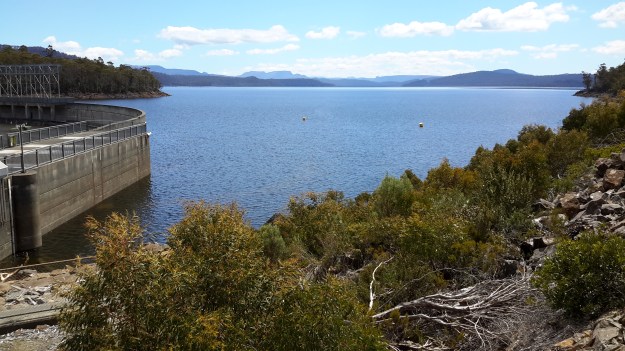
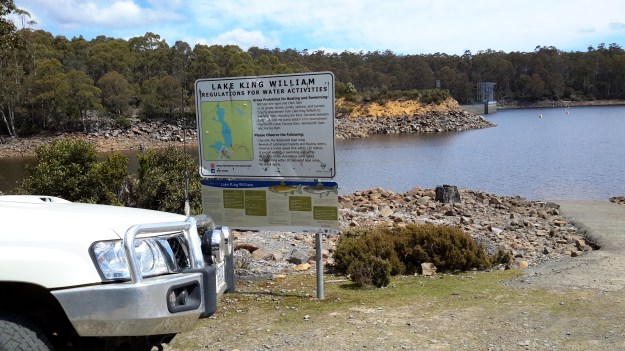
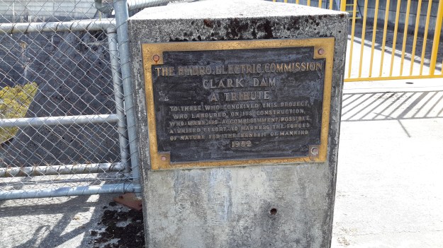
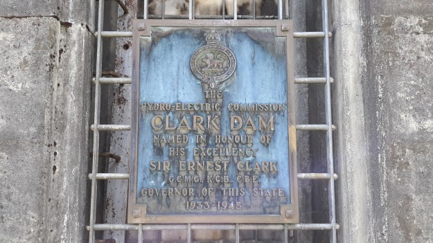
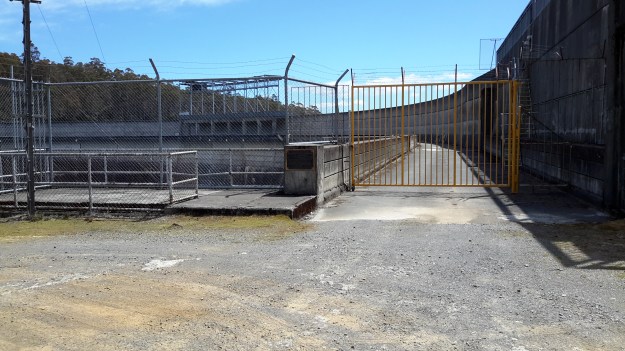
Over the past four days I have enjoyed remote, off-the-main-track inland Tasmania from Clark Dam at Butlers Gorge, along the edge of Lake King William to the town ship of Derwent Bridge, and then further north to where the Derwent River commences out of the gates of St Clair Lagoon.  I continued further north also to the Weir which controls water into St Clair Lagoon from the Derwent Basin (which is kept filled with water flowing from Lake St Clair).  Dozens of posts with all the details of the walks, and accompanied by some grand photos, will be forthcoming over the coming days.

This latest walk means I have walked most of the length of the Derwent River from the mouth to the source.  There are only a few gaps to fill if I have the courage (or a moment perhaps of insanity because of the level of difficulty I believe is involved) in the coming weeks.

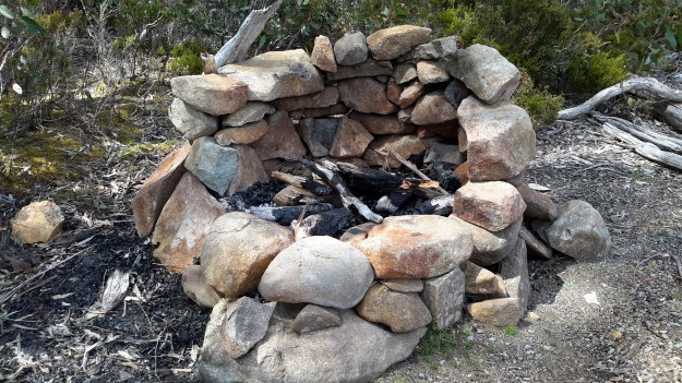
For the moment, I thought a few photos would be in order to whet your appetite for more.

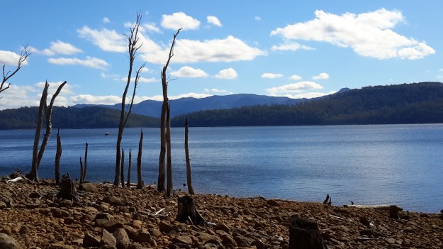
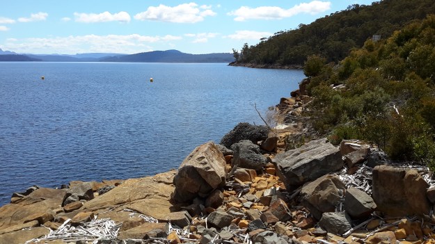
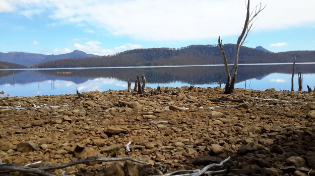
The photo below shows one aspect of a view across Lake King William in the late afternoon.

20160102_170531.jpg

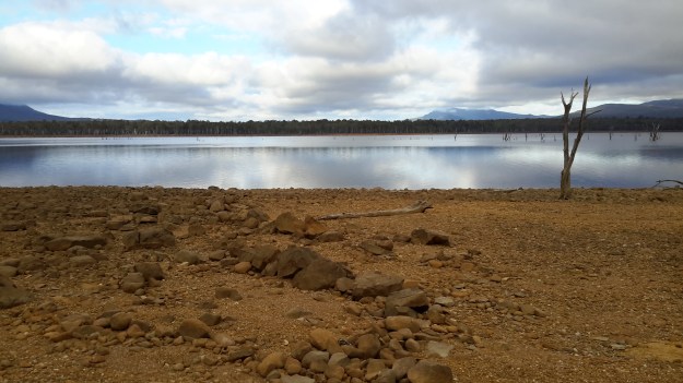
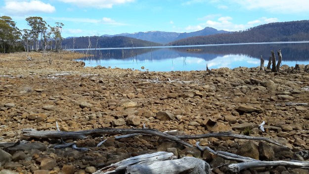
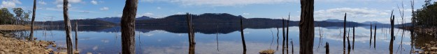
The photo below looks across Lake King William early in the morning.

20160103_072935.jpg

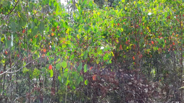
Sun passing through gum leaves.

20160103_110629.jpg

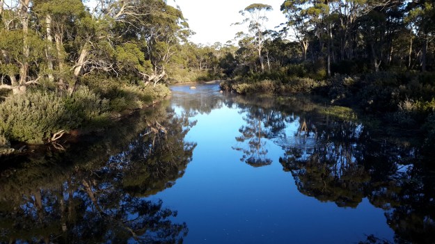
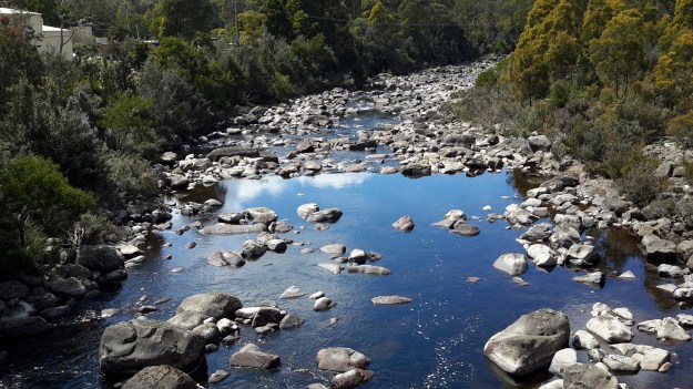
The Derwent River early morning near Derwent Bridge.

20160104_064805.jpg

The source of the Derwent River – the water as it leaves St Clair Lagoon. I was standing on the dam when I took the second photo, and watching the water run away eventually to pass New Norfolk then Hobart and finally exit into Storm Bay before dispersing into the wide ocean.  The whole experience was quite marvellous.  The river was fresh and alive!  And so was I!

20160104_075644 20160104_081109


Lake King William

Lake King William map

At the lower edge of my aerial photo below sits the Clark Dam with Lake King William backed up behind. The photo also shows clearly the road/track to be taken westwards to walk along the edge of the Lake.

20151028_120116.jpg

Behind the massive curved wall of Clark Dam sits millions of tonnes of water in a glorious expanse that extends over 15 kilometres northwestwards.

20151029_123306.jpg

20151029_123353.jpg

At the boat ramp, a sign provides information for visitors.

20151029_123855.jpg

The water level of the Lake is extremely low.

20151028_120129.jpg

20151028_120307

I loved the silver grey driftwood on the rocky shore and imagined the creation of rustic furniture.  That might become my next project.

20151029_125002.jpg

The views across the Lake were sensational.

20151029_125012

20151029_125026.jpg

20151029_125114.jpg

20151029_125134

I should have chosen a panoramic photo option.  Fortunately my chauffeur and companion walker Andrew did take such a stunning shot.

Andrews Lake King William panorama 1451 (1)

While there was no-one else around during our visit, this fireplace was an obvious sign of past visitors.

20151029_125152.jpg

I expect to walk the length of Lake King William solo before Christmas: 15 km ‘as the crow flies’, and possibly 30 kms to walk at ground level. Before I reach the Lyell Highway way up in a north westerly direction, the Derwent River will empty into Lake King William.

When I flew up the Derwent River, and when Lake King William came into view, it was clearly a massive stretch of water.  See Michelle’s photos below.

PA280106.JPG

PA280108Lake King William.JPG

PA280109lake King William.JPG


Clark Dam

Clark Dam map

Late in October 2015, on the northern side of the Derwent River, I walked at Clark Dam built on Butlers Gorge, and then along a little of Lake King William. We know that in 1835, George Frankland followed the Derwent River in a southwesterly direction from Lake St Clair across huge plains until the gorge country commenced. The Clark Dam has been built at that junction, and over the decades the plains behind have been swamped with what is now known as Lake King William. The location is a place of extreme weather conditions, from blizzardly snows to ferocious and bitterly cold winds and to scorching sunny days, but always stunning.

Clark Dam is a massive piece of engineering in a beautiful but remote area of central Tasmania.

20151029_122628.jpg

20151029_122354.jpg

20151029_122454.jpg

Chantale’s aerial photograph below puts the Dam and Lake King William into context.

IMG_3876Clark Dam

Michelle’s photos below provide similar information.

PA280110Clark Dam.JPGPA280111Clark Dam.JPG

In 1952 a special tribute plaque was installed on the Dam: ‘The Hydro Electric Commission, Clark Dam, A Tribute, To those who conceived this project, who laboured on its construction, who made its accomplishment possible, a united effort to harness the forces of nature for the benefit of mankind.’

20151029_122335.jpg

Another plaque nearby records: ‘The Hydro Electric Commission, Clark Dam, Named in honour of his Excellency, Sir Ernest Clark,  G.C.M.G., K.C.B., C.B.E., Governor of this State, 1933- 1945.’

20151029_122849.jpg

My chauffeur for the day Andrew, remembered years ago he walked across the Dam wall but that is now impossible.

20151029_122312.jpg

20151029_122459.jpg

This means it is impossible to change from one side of the Derwent River to the other at this point.  In the photo below despite the walkway beckoning a walker, it was impassably gated at the other end.

20151029_123303.jpg

The reminder that the Clark Dam is part of an electricity generating project is everywhere.

20151029_122528

The complex that makes up Wayatinah – posting 7 of 7

The Derwent River at Wayatinah

20151029_113841.jpg

20151029_113829.jpg

From my aerial experience, I know the river looks like this all the way north-westwards of the Wayatinah Lagoon to Clark Dam at Butlers Gorge; a distance of not much less than 30kms in very steep country with numerous creeks cutting the landscape and flowing into the Derwent River.  In the post introducing George Frankland’s walk, mention was made of the Nive River. The Nive flows into the northern end of Wayatinah Lagoon. Before the Wayatinah dam was built, the Nive flowed directly into the Derwent.  The river edge between Wayatinah and Butlers Gorge is where Frankland and his expedition found two to four miles per day was the going rate because of the density of the bush. And then they gave up and walked inland away from the Derwent River.

 20151028_115431

20151028_115442.jpg  
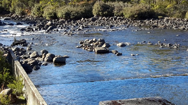
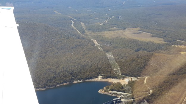
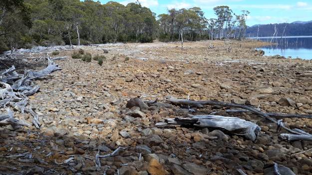
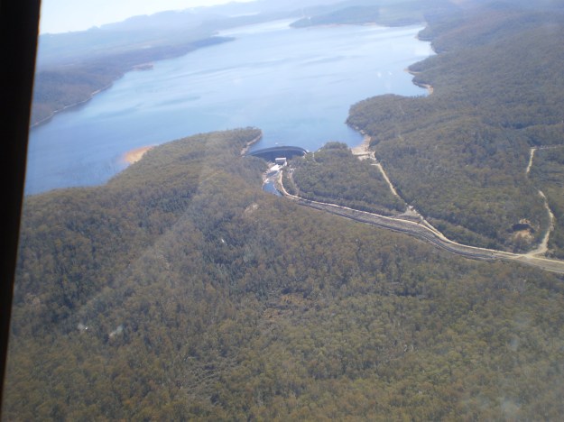
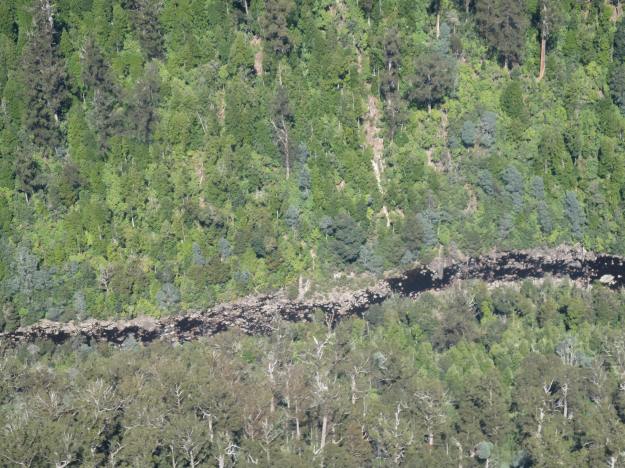
A couple of Chantale’s aerial photos show similar rocky beds along this remote and wild part of the Derwent River.

IMG_3828dryish river bed.JPG

IMG_3832.JPG