
Eventually Andrew reached cleared paddocks at the point where the transmission line swung to the south east. The going then was much easier through low scrub in a shallower gully and then up onto the summit of Bushman’s Hill, some three hours after the start of the day’s walk. From this hill Mt Wellington above Hobart was visible in the distance, and Andrew’s mobile phone pinged. He had come back into mobile phone coverage range. The one occasional bar of reception was enough for a text message but not sufficient for a phone call. Bushman’s Hill offered a very comfortable spot with the occasional shade tree and logs to rest on.

After a quick lunch around 1 pm, Andrew followed the power line easement hoping to get to Lake Catagunya’s edge. Unfortunately, the terrain became impressively steep and scrubby with a coverage of thick ferns towards the bottom so that idea was abandoned.
Before crossing Lake Catagunya’s inlet, as Andrew skirted around looking for a cross over point, Dunns Hill stood prominently. This hill, pictured below, had to be traversed to reach Catagunya Dam and Catagunya Power Station. But first the water had to be crossed or walked around.
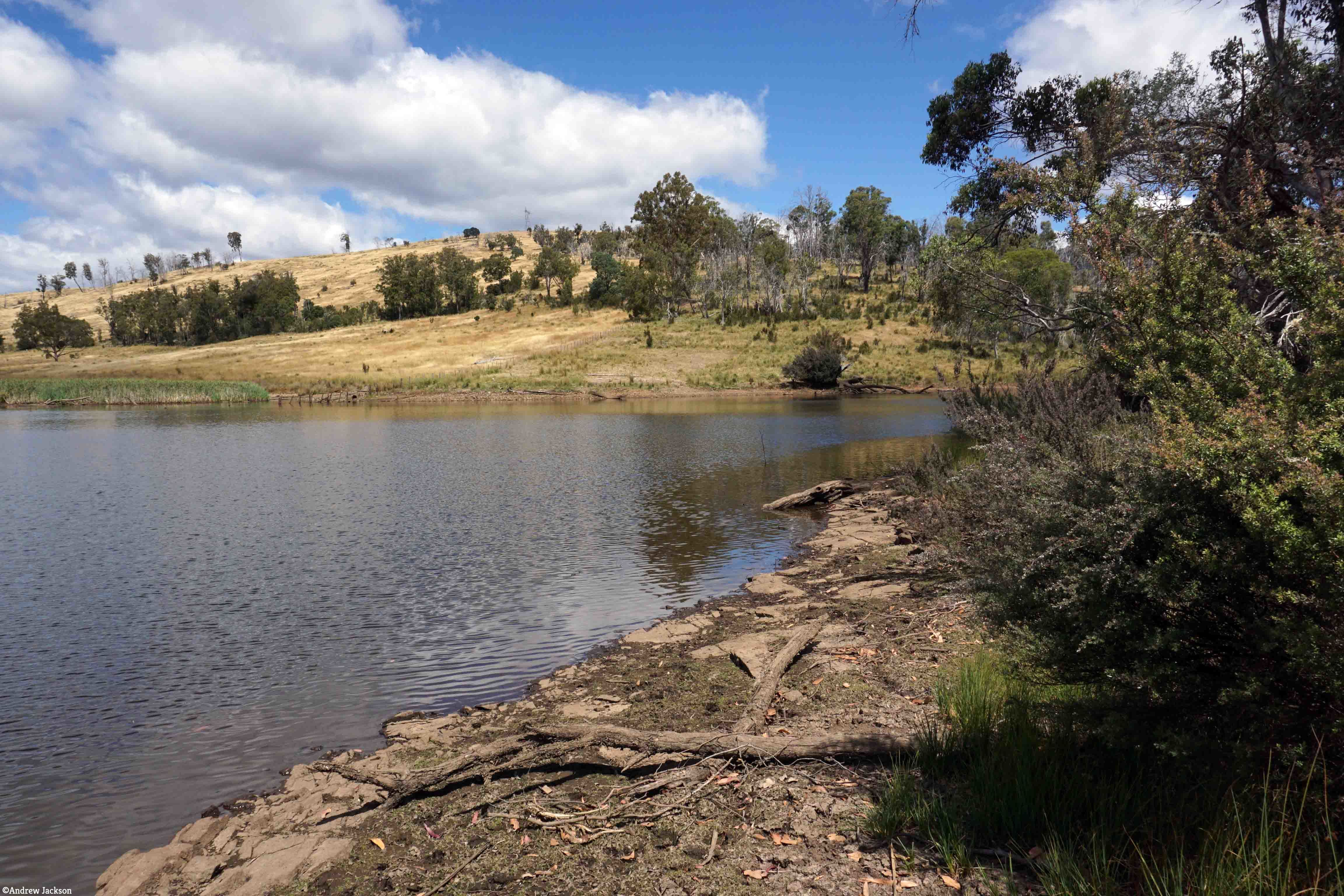
The challenge was to find a way of by-passing the large inlet of water where Black Bobs Rivulet enters Catagunya Lake. By heading 1 km north, north east, then east through open forest and then progressively steeper country Andrew reached a point where the rivulet hit the Lake. Right at the junction the exposed rock made for an easy rock-hop to the other side (in flood this part would be impassable as it is obvious that it carries a lot of water after heavy rain). He was so glad to see the low water level at that point. otherwise it would have meant wet feet or more kilometres of walking to skirt around this obstacle.
The first photo below of Black Bob’s Rivulet looks upstream and the second looks downstream to where it enters the lake.

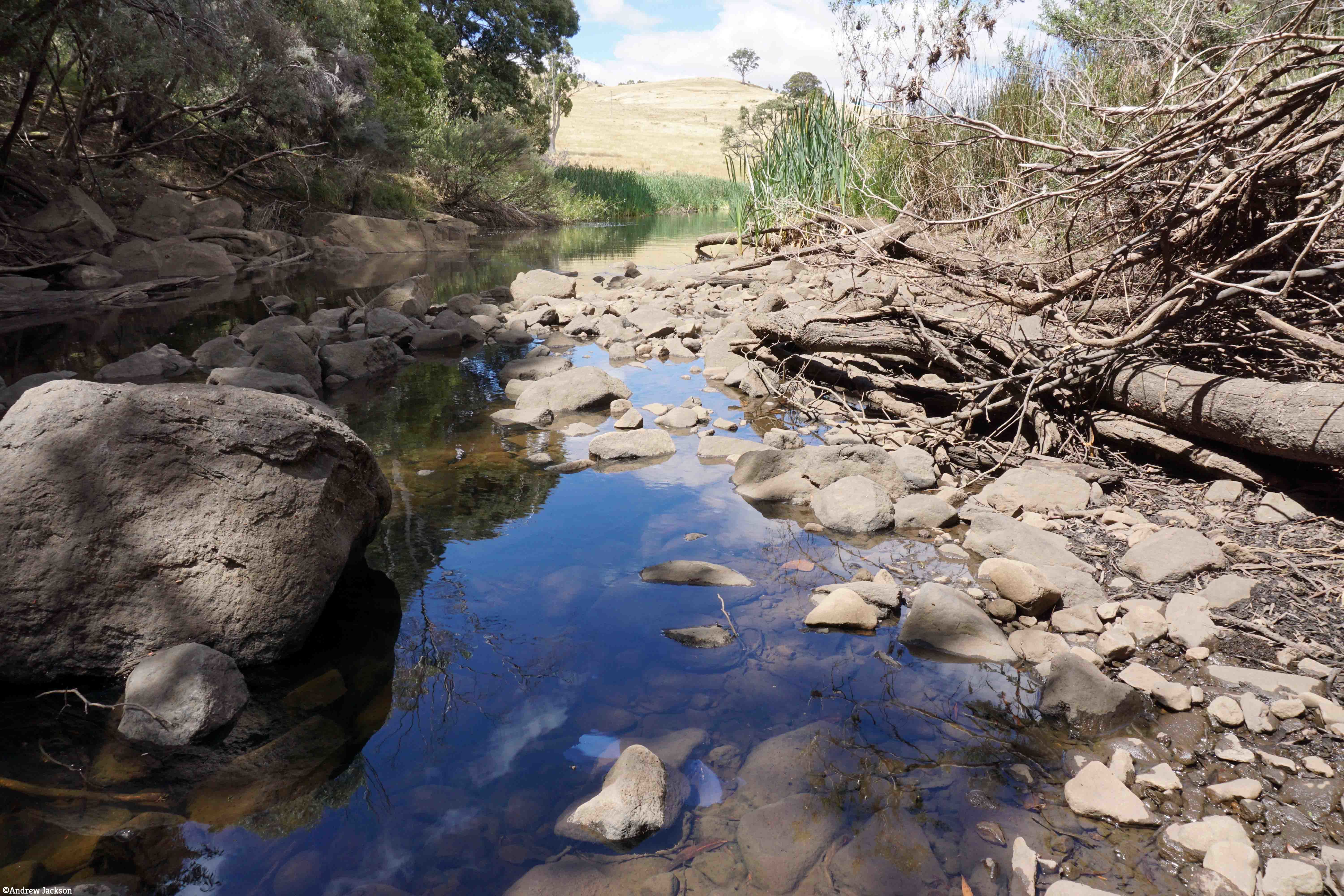
The open hill in the distance on the second photo is located north of Catagunya Dam and on the other/eastern side of Catagunya Road – this is not Dunns Hill. Once over Black Bob’s Rivulet, the direction taken was south towards Dunns Hill. After a short scrub-bash, the route emerged into the open paddocks of the cattle country surrounding Catagunya Power Station. Andrew then climbed 1 km steeply up Dunns Hill to rejoin the power lines. The reward for reaching the top of Dunns Hill was a fine view down into the Lake and westwards to Wylds Craig.

Looking westwards the continuing power lines disappear into the distance. The undulating nature of the landscape is also on show.
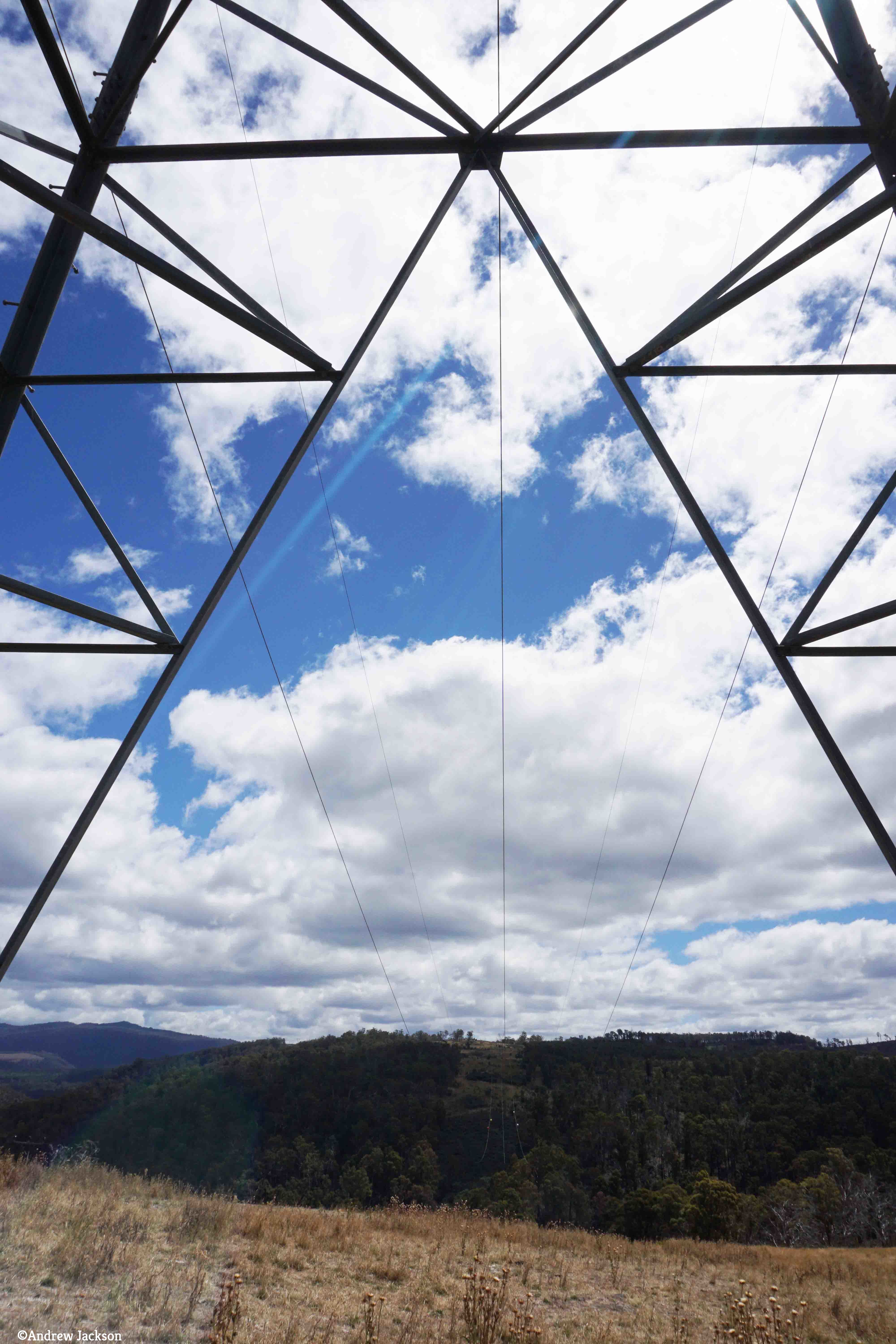
The glorious openness of Dunns Hill with its vistas on a sunny day, provided the stimulus for creative photography showcasing the patterns offered by the electricity transmission pylons and the grass. 

The final kilometre to the power station was through open grasslands, buzzing with grasshoppers and butterflies. It was like creating a bow wave; with each step the masses of insects were spread ahead. My walk from Lake Repulse Dam to Catagunya Dam was in similar country and the postings 3 and 4 of 13 talk about my experiences with grasshoppers and butterflies.
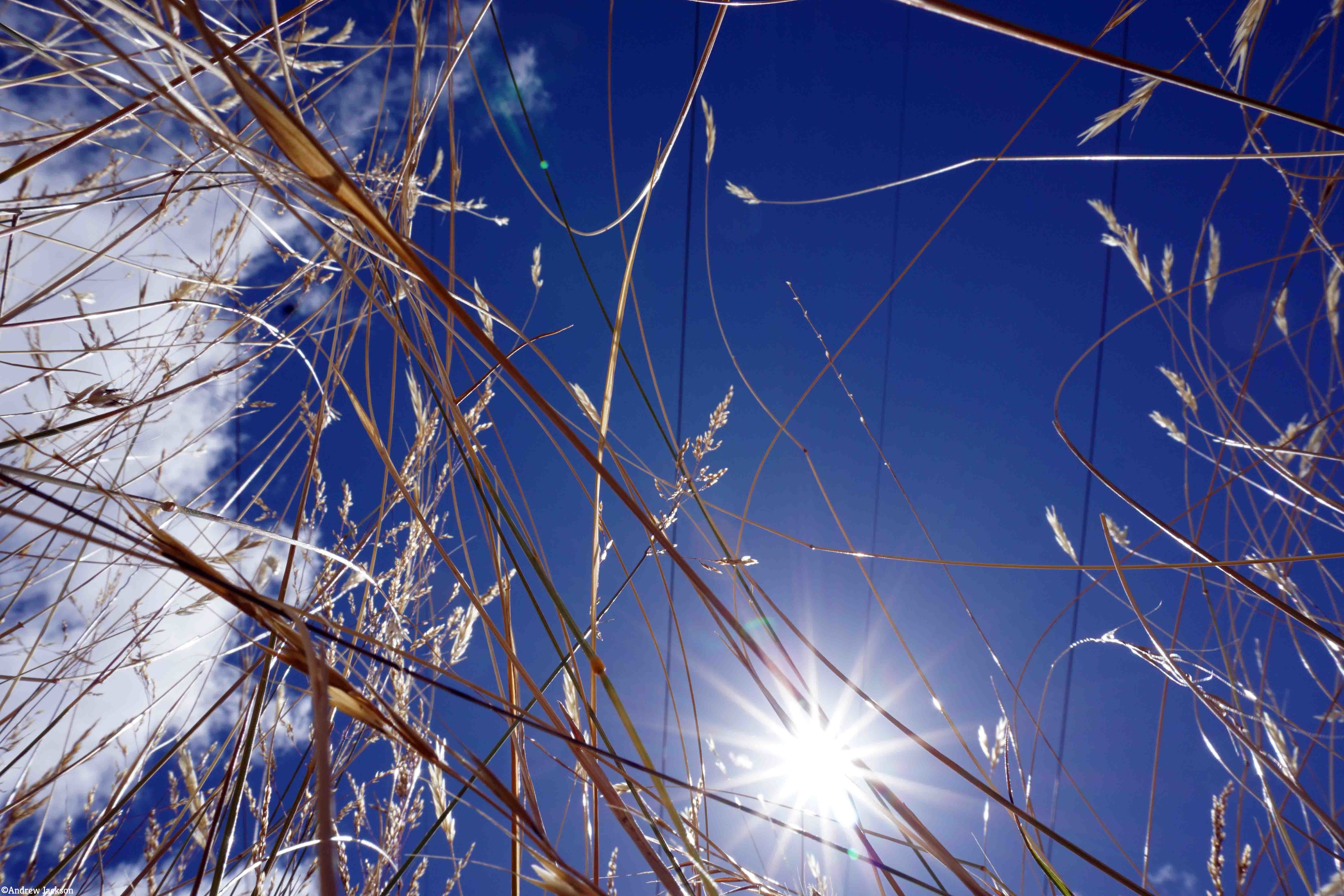
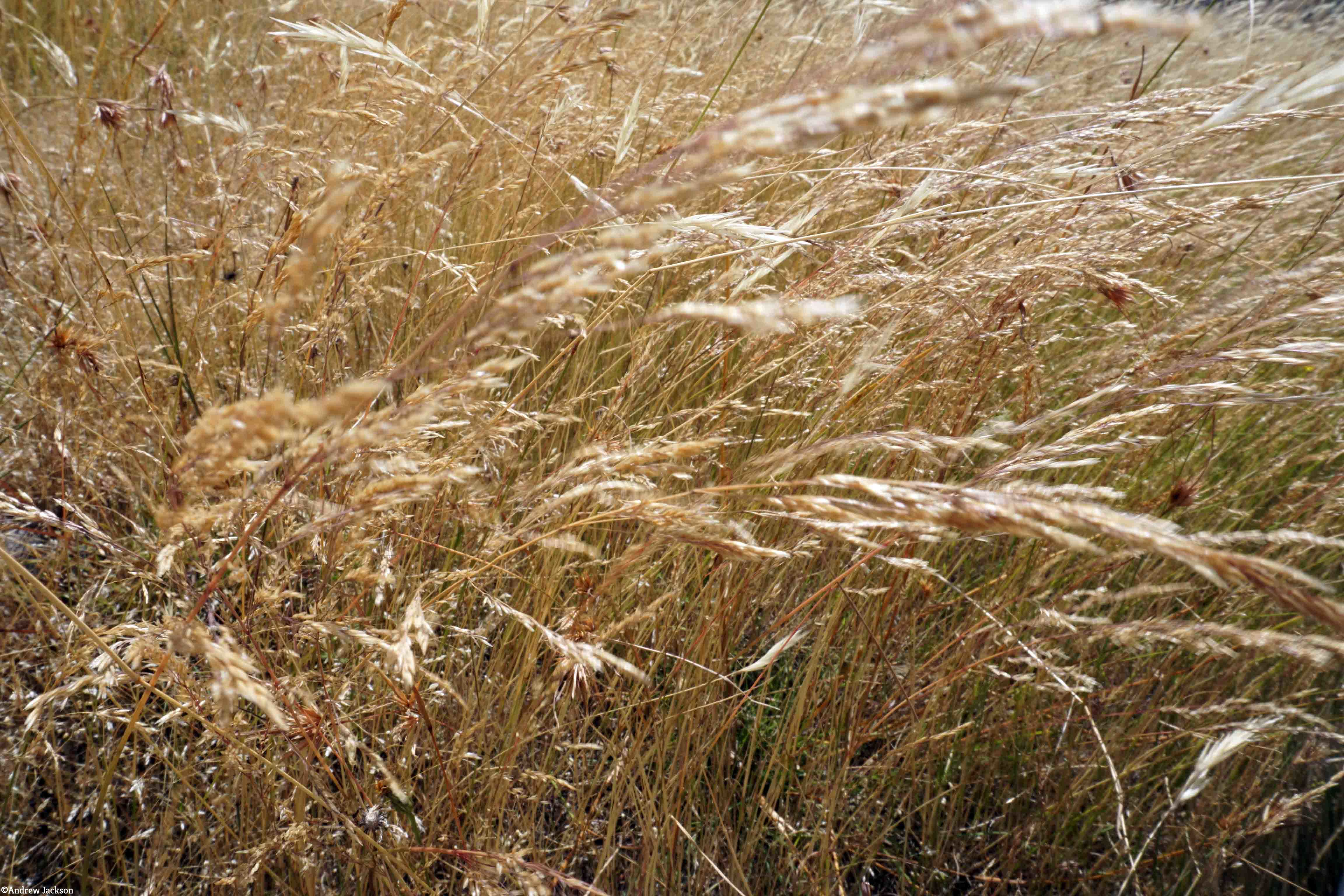
I am very keen on grass with its colours and textures. Long term blog readers have seen many photos of grasses taken in many locations during my walk along the Derwent. Andrew’s photo below shows Dunns Hill grass moved by the breeze.
Navigation during this walk was never in doubt – the prominent shadow on the grass from the transmission cables overhead marked the route to the power station! See the shadow line in the photo below. Of course if the inland forest plantation/logging roads had been followed (which might be necessary in wet weather and when Black Bob’s Rivulet was flooding), then using GPS equipment would have been essential to keep track of your location. 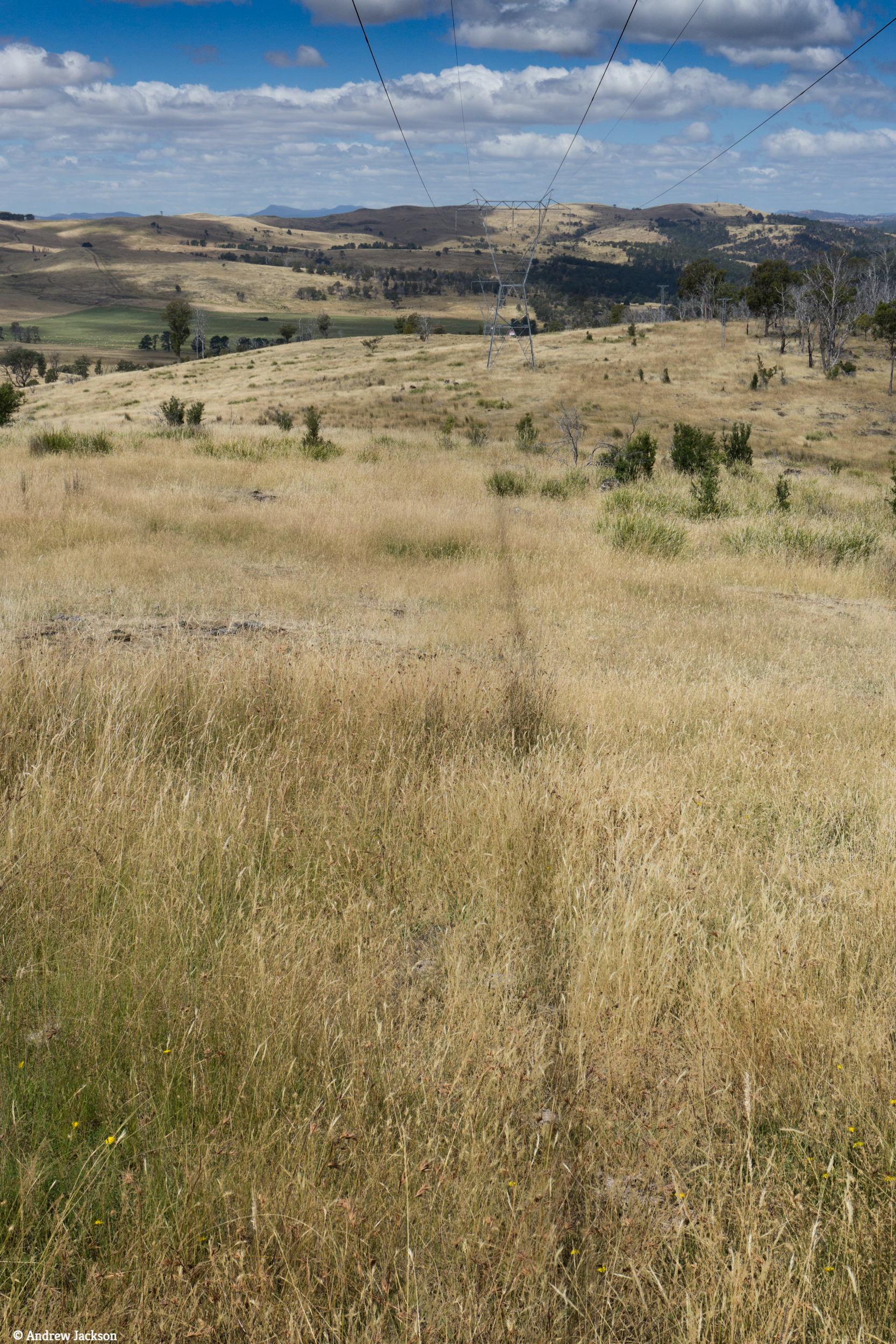
The day was glorious and the following panoramic photo captures some of that magic.

