Category Archives: Walking

The Comfort of Water – a River Pilgrimage

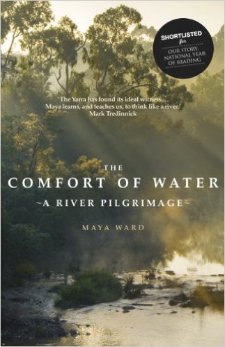
Maya Ward’s story of walking from the mouth to the source of the Yarra River in Victoria, Australia (The Comfort of Water – a River Pilgrimage, Transit Lounge Publishing, Yarraville, Australia) was published in 2011. Maya Ward says, ‘There were many reasons to start where the river meets the sea. We knew where the sea was, but we didn’t know the location of the source, so we needed to follow the Yarra to find it. We’d start from where we live and what we knew to walk into the unknown.’

The Comfort of Water book cover

This was a continuous walk over three weeks made with a changing collection of friends, backed by a support crew, and with an assortment of accommodation pre-arranged for the end of the each day.  Maya Ward undertook preparation prior to departure to the extent most of the landowners along the length of the River were contacted for permission to walk across their land.

The two main themes of the walk, and therefore the book, were the environment and indigenous practices and history (Birrarung in the Wurundjeri language).  Intertwined, were the author’s personal reflections and philosophy as well as some of her life story in which she seemed devoted to cultural and ecological political activism at a community level.

From time to time, the author offered simple ideas which I found very attractive. For example, ‘I liked the wind – it stopped us talking.’ … ‘A story is like the wind – it comes from a far off place, and we feel for it.  So says the Kalahari Bushmen …’, ‘Grandma knew, I think, of the comfort and the intimacy to be found among trees.’, and ‘The watching is just the start of something.’

I am pleased to have discovered this book because Maya Ward’s approach has made me consider that the history of Tasmanian indigenous peoples has not been evident in my posts during my walk along the Derwent River. In fact, I have been remarkably ignorant of the nature and practices of the original inhabitants prior to European settlement on the edge of Tasmania’s Derwent River in 1803. I am now interested to know more and it occurs to me that blog readers might also be curious.  To rectify this gap in my knowledge, I have set myself a new project (I do like projects) to find out if I can discover information relevant to the Derwent River that is reliable and authentic.

Unspeakables. Unmentionables.

Where ever we walk some sort of crime is likely to have been committed in past years, centuries, or millennia – that is, if the concept of crime is part of the culture.

In the past week, Tasmanian police have been hopeful for a breakthrough in the search for Lucille Butterworth, a young woman who has been missing for almost half a century, believed murdered.  Reports indicate that police ‘have the best lead yet with credible new information leading them to the lonely gravelled roadside area 8.5km from the Granton turn-off on the Lyell Highway’. The location is next to the Derwent River.

Having seen the latest news media photos, I remember walking this section of the road on my jaunt from Granton to New Norfolk. It was the section where no road verge offered protection from the traffic and I needed to walk on the tarmac.  No sign of human habitation.  Only vehicles with their racing drivers charging along the highway.  I had no clairvoyant moments that day – I never felt the presence of anyone interred in the land nearby.  But I hope the scientific and systematic exploration of the area between the road and the Derwent River will bring answers to the many questions which the family have lived with for decades.

Lucille disappeared at a time in history preceding the invasion of mobile phones.  By all accounts she waited for a public bus in Hobart’s northern suburbs but the bus never arrived so she accepted a ride with someone in a passing car.  These days, a person in a similar situation would simply phone a friend or a relative for help.

Should a blog reader have more information about Lucille Butterworth’s disappearance please contact Tasmania Police.

Lake St Clair and architectural awards

Previous posts have introduced the re-purposed Pumphouse that sits proudly in the centre of Tasmania.  When blog follower Ju alerted me to the 2015 Tasmanian Architectural Awards I was keen to follow up. I found the new buildings at Pumphouse Point on Lake St Clair won this year’s Commercial Award. You can glide over the glorious photographs at http://wp.architecture.com.au/tasawards/2015-awards/commercial-architecture/commercial-architecture-pumphouse-point/. The accompanying information includes words such as art deco, Tasmanian Wilderness, heritage, World Heritage Area – I hope these focussed your attention as they did mine.

Complete with 18 guest suites, a communal lounge area and a shared dining area, I find this development very attractive.  When I checked the website (http://www.pumphousepoint.com.au/) imagine my surprise to discover that of the 18 accommodation spaces very very few remain to be booked over the coming weeks.  Popular!!!  Yes.

I plan to stay for one or two nights as my reward for completing the walk along the Derwent River to Lake St Clair – one day when that happens (bring on the warmer weather!).  Can you blame me?

40 degrees south

The iconic magazine produced in, by and about Tasmania is Tasmania 40° South.

Details about the latest issue can be read at http://www.fortysouth.com.au/back-issues/issue/77. One current story highlights the cleverly re-purposed Pumphouse at Lake St Clair (the end goal for my walk along the Derwent River). The accompanying photos include mirror quality reflections across the lake – simply stunning.

Tas 40deg south mag cover

Each issue of the magazine showcases the wonders and diversity of Tasmania, the stories are always well written and accompanied by magical photographs.

It is possible to subscribe and receive each quarterly issue through the post, or purchase electronic issues – go to (http://www.magzter.com/AU/Forty-South-Publishing-Pty-Ltd/Tasmania-40%C2%B0South). For people planning to visit or to move to and live in this state, obtaining copies of this glossy magazine is a must. The information will inspire and orient you. Also, it will provide something wonderful to show friends and relatives.

While Tasmania may be located remotely at one edge of the world before the southern polar cap, it is an Australian state with startling natural beauty, a flurry of surprising international and community festivals throughout the year, clean air, the freshest of sea and land food, a rich and complex cultural scene, beautiful remnants of heritage listed architecture, and short travel times with easy access within the cities and throughout regional areas. In addition, Tasmania boasts valuable educational institutions (for example, our University of Tasmania is ranked in the world top 100 universities in the disciplines of Earth and marine sciences, top 150 for Agriculture and forestry, top 300 for Law and top 400 for Medicine).

Many residents and visitors to the state are lifted by a sense of vibrancy and vitality from the opportunities which Tasmania offers.  Technological and communication access to the world is a given from Tasmania, and a number of airlines fly in and out of Tasmania all day throughout the year.  In other words, we are easily connected to the world – when we are not out and about in Tasmania eating world class meals, participating in all manner of sports, or discovering more of the natural environment by walking, cycling, driving, swimming, diving, fishing or flying. Oh yes … and some of us work.

If you are wondering where the magazine title came from, consult your maps or have a look at https://en.wikipedia.org/wiki/40th_parallel_south.  You will see that the latitude of 40 degrees south passes through King and Flinders Islands the two most northern islands of Tasmania and therefore that line of latitude marks the northern extremity of this Australian state.

I wonder who of my blog readers, apart from Tasmanians, live somewhere near 40 degrees South (New Zealand, Chile, Argentina?).  And how many readers are living at 40 degrees North?

Bear Grylls guidance

Barely a newspaper or magazine doesn’t publish a story about Bear Grylls, so it seemed only reasonable that I find a way to incorporate him into this blog. His is a life of extreme adventures and fighting for survival in tough environments, so a peaceful walk along a placid river seems a long way from his favoured pursuits.  And none are documented.  However, it is Bear Grylls guidelines for daily life which are useful for me to recall even if the going is easy.  Some of these ideas are recorded below.

  • Make the first step – that should empower you to take more steps. ‘There’s great power in just beginning and committing to action, even when you don’t feel like it.’
  • Challenge yourself – ‘I believe we are like grapes and it is only when we are squeezed that we can see what we are really made of.’
  • Try something you’re afraid of – ‘My Dad inspired me not to be afraid to go for things and take a few risks.’ ‘Failure is never failure rather it is a stepping stone to success.’
  • Energise your day – ‘a little fresh air can do the world of good.’ ‘Almost all cities have some great iconic open spaces and parks. Use them.’

After reading this list, hopefully blog readers will be inspired to get out and about. I found another blogger at http://cdeanblog.blogspot.com.au/2012/04/derwent-river-flows-and-present-people.html referenced Bear Grylls when she faced her fears and descended the cliffs into the Blowhole at Blackmans Bay, located a few kilometres short of the mouth of the Derwent River near Hobart.  Good for her!

The Fish Ladder

Katherine Norbury’s new book surprised me (The Fish Ladder. A Journey Upstream Bloomsbury, London, 2015).

The Fish Ladder book cover

I was expecting a travelogue which described her walk from the mouth to the source of one river; of that which runs through Dunbeath in northern Scotland to the North Sea. The nature of the book was quite different. Although not a memoir or an autobiography, it was written in an autobiographical style which exposed the author’s activities and emotions experienced one summer, accompanied by flash-backs to significant deaths and other events.  Katherine Norbury undertook a number of walks over a summer and used these as the basis for the structure of the book. She wrote about walks along various watercourses and then in one chapter she traversed the edge of Dunbeath Water from the sea to an isolated inland Loch.

What might the book title mean in relation to her walks? Fish ladders are structures in rivers, designed to bypass dams, which allow migrating fish to make their way upstream. Perhaps the journey along watercourses away from the known to the unknown, was similar for the author to the process of moving through a fish ladder-like structure.  Perhaps Katherine Norbury used the walks as a way of moving around the obstacles of her strong memories and emotions.

Intertwined with stories of the walks were details of her life. But I wasn’t interested to read about her failed pregnancy, lost baby, daughter, husband, father’s passing, the changing value of the Euro, her own adoption, picnics with her mother, etc, etc.  I felt the author was using the book as a site to explore the challenges of her past life and her relationship with her daughter during the summer of the book. As a result, reading was hard going; I could not bring myself to read every word preferring to graze selectively.

When I focused on the chapter titled Spey, I found the author arrived in a small town late afternoon and was lucky to find one shop that could sell her a survival bivouac bag to carry her overnight sleeping gear for a short trek, and a map of the Dunbeath, Caithness area where she planned to walk from the sea to the source on the following day. The chapter which followed, titled Dunbeath, provides a record of the walk from the North Sea to the Loch Braighe na h’Aihbne, wrapped around a very long section describing remembered past events. Skipping the past stories, the imagery on the walk was magnificent. Three excerpts are given below as examples.

  • ‘While I was pondering on the meal I might make … I heard something.

At first I thought it was an effect of my being alone, a trick my ears were playing caused by the silence of the moor – I wondered if it was tinnitus. But it didn’t seem to be coming from inside my head, so I stopped a moment to listen. As soon as I stopped moving they descended.

Midges!

They filled my eyes, my ears, my nose and mouth with their pointy needle kisses. I breathed them, swallowed them, spat them out, batted at them, and then began to run.’

  • ‘I felt him before I saw him.… He coughed and then shifted his footing, and my nose burned with pungent musk. Lying very still, I lifted my face. The stag was standing just behind the crown of my head, his own head held high. His antlers filled the darkness above me; it was like looking at the sky through leaded panes. I could make out the deeper darkness of his body but he was too close, and it was too dark, to see his legs. He seemed unsure about what to do and then, sliding back his head … he delicately stepped down onto the track, and whether he stayed to drink or left immediately I will never know – because sleep again stopped my senses.’
  • ‘The loch. Its surface, soft as pewter, mirrored the clouds, Salt white boulders lined a powdery shore of crystal sand, unmarked and clean,  its whiteness stained to the colour of cork by the peat.’

Last April I wrote a post https://walkingthederwent.com/2015/04/05/travelling-to-the-river-source/ in which I urged readers to listen to a radio program and hear Katherine Norbury talk about this book. Subsequently, I purchased the book hoping to be exhilarated by the challenges and successes of her walk. Unfortunately, these were overshadowed by the indulgences of back stories. Dramatic culling of the non-walking stories would have suited me better and the size of the book could have been halved.  Without the expectation that this book was about walking a river, I would never have turned its pages. If you want to know more about Katherine Norbury, what she thinks and feels, and the significant things in her life then this is the book for you to read.

Piguenit – artist extraordinaire in southern Tasmania

The 19th century lady who wrote her story of a walk from Trial Harbour to Ouse (refer https://walkingthederwent.com/2015/06/20/a-story-of-a-walk-in-19th-century-tasmania/) mentioned Tasmanian artist William Charles Piguenit in her record of the events.

‘… had our first near view of the various peaks of the West Coast Range. From here we kept on rising till we reached the Government hut, 1,500 ft above and 15 miles from Strahan.  Here the first of a series of magnificent views met our eyes; beneath us lay a deep valley, forest clad for miles, and beyond, stretching as far away as the eye could reach, lay the range, its rugged peaks standing out sharply against the sky.

How it makes one long for the brush of a ready painter, to be able to place on canvas at least something to keep one’s mind fresh with the remembrance of all this beauty. Mr Piguenit is, I believe, the only artist who has devoted his time and labour to this district, and the results of his work are to be seen in the pictures now hanging in the Art Gallery of the Hobart Museum, and certainly the next best thing to visiting the West Coast is to see Mr Piguenit’s pictures of different scenes in that region.’

The collection of the Tasmanian Museum and Art Gallery (TMAG) contains a substantial number of his oil paintings.  Years ago I was employed by TMAG as an attendant and stationed in the upstairs ‘colonial’ gallery where the 19th century paintings were hung adjacent to marble sculptures and rare examples of early Tasmanian wood furniture. Back then I was a student of art history, and the establishment deemed me to be the expert amongst their collection of gallery attendants. They felt sure I would be able to help any visitor with enquiries about the collection on show.  One whole end of that 19th century gallery space was devoted to the work of Piguenit.  With much time on my hands to study each work of art, I fell in love with his dramatic descriptions of remote Tasmanian wilderness. But most surprising was that many of the very large oils, surrounded by beautiful carved frames, were compositions of the landscape in many gradations of grey when Piguenit had only chosen to use black and white paint.  Gloriously glossy. Unexpectedly stunning.  Tasmania’s inland environment had never been seen by most people (and still hasn’t been).

It was a surprise to me that I can only find online reproductions of these great paintings in a TMAG published catalogue raisonne of the work of William Charles Piguenit (http://www.tmag.tas.gov.au/__data/assets/pdf_file/0017/73142/piguenit_catalogue.pdf). Unfortunately, the document is incomplete and the images are very poorly reproduced – this booklet does the artist a great disservice. When faced with the paintings, the oils are truly majestic and have a similar power to mountainous work by artists such as Eugen von Guerard, Casper David Friedrich, and those from the Hudson River School such as Frederick Edwin Church.

The collection of the Art Gallery of New South Wales in Sydney holds some of his work including the following paintings (in coloured oils) which show aspects of Lake St Clair (the source of the Derwent River and the goal of my walk).

Mount Ida, Lake St Clair, Tasmania c1881

AGNSW Mount Ida Lake St Clair Tasmaniac1881

Mount Olympus, Lake St Clair, Tasmania, the source of the Derwent 1875

AGNSW Mount Olympus Lake St Clair Tasmania the source of the Derwent 1875

Have the invading Seastars been discovered by a mortal enemy?

Today I watched a family of Dominican Gulls at Howrah Beach on the Derwent River.

When the temperature rose, I meandered off towards the Derwent River beckoned by the thought of a peaceful walk along a beach (albeit one that I walked on an earlier stage of my trek from the mouth to the source of the River). By the time I reached the end of Bellerive Beach I was feeling very good about the world and so I continued around the point and down onto the people-less Howrah Beach.

The only life was a pair of adult Dominican Gulls and their three immature offspring fishing.

Two surprised me.  From a distance I could see that one adult and one immature were active on the sand where the wash of gentle waves covered their feet from time to time. Each had food of some sort which they couldn’t seem to swallow.  How they tried!  When I walked closer, it was clear both birds were playing with exotic Seastars, with their five brightly orange-coloured arms.

20140904_094156

The immature bird played with a tiny starfish, while the adult focused on a much larger version.  While I watched, both birds battled with their prey, sometimes getting it into their mouth then usually it was disgorged immediately. The shape of bird throats and the shape of the food source were seemingly incompatible. Apart from the challenge of five thick arms which are not particularly pliable, the surface of the starfish is a little knobbly, so I could not believe the birds would have any success getting them ‘down the hatch’.

But then my mouth dropped open in amazement. The immature bird suddenly swallowed his Seastar.   Gulp.  And s/he waded off looking for more. Now that was a feat!

You can read more about these invading starfish in earlier postings at: https://walkingthederwent.com/2015/03/31/pacific-seastars-are-multiplying-in-kangaroo-bay/; https://walkingthederwent.com/2014/09/14/northern-pacific-seastars/; and https://walkingthederwent.com/2014/09/05/stage-2-on-492014-mitchells-beach-email-4-of-14/.

After today’s experience, I wonder whether the Dominican Gulls are finding these Seastars sufficiently tasty so that they will seek them out deliberately.  Perhaps these Gulls will become the natural predator to help reduce the Seastar plague on our native species.  But it looks like hard work to me. Not a comfortable swallow.

Walking the Nile River in Africa

Overseas followers of my blog may have already seen the four part series documenting a recent walk from the source to the mouth of the Nile River – I can see on the internet it was screened in some countries earlier this year.

This Thursday on WIN TV around Australia, the first hour will be screened from 8.30pm (Eastern Standard Time).  How thrilling!  What a wonderful opportunity to immerse myself in such a journey albeit from the comfort of my couch.

Former British soldier, journalist and now explorer, Levison Wood started out in the African country of Rwanda and walked northwards through 5 other countries until he reached the Mediterranean at the northern edge of Egypt. This epic journey covering upwards of 4000 miles, took about 9 months after starting in December 2013 and finishing later last year.  Lev Wood has written a book of these travels.

Levison Wood Walking the Nile book cover

Websites including http://www.levisonwood.com/, https://twitter.com/walkingthenile; and https://www.facebook.com/WalkingTheNile provide additional information about this extraordinary achievement. Isn’t it marvellous that in this day and age, people can still undertake ‘pioneering firsts’ on this planet? “Everything” hasn’t been done already.

Australians, I urge you to join me on the couch this Thursday night to begin to see the challenges faced by this inspirational walker.

Hobart to Lake St Clair in 1850; mostly by foot.

Another of the stories published in Hilary Webster’s compilation: The Tasmanian Traveller A Nineteenth Century Companion For Modern Traveller, recorded the Journey of F.J. Cockburn who on foot travelled ‘From Hobart to Lake St Clair and Return’ in 1850.

The Tasmanian Traveller

Cockburn seems to have been the butt of nonsense advice when he asked around for the best time of year to walk from Hobart to the remote inland Lake St Clair, which is located roughly in the centre of Tasmania. He tells ‘I received replies which induced me to start on May-day.’  By that time of year, temperatures are plummeting and the further you progress away from the coast of Tasmania the more the rain settles in.

He took a steamer to New Norfolk and then it rained for 4 days.  On one of these early walking days he found an essential bridge had been washed away with the deluge. His crossing was memorable. ‘The river remained impassable until 7th, when by letting a long ladder down from the remnant of the bridge onto the ruins of one of the piers, I was able to cross, like a monkey, before an admiring audience’.

Miles later he ‘stopped at a little eating house, in a damp situation surrounded with wet fields …” What was wrong with F.J. Cockburn’s powers of perception?  All the weather signs indicated that proceeding further at that time of the year was a bad idea.  Then came more reasons for abandoning the walk; ‘the last six or seven miles of my day’s journey was along a regular wild bush road, affording admirable opportunities for murder and robbery.’

Despite these factors, F.J. Cockburn persisted with his journey. After losing his way at one point he came across a hut with two shepherds who fed him mutton chops, damper and tea. “My bed was formed on the floor near the fire, of sheepskins, and I was very thankful that it was too cold for fleas.”

When he reached Lake St Clair, his appreciation of the lake was stymied. ‘The sides of the lake being covered with dense forest, almost impenetrable, it cannot be seen to advantage without a boat, and boat there was none.’

Cockburn summed up his experience of Lake St Clair as ‘certainly a gem in its own way. It is as fine as any Scotch lake of its size, excepting in the beauty of the foliage on the banks. It was a wild and striking scene.’

F.J. Cockburn carried a satchel weighing ‘about twelve pounds: one shooting coat, waistcoat and trousers; one pair of shoes; three shirts; three flannel waistcoats; three pairs of socks; three handkerchiefs; one pair of braces; one neck-tie; one travelling dressing case – and when I started, half a pound of “nailrod” tobacco.’  I can’t help wondering how small this man was – these days the clothes on this list would weigh much more for the average sized walker.

He concluded ‘on the whole I was pleased with my trip; the roads were bad, the country wet and the air cold, but on the other hand, the grass was more vividly green than at any other time, the air was clear and crisp, there were no fleas, and walking was pleasant in the cold.’

Long-term followers of this blog know that I found the start of my last walk (in April) from Bridgewater/Granton to New Norfolk way too cold. This led me to the decision to put on hold any further walking towards Lake St Clair until Springtime when the temperature starts to climb towards summer.  I am in awe of walkers around the world who like being cold and wet and find pleasure in achieving walking goals in such environments.  Perhaps I am too soft!

A story of a walk in 19th century Tasmania

In the late 1980s, Hilary Webster compiled a book of short stories written by people who travelled around Tasmania by foot and by horse and carriage in the nineteenth century; The Tasmanian Traveller A Nineteenth Century Companion For Modern Travellers.   Thanks to blog follower Ma, I was alerted to this publication.

The Tasmanian Traveller

These stories helped me to understand the difficulty of travel in early colonial Tasmania when roads were not always developed. Some stories surprised me so that I feel inspired to visit Tasmania’s State Archives in order to discover more.

A standout was the story of a walk from ‘Trial Harbour to the Ouse” because the journey relates to some of the area over which I may walk later this year when I restart my walk along the Derwent River.

Trial Harbour is an isolated tiny community on the west coast north of Queenstown where, these days, the few shacks are built with the strangest chimneys to cope with the weight of the westerly winds which blow fiercely from across the Indian Ocean. The Ouse refers to a small town, then hamlet, somewhat south of the centre of Tasmania and situated most remotely from civilisation.  Back then, it took a day’s coach and train ride to reach Hobart. These areas and the land between is an exceptionally rugged environment today and I have difficulty imagining the situation in the 19th century when the walk in the story was taken.

The subtitle of the 1890s story was ’A Lady’s Walking Tour on the West Coast’. A woman (no name) walked with her husband and a dog through ‘untamed’ wilderness, along mining and forestry tracks and the occasional muddy rutted roads.  They climbed mountains, crossed button grass plains and walked through valleys.  She recorded “More than once we were asked our business, the notion of travelling on foot for pleasure in these regions appeared preposterous.” I would say such a walk is extraordinary in this day and age, and totally amazing 125 years ago.  Innovative means were taken to cross rivers. Overnight accommodation was found in out of the way tiny remote mining shops, shacks, huts and the occasional Inn. Telegraph wires were often their only guide for a way forward. Through the rugged wilderness, routinely they walked 17 or more miles (27+kilometres) each day and on one day they walked 33 miles (53 kilometres). I am staggered.  I know the challenging environment in which they walked.  The mountains are many and very steep with ravine and river gullies that are cut into the rock deeply.

Her pack of provisions weighed 7 pounds while her husband carried 21 pounds.  This makes me wonder if contemporary bushwalkers aren’t tough enough – or are we trying to be prepared for every eventuality. The good will of people they met and the willingness of others to share their meagre food supplies, and help with sleeping arrangements, was perhaps something that could be taken for granted in 19th century Tasmania. Generous hospitality as a given.  ‘We got some bread here, and at a house a mile further on the track, some milk, the first fresh milk we had tasted since Waratah.’  This comment indicates she was walking across Tasmania before Trial Harbour – the significant mining town of Waratah is quite a distance north east of Trial Harbour.  So I suspect there may be earlier stories of her walking across other parts of Tasmania – I look forward to conducting research to find records of these.

Reasons. Pleasure. Walking.

My world of blogging has allowed me to ‘meet’ fellow bloggers with all their different projects, ideas, aspirations and enthusiasms. Today’s posting in the blog titled ‘100 years walking’ expresses so vividly the reasons for walking in a posting titled ‘Why do you do it to yourself?’

I felt sheer joy reading it.

Please read the post at: https://100yearswalking.wordpress.com/  To access the story click on the top left photo which is headed with the title I gave above. Then sink back into the photos and the theme, and enjoy.  Perhaps even be motivated to get out and go somewhere: around your block, around your town, or further afield.

The first piece of travel writing?

Simon Armitage, in his book Walking Home (Faber & Faber 2012), put modern day walking projects into perspective when he looked back into history to find the earliest record of something similar.

He settled on an account written around 700-800 B.C., titled The Odyssey about Odysseus (Ulysses) the King of the island of Ithaca off the west coast of Greece, who took a decade to travel a comparatively short distance back home after fighting the Trojan war in Troy.  This was a sea voyage; not a walking trip. Nevertheless I can understand Armitage’s choice because Homer has been described as ‘the best story teller in the world’ (E.V.Rieu, 1980, Homer The Odyssey, Penguin Books.

Sculpture of Homer

(Above: a marble bust of Homer displayed in the collection of the British Museum. Apparently, this sculpture was carved in the first or second century A.D in Italy.)

Simon Armitage says ‘The Odyssey is one of the greatest works of western literature, and also one of the earliest, a sort of bedrock or foundation on which many subsequent stories are built. In what could also be described as one of the first pieces of travel writing, The Odyssey is presented as a poem, written by Homer, who may or may not have existed, and tells the tale of Odysseus’s exhausting and beleaguered return from battle.’

Through subsequent centuries, Homer’s work inspired others to write both fictional and documentary style travel stories. You can read a translation of his epic at http://classics.mit.edu/Homer/odyssey.html. If you want an entertaining crash course in the story, try viewing:  https://www.youtube.com/watch?v=MS4jk5kavy4

For a bit of fun for those who learn visually, you can interact with a map of Odysseus’s possible travels at: http://www.classics.upenn.edu/myth/php/homer/index.php?page=odymap

Walking Home-the Pennine Way

During Tasmania’s current winter days I am using my time to read books with a travel theme, and mostly those involving a significant walk.  These books both inform and inspire me so that I eagerly look forward to the warmer spring weather when I will be able to continue walking to the source of the Derwent River.

I am thankful some local followers of my blog have alerted me to titles and, in some cases, loaned me their books. Thanks to Ma, my current read is Simon Armitage’s book Walking Home (Faber & Faber 2012).

Walking Home Simon Armitage

In this easy-to-read record, Armitage offers anecdotes and describes his reaction to the walk, the dramatic terrain, the endlessly misty, ferociously windy and inclement weather, the people who walked with him on occasion, the animals, and much more. Through his very entertaining writing style I have come to understand the 256 mile long Pennine Way in England via each step he took as he tramped from the northern to the southern end during 19 days of continuous walking.

The logistics of this walk were well-researched and involved pre-arranged poetry readings each night when he reached each day’s destination in villages, farm cottages, churches, people’s houses, hotels and all manner of other buildings. One of his dry unused walking socks was handed around at the end of each reading and the audience was asked to contribute funds. Simon set out to survive only on the income he could generate in this way. He was so well received that around the journey’s half way point, his wife and daughter came and relieved him of a heavy weight of coins: at the same time they took away a load of very wet and muddy clothes.

I live in a part of the world where rain is not so common, and impenetrable mist is rarely a feature. By contrast, when in summer Simon Armitage walked the higher hills and ridges of the Pennine Way, they were often shrouded in mist and, when the tracks sometimes petered out Simon, would lose his way for a while, become thoroughly drenched and, while trying not to become demoralised, persist in finding his way even if unnecessary miles were covered.  This was an arduous adventure taken one step at a time and I felt a real sense of joy coming from the author as he met each challenge, and as the miles passed. He became both physically and mentally stronger.

Whether or not, you enjoy walking, if you like to be carried along by a book and feel an immense sense of pleasure from reading something which is well written, then add Walking Home to your wish list for reading material. This book made me laugh and certainly lifted my spirits.

A long distance walk

Hundreds of dedicated long distance trails have been defined over the centuries or more recently in different parts of the world.  To the east, across the ocean from Tasmania, lies the very beautiful country New Zealand and today I learned that a walking trail Te Araroa extends the length of the country over 3068km.

In 2013, Australian Laura Waters completed the trek often walking solo in some of the most challenging parts of the country.  Currently she is writing a book about the experience but, in the meantime, you can read her blog of the walk at http://soultrekkers.com.au/blog/.  An interview with her has been transcribed at http://www.newzealandonfoot.com/catching-up-with-a-te-araroa-thru-hiker.

The June-July 2015 issue of the magazine Great Walks Australia’s Bushwalking Magazine includes an article with glorious photos and her 10 tips for managing such a walk.  I was interested to learn she carried 18kgs at the beginning of her walk, and only 12 kgs at the end – obviously having become more ruthless about what was essential. Laura Water’s trek is another example of someone making their dream happen.  When she says ‘You’re capable of more than you think” and “don’t let fear get in the way of progress. The reality is often never as bad as you imagine it to be”, I hope this will inspire you to seek out your own projects, however large or small and pursue them with a passion – wherever you live, or wherever you travel.