Tag Archives: Tasmania

How did Hobart’s Derwent River get its name?

Dan Sprod’s information for the Centre for Tasmanian Historical Studies was a great help in understanding that our Derwent’s (http://www.utas.edu.au/library/companion_to_tasmanian_history/R/River%20Derwent.htm) European discovery was made during the second (1793) visit to what is now the island of Tasmania, by French explorer Bruny d’Entrecasteaux. The given French name ‘Rivière du Nord’ never took hold. When Englishman Lieutenant John Hayes arrived in April 1793, he was unaware of d’Entrecasteaux’s visit two months earlier, and named the river after the Derwent River in England.

Great Britain’s Derwent River flows through Cumbria, a sparsely populated non-metropolitan county in the north west of England.

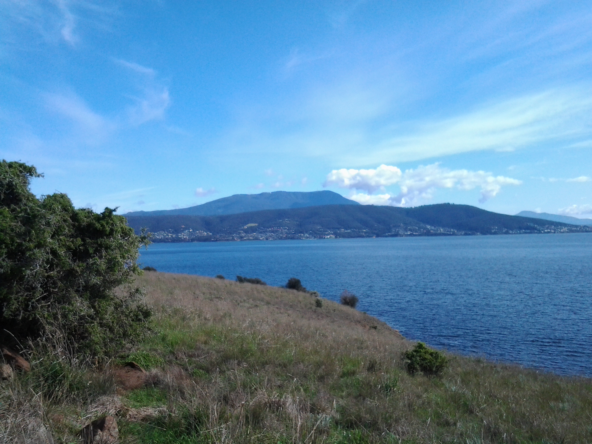
Cumbria contains the famously beautiful Lakes District, and presents as a combination of mountains, rugged seashore, parkland and rural landscape. In the early eighteenth century, the landscape and climate similarities between Cumbria and our island’s river backed by the stunning Mount Wellington make it easy to understand how our river came to be named.  In England, the name Derwent is derived from a Celtic word for “oak trees”.  Australia and Tasmania do not have native trees with the same leaf and character as English Oaks. However the heavy thick forests with large stands of trees either side of Tasmania’s Derwent River, would have made a strong impression on Lieutenant Hayes.

The Cumbrian Derwent flows westwards towards the Irish Sea; the city of Workington sits at the mouth. Google Earth includes photos of a mountain, powdered with snow, showing similarities with our Mount Wellington at cooler times.  I imagine Lieutenant Hayes would have been away from England for many months, if not years, and so his ability to make direct comparisons between his English and our river would be based on hazy memories.  Notwithstanding this, when I look at a current photo of the Derwent in Cumbria, the landscape has a character similar to our local environment. Of course, the landscape and its features at both locations will not be the same as when seen in the late 1700s. However and despite the passing of centuries, I can see how and why Lieutenant Hayes chose to name our river, the Derwent.

But what about the man; what was Lieutenant Hayes connection with Cumbria and the Derwent River?

The Australian Dictionary of Biography (MUP Volume 1 1996) notes that Sir John Hayes (1768-1831), naval officer and explorer, was baptized on 11 February 1768, the son of Fletcher Hayes of Tallentire on the River Derwent, England. On 7 December 1781, when 13, he joined the Bombay Marine as a midshipman on the Bombay. By December 1788 he was promoted to second lieutenant and his rise through the ranks continued over the years. Hayes is best remembered for a private voyage undertaken between February 1792 and December 1794. Glowing accounts of New Guinea’s economic potential fired Hayes to lead an expedition financed by some Calcutta merchants. On 6 February 1793 the Duke of Clarence (250 tons) and the Duchess of Bengal (100 tons) left Calcutta, India. Because of adverse winds Hayes could not sail direct to New Guinea, so at the young age of 27 years, he decided to voyage round New Holland (this was the original European name for Australia). He reached Van Diemen’s Land on 24 April and left on 9 June. During that time, he discovered and named the Derwent River, and other features of the terrain. Risdon Cove and Cornelian Basin still bear the names he gave them. According to the publication “British Heritage of Tasmania’, (http://members.iinet.net.au/~rwatson1/britishheritage/BRITISH%20HERITAGE%20OF%20TASMANIA.pdf

Hayes named Ralphs’ Bay (a beautiful bay which I have mentioned during both my first and second stage of walking along the eastern shore of Tasmania’s Derwent River) at Lauderdale, after William Ralph who was in charge of the Duchess of Bengal.

While I would like to think that the City of Clarence (the eastern shore city of the Greater Hobart Area and the one in which I live) must have been named specifically after the ship which Hayes’ commanded, this apparently isn’t true.  It seems that the City of Clarence was named after King William IV of the United Kingdom who as he ascended the throne was titled His Royal Highness, The Duke of Clarence and St Andrews. However, let’s look at this a little more closely. In 1843, Prince William (the future King William IV crowned in 1830) began a career in the Royal Navy by becoming a midshipman at 13 years. In 1789 he was made Duke of Clarence, and then retired from the Navy in 1790.  The elements are: the future king is a naval man who held the title of Duke of Clarence before Lieutenant John Hayes (who started his naval career as a midshipman) set out from India towards Australia. Travelling to Tasmania, Hayes just happens to be in command of a ship named the Duke of Clarence in 1793. How did his ship get the name?  Considering the timing, surely Hayes ship was named in honour of the new Duke of Clarence (the Sailor King or Silly Willy as the future king was known). I would prefer to believe that the name of today’s City of Clarence lying along the eastern edges of the Derwent River, is a reference to the ship of the man who named our River, and only indirectly refers back to the early title of King William IV.

Northern Pacific Seastars

A couple of weeks ago, on some of the beaches in the northern section of the South Arm peninsula, I located some seastars (orange pronged starfish) and threw them up onto the dry sand so they could no longer breed and multiply. I recorded that these seastars had infected our Tasmanian waters and were a proliferating pest. Today’s Sunday Tasmanian newspaper has published an article about the seastars’ new enemy: the University of Tasmania’s Diving Club.  Recently members of the club have been conducting a clean out of the waters at Blackman’s Bay (located across the Derwent River from the South Arm peninsula) – and doing so in a more humane way than I was.  Apparently a species of spotted handfish used to be common in these waters but is now rarely seen.  The divers hope that this fish will return once they rid the area of the seastars.

20140904_094156


Stage 2 on 4/9/2014 Summing up Email 14 of 14

I arrived at the Opossum Bay shop at 9.10 am to start Stage 2 of the walking journey, and I caught the return bus (number 638 with a transfer onto bus number 632 at Lauderdale) across from the shop around 2.05 pm.

Between times I walked approximately 10 kilometres.  However, Stage 2 only represents around 4 kilometres of the length of the Derwent River. Adding this to the 7 kms covered in Stage 1, I have now covered 11 kms of the 249 kilometre long river.

I am persuaded that no-one could complete Stage 1 and 2 on one occasion to fit within these bus times. For someone to replicate my journeys two separate trips are required. Alternatively, one longer visit could finish with a return to Hobart on the bus which departs Opossum Bay near Shelly Beach at 5.55 pm.  Unfortunately this latter option would probably leave you with lots of time to fill in waiting for the bus; this eventuality would need to be expected and planned for.

As a post note, in 1995 the Gellibrand property was acquired by the state, on behalf of the people of Tasmania and in 2011 the area was declared a nature reserve and named Gellibrand Point Nature Recreation Area. I feel excited to have walked the trails and found my own way around, for the friendly people I met, the stunning views, the fascinating history, and the discovery of another part of Tasmania, one footstep at a time.  And all for the cost of a couple of bus fares.

 The photo below was taken from Gellibrand Point, Stage 2’s destination. It looks across the Derwent River towards Hobart city with Mount Wellington behind.

20140904_110649

Stage 2 on 4/9/2014 William Gellibrand’s convicts Email 8 of 14

Researchers, Penelope Marshall and Alan Townsend, have written “The Convicts of South Arm” (available from http://www.ccc.tas.gov.au/webdata/resources/files/The%20Convicts%20of%20South%20Arm.pdf) which offers information and insights.  Here below are some examples of workers on Gellibrand property.

  • John Asgill, a labourer and shoemaker from Coventry in England, was transported aged 19 years for stealing gowns and frocks. He arrived in November 1836 and worked for William Gellibrand until 1841, when he absconded and was caught across on the other side of the Derwent River at Sandy Bay pretending to be a free man.
  • Lydia Hines was tried in London in 1821 and sentenced to 14 years for felony. Despite standing 4 feet 11 and ¼ tall, she was impudent and insolent. Lydia was assigned to William Gellibrand in 1825. She spent six months at South Arm as his domestic servant before being returned to the Female Factory in South Hobart (currently open to tourists) for ‘insolence’.
  • Edmund Musk arrived in Hobart on 16 May 1832, married with five children (he and his wife had a further 10 children while at South Arm. John the eldest son drowned in Ralphs Bay while loading a boat. Their daughter Susannah drowned when a boat capsized at Rokeby.). Edmund was transported for stealing ‘beans and barley’. He was assigned to William Gellibrand, where his skills as a ploughman were used. He later gained his ticket of leave and leased a farm from the Gellibrand’s. By 1858 he was farming 120 acres at South Arm, and employing convicts himself. Edmund Musk is buried at St Barnabas’ at South Arm. The Opossum Bay bus passes this church. It is located on the left as you head back towards Hobart on the South Arm Road, after you have left Opossum Bay and not long before the South Arm Cenotaph corner is reached.
  • Thomas Kimble was transported in 1844 for the highway robbery of 1 ½ sovereigns. He received 15 years at His Majesty’s pleasure. After serving as a probationary convict at Maria Island isolated off the east coast of Tasmania, Kimble was employed at South Arm by George Gellibrand (William’s grandson) during the harvest time. His record lists him as a farm labourer who could plough, a shepherd and a hop grower all useful traits to establish the new colony. Thomas’s distinguishing features were a tattoo of a Mermaid on his left arm, a woman with a glass in hand on his right arm and the bust of a woman on the back of his right hand. He received a ticket of leave on 30 March 1852.

James Cumberland was sent to Sydney from his native home of Walthamstow in England for stealing geese but gained his Certificate of Freedom in 1827. In 1846, following his conviction for the manslaughter of his pregnant wife under the ‘spiritual influence’ of public house liquor, James was transported to Hobart for life. In Van Diemen’s Land, James worked for George Gellibrand at South Arm where he died from heart disease on 19 June 1853 aged 53.


Fort Direction memories

My posting about Fort Direction prompted the following response from a friend:

“Well in 1961, and I can’t find any reference to it on Google, the Fort Direction site was lent to the Methodist youth whatever to have an Easter camp and I was there.  I can remember the chapel and the kitchens etc and my friend Sue and I wandered far and wide and kept coming across rolled barbwire fences that kept us in rather than let us out.  We ventured as far as Roaring Beach which impressed me no end.  Christian youth camps in the 50s and early 60s were the hotbed for discussion especially philosophy and I can remember one of the groups that camp, discussing objectivity and subjectivity.  Lots of the brightest students went to these camps.

And this is when I first saw Ralph’s Bay as we travelled at dusk in a bus to South Arm and Fort Direction.  Over the years I thought this image of the tidal flats, so different from my experience on the north west coast of Tasmania, was something in my imagination. So when I had moved to live in Hobart and was exploring to buy a place, imagine my excitement when I found that very image and it was la de dardle!!!!”  (Or, as the map lists it, Lauderdale)