Category Archives: Tasmania

St Clair Lagoon signage

Interpretive signage work needs to be introduced, and current signs rationalised; at least made consistent.  Within metres of each other stood the two signs below:

 20160104_080414.jpg

20160104_080152.jpg

The third sign focuses on the needs of anglers but not on general tourists.

20160104_080445.jpg

One on-site map helps people get their bearings. However, I guess because the water level is generally low, the island close to the St Clair Lagoon Dam which appeared before me as an extensive well-established vegetated outcrop, cannot be seen on the map below.  As a result, visitors may feel disoriented.

20160104_081416.jpg

Four signs exist at St Clair Lagoon. I am disappointed the Derwent River as a whole and the fact this is the River’s source isn’t recognised and celebrated.  The St Clair Lagoon area seems only to anticipate visitation from fishermen who do not have permission to fish here.  A short gravel road detours to the Lagoon Dam from the main gravel road that leads to Pumphouse Point, but no signs have been installed to let people know what they will find if they take the detour, nor the significance of the St Clair Lagoon dam for the Derwent River.

A 215 km river is not a small or insignificant waterway. The Derwent River, as Tasmania’s most iconic river, provides a major marker of thousands of years of social, economic and natural history. In the coming weeks, I plan to communicate with everyone who has influence over the writing and installation of signage and interpretation.

Glistening waters and the final push to the source of the Derwent River

I watched the Derwent River scampering along playfully.  Youthful. The source was nearby.

20160104_075336.jpg

20160104_075414.jpg

Enjoy the sound of the rushing waters in my short video near the River’s source.

I walked northwards towards the St Clair Lagoon dam, and the first of the Derwent River waters flowing beneath the baffles, showed themselves.

20160104_075514.jpg

20160104_075644.jpg

20160104_075651.jpg

20160104_075654.jpg

This was the time for a selfie and, as usual, it was grossly unflattering – but the moment called for it.  I had reached the source of the Derwent River.

20160104_075844

This striking moment, as are all moments, was impossible to grasp.

While I tried to absorb and ingest the atmosphere of the place with all its aboriginal and non-aboriginal histories, my mind was so muddled I forgot to breathe. Then I felt compelled to take deep and long breaths but was too excited to inhale more than a couple of shallow breaths.  I felt I should stop, stand or sit and never leave yet at the same time I felt I must move on.  I wasn’t sure what to look at nor what to think about. That the natural environment was powerfully enduring despite man’s intervention, reminded me I was like a small scratch on the surface of this land.

Yes – I had arrived at my destination. Finally.

I was amazed that walking the Derwent was possible, not for all people, but definitely possible. That what I had commenced as a whimsical and unresearched idea, had been realised as an epic adventure.  One step at a time.

Of course, I remembered sections of the River had yet to be walked but they were few and I sensed that if I didn’t worry, then each would be achievable in the coming days. I could see it was much more satisfying to enjoy the present and not to plan the future. Only then did I feel like I was blossoming with the profound pleasure of the cool morning, the clean air, the colourful and complex natural environment,and my arrival at the Derwent River’s source. This was one of the most significant moments in my life.

20160104_080317


20160104_080022


The road to Pumphouse Point

I turned right onto the road to Pumphouse Point rather than continuing on to Cynthia Bay, the main settlement at the southern end of Lake St Clair.

20160104_073545.jpg

The discrete sign to the hotel allowed the environment to dominate.

20160104_073807.jpg

I followed the quiet gravel road northwards.

20160104_073812.jpg

In taking this road it is important to realise you have entered a national park, and that you need to pay for the privilege.

20160104_073859.jpg

20160104_073910.jpg

Before long I passed by a sewage treatment works, although one without a name or identification. A delicate odour gave notice.  I think that now I have walked passed every treatment works on the Derwent River – I am not sure if medals are given out for that sort of achievement.

20160104_074609.jpg

20160104_074727.jpg

Then the bush was my only companion with the Derwent River seemingly running through the trees.

20160104_074731.jpg

Along the route, tracks of various qualities diverged to the River every few metres or so.

20160104_074907

20160104_075212.jpg

20160104_075216


The winding River

Between the Lyell Highway and the source of the Derwent River the River winds back on itself time and time again.

Sometimes a mesh of dense bush separated me from the Derwent River, and at other times I could dip my hands into the water. The opportunities to get a good look were variable, but in the early morning sun, all views were richly rewarding.

20160104_071147.jpg

20160104_071220.jpg

20160104_071232

20160104_071414.jpg

20160104_071425

20160104_071421

20160104_072038

20160104_072325


Starting out for the source of the Derwent River

I turned north and walked off the Lyell Highway along the road leading to Lake St Clair and other locations including the source of the Derwent River.  As I walked beside the River, I revelled in the colours of that pure water, and in the mystery of its twists and turns.

20160104_065538

20160104_070604

20160104_070745.jpg

The water clarity was such that I could see the bottom of the River easily.

20160104_070613

I passed an area designed for helicopters to land. There were none waiting, but I heard and saw many flying around every day giving tourists a bird’s eye views of the terrain.

20160104_070849.jpg

I loved the sign alerting drivers to be aware of walkers. The one below amused me because it was placed about 1 or 2 kms from the Lyell Highway and it occurred to me that if walkers were on the road after the sign then they had to be on the road before the sign as well. Like me.

20160104_070921.jpg

Then there was one of my favourite tall-story telling signs.

20160104_071036

This sign suggests our Tasmanian Kangaroos are larger and stronger than a car.  While mainland Australia has some giant sized ‘roos, our Tasmanians grow to a more modest size. However, in any collision, while our kangaroos won’t pick up a car, the power of the contact as they jump into the car’s path can send a car careering off the road perhaps towards a tree, or severely dent it, and personal injuries may result.  That is, both our kangaroos and our wallabies can unexpectedly cause major vehicle accidents.  By the way, our wildlife do not know what we write on signs. When a sign alerts motorists to be aware between dusk and dawn, they may be forgiven if surprised by an animal running or hopping on the road at other times of day.  Motorists must expect a rare occasion when a ‘Jonathan Living Seagull’, a maverick, an animal demonstrating great independence will suddenly appear.

On a more pleasant note and through my walk, the early morning birdsong was a delight. Listen to their crystal clear sounds on this video.

The Derwent River at Derwent Bridge

Having enjoyed showers, easy cups of tea and a comfortable bed, I woke early and was walking before 7am. It was cool so I wore a hat and jacket.  I noted the evidence of cold winters when snow lies on the ground and sometimes blocks the highway.

 20160105_074035.jpg

If you want to buy land in Derwent Bridge, a package of 3 lots is for sale.

20160104_064355.jpg

Signage on the Lyell Highway is clear.

20160104_064517

20160104_064646

In the early light of day, the Derwent River glowed. The water was warmer than the air temperature causing a draft of steamy fog to float above the water.

20160104_064714.jpg

20160104_064830.jpg

20160104_064731

20160104_064738

20160104_064749

20160104_064844

20160104_064854


Derwent Bridge

Located 174 kms west of Hobart on the Lyell Highway, the town of Derwent Bridge extends about a kilometre from one end to the other and contains a scattering of private houses and a handful of small businesses. This tiny township takes its name from the bridge in its midst which crosses the Derwent River.  Lake St Clair sits to the north and Lake King William to the south.

I love writing Trip Advisor reviews (as Crocodillus) and after returning to Hobart from Derwent Bridge I wrote four: my accommodation at the Derwent Bridge Cabins, the food experience I enjoyed at Hungry Wombat Café , the Derwent Bridge Hotel, and the Wall in the Wilderness .  A description of these is not particularly relevant to this blog so, if you are interested, I have provided the links to my reviews with a few photographs.  I am happy to answer any email enquiries if you are considering visiting Derwent Bridge.

I stayed in Derwent Bridge for two nights (buses to Hobart do not travel every day) and every chat, communication, look that I experienced with another person was full of positive energy, good will, happiness, and this made the time pass so easily.  It did not matter whether I was connecting with the Cabin owner or her cleaner, the bar and meal staff at the Hotel, the wait staff at the café, or the owner and others at the Wall in the Wilderness, everyone was upbeat and the services the businesses provided were excellent.

In addition, I met many interstate and overseas travellers, almost all of them walkers who had been journeying either on the Overland Track from Cradle Mountain to Lake St Clair, or had been walking some of the day or longer walks in the vicinity of Lake St Clair.  The effect of continuing kind weather on walkers, the fact that their walks had introduced them to environments which they found profoundly beautiful, and their plans for future walks and discoveries were the catalyst for everyone to buzz with vitality. Infectious.

Update – identifying snakes

Recently I published the post Snakes Alive.

Today I have been informed that the snakes I saw in recent walks would not be the White Lipped Snake or Whip Snake because the size of the snakes I saw is too large; rather those I saw are likely to be juvenile Tiger or Brown snakes.  I cannot find any information or photographs showing or describing an immature snake that matches what I have seen.  Are there any blog followers who know their Tasmanian snakes?  If so, I welcome feedback.

Showing me the way to go

Through the bush near the town ship of Derwent Bridge, many tracks criss-cross the landscape and I can see that some might get lost – and the maps do not show all tracks. However, no walker should have a problem if s/he remembers that going downhill will either bring him or her out onto the Derwent River or onto the Lyell Highway.

Nevertheless, when I came across a series of stones arranged into an arrow pointing along one track, I chose to believe it was the best track to take.

20160103_115813.jpg

Of course it was a risk to trust the arrow, because the stones could have been arranged for other purposes rather than to get someone to the town of Derwent Bridge by the shortest route.  I was pleased that sometime later, the Lyell Highway was in front of me albeit with a padlocked gate between us.  When I walked onto the road and looked back, this is what I saw.

20160103_122429.jpg

That was the first and only sign between Clark Dam and the southern end of Lake King William and this gate that indicated I was walking on private land which I should not be on.  Too late!  I have arrived.

The Derwent River was not far away. It is located between the gate and the Derwent Bridge Hotel 250 metres westwards.

20160103_122451.jpg

I was elated because I arrived in Derwent Bridge a day earlier than I expected.  A lovely surprise.

The marks of man

Lake King William, the electricity transmission lines and their towers, the cleared but regrowing areas surrounding them, and the nearby 4WD vehicle tracks changed the landscape from its original form and I spotted other signs of non-aboriginal intervention in the bush.

As I was closing in on civilisation again, while nearing the town ship of Derwent Bridge, I noticed a felled log beside the track with saw marks.  What struck me as strange was the way more than one straight length of timber had been sawn from within the tree trunk.

20160103_111222 20160103_111222

Not a letterbox

When walking through the bush from time to time you see tree stumps with a horizontal man-made slit.  These were not letter boxes for use by the old European settlers.  Rather they were part of the process to fell huge ancient trees. Where I was walking, the trees would have been felled to clear a path for the electrical transmission power lines and the 4WD track.

20160103_101610.jpg

These notches were made in the days when strong men wielded axes with accuracy and extraordinary bush knowledge. This was before chain saws: the massive girth of many trees would have rendered such equipment useless. In addition, such tree clearings were in an area too remote for massive machinery to access, even if it had existed.

At its simplest, the process can be described as: first the axeman cuts a small slit in the tree trunk then jams a board into the gap.  He (and I have never heard of a woman doing this) jumps up onto that board. Then he creates a new slit higher up the tree, grabs a second board and jams that into the new slit.  He jumps up onto the second board and releases the first board, rests it across the one on which he stands, and then he cuts another slit higher up. The process is repeated until he is sufficiently high to start cutting a 45 degree notch which will help the tree fall in a certain direction.  After a while, the axeman descends and repeats the process up the same tree from another angle, then continues on cutting the notch until the top part of the tree sends signs that it will fall. At this point, in order to stay alive, he jumps down the tree as quickly as he can and moves a distance away being careful not to be struck by any other vegetation or tree than is inadvertently brought down at an unexpected angle.

From this practice has grown the international sport of wood chopping which includes a competition on tree felling.  The image below from the Queensland Archive shows how this looks in the sporting arena.

Queensland_State_Archives_5507_Tree_felling_contest_at_the_Royal_National_Show_Brisbane_c_1958 (1).png

Did you know the first wood chopping competitions were held on the north-west coast of Tasmania (not far from where I was born)? These days the competitions have become an international event.  To see how it all works in practice, at least in competitions, I suggest you have a look at a local competition in Canada on You Tube

Snakes alive

In recent walks (Nearing Derwent Bridge from Lake King William, and between the Florentine River and Wayatinah), I have been surprised to see two examples of one of Tasmania’s venomous snakes the White Lipped Snake, also known as the Whip Snake.  What I saw was a delicate slender olive greenish brown snake with soft looking velvety skin.  You can refer to the Department of Primary Industries, Parks, Water and Environment’s site for more information.

The first snake was close to a metre in length and calmly meandered across the stony track, about a metre in front of me, as I descended towards the town of Derwent Bridge. The second snake was just under half a metre in length and was lying on the gravel road in the greenish shade – something made me look down and I realised I was only a couple of steps from standing on it. Naturally I stopped, apologised for my intrusion, stepped away to the other side of the road, and the snake in its own good time, calmly and slowly slid off into the bush away from me.

The length of my snakes is greater than that which the above government website suggests for the standard length. Mine were very slim but long.

These experiences have now made me doubt a ‘fact’ which I had always believed.  The ‘fact’ is that snakes feel the vibration through the ground of something coming towards them and then disappear because they are fundamentally shy and do not seek confrontation. The website listed above suggests the Whip Snake is shy but my experience is at odds with their information.

A chat with another walker recently reminded me that wearing gaiters is a protection against snake bite on the lower legs.  I had forgotten that important use – I was only thinking of wearing them in muddy conditions.  If you don’t know what they look like, then the Paddy Palin website, for example, show a range of gaiter styles.

Trackless under the powerlines

My map of the Lake King William area showed the 4WD vehicle Switchyard Track restarting on the northern side of the plain on the far side of the power line ‘clearway’.  I believed if I walked westwards under the powerlines then eventually I would see clearings through the trees and locate the track.

20160103_090805.jpg

In my previous post I introduced the deeply compressible mossy plant that prevented rhythmic walking.  All the pale green vegetation in the photo above is that soft spongy moss.  Admirably beautiful to behold but challenging to walk across.

Our world is full of thoughts about ‘mindfulness’ and ‘being present’.  Walking this section required 100% concentration. I was forever present as I focused on the ground checking where my next step might be placed. I stumbled along for seemingly ages until I noticed a row of rocks unnaturally placed at the tree line.  That had to be a marker for the track.  It was. Relieved, I was soon following the track westwards.  I remember taking many photos of the dense forests either side of that track, but obviously I did not properly make the click because there are no photographs. I remember the air was clean and cool. Delightfully fresh. Eventually the track emerged from the forest and continued for a short distance next to the plain. The photo below which looks back inland, clearly shows the extensive depth of that plain.

20160103_091132.jpg

Still parallel to the plain, the track ran westwards towards the water of Lake King William.

20160103_091137.jpg

Soon I was surrounded by forest which, in normal climate conditions, would be a wet forest.

20160103_092129 20160103_092145

Occasionally I could look southwards and see out over the plain to Lake King William.

20160103_093105

Eventually I found great vantage points to look back inland.  I suspect that had I been able to walk across the plain to this point, I would not have needed to battle through the button grass, moss and spiky plants.  But I remembered this spacious landscape might, on other days and after considerable rain, be a sheet of water.

20160103_093447 20160103_093450

20160103_093455

A while later I could see the Derwent River flowing into the northern end of Lake King William.

20160103_094120

20160103_094225

Then I began the uphill climb on, what the maps marked as, an incline topping 800 metres. I realise that the Lake and river would not be at sea level, but in my mind I wanted the exaggeration because it made me feel like I had achieved a major climb once I reached the top.  Silly, I know.  But these are some of my inconsequential mind games.

20160103_094625

20160103_103642.jpg

20160103_103256.jpg

On the way up I deviated through a complex rain forest. Gentle. Beautiful. In the second photo below the Derwent River can be seen as a washed out blue line through the trees – my tablet camera cannot cope with lighting extremes.

20160103_095126

20160103_095353

Majestic tall straight trees amazed me at every turn.

20160103_100523

20160103_101147

By placing one foot over the other and enjoying the bush sounds, the top of the hill was gained.  What an extraordinary morning had passed: from starting the day packing up the tent and collecting fresh Lake water to drink, to battling my way across challenging vegetation, farewelling Lake King William, reuniting with the undammed Derwent River, to climbing a relentless hill with all the unexpected visual pleasures that provided.  I felt clean of mind and spirit. Refreshed. Alive. And grateful.

Rise and shine

At 6 am, my day started with soft clouds. And it was cool; just perfect for walking.  It was only later, around midday, that I removed my jacket.  Each of the sky, the water of Lake King William and the air seemed silvery. Perhaps I was influenced by the beautiful soft grey colours of the driftwood and dead trees. Serenity.

20160103_072947

20160103_072950.jpg

Before departing my camp site, I filled my water bladders with Lake water. Later, when staying in Cabin accommodation at the town ship of Derwent Bridge, I poured some water into a sparkling clean glass.  I was surprised. The water was crystal clear.  No sediment. No wriggling larvae.  As I thought; this was pure water.  Marvellous!

Time sped fast while I slowed down. It was 7.30 am before I started walking.

It wasn’t long before Mount Charles stood ahead to the north. I knew I needed to find a way to walk around its left-hand side.

20160103_080612.jpg

The night before, from the rocky shore I could see Charles. In the photo below, at some distance to the left of the Mount I picked out a U shaped cut in the landscape.  From the map, I knew the electricity transmission line pathway passed through that gap.

20160103_072923

I expected to walk in the regrowth up that hill. In a direct line, approximately 2kms separated my camping site from the foot of that hill. Between the two locations the map indicated a swampy area.  Google Maps show a water-filled bay. No crossing tracks are evident.

What Google Maps show:

Google map of swampy area

What I saw from the south eastern end:

20160103_082040.jpg

What I saw from the north western end with a sliver of Lake King William in view:

20160103_093105.jpg

What I saw from the north western end looking inland back towards where I had crossed:

20160103_093450.jpg

I imagine you are thinking this ‘plain’ which was once filled as part of the Lake, would be easy to cross, and that it would take me no time.  Well my story is different from those expectations. I took three hours to cover the 2kms from the camping spot to the foot of the hill with the transmission line . Despite my experiences, I visualised my progress and could see the funny side.

The story starts as I walk towards Mount Charles and will be detailed in the next post.

Death and Lake King William

Fairly early in my walk along the eastern edge of Lake King William, when I neared the power transmission lines, signs such as the following were posted.

20160102_174916.jpg

I have no idea how close one must be to incur death, and therefore the concept of a ‘near approach’ is rather meaningless.  However, because I saw the 4WD track crossing under the power lines from time to time, I guessed that walking along these tracks wouldn’t bring on my early demise, well at least not from electricity jumping about. And so I live to tell tales.

Later in the walk when I approached another sign, the combination of the sign and the vista created a special message.

20160102_180613

The way my simple mind worked was this:  Lake King William is a man-made lake damming the burblings and gurglings of the infant Derwent River. The purpose of the Lake is to enable hydro-electricity power generation. The Lake drowned the native vegetation and dead trees are the result. The Danger sign alerts people to the danger of death from the electricity pouring through the wires overhead. The making of electricity kills and electricity itself is a killer.

As I walked, I thought a lot about the conservation needs of our forests and our contemporary way of life needs.

On the one hand, I can imagine the sorrow and despair that some will have when seeing the photos of the dead remains of old forests jutting out of the land as the Lake’s water level drops. I guess some people would wish this dramatic change to the original landscape never happened.

On the other hand, most people want to click lights on at night, recharge their technological devices, and have a refrigerator to keep their food cold and safe, run a washing machine, boil water and cook food. Without electricity (which is always generated using some natural resource), our contemporary lives could not continue. Hydro power is cleaner than coal power, and not dangerous like nuclear power.  If we must have electricity, which resource source should we use?  The creation of wind turbines changes landscapes and uses large quantities of processed mineral resources.  Equipment to support the gathering of solar power also uses processed mineral resources. If we choose to live as we have become accustomed, then ancient forests will be continue to be lost either directly or indirectly. There are very few who would give up the use of anything made from or using electricity.  I wonder if it is even possible to do so absolutely in first world and most third world countries.

Looking for a place to camp overnight

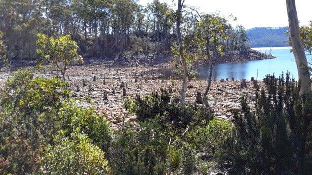
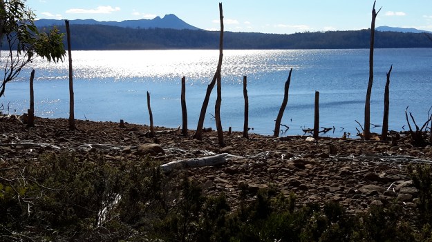
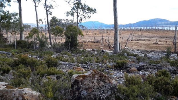
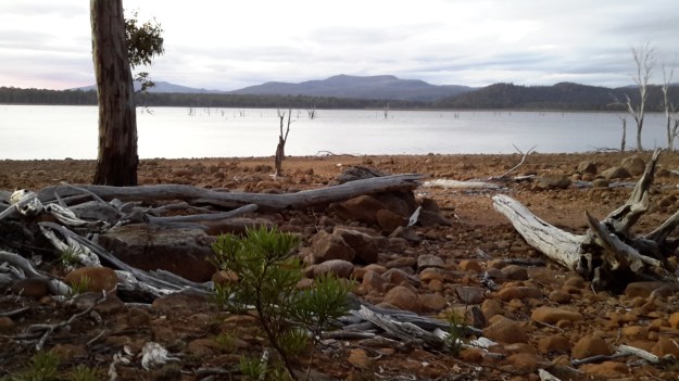
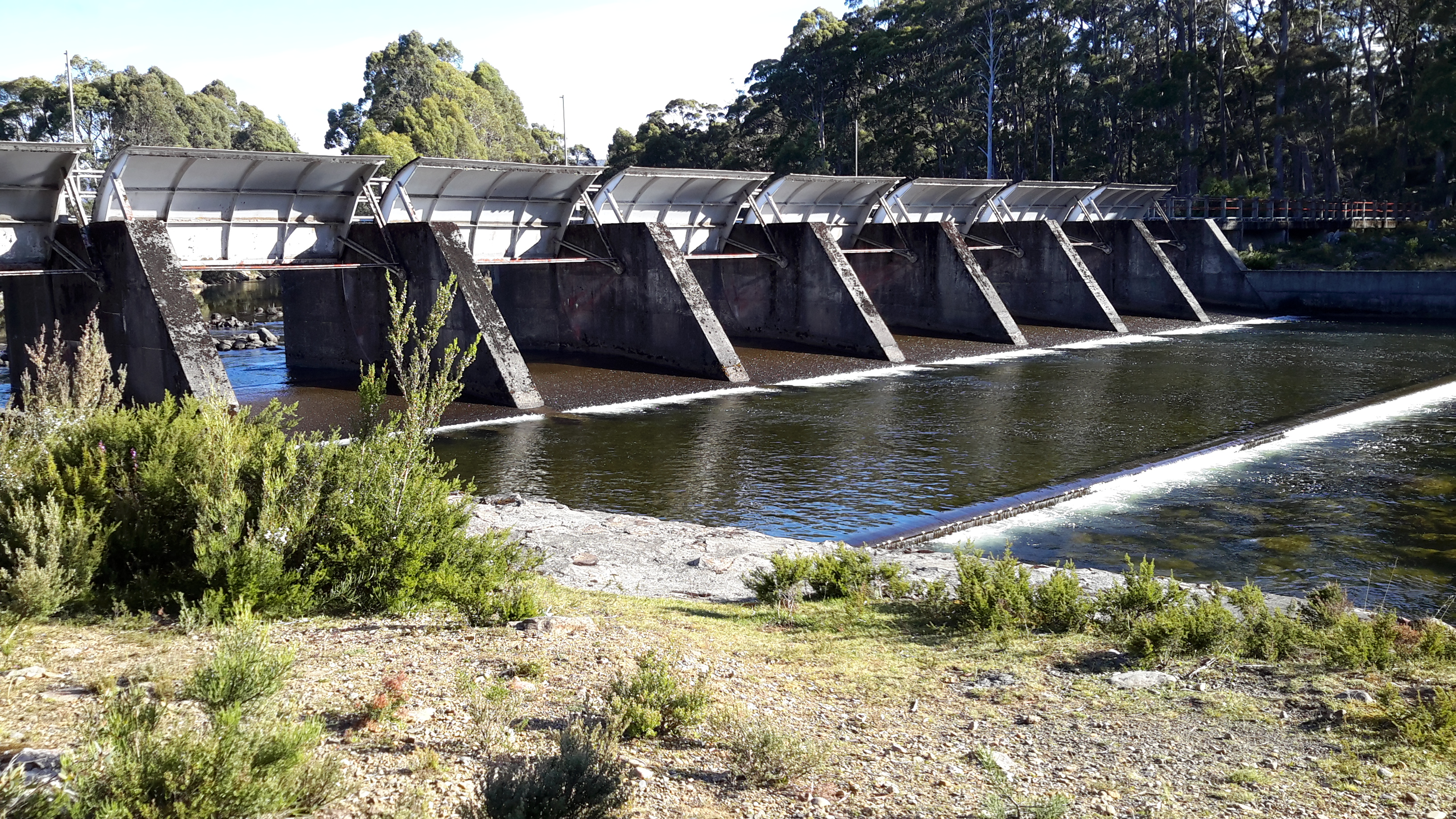
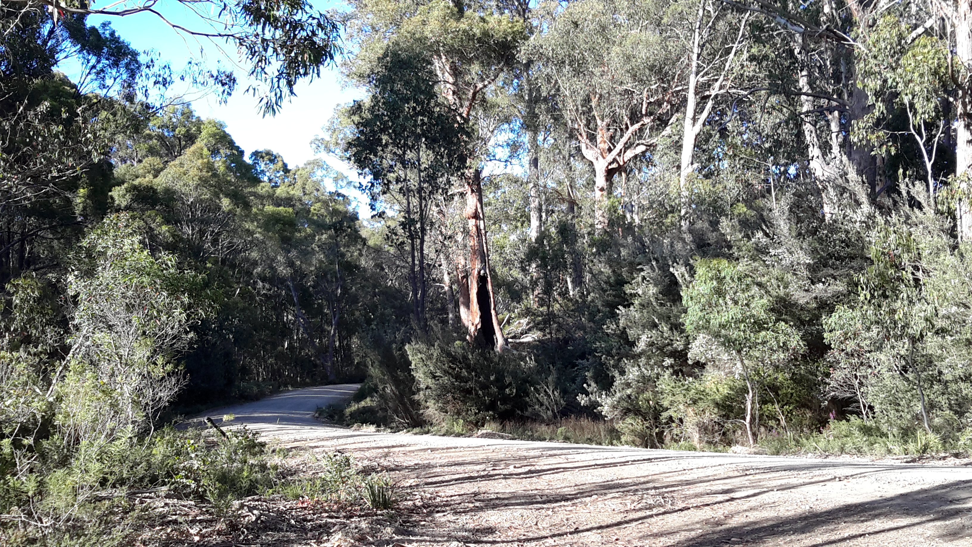
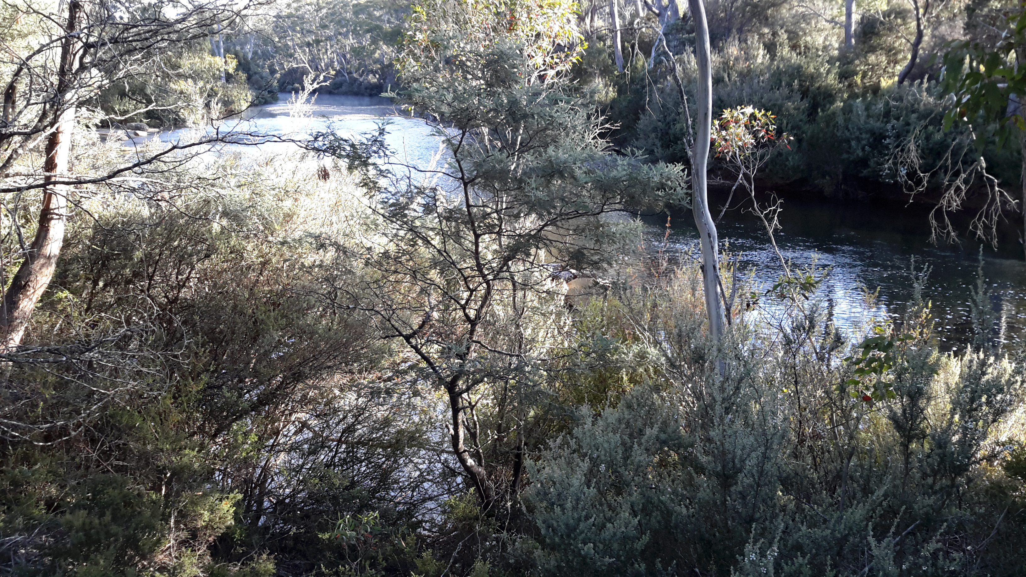
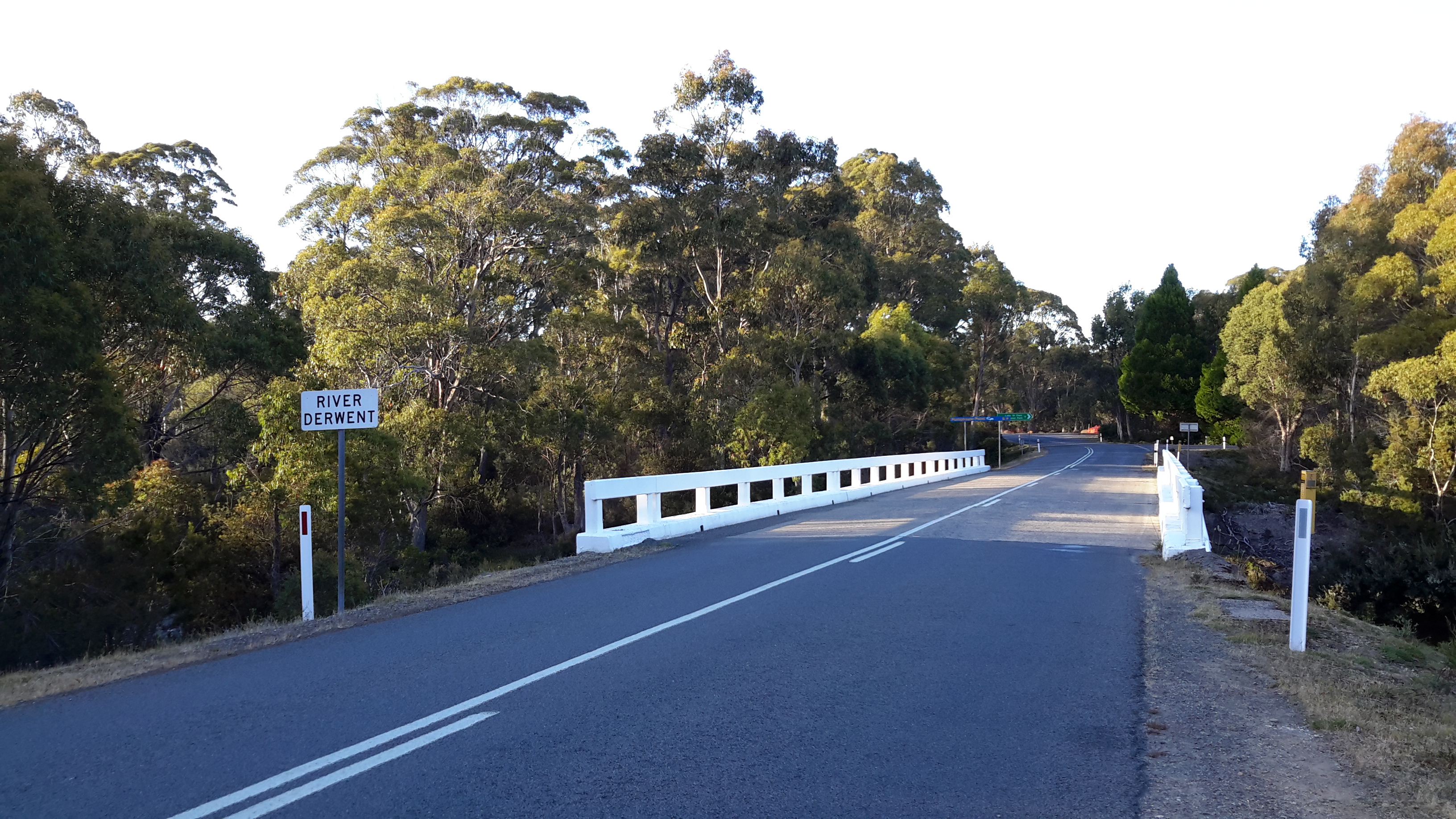
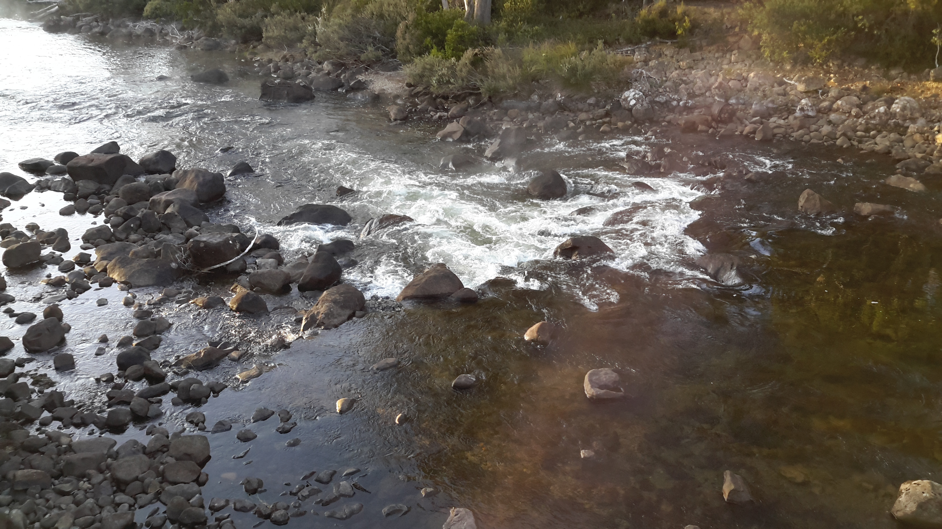
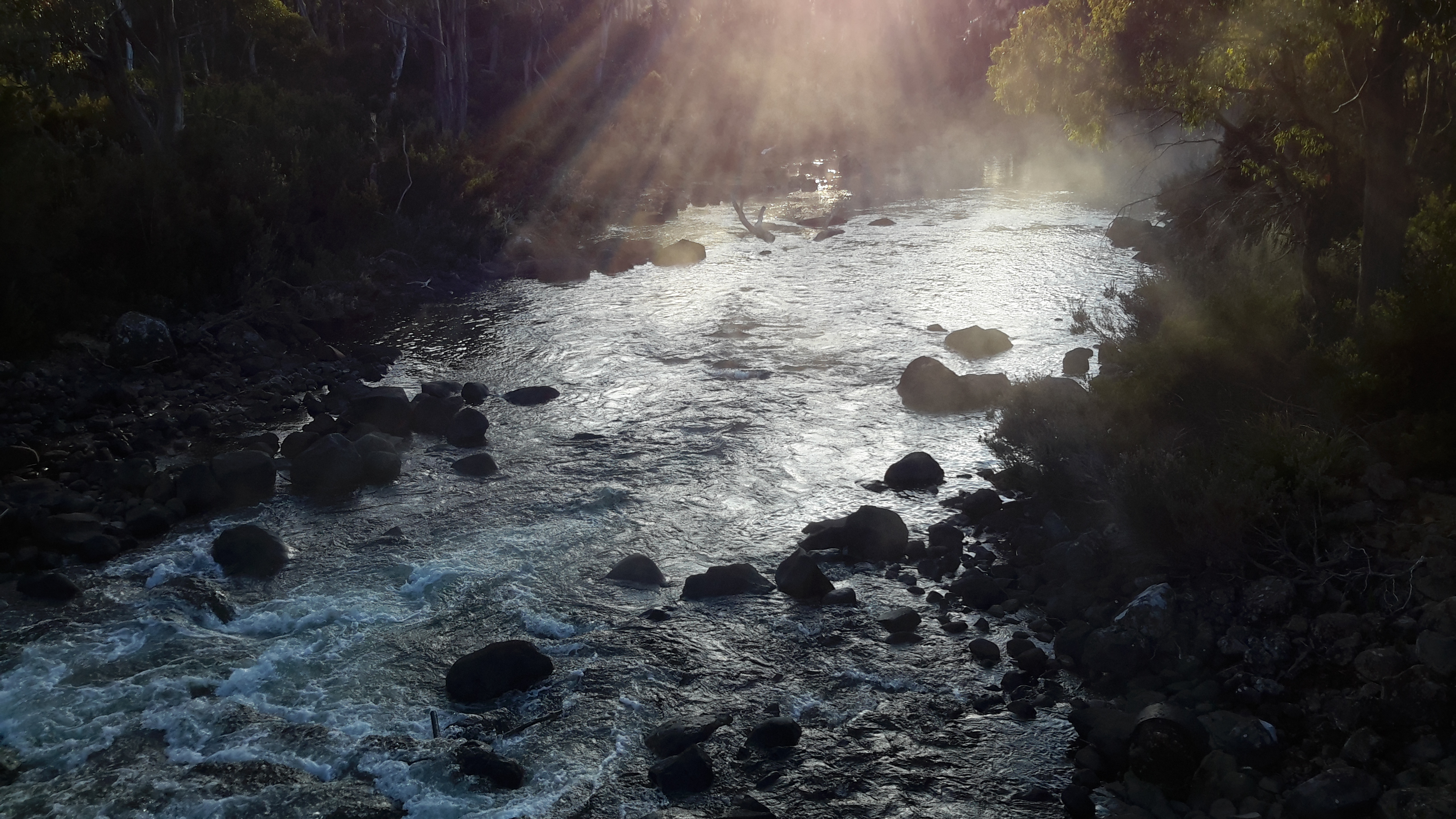
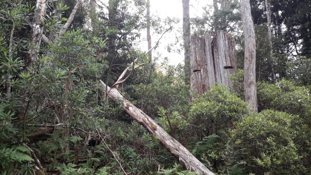
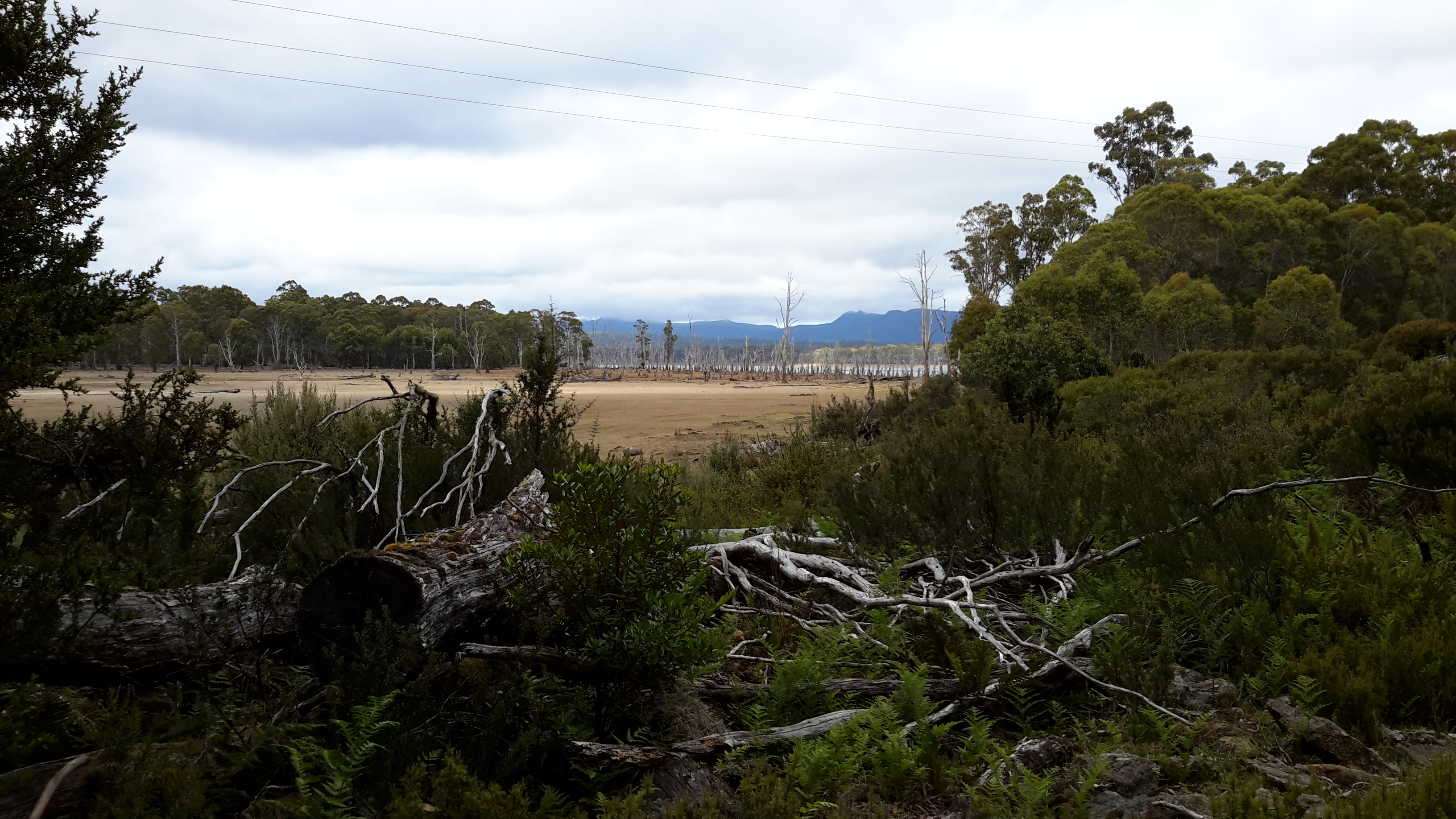
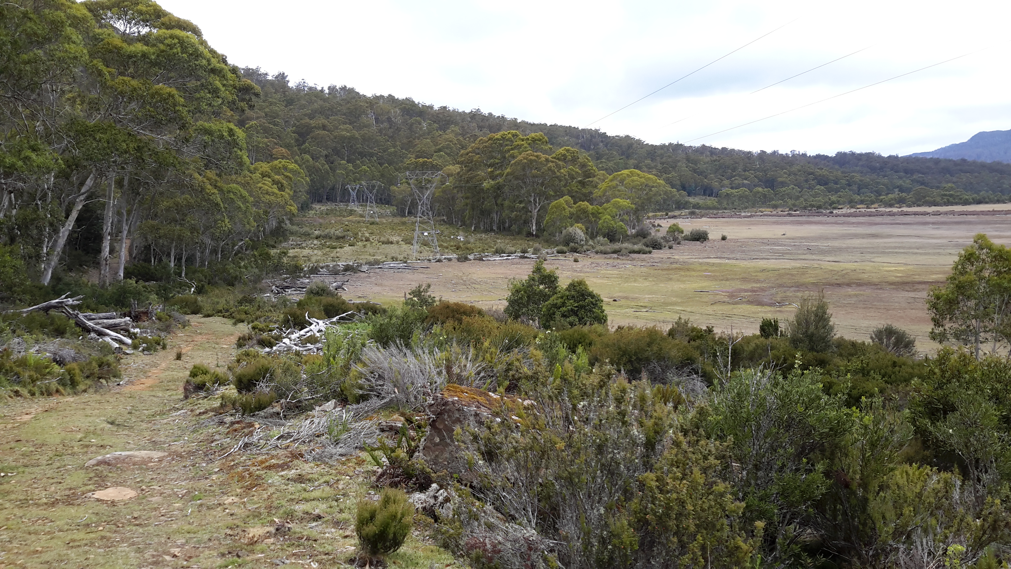
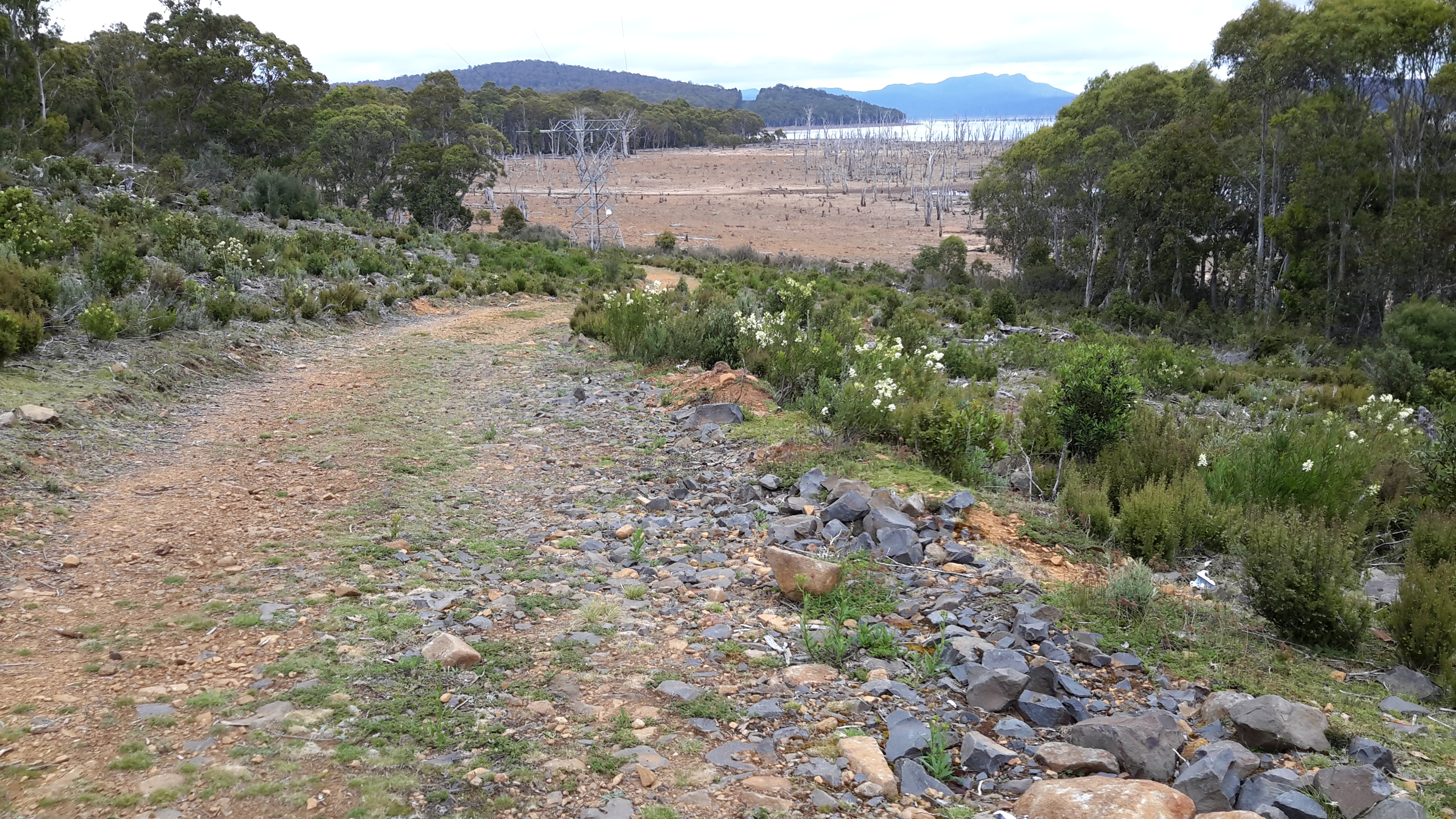
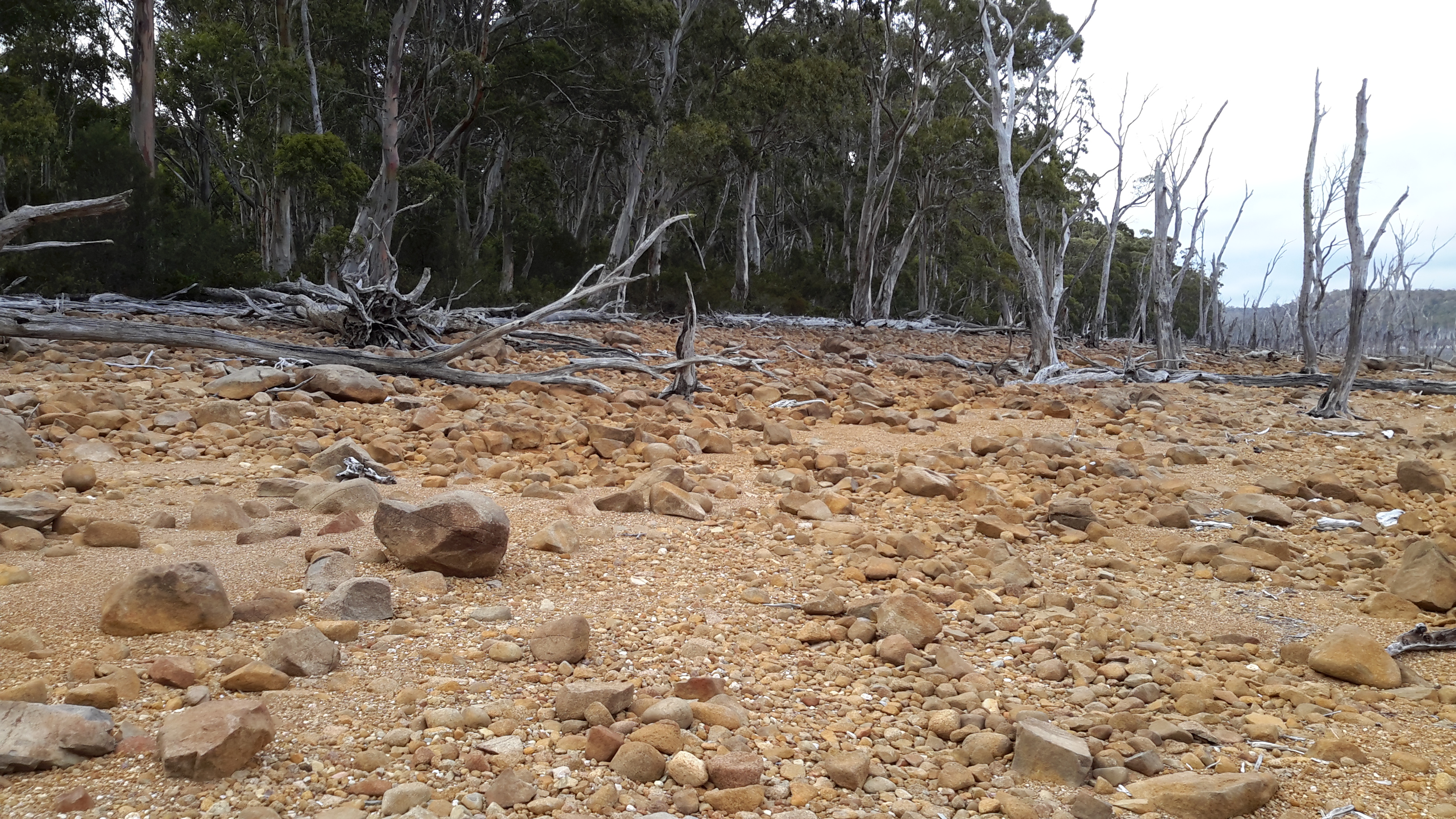
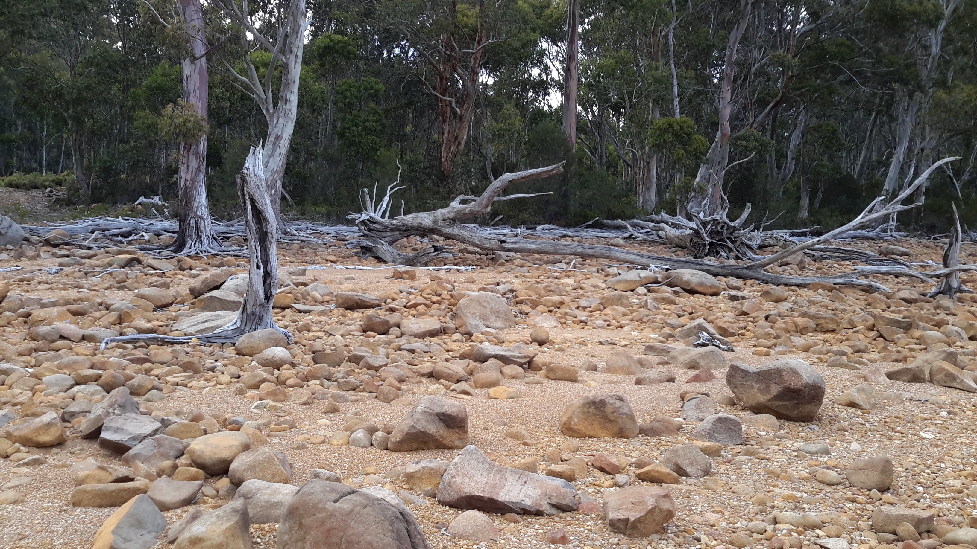
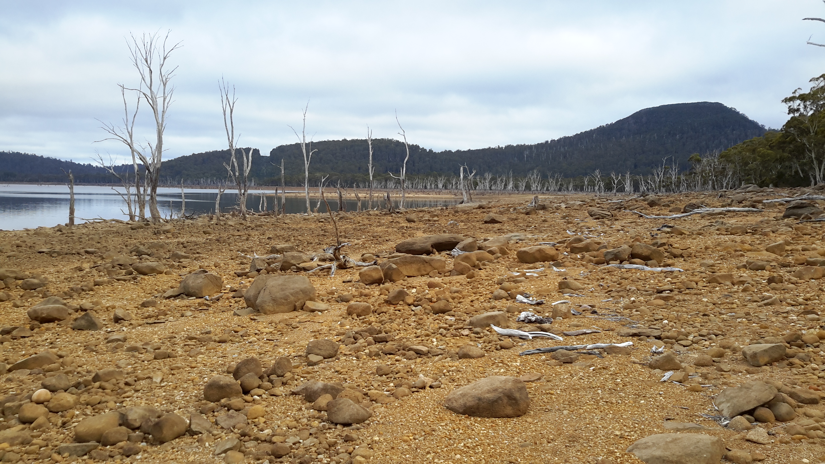
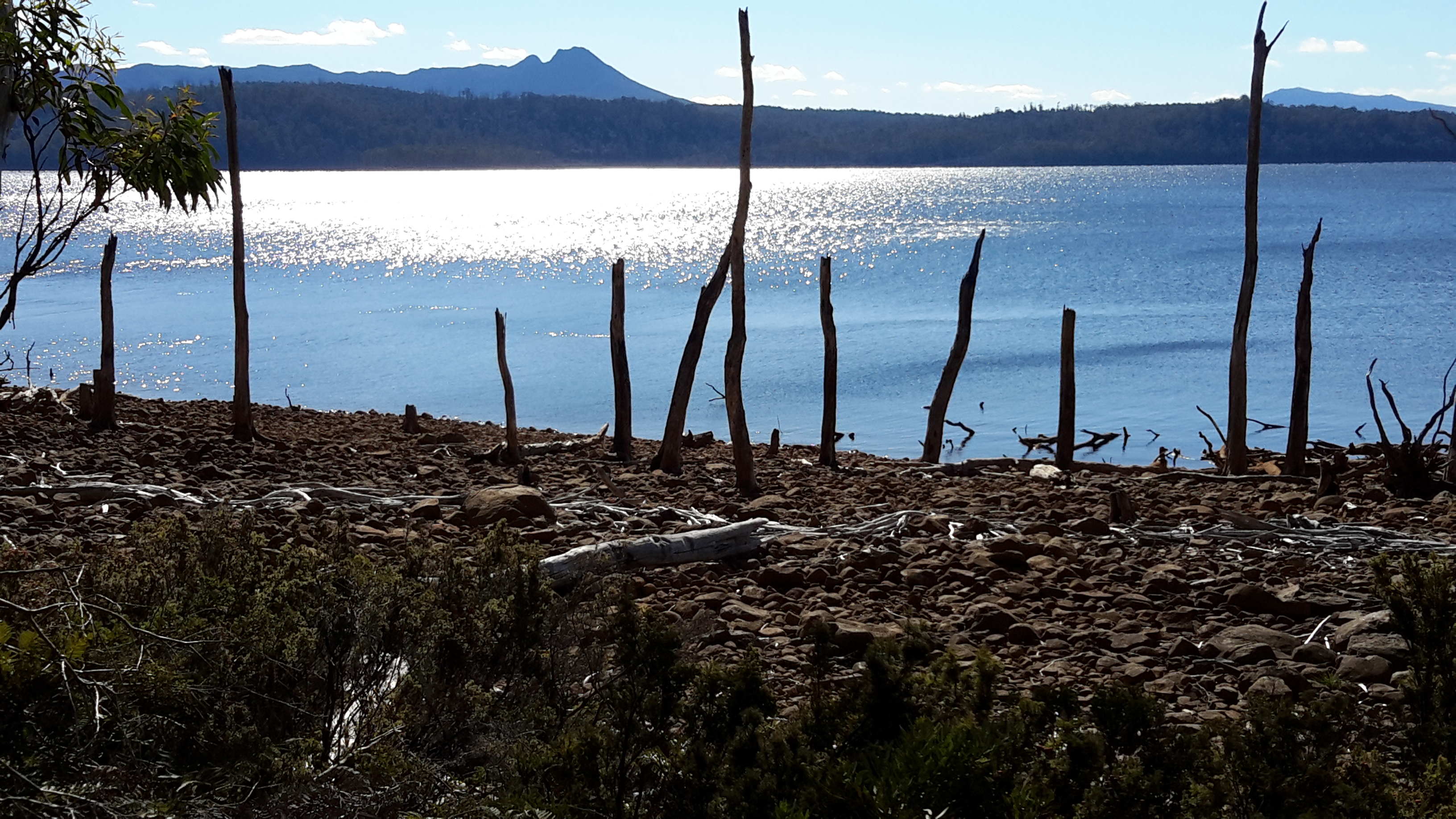
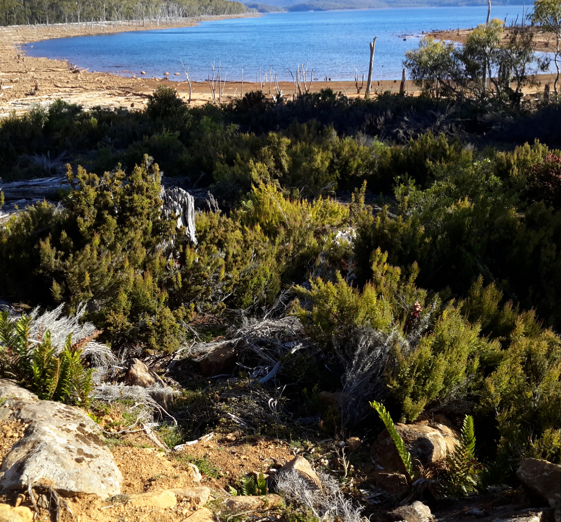
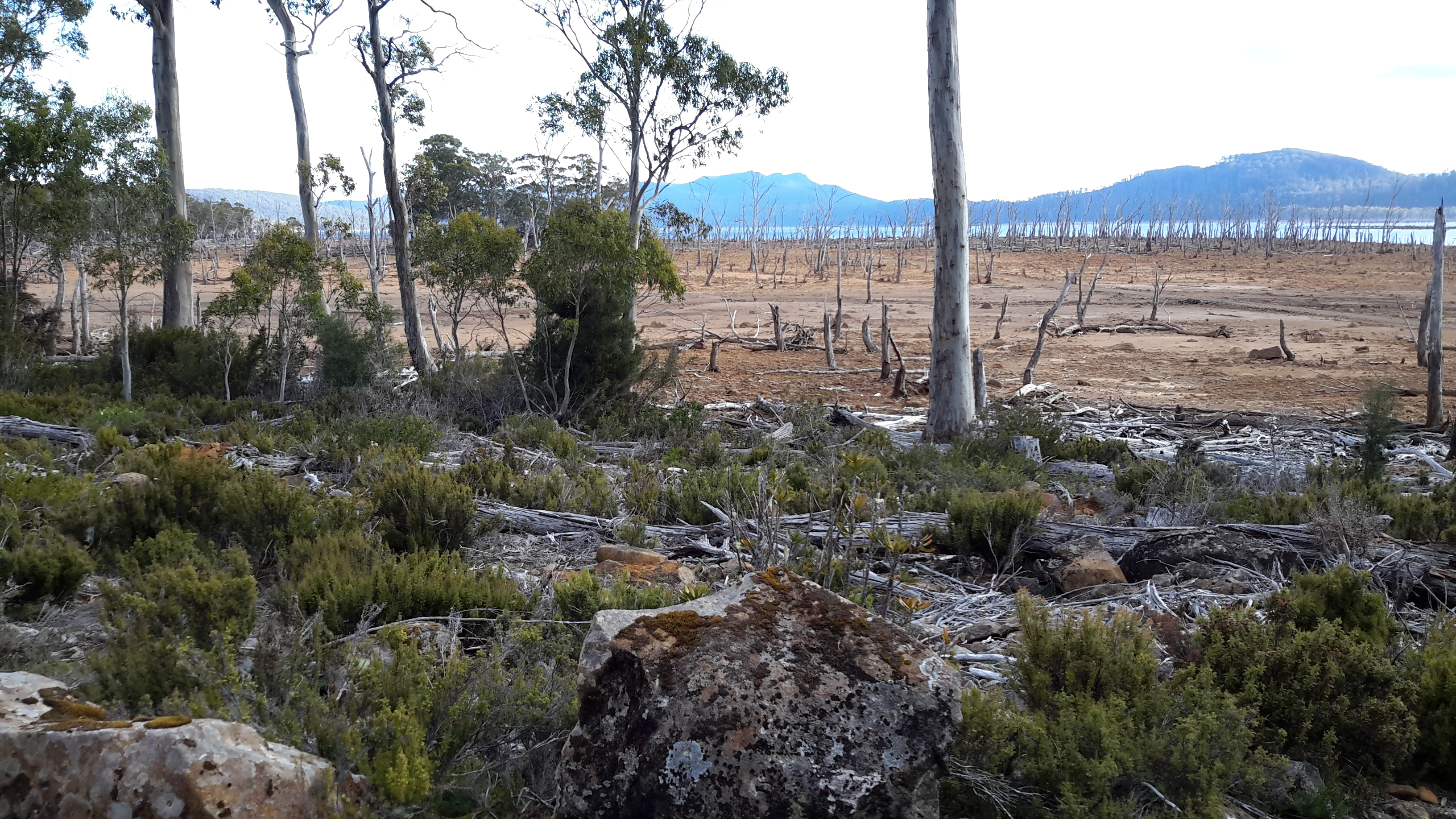
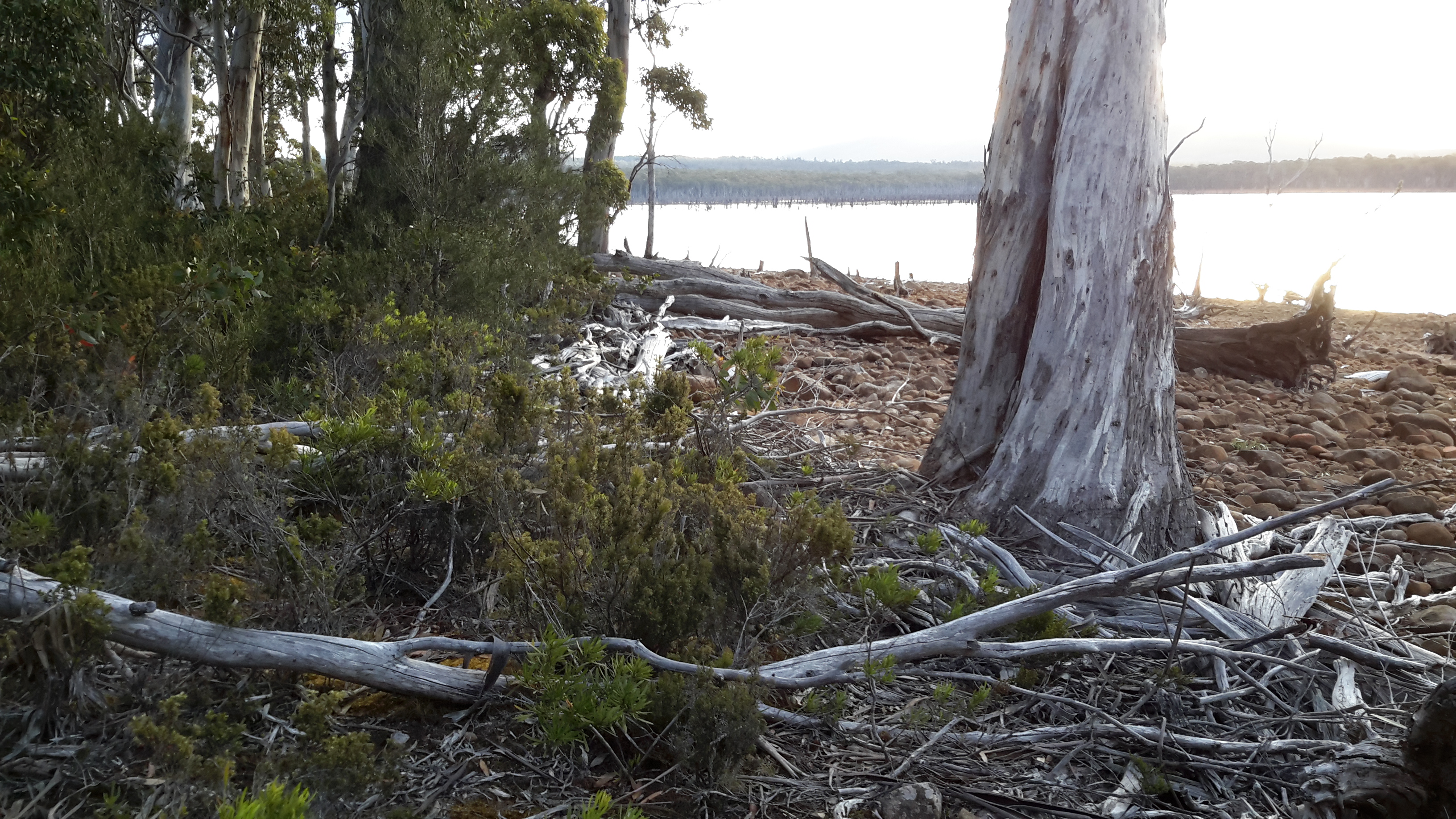
An earlier post told how I started the walk on the eastern shore of Lake King William at 4 pm. Once on the way, I saw the following views.

20160102_161625

20160102_172601.jpg

20160102_180733.jpg

20160102_180711.jpg

20160102_190959.jpg

I planned to walk until around 7.30 but I walked until 8.30 pm before finding a spot that I liked near the water.

I enjoyed the walk, my knees and ankles and feet were all travelling relatively comfortably, the day had a mild temperature which made passing through the bush a delight, and I was excited to be out in the wilds again and exploring and discovering.

Despite considerable research, I couldn’t be sure what to expect nor could I calculate how fast and far I could go. I knew part of my uncertainty was based on not knowing the degree of wetness I might encounter, and not knowing how much bush would be difficult to walk through.

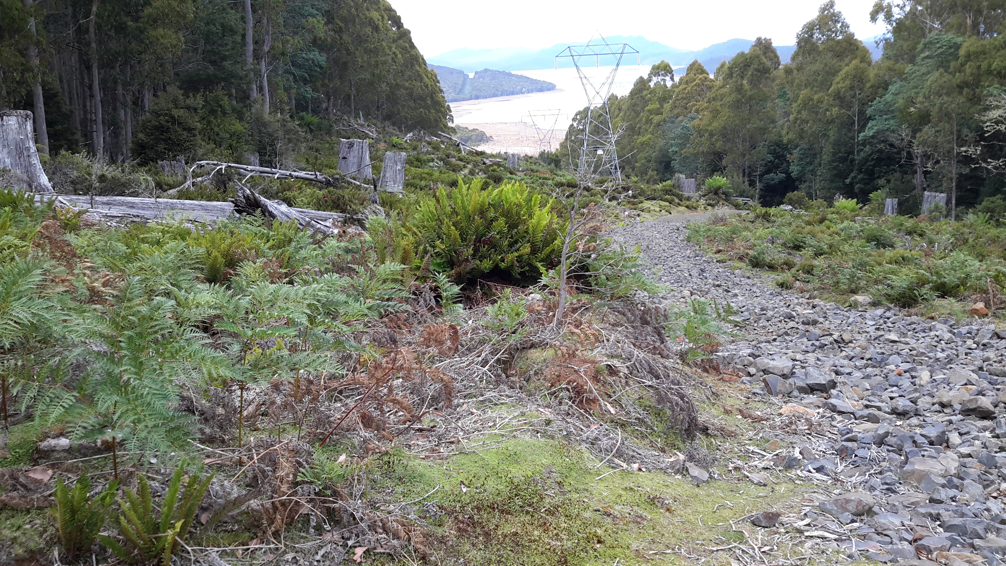
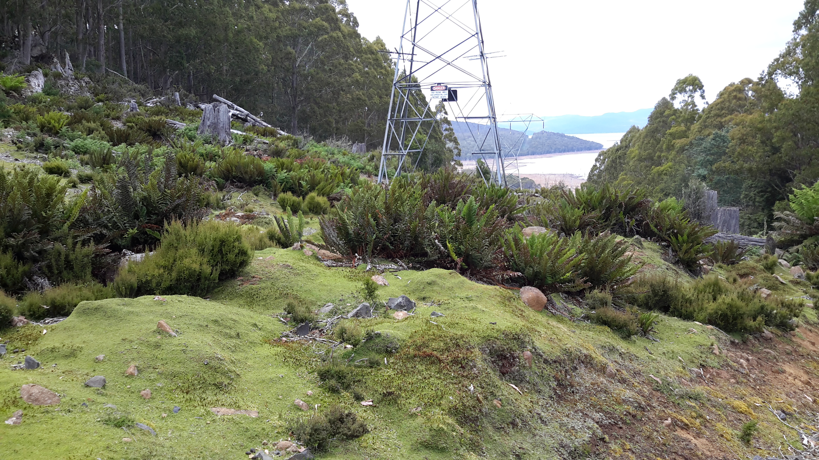
In the end I found it easiest to walk on the blue metal based Switchyard Track where it ran next to the Lake edge or deviated very little inland.  Occasionally I walked in the regrowth area beneath the powerlines.

I felt free. Lucky.  Profoundly happy.  Immensely privileged to be able to make such a walk. But as the sun edged closer to the western horizon, a tiny fear began to niggle.  Would I be able to find a flat area to pitch my tent before the sun went down?  I didn’t want to walk in the dark in case I tripped and injured myself all the while knowing there was not a soul around to pass by and render help if needed.  Certainly I was armed with my Personal Locator Beacon but I never want to press the SOS button.

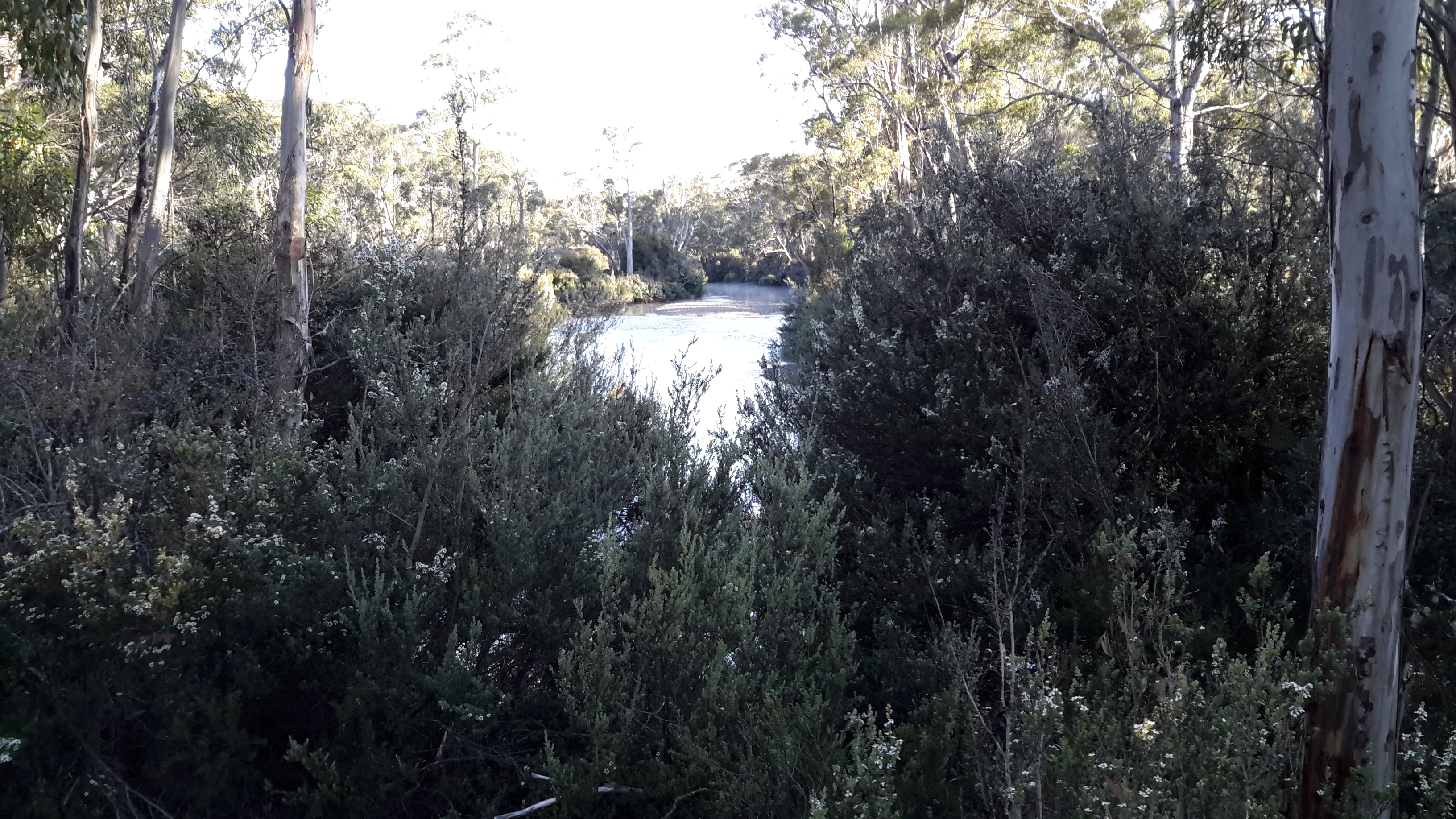
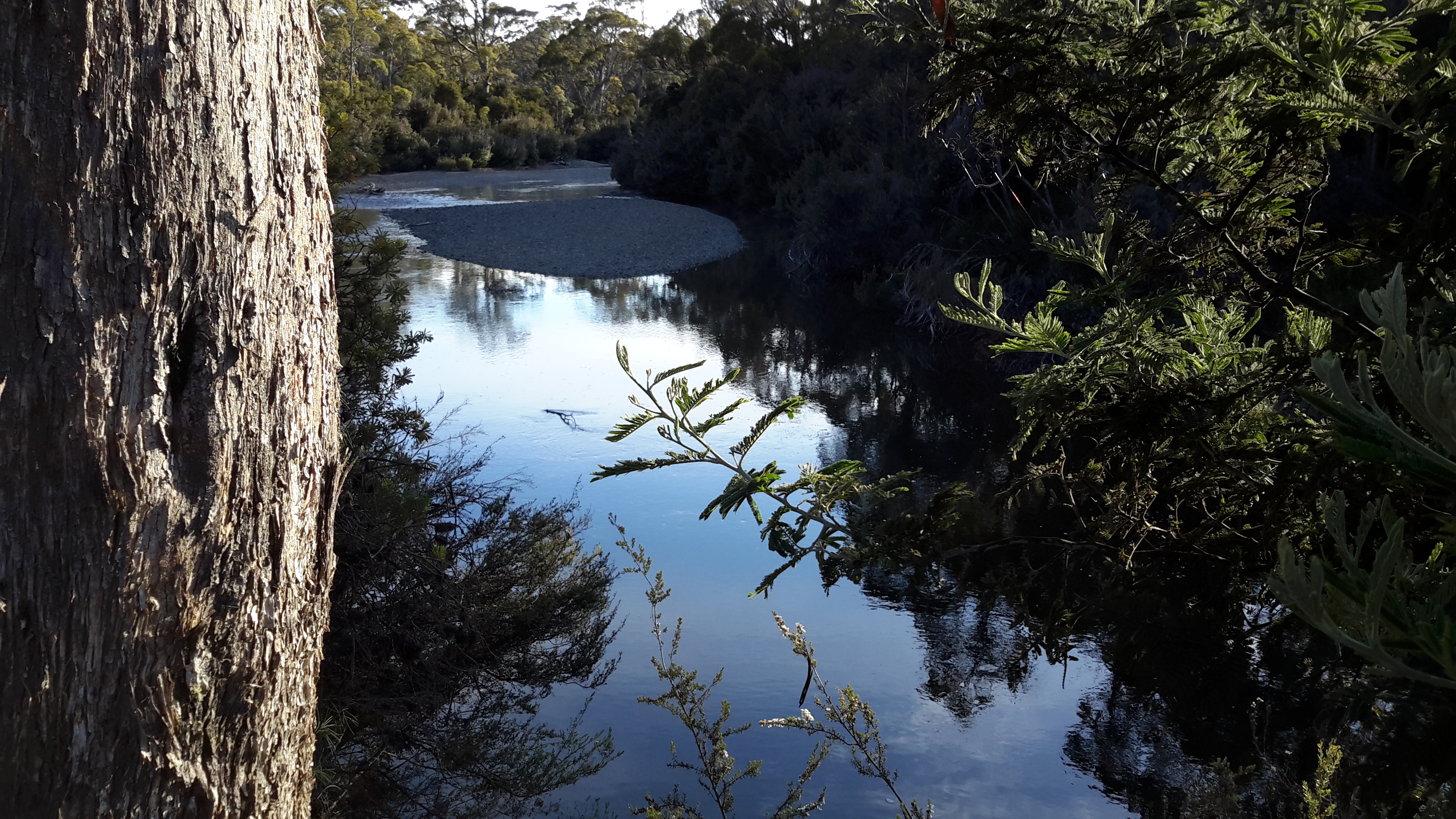
I reminded myself of all the luck I have had in life, and how ‘the right thing always happens at the right time’ for me.  And so it did yet again: not long before the sun went down I noticed the remnants of a vehicular track T-junctioning the main track on which I walked.  That barely visible track headed towards the Lake. Feeling partly desperate and partly positive, I followed the track until it stopped at the bank of the Lake, fifty or more metres from the water edge.   Within the red circle in the photo below is the track on which I camped, and my backpack can be seen to the left of the track – this photo was taken next morning.

20160103_072953-Helens camp spot with pack.jpg

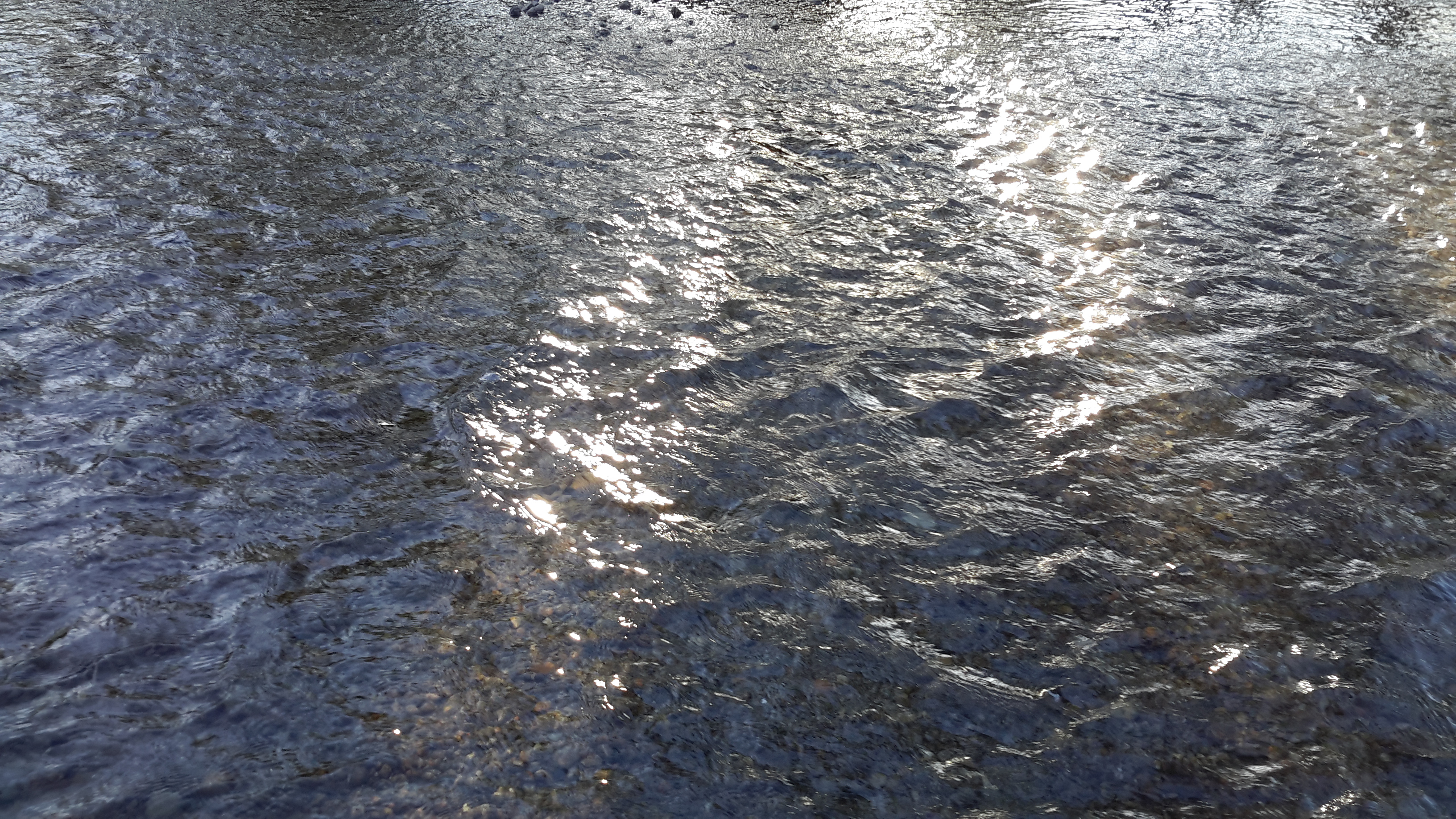
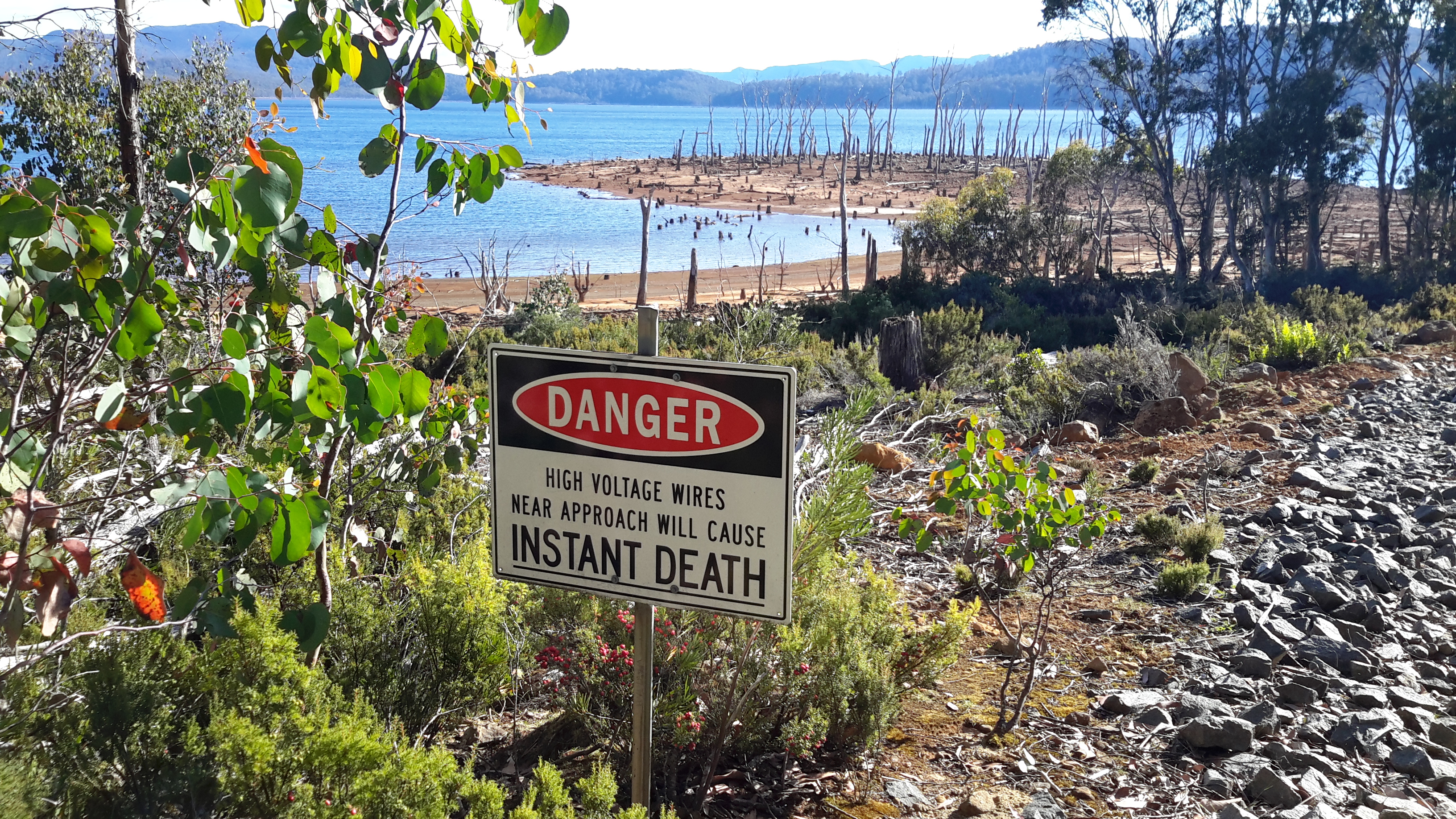
As the sun went down behind the ranges on the opposite side of the Lake. the decision was made for me; so the tent was pitched, my dehydrated dinner set in a water filled billy to soak, and I slipped and flopped over the shore to the water.  Wonderfully clean water.  Pure tasting water.  Untainted.  And I remember feeling the water was warmer than the quickly declining air temperature.  For a split second I contemplated stripping off and going for a swim.  But reason prevailed. No point in catching night air chills.

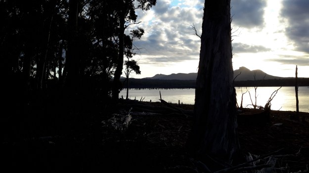
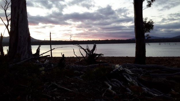
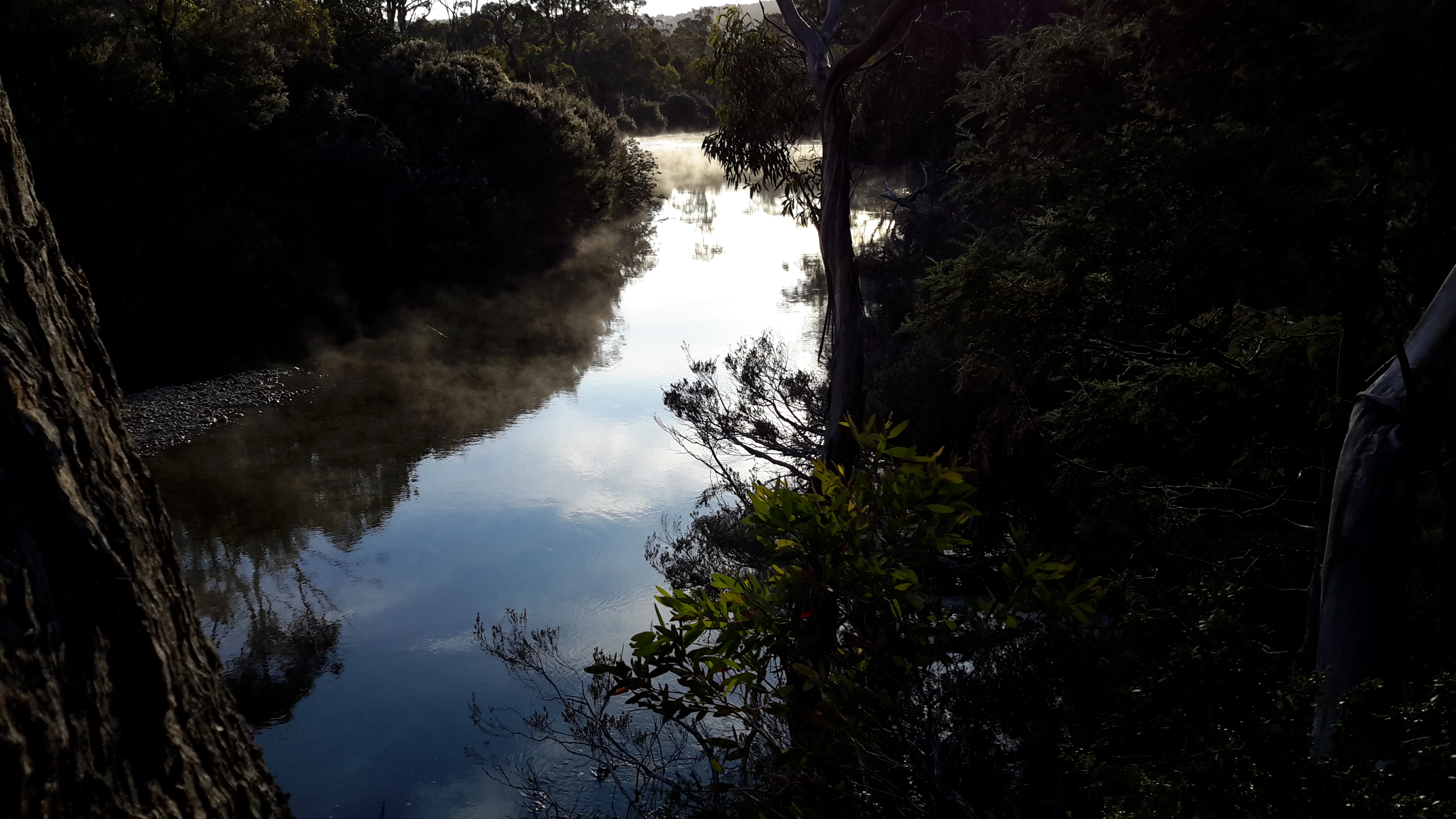
The two photos below are taken after sunset at the Lake bank near my camping spot at the same point and at the same time – because of the intensity of the light my tablet’s camera can’t compensate easily.

20160102_200833.jpg 20160102_200829

The weather forecast had indicated the overnight temperature could be around 6 degrees Celcius and I felt the dramatic drop as the daylight began to disappear. I was glad I carried a winter beanie and thermals and it was a reminder that inland Tasmania has weather/climate extremes regardless of the season (and this is high summer time). My warm clothes were worn until bedtime.  And then, perhaps with the shock of the walk and all the related experiences, and/or with the lowering temperature I shivered in my sleeping bag until I relaxed and its warming qualities kicked in.

I lay trying to hear the sounds of the night and the bush, but the rustle of my sleeping bag made that impossible.  Then I resigned myself that I would never hear the rhythms of the bush.  As yet I have not heard the murderous cries of fighting Tasmanian Devils in the night – probably best. So, finally when I was well fed, warm and comfortable, I drifted off to sleep.

20160102_210115.jpg 20160102_210109.jpg