Category Archives: Derwent River

Beech Creek and beyond– towards Wayatinah post 6 of 9

The water volume (in quantity and sound) increased again where Beech Creek announced its arrival, bringing water from the large catchment around Mt Shakespeare.

_DSC5769-1.jpg

Andrew reached this section of the Derwent around 5.45 pm. Approximately 9 km of the River’s length had been walked through the day. Having first arrived at the river’s edge around 10.50 am, clearly the difficulty of walking the river is apparent.

_DSC5765-1.jpg

_DSC5789.jpg

As the river level rose and the water speed increased, the process of walking downstream slowed. It was taking increasing time to find a safe route. The river was crossed frequently, looking for the most efficient route. At the same time, the river bank edges rose dramatically and the river entered a series of bends. The banks on the outer edge of the bends were invariably steep where the river had cut into the landscape, and the inner edge provided more exposed boulders. Between the bends were large, deep pools with the water moving more slowly. It became increasingly difficult to cross the river above or below these pools and a lot of time was spent scouting the best way forward. It sometimes became a choice of making a difficult crossing in sometimes fast flowing water; clambering up, over, around the flood debris on the river banks; or pushing uphill through tangling scrub and over fallen logs to bypass the cliffs at the water’s edge. Remember all of this activity occurred while carrying a backpack with the weight of overnight gear.

Only once did Andrew fall in the river; after all the inevitable small tumbles and stumbles this was the only mishap. Having picked a sturdy looking large rock to stand on, when it rolled Andrew landed waist deep but feet first in a pool of water.


Nature’s patterns – towards Wayatinah post 5 of 9


Fascinating patterns floated on the water surface at the edges of some pools where the Derwent River’s movement was slower.

_DSC5725-1.jpg _DSC5733-1.jpg

_DSC5738-1.jpg

_DSC5742-1.jpg

_DSC5757-1.jpg

_DSC5771-1.jpg

_DSC5776-1.jpg

_DSC5779-1.jpg


The creation of these white swirling patterns has been explained as follows: The natural tannins from button grass plains and other vegetation seeps into the soil and, with rain, runs off the hills into creeks and rivers. The washing of water over the rocks creates a slight foam. When in deep pools the foam gets pushed into back-waters and the continual slow movement of the water creates the lacework.  Mesmerising to watch the gradual changes.

Increasing water flows – towards Wayatinah post 4 of 9


The water in the river bed came from the many tiny creeks that flow off the surrounding hills, suggesting that even in the height of summer this part of the Derwent would never be completely dry. Some of these creeks seeped into the river bed while others entered by falling over small escarpments.

_DSC5690-1.jpg

_DSC5701-1.jpg

The further Andrew walked downstream, the more the river’s water level rose and the gaps between navigable rocks got wider. Hopping turned to leaping, and occasionally it was necessary to wade to get to another section of walkable rocks. It became a long game of “join the dots” as it was far easier to stay in the river bed than take to the banks and deal with the vegetation, much of which was infested with the flood debris.  Wet feet and legs became the norm.

_DSC5705-1.jpg

_DSC5707-1.jpg

The walking was pleasant with occasional patches of fine riverine rainforest, dominated by myrtles and sassafras, punctuated by tree ferns and moss. Needless to say, when Andrew was forced out of the river he preferred banks with less vegetation. The river valley showed no sign of humans having passed – perhaps the few who might have done so had travelled by raft or kayak during times of flood. The inhabitants seemed to be abundant birds, as well as snakes taking the opportunity for a quiet bask among the warm rocks.  Can you spot the sleeping reptile hidden in the rocks? How close would you have been prepared to get?

_DSC5686-1.jpg

The Counsel River joined the Derwent with a noisy cascade, framed by myrtles standing as a gateway to a secluded rainforested valley. A quick detour was undertaken to look through the gates to see lovely scenes of unexploited river and mossy rainforest – a beautiful place to revisit one day.

_DSC5724-1.jpg

_DSC5710-1.jpg

Below that confluence of rivers the Derwent now ran much fuller, with the water volume having doubled with the Counsel’s contribution.  With more water, larger and deeper pools of water spread across the Derwent and more wading in the dark water over slippery rocks was required to get ahead.  It was easier to walk when the river was wide and more rocks were above water enabling renewed rock hopping.


Onto the river bed – towards Wayatinah post 3 of 9


After a short (45 minutes) and steep walk Andrew chose the easiest exit and popped out of the forest and onto the Derwent. He felt pleasantly relieved that the descent had been easier than expected although ‘not a walk in the park’. At that point, the river bed was mostly water-worn dolerite boulders, but he was surprised there was much more water than expected (or wanted). While there was lots of water rushing around, thankfully there were also plenty of dry rock tops suitable for rock hopping.

There was a fair gradient on the river; the river drops 150 metres from the start of the walk to Wayatinah. The result was high noise levels as the water rushed downstream.

Looking upstream:

_DSC5682-1.jpg

Looking downstream:

_DSC5683-1.jpg

Swapping boots for Dunlop Volleys (good for river walking because of their excellent grip), Andrew progressed downstream hopping from rock to rock. It was not speedy as great care had to be taken to avoid twisting an ankle, but it meant dry feet.

_DSC5685-1.jpg

Occasionally great mounds of flood debris were piled high above the river level, and tangled in the scrub on the river banks – evidence that this was the summer-level of low water and that no water was coming over the Butlers Gorge dam spillway further inland.  While most tangles were at the river edges, one huge beaver-like dam was created by the obstruction of an island in midstream.  All of these required effort and care to pass over and by.  Awkward and unpleasant.   _dsc5760-1_DSC5762-1.jpg

Throughout the walk down the river, very often the water undercut the banks, uncovering tree roots and weakening their hold on the land – many had toppled across the river creating new impediments to progress.


From the visualisation to the actual – towards Wayatinah post 2 of 9

The question remained. Was walking this leg achievable? Was the Derwent River sufficiently friendly to allow humans to walk its length? With my feet and knees complaining every time I walk for more than a couple of hours, I asked friend Andrew to proxy for me and undertake the walk along the Derwent River from near Tarraleah to Wayatinah. Since Andrew is a fit, agile, very experienced and sensible bushwalker, I felt certain if he could not finish this leg of the walk then no-one could. Besides he has been a positive supporter of the project from day one and was happy to undertake the walk on my behalf.

At 6.30 am, the day started with a drive from Hobart to the bridge crossing the Derwent River at Wayatinah. After parking his ute on the Florentine Road near the salmon hatchery at Wayatinah around 8.30 am, a friend drove him westwards along the Lyell Highway to the junction with Butlers Gorge Road. Under overcast skies on a cool day, Andrew began walking next to Tarraleah Canal No 1 around 9.30 am and continued until he reached the first crossover walkway about one kilometre further on. This location promised the shortest distance down to the Derwent river bed.

_dsc5676-1

Andrew crossed, looked downhill and saw nothing but dense scrub ahead. He remembers remarking out loud “don’t dither, just do it. Don’t delay.  Here we go; just do it”.  At 10.10 am he left the Canal. Before stepping into the unknown, he spent time getting a GPS position fix and a magnetic bearing. Once set, he plunged into the thicket and took a series of sightings from one key tree to the next.  This allowed him to stay on his bearing, and meant he would be able to retrace his steps if the going was too tough and the forest impossibly dense.  The route down the steep slope passed massive tree ferns, smaller ferns, myrtles, mature eucalypts and the occasional Sassafras tree.  Many fallen trees littered the understorey and it was clear this was an old forest in a constant state of regeneration. Scrambling over or under logs and negotiating rocky bluffs was a normal part of the descent.

_dsc5677-1

_dsc5680-1

Half way down the steep incline,  it seemed that serious wind was blowing high up in the trees. Before long it was clear the rushing sound was the water of the Derwent River further below.  Once the river could be seen, then it was a comparatively simple process to choose the clearest path to the river bed.

_dsc5681-1

Visualising each walk in advance – towards Wayatinah post 1 of 9

The further I travelled inland towards central Tasmania, the less guidance and direction was available. This meant that I needed to scrutinise every piece of available information more intensely because the challenges of the terrain increased and therefore the dangers of walking alone multiplied.  My friends and relatives feared the worst and hoped for the best and we have all been thankful that my walks and returns home have been safe. Apart from the occasional bruise and scratch or two, no physical harm has befallen me.

During my first walks along the Derwent River, I gradually increased the volume of research I conducted in advance, so that I could make the most of each opportunity.  As the project lengthened, I spent more time visualising the walks so that I could be sure my pack contained the appropriate provisions. In addition, I wanted to be sure that I could achieve my goal.

In particular, I invested a huge amount of time imagining a couple of the walks. These were walks about which I knew very little and which I anticipated would be the trickiest.  One was the walk along the river starting near the junction of the Lyell Highway and Butlers Gorge Road close to Tarraleah, and extending to the bridge over the river at Wayatinah.

Using knowledge from my walk along Tarraleah Canal No 1 and from walking beside the Derwent River near the Wayatinah bridge,  I had some understanding of the challenges. My intention was always to start at the Tarraleah end and work my way downstream along the River bed.

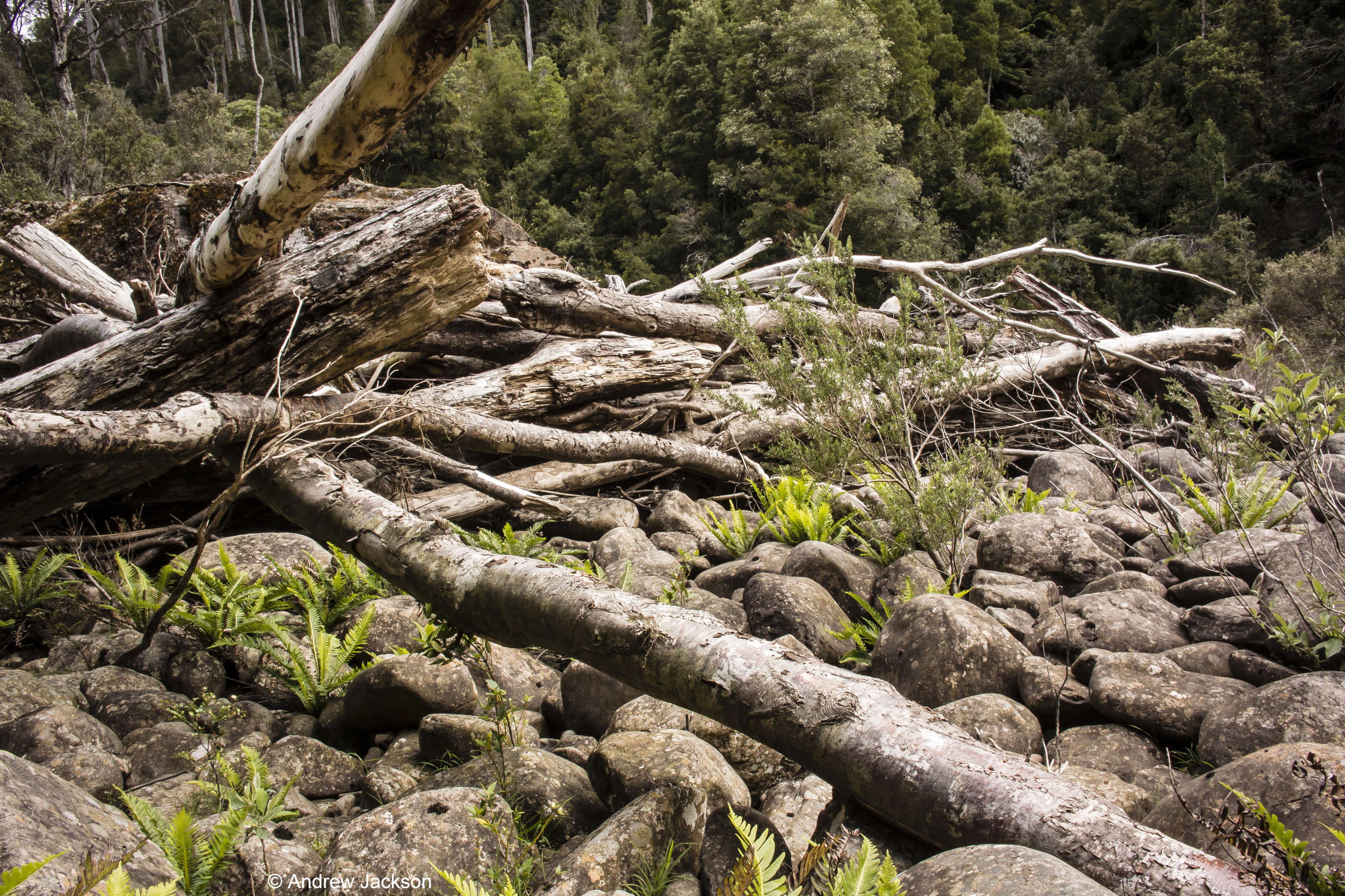
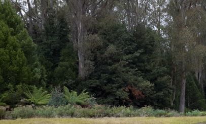
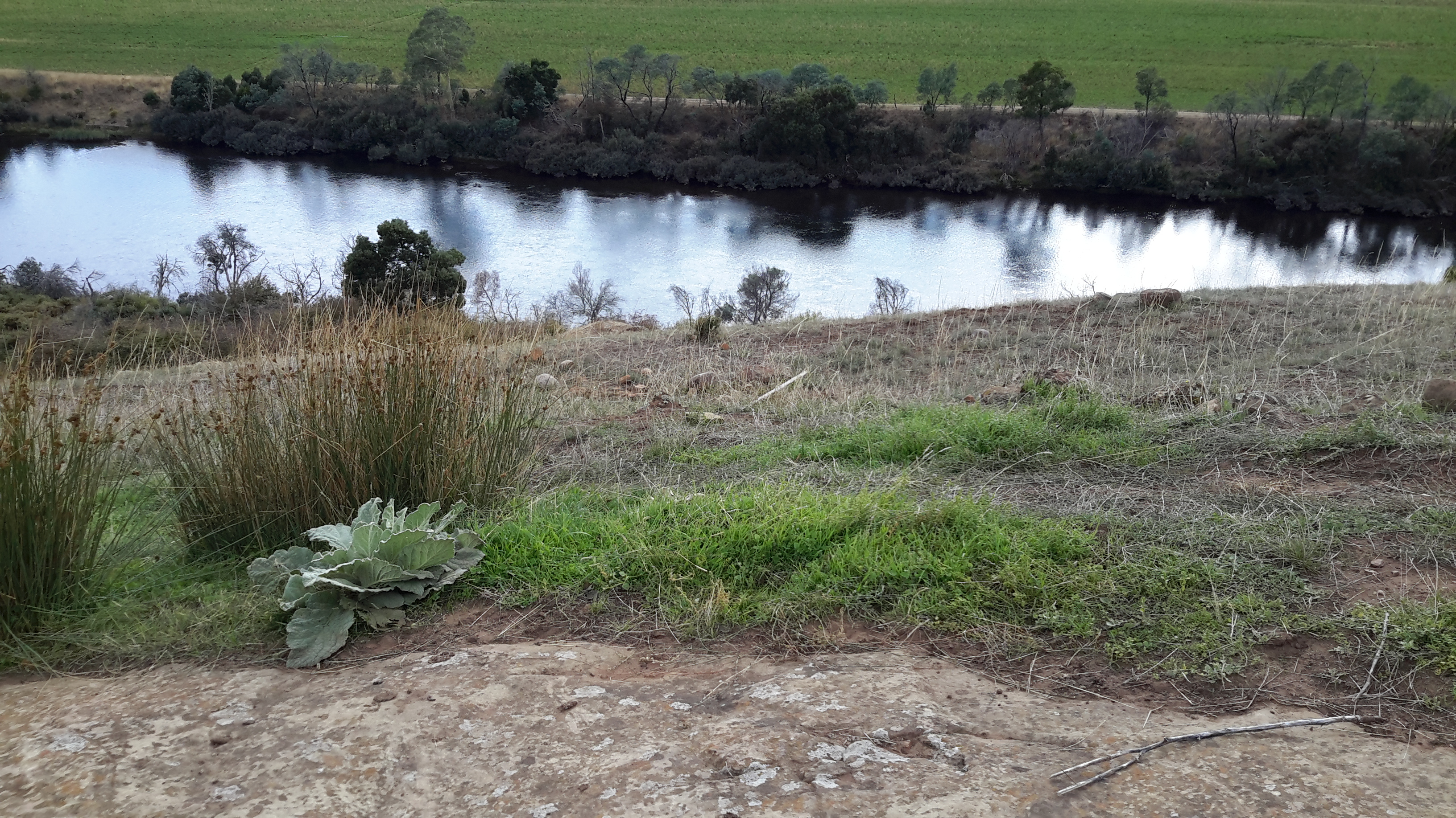
The first obstacle was the dense bush between the Canal and the river bed down an exceptionally steep incline. From what I could see at the top, the rainforest was a tightly packed mangle of massive tree ferns with their fronds at face level and above, amidst all manner of eucalypts, myrtles,  celery-top-pines, sassafras trees and laurels.  If I was very unlucky intermingled with these wonderful but tightly packed specimens, I suspected the tree known as Horizontal (Anodopetalum biglandulous), the anathema to bushwalkers, could be a major impediment.

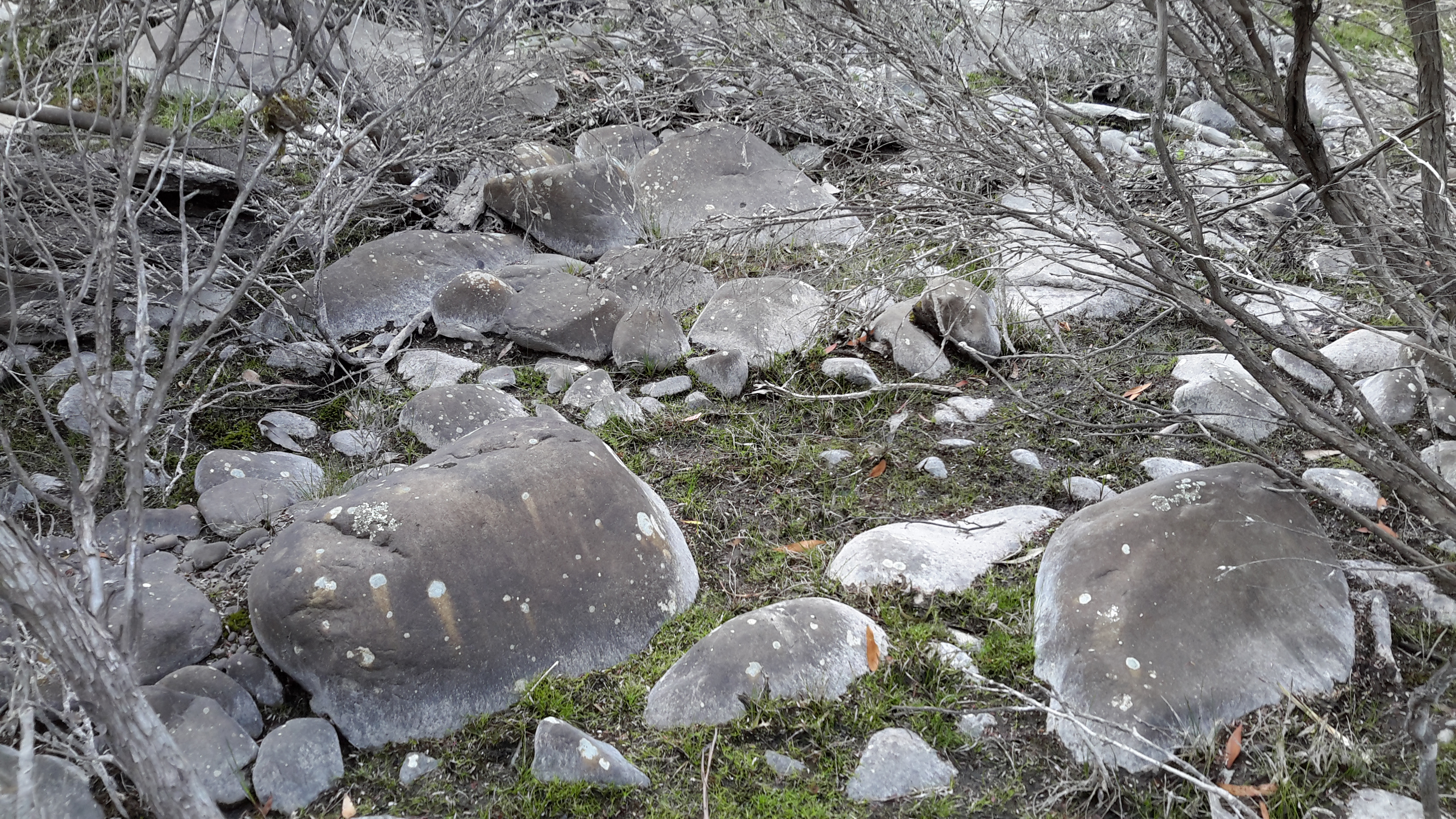
Photos near my imagined starting point show the beautiful but almost impenetrable bush facing the start of my walk along this section.

20160218_102537.jpg

20160218_101825 cropped.JPG

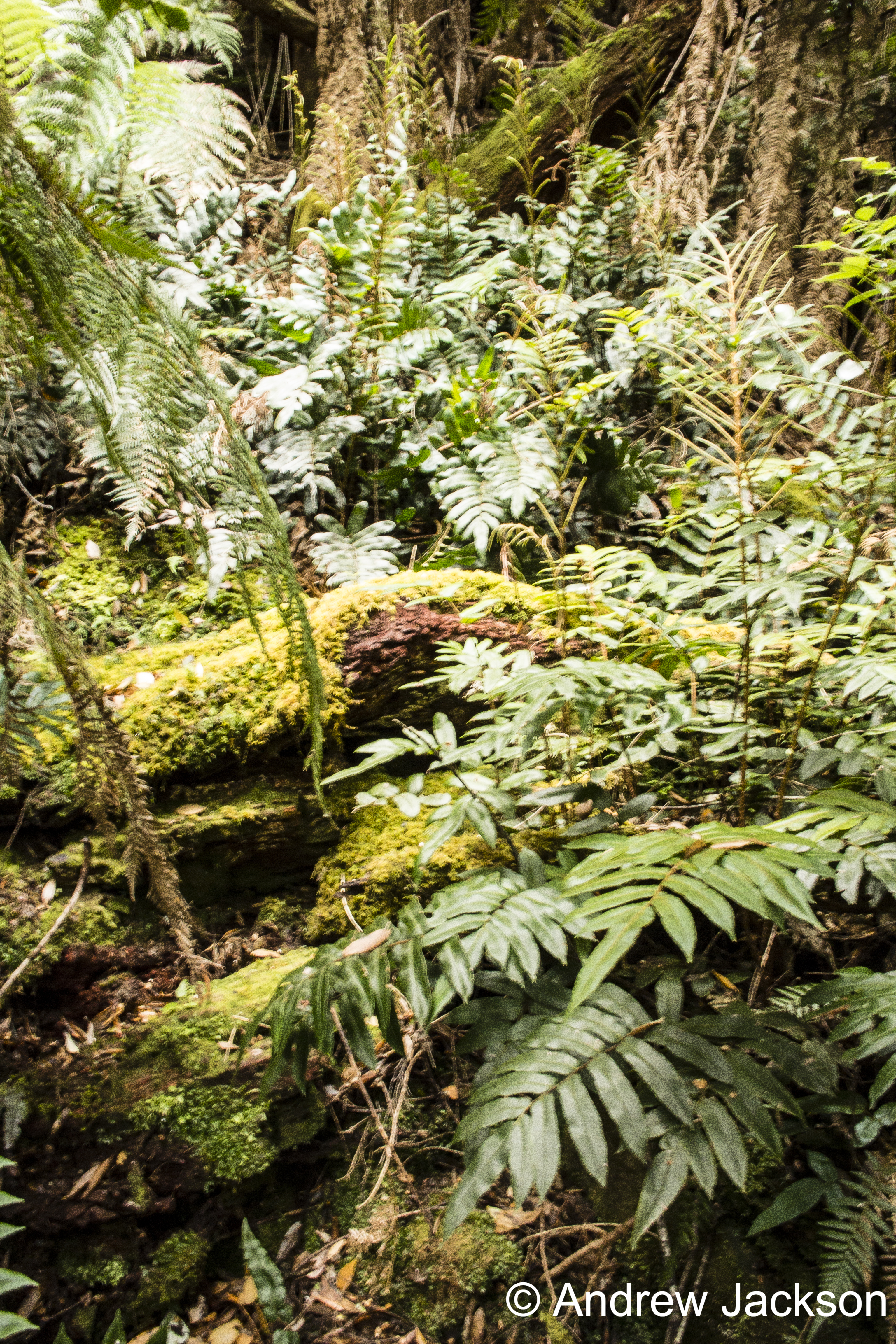
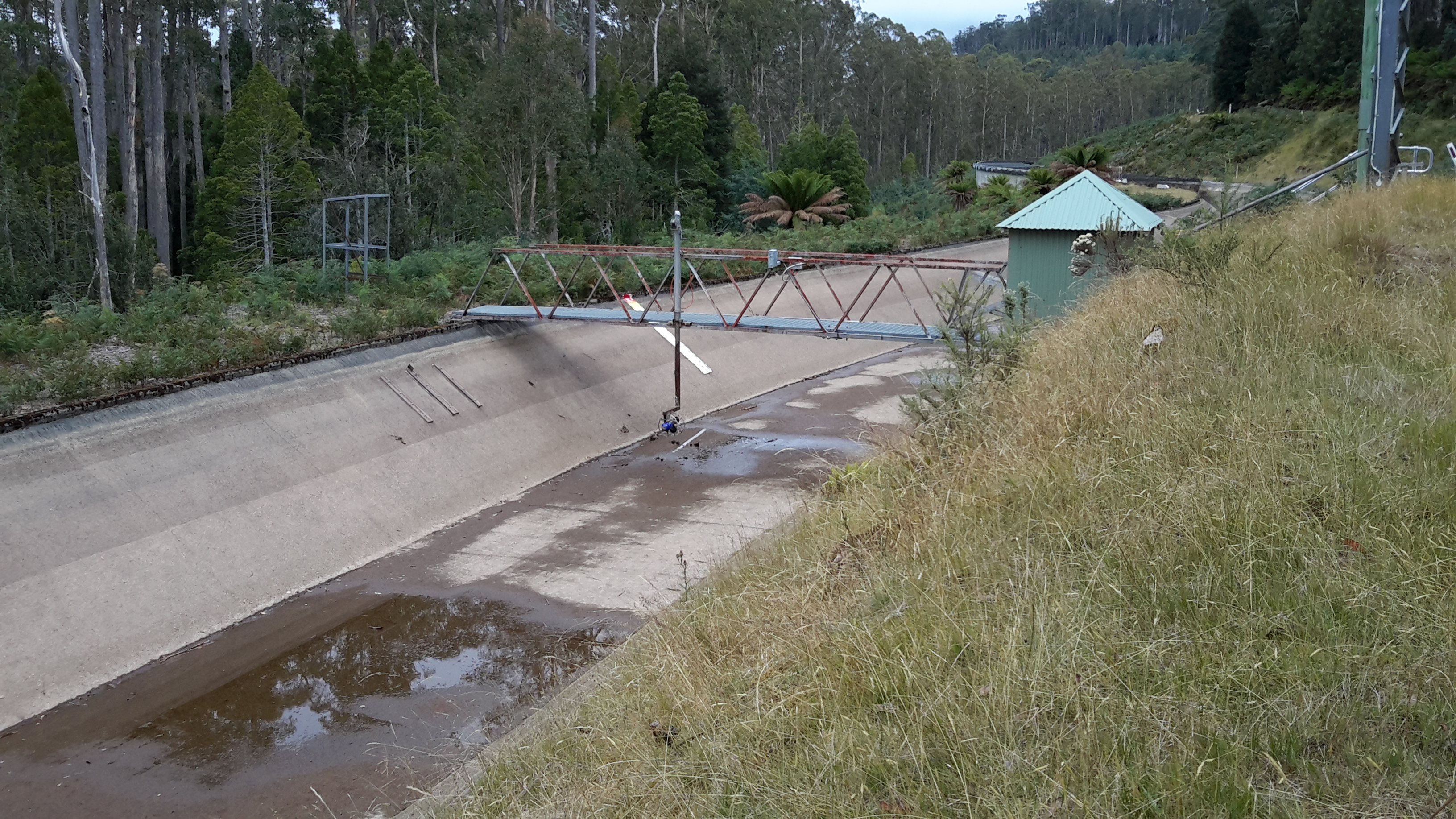
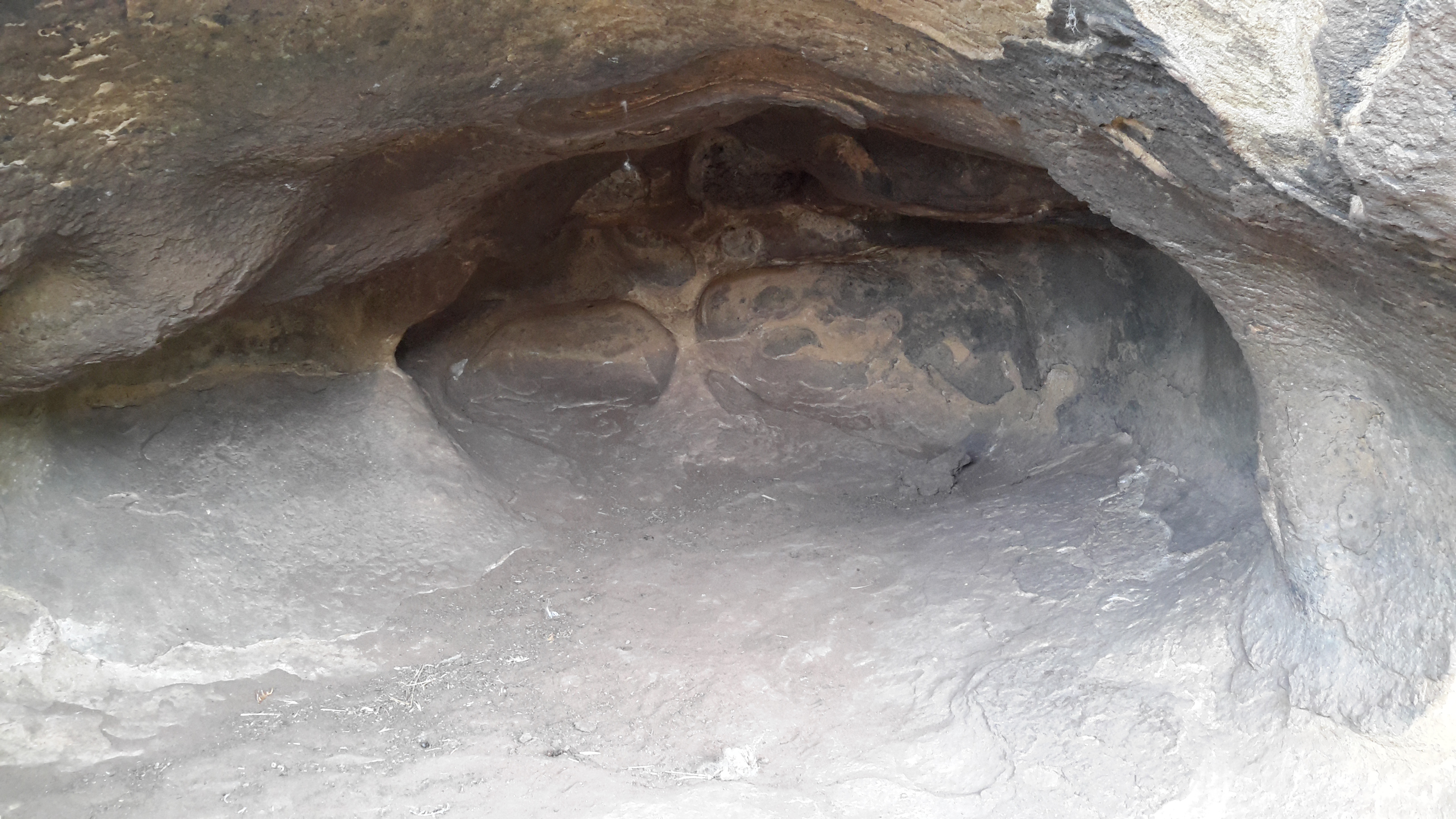
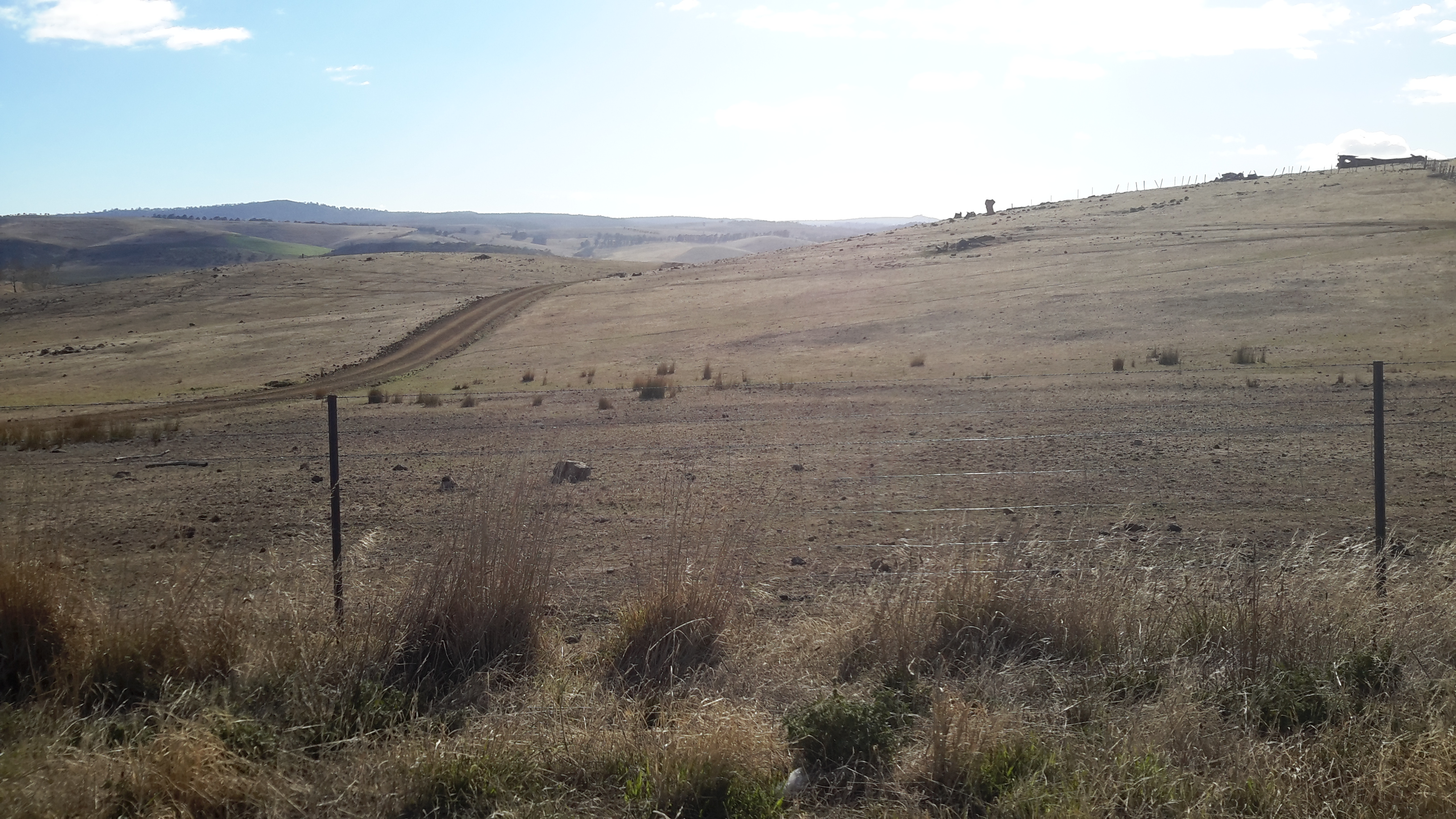
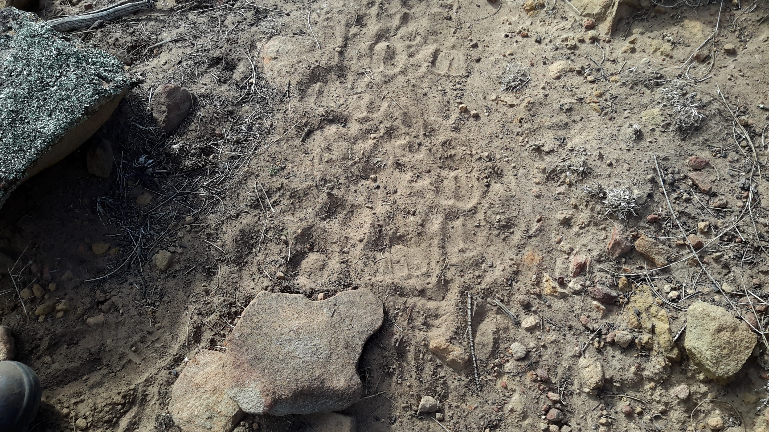
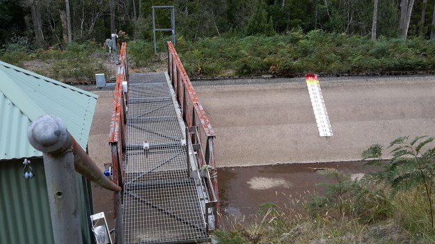
I believed I had two options; one was to walk along the plush mossy flat Canal verge until I could spot a ‘gap’ and then plunge into the thicket.  The second option was to walk on the track beside the Canal until I reached the first Hydro Tasmania crossing located about a kilometre westwards along the track,  cross over, and hope there was some sort of clearing through the bush down to the bottom of the hill.  If not, then I would have to make my own way until I reached the Derwent River bed.   The first crossing, in the photo below, shows no sign of tracks extending further.

20160218_104456.jpg

20160218_104534.jpg

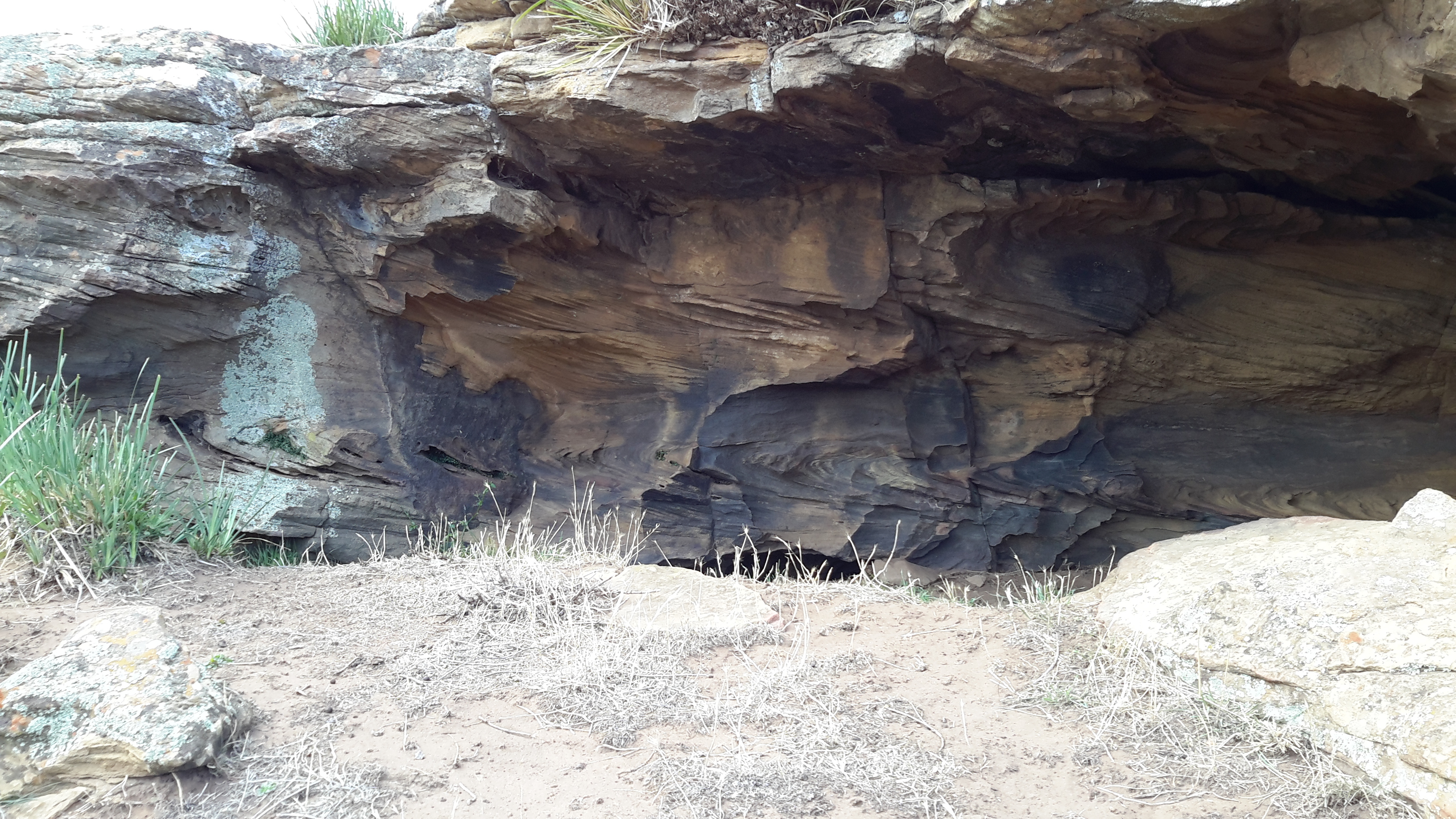
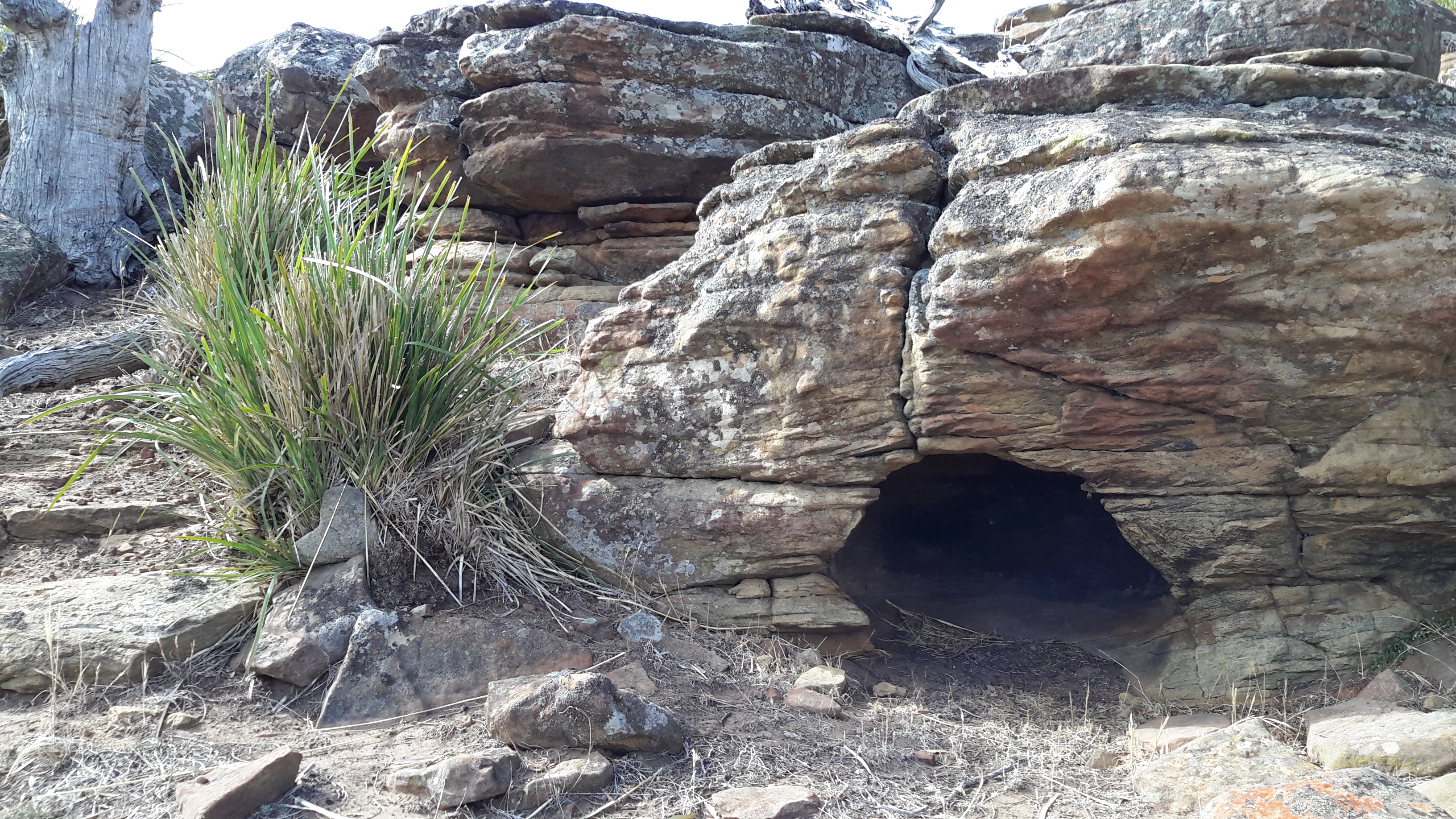
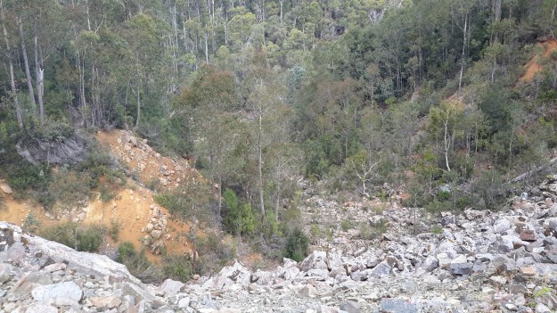
From that crossing down to the river, I anticipated the distance would be approximately  one and a quarter kilometres on a slope that dropped around 210 metres.  Unless I was fortunate to find a clearing that Hydro Tasmania had made, something like the following example spotted closer to Clark Dam, I expected to be in for a hard time.

20160218_142938.jpg

I knew this was the side of the river that received minimal direct daily sunlight compared to the bush on the other side. I imagined a wet slippery bush environment, that would be dark amidst the undergrowth ( I am short and I realised much of the vegetation would be above me) with interspersed and unpredictable rocky outcrops that would require flexibility and care. If the day was overcast, my ability to see clearly through the dense bush might be limited, so the danger of slipping over a cliff had to be taken into account.

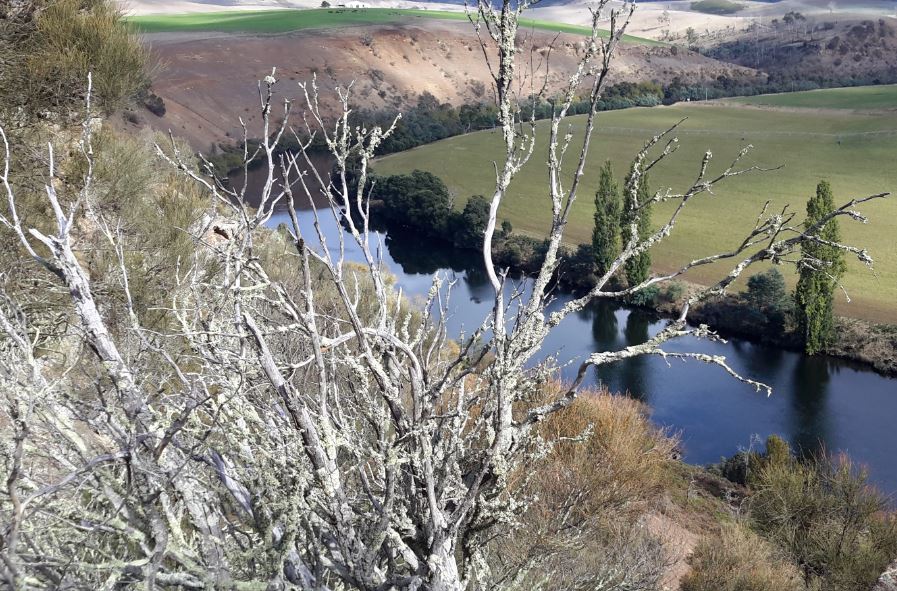
While Michelle’s photo below taken during a flight along the Derwent River shows the vegetation between the Canal and the River bed, the location is further along towards Clark Dam. Nevertheless it does show the density of the bush which needed to be penetrated and walked through.

PA280105Butlers Gorge rd.JPG

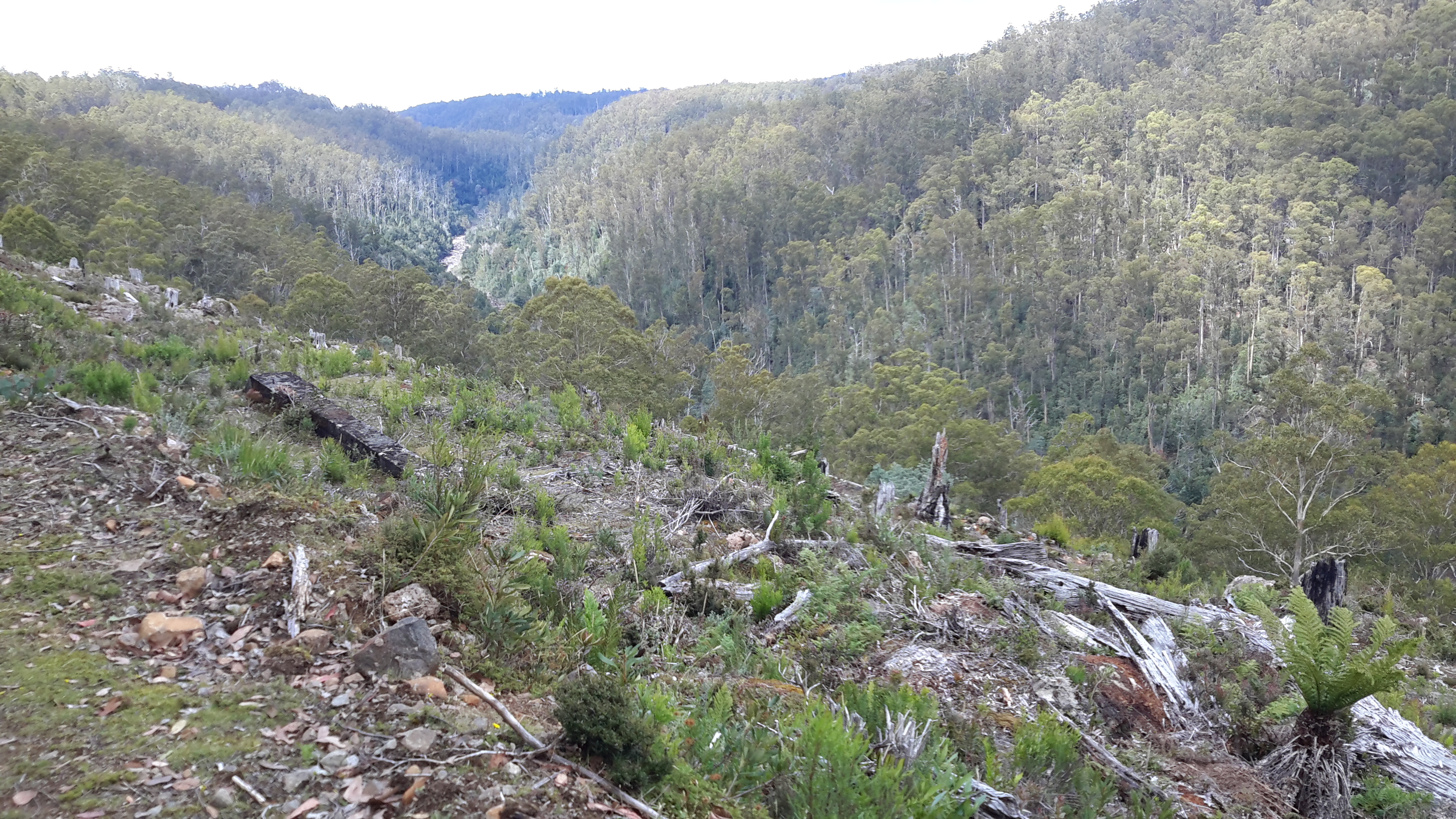
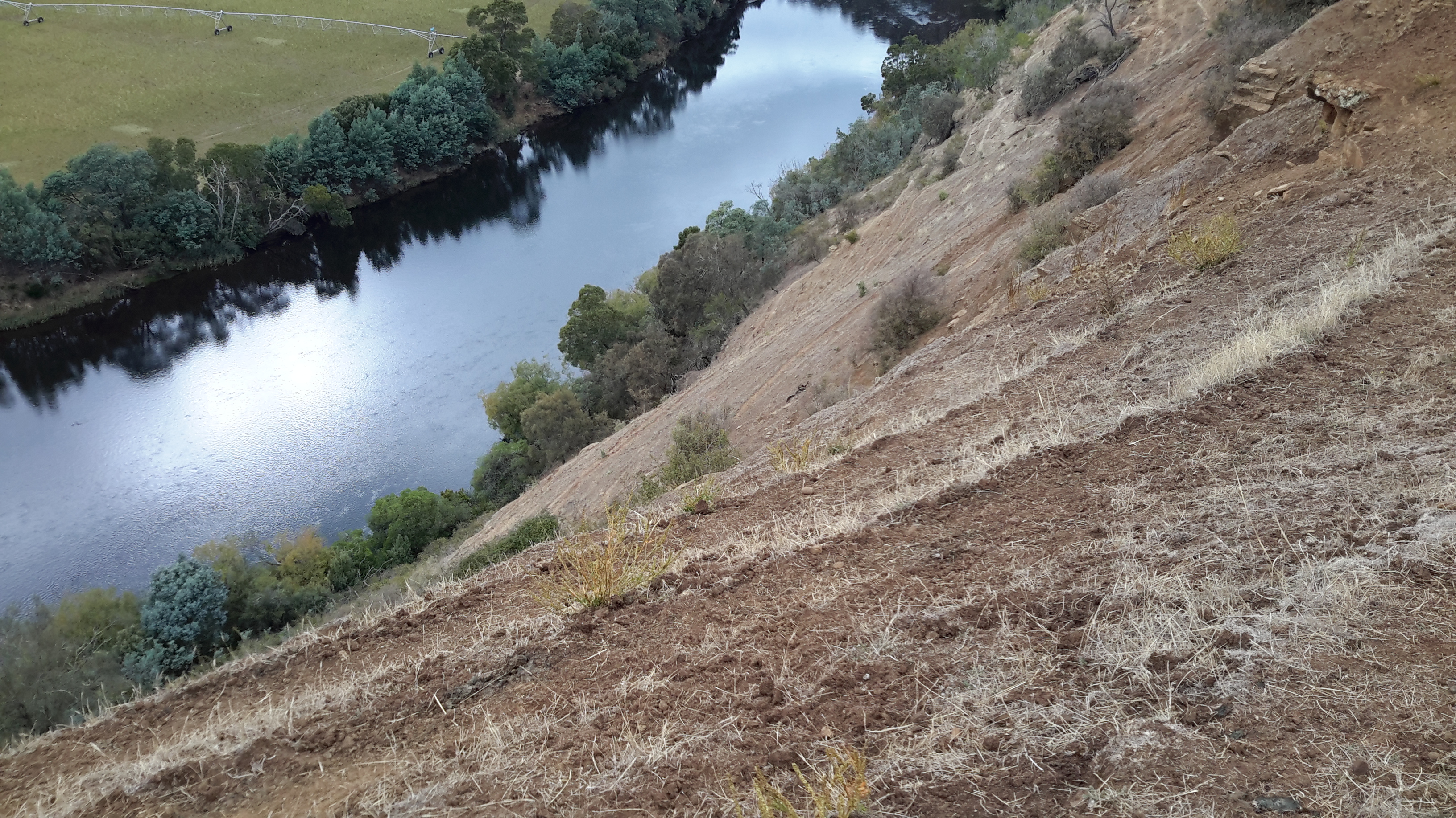
My aerial photo below gives a stronger sense of the gradient from the Canal to the river bed in some sections.

20151028_115802.jpg

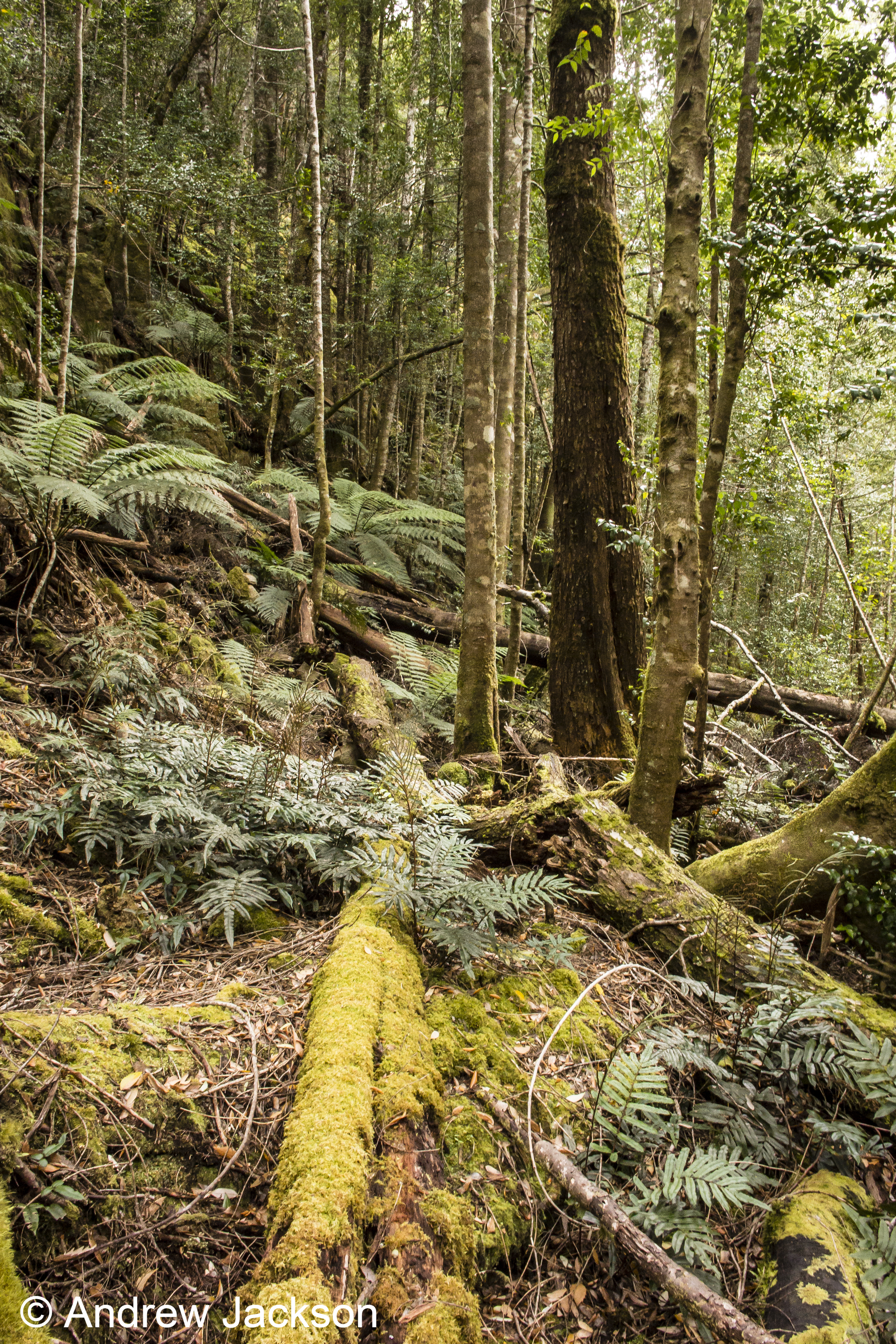
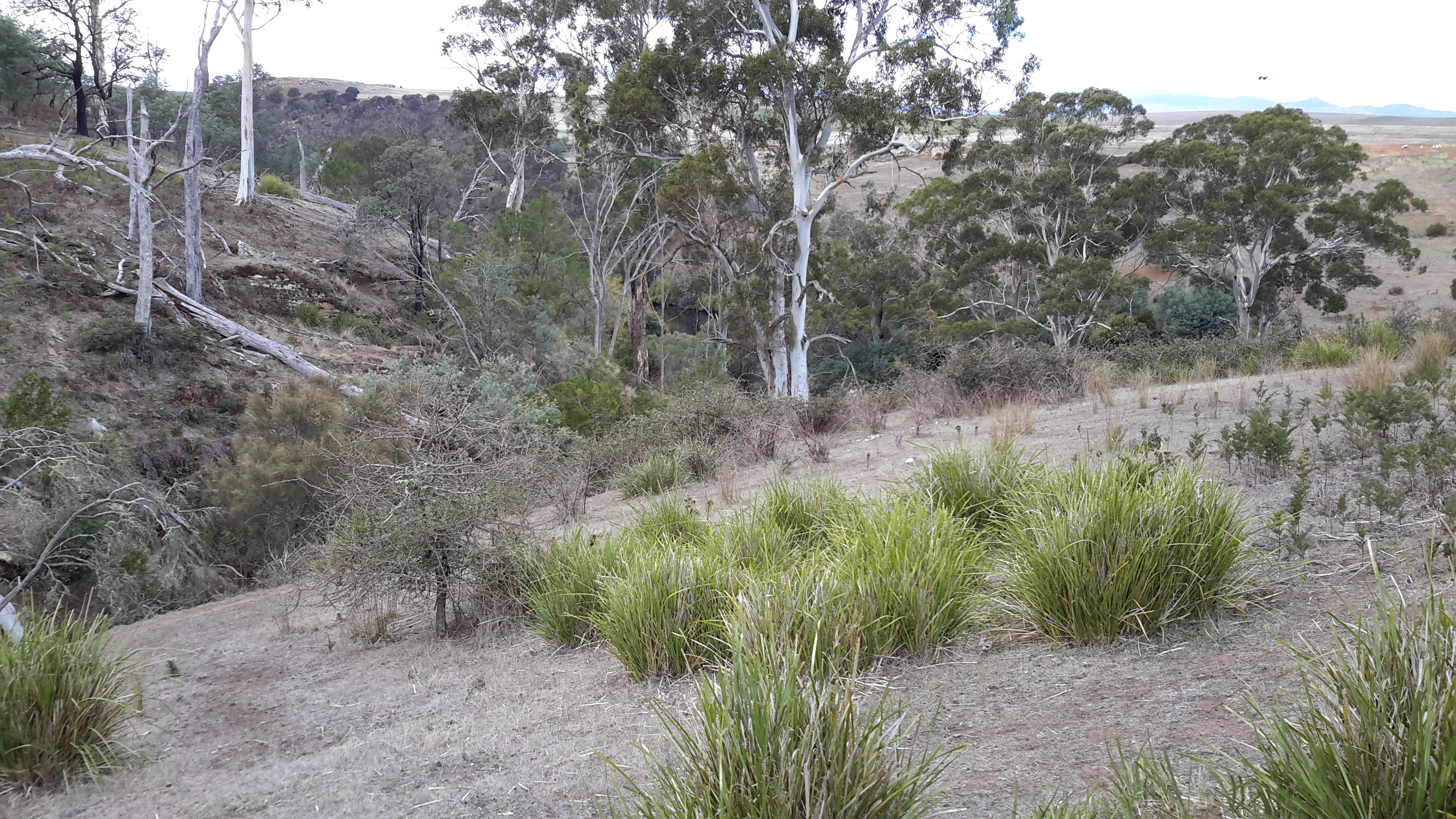
The photo below, which I took during my Canal walk, looks back and clearly shows the steep gradient.

20160218_130943.jpg

I imagined slipping and sliding part way, with backpack occasionally getting ‘hooked’ to slow me down. Despite the short distance but considering the possible obstructions and the need to skirt around these,  I mentally allowed at least an hour for the descent.

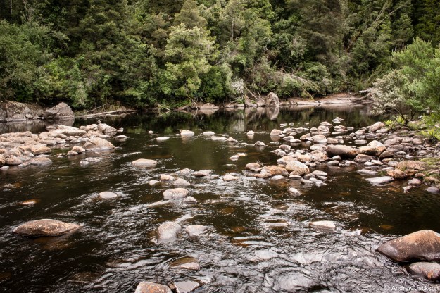
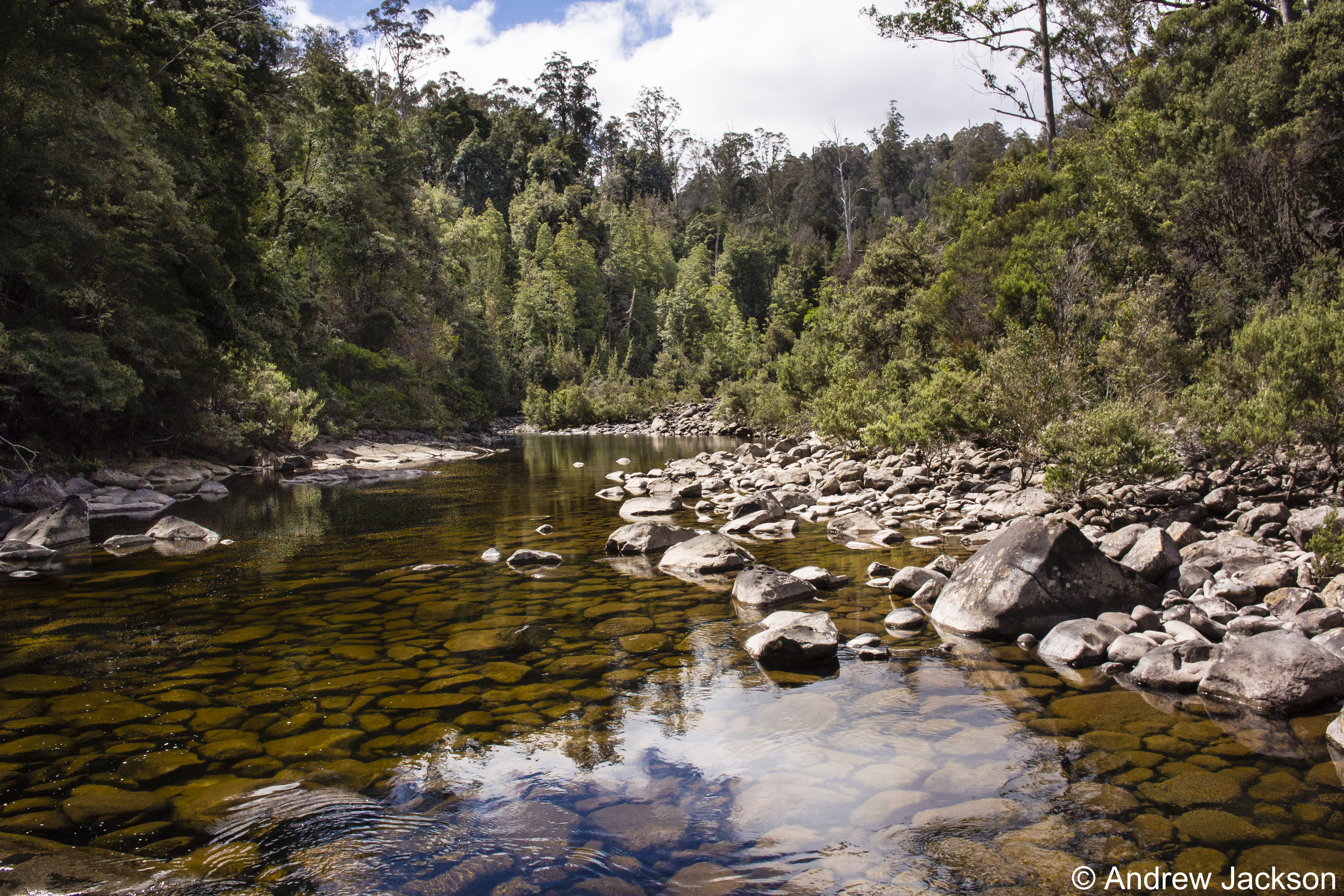
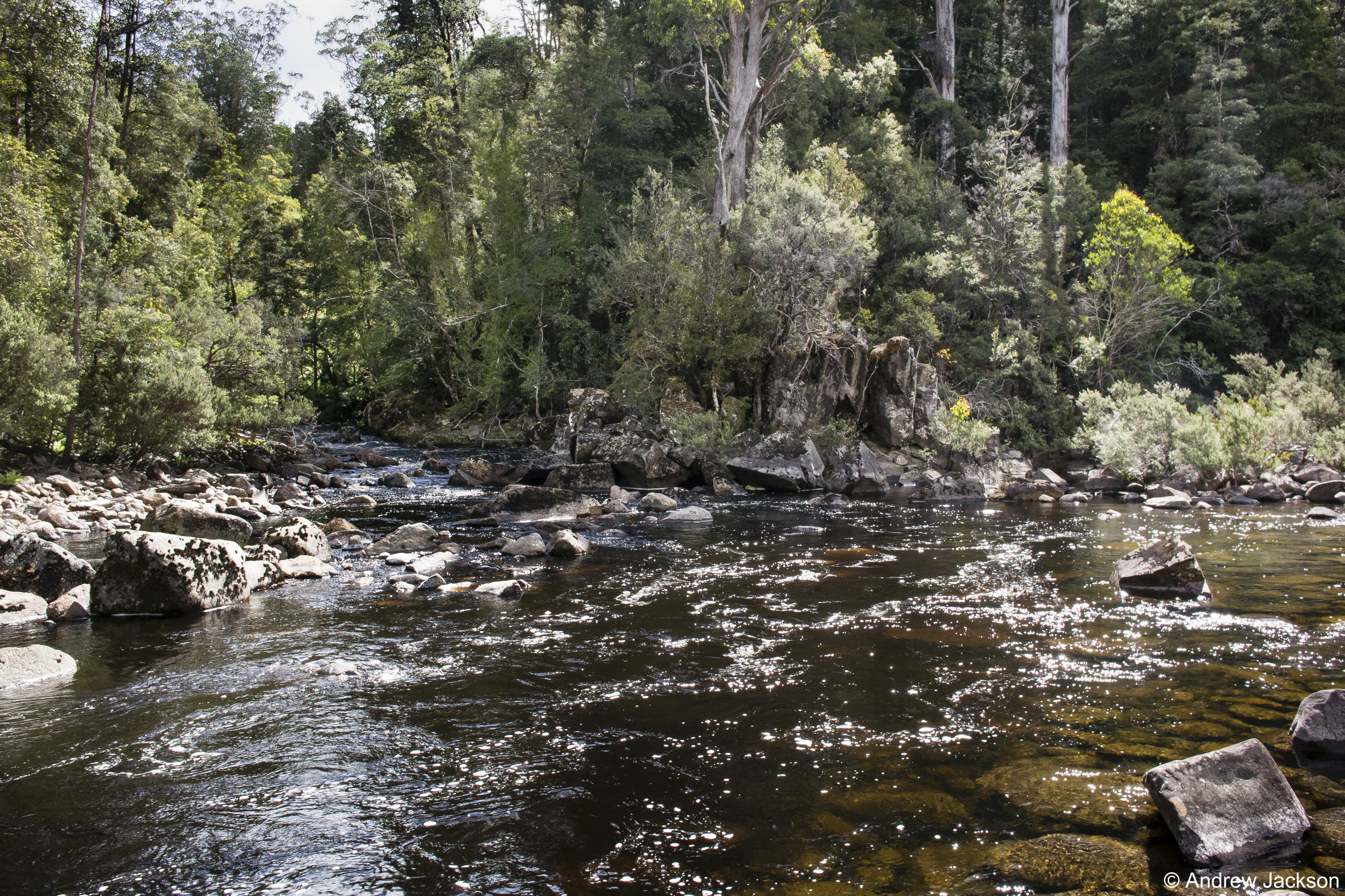
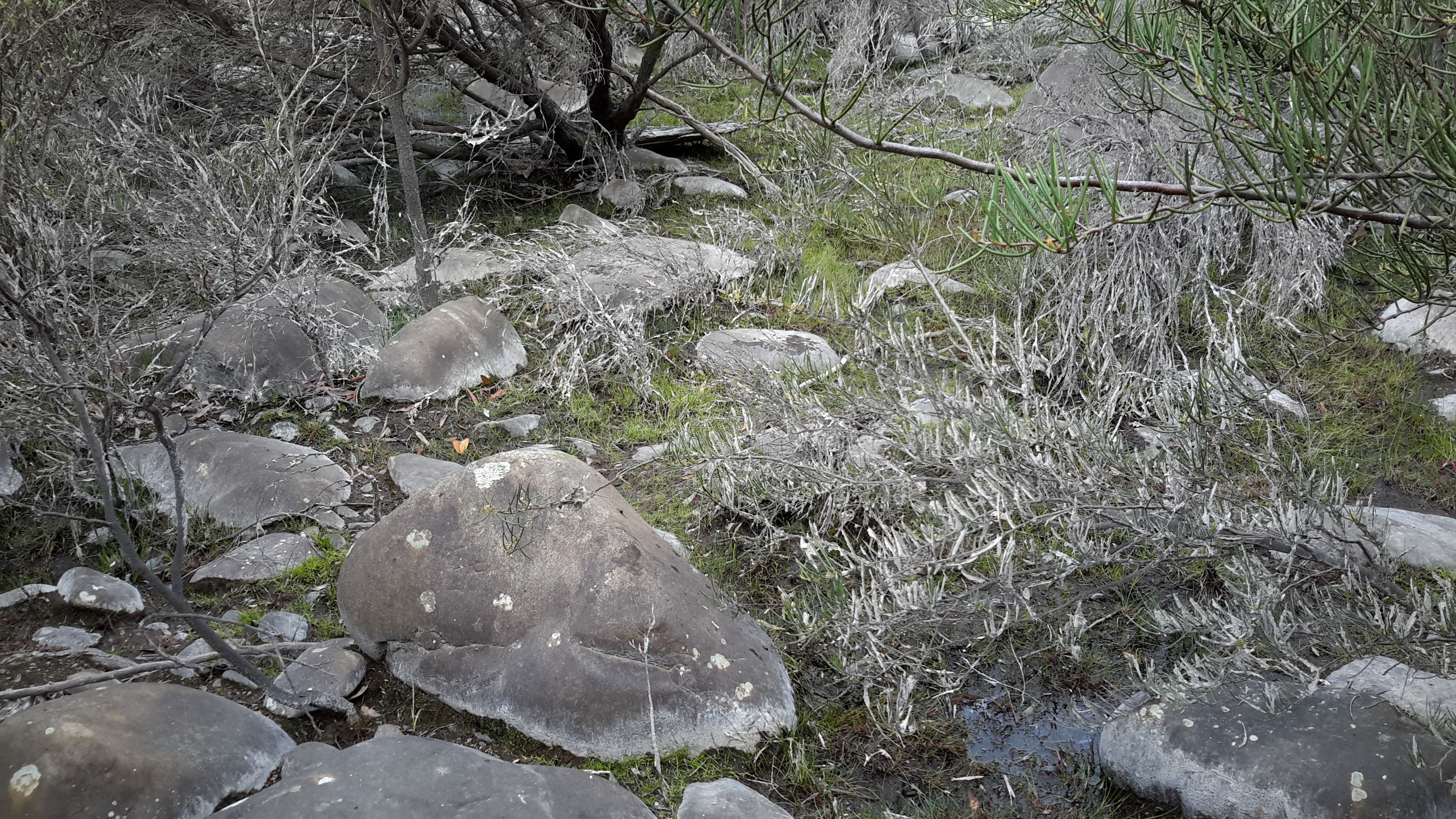
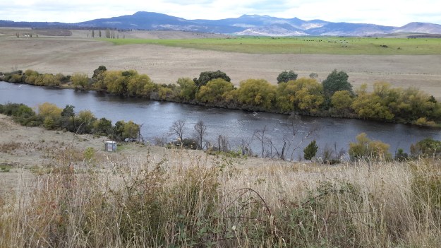
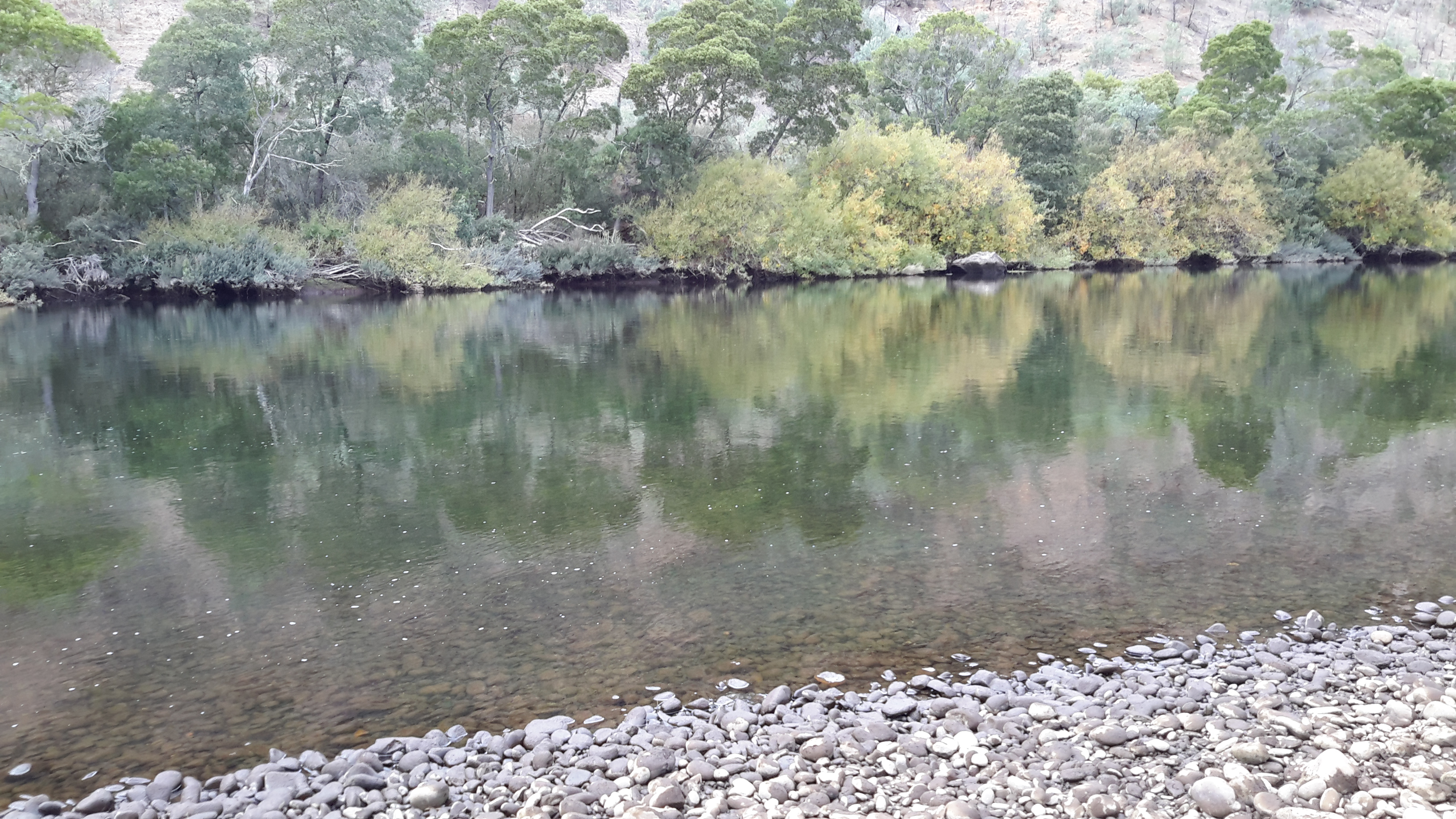
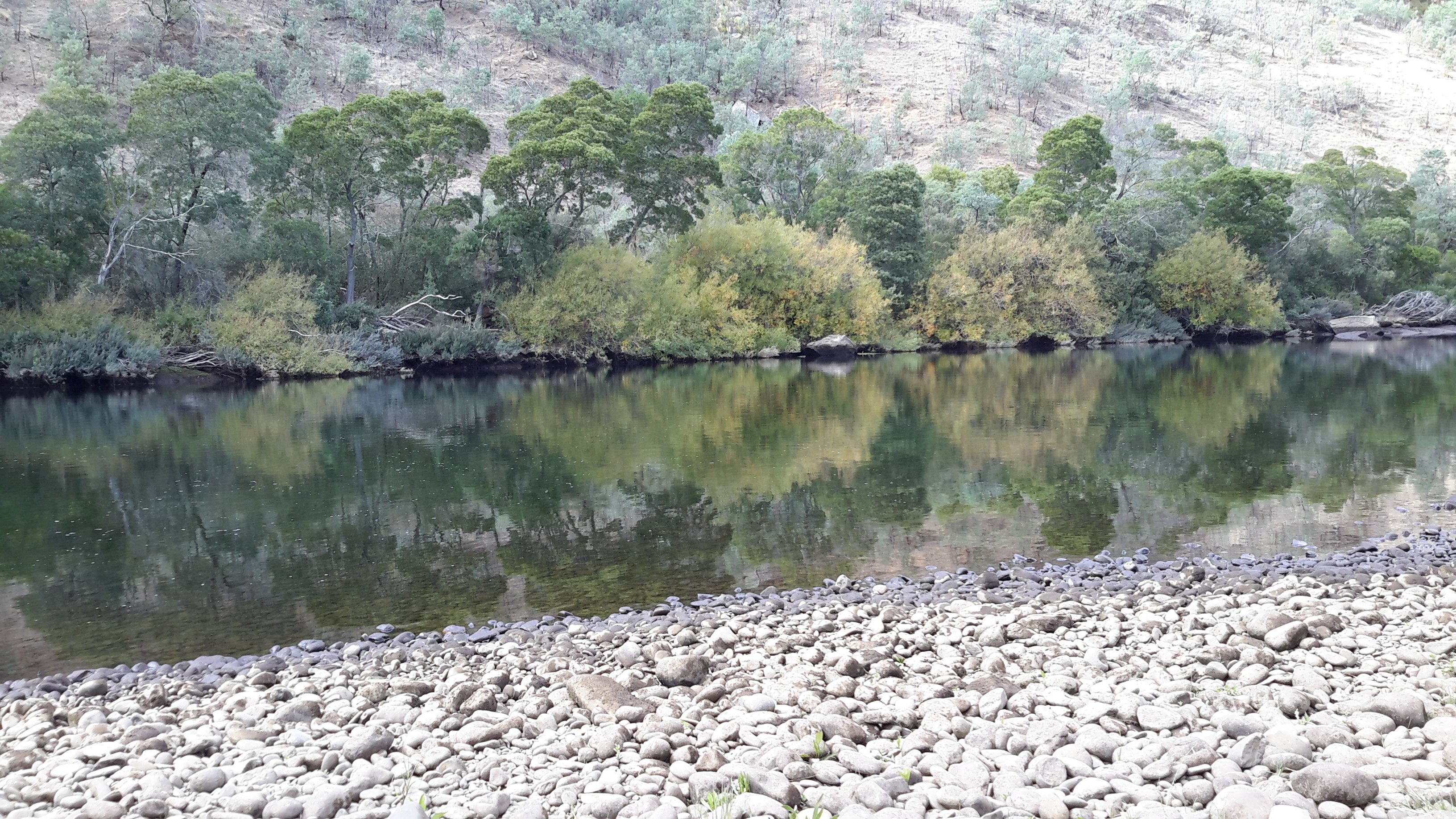
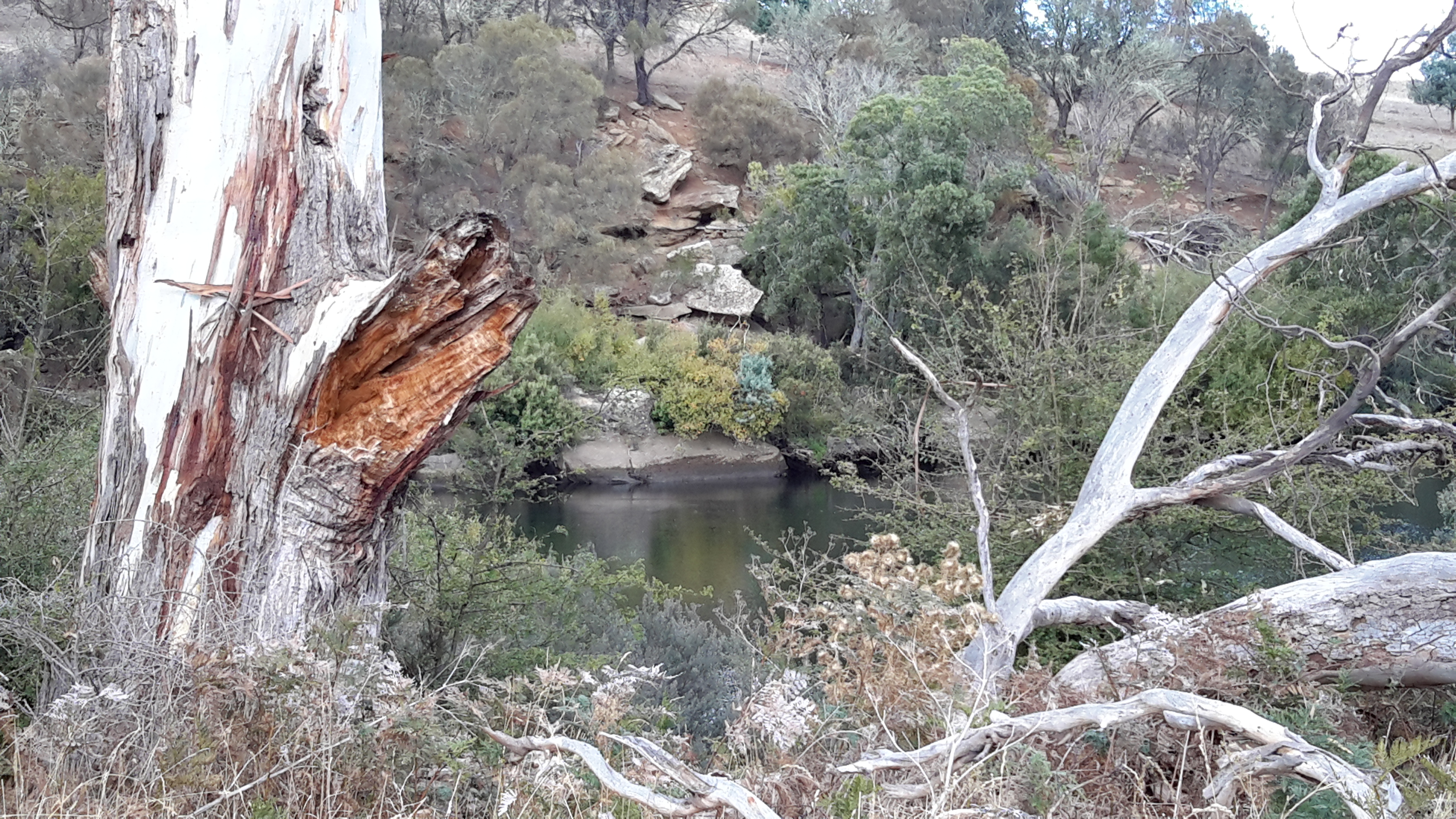
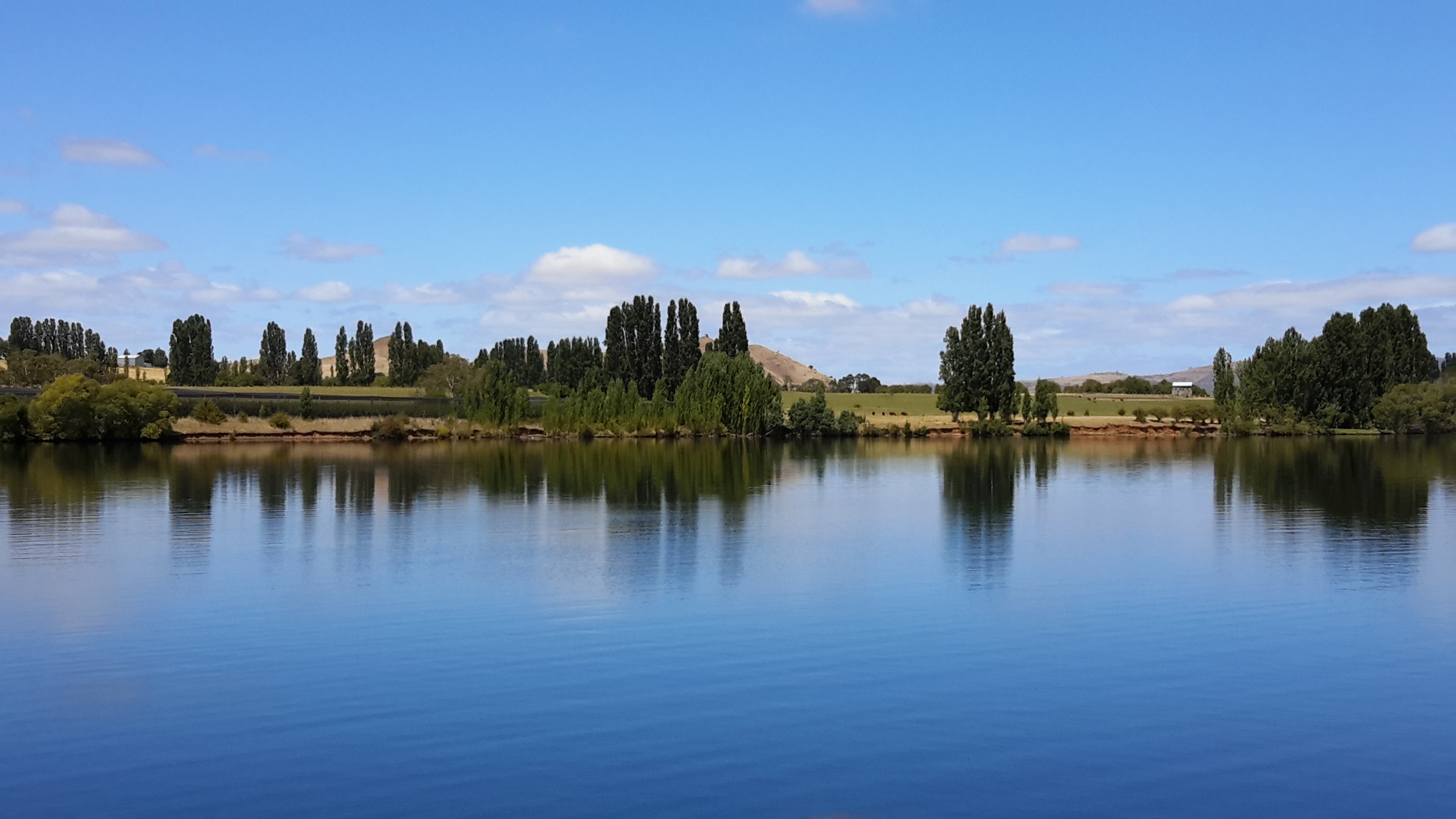
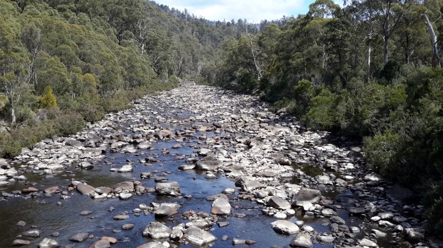
On the River bed I hoped for a low water level in order to be able to rock hop for much of the 14-15 kilometres down to the Wayatinah bridge. If the water level was low, at best the river bed might look like the following photos as it did near the confluence of the Derwent with the Florentine  Rivers.

20151029_101148.jpg

20151029_101151.jpg

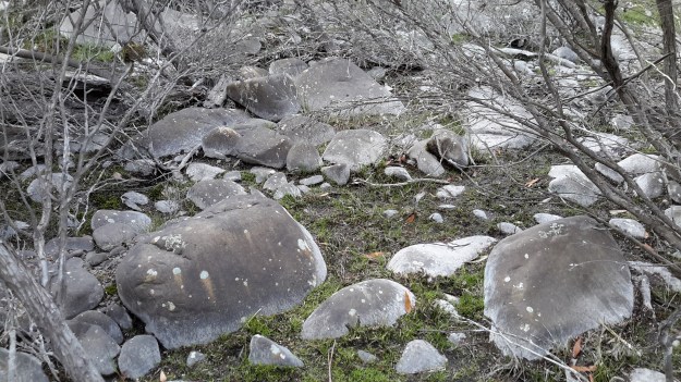
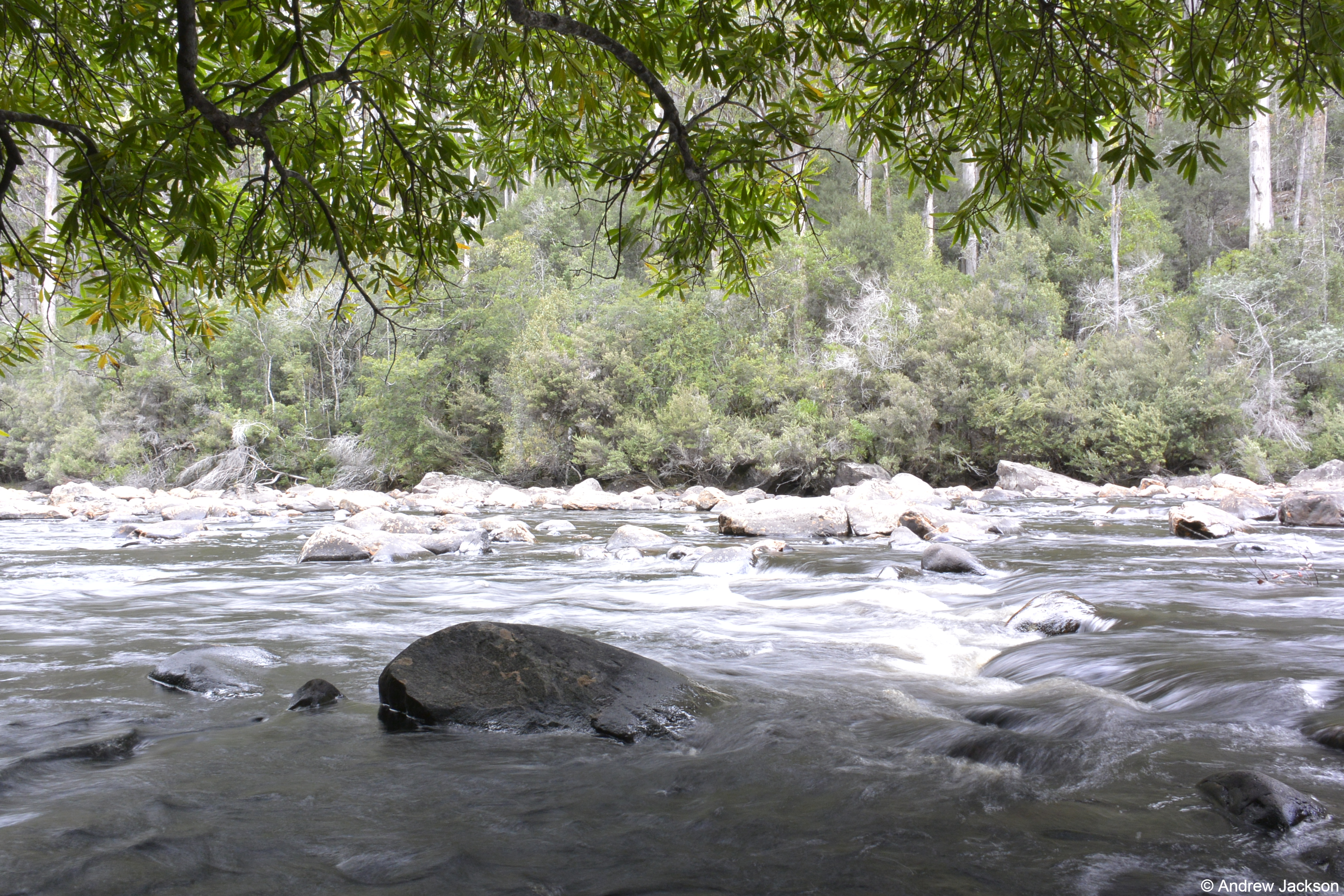
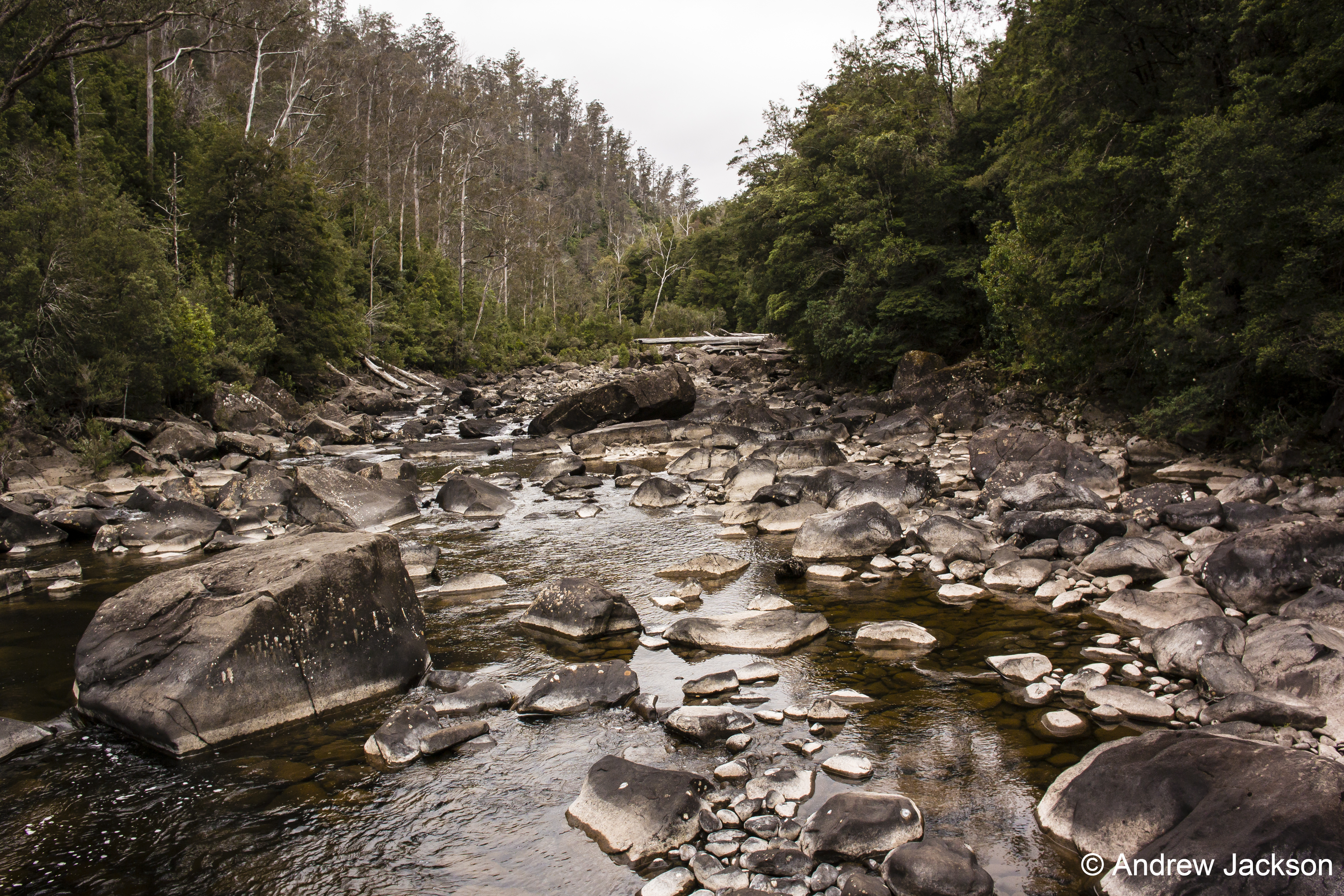
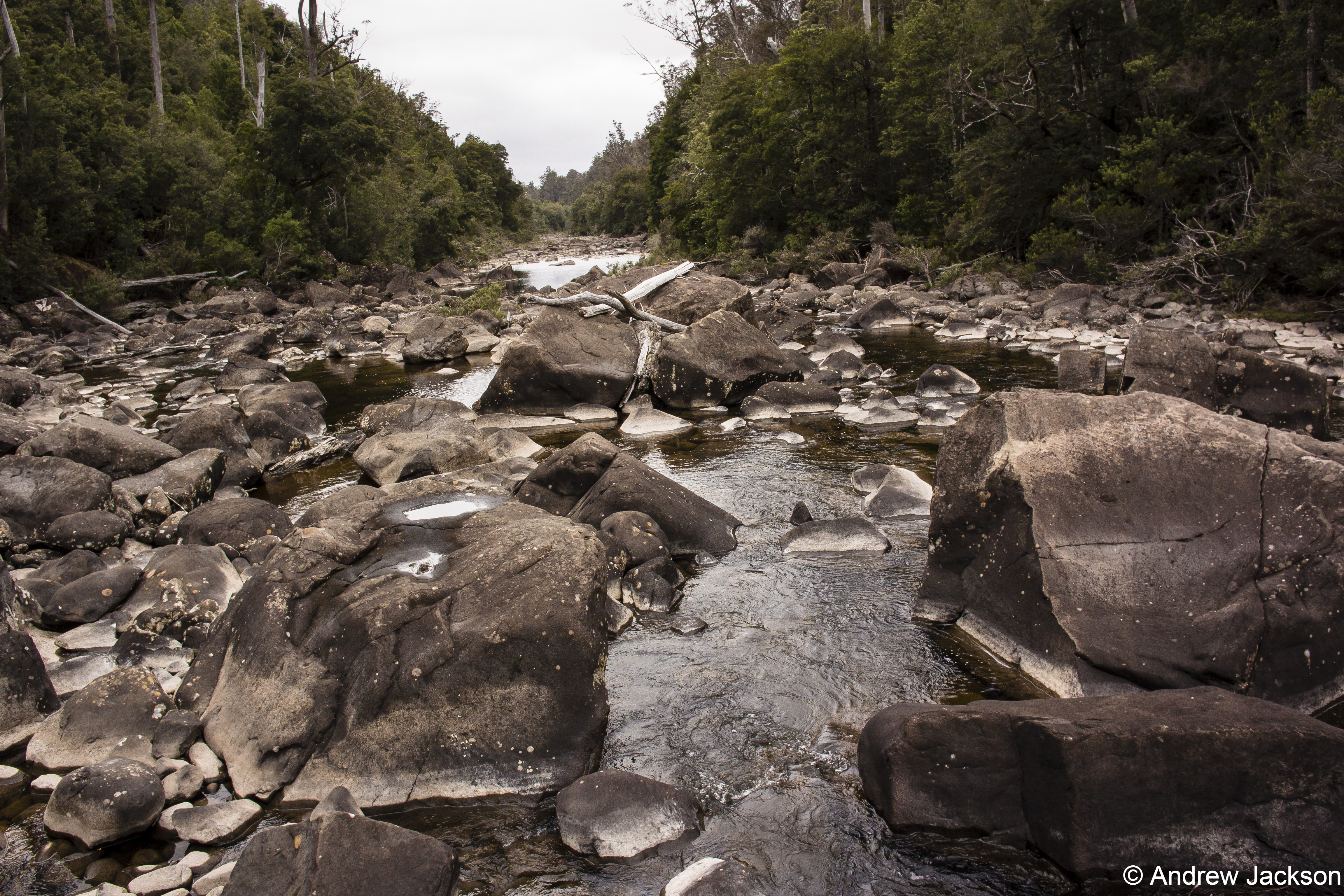
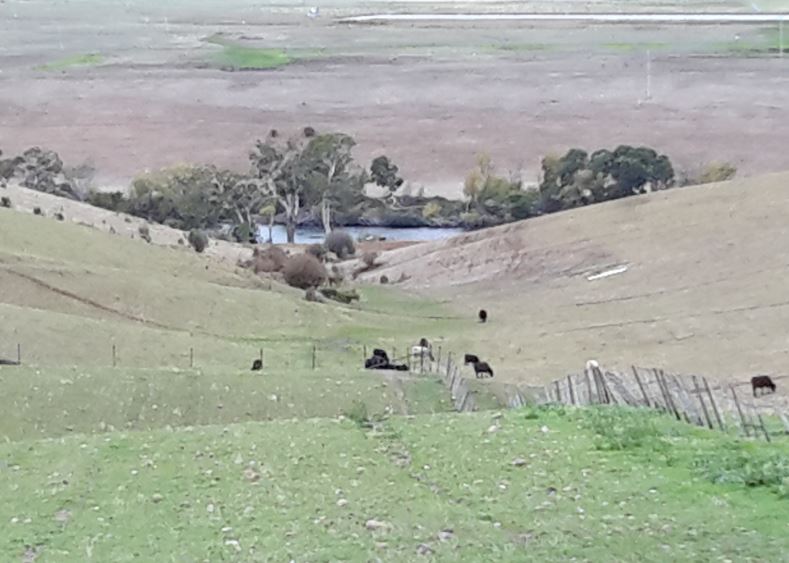
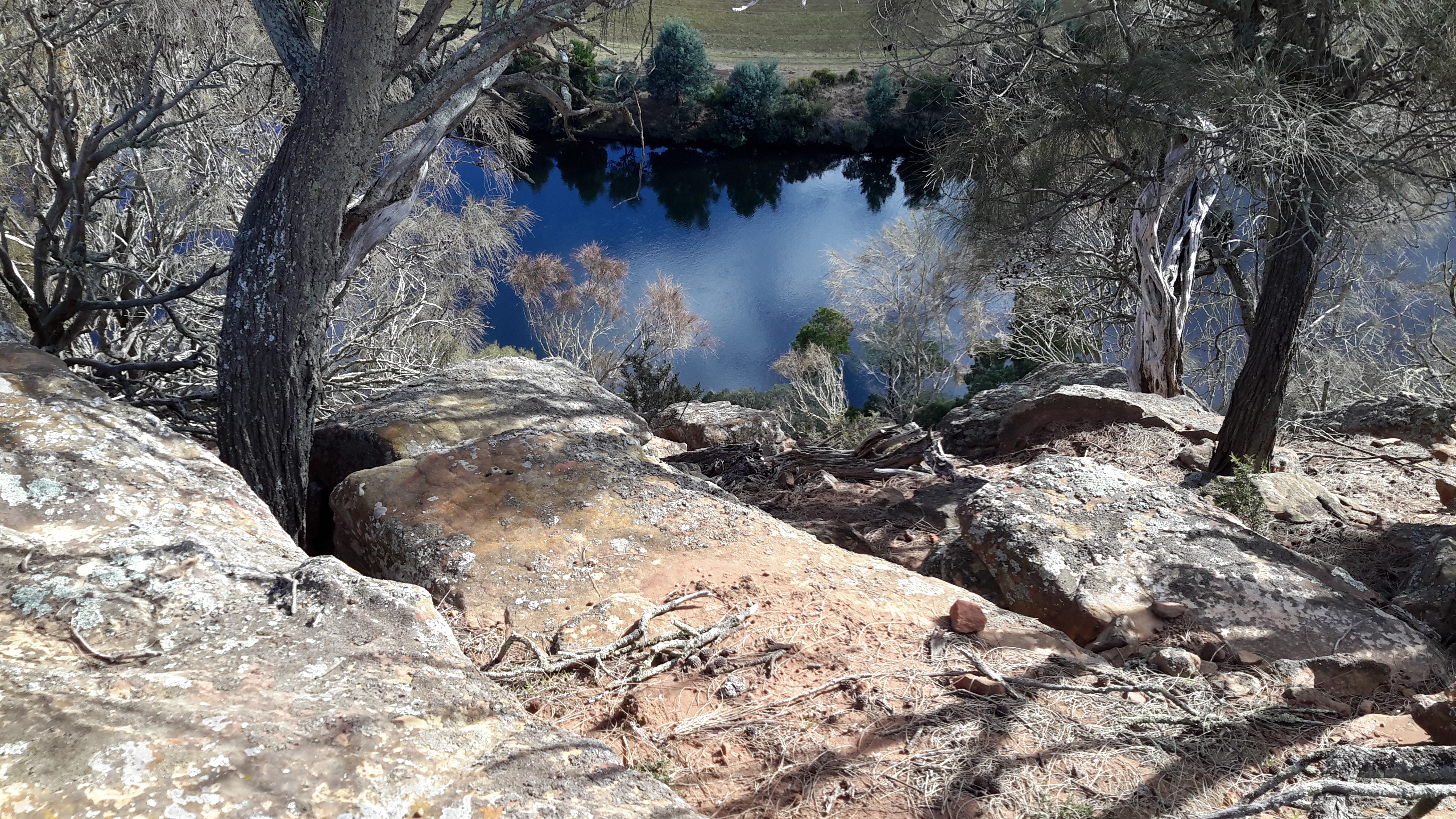
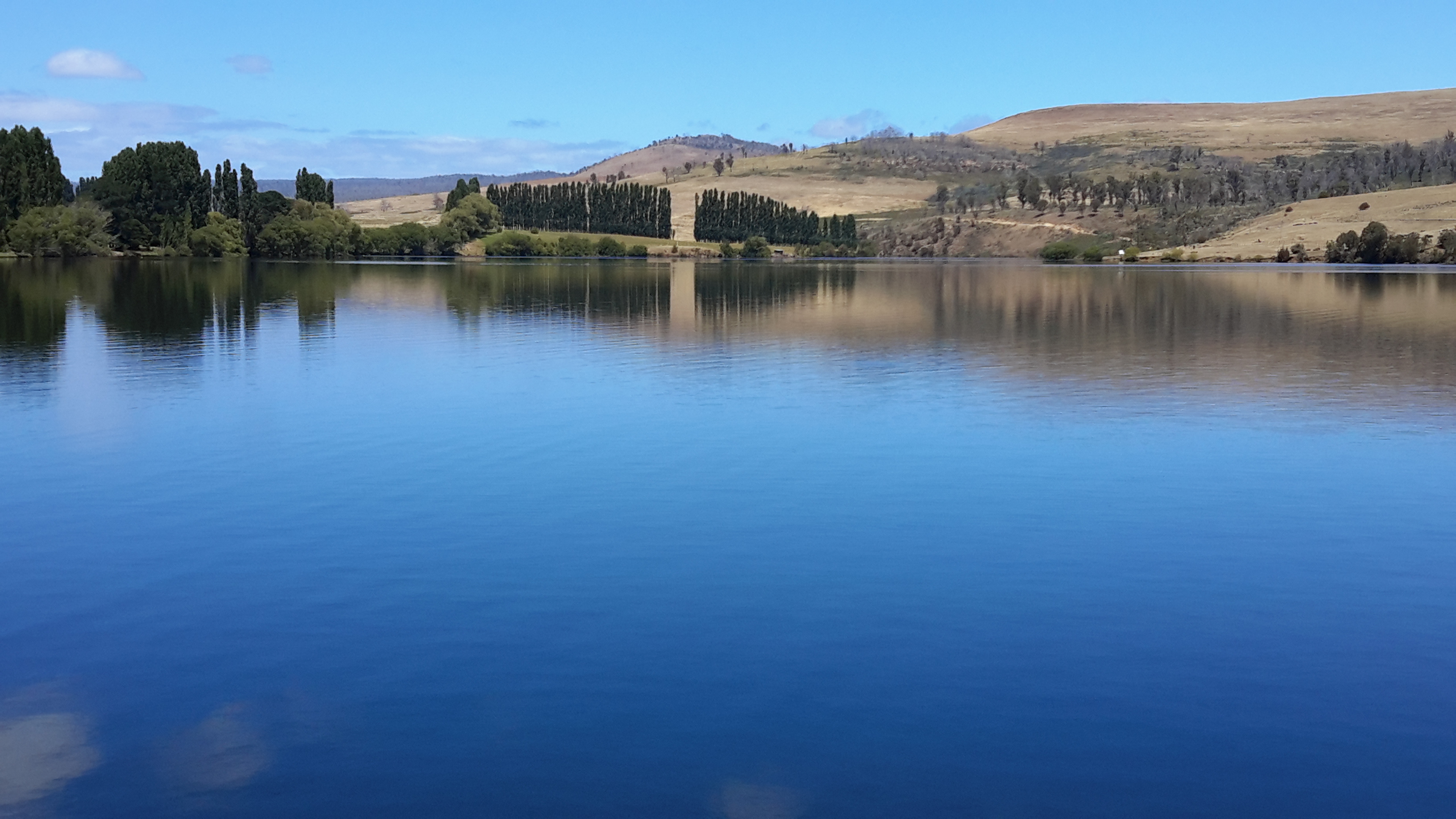
Alternatively it might have limited water something like the following photos of the Derwent near Wayatinah.

20151029_113841.jpg

20160115_130425 Derwent.jpg

Of course, hoping for minimal water was likely to be a pipe dream and I realised it would not be realistic to expect this situation for the entire length of the walk. I knew from aerial shots, old maps and out of date Google Earth that large pools of water would present challenges and that clambering up any side of the River to avoid these would be part of the walk.

From maps I could see approximately  eleven small creeks and the Counsel River feed into the Derwent. I fervently hoped little rain had fallen in this area in the preceding weeks, that these creeks were low on water, and therefore that the spill into the Derwent River would be minimal. If much water ran down these creeks then the likelihood of more and larger water holes along the Derwent increased. If this was the case then I could imagine fighting my way through vegetation overhangs in order to clamber onto the bank and then negotiate the forest to bypass the water obstruction.  Anticipation of such exhausting activities did not thrill me.

Once on the River bed, rocks that roll were at the top of my list of fears; such as – would I turn an ankle, break a leg, smash my head into another rock, or get weighted down in a deeper pool with the pack on my back.  I could not see how developing any sort of walking rhythm would be possible. My usual opportunities to walk and look around me would be unlikely. I foresaw the absolute necessity to watch the ground/rocks/water and think about and make decisions where to put each footstep would become mentally exhausting over such a distance.  I doubted if it was possible to walk this stretch of the River and, even if it was, I thought the possibility of covering the length in a day even a long day, would be unlikely.  I allowed two days for this leg of the walk.

I always take my tablet for photos and carry this with me to point and click as a record. Typically on a one-day walk I might take 300-400 photos and then pick a selection for the blog posts.  But for this walk I realised that carrying the tablet would not be wise. I could see that having two free hands to clamber over rocks and debris and vegetation would be smart, and I also needed to allow for the unexpected underfoot changes and the need to grab or balance using my hands.  Clearly stopping to retrieve my tablet for photo ops would slow me down. Therefore, I knew that I would not be taking many photos so that the record of this walk would be less than normal.  But my safety had to be paramount.

From aerial reconnaissance and nearby on-the-ground checks and maps, I found it difficult to visualise where I would set up the tent overnight.  Both hill sides were steep but maps did indicate that near some major bends in the river there was sections beside the water bed that might be a little flatter than elsewhere.  On one bend, some larger islands were mapped mid-stream. I wondered whether I might be lucky to find them water free and accessible and not totally tight with vegetation.  Perhaps there I might find a sleeping spot.

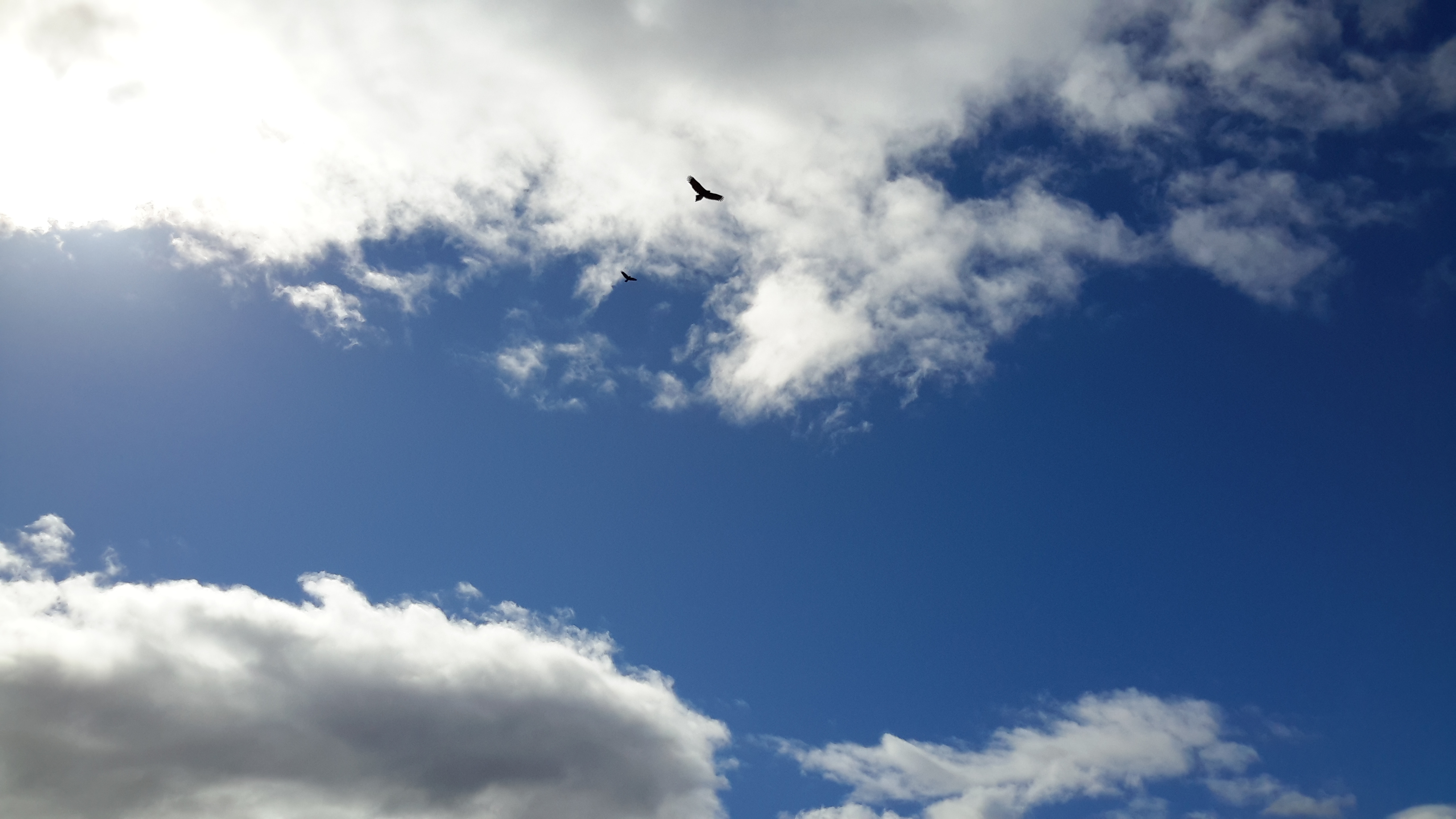
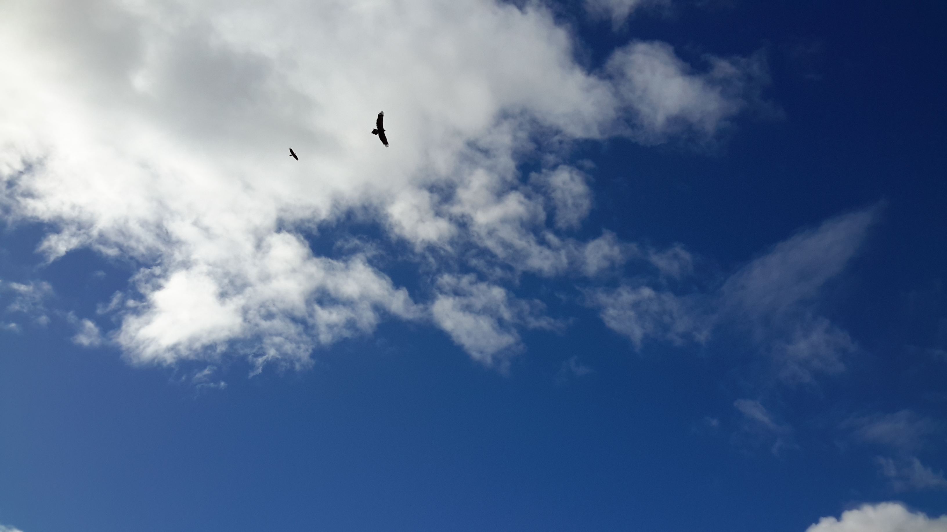
Overall I visualised a most unusual journey. One where the only view would be of steep forested hillsides rising above a comparatively tiny water bed, and never a panoramic vista of distant hills or mountains. Rather I could expect to see only the next bend in the river. While that would provide me with curiosity about what might be around the corner, in advance, already I imagined seeing more of the same.  So this leg of the journey along the Derwent River was to be about physical endurance; surviving without becoming despondent about the relentlessness of watching my feet placement.  This was the ultimate chance for me to understand the limits of my capacity and capabilities.  I looked forward to  snatching and enjoying occasional moments when native birds flitted about, the sun sparkled on wet vegetation, and variations of mosses and lichens on rocks appeared in all their glories.

I envisaged this experience would introduce me to a continuous valley that is currently protected, untouched, unvisited, and not normally seen at close quarters.  Simply wonderful, however great the challenge to see it.

Rocky outcrops

Most of the country through which I walked consisted of undulating hills.  Occasionally I was close enough to cliffs and rocky outcrops to be able to have a good look at their structures and colours.  A selection of examples follows:

20160328_131235.jpg

20160328_105121.jpg

20160328_110952.jpg Please note that I do not enter any of these rock overhangs and caves, just in case they are sacred sites for Tasmania’s first inhabitants pre-European settlement.


Soaring eagle

I was privileged to watch not one but three endangered Tasmanian Wedge Tailed Eagles during one walk along the Derwent River. The third eagle was being chased by a black Crow and I was fortunate to be able to photograph it.  A Crow is not a small bird but, in comparison to the expansive eagle, it appears tiny.

20160328_111212(0).jpg

20160328_111213.jpg

20160328_111215.jpg

Tasmania’s Parks and Wildlife Service provides more information about this majestic eagle here.

The DPIWE government site provides information including:

“Ever since Europeans settled in Australia, wedge-tailed eagles have been accused of attacking and killing almost anything from horses to honey-eaters. In some States bounties were paid for their destruction and a total of about 20 000 were slaughtered per year in the mid 1960’s. 
Today, despite legal protection and changing attitudes, the wedge-tailed eagle remains vulnerable to extinction. Some landowners believe that wedge-tailed eagles pose a threat to lambs and kids. However, studies have shown these fears to be unwarranted. In 1970, for example, the CSIRO published an analysis of the cause of death of over 12 000 lambs in several States. Although up to 34% of dead lambs had been at least partly eaten, only 2% of lambs born had been actually killed by predators such as eagles. More importantly, only 2.7% of dead lambs would have survived if a predator had not attacked. Exposure to bad weather and miss-mothering were the most important causes of death.
Studies in Tasmania show that in sheep grazing areas, rabbits, hares, brushtail possums and wallabies are the most important prey, although a great variety of animals are eaten dead or alive, from cormorants and echidnas to snakes. With rare exceptions, eagles simply do not create an economic problem.”

It is rare to see these eagles.  The last time I saw one was years ago when I had walked to the bottom of the ‘organ pipes’ on Mount Wellington and sat in the sun on a smooth rock looking down on the city of Hobart with the ribbon of the Derwent River splitting it apart.  My peripheral vision recognised movement.  Just then, an eagle used an updraft and soared in front of me, then over the edge of the mountain out of sight.  Another never to be forgotten experience.


The tradition of long walks


Though the millennia people have walked long distances across parts of the world for a variety of reasons. In recent decades, long walks have mostly been achieved by those escaping wars and civil strife, those creating television documentaries, and those looking to understand the extent of their personal capabilities through adventure.  In my case, the project to walk besides the Derwent River was simply curiosity – could it be done and was I capable of doing it. During that project and since, I have always been interested to read other stories of walks besides rivers or any walk that challenges the walker. When I received a link to a news article that introduces the plan for a new massive walk, I was naturally most interested.  Thanks blog reader John.

Currently an Australian woman is preparing to walk 30,000 km from Argentina to Alaska. Lucy Barnard’s story can be read on the ABC news site here.

With more sleuthing I was impressed when I read  a Northface article: “Most notably, 12 months ago Lucy was hit by a car during an endurance cycling event. She was temporarily paralysed, became aphasic, lost significant proportion of muscle mass and memory. Since then, she has worked tirelessly to regain her previous condition and improve her attitude towards caring for her physical and mental health.”  This is yet another reminder about the power of the mind and the effect of sheer determination to achieve goals.  We all know not everything is possible but the willingness to try with a positive attitude often brings surprising results.  Lucy has a LinkedIn site on which I hope she will record milestones during her epic journey.  Her Twitter account offers a means for communication.

Moving river shots

Where the Derwent River is deep , rocks on its bed do not break the surface and create rapids.  In these instances, judging the speed of the river flow is impossible. Only when the water gushes around protruding rocks could I understand these as markers of the speed of water flow. I have no doubt that for much of the length of the river, if you were to brave the cold water and try to swim across, you would end up many metres downstream before connecting with the bank on the other side. The Derwent River rushes past fast.

 20160328_123213

20160328_123708.jpg

20160328_143437.jpg


Suddenly the river appears

When the Derwent River appears, my heart flutters with excitement.  ‘There it is!’, I exclaim. My mouth softens towards a smile and any walking challenges experienced reaching the River, are forgotten immediately.

20160328_113227.jpg

20160328_143138 cropped.JPG

20160328_124943.jpg

20160328_105556.jpg

20160328_103046.jpg

20160328_104811.jpg

20160328_104116.jpg

20160328_110825 cropped.JPG

20160328_114009.jpg

20160328_114127.jpg


Walking to and from the Derwent River

Sometimes, time was taken to walk to and from roads in order to reach the Derwent River and then walk alongside it’s flow.  The photos  below show a selection of those landscapes.

20160328_095809 cropped.JPG

20160328_094204 cropped.JPG

20160328_095814.jpg

20160328_101538.jpg

20160328_101551.jpg

20160328_102516 cropped.JPG

20160328_104957.jpg

20160328_135756.jpg

20160328_105405.jpg

20160328_111035.jpg

20160328_110810.jpg20160328_122943.jpg

20160328_123040.jpg

20160328_124030.jpg

20160328_123820.jpg

20160328_130921.jpg


19/1/17

Glorious photos of Meadowbank Lake


Meadowbank Lake is the last expanse of water that has been dammed for hydro power generation purposes, before Hobart.  A good, but narrow bitumen road (Ellendale Road) crosses Meadowbank Lake near its inland western extremity.

20160115_140312.jpg

20160115_140337.jpg

20160115_140356.jpg

This glorious sight is easily accessible from the Lyell Highway on the northern/eastern side of the Derwent River, or via the tiny towns of Glenora and Ellendale on the southern/western side.

Looking westwards:

20160115_140332.jpg

20160115_140329.jpg

20160115_140317.jpg

Looking eastwards:

20160115_140223.jpg

20160115_140304.jpg

20160115_140300.jpg

I have written about Meadowbank Lake before and previously included photos.  The photos in this post were taken one day after completing a walk further inland. I was being driven back to Hobart along the Lyell Highway, and then we deviated by crossing the Lake and proceeding to Ellendale to buy freshly picked raspberries and blueberries.

Only on one occasion have I passed by this Lake under cloud.  Even then, the more sombre colour of the Lake and the less vivid greens, greys and beiges of the landscape were still most attractive.  There are picnic spots either side of the Lake, and public toilets on the Lyell Highway side.  A wonderful location for solo or family visits.

Hitchhiking

Part of the fun (challenge) was returning home after completing an inland walk along the Derwent River.  Elsewhere in this blog,  I have talked about the difficulty of accessing public transport away from the Greater Hobart Area.

On a few occasions, I emerged onto the Lyell Highway and with no public bus scheduled to pass, I stuck out my thumb and hitchhiked a ride back to Hobart.  As in most countries, hitchhiking can be a dangerous choice but in all cases I was fortunate.

I felt the most fragile on one ride because the young and inexperienced international driver who was used to driving on the other side of the road, was driving either at or over Tasmania’s speed limit.  With her perfect blond hair swinging, and her fine hands resting loosely on the steering wheel, she seemed unable to understand the limitations of our Central Highlands highway. Our road signs indicate cars can travel at a maximum of 100 km per hour on the Lyell Highway, but this does not mean it is always safe to do so.  Despite being a highway, this two-lane road is narrow and does not always carry white line markings to indicate where the road meets the loose gravel or vegetated verge. In addition, this winding road requires drivers to reduce their speed to navigate corners safely.  I made, what I thought were casually expressed, comments such as ‘I suppose you wouldn’t be familiar with narrow winding highways and how this makes a difference to your driving’, and ‘I know this road reasonably well and think the patch coming up will need to be taken a bit slower to avoid entering traffic if any’, and other similar comments.  It made no difference and, if anything, the car whizzed along even faster.   I tightened my seat belt.  Closer to home she told me she planned to deviate and take a slightly longer route to Hobart. I knew the deviation was a narrow gravel road in parts and I believed skidding along such byways was highly possible with her driving style. Her decision gave me an opening to get out and say good bye without hurt feelings.  I was most relieved when I stood back on terra firma and waved farewell.

On another occasion, after standing in the one spot for one and a half hours and watching traffic stream past, a very old beaten-up ute driven by an even older man pulled up.  He had seen me there an hour or so earlier when he travelled west. Now he was returning home to the next town 8 kms away.  Would I be happy if he dropped me there?  Absolutely.

At the worst, I knew I could set up my tent in the camping ground or book into the hotel overnight then catch a bus home the next day. But life treated me better than that.  A cup of tea in a civilised café was my first priority.  I sat outside at a garden table in the warm afternoon sun, with a large pot of tea feeling like I had won the lottery.  At the next table two men were eating a late lunch.  They noticed my backpack and struck up a conversation. One was a walker who was in training for some serious trail walking in Europe where he planned to travel later last year.  So we had interests in common and our chatter was convivial. Without knowing what sort of vehicle they were travelling in, I asked if I could get a lift back to Hobart.  Yes they said ‘if you don’t mind travelling in a truck’.  Visions of smelly cattle or sheep trucks with generations of human flotsam and jetsam distributed through the cabin came to mind.  But I was smelly I supposed having not showered for a day or two, and they were travelling my way.  I nodded,  ‘Fine. Thanks.’

‘That’s it over there’.  They pointed.  A shiny state of the art new truck gleamed on the other side of the road.  It took my breath away.  Inside, it was clearly so new that the original plastic sheeting covers were still across all seats and everything was protected.  Never in my life have I experienced a vehicle in pristine condition, and with all attempts by its occupants to keep it this way.  Once we were on the road, Kevin and Adrian explained.  That morning they had made a sales presentation to a local government agency hoping to inspire them to buy one or more of these state-of-the-art trucks.  I have always wondered what the outcome was for their negotiations.  I thought it was a superb vehicle not the least because the airconditioning could be controlled.  But what do I know?

This was a Webster truck. I can no longer recall which brand and  – at the risk of being the stereotypical female –  I do recall it was gleaming white. Is that a help?

All of these people and more, have helped me to return home safely. I am grateful. Thank you.