
The low level of water on Lake King William exposed a wilderness of silvered dead trees (once ancient forests) and a rocky shore. Sometimes the rocky shore extended flatly to the Lake and sometimes it dived down deeply. Where I camped on the first night, the distance of the water from the bank would have been at least fifty metres. Elsewhere the wide rocky shoreline extended 100 or more metres. A combination of various sized boulders, stones, fine gravel and the occasional sand, this shore line created a sometimes grey and sometimes yellow ring enclosing the huge expanse of lake.

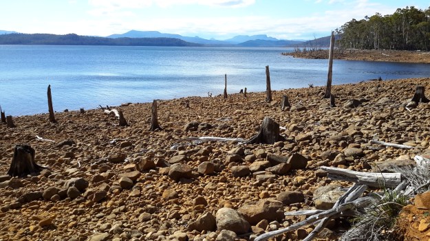
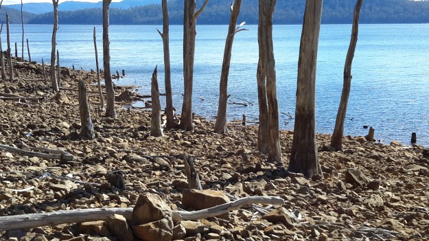
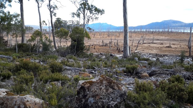
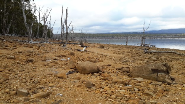

From the drowning of the landscape, the now receding waters are giving up the flotsam of driftwood. The surfaces of the wood, smoothed by the action of the weather and the Lake, are stunningly beautiful.


What a beautiful yet eerie landscape.
LikeLike
Hi Ruth You would be able to access part of that landscape if you were prepared to walk a km or so from Clark Dam (or have a 4WD and can potter over the track)- if you can walk this, I think you would love seeing the shore.
LikeLiked by 1 person
We’ll have to take a look there, we don’t have 4WD but enjoy exploring.
LikeLike
If walking isn’t a problem for you, then its easy open walking if you stay on the Switchyard Track so I think you would enjoy the experience.
LikeLiked by 1 person
Thanks for the info, Helen.
LikeLike