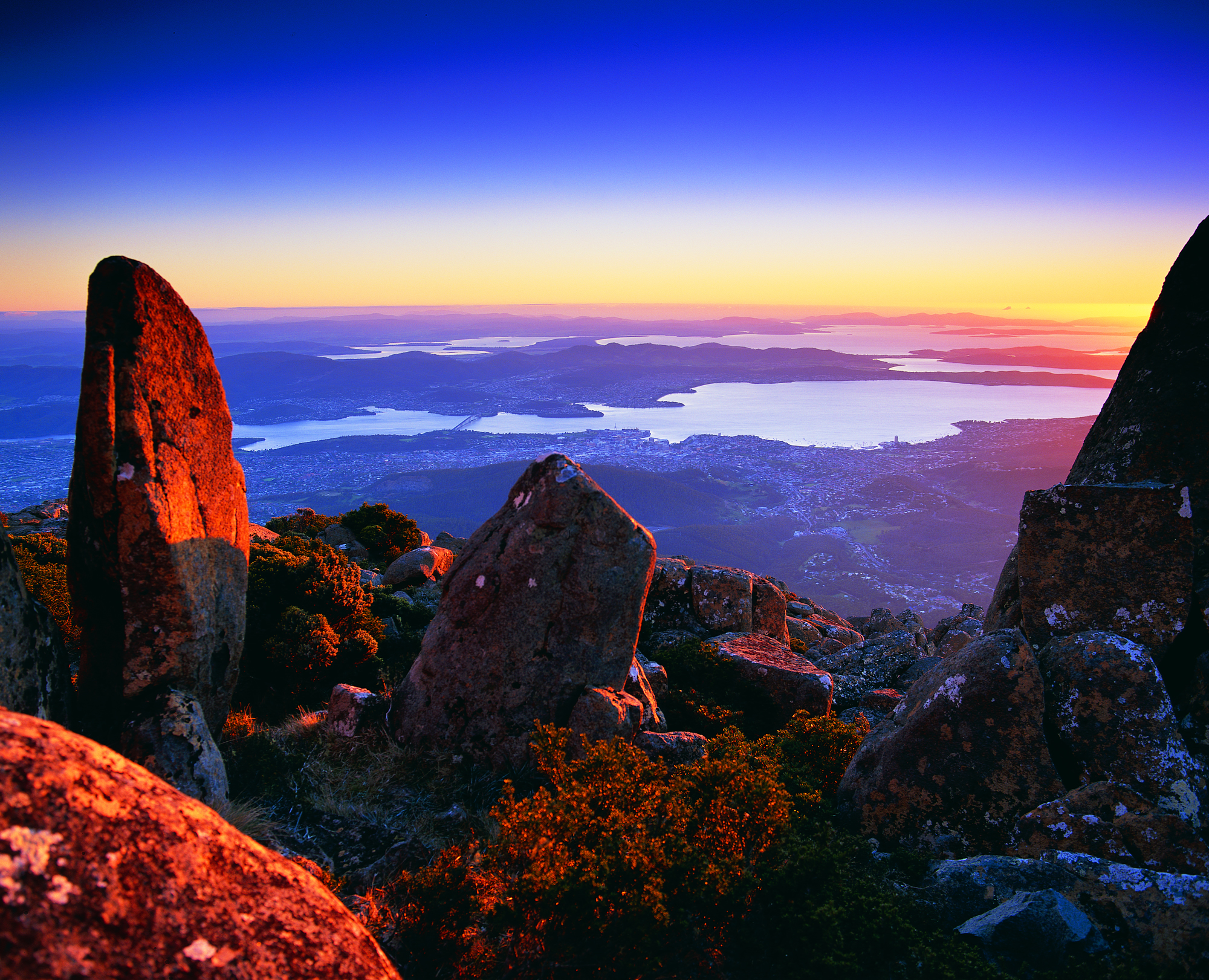
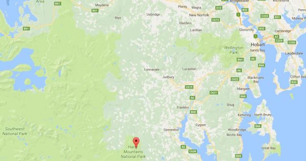
Over the weekend one of my favourite bloggers This Amazing Planet published an image from his latest foray into Tasmania’s south. The location of his ‘viewing platform’ is indicated on the following Google map.
The post, titled View from Hartz Peak thru to the mouth of the Derwent River. Southern Tasmania , describes the scene accurately.
I am in awe of Mark’s walk up to the top of Hartz Peak clambering over snow covered rocks and unreadable depressions in the ground. But I am so very grateful to see this photograph. Sensational. It presents the Derwent River as a soft silvery ribbon. Beautiful!

Thank you for your comments. Really appreciated.
LikeLike
I am so envious of your experiences in Nepal and on the mountains. Keep those photos coming!
LikeLiked by 1 person
Tassie remains my favourite place to hike. So clean and unpolluted. Missing it.
LikeLike
There have been millions more people walk where you currently are than have ever set foot in Tassie. Guess that helps keep much of our state more pristine.
LikeLiked by 1 person
Yes indeed.
LikeLike